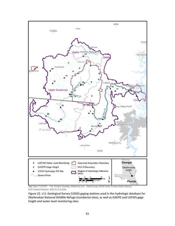
Figure 22. U.S. Geological Survey (USGS) gaging stations used in the hydrologic database for Okefenokee National Wildlife Refuge (numbered sites), as well as GAEPD and USFWS gage height and water level monitoring sites.Okefenokee_WRIA_Final_wAppendices_08172015 | | Okefenokee Swamp watershed boundaries | | 1 August 2015 | |
|