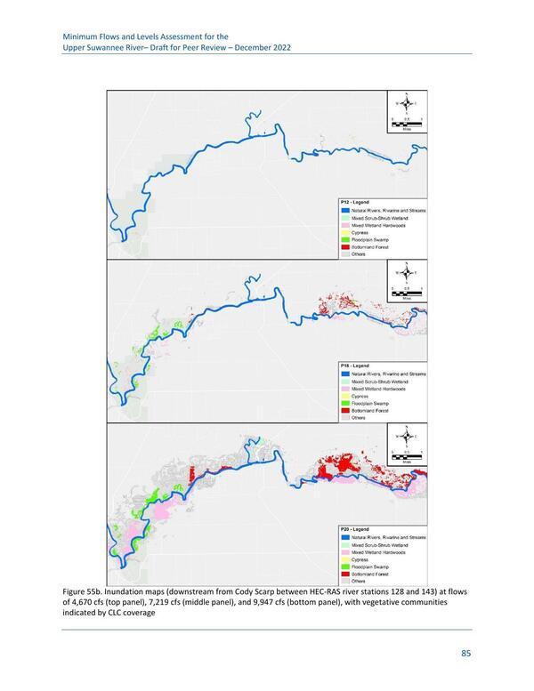
Figure 55b. Inundation maps (downstream from Cody Scarp between HEC-RAS river stations 128 and 143) at flows of 4,670 cfs (top panel), 7,219 cfs (middle panel), and 9,947 cfs (bottom panel), with vegetative communities indicated by CLC coverageFigures | | Upper and Middle Suwannee River MFL Peer Review Meeting | | 15 March 2023 | |
|