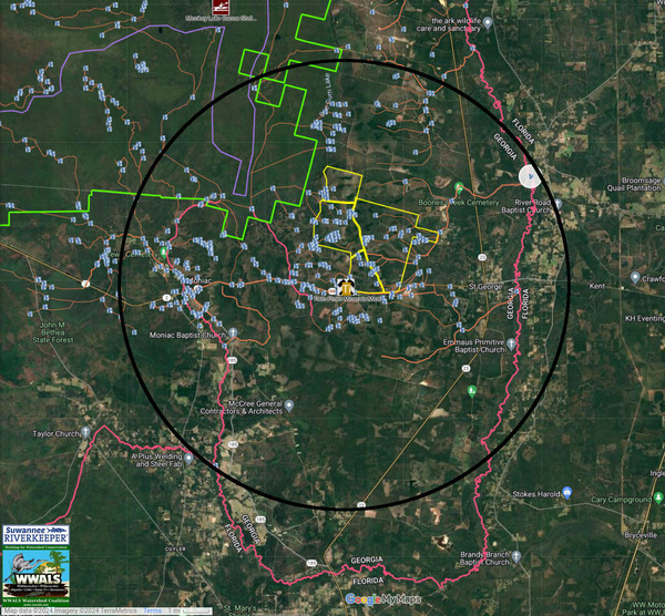
A circle of radius approximately 44,608 feet around the TPM mine site reaches the Middle Prong of the St. Marys River to the southwest, Cross Creek to the Northwest, and Boone Creek to the northeast, with parts of two Florida counties and two Georgia counties inside it, as well as Moniac, the Cherokee of Georgia Tribal Grounds, and St. George.Maps | | Permit application deficiencies; water modeling, monitoring, and management, mercury, spills, slimes, Florida --WWALS to GA-EPD, TPM TiO2 mining | | 9 April 2024 | |
|