Tag Archives: WWALS

Rivers Alive Little River Clean Up 2013-09-28

According to GA DNR, Rivers Alive Little River Clean Up

Saturday, Sep 28, 2013 8 AM to 1 PM
Volunteers will be split into two groups for both river and lake side clean-up. Volunteers are welcome to bring their own kayaks and canoes to join the paddling team down the river for trash collecting. Boats are available at half price rental. The lake crew will be walking the lake perimeter removing trash from the water’s shores. $4 boat rental. 229-896-3551.

Location:
Reed Bingham State Park
542 Reed Bingham Road
Adel, GA 31620

Directions:
Continue reading

Aquifer at max pumping in central Florida

Remember, this is our aquifer, too. And watch out! They’d rather pipe somebody else’s river water than conserve in Central Florida.

Kevin Spear wrote for the Orlando Sentinel yesterday, Analysis: Floridan Aquifer can only handle 6% more pumping before serious environmental harm,

Just how much more water can Central Florida pump from the Floridan Aquifer without causing real harm to the region’s environment? After years of debate, study and anxiety, state authorities say they have finally — and officially — figured it out.

The answer: hardly any.

Using the most advanced databases and computing methodology yet developed for such a task, a consortium of state water managers and local utilities have calculated that the current amount of water pumped from the underground aquifer each day can be increased by only about 6 percent — which means the region is already exploiting the huge, life-sustaining aquifer for nearly every drop it can safely offer.

Beware! Continue reading

the single largest asset that you’ll ever own –Gordon Rogers

Albany TV covered yesterday’s WWALS Watershed Conference. First picture by Fox31, the rest by John S. Quarterman and Gretchen Quarterman. WWALS video will follow.

Franklin White wrote for Fox31online yesterday, The importance of Watershed conservation,

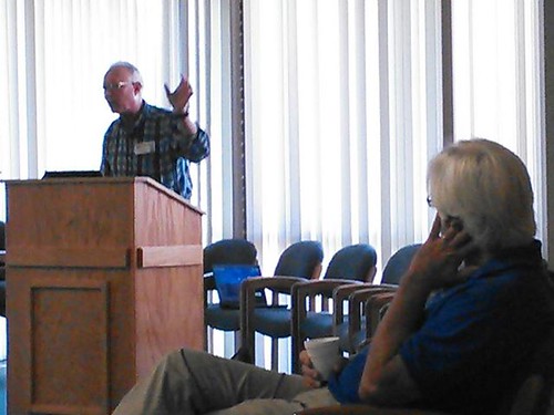
Gordon Rogers says, “it’s important to advocate for good management by our resource agencies within that framework of laws.”

Franklin White, Fox 31, and Gordon Rogers, Flint Riverkeeper at WWALS Water Conference

Gordon says it hits home for him because the Flint River where he works ranks second on the american rivers endangered rivers list, a reason he says water management is such an important issue to the region.

Hydrology

He says, “it belongs to all of us. it’s the single largest asset that you’ll ever own is your river and your creek and you’re aquifer.”

Environmental Lobbyist Neill Herring says the goal is to restore and preserve the habitat, water quality and flow of the Flint and other rivers.

Neill Herring

Herring says, “these natural resources particularly the water systems are their private property, they have a property interest in the water.”

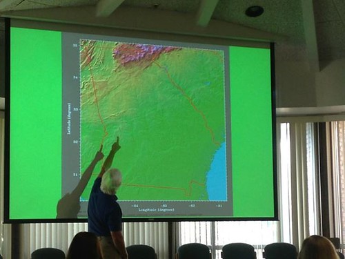
And outside of the Flint, officials say there are four other major rivers to keep an eye on. those being Willacooche, Withlocooche, Alapha, and Little River systems.

Blackwater

“Cause it’s a rapidly moving political landscape. Operating wisely with this limited amount of water that you have,” says Gordon.

Permits

He says it’s important for local citizens to take ownership of the political process of their watershed. To learn more, visit the Watershed Coalitions website at WWALS.net.

Floridan Aquifer VSU class paper

Found by Chris Graham. I added the illustrations and the table. -jsq

THE FLORIDAN AQUIFER

by Sandra McCullough
Sandra McCullough lives in Valdosta, Georgia. She is a Speech Communications major and has an interest in the Environment and Humankind’s interaction with the Environment. Sandra plans to continue her education and become a teacher of public speaking. The topic to be discussed here is the Floridan Aquifer.

The Floridan aquifer system is very important to a large number of people, despite general lack of knowledge of or about it. The Floridan aquifer underlies all of Florida, south Georgia, and parts of both Alabama and South Carolina.’ This particular aquifer system is one of the major sources of ground-water in the United States. For this reason and more, studies of its function have been done for years. These studies as well as other findings will be discussed in this paper.

Continue reading

WWALS Watershed Conference, Tifton, GA, 24 August 2013

How we manage water affects our water’s quality and quantity. WWALS logo WWALS Watershed Coalition is pleased to announce a Water Conference where Gordon Rogers, Flint Riverkeeper will share information on hydrology of the South Georgia region and Neill Herring, Environmental Lobbyist, will discuss upcoming legislation that can affect our watersheds and aquifer. The conference will take place in Tifton on Saturday, August 24, 2013 from 9:00 am until noon at the NESPAL, University of Georgia, Tifton Campus at 2360 Rainwater Road.

Continue reading

JIA replies to WWALS about marsh and land

“There currently are no plans for more development on Jekyll Island” said JIA in a response to WWALS’ assertion that marsh is not land. So why does a map under consideration by JIA show all marsh as land at mean high tide? Could “currently” mean until the law gets changed? -jsq

Continue reading

Entering Floridan Aquifer Recharge Zone

Maybe we need signs like that around here to remind people that what goes into the ground comes out in our drinking water. For example, San Antonio has its Edwards Aquifer Protection Program. Maybe our local governments need to have Floridan Aquifer Protection Programs. Georgia state law seems to indicate they should.

GA Secretary of State has GA Code §391-3-16-.02 Criteria For Protection of Groundwater Recharge Areas. (more legible copy on GA EPD website),

Georgia's Groundwater Recharge Areas (1) Background. Variable levels of recharge area protection can be based upon the State’s hydrogeology (e.g., areas such as the Dougherty Plain where a major aquifer crops out would receive a relatively high degree of protection whereas other areas, such as the shale hills of northwest Georgia, would receive a lower degree of protection). Recharge area protection within the significant recharge areas would be further refined, based upon the local susceptibility or vulnerability to human induced pollution (e.g., high, medium, or low). The significant recharge areas have already been identified and mapped (about 22-23% of the State). Pollution susceptibility mapping is ongoing. Existing statutes are adequate for protecting the remaining recharge areas (about 77-78% of the State).

[…]

(2)(f)3. In the Coastal Plain, the significant recharge areas are Continue reading

JIA map shows all marsh as land at mean high tide –David Egan

Received Thursday on Marsh is not land, not here, not at Jekyll Island –WWALS Watershed Coalition -jsq

WWALS Watershed Coalition is on target with its analysis of the Jekyll 65-35 issue! Just a quick glance at the the 65-35 map under consideration by the JIA reveals all —- according to the JIA, ALL of Jekyll’s tidal marsh is above water, as in dry, at mean high tide, and is therefore part of the land area of Jekyll Islnsd subject to the 65-35 law. On-site conditions deny the accuracy of that map, for most of the marsh is actually under water (as in wet) at the time of high tide. The JIA’s map can be viewed at http://www.savejekyllisland.org/MPMOAAMHWPapJuly2013.html

-David Egan


SaveJekyllIsland.org wrote: Continue reading

Paddle the Alapaha at US 82 2PM Saturday 27 July 2013

Join WWALS on our monthly outing, on the exotic Alapaha River:

Jungle-like in its remoteness and luxurious with exotic vegetation, the dark reddish-brown waters of the Alapaha wind through a swampy wonderland teeming with wildlife. — Alapaha River Paddling Guide, by Suzanne Welander

Yet it’s right here in Berrien County, Georgia, only an hour’s drive from Valdosta and less from Adel, Lakeland, Tifton, etc.

Meet at the intersection of Hwy 82 bridge and the Alapaha River, about 2 miles east of Alapaha, GA.

Park cars at the top near a derelict brick building (south of highway). There is a road down to the river but it is badly washed out so you probably want to take a look before you drive down.

We’re planning to paddle upstream a ways and then float back down.

Join the facebook event or just come paddle!

-jsq