
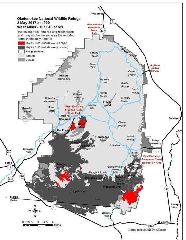
600×776 Infra-red and recon flight map 2017-05-03 08:31:33.082-CDT, in More than 100,000 acres and Billy’s Island in West Mims Fire, by John S. Quarterman, for WWALS.net, 3 May 2017,
Okefenokee NWR
/2017/05/04/more-than-100000-acres-and-billys-island-in-west-mims-fire-2017-05-03/
600×776 Infra-red and recon flight map 2017-05-03 08:31:33.082-CDT, in More than 100,000 acres and Billy’s Island in West Mims Fire, by John S. Quarterman, for WWALS.net, 3 May 2017,
Okefenokee NWR
/2017/05/04/more-than-100000-acres-and-billys-island-in-west-mims-fire-2017-05-03/
Short Link: