
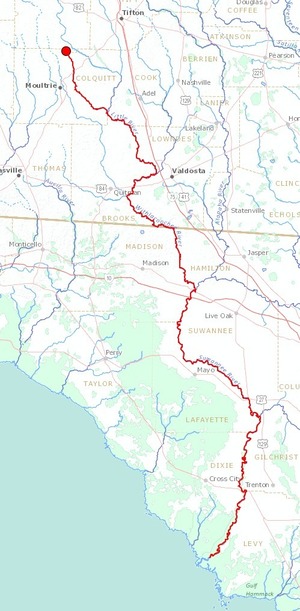
Points on the WLRWT map
Last update: 2026-01-20
Suggest changes, additions, etc. in pictures or text through this form.
See also Categories and Access points.
Descriptions
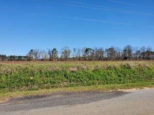
Source of the Little River 
CATEGORIES: Source
LAYER: Other
OWNERSHIP: Private
WATER BODY: Little River
MILE: 104.56
ADDRESS: Between Warwick Highway (CR 249) and CR 94, NW of Ashburn, GA, SSW of Arabi, Turner County.
DESCRIPTION: In trees in a field.
WEBSITE: https://wwals.net/2020/04/05/source-of-the-little-river-2020-02-27/
PHOTO: https://wwals.net/pictures/2020-02-27–little-river-source/20200227_121132.jpg
PHOTOSET: https://wwals.net/2020/04/05/source-of-the-little-river-2020-02-27/
PHOTO SOURCE: John S. Quarterman
PHONE NUMBER: (229) 242-0102
Suggestions: https://forms.gle/DipPgU2TP5atc2Rf9
Warwick Highway Bridge 
CATEGORIES: Bridge
LAYER: Bridge
OWNERSHIP: Public
WATER BODY: Little River
MILE: 104.31
ADDRESS: On Warwick Highway (CR 249) NW of Ashburn, GA. Turner County.
WEBSITE: https://www.google.com/maps/place/31%C2%B044’54.8%22N+83%C2%B045’47.3%22W/@31.7190622, -83.7829856, 19062m/data=!3m1!1e3!4m5!3m4!1s0x0:0x0!8m2!3d31.748563!4d-83.763148?hl=en
Suggestions: https://forms.gle/DipPgU2TP5atc2Rf9
WL Ward Road Bridge
CATEGORIES: Bridge
LAYER: Bridge
OWNERSHIP: Public
WATER BODY: Little River
MILE: 103.14
ADDRESS: On WL Ward Road between Charlie Lamb Road (CR 6) and Oak Grove Road (CR 96) WNW of Ashburn. Turner County.
WEBSITE: https://www.google.com/maps/place/31%C2%B044’04.8%22N+83%C2%B045’11.5%22W/@31.7168997, -83.7389548, 13z/data=!4m5!3m4!1s0x0:0x0!8m2!3d31.734672!4d-83.753192?hl=en
Suggestions: https://forms.gle/DipPgU2TP5atc2Rf9
Cleghorn Road Bridge
CATEGORIES: Bridge
LAYER: Bridge
OWNERSHIP: Public
WATER BODY: Little River
MILE: 101.82
ADDRESS: On Cleghorn Road aka Oak Grove Road aka CR 88 between Arabi and Terrell, WNW of Ashburn, Turner County.
WEBSITE: https://www.google.com/maps/place/31%C2%B043’10.5%22N+83%C2%B044’36.2%22W/@31.7348248, -83.8794998, 11z/data=!4m5!3m4!1s0x0:0x0!8m2!3d31.719592!4d-83.743375?hl=en
Suggestions: https://forms.gle/DipPgU2TP5atc2Rf9
Jefferson Street Bridge
CATEGORIES: Bridge
LAYER: Bridge
OWNERSHIP: Public
WATER BODY: Little River
MILE: 100.83
ADDRESS: West of Ashburn. Turns into Sun Story Road (CR 86) west across the river. Turner County.
WEBSITE: https://en.wikipedia.org/wiki/Little_River_(Withlacoochee_River)
Suggestions: https://forms.gle/DipPgU2TP5atc2Rf9
Ashburn MLK Lift Station 
CATEGORIES: Liftstation
LAYER: Point of Interest
OWNERSHIP: Public, City of Ashburn, PARCEL A02 012
WATER BODY: Fudge Branch of Ashburn Branch
ADDRESS: Martin Luther King Jr. Drive between Fudge Street and Coley St., Ashburn, GA 31714, Turner County.
DESCRIPTION: It spills sewage too often.
WEBSITE: https://cityofashburn.net/departments/wastewater-management/
Suggestions: https://forms.gle/DipPgU2TP5atc2Rf9
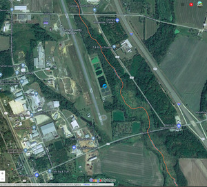
Ashburn Airport WPCP 
CATEGORIES: Wtp
LAYER: Brochure
OWNERSHIP: Public, City of Ashburn, PARCEL 027 055
ACCESS: No
WATER BODY: Hat Creek
MILE: 20.28
ADDRESS: 410 Rockhouse Rd, Ashburn, GA 31714, Turner County.
DESCRIPTION: “Up to 1.16 MGD of treated wastewater is being discharged to the Hat Creek in the Suwanee River Basin.”” Hat Creek runs into the Alapaha River upstream of US 319. NPDES Permit No. GA0025852.
WEBSITE: https://cityofashburn.net/departments/wastewater-management/
OTHER REFERENCE: https://wwals.net/pictures/2018-08-30–permits/ashburn
ADDITIONAL INFO SOURCES: https://greencompanydb.com/facilities/view/318245
PHOTO: https://wwals.net/wp-content/themes/pianoblack/img//2019/02/95953dcadea2d811899e2bfbb7d6fa34.jpg
PHOTOSET: https://wwals.net/2019/02/05/ashburn-ga-spilled-at-top-of-little-river-basin-2019-01-22/
PHOTO SOURCE: John S. Quarterman
PHONE NUMBER: (229) 242-0101
Suggestions: https://forms.gle/DipPgU2TP5atc2Rf9
GA 32 Bridge
CATEGORIES: Bridge
LAYER: Bridge
OWNERSHIP: Public
WATER BODY: Little River
MILE: 97.87
ADDRESS: GA 32 between Leesburg and Ashburn, GA, Turner County.
WEBSITE: https://en.wikipedia.org/wiki/Little_River_(Withlacoochee_River)
Suggestions: https://forms.gle/DipPgU2TP5atc2Rf9
GA 112 Bridge
CATEGORIES: Bridge
LAYER: Bridge
OWNERSHIP: Public
WATER BODY: Little River
MILE: 96.24
ADDRESS: GA 112 between Sylvester and Ashburn, GA, Turner County.
WEBSITE: https://en.wikipedia.org/wiki/Little_River_(Withlacoochee_River)
Suggestions: https://forms.gle/DipPgU2TP5atc2Rf9
GASC RR Bridge 
CATEGORIES: Railbridge
LAYER: Bridge
GPS: 31.672323, -83.68548
OWNERSHIP: Private
WATER BODY: Little River
MILE: 95.88
ADDRESS: Between GA 112 and Cannon Road, between Sylvester and Ashburn, GA, Turner County.
DESCRIPTION: Georgia, Ashburn, Sylvester, and Camilla Railroad Bridge, closed 1971, little remains
WEBSITE: https://en.wikipedia.org/wiki/Little_River_(Withlacoochee_River)
Suggestions: https://forms.gle/DipPgU2TP5atc2Rf9
Cannon Road Bridge
CATEGORIES: Bridge
LAYER: Bridge
OWNERSHIP: Public
WATER BODY: Little River
MILE: 95.74
ADDRESS: Cannon Road between Sylvester and Ashburn, GA, Turner County.
WEBSITE: https://en.wikipedia.org/wiki/Little_River_(Withlacoochee_River)
Suggestions: https://forms.gle/DipPgU2TP5atc2Rf9
Cofer Road Bridge
CATEGORIES: Bridge
LAYER: Bridge
GPS: 31.653978, -83.66597
OWNERSHIP: Public
WATER BODY: Little River
MILE: 93.88
ADDRESS: Cofer Road (SR 204) between Sycamore and Terrell, GA, Turner County.
WEBSITE: https://en.wikipedia.org/wiki/Little_River_(Withlacoochee_River)
Suggestions: https://forms.gle/DipPgU2TP5atc2Rf9
Coverdale Highway Bridge
CATEGORIES: Bridge
LAYER: Bridge
OWNERSHIP: Public
WATER BODY: Little River
MILE: 92.52
ADDRESS: Coverdale Highway (CR 99) between Sycamore and Terrell, GA, Turner County.
WEBSITE: https://en.wikipedia.org/wiki/Little_River_(Withlacoochee_River)
Suggestions: https://forms.gle/DipPgU2TP5atc2Rf9
Nesmith Road Bridge
CATEGORIES: Bridge
LAYER: Bridge
OWNERSHIP: Public
WATER BODY: Little River
MILE: 88.93
ADDRESS: Nesmith Road between Irwinville and Terrell, GA, Turner County.
WEBSITE: https://en.wikipedia.org/wiki/Little_River_(Withlacoochee_River)
Suggestions: https://forms.gle/DipPgU2TP5atc2Rf9
CR 147 Bridge
CATEGORIES: Bridge
LAYER: Bridge
OWNERSHIP: Public
WATER BODY: Little River
MILE: 85.05
ADDRESS: Little River Road (CR 147) between Irwinville and Terrell, GA, Tift County.
WEBSITE: https://en.wikipedia.org/wiki/Little_River_(Withlacoochee_River)
Suggestions: https://forms.gle/DipPgU2TP5atc2Rf9
Whiddens Bridge
CATEGORIES: Bridge
LAYER: Bridge
OWNERSHIP: Public
WATER BODY: Little River
MILE: 82.88
ADDRESS: Ty Ty Whidden Mill Road between Irwinville and Ty Ty, GA, Tift County.
WEBSITE: https://en.wikipedia.org/wiki/Little_River_(Withlacoochee_River)
Suggestions: https://forms.gle/DipPgU2TP5atc2Rf9
Parkers Ford 
CATEGORIES: Ford
LAYER: Point of Interest
OWNERSHIP: Private
WATER BODY: Little River
MILE: 79.91
ADDRESS: North of Tifton-Worth County Line Road northwest of Tifton, Tift County.
WEBSITE: https://en.wikipedia.org/wiki/Little_River_(Withlacoochee_River)
Suggestions: https://forms.gle/DipPgU2TP5atc2Rf9
Heard Creek Confluence 
CATEGORIES: Tributary
LAYER: Other
GPS: 31.49901, -83.592756
OWNERSHIP: Public
WATER BODY: Little River
MILE: 79.24
ADDRESS: Early Hutchinson, Tifton, GA 31793, Tift County.
WEBSITE: https://georgia.hometownlocator.com/maps/feature-map, ftc, 1, fid, 356240, n, heard%20creek.cfm
PHOTO: https://www.google.com/maps/@31.5063416, -83.5808067, 3a, 75y, 145.75h, 83.55t/data=!3m7!1e1!3m5!1sjvh8VhRCXG2K4rhEccF7Lg!2e0!6s%2F%2Fgeo3.ggpht.com%2Fcbk%3Fpanoid%3Djvh8VhRCXG2K4rhEccF7Lg%26output%3Dthumbnail%26cb_client%3Dmaps_sv.tactile.gps%26thumb%3D2%26w%3D203%26h%3D100%26yaw%3D18.499731%26pitch%3D0%26thumbfov%3D100!7i3328!8i1664
PHOTOSET: https://www.google.com/maps/@31.5063416, -83.5808067, 3a, 75y, 145.75h, 83.55t/data=!3m7!1e1!3m5!1sjvh8VhRCXG2K4rhEccF7Lg!2e0!6s%2F%2Fgeo3.ggpht.com%2Fcbk%3Fpanoid%3Djvh8VhRCXG2K4rhEccF7Lg%26output%3Dthumbnail%26cb_client%3Dmaps_sv.tactile.gps%26thumb%3D2%26w%3D203%26h%3D100%26yaw%3D18.499731%26pitch%3D0%26thumbfov%3D100!7i3328!8i1664
PHOTO SOURCE: Google maps
PHONE NUMBER: (850) 290-2350
Suggestions: https://forms.gle/DipPgU2TP5atc2Rf9
Dixie Pipeline Horse Creek 
CATEGORIES: Pipeline
LAYER: Point of Interest
OWNERSHIP: Private
WATER BODY: Horse Creek
ADDRESS: 289 Evergreen Rd, Sylvester, GA 31791, Worth County.
DESCRIPTION: Dixie Pipeline Company Opelika—Alma (Spur Line), 6.625-inch diameter, product type Highly Volatile Liquids (HVL), as in Propane, Butane, Ethane, E/P Mix, HVLs are hydrocarbons that have been pressurized to keep them in a liquid state. If a pipeline is punctured, the HVLs will escape and convert from a liquid to a gas. HVLs are heavier than air; therefore, if they escape from the pipeline, they will likely pool in low-lying areas. HVLs are highly flammable and will burn or explode if exposed to an ignition source. HVLs are dangerous and could be lethal if inhaled by humans or animals.
WEBSITE: http://www.enterpriseproducts.com/pipeline-safety/pipeline-viewer
PHOTO: https://www.google.com/maps/@31.4982227, -83.8555588, 3a, 75y, 323.23h, 85.65t/data=!3m7!1e1!3m5!1sYMf4Ke128IGIt6ti49Sz9g!2e0!6s%2F%2Fgeo1.ggpht.com%2Fcbk%3Fpanoid%3DYMf4Ke128IGIt6ti49Sz9g%26output%3Dthumbnail%26cb_client%3Dmaps_sv.tactile.gps%26thumb%3D2%26w%3D203%26h%3D100%26yaw%3D353.15427%26pitch%3D0%26thumbfov%3D100!7i13312!8i6656
PHOTOSET: https://www.google.com/maps/@31.4982227, -83.8555588, 3a, 75y, 323.23h, 85.65t/data=!3m7!1e1!3m5!1sYMf4Ke128IGIt6ti49Sz9g!2e0!6s%2F%2Fgeo1.ggpht.com%2Fcbk%3Fpanoid%3DYMf4Ke128IGIt6ti49Sz9g%26output%3Dthumbnail%26cb_client%3Dmaps_sv.tactile.gps%26thumb%3D2%26w%3D203%26h%3D100%26yaw%3D353.15427%26pitch%3D0%26thumbfov%3D100!7i13312!8i6656
PHOTO SOURCE: Google maps
PHONE NUMBER: (850) 290-2350
Suggestions: https://forms.gle/DipPgU2TP5atc2Rf9
Dixie Pipeline Town Creek
CATEGORIES: Pipeline
LAYER: Point of Interest
OWNERSHIP: Private
WATER BODY: Town Creek
ADDRESS: 100-198 Melton Rd, Sylvester, GA 31791, Worth County.
DESCRIPTION: Dixie Pipeline Company Opelika—Alma (Spur Line), 6.625-inch diameter, product type Highly Volatile Liquids (HVL), as in Propane, Butane, Ethane, E/P Mix, HVLs are hydrocarbons that have been pressurized to keep them in a liquid state. If a pipeline is punctured, the HVLs will escape and convert from a liquid to a gas. HVLs are heavier than air; therefore, if they escape from the pipeline, they will likely pool in low-lying areas. HVLs are highly flammable and will burn or explode if exposed to an ignition source. HVLs are dangerous and could be lethal if inhaled by humans or animals.
WEBSITE: http://www.enterpriseproducts.com/pipeline-safety/pipeline-viewer
PHOTO: https://www.google.com/maps/@31.4959739, -83.8015821, 3a, 75y, 298.78h, 91.06t/data=!3m6!1e1!3m4!1siy7GCS0EYHeYoiv_hyIk-w!2e0!7i3328!8i1664
PHOTOSET: https://www.google.com/maps/@31.4959739, -83.8015821, 3a, 75y, 298.78h, 91.06t/data=!3m6!1e1!3m4!1siy7GCS0EYHeYoiv_hyIk-w!2e0!7i3328!8i1664
PHOTO SOURCE: Google maps
PHONE NUMBER: (850) 290-2350
Suggestions: https://forms.gle/DipPgU2TP5atc2Rf9
Dixie Pipeline Warrior Creek
CATEGORIES: Pipeline
LAYER: Point of Interest
GPS: 31.495531, -83.7823
OWNERSHIP: Private
WATER BODY: Warrior Creek
MILE: 36.59
ADDRESS: Between Cotton Rd and P T Salter Rd, Poulan, GA 31781, Worth County.
DESCRIPTION: Dixie Pipeline Company Opelika—Alma (Spur Line), 6.625-inch diameter, product type Highly Volatile Liquids (HVL), as in Propane, Butane, Ethane, E/P Mix, HVLs are hydrocarbons that have been pressurized to keep them in a liquid state. If a pipeline is punctured, the HVLs will escape and convert from a liquid to a gas. HVLs are heavier than air; therefore, if they escape from the pipeline, they will likely pool in low-lying areas. HVLs are highly flammable and will burn or explode if exposed to an ignition source. HVLs are dangerous and could be lethal if inhaled by humans or animals.
WEBSITE: http://www.enterpriseproducts.com/pipeline-safety/pipeline-viewer
PHOTO: https://www.google.com/maps/@31.4958131, -83.7860606, 3a, 74.5y, 108.45h, 88.11t/data=!3m7!1e1!3m5!1sySDNk4mLBZyR9ZP6exAGBw!2e0!6s%2F%2Fgeo3.ggpht.com%2Fcbk%3Fpanoid%3DySDNk4mLBZyR9ZP6exAGBw%26output%3Dthumbnail%26cb_client%3Dmaps_sv.tactile.gps%26thumb%3D2%26w%3D203%26h%3D100%26yaw%3D85.05638%26pitch%3D0%26thumbfov%3D100!7i3328!8i1664
PHOTOSET: https://www.google.com/maps/@31.4958131, -83.7860606, 3a, 74.5y, 108.45h, 88.11t/data=!3m7!1e1!3m5!1sySDNk4mLBZyR9ZP6exAGBw!2e0!6s%2F%2Fgeo3.ggpht.com%2Fcbk%3Fpanoid%3DySDNk4mLBZyR9ZP6exAGBw%26output%3Dthumbnail%26cb_client%3Dmaps_sv.tactile.gps%26thumb%3D2%26w%3D203%26h%3D100%26yaw%3D85.05638%26pitch%3D0%26thumbfov%3D100!7i3328!8i1664
PHOTO SOURCE: Google maps
PHONE NUMBER: (850) 290-2350
Suggestions: https://forms.gle/DipPgU2TP5atc2Rf9
Dixie Pipeline Ty Ty Creek
CATEGORIES: Pipeline
LAYER: Point of Interest
GPS: 31.50207, -83.70127
OWNERSHIP: Private
WATER BODY: Ty Ty Creek
ADDRESS: 3300-3390 US-82, Sumner, GA 31789, Worth County.
DESCRIPTION: Dixie Pipeline Company Opelika—Alma (Spur Line), 6.625-inch diameter, product type Highly Volatile Liquids (HVL), as in Propane, Butane, Ethane, E/P Mix, HVLs are hydrocarbons that have been pressurized to keep them in a liquid state. If a pipeline is punctured, the HVLs will escape and convert from a liquid to a gas. HVLs are heavier than air; therefore, if they escape from the pipeline, they will likely pool in low-lying areas. HVLs are highly flammable and will burn or explode if exposed to an ignition source. HVLs are dangerous and could be lethal if inhaled by humans or animals.
WEBSITE: http://www.enterpriseproducts.com/pipeline-safety/pipeline-viewer
PHOTO: https://www.google.com/maps/@31.4966174, -83.7098016, 3a, 15y, 231.02h, 87.42t/data=!3m6!1e1!3m4!1sWBJm7Q6yLnZ08VecNZtUeg!2e0!7i13312!8i6656
PHOTOSET: https://www.google.com/maps/@31.4966174, -83.7098016, 3a, 15y, 231.02h, 87.42t/data=!3m6!1e1!3m4!1sWBJm7Q6yLnZ08VecNZtUeg!2e0!7i13312!8i6656
PHOTO SOURCE: Google maps
PHONE NUMBER: (850) 290-2350
Suggestions: https://forms.gle/DipPgU2TP5atc2Rf9
US 319 Ty Ty Creek Bridge
CATEGORIES: Bridge
LAYER: Bridge
GPS: 31.322587, -83.62267
OWNERSHIP: Public
WATER BODY: Ty Ty Creek
MILE: 6.27
ADDRESS: Between Ty Ty-Sparks Road and Grass Farm Road. Colquitt County.
DESCRIPTION: A concrete bridge carrying a four-lane highway across Ty Ty Creek.
Suggestions: https://forms.gle/DipPgU2TP5atc2Rf9
Dixie Pipeline Little River
CATEGORIES: Pipeline
LAYER: Point of Interest
GPS: 31.498079, -83.59252
OWNERSHIP: Private
WATER BODY: Little River
MILE: 79.21
ADDRESS: Early Hutchinson, Tifton, GA 31793, Tift County.
DESCRIPTION: Dixie Pipeline Company Opelika—Alma (Spur Line), 6.625-inch diameter, product type Highly Volatile Liquids (HVL), as in Propane, Butane, Ethane, E/P Mix, HVLs are hydrocarbons that have been pressurized to keep them in a liquid state. If a pipeline is punctured, the HVLs will escape and convert from a liquid to a gas. HVLs are heavier than air; therefore, if they escape from the pipeline, they will likely pool in low-lying areas. HVLs are highly flammable and will burn or explode if exposed to an ignition source. HVLs are dangerous and could be lethal if inhaled by humans or animals.
WEBSITE: http://www.enterpriseproducts.com/pipeline-safety/pipeline-viewer
PHOTO: https://www.google.com/maps/@31.4981341, -83.5795784, 3a, 75y, 260.56h, 89.05t/data=!3m7!1e1!3m5!1s6AohXgjvgQQ5kx0qokxCfg!2e0!6s%2F%2Fgeo0.ggpht.com%2Fcbk%3Fpanoid%3D6AohXgjvgQQ5kx0qokxCfg%26output%3Dthumbnail%26cb_client%3Dmaps_sv.tactile.gps%26thumb%3D2%26w%3D203%26h%3D100%26yaw%3D211.15416%26pitch%3D0%26thumbfov%3D100!7i3328!8i1664
PHOTOSET: https://www.google.com/maps/@31.4981341, -83.5795784, 3a, 75y, 260.56h, 89.05t/data=!3m7!1e1!3m5!1s6AohXgjvgQQ5kx0qokxCfg!2e0!6s%2F%2Fgeo0.ggpht.com%2Fcbk%3Fpanoid%3D6AohXgjvgQQ5kx0qokxCfg%26output%3Dthumbnail%26cb_client%3Dmaps_sv.tactile.gps%26thumb%3D2%26w%3D203%26h%3D100%26yaw%3D211.15416%26pitch%3D0%26thumbfov%3D100!7i3328!8i1664
PHOTO SOURCE: Google maps
PHONE NUMBER: (850) 290-2350
Suggestions: https://forms.gle/DipPgU2TP5atc2Rf9
Upper Ty Ty Road Bridge
CATEGORIES: Bridge
LAYER: Bridge
OWNERSHIP: Public
WATER BODY: Little River
MILE: 77.84
ADDRESS: Little River at Upper Ty Ty Road, off of Whiddon Mill Road NW of Tifton, Tift County.
WEBSITE: https://en.wikipedia.org/wiki/Little_River_(Withlacoochee_River)
Suggestions: https://forms.gle/DipPgU2TP5atc2Rf9
Zion Hope Road Mill Creek Bridge

CATEGORIES: Bridge
LAYER: Bridge
GPS: 31.497133, -83.55326
OWNERSHIP: Public
WATER BODY: Mill Creek
MILE: 2.16
ADDRESS: Between Early Hutchison Road and Post Oak Place, Tifton, GA, two miles upstream on Mill Creek from the Little River. Tift County.
DESCRIPTION: Probably a box culvert. It’s under a large power line.
WEBSITE: https://wwals.net/2025/04/25/clean-alapaha-and-withlacoochee-rivers-2025-04-23/
PHOTOSET: https://www.wwals.net/pictures/2025-04-23–wq/
PHOTO SOURCE: Samantha Carr
PHONE NUMBER: (850) 290-2350
Suggestions: https://forms.gle/DipPgU2TP5atc2Rf9
Tifton Gauge 
CATEGORIES: River Gauge
LAYER: River Gauge
OWNERSHIP: Public
WATER BODY: Little River
Lowest boatable: 267.2′
Highest safe: 271′
GAUGE: Tifton
MILE: 77.83
ADDRESS: Little River at Upper Ty Ty Road, near Tifton, Tift County.
DESCRIPTION: USGS 02317797
WEBSITE: https://wwals.net/2014/05/06/flooding-charts-2/#Ty-Ty
PHOTO: http://waterwatch.usgs.gov/wwapps/ww_chart.php?i=nwis&vt=uv&site_no=02317797&p_cd=00065
PHOTOSET: https://wwals.net/2014/05/06/flooding-charts-2/
PHOTO SOURCE: WWALS
PHONE NUMBER: (229) 242-0102
Suggestions: https://forms.gle/DipPgU2TP5atc2Rf9
716 18th Street sample site
CATEGORIES: Bridge
LAYER: Bridge
OWNERSHIP: Public
WATER BODY: New River
ADDRESS: 716 18th Street, Tifton, GA 31794, Tift County.
DESCRIPTION: A driveway bridge over the New River ditch just south of 18th Street.
Suggestions: https://forms.gle/DipPgU2TP5atc2Rf9
2406 N Ridge Ave Spill 
CATEGORIES: Spill
LAYER: Point of Interest
OWNERSHIP: Public
WATER BODY: New River
MILE: 32.56
ADDRESS: 2406 N Ridge Ave., Tifton, GA 31794, Tift County.
DESCRIPTION: Spilled 10, 050 gallons raw sewage 2021-02-14, next to Park Ave. Creek, which flows into the New River.
WEBSITE: https://wwals.net/pictures/2021-02-16–tifton-spills
PHOTO: https://wwals.net/pictures/2021-02-16–tifton-spills/tifton.jpg
PHOTOSET: https://wwals.net/pictures/2021-02-16–tifton-spills/
PHOTO SOURCE: WWALS
PHONE NUMBER: (229) 242-0102
Suggestions: https://forms.gle/DipPgU2TP5atc2Rf9
2407 N Ridge Ave. Spill

CATEGORIES: Spill
LAYER: Point of Interest
OWNERSHIP: Public
WATER BODY: New River
MILE: 32.56
ADDRESS: 2407 N Ridge Ave., Tifton, GA 31794, Tift County.
DESCRIPTION: Spilled 16, 920 gallons raw sewage 2021-02-18, next to Park Ave. Creek, which flows into the New River.
WEBSITE: https://wwals.net/2021/02/26/tifton-spills-little-river-new-river-2021-02-18/
PHOTO: https://wwals.net/pictures/2021-02-18–tifton-spill/2021-02-18–tifton-spills.jpg
PHOTO SOURCE: WWALS
PHONE NUMBER: (229) 242-0102
Suggestions: https://forms.gle/DipPgU2TP5atc2Rf9
26th St. and Ridge Ave. Spill

CATEGORIES: Spill
LAYER: Point of Interest
GPS: 31.47827, -83.509452
OWNERSHIP: Public
WATER BODY: New River
MILE: 32.56
ADDRESS: 26th St. and Ridge Ave., Tifton, GA 31794, Tift County.
DESCRIPTION: Spilled 175, 000 gallons raw sewage 2024-09-26 during Hurricane Helene, next to Park Ave. Creek, which flows into the New River.
WEBSITE: https://wwals.net/pictures/2024-09-27–spills
PHOTOSET: https://www.wwals.net/pictures/2024-09-27–spills/
PHOTO SOURCE: WWALS
PHONE NUMBER: (850) 290-2350
Suggestions: https://forms.gle/DipPgU2TP5atc2Rf9
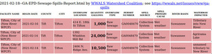
325 W. 16th St. Spill
CATEGORIES: Spill
LAYER: Point of Interest
OWNERSHIP: Public
WATER BODY: New River
MILE: 31.81
ADDRESS: 325 W 16th Street, Tifton, GA 31794, Tift County.
DESCRIPTION: Spilled 1, 000 gallons raw sewage 2021-02-18, next to the New River.
WEBSITE: https://wwals.net/2021/02/26/tifton-spills-little-river-new-river-2021-02-18/
PHOTO: https://wwals.net/pictures/2021-02-18–tifton-spill/2021-02-18–tifton-spills.jpg
PHOTO SOURCE: WWALS
PHONE NUMBER: (229) 242-0102
Suggestions: https://forms.gle/DipPgU2TP5atc2Rf9
414 18th St Spill
CATEGORIES: Spill
LAYER: Point of Interest
OWNERSHIP: Public
WATER BODY: New River
MILE: 29.84
ADDRESS: 414 E 18th Street, Tifton, GA 31794, Tift County.
DESCRIPTION: Spilled 1, 000 gallons raw sewage 2021-02-16, just south of Northside Primary School, into an unnamed tributary of the New River. And 3, 800 gallons raw sewage 2021-02-18. https://wwals.net/2021/02/26/tifton-spills-little-river-new-river-2021-02-18/
WEBSITE: https://wwals.net/pictures/2021-02-16–tifton-spills
PHOTO: https://wwals.net/pictures/2021-02-16–tifton-spills/tifton.jpg
PHOTOSET: https://wwals.net/pictures/2021-02-16–tifton-spills/
PHOTO SOURCE: WWALS
PHONE NUMBER: (229) 242-0102
Suggestions: https://forms.gle/DipPgU2TP5atc2Rf9
1434 Sutton Circle Spill

CATEGORIES: Spill
LAYER: Point of Interest
GPS: 31.45087, -83.481579
OWNERSHIP: Public
WATER BODY: New River
MILE: 29.84
ADDRESS: 1434 Sutton Circle, Tifton, GA 31794, Tift County.
DESCRIPTION: Spilled 7, 200 gallons raw sewage 2021-02-18, near Queen Bee Creek, which runs into the New River.
WEBSITE: https://wwals.net/2021/02/26/tifton-spills-little-river-new-river-2021-02-18/
PHOTO SOURCE: WWALS
PHONE NUMBER: (229) 242-0102
Suggestions: https://forms.gle/DipPgU2TP5atc2Rf9
1439 Sutton Circle Spill
CATEGORIES: Spill
LAYER: Point of Interest
OWNERSHIP: Public
WATER BODY: New River
MILE: 29.84
ADDRESS: 1439 Sutton Circle, Tifton, GA 31794, Tift County.
DESCRIPTION: Spilled 250, 000 gallons raw sewage 2024-09-26 during Hurricane Helene, near Queen Bee Creek, which runs into the New River.
WEBSITE: https://wwals.net/pictures/2024-09-27–spills
PHOTOSET: https://www.wwals.net/pictures/2024-09-27–spills/
PHOTO SOURCE: WWALS
PHONE NUMBER: (850) 290-2350
Suggestions: https://forms.gle/DipPgU2TP5atc2Rf9
Georgia Museum of Agriculture 


CATEGORIES: Point Of Interest
LAYER: Point of Interest
OWNERSHIP: Public
WATER BODY: Agrirama Lake
ADDRESS: 1392 Whiddon Mill Rd, Tifton, GA 31793, Tift County.
DESCRIPTION: “”The Georgia Museum of Agriculture is an immersive experience into the agrarian and cultural traditions of the 19th century American South. Take a glimpse into the innovative and storied history of the Wiregrass region of Southern Georgia through hands-on learning experiences and a sweeping landscape of historic sites and artifacts.””
HISTORIC FACTS: Formerly known as the Georgia Agrirama. All about agricultural history in Georgia.
WEBSITE: https://gma.abac.edu/
PHOTO: https://www.wwals.net/pictures/2022-11-02–ssrwpc/Attractions-Parent-1590×1080.jpg
PHOTOSET: https://www.wwals.net/pictures/2022-11-02–ssrwpc/
PHOTO SOURCE: ABAC
PHONE NUMBER: (850) 290-2350
Suggestions: https://forms.gle/DipPgU2TP5atc2Rf9
Agrirama Spill
CATEGORIES: Spill
LAYER: Point of Interest
OWNERSHIP: Public
WATER BODY: Agrirama Lake
ADDRESS: 1392 Whiddon Mill Rd., Tifton, GA 31793, Tift County.
DESCRIPTION: Spilled 24, 000 gallons raw sewage 2021-12-14 into Agrirama Lake, which drains into the Little River. And 16, 560 gallons raw sewage 2021-02-18. https://wwals.net/2021/02/26/tifton-spills-little-river-new-river-2021-02-18/
WEBSITE: https://wwals.net/pictures/2021-02-16–tifton-spills
PHOTO: https://wwals.net/pictures/2021-02-16–tifton-spills/tifton.jpg
PHOTOSET: https://wwals.net/pictures/2021-02-16–tifton-spills/
PHOTO SOURCE: WWALS
PHONE NUMBER: (229) 242-0102
Suggestions: https://forms.gle/DipPgU2TP5atc2Rf9
BA RR Bridge 
CATEGORIES: Railbridgesite
LAYER: Bridge
OWNERSHIP: Private
WATER BODY: Little River
MILE: 77.83
ADDRESS: Less than a mile due west of King Road, Tifton, GA, Tift County.
DESCRIPTION: Brunswick and Albany Railroad Bridge: RR is defunct, but there may be some bridge remains.
WEBSITE: https://en.wikipedia.org/wiki/Little_River_(Withlacoochee_River)
Suggestions: https://forms.gle/DipPgU2TP5atc2Rf9
Five Bridges
CATEGORIES: Bridge
LAYER: Bridge
GPS: 31.43903, -83.560781
OWNERSHIP: Public
WATER BODY: Little River
MILE: 76.18
ADDRESS: US 82 west of Tifton, GA towards Ty Ty, GA, Tift County.
DESCRIPTION: A four-lane concrete bridge with sidewalk on one side, built in 1979.
WEBSITE: https://en.wikipedia.org/wiki/Little_River_(Withlacoochee_River)
OTHER REFERENCE: https://maps.app.goo.gl/4QhaAn6fk44zv8uP7
Suggestions: https://forms.gle/DipPgU2TP5atc2Rf9
Golden Road Lift Station
CATEGORIES: Liftstation
LAYER: Point of Interest
GPS: 31.43021, -83.523963
OWNERSHIP: Public, City of Tifton, PARCEL T022 005
WATER BODY: Cow House Branch
MILE: 74.10
ADDRESS: West across Cow House Branch from I-75 Exit 60, Tift County.
DESCRIPTION: Spilled in Tropical Storm Irma 2017-09-11 http://www.tiftongazette.com/news/power-outage-cause-gallon-wastewater-spill/article_90712fd2-9e29-11e7-8d9c-33a0bdedea58.html
WEBSITE: https://www.google.com/maps/place/31%C2%B025’48.8%22N+83%C2%B031’26.3%22W/@31.4302114, -83.5246544, 197m/data=!3m2!1e3!4b1!4m6!3m5!1s0x0:0x0!7e2!8m2!3d31.43021!4d-83.5239631
Suggestions: https://forms.gle/DipPgU2TP5atc2Rf9
803 Golden Road Tifton Spill
CATEGORIES: Spill
LAYER: Point of Interest
GPS: 31.429849, -83.526
OWNERSHIP: Public
WATER BODY: Cow House Branch
MILE: 74.00
ADDRESS: Between the two railroad sidings west of the lift station (where there have been many spills before), west across Cow House Branch from I-75 Exit 60. Tift County.
DESCRIPTION: A 7, 000-gallon raw sewage spill because of power failure, reported into Gum Creek, in the GA-EPD Sewage Spills Report for February 19, 2024. Whatever the name of the creek, it runs into the Little River downstream of Alabama Avenue.
Suggestions: https://forms.gle/DipPgU2TP5atc2Rf9
900 W Golden Road Tifton Spill
CATEGORIES: Spill
LAYER: Point of Interest
OWNERSHIP: Public
WATER BODY: Cow House Branch
MILE: 74.00
ADDRESS: At Mebrom, 900 Golden Rd W, Tifton, GA 31793, Tift County.
DESCRIPTION: A 950, 000-gallon raw sewage spill after Hurricane Helene, next to a creek that runs into the Little River downstream of Alabama Avenue. At Mebrom, “”a well-known worldwide manufacturer and distributor of agrochemical products. Mebrom offers a wide selection of fumigation, pest control, disinfection, bio-stimulating products as well as gas destruction and reclaim services.””
WEBSITE: https://wwals.net/pictures/2024-09-27–spills
PHOTOSET: https://www.wwals.net/pictures/2024-09-27–spills/
PHOTO SOURCE: WWALS
PHONE NUMBER: (850) 290-2350
Suggestions: https://forms.gle/DipPgU2TP5atc2Rf9
Golden Road Cow House Bridge
CATEGORIES: Bridge
LAYER: Bridge
GPS: 31.43021, -83.523461
OWNERSHIP: Public
WATER BODY: Cow House Branch
MILE: 73.31
ADDRESS: West from I-75 Exit 60. Tift County.
DESCRIPTION: Street bridge
WEBSITE: https://www.google.com/maps/place/31%C2%B025’48.8%22N+83%C2%B031’24.5%22W/@31.4302114, -83.5241644, 197m/data=!3m2!1e3!4b1!4m6!3m5!1s0x0:0x0!7e2!8m2!3d31.4302102!4d-83.5234725
Suggestions: https://forms.gle/DipPgU2TP5atc2Rf9
Cow House Branch Confluence
CATEGORIES: Tributary
LAYER: Other
OWNERSHIP: Private, Barbara Duncan Kellogg, PARCEL 0049 028
WATER BODY: Little River
MILE: 70.15
ADDRESS: Between US 319 and the (closed) Tifton-Moultrie Railroad Bridge, Tift County.
Suggestions: https://forms.gle/DipPgU2TP5atc2Rf9
Jordan Road Willow Creek Bridge
CATEGORIES: Bridge
LAYER: Bridge
OWNERSHIP: Public
WATER BODY: Willow Creek
ADDRESS: Between US 319 and Union Road. Tift County.
DESCRIPTION: On the satellite map, it looks like a box culvert. The first bridge downstream from the notorious W. Golden Road Lift Station and other sewage spill sites.
Suggestions: https://forms.gle/DipPgU2TP5atc2Rf9
Kell Road Creek Bridge
CATEGORIES: Bridge
LAYER: Bridge
OWNERSHIP: Public
WATER BODY: Kell Road Creek
ADDRESS: East of Aberdeen Drive. Tift County.
DESCRIPTION: Looks like probably three box culverts on the satellite map.
Suggestions: https://forms.gle/DipPgU2TP5atc2Rf9
Overstreet Bridge
CATEGORIES: Bridge
LAYER: Bridge
OWNERSHIP: Public
WATER BODY: Little River
MILE: 70.36
ADDRESS: US 319, GA 35, Alabama Ave., Tifton, GA towards Moultrie, GA, Tift County.
WEBSITE: https://en.wikipedia.org/wiki/Little_River_(Withlacoochee_River)
Suggestions: https://forms.gle/DipPgU2TP5atc2Rf9
TM RR Bridge
CATEGORIES: Railbridgesite
LAYER: Bridge
OWNERSHIP: Public
WATER BODY: Little River
MILE: 70.06
ADDRESS: Due south of Bobby Rd., Tifton, GA, Tift County.
DESCRIPTION: Tifton and Moultrie Railroad, closed 1903.
WEBSITE: https://en.wikipedia.org/wiki/Little_River_(Withlacoochee_River)
Suggestions: https://forms.gle/DipPgU2TP5atc2Rf9
Omega-Eldorado Road Bridge
CATEGORIES: Bridge
LAYER: Bridge
OWNERSHIP: Public
WATER BODY: Little River
MILE: 67.04
ADDRESS: Between Omega and Eldorado, GA, Tift County.
WEBSITE: https://en.wikipedia.org/wiki/Little_River_(Withlacoochee_River)
Suggestions: https://forms.gle/DipPgU2TP5atc2Rf9
Lott Bridge
CATEGORIES: Bridge
LAYER: Bridge
OWNERSHIP: Public
WATER BODY: Little River
MILE: 63.05
ADDRESS: Lott Bridge Road, Lenox, GA 31637, Cook, Colquitt Counties.
DESCRIPTION: Crossland-Lenox Road, Omega, GA 31775
WEBSITE: https://en.wikipedia.org/wiki/Little_River_(Withlacoochee_River)
Suggestions: https://forms.gle/DipPgU2TP5atc2Rf9
Rentz Bridge 
CATEGORIES: Bridgesite
LAYER: Bridge
OWNERSHIP: Public
WATER BODY: Little River
MILE: 61.07
ADDRESS: Rentz Bridge Road (CR 142), Lenox, GA 31637, Cook, Colquitt Counties.
DESCRIPTION: Rentz Bridge Road used to cross the Little River.
WEBSITE: https://en.wikipedia.org/wiki/Little_River_(Withlacoochee_River)
Suggestions: https://forms.gle/DipPgU2TP5atc2Rf9
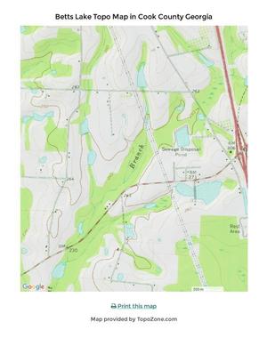
Lenox WPCP
CATEGORIES: Wtp
LAYER: Brochure
OWNERSHIP: Public, Town of Lenox Oxidation Pond, PARCEL 0021B 031
WATER BODY: Flat Branch
MILE: 3.12
ADDRESS: Oxidation Pond Road off Old Union Road, Lenox, GA 31637, Cook County.
DESCRIPTION: “Up to 0.17MGD of treated wastewater is being discharged to an unnamed tributary to the Little River in the Suwannee River Basin.”” On the WLRWT map as Flat Branch, into Doe Branch, into Big Branch 00311333, into the Little River about half way between Kinard Bridge Road Landing and Red Roberts Landing. NPDES Permit No. GA0031950, for the City of Lenox Water Pollution Control Plant (WPCP).
AKA: Lenox Water Pollution Control Plant
GRN: Yes
WEBSITE: https://wwals.net/pictures/2018-08-30–permits/lenox
PHOTO: https://wwals.net/pictures/2018-08-30–permits/lenox/application/LENOX-TOPO-2-0001.jpg
PHOTOSET: https://wwals.net/pictures/2018-08-30–permits/lenox/application
PHOTO SOURCE: GA-EPD
PHONE NUMBER: (850) 290-2350
Suggestions: https://forms.gle/DipPgU2TP5atc2Rf9
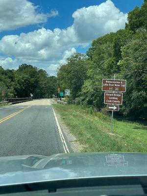
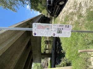
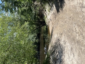
Kinard Bridge Landing 
CATEGORIES: Landing
LAYER: Brochure
GPS: 31.2543, -83.507861
OWNERSHIP: Public
ACCESS: Yes, Launch: county road right of way
WATER BODY: Little River
Lowest boatable: 266.5′
Highest safe: 271′
GAUGE: Tifton
MILE: 59.24
ADDRESS: 2640 Kinard Bridge Rd, Lenox, GA 31637. North side of the road, left bank, east side of the river. From I-75 take exit 49, go west on Central Avenue, which becomes Kinard Bridge Road; it is three miles to the bridge. Cook County.
DESCRIPTION: This rough roadside access is the most upstream put-in on Little River in the Withlacoochee and Little River Water Trail. Downstream you may see Gum Creek, coming down almost sixty miles past Omega, or Warrior Creek coming down 73 miles past Sylvester. You might even spot Flat Ford. Mostly you will see cypress, tupelo, and pines, probably turtles, fish, and birds.
WEBSITE: https://wwals.net/pictures/2021-05-21–water-trail-signs-planted/
DOWNSTREAM: 6.19 miles from Kinard Bridge Landing to Red Roberts Landing
PHOTO: https://wwals.net/pictures/2021-05-21–water-trail-signs-planted/Kinard-Bridge-Road-Sign-East.jpg
PHOTOSET: https://wwals.net/pictures/2021-05-21–water-trail-signs-planted/
PHOTO SOURCE: Bobby McKenzie
PHONE NUMBER: (850) 290-2350
Suggestions: https://forms.gle/DipPgU2TP5atc2Rf9
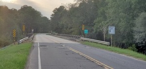
Kinard Bridge
CATEGORIES: Bridge
LAYER: Bridge
OWNERSHIP: Public
WATER BODY: Little River
MILE: 59.23
ADDRESS: 2640 Kinard Bridge Rd, Lenox, GA 31637, Cook, Colquitt Counties.
DESCRIPTION: I-75 exit 49, west on Central Avenue becomes Kinard Bridge Road, 3 miles to bridge.
AKA: Cool Springs Bridge (A Paddler’s Guide to Southern Georgia).
WEBSITE: http://www.brownsguides.com/blog/little-river-of-southern-georgia-paddling-guide/
PHOTO: https://wwals.net/pictures/2020-09-21–kinard-bridge-landing/20200921_184717.jpg
PHOTOSET: https://wwals.net/pictures/2020-09-21–kinard-bridge-landing/20200921_184717.html
PHOTO SOURCE: John S. Quarterman
PHONE NUMBER: (229) 242-0102
Suggestions: https://forms.gle/DipPgU2TP5atc2Rf9
Kinard Bridge Gauge
CATEGORIES: River Gauge
LAYER: River Gauge
OWNERSHIP: Public
WATER BODY: Little River
MILE: 59.23
ADDRESS: 2640 Kinard Bridge Rd, Lenox, GA 31637, Cook County.
DESCRIPTION: USGS 02317830, historical data only.
WEBSITE: http://waterdata.usgs.gov/nwis/inventory/?site_no=02317830
Suggestions: https://forms.gle/DipPgU2TP5atc2Rf9
Gum Creek (Little River)
CATEGORIES: Tributary
LAYER: Point of Interest
OWNERSHIP: Private
WATER BODY: Little River
MILE: 58.44
ADDRESS: Downstream 3/4 mile from Kinard Bridge. Colquitt County.
DESCRIPTION: Entering Little River right, this 23-mile creek comes down from well above Omega.
Suggestions: https://forms.gle/DipPgU2TP5atc2Rf9
Ellenton Omega Road Warrior Creek Bridge
CATEGORIES: Bridge
LAYER: Bridge
OWNERSHIP: Public
WATER BODY: Warrior Creek
MILE: 6.19
ADDRESS: On CR 486 between Ellenton and Omega, 6 miles upstream from the Little River. Colquitt County.
DESCRIPTION: A two-lane concrete bridge with asphalt deck marks the most upstream navigable part of Warrior Creek according to GA YB 1397 of 2024.
WEBSITE: https://wwals.net/2024/02/24/all-wwals-water-trails-navigable-according-to-ga-hb-1397-2024-02-22/
Suggestions: https://forms.gle/DipPgU2TP5atc2Rf9
Vickers Bridge
CATEGORIES: Bridge
LAYER: Bridge
OWNERSHIP: Public
WATER BODY: Warrior Creek
MILE: 2.55
ADDRESS: On CR 177 between Ellenton and Lenox, 2 1/2 miles upstream from the Little River. Colquitt County.
DESCRIPTION: A two-lane concrete bridge on a dirt road.
WEBSITE: https://wwals.net/2024/02/24/all-wwals-water-trails-navigable-according-to-ga-hb-1397-2024-02-22/
Suggestions: https://forms.gle/DipPgU2TP5atc2Rf9
Warrior Creek
CATEGORIES: Tributary
LAYER: Point of Interest
GPS: 31.2285, -83.513374
OWNERSHIP: Private
WATER BODY: Little River
MILE: 57.15
ADDRESS: Downstream 2 miles from Kinard Bridge and upstream 4 miles from Rountree Bridge. Colquitt County.
DESCRIPTION: Entering Little River right, this 73-mile creek comes all the way down from above Sylvester.
Suggestions: https://forms.gle/DipPgU2TP5atc2Rf9
Big Branch
CATEGORIES: Tributary
LAYER: Point of Interest
OWNERSHIP: Private
WATER BODY: Little River
MILE: 56.87
ADDRESS: Downstream 2 1/3 miles from Kinard Bridge and upstream 2/3 of a mile from Flat Ford. Cook County.
DESCRIPTION: Entering Little River left, this creek comes down acres US 41, I-75, and Barneyville Road twice. Lenox WPCP discharge ends up here.
Suggestions: https://forms.gle/DipPgU2TP5atc2Rf9
Flat Ford
CATEGORIES: Ford
LAYER: Point of Interest
OWNERSHIP: Public
WATER BODY: Little River
MILE: 56.20
ADDRESS: Past end of Flat Ford Road, Sparks, GA 31647, Cook, Colquitt Counties.
DESCRIPTION: Where Flat Ford Road used to cross the Little River.
WEBSITE: https://en.wikipedia.org/wiki/Little_River_(Withlacoochee_River)
Suggestions: https://forms.gle/DipPgU2TP5atc2Rf9
Float Under Deadfall 
CATEGORIES: Deadfall
LAYER: Point of Interest
OWNERSHIP: Public
WATER BODY: Little River
MILE: 55.30
ADDRESS: Between Flat Ford and Poley Branch. Cook, Colquitt Counties.
DESCRIPTION: A quite large oak across the river, but you can float under it.
Suggestions: https://forms.gle/DipPgU2TP5atc2Rf9
Lower Flat Ford Deadfall
CATEGORIES: Deadfall
LAYER: Point of Interest
OWNERSHIP: Public
WATER BODY: Little River
MILE: 55.07
ADDRESS: Between Flat Ford and Poley Branch. Cook, Colquitt Counties.
DESCRIPTION: A big rotten oak blocking the river.
HISTORIC FACTS: An opening cleared by a WWALS Chainsaw Cleanup 2024-09-21 https://wwals.net/2024/09/01/red-roberts-little-river-chainsaw-cleanup-2024-09-21/
Suggestions: https://forms.gle/DipPgU2TP5atc2Rf9
Poley Deadfall

CATEGORIES: Deadfall
LAYER: Point of Interest
GPS: 31.21116667, -83.51111111
OWNERSHIP: Public
WATER BODY: Little River
MILE: 54.96
ADDRESS: Between Flat Ford and Poley Branch. Cook, Colquitt Counties.
DESCRIPTION: A mile and a half above the bottom of Rountree Lake, another big deadfall.
HISTORIC FACTS: An opening cleared by a WWALS Chainsaw Cleanup 2024-09-21 https://wwals.net/2024/09/01/red-roberts-little-river-chainsaw-cleanup-2024-09-21/
WEBSITE: https://wwals.net/pictures/2024-08-20–little-river-chainsaw-cleanup-request
PHOTO: https://www.wwals.net/pictures/2024-08-20–little-river-chainsaw-cleanup-request/poley-deadfall.jpg
PHOTOSET: https://www.wwals.net/pictures/2024-08-20–little-river-chainsaw-cleanup-request/
PHOTO SOURCE: Darlene Eanes Ray
PHONE NUMBER: (850) 290-2350
PHOTO2: https://www.wwals.net/pictures/2024-08-20–little-river-chainsaw-cleanup-request/poley-deadfall2.jpg
Photoset2: https://www.wwals.net/pictures/2024-08-20–little-river-chainsaw-cleanup-request/
PHOTO2 SOURCE: Darlene Eanes Ray
Suggestions: https://forms.gle/DipPgU2TP5atc2Rf9

Sumner Deadfall
CATEGORIES: Deadfall
LAYER: Point of Interest
OWNERSHIP: Public
WATER BODY: Little River
MILE: 54.71
ADDRESS: Somewhat above Poley Branch. Cook, Colquitt Counties.
DESCRIPTION: A big oak with ressurrection fern across the river.
HISTORIC FACTS: An opening cleared by a WWALS Chainsaw Cleanup 2024-09-21 https://wwals.net/2024/09/01/red-roberts-little-river-chainsaw-cleanup-2024-09-21/
Suggestions: https://forms.gle/DipPgU2TP5atc2Rf9
Poley Branch Deadfall
CATEGORIES: Deadfall
LAYER: Point of Interest
OWNERSHIP: Public
WATER BODY: Little River
MILE: 54.60
ADDRESS: At Poley Branch, downstream 1.59 miles from Flat Ford Road and upstream 1.53 miles from Rountree Bridge. Cook, Colquitt Counties.
DESCRIPTION: A small oak with many branches across the river.
HISTORIC FACTS: An opening cleared by a WWALS Chainsaw Cleanup 2024-09-21 https://wwals.net/2024/09/01/red-roberts-little-river-chainsaw-cleanup-2024-09-21/
Suggestions: https://forms.gle/DipPgU2TP5atc2Rf9
Poley Branch
CATEGORIES: Tributary
LAYER: Point of Interest
OWNERSHIP: Private
WATER BODY: Little River
MILE: 54.61
ADDRESS: Downstream 1.59 miles from Flat Ford Road and upstream 1.53 miles from Rountree Bridge. Cook County.
DESCRIPTION: Left bank, this creek comes down across Old Union Road.
Suggestions: https://forms.gle/DipPgU2TP5atc2Rf9
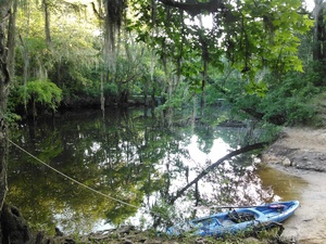
Rountree Lake 

CATEGORIES: Lake
LAYER: Point of Interest
OWNERSHIP: Public
WATER BODY: Little River
MILE: 53.54
ADDRESS: A bit more than half a mile upstream from Rountree Bridge. Cook, Colquitt Counties.
DESCRIPTION: A wide spot in the little river, known for fishing.
WEBSITE: https://wwals.net/pictures/2024-08-20–little-river-chainsaw-cleanup-request
PHOTOSET: https://www.wwals.net/pictures/2024-08-20–little-river-chainsaw-cleanup-request/
PHOTO SOURCE: Darlene Eanes Ray
PHONE NUMBER: (850) 290-2350
Suggestions: https://forms.gle/DipPgU2TP5atc2Rf9
Rountree Creek 03110204000514
CATEGORIES: Tributary
LAYER: Point of Interest
OWNERSHIP: Private
WATER BODY: Little River
MILE: 53.77
ADDRESS: About 2/3 miles upstream from Rountree Bridge. Cook County.
DESCRIPTION: Enters Little River left after crossing Rountree Bridge Road.
Suggestions: https://forms.gle/DipPgU2TP5atc2Rf9
Rountree Deadfall 2

CATEGORIES: Deadfall
LAYER: Point of Interest
OWNERSHIP: Public
WATER BODY: Little River
MILE: 53.52
ADDRESS: Half a mile upstream from Rountree Bridge, above Rountree Deadfall 1, at a cut-through. Cook, Colquitt Counties.
DESCRIPTION: A trashjam in the Little River.
HISTORIC FACTS: An opening cleared by a WWALS Chainsaw Cleanup 2024-09-21 https://wwals.net/2024/09/01/red-roberts-little-river-chainsaw-cleanup-2024-09-21/
WEBSITE: https://wwals.net/pictures/2024-08-20–little-river-chainsaw-cleanup-request
PHOTOSET: https://www.wwals.net/pictures/2024-08-20–little-river-chainsaw-cleanup-request/
PHOTO SOURCE: Darlene Eanes Ray
PHONE NUMBER: (850) 290-2350
Suggestions: https://forms.gle/DipPgU2TP5atc2Rf9
Rountree Deadfall 1

CATEGORIES: Deadfall
LAYER: Point of Interest
OWNERSHIP: Public
WATER BODY: Little River
MILE: 53.46
ADDRESS: Half a mile upstream from Rountree Bridge, Cook, Colquitt Counties.
DESCRIPTION: A logjam in the Little River.
WEBSITE: https://wwals.net/pictures/2024-08-20–little-river-chainsaw-cleanup-request
PHOTOSET: https://www.wwals.net/pictures/2024-08-20–little-river-chainsaw-cleanup-request/
PHOTO SOURCE: Darlene Eanes Ray
PHONE NUMBER: (850) 290-2350
Suggestions: https://forms.gle/DipPgU2TP5atc2Rf9
Rountree Bridge

CATEGORIES: Bridge
LAYER: Bridge
OWNERSHIP: Public
WATER BODY: Little River
MILE: 53.08
ADDRESS: I-75 exit 41, west on Rountree Bridge Road to the Little River, Cook, Colquitt Counties.
DESCRIPTION: Two-lane county highway bridge over the Little River, with Red Roberts Landing on its south side, on the left (west) bank of the river.
AKA: Ellington Bridge (A Paddler’s Guide to Southern Georgia) or Ellenton Bridge.
WEBSITE: https://en.wikipedia.org/wiki/Little_River_(Withlacoochee_River)
PHOTOSET: https://wwals.net/2014/03/30/pictures-gretchen-quarterman-big-little-river-paddle-event-2014-03-29/
PHOTO SOURCE: Gretchen Quarterman
PHONE NUMBER: (229) 834-1945
Suggestions: https://forms.gle/DipPgU2TP5atc2Rf9
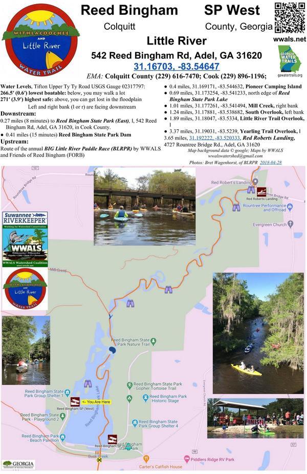
Red Roberts Landing @ Rountree Bridge Road 

CATEGORIES: Landing
LAYER: Brochure
OWNERSHIP: Public
ACCESS: Yes, Launch: dirt road to riverside, PARKING: Free, PICNIC AREA
WATER BODY: Little River
Lowest boatable: 266.5′
Highest safe: 271′
GAUGE: Tifton
MILE: 53.05
ADDRESS: 4727 Rountree Bridge Rd., Adel, GA 31620. River left at Rountree Bridge south of Rountree Bridge Road (CR 251) west of Adel; exit 41 off I-75. Cook County.
DESCRIPTION: The dirt entry road to this sloping riverside access has plenty of parking and woods trails. Put in here at the top of Reed Bingham State Park and paddle under cypress, tupelo, and pines on the winding blackwater Little River past three overlooks to the park Lake, where you will probably see alligators. Start point of the annual WWALS and FORB (Friends of Reed Bingham) BIG Little River Paddle Race.
WEBSITE: https://wwals.net/events-2/?ee=9
ADDITIONAL INFO SOURCES: https://wwals.net/2019/05/01/winners-big-little-river-paddle-race-2019-04-27/
UPSTREAM: 6.19 miles from Red Roberts Landing to Kinard Bridge Landing
DOWNSTREAM: 3.64 miles from Red Roberts Landing to Reed Bingham State Park West Boat Ramp
PHOTO: https://wwals.net/wp-content/themes/pianoblack/img//2015/05/9cd96f2addb1790f56bed88dffc8e65a.jpg
PHOTOSET: https://wwals.net/2015/05/18/winners-of-3rd-annual-big-little-river-paddle-race-2015-05-16/
PHOTO SOURCE: John S. Quarterman
PHONE NUMBER: (229) 242-0102
PHOTO2: https://www.wwals.net/pictures/2020-09-26–drafts-metal-signs/Red-Roberts-Landing-Sign-0001.jpg
Photoset2: https://www.wwals.net/pictures/2020-09-26–drafts-metal-signs/Red-Roberts-Landing-Sign-0001.html
PHOTO2 SOURCE: WWALS
Suggestions: https://forms.gle/DipPgU2TP5atc2Rf9

Red Roberts Landing River GPS
CATEGORIES: Point Of Interest
LAYER: Point of Interest
OWNERSHIP: Public
ACCESS: Yes, Launch: dirt road to riverside, PARKING: Free, PICNIC AREA
WATER BODY: Little River
Lowest boatable: 266.5′
Highest safe: 271′
GAUGE: Tifton
MILE: 53.05
ADDRESS: 4727 Rountree Bridge Rd., Adel, GA 31620. River left at Rountree Bridge south of Rountree Bridge Road (CR 251) west of Adel; exit 41 off I-75. Cook County.
DESCRIPTION: The dirt entry road to this sloping riverside access has plenty of parking and woods trails. Put in here at the top of Reed Bingham State Park and paddle under cypress, tupelo, and pines on the winding blackwater Little River past three overlooks to the park Lake, where you will probably see alligators. Start point of the annual WWALS and FORB (Friends of Reed Bingham) BIG Little River Paddle Race.
WEBSITE: https://wwals.net/events-2/?ee=9
ADDITIONAL INFO SOURCES: https://wwals.net/2019/05/01/winners-big-little-river-paddle-race-2019-04-27/
PHOTO: https://wwals.net/wp-content/themes/pianoblack/img//2015/05/9cd96f2addb1790f56bed88dffc8e65a.jpg
PHOTOSET: https://wwals.net/2015/05/18/winners-of-3rd-annual-big-little-river-paddle-race-2015-05-16/
PHOTO SOURCE: John S. Quarterman
PHONE NUMBER: (229) 242-0102
PHOTO2: https://www.wwals.net/pictures/2020-09-26–drafts-metal-signs/Red-Roberts-Landing-Sign-0001.jpg
Photoset2: https://www.wwals.net/pictures/2020-09-26–drafts-metal-signs/Red-Roberts-Landing-Sign-0001.html
PHOTO2 SOURCE: WWALS
Suggestions: https://forms.gle/DipPgU2TP5atc2Rf9
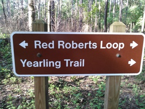
Yearling Trail 
CATEGORIES: Hiking Trail
LAYER: Hiking Trail
GPS: 31.19031, -83.523858
OWNERSHIP: Public
WATER BODY: Little River
MILE: 52.77
ADDRESS: 4727 Rountree Bridge Rd., Adel, GA 31620, Cook County.
DESCRIPTION: Begins at Red Roberts Landing and goes to Yearling Trail Overlook: “”This one-mile-long bike trail covers an area that was once cultivated and features a variety of scrub oaks, longleaf pine, saw palmetto and wiregrass. You’ll also see large live oaks and wax myrtle.””, “”This section is also part of our Gopher Tortoise Management Area and the tortoises are commonly seen here.”
WEBSITE: https://gastateparks.org/ReedBingham/Trails
ADDITIONAL INFO SOURCES: https://gastateparks.org/sites/default/files/parks/pdf/trailmaps/ReedBingham_TrailMap.pdf
PHOTO: https://wwals.net/wp-content/themes/pianoblack/img//2015/05/f6f3f4d1cc0ad9f4a7797a014aa94eb9.jpg
PHOTOSET: https://wwals.net/2015/05/18/winners-of-3rd-annual-big-little-river-paddle-race-2015-05-16/
PHOTO SOURCE: John S. Quarterman
PHONE NUMBER: (229) 242-0102
Suggestions: https://forms.gle/DipPgU2TP5atc2Rf9
Yearling Trail Overlook
CATEGORIES: Point Of Interest
LAYER: Point of Interest
GPS: 31.19031, -83.523858
OWNERSHIP: Public
WATER BODY: Little River
MILE: 52.77
ADDRESS: Cook County.
DESCRIPTION: River left, on the Yearling Trail.
WEBSITE: https://gastateparks.org/ReedBingham/Trails
ADDITIONAL INFO SOURCES: https://gastateparks.org/sites/default/files/parks/pdf/trailmaps/ReedBingham_TrailMap.pdf
Suggestions: https://forms.gle/DipPgU2TP5atc2Rf9
Little River Trail
CATEGORIES: Hiking Trail
LAYER: Hiking Trail
OWNERSHIP: Public
WATER BODY: Little River
MILE: 51.29
ADDRESS: Cook County.
DESCRIPTION: Extends from Yearling Trail Overlook to Little River Trail Overlook and South Overlook, then inland to Gopher Tortoise Loop. “”This 0.9-mile trail introduces you to a River Swamp. Periodically flooded by the Little River, these bottomlands contain plants such as bald cypress, tupelos and spruce pine, that have adapted to wet conditions. This area is the interface between higher and drier uplands and the aquatic river environment.””, “”There are extensive boardwalks and two observation points overlooking the river. Look for river otters, spotted turtles and deer.”
WEBSITE: https://gastateparks.org/ReedBingham/Trails
ADDITIONAL INFO SOURCES: https://gastateparks.org/sites/default/files/parks/pdf/trailmaps/ReedBingham_TrailMap.pdf
Suggestions: https://forms.gle/DipPgU2TP5atc2Rf9
Little River Trail Overlook
CATEGORIES: Point Of Interest
LAYER: Point of Interest
OWNERSHIP: Public
WATER BODY: Little River
MILE: 51.29
ADDRESS: Cook County.
DESCRIPTION: River left, on the Little River Trail.
WEBSITE: https://gastateparks.org/ReedBingham/Trails
ADDITIONAL INFO SOURCES: https://gastateparks.org/sites/default/files/parks/pdf/trailmaps/ReedBingham_TrailMap.pdf
Suggestions: https://forms.gle/DipPgU2TP5atc2Rf9
Shortcut Deadfall

CATEGORIES: Deadfall
LAYER: Point of Interest
GPS: 31.18105556, -83.53608333
OWNERSHIP: Public
WATER BODY: Little River
MILE: 50.93
ADDRESS: Halfway between the Little River Trail Overlook and the South Overlook. Cook, Colquitt Counties.
DESCRIPTION: A downed tree blocking a shortcut through an oxbow.
WEBSITE: https://wwals.net/pictures/2024-08-20–little-river-chainsaw-cleanup-request
PHOTOSET: https://www.wwals.net/pictures/2024-08-20–little-river-chainsaw-cleanup-request/
PHOTO SOURCE: Darlene Eanes Ray
PHONE NUMBER: (850) 290-2350
Suggestions: https://forms.gle/DipPgU2TP5atc2Rf9
South Overlook
CATEGORIES: Point Of Interest
LAYER: Point of Interest
GPS: 31.17881, -83.538682
OWNERSHIP: Public
WATER BODY: Little River
MILE: 50.64
ADDRESS: Cook County.
DESCRIPTION: River left, on the Little River Trail.
WEBSITE: https://gastateparks.org/ReedBingham/Trails
ADDITIONAL INFO SOURCES: https://gastateparks.org/sites/default/files/parks/pdf/trailmaps/ReedBingham_TrailMap.pdf
Suggestions: https://forms.gle/DipPgU2TP5atc2Rf9
Mill Creek
CATEGORIES: Tributary
LAYER: Point of Interest
OWNERSHIP: Public
WATER BODY: Little River
MILE: 50.41
ADDRESS: Colquitt County.
DESCRIPTION: This 8-mile creek enters Little River right after crossing Rountree Bridge Road.
Suggestions: https://forms.gle/DipPgU2TP5atc2Rf9
Reed Bingham State Park Lake


CATEGORIES: Lake
LAYER: Point of Interest
OWNERSHIP: Public
ACCESS: No, CANOE, CAMPING: RV Campsites, WATER, Flush Toilet, PARKING: Park entrance fee, SHELTER, PICNIC AREA, HANDICAPPED ACCESSIBLE
WATER BODY: Little River
MILE: 50.09
ADDRESS: 542 Reed Bingham Rd, Adel, GA 31620, Cook, Colquitt Counties.
DESCRIPTION: “A 375 acre lake popular with boaters and skiers. Fishing for bass, crappie, catfish and bream is excellent. Paddlers can rent canoes and kayaks to explore this beautiful lake lined with fragrant water lilies and tupelo trees. Guided pontoon boat tours are sometimes offered during events.””, The lake has two boat ramps directly on it, or you can paddle down the Little River from Red Roberts Landing.
AKA: Reed Bingham SP
GRN: Yes
WEBSITE: https://gastateparks.org/ReedBingham/Trails
PHOTO: https://www.wwals.net/pictures/2018-04-28–blrpr-hubbard/4063062-28Apr18.jpg
PHOTOSET: https://www.wwals.net/pictures/2018-04-28–blrpr-hubbard/
PHOTO SOURCE: Phill Hubbard for WWALS
PHONE NUMBER: (850) 290-2350
PHOTO2: https://www.flickr.com/gp/187730456@N03/6408L9
PHOTO2 SOURCE: Mark Yuan
Photo2 Phone Number: 229-896-3551
Suggestions: https://forms.gle/DipPgU2TP5atc2Rf9
Pioneer Camping Island

CATEGORIES: Camping
LAYER: Point of Interest
OWNERSHIP: Public
ACCESS: Yes, Launch: island side on lake, CAMPING: Tent Campsites, Pit Privy, PARKING: $60/day, PICNIC AREA
WATER BODY: Little River
MILE: 49.80
ADDRESS: Offshore from Reed Bingham SP (West) Boat Ramp. Cook, Colquitt Counties.
DESCRIPTION: This entire island can be rented by the day from Reed Bingham State Park for camping. Up to 30 people per day can camp on the island.
HISTORIC FACTS: Apparently the first rentable camping island in a Georgia state park.
AKA: Eagle Island
GRN: Yes
WEBSITE: https://www.reserveamerica.com/explore/reed-bingham-state-park/GA/530186/6609/campsite-booking
OTHER REFERENCE: https://gastateparks.reserveamerica.com/camping/reed-bingham-state-park/r/campgroundDetails.do?contractCode=GA&parkId=530186
ADDITIONAL INFO SOURCES: https://www.n-georgia.com/reed-bingham-state-park-eagle-island.html
PHOTO: https://www.reserveamerica.com/webphotos/GA/pid530186/sid6609/1/540×360.jpg
PHOTOSET: https://www.reserveamerica.com/explore/reed-bingham-state-park/GA/530186/6609/campsite-booking
PHOTO SOURCE: ReserveAmerica.com
PHONE NUMBER: (229) 896-3551
Suggestions: https://forms.gle/DipPgU2TP5atc2Rf9
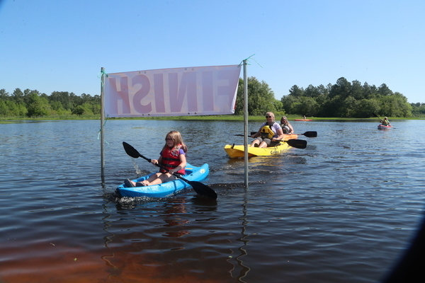
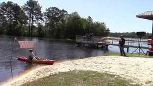
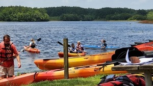
Reed Bingham State Park West Boat Ramp


CATEGORIES: Landing
LAYER: Brochure
GPS: 31.16703, -83.54647
OWNERSHIP: Public
ACCESS: Yes, Ramp: Concrete, CANOE, CAMPING, FOOD: Snack Machine, WATER, Flush Toilet, PARKING: Park entrance fee, SHELTER, PICNIC AREA, HANDICAPPED ACCESSIBLE
WATER BODY: Little River
MILE: 49.41
ADDRESS: 542 Reed Bingham Rd, Adel, GA 31620. Take I-75 Exit 39, turn west on GA 37, right on Evergreen Church Road (CR 99), left on Reed Bingham SP Road (CR 221). Colquitt County.
DESCRIPTION: Paddle out on the 375-acre Reed Bingham State Park Lake to sightsee, fish for bass, crappie, catfish and bream, or camp on Pioneer Camping Island. Slightly downstream is the only dam on the Little River. The park rents boats and campsites. “”Nesting bald eagles are often seen in winter. American alligators are often seen sunning along the lake’s edge. During winter, thousands of black vultures and turkey vultures, roost in the trees and soar overhead.”
HISTORIC FACTS: Finish line for the annual WWALS and FORB (Friends of Reed Bingham State Park) BIG Little River Paddle Race.
AKA: Reed Bingham State Park (West) Boat Ramp
WEBSITE: https://georgiawildlife.com/locations/fishing
UPSTREAM: 3.64 miles from Reed Bingham State Park West Boat Ramp to Red Roberts Landing
DOWNSTREAM: 0.33 mile from Reed Bingham State Park West Boat Ramp to Reed Bingham State Park East Boat Ramp
PHOTO: https://wwals.net/pictures/gretchen/2019-04-27–wwals-blrpr/10-bib24-nikki-york.jpg
PHOTOSET: https://wwals.net/pictures/gretchen/2019-04-27–wwals-blrpr/
PHOTO SOURCE: Gretchen Quarterman
PHONE NUMBER: (850) 290-2350
PHOTO2: https://www.wwals.net/pictures/2020-09-26–drafts-metal-signs/Reed-Bingham-SP-West-Sign-0001.jpg
Photoset2: https://www.wwals.net/pictures/2020-09-26–drafts-metal-signs/Reed-Bingham-SP-West-Sign-0001.html
PHOTO2 SOURCE: WWALS
Suggestions: https://forms.gle/DipPgU2TP5atc2Rf9

Reed Bingham State Park Swim Area


CATEGORIES: Beach
LAYER: Point of Interest
OWNERSHIP: Public
ACCESS: WATER, RESTROOMS, PARKING: Park entrance fee, SHELTER
WATER BODY: Little River
MILE: 49.07
ADDRESS: 542 Reed Bingham Rd, Adel, GA 31620. Take I-75 Exit 39, turn west on GA 37, right on Evergreen Church Road (CR 99), left on Reed Bingham SP Road (CR 221), in through the gate and across the dam. Colquitt County.
DESCRIPTION: A sandy beach on the 375-acre Reed Bingham State Park Lake.
AKA: Reed Bingham State Park Beach
WEBSITE: https://gastateparks.org/ReedBingham/
PHOTO: https://www.wwals.net/pictures/2021-06-19–juneteenth-rbsp-pictures/20210619_132412.jpg
PHOTOSET: https://www.wwals.net/pictures/2021-06-19–juneteenth-rbsp-pictures/
PHOTO SOURCE: John S. Quarterman
PHONE NUMBER: (229) 242-0102
PHOTO2: https://www.wwals.net/pictures/gretchen/2022-04-30–blrpr-pictures/IMG_6992.jpg
Photoset2: https://www.wwals.net/pictures/gretchen/2022-04-30–blrpr-pictures/
PHOTO2 SOURCE: Gretchen Quarterman
Suggestions: https://forms.gle/DipPgU2TP5atc2Rf9

Reed Bingham State Park East Boat Ramp
CATEGORIES: Landing
LAYER: Brochure
GPS: 31.16253, -83.54123
OWNERSHIP: Public
ACCESS: Yes, Ramp: Concrete, CANOE, CAMPING, FOOD: Snack Machine, WATER, Flush Toilet, PARKING: Park entrance fee, SHELTER, PICNIC AREA, HANDICAPPED ACCESSIBLE
WATER BODY: Little River
MILE: 49.08
ADDRESS: 542 Reed Bingham Rd, Adel, GA 31620. Take I-75 Exit 39, turn west on GA 37, right on Evergreen Church Road (CR 99), left on Reed Bingham SP Road (CR 221). Cook County.
DESCRIPTION: Paddle out on the 375-acre Reed Bingham State Park Lake for sightseeing or fish for bass, crappie, catfish and bream. Slightly downstream is the only dam on the Little River. The park rents boats and campsites. “”Nesting bald eagles are often seen in winter. American alligators are often seen sunning along the lake’s edge. During winter, thousands of black vultures and turkey vultures, roost in the trees and soar overhead.”
HISTORIC FACTS: Site of the Cook County Centennial in June 2019.
AKA: Reed Bingham State Park (East) Boat Ramp
WEBSITE: https://georgiawildlife.com/locations/fishing
ADDITIONAL INFO SOURCES: https://www.facebook.com/permalink.php?story_fbid=456792108483221&id=293673894795044
UPSTREAM: 0.33 mile from Reed Bingham State Park East Boat Ramp to Reed Bingham State Park West Boat Ramp
DOWNSTREAM: 0.51 mile from Reed Bingham State Park East Boat Ramp to Adel-Moultrie Landing
PHOTO: https://wwals.net/pictures/2019-06-22–reed-bingham-cook-county-centennial-forb/20190622_135502.jpg
PHOTOSET: https://wwals.net/pictures/2019-06-22–reed-bingham-cook-county-centennial-forb
PHOTO SOURCE: John S. Quarterman
PHONE NUMBER: (229) 242-0102
PHOTO2: https://www.wwals.net/pictures/2020-09-26–drafts-metal-signs/Reed-Bingham-SP-East-Sign-0001.jpg
Photoset2: https://www.wwals.net/pictures/2020-09-26–drafts-metal-signs/Reed-Bingham-SP-East-Sign-0001.html
PHOTO2 SOURCE: WWALS
Suggestions: https://forms.gle/DipPgU2TP5atc2Rf9

Reed Bingham State Park 

CATEGORIES: Public Land
LAYER: Point of Interest
OWNERSHIP: Public
ACCESS: Yes, FOOD: Snack Machine, WATER, RESTROOMS, PARKING: Park entrance fee, SHELTER, PICNIC AREA, HANDICAPPED ACCESSIBLE
WATER BODY: Little River
MILE: 49.01
ADDRESS: 542 Reed Bingham Rd, Adel, GA 31620, Cook, Colquitt Counties.
DESCRIPTION: Between Adel and Moultrie, one of only two state parks in the Suwannee River Basin in Georgia, and site of the annual WWALS and FORB (Friends of Reed Bingham) BIG Little River Paddle Race.
GRN: Yes
WEBSITE: https://gastateparks.org/ReedBingham/
PHOTOSET: https://gastateparks.org/ReedBingham?asset=2589-wl-33a2380c-435b-42de-85a4-3904e62c399c
PHOTO SOURCE: Reed Bingham SP
PHONE NUMBER: (229) 896-3551
Suggestions: https://forms.gle/DipPgU2TP5atc2Rf9
Reed Bingham State Park Dam 
CATEGORIES: Dam
LAYER: Point of Interest
OWNERSHIP: Public
WATER BODY: Little River
MILE: 49.00
ADDRESS: 542 Reed Bingham Rd, Adel, GA 31620, Cook, Colquitt Counties.
DESCRIPTION: The only dam on the Little River. On Reed Bingham State Park Lake, GA 37 to CR 99 to CR 221.
GRN: Yes
WEBSITE: https://gastateparks.org/ReedBingham/
PHONE NUMBER: (229) 896-3551
Suggestions: https://forms.gle/DipPgU2TP5atc2Rf9
Reed Bingham Bridge
CATEGORIES: Bridge
LAYER: Bridge
OWNERSHIP: Public
WATER BODY: Little River
MILE: 48.95
ADDRESS: Reed Bingham Road (CR 221), Adel, GA 31620, Cook, Colquitt Counties.
DESCRIPTION: Buck Creek Church Road, Norman Park, GA 31771. Just below Reed Bingham SP Dam.
WEBSITE: https://en.wikipedia.org/wiki/Little_River_(Withlacoochee_River)
PHONE NUMBER: (229) 896-3551
Suggestions: https://forms.gle/DipPgU2TP5atc2Rf9
Sparks Western Railroad Bridge
CATEGORIES: Railbridge
LAYER: Bridge
GPS: 31.160057, -83.54305
OWNERSHIP: Private
WATER BODY: Little River
MILE: 48.88
ADDRESS: Just south (downstream) of Reed Bingham Bridge, Cook, Colquitt Counties.
DESCRIPTION: “”The Sparks Western twenty miles of log road between Sparks and Kingwood.””
WEBSITE: https://en.wikipedia.org/wiki/Little_River_(Withlacoochee_River)
OTHER REFERENCE: https://raycityhistory.wordpress.com/tag/sparks-western-railroad/
Suggestions: https://forms.gle/DipPgU2TP5atc2Rf9
Adel Gauge
CATEGORIES: River Gauge
LAYER: River Gauge
OWNERSHIP: Public
WATER BODY: Little River
Lowest boatable: 175.3′
Highest safe: 181′
GAUGE: Adel
MILE: 48.57
ADDRESS: GA 37 between Adel and Moultrie, , just south of Reed Bingham State Park. Cook County.
DESCRIPTION: USGS 02318000
AKA: GA 37 Gauge
WEBSITE: https://wwals.net/2014/05/06/flooding-charts-2/#Adel
PHOTO: http://waterwatch.usgs.gov/wwapps/ww_chart.php?i=nwis&vt=uv&site_no=02318000&p_cd=00065
PHOTOSET: https://wwals.net/2014/05/06/flooding-charts-2/
PHOTO SOURCE: WWALS
PHONE NUMBER: (229) 242-0102
Suggestions: https://forms.gle/DipPgU2TP5atc2Rf9
Whitehurst Bridge
CATEGORIES: Bridge
LAYER: Bridge
OWNERSHIP: Public
WATER BODY: Little River
MILE: 48.57
ADDRESS: West of Adel towards Moultrie across the Little River, Colquitt, Cook Counties.
DESCRIPTION: Above Adel-Moultrie Landing. 405.9-foot concrete cast-in-place stringer bridge built in 1994.
WEBSITE: http://bridgereports.com/1093343
Suggestions: https://forms.gle/DipPgU2TP5atc2Rf9
Adel-Moultrie Landing @ GA 37
CATEGORIES: Landing
LAYER: Brochure
OWNERSHIP: Public
ACCESS: Yes, Launch: dirt road to riverside, PARKING: Free
WATER BODY: Little River
Lowest boatable: 175.3′
Highest safe: 181′
GAUGE: Adel
MILE: 48.57
ADDRESS: 2 GA 37, Adel, GA 31620, Colquitt County.
DESCRIPTION: Easy access on the west (right bank, Colquitt County) side of Little River, south of GA 37, east of Moultrie towards Adel. This is the most upstream you can start a continuous paddle down the Little River (48.57 miles), then the Withlacoochee (another 62.47 miles), and Suwannee Rivers (127.79 miles), for about 239 river miles to the Gulf of Mexico. This is also one of the most remote and unspoiled stretches of river in the Withlacoochee and Little River Water Trail. Sand beaches abound for lunch or even overnight camping. In the new year expect yellow jessamine earliest, then wild native azaleas (Rhododendron canescens) blooming in their white to yellow or pink glory. In spring see red maple and white Grancy Greybeard and dogwood trees. In summer you may see the halberdleaf five-large-petaled swamp rose-mallow (Hibiscus laevis); each bloom only lasts one day. In the fall, expect swamp sunflower (Helianthus Angustifolius). Year-round, see loblolly pines, live oaks, water oaks, cypress, river birch, willow, and Spanish moss.
WEBSITE: https://wwals.net/pictures/2020-09-26–drafts-metal-signs/Adel-Moultrie-Landing-Sign-0001.html
ADDITIONAL INFO SOURCES: https://wwals.net/2018/04/10/canoeing-from-the-little-to-the-chee-by-burt-kornegay-2018-03-24/
UPSTREAM: 0.51 mile from Adel-Moultrie Landing to Reed Bingham State Park East Boat Ramp
DOWNSTREAM: 10.4 miles from Adel-Moultrie Landing to Antioch Road Landing
PHOTO: https://wwals.net/pictures/2021-05-21–water-trail-signs-planted/Adel-Moultrie-sign.jpg
PHOTOSET: https://wwals.net/pictures/2021-05-21–water-trail-signs-planted/
PHOTO SOURCE: Bobby McKenzie
PHONE NUMBER: (850) 290-2350
PHOTO2: https://wwals.net/pictures/2020-09-26–drafts-metal-signs/Adel-Moultrie-Landing-Sign-0001.jpg
Photoset2: https://wwals.net/pictures/2020-09-26–drafts-metal-signs/Adel-Moultrie-Landing-Sign-0001.html
PHOTO2 SOURCE: WWALS
Photo2 Phone Number: 850-290-2350
Suggestions: https://forms.gle/DipPgU2TP5atc2Rf9

Adel-Moultrie Landing River GPS @ GA 37
CATEGORIES: Point Of Interest
LAYER: Point of Interest
GPS: 31.15534, -83.5438
OWNERSHIP: Public
ACCESS: Yes, Launch: dirt road to riverside, PARKING: Free
WATER BODY: Little River
Lowest boatable: 175.3′
Highest safe: 181′
GAUGE: Adel
MILE: 48.57
ADDRESS: 2 GA 37, Adel, GA 31620, Colquitt County.
DESCRIPTION: Easy access on the west (right bank, Colquitt County) side of Little River, south of GA 37, east of Moultrie towards Adel. This is the most upstream you can start a continuous paddle down the Little River (48.57 miles), then the Withlacoochee (another 62.47 miles), and Suwannee Rivers (127.79 miles), for about 239 river miles to the Gulf of Mexico. This is also one of the most remote and unspoiled stretches of river in the Withlacoochee and Little River Water Trail. Sand beaches abound for lunch or even overnight camping. In the new year expect yellow jessamine earliest, then wild native azaleas (Rhododendron canescens) blooming in their white to yellow or pink glory. In spring see red maple and white Grancy Greybeard and dogwood trees. In summer you may see the halberdleaf five-large-petaled swamp rose-mallow (Hibiscus laevis); each bloom only lasts one day. In the fall, expect swamp sunflower (Helianthus Angustifolius). Year-round, see loblolly pines, live oaks, water oaks, cypress, river birch, willow, and Spanish moss.
WEBSITE: https://wwals.net/pictures/2020-09-26–drafts-metal-signs/Adel-Moultrie-Landing-Sign-0001.html
ADDITIONAL INFO SOURCES: https://wwals.net/2018/04/10/canoeing-from-the-little-to-the-chee-by-burt-kornegay-2018-03-24/
PHOTO: https://wwals.net/pictures/2021-05-21–water-trail-signs-planted/Adel-Moultrie-Boat-ramp.jpg
PHOTOSET: https://wwals.net/pictures/2021-05-21–water-trail-signs-planted/
PHOTO SOURCE: Bobby McKenzie
PHONE NUMBER: (850) 290-2350
PHOTO2: https://wwals.net/pictures/2020-09-26–drafts-metal-signs/Adel-Moultrie-Landing-Sign-0001.jpg
Photoset2: https://wwals.net/pictures/2020-09-26–drafts-metal-signs/Adel-Moultrie-Landing-Sign-0001.html
PHOTO2 SOURCE: WWALS
Photo2 Phone Number: 850-290-2350
Suggestions: https://forms.gle/DipPgU2TP5atc2Rf9
Adel Tennis Court East 4th Street Spill
CATEGORIES: Spill
LAYER: Point of Interest
OWNERSHIP: Public
WATER BODY: Bear Creek
MILE: 7.32
ADDRESS: At or near Adel Lift Station #7, 112 N. Forrest Ave., Adel, GA 31620, Cook County.
DESCRIPTION: Spill of 6, 000 gallons of raw sewage 2023-08-30, according to GA-EPD Sewage Spills Report of 2023-09-11
Suggestions: https://forms.gle/DipPgU2TP5atc2Rf9
Adel N Brookside Drive spill
CATEGORIES: Spill
LAYER: Point of Interest
OWNERSHIP: Public
WATER BODY: Bear Creek
MILE: 7.15
ADDRESS: 102 N Brookside Drive, Adel, GA 31620, Cook County.
DESCRIPTION: Spill of 6, 000 gallons of raw sewage 2020-04-23, according to GA-EPD Sewage Spills Report
Suggestions: https://forms.gle/DipPgU2TP5atc2Rf9
Adel S Brookside Drive spill
CATEGORIES: Spill
LAYER: Point of Interest
OWNERSHIP: Public
WATER BODY: Bear Creek
MILE: 7.10
ADDRESS: 301 & 307 South Brookside Drive, Adel, GA 31620, Cook County.
DESCRIPTION: Spill of 5, 000 gallons of raw sewage 2020-04-24, according to GA-EPD Sewage Spills Report
Suggestions: https://forms.gle/DipPgU2TP5atc2Rf9
Adel 307 Brookside Drive spill
CATEGORIES: Spill
LAYER: Point of Interest
GPS: 31.13568, -83.415991
OWNERSHIP: Public
WATER BODY: Bear Creek
MILE: 7.10
ADDRESS: 307 South Brookside Drive, Adel, GA 31620, Cook County.
DESCRIPTION: Spill of 500 gallons of raw sewage 2023-08-30, according to GA-EPD Sewage Spills Report of 2023-09-11
Suggestions: https://forms.gle/DipPgU2TP5atc2Rf9
Adel W 9th St spill
CATEGORIES: Spill
LAYER: Point of Interest
OWNERSHIP: Private, Williams Investment Company, PARCEL A003 042
WATER BODY: Morrison Creek
MILE: 5.41
ADDRESS: 807 W 9th St., Adel, GA 31620, Cook County.
DESCRIPTION: Spill of 9, 000 gallons of raw sewage from collection system due to equipment failure into “”Morris Creek”” apparently meaning Morrison Creek. Apparently from Adel sewage station past the end of W 9th St. on Williams Investment Company land near I-75.
Photoset2: https://wwals.net/pictures/2020-12-07–adel-spill-w-9th-st/
PHOTO2 SOURCE: Google street view via WWALS
Photo2 Phone Number: 229-242-0102
Suggestions: https://forms.gle/DipPgU2TP5atc2Rf9

Sanderson Farms spill
CATEGORIES: Spill
LAYER: Point of Interest
OWNERSHIP: Private
WATER BODY: Morrison Creek
MILE: 3.83
ADDRESS: 3140 J-M Dr, Adel, GA 31620, USA, Cook County.
DESCRIPTION: Spill of 150 gallons of raw sewage in the watershed of Morrison Creek, which flows into Wells Mill Creek and then the Little River below Cook County Boat Ramp. However, the GA-EPD Sewage Spills Report says its sewage goes to City of (Adel WPCP) and Did Not Enter State Waters.
OTHER REFERENCE: https://sandersonfarms.com/
PHOTOSET: https://maps.app.goo.gl/EWd7jZkRZzT2o4o97
PHOTO SOURCE: Google Street View
Suggestions: https://forms.gle/DipPgU2TP5atc2Rf9
Adel WPCP
CATEGORIES: Wtp
LAYER: Brochure
OWNERSHIP: Public
WATER BODY: Bear Creek
MILE: 4.50
ADDRESS: 1325 Honeymoon Lane, Adel, GA 31620, Cook County.
DESCRIPTION: For release of Adel’s treated wastewater into Bear Creek. NPDES Permit No. GA0024911.
WEBSITE: https://ofmpub.epa.gov/enviro/fii_query_detail.disp_program_facility?p_registry_id=110006623742
OTHER REFERENCE: https://wwals.net/wwals.net/pictures/2018-08-30–permits/adel
Suggestions: https://forms.gle/DipPgU2TP5atc2Rf9
Pikes Creek
CATEGORIES: Tributary
LAYER: Point of Interest
OWNERSHIP: Public
WATER BODY: Little River
MILE: 45.18
ADDRESS: North of end of McConnell Bridge Rd, Adel, GA 31620, Cook County.
DESCRIPTION: Left bank. Drains much of Cook County west of Adel into the Little River.
WEBSITE: https://www.google.com/maps/place/31%C2%B007’22.9%22N+83%C2%B033’19.2%22W/@31.1230501, -83.5640978, 5315m/data=!3m2!1e3!4b1!4m5!3m4!1s0x0:0x0!8m2!3d31.123032!4d-83.555343
Suggestions: https://forms.gle/DipPgU2TP5atc2Rf9
McConnell Bridge
CATEGORIES: Bridgesite
LAYER: Bridge
OWNERSHIP: Private
WATER BODY: Little River
MILE: 45.15
ADDRESS: Past end of McConnell Bridge Rd, Adel, GA 31620, there used to be a bridge to McConnell Bridge Road. Cook, Colquitt Counties.
DESCRIPTION: Past end of China Grove Church Rd, Moultrie, GA 31788, Ruins.
WEBSITE: https://en.wikipedia.org/wiki/Little_River_(Withlacoochee_River)
Suggestions: https://forms.gle/DipPgU2TP5atc2Rf9
Baldree Oakridge Creek
CATEGORIES: Tributary
LAYER: Point of Interest
GPS: 31.09155, -83.566939
OWNERSHIP: Private, BALDREE OAKRIDGE FARMS I, LLC, PARCEL 0004 009
WATER BODY: Little River
MILE: 41.37
ADDRESS: North of Antioch Road, Cook County.
DESCRIPTION: Left bank. Drains a sizeable farm into the Little River.
WEBSITE: https://www.google.com/maps/place/31%C2%B005’29.6%22N+83%C2%B034’01.0%22W/@31.0915681, -83.5756938, 5316m/data=!3m2!1e3!4b1!4m5!3m4!1s0x0:0x0!8m2!3d31.09155!4d-83.566939
Suggestions: https://forms.gle/DipPgU2TP5atc2Rf9
Old Adel Road Bridge N
CATEGORIES: Bridge
LAYER: Bridge
OWNERSHIP: Public
WATER BODY: Indian Creek
MILE: 12.18
ADDRESS: 4099 Old Adel Rd, Moultrie, GA 31788, Colquitt County.
DESCRIPTION: At Clarence Norman Road
Suggestions: https://forms.gle/DipPgU2TP5atc2Rf9
Spence Field WPCP
CATEGORIES: Wtp
LAYER: Brochure
OWNERSHIP: Public
ACCESS: No, PARKING: Free
WATER BODY: Indian Creek
MILE: 9.76
ADDRESS: Dickinson Rd, Moultrie, GA 31788, Colquitt County.
DESCRIPTION: NPDES Permit No. GA0025879 for Moultrie, GA, discharging into Little Indian Creek.
PHOTOSET: https://wwals.net/2017/01/26/moultrie-sewage-spill-into-ocholockonee-river/
PHOTO SOURCE: WWALS
PHONE NUMBER: (229) 985-1974 x6150
Suggestions: https://forms.gle/DipPgU2TP5atc2Rf9
Skipper Road Bridge
CATEGORIES: Bridge
LAYER: Bridge
GPS: 31.138195, -83.67718
OWNERSHIP: Public
WATER BODY: Indian Creek
MILE: 9.10
ADDRESS: 816 Skipper Rd, Moultrie, GA 31788, Colquitt County.
DESCRIPTION: A narrow two-lane concrete bridge built in 1995.
WEBSITE: https://maps.app.goo.gl/kfLBzCUyUWoT9Yd37
Suggestions: https://forms.gle/DipPgU2TP5atc2Rf9
Old Adel Road Bridge S
CATEGORIES: Bridge
LAYER: Bridge
OWNERSHIP: Public
WATER BODY: Indian Creek
MILE: 5.81
ADDRESS: 7541 Old Adel Rd, Moultrie, GA 31788, Colquitt County.
DESCRIPTION: At Sangster Road
Suggestions: https://forms.gle/DipPgU2TP5atc2Rf9
Tillman Road Bridge
CATEGORIES: Bridge
LAYER: Bridge
OWNERSHIP: Public
WATER BODY: Indian Creek
MILE: 1.19
ADDRESS: 2528 Tillman Rd, Moultrie, GA 31788, Colquitt County.
DESCRIPTION: A narrow two-lane concrete bridge built in 1961.
WEBSITE: https://maps.app.goo.gl/837a343ZsmbCcYCz6
Suggestions: https://forms.gle/DipPgU2TP5atc2Rf9
Indian Creek
CATEGORIES: Tributary
LAYER: Other
OWNERSHIP: Public
WATER BODY: Little River
MILE: 40.54
ADDRESS: East of Tillman Road,, Colquitt County.
DESCRIPTION: This Tributary is located on river right of the Little River.
Suggestions: https://forms.gle/DipPgU2TP5atc2Rf9
Odom Road Creek
CATEGORIES: Tributary
LAYER: Point of Interest
OWNERSHIP: Public
WATER BODY: Little River
MILE: 39.58
ADDRESS: East of Odom Road. Colquitt County.
DESCRIPTION: Right bank. Many sandy banks nearby good for rest stops.
WEBSITE: https://www.google.com/maps/place/31%C2%B004’41.5%22N+83%C2%B034’30.5%22W/@31.0782161, -83.5838918, 5317m/data=!3m2!1e3!4b1!4m5!3m4!1s0x0:0x0!8m2!3d31.078198!4d-83.575137
Suggestions: https://forms.gle/DipPgU2TP5atc2Rf9
Colquitt-Brooks Co. Line (googlemaps)
CATEGORIES: Point Of Interest
LAYER: Point of Interest
OWNERSHIP: Public
WATER BODY: Little River
MILE: 39.56
ADDRESS: Right bank, east of Odom Road. Colquitt, Brooks Counties.
DESCRIPTION: According to google maps.
WEBSITE: https://www.google.com/maps/place/31%C2%B004’41.1%22N+83%C2%B034’29.3%22W/@31.0780891, -83.5835618, 5317m/data=!3m2!1e3!4b1!4m6!3m5!1s0x0:0x0!7e2!8m2!3d31.0780707!4d-83.5748074
Suggestions: https://forms.gle/DipPgU2TP5atc2Rf9
Colquitt-Brooks Co. Line (Tax Assessors)
CATEGORIES: Point Of Interest
LAYER: Point of Interest
GPS: 31.076186, -83.57375
OWNERSHIP: Public
WATER BODY: Little River
MILE: 39.22
ADDRESS: Right bank, east of Odom Road. Colquitt, Brooks Counties.
DESCRIPTION: According to Lowndes County Tax Assessors map.
WEBSITE: https://www.google.com/maps/place/31%C2%B004’41.1%22N+83%C2%B034’29.3%22W/@31.0780891, -83.5835618, 5317m/data=!3m2!1e3!4b1!4m6!3m5!1s0x0:0x0!7e2!8m2!3d31.0780707!4d-83.5748074
Suggestions: https://forms.gle/DipPgU2TP5atc2Rf9
Bob Hires Road Creek
CATEGORIES: Tributary
LAYER: Point of Interest
OWNERSHIP: Public
WATER BODY: Little River
MILE: 38.68
ADDRESS: East of Bob Hires Road. Brooks County.
DESCRIPTION: This Tributary is located on river right of the Little River.
WEBSITE: https://www.google.com/maps/place/31%C2%B004’19.2%22N+83%C2%B034’15.1%22W/@31.0720171, -83.5796278, 5318m/data=!3m2!1e3!4b1!4m5!3m4!1s0x0:0x0!8m2!3d31.071999!4d-83.570873
Suggestions: https://forms.gle/DipPgU2TP5atc2Rf9
Utility Crossing
CATEGORIES: Pipeline
LAYER: Point of Interest
OWNERSHIP: Private
WATER BODY: Little River
MILE: 38.28
ADDRESS: About 540 feet upstream of Antioch Road. Brooks, Cook Counties.
DESCRIPTION: Could just be an old road right of way, but it looks like it is being maintained and there is some sort of equipment installation in the middle of it in Cook County.
WEBSITE: https://www.google.com/maps/place/31%C2%B004’06.4%22N+83%C2%B033’59.4%22W/@31.0681126, -83.5671234, 332m/data=!3m1!1e3!4m5!3m4!1s0x0:0x0!8m2!3d31.068446!4d-83.566487
Suggestions: https://forms.gle/DipPgU2TP5atc2Rf9
Antioch Road Landing
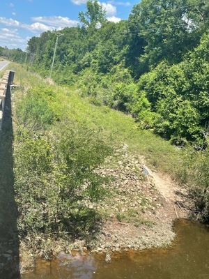
CATEGORIES: Landing
LAYER: Brochure
GPS: 31.0682, -83.56425
OWNERSHIP: Public
ACCESS: Yes, Launch: river bank down rough county road right of way. PARKING: Free
WATER BODY: Little River
Lowest boatable: 175.3′
Highest safe: 181′
GAUGE: Adel
MILE: 38.17
ADDRESS: Southwest of Adel, SE side of Antioch Road, NE side of Little River, left bank, under the power line. Cook County.
DESCRIPTION: Year-round, see loblolly pines, live oaks, water oaks, cypress, river birch, willow, and Spanish moss. Sand beaches abound for lunch or even overnight camping. In the new year expect yellow jessamine earliest, then wild native azaleas (Rhododendron canescens), white to yellow or pink glory. In spring see red maple and white Grancy Greybeard and dogwood trees. In summer you may see the halberdleaf five-large-petaled swamp rose-mallow (Hibiscus laevis); each bloom only lasts one day. In the fall, expect swamp sunflower (Helianthus Angustifolius).
WEBSITE: https://wwals.net/pictures/2020-09-26–drafts-metal-signs/Antioch-Road-Landing-Sign-0001.html
ADDITIONAL INFO SOURCES: https://wwals.net/2018/04/10/canoeing-from-the-little-to-the-chee-by-burt-kornegay-2018-03-24/
UPSTREAM: 10.4 miles from Antioch Road Landing to Adel-Moultrie Landing
DOWNSTREAM: 6.85 miles from Antioch Road Landing to Cook County Boat Ramp
PHOTOSET: https://wwals.net/pictures/2021-05-21–water-trail-signs-planted/
PHOTO SOURCE: Bobby McKenzie
PHONE NUMBER: (850) 290-2350
PHOTO2: https://wwals.net/pictures/2020-09-26–drafts-metal-signs/Antioch-Road-Landing-Sign-0001.jpg
Photoset2: https://wwals.net/pictures/2020-09-26–drafts-metal-signs/Antioch-Road-Landing-Sign-0001.html
PHOTO2 SOURCE: WWALS
Photo2 Phone Number: 850-290-2350
Suggestions: https://forms.gle/DipPgU2TP5atc2Rf9

Antioch Bridge

CATEGORIES: Bridge
LAYER: Bridge
OWNERSHIP: Public
WATER BODY: Little River
MILE: 38.17
ADDRESS: Antioch Rd, Adel, GA 31620, Cook, Brooks Counties.
DESCRIPTION: Hempstead Church Rd, Barney, GA 31625, The old bridge before it was rebuilt was called Burney Bridge.
AKA: Burney Bridge.
WEBSITE: https://en.wikipedia.org/wiki/Little_River_(Withlacoochee_River)
PHOTOSET: https://www.wwals.net/pictures/2021-05-21–water-trail-signs-planted/
PHOTO SOURCE: Bobby McKenzie
PHONE NUMBER: (850) 290-2350
Suggestions: https://forms.gle/DipPgU2TP5atc2Rf9
Plantation Little Creek
CATEGORIES: Tributary
LAYER: Other
GPS: 31.05343322, -83.52068291
OWNERSHIP: Private
WATER BODY: Little River
MILE: 34.35
ADDRESS: About a mile upstream from Stone Bridge. Cook County.
DESCRIPTION: What is the real name of this left bank creek, which starts up at Plantation Road in Cook County, GA? USGS Reach Code 03110204004993.
Suggestions: https://forms.gle/DipPgU2TP5atc2Rf9
Herring Creek
CATEGORIES: Tributary
LAYER: Other
GPS: 31.04822, -83.507413
OWNERSHIP: Private
WATER BODY: Little River
MILE: 33.33
ADDRESS: About a thousand feet upstream from Stone Bridge. Brooks County.
DESCRIPTION: What is the real name of this right bank creek, that starts way up near Barney, and comes down across Moody Road (CR 181) and Herring Road (CR 180), Brooks County, GA? USGS Reach Code 03110204001330.
Suggestions: https://forms.gle/DipPgU2TP5atc2Rf9
LOPSG RR Bridge 
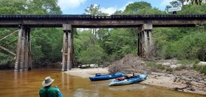
CATEGORIES: Railbridgehistoric
LAYER: Bridge
GPS: 31.05202, -83.500841
OWNERSHIP: Private
WATER BODY: Little River
MILE: 32.51
ADDRESS: Past end of Old Quitman Annex Rd, Adel, GA 31620, Cook, Brooks Counties.
DESCRIPTION: A brief paddle upstream from Stone Bridge is this historic bridge of the Live Oak, Perry & South Georgia Railroad. Currently owned by Georgia & Florida Railway.
HISTORIC FACTS: The railroad was replacing ties on this bridge in May 2020, and it sure needed that.
WEBSITE: https://en.wikipedia.org/wiki/Little_River_(Withlacoochee_River)
PHOTO: https://wwals.net/pictures/2020-05-16–stone-bridge-paddle/20200516_115203.jpg
PHOTOSET: https://wwals.net/pictures/2020-05-16–stone-bridge-paddle
PHOTO SOURCE: John S. Quarterman
PHONE NUMBER: (229) 242-0102
Suggestions: https://forms.gle/DipPgU2TP5atc2Rf9
Stone Bridge

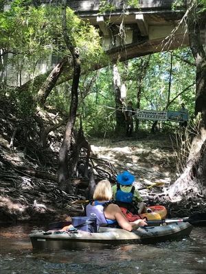
CATEGORIES: Bridgehistoric
LAYER: Bridge
GPS: 31.04962, -83.49932
OWNERSHIP: Public, B.A. Young, PARCEL 0018 003
WATER BODY: Little River
MILE: 32.30
ADDRESS: Past where Old Quitman Annex Rd, Adel, GA 31620 used to bend to the left. Brooks, Cook Counties.
DESCRIPTION: An easy one-mile paddle upstream from Cook County Boat Ramp is this historic stone (actually concrete) bridge, although paddling up under the bridge itself is challenging.
HISTORIC FACTS: “”Nine, 45-foot arches make up Stone Bridge, the 450-foot structure over Little River five miles west of Adel. The concrete for the bridge was mixed in wheelbarrows and pushed to the wooden forms. The bridge was built to last. Issac Shiflett and his comrades drove the pilings down until they hit the bedrock some 20 feet below the earth’s surface.”” Adel News Tribune, 1 Oct 2014, Page 9-A.
AKA: Rock Bridge (historical), by USGS GNIS placename database. https://geonames.usgs.gov
WEBSITE: https://bridgehunter.com/ga/cook/rock/
PHOTOSET: https://wwals.net/pictures/2020-05-16–stone-bridge-paddle/
PHOTO SOURCE: Helen Chaney
PHONE NUMBER: (850) 290-2350
PHOTO2: https://wwals.net/wp-content/themes/pianoblack/img//2018/11/aedaa9d5bcbed7bbb3cf5d12154139c5.jpg
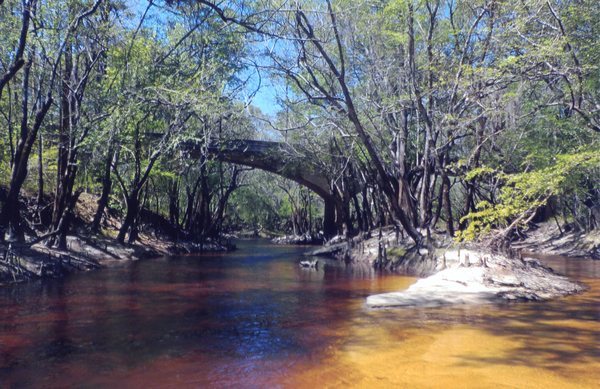
Photoset2: https://wwals.net/2018/11/04/stone-bridge-little-river-by-dan-phillips-2016-08-01/
PHOTO2 SOURCE: Dan Phillips
Photo2 Phone Number: 850-290-235
Suggestions: https://forms.gle/DipPgU2TP5atc2Rf9

Jones Sinkhole 
CATEGORIES: Sinkhole
LAYER: Other
OWNERSHIP: Private, JONES & JONES FARMS, LLLP, PARCEL 115 0008
WATER BODY: Little River
ADDRESS: Betweeen LOPSG Sinkhole RR Bridge and Intended GA 76 Bridge over Little River, Brooks County.
DESCRIPTION: Looks like a sinkhole on google maps
GRN: No
PHOTOSET: https://www.google.com/maps/place/31%C2%B002’54.1%22N+83%C2%B030’06.7%22W/@31.0462553, -83.5036732, 1558m/data=!3m1!1e3!4m5!3m4!1s0x0:0x0!8m2!3d31.048354!4d-83.501861
Suggestions: https://forms.gle/DipPgU2TP5atc2Rf9
LOPSG Sinkhole RR Bridge
CATEGORIES: Railbridgehistoric
LAYER: Bridge
OWNERSHIP: Private
WATER BODY: Little River
ADDRESS: Between Broke End Bridge and LOPSG RR Bridge, Brooks County.
DESCRIPTION: A historic bridge over what appears to be a sinkhole for Live Oak, Perry & South Georgia Railroad.
GRN: No
PHOTOSET: https://www.google.com/maps/place/31%C2%B002’44.2%22N+83%C2%B030’13.1%22W/@31.0475509, -83.5040083, 1101m/data=!3m1!1e3!4m5!3m4!1s0x0:0x0!8m2!3d31.045615!4d-83.503644
Suggestions: https://forms.gle/DipPgU2TP5atc2Rf9
Broke End Bridge
CATEGORIES: Bridgesite
LAYER: Bridge
OWNERSHIP: Private, JONES & JONES FARMS, LLLP, PARCEL 115 0008
WATER BODY: Little River
ADDRESS: Betweeen GA 76 and LOPSG RR, Brooks County.
DESCRIPTION: One of the concrete sections fell in because of a sinkhole, according to Ernest Browning.
GRN: No
PHOTOSET: https://www.google.com/maps/place/31%C2%B002’37.3%22N+83%C2%B030’06.2%22W/@31.0437944, -83.5026216, 462m/data=!3m1!1e3!4m5!3m4!1s0x0:0x0!8m2!3d31.043698!4d-83.501729
Suggestions: https://forms.gle/DipPgU2TP5atc2Rf9
Rock Bridge

CATEGORIES: Bridge
LAYER: Bridge
OWNERSHIP: Public
WATER BODY: Little River
MILE: 31.33
ADDRESS: Quitman Highway (GA 76), Adel, GA 31620, Brooks, Cook Counties.
DESCRIPTION: State highway bridge between Adel and Barney across the Little River.
WEBSITE: http://bridgereports.com/1090965
PHOTOSET: https://commons.wikimedia.org/wiki/File:SR76_Bridge_over_Little_River_1.jpg
PHOTO SOURCE: Michael Rivera
PHONE NUMBER: (850) 290-2350
PHOTO2: https://wwals.net/pictures/2020-05-16–stone-bridge-paddle/20200516_125202.jpg
Photoset2: https://wwals.net/pictures/2020-05-16–stone-bridge-paddle
PHOTO2 SOURCE: WWALS
Photo2 Phone Number: 850-290-235
Suggestions: https://forms.gle/DipPgU2TP5atc2Rf9

Cook County Boat Ramp @ GA 76
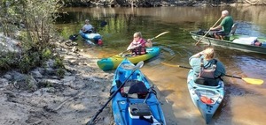
CATEGORIES: Landing
LAYER: Brochure
OWNERSHIP: Public
ACCESS: Yes, Ramp: dirt and gravel access road to concrete ramp, PARKING: Free
WATER BODY: Little River
Lowest boatable: 137
Highest safe: 144
GAUGE: Hahira
MILE: 31.32
ADDRESS: 966 Quitman Highway (GA 76), Adel, GA 31620, Cook County.
DESCRIPTION: Left bank, southeast of the road. Upstream of this GA-DNR boat ramp, Stone Bridge is the star of the Little River. Downstream is a nice paddle with many fish in deep holes of the shallow river, after some popular picnic sandbars. Cook County Boat Ramp is loacted between Adel and Barney, southeast side of GA 76, northeast side (left bank) of the Little River.
AKA: Cook County Landing (GDOT)
WEBSITE: https://www.georgiaoutdoormap.com/
ADDITIONAL INFO SOURCES: https://www.theswimguide.org/beach/9697
UPSTREAM: 6.85 miles from Cook County Boat Ramp to Antioch Road Landing
DOWNSTREAM: 6.02 miles from Cook County Boat Ramp to Folsom Bridge Landing
PHOTO: https://wwals.net/pictures/2020-05-16–stone-bridge-paddle/20200516_100818.jpg
PHOTOSET: https://wwals.net/pictures/2020-05-16–stone-bridge-paddle/
PHOTO SOURCE: John S. Quarterman
PHONE NUMBER: (229) 242-0102
PHOTO2: https://wwals.net/pictures/2020-09-26–drafts-metal-signs/Cook-County-Boat-Ramp-Sign-0001.jpg
Photoset2: https://wwals.net/pictures/2020-09-26–drafts-metal-signs/Cook-County-Boat-Ramp-Sign-0001.html
PHOTO2 SOURCE: WWALS
Photo2 Phone Number: 850-290-235
Suggestions: https://forms.gle/DipPgU2TP5atc2Rf9

John David Road Bridge
CATEGORIES: Bridge
LAYER: Bridge
OWNERSHIP: Public
WATER BODY: Franks Creek
MILE: 10.01
ADDRESS: John David Road is the driveway for Frogtown South, 7495 Union Road, Hahira, GA 31632, Lowndes County.
DESCRIPTION: A narrow paved road with probably a culvert over Franks Creek.
Suggestions: https://forms.gle/DipPgU2TP5atc2Rf9
Franks Creek Big Branch

CATEGORIES: Tributary
LAYER: Point of Interest
GPS: 31.00615, -83.389324
OWNERSHIP: Private
WATER BODY: Franks Creek
MILE: 9.86
ADDRESS: South of John David Road, west of Union Road, Hahira, GA 31632, Lowndes County.
DESCRIPTION: A brief branch running west across the Norfolk & Southern Railroad and Union Road into Franks Creek.
WEBSITE: http://www.l-a-k-e.org/govt/glpc/2022-04-25–glpc-packet/#X10-HA202206-Sweet-Bay-Properties
PHOTOSET: https://www.wwals.net/pictures/2022-04-25–hahira-rezoning-big-branch-franks-creek/
PHOTO SOURCE: City of Hahira
PHONE NUMBER: (850) 290-2350
Suggestions: https://forms.gle/DipPgU2TP5atc2Rf9
Stormwater Outfall HO7 into Franks Creek
CATEGORIES: Tributary
LAYER: Point of Interest
OWNERSHIP: Public
WATER BODY: Franks Creek
MILE: 9.51
ADDRESS: 7381 Northcreek Cir, Hahira, GA 31632, west past the south turnaround of Northcreek Circle. Lowndes County.
DESCRIPTION: A stormwater outfall into Franks Creek.
Suggestions: https://forms.gle/DipPgU2TP5atc2Rf9
Franks Creek I-75 Bridge
CATEGORIES: Bridge
LAYER: Bridge
OWNERSHIP: Public
WATER BODY: Franks Creek
MILE: 9.40
ADDRESS: 3, 000 feet north of I-75 Exit 29. Lowndes County.
DESCRIPTION: Double interstate highway bridges, each with two lanes.
Suggestions: https://forms.gle/DipPgU2TP5atc2Rf9
Franks Creek GA 122 Lift Station
CATEGORIES: Liftstation
LAYER: Point of Interest
OWNERSHIP: Public
WATER BODY: Franks Creek
MILE: 8.89
ADDRESS: 1320 GA HWY 122W, Hahira, GA 31632, Lowndes County.
DESCRIPTION: A sewer lift station just east of Franks Creek on GA 122, west of Hahira, GA.
Suggestions: https://forms.gle/DipPgU2TP5atc2Rf9
Franks Creek GA 122 Bridge
CATEGORIES: Bridge
LAYER: Bridge
GPS: 30.993853, -83.39369
OWNERSHIP: Public
WATER BODY: Franks Creek
MILE: 8.89
ADDRESS: About a thousand feet west of Morven Road. Lowndes County.
DESCRIPTION: The main waterway closest to Hahira, Georgia.
Suggestions: https://forms.gle/DipPgU2TP5atc2Rf9
Barney-Adel Landing @ GA 76 
CATEGORIES: Landing Private No
LAYER: Other
OWNERSHIP: Private
ACCESS: No, Launch: dirt road to river bank, PARKING: Free
WATER BODY: Little River
Lowest boatable: 137
Highest safe: 144
GAUGE: Hahira
MILE: 31.32
ADDRESS: Between Barney and Adel, southeast side of GA 76, southwest side (right bank) of Little River, Brooks County.
DESCRIPTION: Nobody uses Little River right Brooks County access this unless they’re lost; use Cook County Landing.
Suggestions: https://forms.gle/DipPgU2TP5atc2Rf9
Old Folsom Bridge
CATEGORIES: Bridgesite
LAYER: Bridge
GPS: 31.001546, -83.45854
OWNERSHIP: Private
WATER BODY: Little River
MILE: 25.45
ADDRESS: Just upstream from GA 122, Lowndes, Brooks Counties.
DESCRIPTION: “”(Closed and replaced early 1940s)””
WEBSITE: https://en.wikipedia.org/wiki/Little_River_(Withlacoochee_River)
Suggestions: https://forms.gle/DipPgU2TP5atc2Rf9
Mary Turner Lynching Site

CATEGORIES: Point Of Interest
LAYER: Point of Interest
OWNERSHIP: Public
ACCESS: Memorial of May 1918 lynchings. PARKING: Free
WATER BODY: Little River
MILE: 25.30
ADDRESS: On Wells Road just north of GA 122 near Little River west of Hahira. Lowndes County.
DESCRIPTION: A red steel cross memorial to historical events of May 1918. The actual memorial sign is currently in Atlanta due to vandalism at the signpost. The actual lynching site is on the Brooks County side downstream of Folsom Bridge.
GRN: Yes
WEBSITE: http://www.maryturner.org/
PHOTO: https://www.wwals.net/pictures/2021-05-01–folsom-bridge/20210501_164913.jpg
PHOTOSET: https://www.wwals.net/pictures/2021-05-01–folsom-bridge/
PHOTO SOURCE: Mary Turner Project
PHONE NUMBER: (229) 234-2856
PHOTO2: http://www.maryturner.org/images/unveil2.jpg
Photoset2: http://www.maryturner.org/
PHOTO2 SOURCE: Mary Turner Project
Photo2 Phone Number: 229-234-2856
Suggestions: https://forms.gle/DipPgU2TP5atc2Rf9

Hahira Gauge
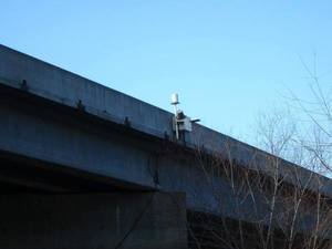
CATEGORIES: River Gauge
LAYER: River Gauge
OWNERSHIP: Public
WATER BODY: Little River
Lowest boatable: 137
Highest safe: 144
GAUGE: Hahira
MILE: 25.30
ADDRESS: 8700 GA Hwy 122 W, Hahira, GA 31632. Lowndes County.
DESCRIPTION: USGS 02318380
AKA: GA 122 Gauge
WEBSITE: https://wwals.net/2014/05/06/flooding-charts-2/#Little-122
PHOTOSET: https://wwals.net/2014/05/06/flooding-charts-2/
PHOTO SOURCE: WWALS
PHONE NUMBER: (850) 290-2350
Suggestions: https://forms.gle/DipPgU2TP5atc2Rf9
Folsom Bridge Landing @ GA 122
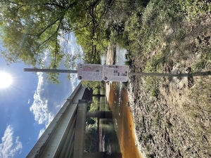
CATEGORIES: Landing
LAYER: Brochure
OWNERSHIP: Public
ACCESS: Yes, Launch: dirt road to riverside, PARKING: Free
WATER BODY: Little River
Lowest boatable: 137
Highest safe: 144
GAUGE: Hahira
MILE: 25.30
ADDRESS: 8630 GA Hwy 122 W, Hahira, GA 31632. Lowndes County.
DESCRIPTION: Left bank. This sand riverbank begins by far the longest stretch of the WLRWT, and one of the wildest, with plenty of swamps and oxbows to get lost in cypress, pines, tupelo, red maples, and river birch. Between Hahira and Barney, north side of GA 122 turn onto Wells Road, immediate left to the east side of river, Usually lots of mussels. Fish jump in the spring, and bed in pools in this idyllic blackwater south Georgia River. For those from elsewhere: fish make beds for laying their eggs. The beds appear as round and slightly concave areas cleared in the sand, about a foot in diameter.
AKA: GA 122 Little River Access.
WEBSITE: https://wwals.net/2016/09/26/little-river-scouting-2016-07-10/
ADDITIONAL INFO SOURCES: https://www.theswimguide.org/beach/9698
UPSTREAM: 6.02 miles from Folsom Bridge Landing to Cook County Boat Ramp
DOWNSTREAM: 24.94 miles from Folsom Bridge Landing to Troupville Boat Ramp
PHOTO: https://wwals.net/pictures/2021-05-21–water-trail-signs-planted/Folsom-Bridge.jpg
PHOTOSET: https://wwals.net/pictures/2021-05-21–water-trail-signs-planted/
PHOTO SOURCE: Bobby McKenzie
PHONE NUMBER: (850) 290-2350
PHOTO2: https://wwals.net/pictures/2020-09-26–drafts-metal-signs/Folsom-Bridge-Landing-Sign-0001.jpg
Photoset2: https://wwals.net/pictures/2020-09-26–drafts-metal-signs/Folsom-Bridge-Landing-Sign-0001.html
PHOTO2 SOURCE: WWALS
Photo2 Phone Number: 850-290-2350
Suggestions: https://forms.gle/DipPgU2TP5atc2Rf9

Folsom Bridge
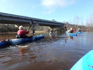
CATEGORIES: Bridge
LAYER: Bridge
OWNERSHIP: Public
WATER BODY: Little River
MILE: 25.30
ADDRESS: 8700 GA Hwy 122 W, Hahira, GA 31632. Brooks, Lowndes Counties.
DESCRIPTION: State highway bridge between Hahira and Barney over the Little River.
WEBSITE: https://en.wikipedia.org/wiki/Little_River_(Withlacoochee_River)
PHOTO SOURCE: Gretchen Quarterman
PHONE NUMBER: (850) 290-2350
Suggestions: https://forms.gle/DipPgU2TP5atc2Rf9
Hahira Land Application Site
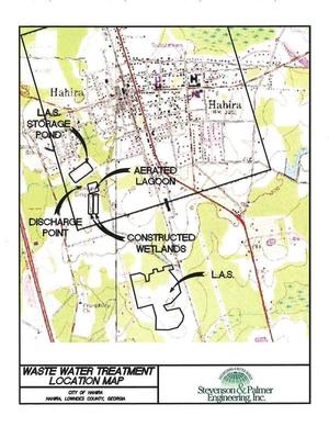
CATEGORIES: Wtp
LAYER: Brochure
OWNERSHIP: Public, City of Hahira, PARCEL Several
ACCESS: No
WATER BODY: Franks Creek
MILE: 7.57
ADDRESS: 598 Hall St, Hahira, GA 31632, Lowndes County.
DESCRIPTION: The waste-water treatment facility is capable of treating up to 400, 000 gallons per day and uses a state of the art Created Wetlands and a land application system where treated wastewater is applied directly to approximately sixty acres of agricultural land by irrigation methods, thus allowing the living filter of soil and growing vegetation to continue the treatment process and provide nutrients to the ground.
WEBSITE: http://www.hahira.ga.us/cityinfo.html
OTHER REFERENCE: wwals.net/pictures/2018-08-30—permits/hahira/2024-10-16—reissuance
PHOTO: https://wwals.net/pictures/2018-08-30–permits/hahira/Hahira-GA0037974-Application-Form-2A-0011.jpg
PHOTOSET: https://wwals.net/pictures/2018-08-30–permits/hahira/
PHOTO SOURCE: GA-EPD & Hahira
PHONE NUMBER: (850) 290-2350
Suggestions: https://forms.gle/DipPgU2TP5atc2Rf9
Hahira LAS Storage Pond
CATEGORIES: Wtp
LAYER: Brochure
OWNERSHIP: Public, City of Hahira, PARCEL 0048 023
WATER BODY: Hahira LAS Pond Branch
MILE: 0.76
ADDRESS: 598 Hall St, Hahira, GA 31632, Lowndes County.
WEBSITE: https://wwals.net/pictures/2018-08-30–permits/hahira/
OTHER REFERENCE: wwals.net/pictures/2018-08-30—permits/hahira/2024-10-16—reissuance
PHOTO: https://wwals.net/pictures/2018-08-30–permits/hahira/Hahira-GA0037974-Application-Form-2A-0011.jpg
PHOTOSET: https://wwals.net/pictures/2018-08-30–permits/hahira/
PHOTO SOURCE: GA-EPD & Hahira
PHONE NUMBER: (850) 290-2350
Suggestions: https://forms.gle/DipPgU2TP5atc2Rf9
Hahira LAS Aerated Lagoon
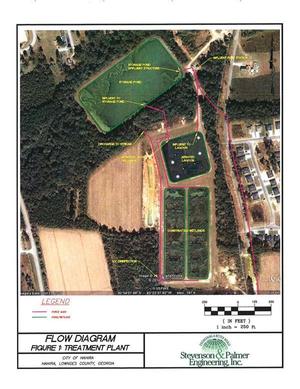
CATEGORIES: Wtp
LAYER: Brochure
OWNERSHIP: Public, City of Hahira, PARCEL 0048 028
WATER BODY: Hahira LAS Lagoon Run
MILE: 0.10
ADDRESS: West of South Hall Street, across from Bryson Circle, Lowndes County.
WEBSITE: https://wwals.net/pictures/2018-08-30–permits/hahira/
OTHER REFERENCE: wwals.net/pictures/2018-08-30—permits/hahira/2024-10-16—reissuance
PHOTO: https://wwals.net/pictures/2018-08-30–permits/hahira/Hahira-GA0037974-Application-Form-2A-0013.jpg
PHOTOSET: https://wwals.net/pictures/2018-08-30–permits/hahira/
PHOTO SOURCE: GA-EPD & Hahira
PHONE NUMBER: (850) 290-2350
Suggestions: https://forms.gle/DipPgU2TP5atc2Rf9
Hahira LAS Aerated Lagoon Outfall
CATEGORIES: Wtp
LAYER: Other
OWNERSHIP: Public, City of Hahira, PARCEL 0048 028
WATER BODY: Hahira LAS Lagoon Run
MILE: 0.09
ADDRESS: 598 Hall St, Hahira, GA 31632, Lowndes County.
WEBSITE: https://wwals.net/pictures/2018-08-30–permits/hahira/
OTHER REFERENCE: wwals.net/pictures/2018-08-30—permits/hahira/2024-10-16—reissuance
PHOTOSET: https://wwals.net/pictures/2018-08-30–permits/hahira/
PHOTO SOURCE: GA-EPD & Hahira
Suggestions: https://forms.gle/DipPgU2TP5atc2Rf9
Hahira LAS Pond Branch 03110204004671
CATEGORIES: Tributary
LAYER: Point of Interest
OWNERSHIP: Public, City of Hahira, PARCEL 0028 027
WATER BODY: Franks Creek
MILE: 7.55
ADDRESS: Where Franks Creek runs alongside I-75 west side, about 2, 000 feet south of Exit 29. Lowndes County.
DESCRIPTION: Outflow of Hahira’s LAS ponds reaches Franks Creek.
PHOTO SOURCE: Lowndes County Tax Assessors
PHONE NUMBER: (850) 290-2350
Suggestions: https://forms.gle/DipPgU2TP5atc2Rf9
Vickers Branch Bridge

CATEGORIES: Bridge
LAYER: Bridge
OWNERSHIP: Public
WATER BODY: Vickers Branch
MILE: 1.94
ADDRESS: 5662 Old US 41 N, Hahira, GA 31632, Lowndes County.
DESCRIPTION: POST UPDATE: 04-02-20 2:30 P.M. The bridge is repaired and reopened. Special thanks to Lowndes County Engineering & Lowndes County Public Works for handling this issue so quickly. The Lowndes County Engineering Department announces the emergency closure of the Old US 41 bridge south of Chancy Drive. The closure is a result of a large tree falling on the bridge and breaking the barrier wall. An update to the length of the closure will be sent out tomorrow morning along with the detour. If you have any questions please call the Engineering Department at 229-671-2424. “”Some maps show it as Vickers Branch. The Vickers family were the ones who owned most of the land in the area back in the 1800s.”” —Phillip Williams 2020-04-01
WEBSITE: https://www.facebook.com/LowndesEMA/photos/a.1232154740135515/3909389295745366/?type=3&theater
PHOTOSET: https://www.facebook.com/LowndesEMA/photos/a.1232154740135515/3909389295745366/?type=3
PHOTO SOURCE: Lowndes County EMA
PHONE NUMBER: (850) 290-2350
Suggestions: https://forms.gle/DipPgU2TP5atc2Rf9
Hahira LAS Spray Field
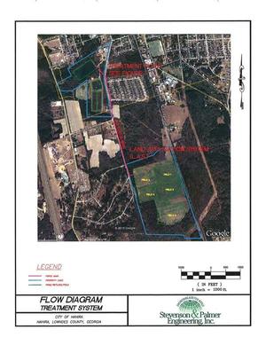
CATEGORIES: Wtp
LAYER: Brochure
OWNERSHIP: Public, City of Hahira, PARCEL 0050 032 & 0050 033
WATER BODY: Vickers Branch
MILE: 1.67
ADDRESS: Between Tillman Street and Brookridge Drive, Lowndes County.
DESCRIPTION: Hahira wastewater sprayfield.
WEBSITE: wwals.net/pictures/2018-08-30—permits/hahira/2025-01-06—hahira
OTHER REFERENCE: https://epd.georgia.gov/document/document/public-noticeno-2025-01mlpdf/download
PHOTO: https://wwals.net/pictures/2018-08-30–permits/hahira/Hahira-GA0037974-Application-Form-2A-0012.jpg
PHOTOSET: https://www.wwals.net/pictures/2018-08-30–permits/hahira/
PHOTO SOURCE: GA-EPD & Hahira
PHONE NUMBER: (850) 290-2350
Suggestions: https://forms.gle/DipPgU2TP5atc2Rf9
Hahira LAS Outfall
CATEGORIES: Wtp
LAYER: Other
OWNERSHIP: Public, City of Hahira, PARCEL 0050 032 & 0050 033
WATER BODY: Vickers Branch
MILE: 0.94
ADDRESS: Southeast of Brookridge Drive, Hahira, GA 31632, about 1 creek mile upstream from Franks Creek. Lowndes County.
DESCRIPTION: Outfall of Hahira sprayfield into Vickers Branch, to Franks Creek, to Little River.
WEBSITE: wwals.net/pictures/2018-08-30—permits/hahira/2025-01-06—hahira
OTHER REFERENCE: https://epd.georgia.gov/document/document/public-noticeno-2025-01mlpdf/download
Suggestions: https://forms.gle/DipPgU2TP5atc2Rf9
Vickers Branch I-75 Bridge
CATEGORIES: Bridge
LAYER: Bridge
GPS: 30.968412, -83.38065
OWNERSHIP: Public
WATER BODY: Vickers Branch
MILE: 0.50
ADDRESS: About 1 1/3 miles south of Exit 29 for Hahira, GA. Lowndes County.
DESCRIPTION: Presumably culverts under I-75 for Vickers Branch, just before it gets to Franks Creek.
WEBSITE: https://www.google.com/maps/place/30%C2%B058’06.3%22N+83%C2%B022’50.3%22W/@30.9684143, -83.381747, 464m/data=!3m2!1e3!4b1!4m6!3m5!1s0x0:0x15c1fb71ab037b7b!7e2!8m2!3d30.9684123!4d-83.3806499
Suggestions: https://forms.gle/DipPgU2TP5atc2Rf9
Vickers Branch
CATEGORIES: Tributary
LAYER: Point of Interest
GPS: 30.962152, -83.3848
OWNERSHIP: Private, PARKER RAYMOND C & SHARON R, PARCEL 0031 045 & 0031 039
WATER BODY: Franks Creek
MILE: 6.33
ADDRESS: Between Old Valdosta Road and Franks Creek Road, west of I-75. Lowndes County.
DESCRIPTION: This branch that comes down across Old US 41, Union Road, and I-75 reaches Franks Creek.
PHOTO SOURCE: Lowndes County Tax Asssessors
PHONE NUMBER: (850) 290-2350
Suggestions: https://forms.gle/DipPgU2TP5atc2Rf9
Tylers Pond Branch
CATEGORIES: Tributary
LAYER: Point of Interest
OWNERSHIP: Private, TILLMAN H Y III ETAL, PARCEL 0054A 001
WATER BODY: Franks Creek
MILE: 3.39
ADDRESS: Halfway between Franks Creek Road and Shiloh Road, just northwest of the I-75 weigh station. Lowndes County.
DESCRIPTION: This branch that comes down across Jericho Road, Union Road, and I-75 reaches Franks Creek.
PHOTO SOURCE: Lowndes County Tax Assessors
PHONE NUMBER: (850) 290-2350
Suggestions: https://forms.gle/DipPgU2TP5atc2Rf9
Cramer Deadfall 2

CATEGORIES: Deadfall
LAYER: Point of Interest
OWNERSHIP: Public
WATER BODY: Little River
MILE: 23.27
ADDRESS: Upstream from Miller Bridge, Brooks, Lowndes Counties.
DESCRIPTION: A deadfall almost completely across the river.
PHOTO: https://www.wwals.net/pictures/2025-04-26–little-river-deadfalls/IMG_5606.jpg
PHOTOSET: https://www.wwals.net/pictures/2025-04-26–little-river-deadfalls/
PHOTO SOURCE: Ken Lowe
PHONE NUMBER: (850) 290-2350
Suggestions: https://forms.gle/DipPgU2TP5atc2Rf9
Cramer Deadfall 3-4

CATEGORIES: Deadfall
LAYER: Point of Interest
OWNERSHIP: Public
WATER BODY: Little River
MILE: 23.16
ADDRESS: Upstream from Miller Bridge, Brooks, Lowndes Counties.
DESCRIPTION: A deadfall completely across the river.
PHOTO: https://www.wwals.net/pictures/2025-04-26–little-river-deadfalls/IMG_5614.jpg
PHOTOSET: https://www.wwals.net/pictures/2025-04-26–little-river-deadfalls/
PHOTO SOURCE: Ken Lowe
PHONE NUMBER: (850) 290-2350
Suggestions: https://forms.gle/DipPgU2TP5atc2Rf9
Deloach Deadfall 1
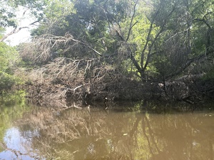
CATEGORIES: Deadfall
LAYER: Point of Interest
OWNERSHIP: Public
WATER BODY: Little River
MILE: 22.63
ADDRESS: Upstream from Miller Bridge, Brooks, Lowndes Counties.
DESCRIPTION: A deadfall on the side.
PHOTO: https://www.wwals.net/pictures/2025-04-26–little-river-deadfalls/IMG_5603.jpg
PHOTOSET: https://www.wwals.net/pictures/2025-04-26–little-river-deadfalls/
PHOTO SOURCE: Ken Lowe
PHONE NUMBER: (850) 290-2350
Suggestions: https://forms.gle/DipPgU2TP5atc2Rf9
Joyces Ferry 
CATEGORIES: Ferry
LAYER: Bridge
GPS: 30.9734, -83.442495
OWNERSHIP: Public
WATER BODY: Little River
MILE: 22.03
ADDRESS: Where Miller Bridge is now. Brooks, Lowndes Counties.
DESCRIPTION: The ferry that preceded the bridge, where Old Coffee Road crossed the Little River.
HISTORIC FACTS: Washington Joyce established a ferry on the Little river, where the Coffee road crosses it, but soon sold out to James J. Joyce. The crossing has a good bridge across thhe river at present which is known as the “”Miller Bridge.”” –Valdosta Times, 23 October 1900, quoted by Phillip Williams 2022-12-03 https://www.facebook.com/phillipwilliams42/posts/pfbid025zggCNDz9gpAGCUdG9afC4Jt66meLKNKhGSbNGV3Qtj7Dfca4xkCdkckE8L9WNDPl
Suggestions: https://forms.gle/DipPgU2TP5atc2Rf9
Miller Bridge
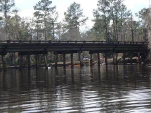
CATEGORIES: Bridge
LAYER: Bridge
OWNERSHIP: Public
WATER BODY: Little River
MILE: 22.02
ADDRESS: Morven Road, Hahira, GA 31632, Brooks, Lowndes Counties.
DESCRIPTION: Lawson Mill Pond Road, Hahira, GA 31632
HISTORIC FACTS: Where Old Coffee Road crossed the Little River. Preceded by Joyces Ferry, which see.
WEBSITE: https://en.wikipedia.org/wiki/Little_River_(Withlacoochee_River)
PHOTO SOURCE: Gretchen Quarterman
PHONE NUMBER: (850) 290-2350
Suggestions: https://forms.gle/DipPgU2TP5atc2Rf9
Lawson Mill Pond Landing
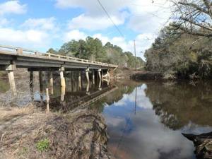
CATEGORIES: Landing Private
LAYER: Other
OWNERSHIP: Private, PARCEL 118 0004
ACCESS: Launch: sand bank on dirt access road, PARKING: Free
WATER BODY: Little River
Lowest boatable: 137
Highest safe: 144
GAUGE: Hahira
MILE: 22.01
ADDRESS: Between Morven and Hahira, south side of Lawson Pond Road, west side of river, Brooks County.
DESCRIPTION: Sand bank next to county road bridge. People think it’s public, but it’s actually privately owned. It’s actually on private property, so go to Folsom Bridge Landing instead.
PHOTO SOURCE: Gretchen Quarterman
PHONE NUMBER: (850) 290-2350
Suggestions: https://forms.gle/DipPgU2TP5atc2Rf9
Hodges Road over Mule Creek Bridge
CATEGORIES: Bridge
LAYER: Bridge
GPS: 30.93164, -83.66381
OWNERSHIP: Public
WATER BODY: Mule Creek
ADDRESS: About 5 miles southeast of Pavo, GA, Brooks County.
DESCRIPTION: Multi-span wooden bridge
WEBSITE: http://bridgereports.com/1090980
Suggestions: https://forms.gle/DipPgU2TP5atc2Rf9
Adams Branch
CATEGORIES: Tributary
LAYER: Point of Interest
OWNERSHIP: Private
WATER BODY: Little River
MILE: 19.46
ADDRESS: Left bank, just upstream (north) of Adams Run; starts just west of Miller Bridge Road. Lowndes County.
AKA: USGS 03110204004695
Suggestions: https://forms.gle/DipPgU2TP5atc2Rf9
Adams Run
CATEGORIES: Tributary
LAYER: Point of Interest
GPS: 30.95565, -83.432132
OWNERSHIP: Private
WATER BODY: Little River
MILE: 19.43
ADDRESS: Left bank, north of Shiloh Ridge Trail, Lowndes County.
AKA: USGS 03110204010929
Suggestions: https://forms.gle/DipPgU2TP5atc2Rf9
Shiloh Road Bridge
CATEGORIES: Bridge
LAYER: Bridge
OWNERSHIP: Public
WATER BODY: Big Creek
MILE: 1.73
ADDRESS: 1.73 miles upstream from Franks Creek, halfway between Morven Road and Franks Creek Road, 3 miles southwest of Hahira. Lowndes County.
DESCRIPTION: Box culvert over Big Creek, built in 1958.
HISTORIC FACTS: Lowndes County is buying wetland credits for replacing this bridge. 2023-09-26 http://www.l-a-k-e.org/blog/2023/09/agenda-golf-carts-mental-health-wetland-credits-regional-transit-lift-station-and-fire-station-access-roads-2-tia-road-bids-lcc-2023-09-25.html
WEBSITE: https://data.thespectrum.com/bridge/georgia/lowndes/shiloh-road-over-big-creek/13-000000018550350/
PHOTO: https://maps.app.goo.gl/XYEvm8tRMi7CmAgNA
PHOTOSET: https://www.google.com/maps/place/Shiloh+Rd, +Hahira, +GA/@30.9651776, -83.4026438, 167m/data=!3m1!1e3!4m6!3m5!1s0x88ee6fa6adeeb31b:0x8ecc7fe0461c8ccb!8m2!3d30.9792673!4d-83.3958159!16s%2Fg%2F1tknl8f7?entry=ttu
PHOTO SOURCE: Google Streetview
PHONE NUMBER: (850) 290-2350
Suggestions: https://forms.gle/DipPgU2TP5atc2Rf9
Shiloh Road Sinkhole

CATEGORIES: Sinkhole
LAYER: Brochure
GPS: 30.955, -83.40724
OWNERSHIP: Private, FRICKER PAULA A, PARCEL 0031 018A
WATER BODY: Big Creek
MILE: 1.73
ADDRESS: 6400 Shiloh Road, Hahira, GA 31632, Lowndes County.
DESCRIPTION: Sinkhole suddenly opened on 4 August 2015 in front yard of house on Shiloh Road between Parker Road and Hall Webb Road, Hahira, GA, in Lowndes County.
PHOTO SOURCE: Joe Adgie, Valdosta Daily Times
PHONE NUMBER: (850) 290-2350
Suggestions: https://forms.gle/DipPgU2TP5atc2Rf9
Steep Hill Branch

CATEGORIES: Tributary
LAYER: Point of Interest
OWNERSHIP: Private
WATER BODY: Little River
MILE: 18.59
ADDRESS: Left (east) bank, north of Hall Webb Road, south of Hidden River Run off of Shiloh Ridge Trail off of Miller Bridge Road. Lowndes County.
DESCRIPTION: A three-quarter-mile creek that may also drain more wetlands across Miller Bridge Road.
HISTORIC FACTS: The name goes back to at least the 1860s, according to Phillip Williams.
AKA: USGS 03110204010930
PHOTO: https://www.wwals.net/pictures/1914-06-08–steep-hill-branch/steep-hill-branch.jpg
PHOTOSET: https://www.wwals.net/pictures/1914-06-08–steep-hill-branch/
PHOTO SOURCE: Phillip Williams
PHONE NUMBER: (850) 290-2350
Suggestions: https://forms.gle/DipPgU2TP5atc2Rf9
Redding Run
CATEGORIES: Tributary
LAYER: Point of Interest
GPS: 30.94179, -83.435303
OWNERSHIP: Private
WATER BODY: Little River
MILE: 17.79
ADDRESS: Left bank. Lowndes County.
AKA: USGS 03110204004697 or Redding Branch
Suggestions: https://forms.gle/DipPgU2TP5atc2Rf9
Redding River Mill 
CATEGORIES: Mill
LAYER: Point of Interest
OWNERSHIP: Private, REDDING JOHN LAWTON IRROVACABLE HOMEPLACE TRUST, PARCEL 0012 001
WATER BODY: Redding Run
MILE: 0.26
ADDRESS: On Redding Run, at the edge of the Little River floodplain, near Redding Cemetery, west of 6944 Reddington Drive, off of Miller Bridge Road. Lowndes County.
DESCRIPTION: Site of an old mill dam, according to Philip Williams. There may also be a cave nearby.
Suggestions: https://forms.gle/DipPgU2TP5atc2Rf9
Myers Bluff Sinkhole

CATEGORIES: Sinkhole
LAYER: Brochure
GPS: 30.930622, -83.43502
OWNERSHIP: Private, Vickers Family Land Company LLLP
WATER BODY: Little River
MILE: 16.31
ADDRESS: Shiloh Road to Snake Nation Road to Myers Bluff Road; last dirt road on right (private), Lowndes County.
DESCRIPTION: Left bank sinkhole into which Little River drains at low water, emerging from the riverbed downstream. According to the property owner, at low water there’s a cave plenty big enough to walk into.
PHOTO: https://wwals.net/wp-content/themes/pianoblack/img//2016/01/e3a0c2b8b40bf50ac8d0771724d3d4f3-1.jpg
PHOTO SOURCE: WWALS
PHONE NUMBER: (850) 290-2350
Suggestions: https://forms.gle/DipPgU2TP5atc2Rf9
Strickland Oxbows
CATEGORIES: Tributary
LAYER: Point of Interest
GPS: 30.928328, -83.43778
OWNERSHIP: Private
WATER BODY: Little River
MILE: 15.84
ADDRESS: Brooks County.
DESCRIPTION: Re-entering Little River Right, these oxbows may be where the river comes back up when it goes into the Myers Bluff Sinkhole. USGS 03110204010982
Suggestions: https://forms.gle/DipPgU2TP5atc2Rf9
Tucker Bridge site
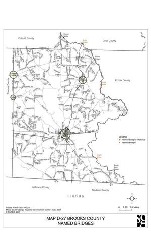
CATEGORIES: Bridgesite
LAYER: Bridge
OWNERSHIP: Public
WATER BODY: Little River
MILE: 15.60
ADDRESS: Past the end of Myers Bluff Road, Hahira, GA 31632, Brooks, Lowndes Counties.
DESCRIPTION: Possibly some ruins.
WEBSITE: https://en.wikipedia.org/wiki/Little_River_(Withlacoochee_River)
OTHER REFERENCE: https://wwals.net/pictures/2007-01-01–brooks-compplan/#Maps:Map-D27-Brooks-County-Named-Bridges-Places
PHOTO: https://wwals.net/pictures/2007-01-01–brooks-compplan/Brooks_County_Community_Assessment-0115.jpg
PHOTO SOURCE: Brooks County Comprehensive Plan 2007
PHONE NUMBER: (850) 290-2350
Suggestions: https://forms.gle/DipPgU2TP5atc2Rf9
Moultrie-Valdosta Power Line 
CATEGORIES: Power Line
LAYER: Point of Interest
GPS: 30.92467, -83.437174
OWNERSHIP: Public
WATER BODY: Little River
MILE: 15.53
ADDRESS: Brooks, Lowndes Counties.
DESCRIPTION: You’ve still got fifteen miles to paddle.
Suggestions: https://forms.gle/DipPgU2TP5atc2Rf9
Slaughter Creek
CATEGORIES: Tributary
LAYER: Other
OWNERSHIP: Private
WATER BODY: Little River
MILE: 12.66
ADDRESS: South of Lawson Mill Pond Road, Hahira, GA 31632, Brooks County.
DESCRIPTION: Enters Little River right after this 21-mile creek comes down across GA 122 and GA 76 past Barney.
Suggestions: https://forms.gle/DipPgU2TP5atc2Rf9
Snake Nation Road Sinkhole

CATEGORIES: Sinkhole
LAYER: Brochure
GPS: 30.90009, -83.39655
OWNERSHIP: Private, SPELL WILLIAM R JR, PARCEL 0033 074
WATER BODY: Little River
ADDRESS: Between 5261 Snake Nation Road and 5315 Snake Nation Road, Valdosta, GA 31605 in Lowndes County. Lowndes County.
DESCRIPTION: Deep sinkhole in Snake Nation Road, discovered ca. October 31, 2010. Lowndes County tried to route around it. Ended up buying 5.22 acres for $42, 000 and rerouting the road to the north around the sinkhole.
WEBSITE: http://www.l-a-k-e.org/blog/2011/08/snake-nation-road-at-.html
PHOTO SOURCE: Paul Leavy, Valdosta Daily Times
PHONE NUMBER: (229) 242-0102
Suggestions: https://forms.gle/DipPgU2TP5atc2Rf9
Colbert Creek
CATEGORIES: Tributary
LAYER: Point of Interest
OWNERSHIP: Private
WATER BODY: Little River
MILE: 10.05
ADDRESS: Right bank, two miles upstream from Little River Road Acre, 10 miles downstream from Miller Bridge, and more than 13 miles downstream from Folsom Bridge Landing. Brooks County.
DESCRIPTION: Enters Little River right, after coming down through Colbert Sturgeon’s property.
AKA: USGS 03110204001365
Suggestions: https://forms.gle/DipPgU2TP5atc2Rf9
Lahood Creek
CATEGORIES: Tributary
LAYER: Point of Interest
OWNERSHIP: Private
WATER BODY: Little River
MILE: 9.38
ADDRESS: Right bank, a third of a mile upstream from Little River Road Acre. Brooks County.
DESCRIPTION: Enters Little River right after coming down from Fellowship Home.
AKA: USGS 03110204004970
Suggestions: https://forms.gle/DipPgU2TP5atc2Rf9
Little River Road Acre
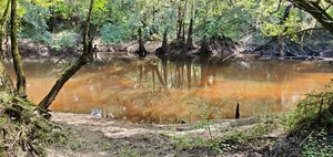
CATEGORIES: Public Land
LAYER: Brochure
GPS: 30.89026786, -83.40795091
OWNERSHIP: Public, LOWNDES COUNTY, PARCEL 0034 017
ACCESS: Yes, Launch: riverbank at end of unmaintained extension of county dirt road. PARKING: Free
WATER BODY: Little River
MILE: 8.06
ADDRESS: At the end of Little River Road, south of Snake Nation Road, which is off of Shiloh Road. Lowndes County.
DESCRIPTION: 1.07 acres of land owned by Lowndes County, on the Little River. Lowndes County has never declared this acre to be public river access.
GRN: No
WEBSITE: https://wwals.net/pictures/2020-07-24–little-river-road-lowndes-county/
PHOTO: https://wwals.net/pictures/2020-07-24–little-river-road-lowndes-county/20200722_163123.jpg
PHOTOSET: https://wwals.net/pictures/2020-07-24–little-river-road-lowndes-county/
PHOTO SOURCE: John S. Quarterman
PHONE NUMBER: (229) 242-0102
Suggestions: https://forms.gle/DipPgU2TP5atc2Rf9
Thomasville-Valdosta Little River Power Line
CATEGORIES: Power Line
LAYER: Point of Interest
OWNERSHIP: Public
WATER BODY: Little River
MILE: 7.32
ADDRESS: Brooks, Lowndes Counties.
DESCRIPTION: Only seven more miles to go.
Suggestions: https://forms.gle/DipPgU2TP5atc2Rf9
Coon Creek 03110204004688
CATEGORIES: Tributary
LAYER: Point of Interest
OWNERSHIP: Private
WATER BODY: Little River
MILE: 6.74
ADDRESS: Brooks County.
DESCRIPTION: Enters Little River right after coming down from near Valdosta Highway.
Suggestions: https://forms.gle/DipPgU2TP5atc2Rf9
Snake Nation Creek 03110204000463
CATEGORIES: Tributary
LAYER: Point of Interest
OWNERSHIP: Private
WATER BODY: Little River
MILE: 5.58
ADDRESS: Lowndes County.
DESCRIPTION: This 6-mile creek enters Little River left after paralleling Snake Nation Road and crossing it near the Snake Nation Road Sinkhole.
Suggestions: https://forms.gle/DipPgU2TP5atc2Rf9
Franks Creek
CATEGORIES: Tributary
LAYER: Other
OWNERSHIP: Private, R Derry Crosby, PARCEL 0055 005A
ACCESS: no
WATER BODY: Little River
MILE: 3.72
ADDRESS: West of Val Tech Road, south of Shiloh Road, Lowndes County.
DESCRIPTION: Enters the Little River on its left after draining Hahira and its wastewater treatment plant.
Suggestions: https://forms.gle/DipPgU2TP5atc2Rf9
Fernleaf Creek 03110204004681
CATEGORIES: Tributary
LAYER: Point of Interest
OWNERSHIP: Private
WATER BODY: Little River
MILE: 3.44
ADDRESS: Right bank, Brooks County.
DESCRIPTION: Enters Little River right after coming down from Fern Leaf Drive.
Suggestions: https://forms.gle/DipPgU2TP5atc2Rf9
Valdosta State Prison

CATEGORIES: Point Of Interest
LAYER: Point of Interest
OWNERSHIP: Public
WATER BODY: Little River
MILE: 1.55
ADDRESS: Left (east) bank, upstream (north) from St. Augustine Road (GA 133), 3259 Val Tech Road, Valdosta, GA 31603. Lowndes County.
DESCRIPTION: The reason Troupville Boat Ramp is often called the prison boat ramp is this state prison just upstream across the river.
WEBSITE: https://gdc.georgia.gov/locations/valdosta-state-prison
PHOTOSET: https://www.wwals.net/pictures/2024-04-07–troupville-boat-ramp-jon-boat-25hp-outboard/
PHOTO SOURCE: WWALS
PHONE NUMBER: (850) 290-2350
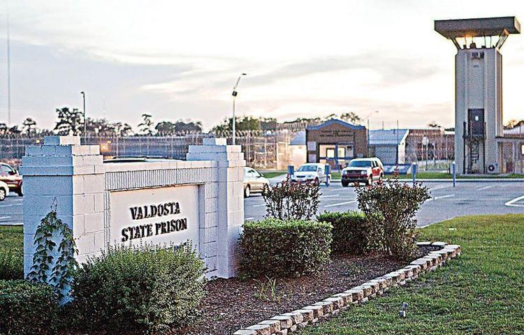
PHOTO2 SOURCE: Valdosta Daily Times
Photo2 Phone Number: 229-244-1880
Suggestions: https://forms.gle/DipPgU2TP5atc2Rf9
Little River Sportsmans Foundation (shooting range)
CATEGORIES: Point Of Interest
LAYER: Point of Interest
OWNERSHIP: Private
WATER BODY: Little River
MILE: 1.45
ADDRESS: 19925 Valdosta Highway, Valdosta, GA 31602, Brooks County.
DESCRIPTION: “The Little River Sportsman’s Association is South Georgia and North Florida’s premier membership-only club dedicated to recreational shooting and shooting sports.””, Readily audible on the right bank as you paddle down the Little River approaching Troupville Boat Ramp, and from that ramp, as well.
WEBSITE: http://www.lrsa.info/directions.html
Suggestions: https://forms.gle/DipPgU2TP5atc2Rf9
Troupville Cemetery No. 2 

CATEGORIES: Cemetery
LAYER: Point of Interest
OWNERSHIP: Public
WATER BODY: Little River
MILE: 0.73
ADDRESS: Left bank (east) of Little River, upstream (north) of St. Augustine Road (GA 133), on grounds of Valdosta State Prison, southwest corner inside the fence, by Tower 5. Lowndes County.
DESCRIPTION: Second historic cemetery of the previous county seat of Lowndes County, apparently for African Americans, closed since 1860. It’s about half an acre, with no obvious grave markers, but bones were found there when the prison wanted to build a gym on the site. There is a fence around it. “”Located within the fences of the Valdosta Correctional Institute. It was discovered when the facility was being built. There are at least 10 graves with no markers. A cemetery at that location shows up on old maps of Troupville.”
WEBSITE: https://wwals.net/?p=65000
OTHER REFERENCE: https://wwals.net/2019/11/05/troupville-river-camp-center-of-little-and-withlacoochee-river-water-trail-2019-10-31/
PHOTOSET: https://www.wwals.net/pictures/2024-06-06–troupville-cemetery-number-2/
PHOTO SOURCE: WWALS and Googlemaps
PHONE NUMBER: (850) 290-2350
Photoset2: https://www.wwals.net/pictures/2024-04-07–troupville-boat-ramp-jon-boat-25hp-outboard/
PHOTO2 SOURCE: WWALS
Suggestions: https://forms.gle/DipPgU2TP5atc2Rf9

Troupville Town Site 

CATEGORIES: Town Site
LAYER: Point of Interest
OWNERSHIP: Public
ACCESS: PARKING: Free
WATER BODY: Little River
MILE: 0.50
ADDRESS: Between the Little and Withlacoochee Rivers, marker on the north side of St. Augustine Road (GA 133) at Val Tech Rd., Valdosta, GA 31602; park on Val Tech Road. Lowndes County.
DESCRIPTION: Carved stone marker for the previous county seat of Lowndes County before its residents moved everything movable to Valdosta. This marker erected by Valdosta Chapter U.D.C. 471 April 26th, 1927.
HISTORIC FACTS: “”Site of Troupville The first town and stage coach line in Lowndes County, settled 1836. This marker erected by Valdosta Chapter U.D.C. 471 April 26th 1927″”
WEBSITE: https://www.hmdb.org/m.asp?m=176404
OTHER REFERENCE: https://wwals.net/2018/03/16/ockolocoochee-little-river-1889-01-29/
PHOTO: https://www.wwals.net/pictures/2024-10-23–troupville-marker/Photo595064.jpg
PHOTOSET: https://www.wwals.net/pictures/2024-10-23–troupville-marker/
PHOTO SOURCE: Tim Fillmon, August 5, 2014
PHONE NUMBER: (850) 290-2350
Suggestions: https://forms.gle/DipPgU2TP5atc2Rf9
Troup Bridge

CATEGORIES: Bridge
LAYER: Bridge
OWNERSHIP: Public
WATER BODY: Little River
MILE: 0.42
ADDRESS: West of Valdosta off I-75 exit 18. Lowndes, Brooks Counties.
DESCRIPTION: GA 133 state highway bridge through site of old Troupville, former Lowndes County seat. 1104.1′ 12-span multi-beam prestressed concrete bridge built in 2000.
AKA: GA 133 Little River Bridge
WEBSITE: https://bridgereports.com/1091017
OTHER REFERENCE: https://wwals.net/2018/03/16/ockolocoochee-little-river-1889-01-29/
PHOTO: https://www.wwals.net/pictures/2022-11-03–wq/20221103_110450.jpg
PHOTOSET: https://www.wwals.net/pictures/2022-11-03–wq/
PHOTO SOURCE: John S. Quarterman
PHONE NUMBER: (229) 242-0102
Suggestions: https://forms.gle/DipPgU2TP5atc2Rf9
Old Troup Bridge wood pilings

CATEGORIES: Bridgesite
LAYER: Bridge
OWNERSHIP: Public
WATER BODY: Little River
MILE: 0.41
ADDRESS: Just south (downstream) of Troup Bridge. Lowndes, Brooks Counties.
DESCRIPTION: Old wood pilings visible at low water in the Little River.
HISTORIC FACTS: “”From various versions of the bridge over the Little River.”” —Phillip Williams
WEBSITE: https://wwals.net/2022/12/02/old-troup-bridge-pilings-phillip-williams-2022-11-23/
PHOTO: https://www.wwals.net/pictures/2022-11-23–old-troup-bridge-pilings/three-pilings.jpg
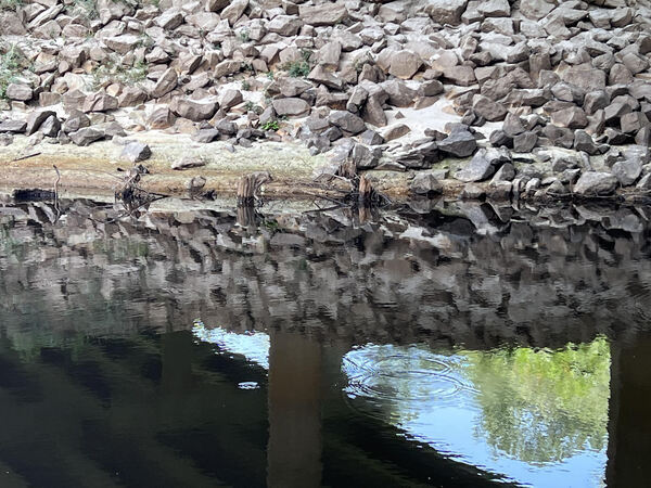
PHOTOSET: https://wwals.net/2022/12/02/old-troup-bridge-pilings-phillip-williams-2022-11-23/
PHOTO SOURCE: Phillip Williams
PHONE NUMBER: (850) 290-2350
Suggestions: https://forms.gle/DipPgU2TP5atc2Rf9
Troupville Dam

CATEGORIES: Dam
LAYER: Point of Interest
OWNERSHIP: Public, SUZANNE MARIE S & LASTINGER JAMES KENNETH SCRUGGS JR, PARCEL 146 0018
WATER BODY: Little River
MILE: 0.39
ADDRESS: About halfway between Troup Bridge and Troupville Boat Ramp, 19664 Valdosta Hwy, Valdosta, GA 31602. I-75 exit 18, west on GA 133 (St. Augustine Road) away from the Valdosta Mall, at the traffic light for Val Tech Road, turn left down to the boat ramp. Lowndes, Brooks Counties.
DESCRIPTION: Horizontal timbers and trenches in the Little River bed visible at very low water.
HISTORIC FACTS: Apparently this was a dam for a mill, but details are unknown.
WEBSITE: https://www.wwals.net/pictures/2022-11-03–wq/#Old-Dam
OTHER REFERENCE: https://wwals.net/2018/03/16/ockolocoochee-little-river-1889-01-29/
PHOTO: https://www.wwals.net/pictures/2022-11-03–wq/20221103_110542.jpg
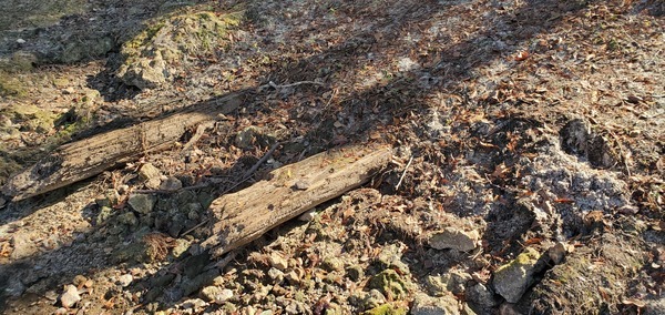
PHOTOSET: https://www.wwals.net/pictures/2022-11-03–wq/#Old-Dam
PHOTO SOURCE: John S. Quarterman
PHONE NUMBER: (229) 242-0102
PHOTO2: https://www.wwals.net/pictures/2022-11-03–wq/20221103_110552.jpg
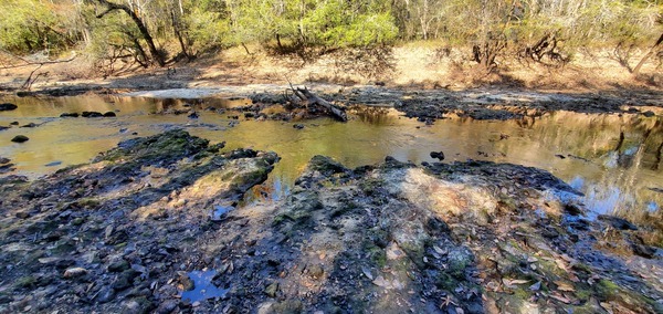
Photoset2: https://www.wwals.net/pictures/2022-11-03–wq/#Old-Dam
PHOTO2 SOURCE: John S. Quarterman
Photo2 Phone Number: 229-242-0102
Suggestions: https://forms.gle/DipPgU2TP5atc2Rf9

Troupville Fish Weir 
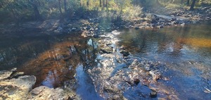
CATEGORIES: Shoal
LAYER: Point of Interest
OWNERSHIP: Public, SUZANNE MARIE S & LASTINGER JAMES KENNETH SCRUGGS JR, PARCEL 146 0018
WATER BODY: Little River
MILE: 0.37
ADDRESS: About 50 feet upstream from Troupville Boat Ramp, downstream from Troupville Dam and Troup Bridge. Lowndes, Brooks Counties.
DESCRIPTION: A rock structure channelling the flow of the Little River through a few points, to make it easier to catch fish. Only visible at low water.
HISTORIC FACTS: Apparently this was a fish weir built by inhabitants of old Troupville.
WEBSITE: https://wwals.net/pictures/2022-11-03–wq/#SSTBR
OTHER REFERENCE: https://wwals.net/2018/03/16/ockolocoochee-little-river-1889-01-29/
PHOTO: https://wwals.net/pictures/2022-11-03–wq/20221103_110746.jpg
PHOTOSET: https://wwals.net/pictures/2022-11-03–wq/#SSTBR
PHOTO SOURCE: John S. Quarterman
PHONE NUMBER: (229) 242-0102
PHOTO2: https://wwals.net/pictures/2022-11-03–wq/20221103_110450.jpg
Photoset2: https://wwals.net/pictures/2022-11-03–wq/#SSTBR
PHOTO2 SOURCE: John S. Quarterman
Photo2 Phone Number: 229-242-0102
Suggestions: https://forms.gle/DipPgU2TP5atc2Rf9

Troupville Boat Ramp @ GA 133
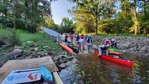
CATEGORIES: Landing
LAYER: Brochure
OWNERSHIP: Public, VLPRA, PARCEL 0057 002A
ACCESS: Yes, Ramp: Concrete on dirt access road, PARKING: Free, PICNIC AREA, HANDICAPPED ACCESSIBLE
WATER BODY: Little River
Lowest boatable: 137
Highest safe: 144
GAUGE: Hahira
MILE: 0.36
ADDRESS: 19664 Valdosta Hwy, Valdosta, GA 31602. I-75 exit 18, west on GA 133 (St. Augustine Road) away from the Valdosta Mall, at the traffic light for Val Tech Road, turn left down to the boat ramp. Lowndes County.
DESCRIPTION: This GA-DNR boat ramp on the left bank of the Little River is in a 49-acre local park, just west of the most populous city in the Suwannee River Basin. It is the last access to the Little River and often the first access to the Withlacoochee River, which is only a couple thousand feet downstream. It’s about 11 river miles downstream past the Little River Confluence and the clean treated water outfall of the Valdosta Withlacoochee Wastewater Treatment Plant to US 84 Landing, which is the roughest takeout on the WLRWT. Troupville Boat Ramp is also a good takeout after 6.72 Withlacoochee River miles downstream from Langdale Park Boat Ramp. Remember to turn right at the Little River Confluence to paddle those last couple thousand feet upstream. This is a Georgia Department of Natural Resources (DNR) boat ramp operated by Valdosta-Lowndes County Parks and Recreation Authority, in a 49.36-acre park. Plus the additional 71 acres down to the Little River Confluence makes a combined 120-acre park and to build the Troupville River Camp proposed by WWALS, here at the center of the Withlacoochee and Little River Water Trail. https://wwals.net/2019/11/05/troupville-river-camp-center-of-little-and-withlacoochee-river-water-trail-2019-10-31/
HISTORIC FACTS: Lowndes County bought the adjoining 71 acres down to the Little River Confluence from Helen Tapp on December 13, 2022, to add to the 49 VLPRA acres as a public park. https://wwals.net/?p=60481 Start of Paddle Georgia 2019. Troupville was the former county seat of Lowndes County, Georgia, here between the blackwater Little and Withlacoochee Rivers. In 1860 the entire town picked up and moved four miles east to the path of the first railroad, and renamed itself Valdosta.
AKA: Little River Boat Ramp (old VLPRA name), Troupville Landing (after the name of the old Lowndes County seat), Troupeville Landing (GDOT), the prison boat ramp (after the state prison across the road).
WEBSITE: http://vlpra.com/231/Troupville-Boat-Ramp
OTHER REFERENCE: https://wwals.net/2018/03/16/ockolocoochee-little-river-1889-01-29/
ADDITIONAL INFO SOURCES: https://wwals.net/pictures/2019-06-15–troupville-confluence-spook-bridge/ https://www.theswimguide.org/beach/9699
UPSTREAM: 24.94 miles from Troupville Boat Ramp to Folsom Bridge Landing
DOWNSTREAM: 11.07 miles from Troupville Boat Ramp to US 84 Landing
PHOTO: https://wwals.net/pictures/2019-06-15–troupville-confluence-spook-bridge/20190615_075154.jpg
PHOTOSET: https://wwals.net/pictures/2019-06-15–troupville-confluence-spook-bridge/
PHOTO SOURCE: John S. Quarterman
PHONE NUMBER: (229) 242-0102
PHOTO2: https://wwals.net/pictures/2020-09-26–drafts-metal-signs/Troupville-Boat-Ramp-Sign-0001.jpg
Photoset2: https://wwals.net/pictures/2020-09-26–drafts-metal-signs/Troupville-Boat-Ramp-Sign-0001.html
PHOTO2 SOURCE: WWALS
Photo2 Phone Number: 850-290-2350
Suggestions: https://forms.gle/DipPgU2TP5atc2Rf9

Troupville Boat Ramp River GPS @ GA 133
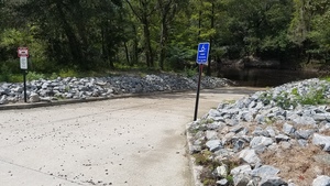
CATEGORIES: Point Of Interest
LAYER: Point of Interest
GPS: 30.85145, -83.3476
OWNERSHIP: Public, VLPRA, PARCEL 0057 002A
ACCESS: Yes, Ramp: Concrete on dirt access road, PARKING: Free, PICNIC AREA, HANDICAPPED ACCESSIBLE
WATER BODY: Little River
Lowest boatable: 137
Highest safe: 144
GAUGE: Hahira
MILE: 0.36
ADDRESS: 19664 Valdosta Hwy, Valdosta, GA 31602. I-75 exit 18, west on GA 133 (St. Augustine Road) away from the Valdosta Mall, at the traffic light for Val Tech Road, turn left down to the boat ramp. Lowndes County.
DESCRIPTION: See Troupville Boat Ramp. This is a Georgia Department of Natural Resources (DNR) boat ramp operated by Valdosta-Lowndes County Parks and Recreation Authority, in a 49.36-acre park. Plus the additional 71 acres down to the Little River Confluence makes a combined 120-acre park and to build the Troupville River Camp proposed by WWALS, here at the center of the Withlacoochee and Little River Water Trail. https://wwals.net/2019/11/05/troupville-river-camp-center-of-little-and-withlacoochee-river-water-trail-2019-10-31/
HISTORIC FACTS: Lowndes County bought the adjoining 71 acres down to the Little River Confluence from Helen Tapp on December 13, 2022, to add to the 49 VLPRA acres as a public park. https://wwals.net/?p=60481 Start of Paddle Georgia 2019. Troupville was the former county seat of Lowndes County, Georgia, here between the blackwater Little and Withlacoochee Rivers. In 1860 the entire town picked up and moved four miles east to the path of the first railroad, and renamed itself Valdosta.
AKA: Little River Boat Ramp (old VLPRA name), Troupville Landing (after the name of the old Lowndes County seat), Troupeville Landing (GDOT), the prison boat ramp (after the state prison across the road).
WEBSITE: http://vlpra.com/231/Troupville-Boat-Ramp
OTHER REFERENCE: https://wwals.net/2018/03/16/ockolocoochee-little-river-1889-01-29/
ADDITIONAL INFO SOURCES: https://wwals.net/pictures/2019-06-15–troupville-confluence-spook-bridge/ https://www.theswimguide.org/beach/9699
PHOTO: https://wwals.net/wp-content/themes/pianoblack/img//2017/11/fc8d79095acf640e73740a29c867b049.jpg
PHOTOSET: https://wwals.net/2017/11/24/troupville-landing-little-river-ga-133-boat-ramp-2017-09-01/
PHOTO SOURCE: John S. Quarterman
PHONE NUMBER: (229) 242-0102
PHOTO2: https://wwals.net/pictures/2020-09-26–drafts-metal-signs/Troupville-Boat-Ramp-Sign-0001.jpg
Photoset2: https://wwals.net/pictures/2020-09-26–drafts-metal-signs/Troupville-Boat-Ramp-Sign-0001.html
PHOTO2 SOURCE: WWALS
Photo2 Phone Number: 850-290-2350
Suggestions: https://forms.gle/DipPgU2TP5atc2Rf9
Old Thomasville Stage Road Bridge

CATEGORIES: Bridgesite
LAYER: Bridge
OWNERSHIP: Public, VLPRA, PARCEL 0057 002A
WATER BODY: Little River
MILE: 0.30
ADDRESS: 320 feet downstream from Troupville Boat Ramp: go south into the woods 140 feet, turn right onto the east road, continue to the Little River. Lowndes, Brooks Counties.
DESCRIPTION: Likely location of the Old Thomasville Stage Road Bridge of Troupville, the former seat of Lowndes County, Georgia.
HISTORIC FACTS: Archaeology needed to determine whether this really is the bridge site.
OTHER REFERENCE: https://wwals.net/2018/03/16/ockolocoochee-little-river-1889-01-29/
PHOTO: https://www.wwals.net/pictures/2022-07-02–troupville-river-park/20220702_092122.jpg
PHOTOSET: https://www.wwals.net/pictures/2022-07-02–troupville-river-park/#LR
PHOTO SOURCE: John S. Quarterman
PHONE NUMBER: (229) 242-0102
Suggestions: https://forms.gle/DipPgU2TP5atc2Rf9
Old Thomasville Stage Road Crossroads

CATEGORIES: Point Of Interest
LAYER: Point of Interest
OWNERSHIP: Public, VLPRA, PARCEL 0057 002A
WATER BODY: Little River
MILE: 0.30
ADDRESS: 140 feet south into the woods from Troupville Boat Ramp. Lowndes County.
DESCRIPTION: Where the likely Old Thomasville Stage Road crosses the current woods road south from Troupville Boat Ramp.
WEBSITE: https://www.wwals.net/pictures/2022-07-02–troupville-river-park/#LR
OTHER REFERENCE: https://www.wwals.net/pictures/2020-08-27–troupville-river-park-walkaround/#Eastwest-road
PHOTO: https://www.wwals.net/pictures/2022-07-02–troupville-river-park/20220702_092342.jpg
PHOTOSET: https://www.wwals.net/pictures/2022-07-02–troupville-river-park/#LR
PHOTO SOURCE: John S. Quarterman
PHONE NUMBER: (229) 242-0102
Suggestions: https://forms.gle/DipPgU2TP5atc2Rf9
Odd rocks

CATEGORIES: Point Of Interest
LAYER: Point of Interest
OWNERSHIP: Public, VLPRA, PARCEL 0057 002A
WATER BODY: Little River
ADDRESS: Near the crossroads. Lowndes County.
DESCRIPTION: Un-natural-looking rocks embedded in the ground.
WEBSITE: https://www.wwals.net/pictures/2020-08-27–troupville-river-park-walkaround/#Eastwest-road
PHOTO: https://www.wwals.net/pictures/2020-08-27–troupville-river-park-walkaround/20200827_133852.jpg
PHOTOSET: https://www.wwals.net/pictures/2020-08-27–troupville-river-park-walkaround/#Eastwest-road
PHOTO SOURCE: John S. Quarterman
PHONE NUMBER: (229) 242-0102
Suggestions: https://forms.gle/DipPgU2TP5atc2Rf9
North Troupville Little River Fishing 

CATEGORIES: Fishing
LAYER: Point of Interest
OWNERSHIP: Public, VLPRA, PARCEL 0057 002A
WATER BODY: Little River
MILE: 0.25
ADDRESS: 580 feet downstream from Troupville Boat Ramp, Lowndes County.
DESCRIPTION: Easy access to the Little River for fishing.
WEBSITE: https://www.wwals.net/pictures/2022-07-02–troupville-river-park/#FS
PHOTO: https://www.wwals.net/pictures/2022-07-02–troupville-river-park/20220702_092531.jpg
PHOTOSET: https://www.wwals.net/pictures/2022-07-02–troupville-river-park/#FS
PHOTO SOURCE: John S. Quarterman
PHONE NUMBER: (229) 242-0102
Suggestions: https://forms.gle/DipPgU2TP5atc2Rf9
“Concrete corner marker, Troupville”
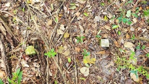
CATEGORIES: Point Of Interest
LAYER: Point of Interest
OWNERSHIP: Public, VLPRA, PARCEL 0057 002A
WATER BODY: Little River
ADDRESS: Due east of Troupville Boat Ramp, about 580 feet southwest of the park entrance, in the woods, next to Old Broad Street. Lowndes County.
DESCRIPTION: A concrete corner marker next to Old Broad Street, Troupville, Georgia.
HISTORIC FACTS: What it marks is unknown; could be as old as Troupville, or more recent.
WEBSITE: https://www.wwals.net/pictures/2019-11-26–vsu-geology-land-between-the-rivers/#Corner-marker
PHOTO: https://www.wwals.net/pictures/2019-11-26–vsu-geology-land-between-the-rivers/20191126_132933.jpg
PHOTOSET: https://www.wwals.net/pictures/2019-11-26–vsu-geology-land-between-the-rivers/#Corner-marker
PHOTO SOURCE: John S. Quarterman
PHONE NUMBER: (229) 242-0102
PHOTO2: https://www.wwals.net/pictures/2019-11-26–vsu-geology-land-between-the-rivers/20191126_132900.jpg
Photoset2: https://www.wwals.net/pictures/2019-11-26–vsu-geology-land-between-the-rivers/#Corner-marker
PHOTO2 SOURCE: John S. Quarterman
Photo2 Phone Number: 229-242-0102
Suggestions: https://forms.gle/DipPgU2TP5atc2Rf9

Troupville Town Square

CATEGORIES: Town Site
LAYER: Point of Interest
OWNERSHIP: Public, VLPRA, PARCEL 0057 002A
WATER BODY: Little River
ADDRESS: 630 feet southeast of the top of Troupville Boat Ramp: go south into the woods 140 feet, turn left onto the east road for 400 feet. Lowndes County.
DESCRIPTION: Likely location of the old town square of Troupville, with Morgan Swain’s hotel and tavern on the southwest corner of Old Broad Street and the Thomasville Stage Road.
HISTORIC FACTS: Likely center of Troupville, the former seat of Lowndes County, Georgia.
WEBSITE: https://wwals.net/2018/03/16/ockolocoochee-little-river-1889-01-29/
PHOTO: https://www.wwals.net/pictures/gretchen/2020-08-27–wwals-troupville/IMG_2795.jpg
PHOTOSET: https://www.wwals.net/pictures/gretchen/2020-08-27–wwals-troupville/#Broad-Street
PHOTO SOURCE: Gretchen Quarterman
PHONE NUMBER: (850) 290-2350
Suggestions: https://forms.gle/DipPgU2TP5atc2Rf9
Broad Street Gateposts

CATEGORIES: Point Of Interest
LAYER: Point of Interest
OWNERSHIP: Private, LOWNDES COUNTY, PARCEL 0057 003
WATER BODY: Little River
ADDRESS: On Old Broad Street about a hundred feet south of Troupville Town Square. Lowndes County.
DESCRIPTION: Relatively modern gateposts a bit south of the property boundary on Old Broad Street.
WEBSITE: https://www.wwals.net/pictures/2021-02-27–troupville-boat-ramp-park/#GP
PHOTO: https://www.wwals.net/pictures/2021-02-27–troupville-boat-ramp-park/20210227_082840.jpg
PHOTOSET: https://www.wwals.net/pictures/2021-02-27–troupville-boat-ramp-park/#GP
PHOTO SOURCE: John S. Quarterman
PHONE NUMBER: (229) 242-0102
Suggestions: https://forms.gle/DipPgU2TP5atc2Rf9
Troupville Mound

CATEGORIES: Point Of Interest
LAYER: Point of Interest
OWNERSHIP: Private, LOWNDES COUNTY, PARCEL 0057 003
WATER BODY: Little River
ADDRESS: 200 feet northeast of Little River Confluence, Lowndes County.
DESCRIPTION: A mound, natural or manmade, in the woods by the south end of Old Broad Street, Troupville, Georgia.
WEBSITE: https://www.wwals.net/pictures/2019-11-26–vsu-geology-land-between-the-rivers/#Inland
PHOTO: https://www.wwals.net/pictures/2019-11-26–vsu-geology-land-between-the-rivers/20191126_130540.jpg
PHOTOSET: https://www.wwals.net/pictures/2019-11-26–vsu-geology-land-between-the-rivers/#Inland
PHOTO SOURCE: John S. Quarterman
PHONE NUMBER: (229) 242-0102
Suggestions: https://forms.gle/DipPgU2TP5atc2Rf9
South Troupville Little River Fishing

CATEGORIES: Fishing
LAYER: Point of Interest
OWNERSHIP: Private, LOWNDES COUNTY, PARCEL 0057 003
WATER BODY: Little River
MILE: 0.12
ADDRESS: 630 feet upsttream from the Little River Confluence, Lowndes County.
DESCRIPTION: Easy access to the Little River for fishing.
WEBSITE: https://www.wwals.net/pictures/2022-07-02–troupville-river-park/#FS
PHOTO: https://www.wwals.net/pictures/2022-07-02–troupville-river-park/20220702_092943.jpg
PHOTOSET: https://www.wwals.net/pictures/2022-07-02–troupville-river-park/#FS
PHOTO SOURCE: John S. Quarterman
PHONE NUMBER: (229) 242-0102
Suggestions: https://forms.gle/DipPgU2TP5atc2Rf9
Source of New River
CATEGORIES: Source
LAYER: Other
OWNERSHIP: Public
WATER BODY: New River
MILE: 34.45
ADDRESS: Animal Science Drive, UGA campus, Tifton, GA, Tift County.
DESCRIPTION: The 55-mile New River begins on the Tifton campus of the University of Georgia.
GRN: Yes
WEBSITE: https://www.google.com/maps/place/31%C2%B029’42.1%22N+83%C2%B031’41.0%22W/@31.4954824, -83.5282719, 1194m/data=!3m1!1e3!4m5!3m4!1s0x0:0x0!8m2!3d31.495025!4d-83.528068?hl=en
Suggestions: https://forms.gle/DipPgU2TP5atc2Rf9
Tifton Love Ave. Spill
CATEGORIES: Spill
LAYER: Point of Interest
GPS: 31.46672, -83.505242
OWNERSHIP: Private
WATER BODY: New River
MILE: 31.99
ADDRESS: 1412 Love Ave, Tifton, GA, 31794, USA, Tift County.
DESCRIPTION: Spill of 4, 000 gallons of raw sewage next to the New River 2020-06-18, according to GA-EPD Sewage Spills Report.
Suggestions: https://forms.gle/DipPgU2TP5atc2Rf9
Outfall of TRWTC
CATEGORIES: Wtp
LAYER: Other
OWNERSHIP: Public, CITY OF TIFTON, PARCEL 0059 015
WATER BODY: New River
MILE: 29.42
ADDRESS: West past TRWTC beyond the end of Old Brookfield Road, and slightly upstream. Near where Queen Bee Creek 03110203000652 enters the New River. Tift County.
DESCRIPTION: Outfall of treated wastewater into the New River from the Tifton Regional Wastewater Treatment Complex (TRWTC). NPDES Permit No. GA0032344.
OTHER REFERENCE: https://wwals.net/2025/12/05/draft-reissuance-tifton-wastewater-permit-ga-epd-2025-11-30/
Suggestions: https://forms.gle/DipPgU2TP5atc2Rf9
TRWTC
CATEGORIES: Wtp
LAYER: Brochure
OWNERSHIP: Public, CITY OF TIFTON, PARCEL 0059 015
WATER BODY: New River
MILE: 29.34
ADDRESS: 80 Old Brookfield Rd W, Tifton, GA 31794, Tift County.
DESCRIPTION: The Tifton Regional Wastewater Treatment Complex (TRWTC) “”has a capacity of 8, 000, 000 gallons per day.””, NPDES Permit No. GA0032344.
WEBSITE: https://www.tifton.net/departments/wastewater_treatment_plant.php
OTHER REFERENCE: https://wwals.net/2025/12/05/draft-reissuance-tifton-wastewater-permit-ga-epd-2025-11-30/
PHONE NUMBER: (229) 386-2115
Suggestions: https://forms.gle/DipPgU2TP5atc2Rf9
Tifton Biosolids Farm
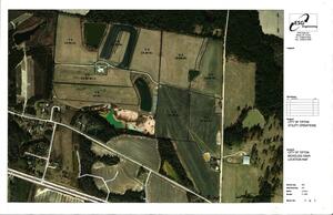
CATEGORIES: Wtp
LAYER: Other
OWNERSHIP: Public, CITY OF TIFTON, PARCEL 0072 063
WATER BODY: New River
MILE: 27.98
ADDRESS: 181 Old Brookfield Rd, Tifton, GA 31794, Tift County.
DESCRIPTION: Tifton’s location for turning wastewater treatment residuals into sludge, coming from the Tifton Regional Wastewater Treatment Complex (TRWTC).
OTHER REFERENCE: https://wwals.net/2025/12/05/draft-reissuance-tifton-wastewater-permit-ga-epd-2025-11-30/
PHOTO SOURCE: GA-EPD
PHONE NUMBER: (850) 290-2350
Suggestions: https://forms.gle/DipPgU2TP5atc2Rf9
Tifton Evergreen Dr. Spill
CATEGORIES: Spill
LAYER: Point of Interest
OWNERSHIP: Public
WATER BODY: Bush Shop Branch
MILE: 1.00
ADDRESS: 1610 Evergreen Drive, Tifton, GA 31794, Tift County.
DESCRIPTION: Spill of 30, 000 gallons of raw sewage on March 11, 2023, upstream of the New River, reported on March 16, 2023 as caused by Debris.
Suggestions: https://forms.gle/DipPgU2TP5atc2Rf9
Tifton E Golden Rd Spill
CATEGORIES: Spill
LAYER: Point of Interest
OWNERSHIP: Public
WATER BODY: Gum Creek 00314966
MILE: 6.09
ADDRESS: 809 E Golden Road, Tifton, GA 31794
DESCRIPTION: Spill of 40, 400 gallons of raw sewage due to “”Wet weather”” into Gum Creek. 2024-04-11
Suggestions: https://forms.gle/DipPgU2TP5atc2Rf9
TMA 
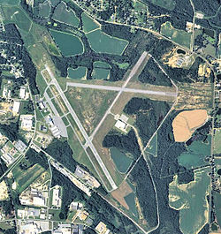
CATEGORIES: Airport
LAYER: Point of Interest
OWNERSHIP: Public, TIFTON & TIFT CO ARPT AUTH.
WATER BODY: Gum Creek 00314966
MILE: 5.14
ADDRESS: Henry Tift Myers Airport (KTMA), Tift County.
DESCRIPTION: Near the headwaters of Gum Creek, 2 miles S of Tifton
WEBSITE: https://www.airnav.com/airport/KTMA
PHOTOSET: http://en.wikipedia.org/wiki/Henry_Tift_Myers_Airport
PHOTO SOURCE: USGS
PHONE NUMBER: (850) 290-2350
Suggestions: https://forms.gle/DipPgU2TP5atc2Rf9
Hardy Millpond

CATEGORIES: Pond
LAYER: Point of Interest
OWNERSHIP: Private, COARSEY, AUSTIN L, PARCEL 007 2 000
WATER BODY: Hardy Mill Creek
ADDRESS: 1.8 miles west of Enigma, GA on US 82, turn right (north) onto Ray Road, continue onto Coursey Lane, private property on the left. Berrien County.
DESCRIPTION: Dammed pond upstream of Paradise Lakes on Hardy Mill Creek.
WEBSITE: https://georgia.hometownlocator.com/maps/feature-map, ftc, 2, fid, 315128, n, hardy%20millpond.cfm
PHOTOSET: https://www.facebook.com/pages/Hardy-Mill-Pond/379549512165527
PHOTO SOURCE: Connie Coarsey Carter
Suggestions: https://forms.gle/DipPgU2TP5atc2Rf9
Paradise PFA

CATEGORIES: Lake
LAYER: Brochure
OWNERSHIP: Public, GA DNR, PARCEL 007 8 000
ACCESS: Yes, Ramp: Concrete, DOCK, CAMPING: Primitive, RESTROOMS, PARKING: License fee, SHELTER, PICNIC AREA, HANDICAPPED ACCESSIBLE
WATER BODY: Paradise Lake
ADDRESS: 536 Paradise Drive, Enigma, GA 31749, Berrien County.
DESCRIPTION: 68 lakes encompassing 525 acres of water. From Tifton: Travel East 8 miles on Hwy. 82 to Brookfield. Turn right on Whitley Rd. and follow signs from Hwy. 82 to the area. The entrance to the area is located on the Brookfield-Nashville Rd. approximately 1.5 miles from Brookfield.
WEBSITE: https://georgiawildlife.com/paradise-pfa
PHOTO: https://gon.com/media/2018/06/ParadisePFA_FishingGuide-4-scaled.jpg
PHOTOSET: https://georgiawildlife.com/sites/default/files/wrd/pdf/pfa/ParadisePFA_FishingGuide.pdf
PHOTO SOURCE: GA DNR
PHONE NUMBER: (229) 533-4792
Suggestions: https://forms.gle/DipPgU2TP5atc2Rf9
Paradise PFA Hiking Trail
CATEGORIES: Hiking Trail
LAYER: Hiking Trail
OWNERSHIP: Public, GA DNR, PARCEL 007 8 000
ACCESS: Yes, CAMPING: Primitive, RESTROOMS, PARKING: License fee
WATER BODY: Paradise Lake
ADDRESS: 536 Paradise Drive, Enigma, GA 31749, Berrien County.
DESCRIPTION: Hiking trail east of Lake Patrick dam, From Tifton: Travel East 8 miles on Hwy. 82 to Brookfield. Turn right on Whitley Rd. and follow signs from Hwy. 82 to the area. The entrance to the area is located on the Brookfield-Nashville Rd. approximately 1.5 miles from Brookfield.
WEBSITE: https://georgiawildlife.com/paradise-pfa
PHOTO: https://gon.com/media/2018/06/ParadisePFA_FishingGuide-4-scaled.jpg
PHOTOSET: https://georgiawildlife.com/sites/default/files/wrd/pdf/pfa/ParadisePFA_FishingGuide.pdf
PHOTO SOURCE: GA DNR
PHONE NUMBER: (229) 533-4792
Suggestions: https://forms.gle/DipPgU2TP5atc2Rf9
Bridge to Lake Paradise side

CATEGORIES: Bridge
LAYER: Bridge
GPS: 31.4122, -83.3611
OWNERSHIP: Public, GA DNR, PARCEL 007 8 000
ACCESS: Yes, Concrete pedestrian bridge, CAMPING: Tent Campsites, RESTROOMS, PARKING: License fee, SHELTER, PICNIC AREA, HANDICAPPED ACCESSIBLE
WATER BODY: Hardy Mill Creek
ADDRESS: 536 Paradise Drive, Enigma, GA 31749, Berrrien County.
DESCRIPTION: One-lane concrete bridge over Hardy Mill Creek. From Tifton: Travel East 8 miles on Hwy. 82 to Brookfield. Turn right on Whitley Rd. and follow signs from Hwy. 82 to the area. The entrance to the area is located on the Brookfield-Nashville Rd. approximately 1.5 miles from Brookfield.
WEBSITE: https://georgiawildlife.com/paradise-pfa
OTHER REFERENCE: https://maps.app.goo.gl/UbQwbjeMRWphfyCc6
PHOTOSET: https://commons.wikimedia.org/wiki/File:Bridge_to_Lake_Paradise_side, _Paradise_PFA.jpg
PHOTO SOURCE: Michael Rivera
PHONE NUMBER: https://creativecommons.org/licenses/by-sa/4.0/deed.en
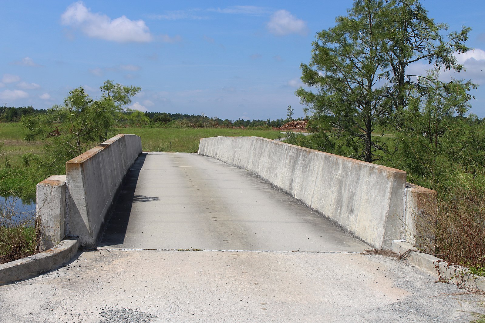
Photoset2: https://commons.wikimedia.org/wiki/File:Bridge_to_Lake_Paradise_side, _Paradise_PFA.jpg
PHOTO2 SOURCE: Michael Rivera
Photo2 Phone Number: https://creativecommons.org/licenses/by-sa/4.0/deed.en
Suggestions: https://forms.gle/DipPgU2TP5atc2Rf9

Paradise Lake Boat Ramp
CATEGORIES: Landing
LAYER: Other
OWNERSHIP: Public, GA DNR, PARCEL 007 8 000
ACCESS: Yes, Ramp: Concrete plus floating boat dock, CAMPING: Tent Campsites, RESTROOMS, PARKING: License fee, SHELTER, PICNIC AREA, HANDICAPPED ACCESSIBLE
WATER BODY: Hardy Mill Creek
ADDRESS: 536 Paradise Drive, Enigma, GA 31749, Berrrien County.
DESCRIPTION: From Tifton: Travel East 8 miles on Hwy. 82 to Brookfield. Turn right on Whitley Rd. and follow signs from Hwy. 82 to the area. The entrance to the area is located on the Brookfield-Nashville Rd. approximately 1.5 miles from Brookfield.
AKA: Paradise Lake Landing
WEBSITE: https://georgiawildlife.com/paradise-pfa
PHOTO: https://gon.com/media/2018/06/ParadisePFA_FishingGuide-4-scaled.jpg
PHOTOSET: https://georgiawildlife.com/sites/default/files/wrd/pdf/pfa/ParadisePFA_FishingGuide.pdf
PHOTO SOURCE: GA DNR
PHONE NUMBER: (229) 533-4792
Suggestions: https://forms.gle/DipPgU2TP5atc2Rf9
Lake Bobben Boat Ramp

CATEGORIES: Landing
LAYER: Other
OWNERSHIP: Public, GA DNR, PARCEL 007 8 000
ACCESS: Yes, Ramp: Concrete plus floating boat dock, CAMPING: Tent Campsites, RESTROOMS, PARKING: License fee, SHELTER, PICNIC AREA, HANDICAPPED ACCESSIBLE
WATER BODY: Hardy Mill Creek
ADDRESS: 536 Paradise Drive, Enigma, GA 31749, Berrrien County.
DESCRIPTION: From Tifton: Travel East 8 miles on Hwy. 82 to Brookfield. Turn right on Whitley Rd. and follow signs from Hwy. 82 to the area. The entrance to the area is located on the Brookfield-Nashville Rd. approximately 1.5 miles from Brookfield.
AKA: Lake Bobben Landing
WEBSITE: https://georgiawildlife.com/paradise-pfa
PHOTOSET: https://commons.wikimedia.org/wiki/File:Lake_Bobben_boat_dock, _Paradise_PFA.jpg
PHOTO SOURCE: Michael Rivera
PHONE NUMBER: https://creativecommons.org/licenses/by-sa/4.0/deed.en
Suggestions: https://forms.gle/DipPgU2TP5atc2Rf9
Lake Patrick Canoe and Kayak Launch

CATEGORIES: Landing
LAYER: Other
OWNERSHIP: Public, GA DNR, PARCEL 007 8 000
ACCESS: Yes, Launch: Wood steps from grassy lakeside, CAMPING: Tent Campsites, RESTROOMS, PARKING: License fee, SHELTER, PICNIC AREA, HANDICAPPED ACCESSIBLE
WATER BODY: Hardy Mill Creek
ADDRESS: 536 Paradise Drive, Enigma, GA 31749, Berrrien County.
DESCRIPTION: From Tifton: Travel East 8 miles on Hwy. 82 to Brookfield. Turn right on Whitley Rd. and follow signs from Hwy. 82 to the area. The entrance to the area is located on the Brookfield-Nashville Rd. approximately 1.5 miles from Brookfield.
AKA: Lake Patrick Landing
WEBSITE: https://georgiawildlife.com/paradise-pfa
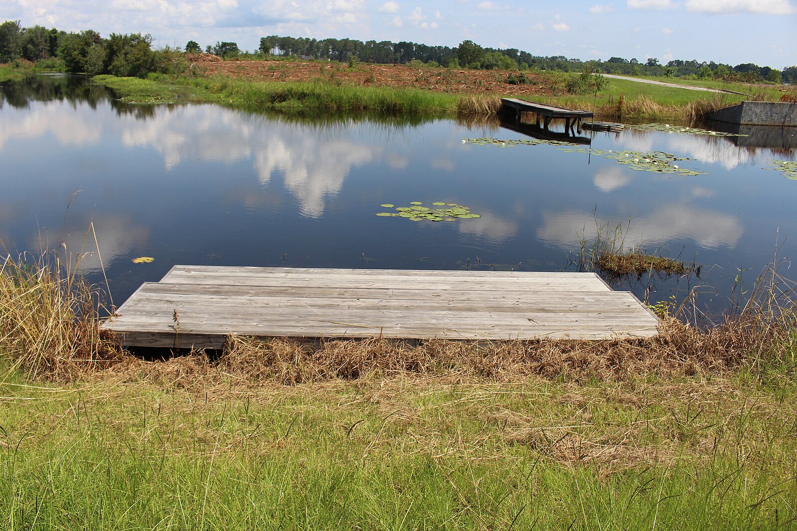
PHOTOSET: https://commons.wikimedia.org/wiki/File:Lake_Patrick_canoe_kayak_launch, _Paradise_PFA.jpg
PHOTO SOURCE: Michael Rivera
PHONE NUMBER: https://creativecommons.org/licenses/by-sa/4.0/deed.en
Suggestions: https://forms.gle/DipPgU2TP5atc2Rf9
Lake Patrick Boat Ramp

CATEGORIES: Landing
LAYER: Other
GPS: 31.40117, -83.359907
OWNERSHIP: Public, GA DNR, PARCEL 007 8 000
ACCESS: Yes, Ramp: Concrete plus floating boat dock, CAMPING: Tent Campsites, RESTROOMS, PARKING: License fee, SHELTER, PICNIC AREA, HANDICAPPED ACCESSIBLE
WATER BODY: Hardy Mill Creek
ADDRESS: 536 Paradise Drive, Enigma, GA 31749, Berrrien County.
DESCRIPTION: From Tifton: Travel East 8 miles on Hwy. 82 to Brookfield. Turn right on Whitley Rd. and follow signs from Hwy. 82 to the area. The entrance to the area is located on the Brookfield-Nashville Rd. approximately 1.5 miles from Brookfield.
WEBSITE: https://georgiawildlife.com/paradise-pfa
PHOTOSET: https://commons.wikimedia.org/wiki/File:Lake_Patrick_boat_ramp, _Paradise_PFA.jpg
PHOTO SOURCE: Michael Rivera
PHONE NUMBER: https://creativecommons.org/licenses/by-sa/4.0/deed.en
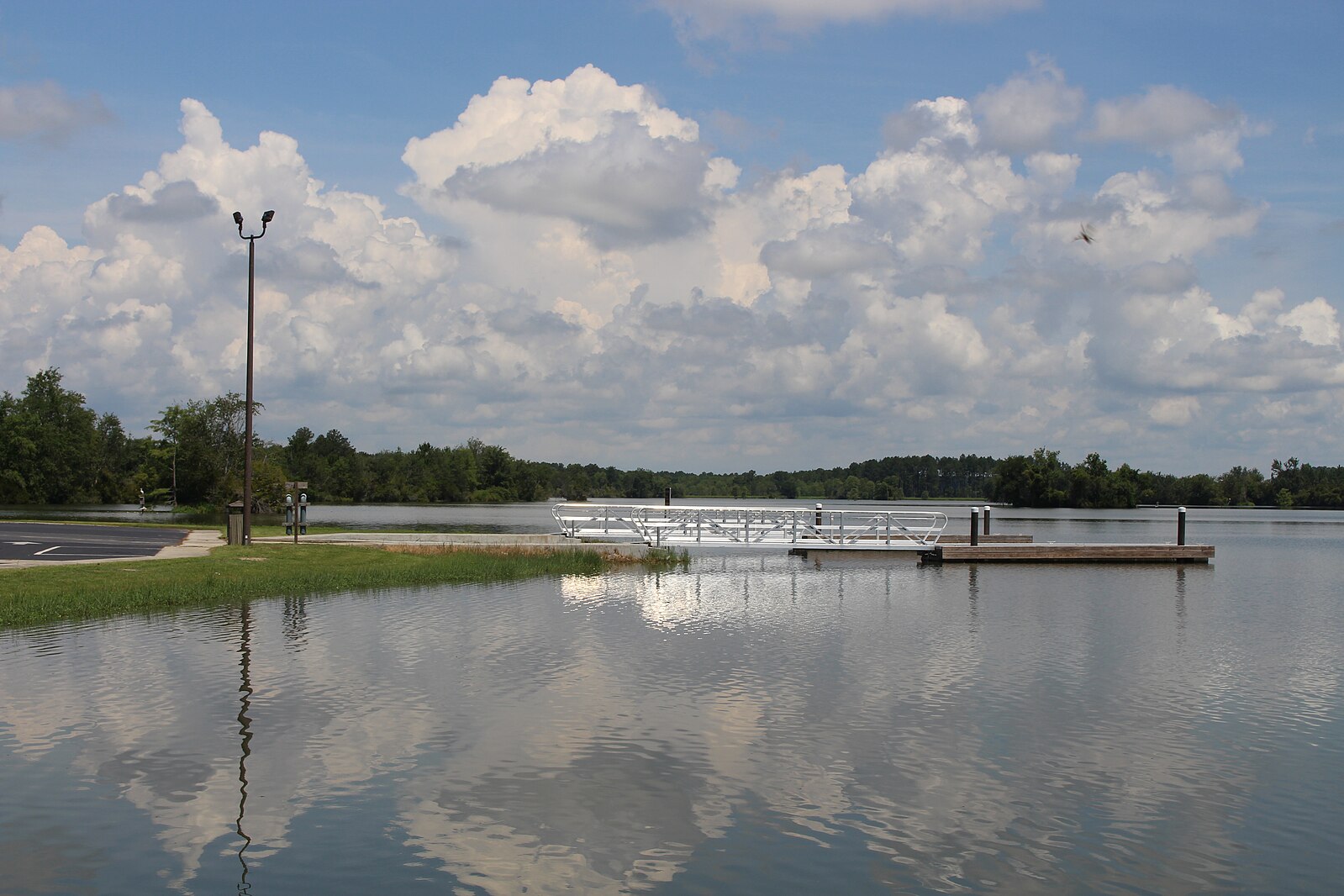
Photoset2: https://commons.wikimedia.org/wiki/File:Lake_Patrick_boat_dock, _Paradise_PFA.jpg
PHOTO2 SOURCE: Michael Rivera
Photo2 Phone Number: https://creativecommons.org/licenses/by-sa/4.0/deed.en
Suggestions: https://forms.gle/DipPgU2TP5atc2Rf9

Tacklebuster Lake Boat Ramp
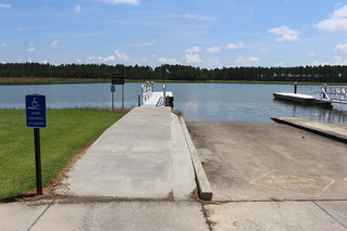
CATEGORIES: Landing
LAYER: Other
OWNERSHIP: Public, GA DNR, PARCEL 007 8 000
ACCESS: Yes, Ramp: Concrete plus floating dock, CAMPING: Tent Campsites, RESTROOMS, PARKING: License fee, SHELTER, PICNIC AREA, HANDICAPPED ACCESSIBLE
WATER BODY: Hardy Mill Creek
ADDRESS: 536 Paradise Drive, Enigma, GA 31749, Berrrien County.
DESCRIPTION: From Tifton: Travel East 8 miles on Hwy. 82 to Brookfield. Turn right on Whitley Rd. and follow signs from Hwy. 82 to the area. The entrance to the area is located on the Brookfield-Nashville Rd. approximately 1.5 miles from Brookfield.
AKA: Tacklebuster Lake Landing
WEBSITE: https://georgiawildlife.com/paradise-pfa
PHOTO: https://gon.com/media/2018/06/ParadisePFA_FishingGuide-4-scaled.jpg
PHOTOSET: https://georgiawildlife.com/sites/default/files/wrd/pdf/pfa/ParadisePFA_FishingGuide.pdf
PHOTO SOURCE: GA DNR
PHONE NUMBER: (229) 533-4792
Suggestions: https://forms.gle/DipPgU2TP5atc2Rf9
Horseshoe 2 Lake Landing

CATEGORIES: Landing
LAYER: Other
OWNERSHIP: Public, GA DNR, PARCEL 007 8 000
ACCESS: Yes, Launch: lakeside plus static fishing pier, CAMPING: Tent Campsites, RESTROOMS, PARKING: License fee, SHELTER, PICNIC AREA, HANDICAPPED ACCESSIBLE
WATER BODY: Hardy Mill Creek
ADDRESS: 536 Paradise Drive, Enigma, GA 31749, Berrrien County.
DESCRIPTION: From Tifton: Travel East 8 miles on Hwy. 82 to Brookfield. Turn right on Whitley Rd. and follow signs from Hwy. 82 to the area. The entrance to the area is located on the Brookfield-Nashville Rd. approximately 1.5 miles from Brookfield.
WEBSITE: https://georgiawildlife.com/paradise-pfa
PHOTOSET: https://commons.wikimedia.org/wiki/File:Horseshoe_2b, _Paradise_PFA.jpg
PHOTO SOURCE: Michael Rivera
PHONE NUMBER: https://creativecommons.org/licenses/by-sa/4.0/deed.en
Suggestions: https://forms.gle/DipPgU2TP5atc2Rf9
Horseshoe 3 Lake Boat Ramp

CATEGORIES: Landing
LAYER: Other
OWNERSHIP: Public, GA DNR, PARCEL 007 8 000
ACCESS: Yes, Ramp: Concrete plus floating dock, CAMPING: Tent Campsites, RESTROOMS, PARKING: License fee, SHELTER, PICNIC AREA, HANDICAPPED ACCESSIBLE
WATER BODY: Hardy Mill Creek
ADDRESS: 536 Paradise Drive, Enigma, GA 31749, Berrrien County.
DESCRIPTION: From Tifton: Travel East 8 miles on Hwy. 82 to Brookfield. Turn right on Whitley Rd. and follow signs from Hwy. 82 to the area. The entrance to the area is located on the Brookfield-Nashville Rd. approximately 1.5 miles from Brookfield.
AKA: Horseshoe 3 Lake Landing
WEBSITE: https://georgiawildlife.com/paradise-pfa
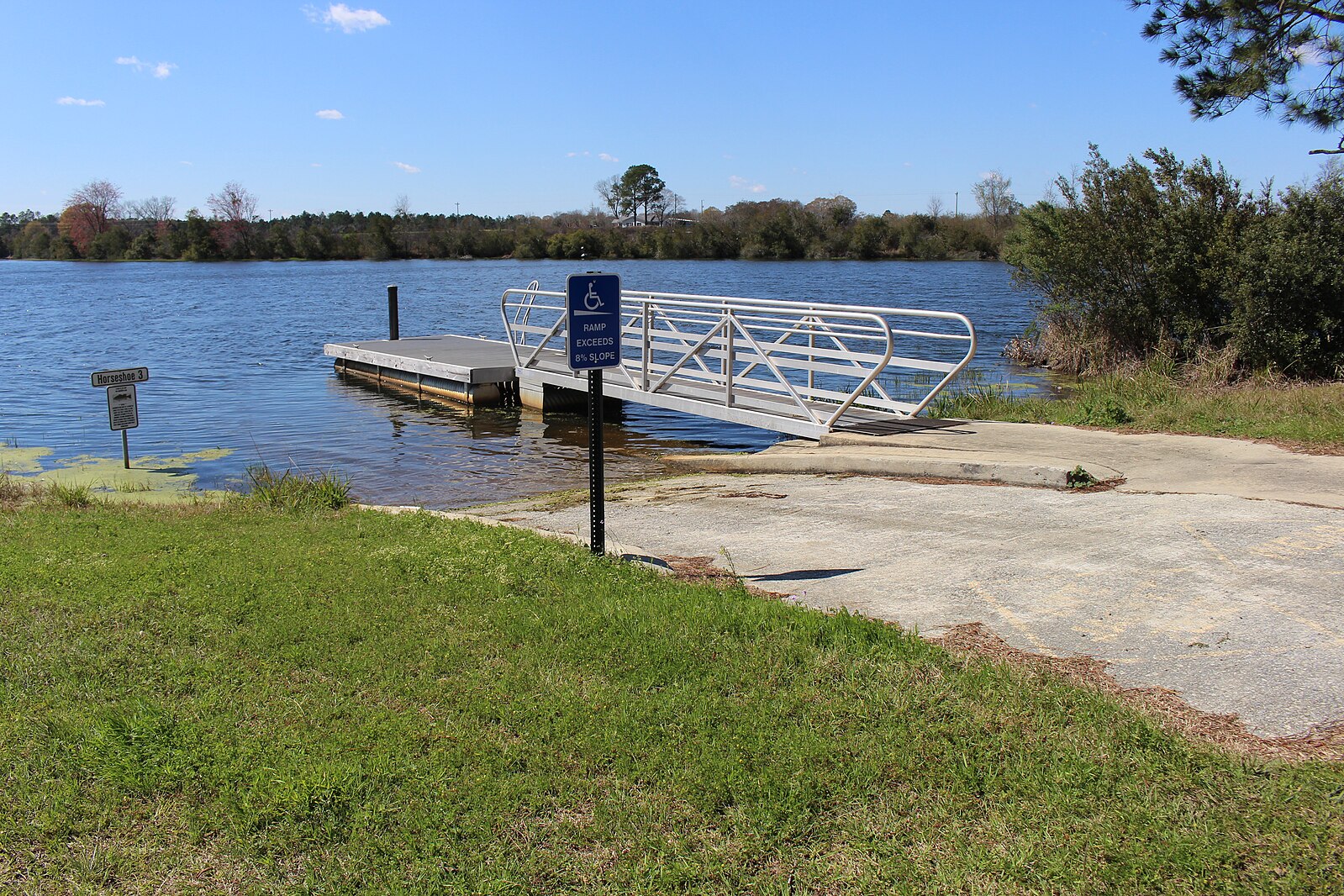
PHOTOSET: https://commons.wikimedia.org/wiki/File:Horseshoe_3, _Paradise_PFA.jpg
PHOTO SOURCE: Michael Rivera
PHONE NUMBER: https://creativecommons.org/licenses/by-sa/4.0/deed.en
Suggestions: https://forms.gle/DipPgU2TP5atc2Rf9
Horseshoe 4 Lake Boat Ramp

CATEGORIES: Landing
LAYER: Other
OWNERSHIP: Public, GA DNR, PARCEL 007 8 000
ACCESS: Yes, Ramp: Concrete plus floating dock, CAMPING: Tent Campsites, RESTROOMS, PARKING: License fee, SHELTER, PICNIC AREA, HANDICAPPED ACCESSIBLE
WATER BODY: Hardy Mill Creek
ADDRESS: 536 Paradise Drive, Enigma, GA 31749, Berrrien County.
DESCRIPTION: From Tifton: Travel East 8 miles on Hwy. 82 to Brookfield. Turn right on Whitley Rd. and follow signs from Hwy. 82 to the area. The entrance to the area is located on the Brookfield-Nashville Rd. approximately 1.5 miles from Brookfield.
AKA: Horseshoe 4 Lake Landing
WEBSITE: https://georgiawildlife.com/paradise-pfa
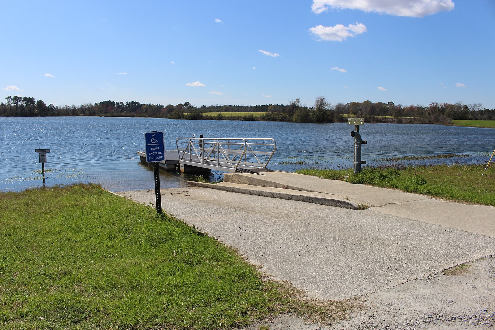
PHOTOSET: https://commons.wikimedia.org/wiki/File:Horseshoe_4a, _Paradise_PFA.jpg
PHOTO SOURCE: Michael Rivera
PHONE NUMBER: https://creativecommons.org/licenses/by-sa/4.0/deed.en
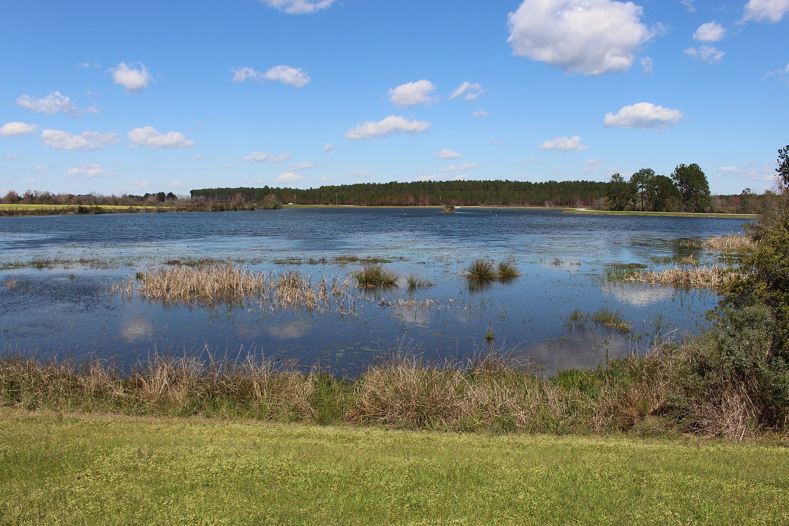
Photoset2: https://commons.wikimedia.org/wiki/File:Horseshoe_4b, _Paradise_PFA.jpg
PHOTO2 SOURCE: Michael Rivera
Photo2 Phone Number: https://creativecommons.org/licenses/by-sa/4.0/deed.en
Suggestions: https://forms.gle/DipPgU2TP5atc2Rf9

Horseshoe 5 Lake Boat Ramp
CATEGORIES: Landing
LAYER: Other
OWNERSHIP: Public, GA DNR, PARCEL 007 8 000
ACCESS: Yes, Ramp: Concrete plus floating boat dock, CAMPING: Tent Campsites, RESTROOMS, PARKING: License fee, SHELTER, PICNIC AREA, HANDICAPPED ACCESSIBLE
WATER BODY: Hardy Mill Creek
ADDRESS: 536 Paradise Drive, Enigma, GA 31749, Berrrien County.
DESCRIPTION: From Tifton: Travel East 8 miles on Hwy. 82 to Brookfield. Turn right on Whitley Rd. and follow signs from Hwy. 82 to the area. The entrance to the area is located on the Brookfield-Nashville Rd. approximately 1.5 miles from Brookfield.
AKA: Horseshoe 5 Lake Landing
WEBSITE: https://georgiawildlife.com/paradise-pfa
PHOTO: https://gon.com/media/2018/06/ParadisePFA_FishingGuide-4-scaled.jpg
PHOTOSET: https://georgiawildlife.com/sites/default/files/wrd/pdf/pfa/ParadisePFA_FishingGuide.pdf
PHOTO SOURCE: GA DNR
PHONE NUMBER: (229) 533-4792
Suggestions: https://forms.gle/DipPgU2TP5atc2Rf9
Lake Beaver Boat Ramp

CATEGORIES: Landing
LAYER: Other
GPS: 31.389801, -83.35725
OWNERSHIP: Public, GA DNR, PARCEL 007 8 000
ACCESS: Yes, Ramp: Concrete plus floating boat dock, CAMPING: Tent Campsites, RESTROOMS, PARKING: License fee, SHELTER, PICNIC AREA, HANDICAPPED ACCESSIBLE
WATER BODY: Hardy Mill Creek
ADDRESS: 536 Paradise Drive, Enigma, GA 31749, Berrrien County.
DESCRIPTION: From Tifton: Travel East 8 miles on Hwy. 82 to Brookfield. Turn right on Whitley Rd. and follow signs from Hwy. 82 to the area. The entrance to the area is located on the Brookfield-Nashville Rd. approximately 1.5 miles from Brookfield.
AKA: Lake Beaver Landing
WEBSITE: https://georgiawildlife.com/paradise-pfa
PHOTOSET: https://commons.wikimedia.org/wiki/File:Lake_Beaver_a, _Paradise_PFA.jpg
PHOTO SOURCE: Michael Rivera
PHONE NUMBER: https://creativecommons.org/licenses/by-sa/4.0/deed.en
Suggestions: https://forms.gle/DipPgU2TP5atc2Rf9
Lake Russell Boat Ramp

CATEGORIES: Landing
LAYER: Other
OWNERSHIP: Public, GA DNR, PARCEL 007 8 000
ACCESS: Yes, Ramp: Concrete plus floating boat dock, CAMPING: Tent Campsites, RESTROOMS, PARKING: License fee, SHELTER, PICNIC AREA, HANDICAPPED ACCESSIBLE
WATER BODY: Hardy Mill Creek
ADDRESS: 536 Paradise Drive, Enigma, GA 31749, Berrrien County.
DESCRIPTION: From Tifton: Travel East 8 miles on Hwy. 82 to Brookfield. Turn right on Whitley Rd. and follow signs from Hwy. 82 to the area. The entrance to the area is located on the Brookfield-Nashville Rd. approximately 1.5 miles from Brookfield.
AKA: Lake Russell Landing
WEBSITE: https://georgiawildlife.com/paradise-pfa
PHOTOSET: https://commons.wikimedia.org/wiki/File:Lake_Russell_a, _Paradise_PFA.jpg
PHOTO SOURCE: Michael Rivera
PHONE NUMBER: https://creativecommons.org/licenses/by-sa/4.0/deed.en
Suggestions: https://forms.gle/DipPgU2TP5atc2Rf9
Noah’s Ark Lake

CATEGORIES: Lake
LAYER: Point of Interest
OWNERSHIP: Public, GA DNR, PARCEL 007 8 000
ACCESS: Yes, Launch: lakeside
WATER BODY: Hardy Mill Creek
ADDRESS: 536 Paradise Drive, Enigma, GA 31749, Berrien County.
DESCRIPTION: From Tifton: Travel East 8 miles on Hwy. 82 to Brookfield. Turn right on Whitley Rd. and follow signs from Hwy. 82 to the area. The entrance to the area is located on the Brookfield-Nashville Rd. approximately 1.5 miles from Brookfield.
WEBSITE: https://georgiawildlife.com/paradise-pfa
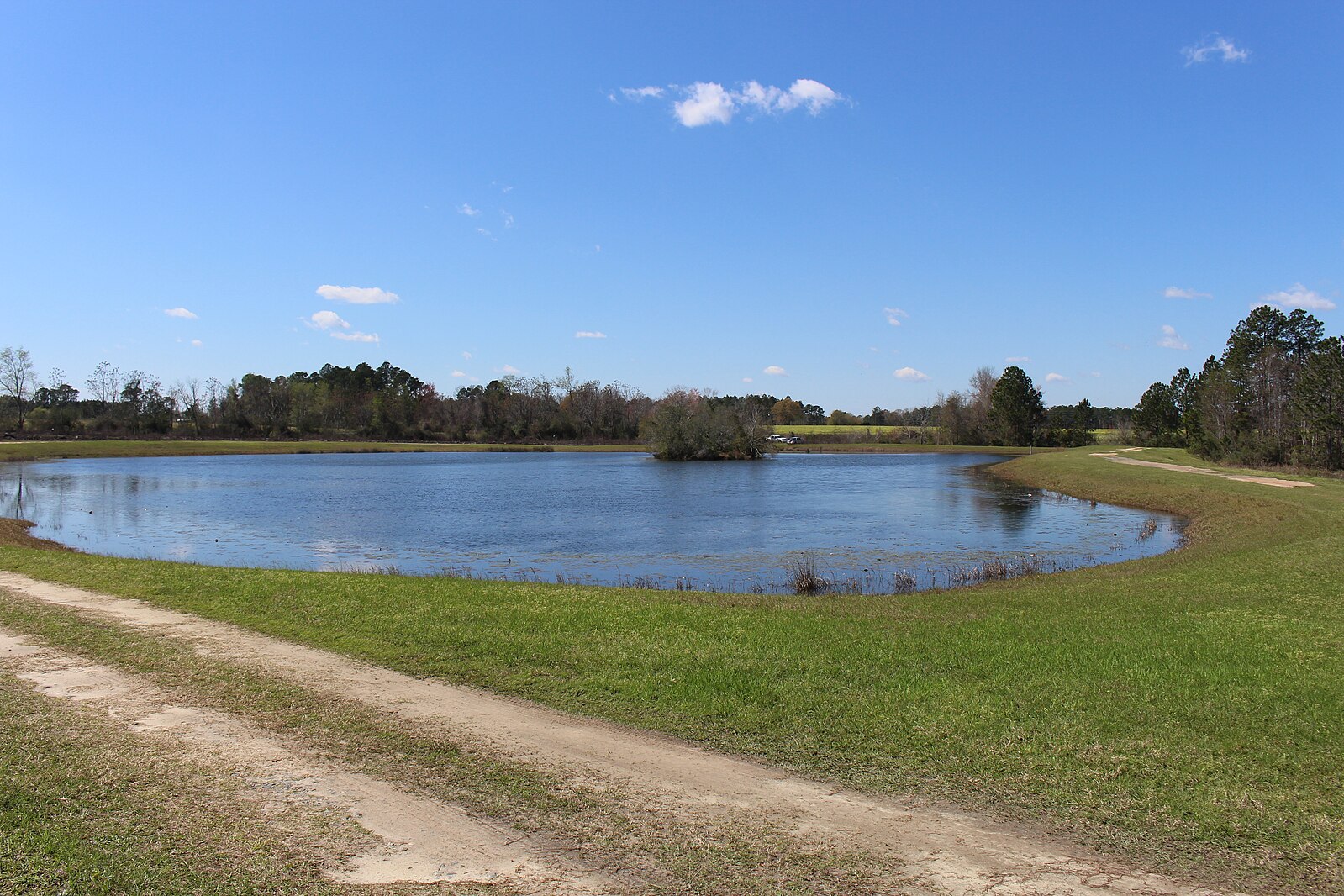
PHOTOSET: https://commons.wikimedia.org/wiki/File:Noah%27s_Ark, _Paradise_PFA.jpg
PHOTO SOURCE: Michael Rivera
PHONE NUMBER: https://creativecommons.org/licenses/by-sa/4.0/deed.en
Suggestions: https://forms.gle/DipPgU2TP5atc2Rf9
Gum Creek (Withlacoochee R.)
CATEGORIES: Tributary
LAYER: Other
OWNERSHIP: Private
WATER BODY: New River
MILE: 23.40
ADDRESS: East of GA 125 SE of Tifton, Tift County.
DESCRIPTION: Starts below Henry Tift Myers Airport (TMA)
Suggestions: https://forms.gle/DipPgU2TP5atc2Rf9
Source of Withlacoochee River
CATEGORIES: Source
LAYER: Brochure
OWNERSHIP: Private, HARPER, LEON DAMON & MYRON WAYNE HARPER, PARCEL 031 4 000
WATER BODY: Withlacoochee River
MILE: 115.06
ADDRESS: Slightly upstream (north) of SP4 Derrell Danforth Bridge on Lenox Alapaha Road (CR 354) west of Nashville-Enigma Road, SW of Alapaha, GA, SSE of Enigma, GA. Berrien County.
DESCRIPTION: In some planted pines, upstream of where Cypress Creek and Hog Creek join, just above the bridge.
WEBSITE: https://www.google.com/maps/place/31%C2%B019’41.8%22N+83%C2%B017’54.1%22W/@31.3508272, -83.3789767, 19137m/data=!3m1!1e3!4m5!3m4!1s0x0:0x0!8m2!3d31.328285!4d-83.298371?hl=en
PHOTO SOURCE: Berrien County Tax Assessors
PHONE NUMBER: (850) 290-2350
Suggestions: https://forms.gle/DipPgU2TP5atc2Rf9
SP4 Derrell Danforth Bridge
CATEGORIES: Bridge
LAYER: Bridge
OWNERSHIP: Public
WATER BODY: Withlacoochee River
MILE: 114.88
ADDRESS: Lenox-Alapaha Road (CR 354), Alapaha, GA 31622, Berrien County.
WEBSITE: https://en.wikipedia.org/wiki/Withlacoochee_River_(Suwannee_River)
Suggestions: https://forms.gle/DipPgU2TP5atc2Rf9
GA 125 Bridge
CATEGORIES: Bridge
LAYER: Bridge
OWNERSHIP: Public
WATER BODY: Withlacoochee River
MILE: 105.93
ADDRESS: Tifton Road (GA 125) NW of Nashville, GA 31639, Berrien County.
WEBSITE: https://en.wikipedia.org/wiki/Withlacoochee_River_(Suwannee_River)
Suggestions: https://forms.gle/DipPgU2TP5atc2Rf9
Nashville-Adel Power Line
CATEGORIES: Power Line
LAYER: Point of Interest
OWNERSHIP: Private
WATER BODY: Withlacoochee River
MILE: 105.11
ADDRESS: Downstream from GA 125 and upstream from Reedy Creek 00310357 and GA 76. Between Sandy Bluff Road and Middle School Circle. Berrien County.
Suggestions: https://forms.gle/DipPgU2TP5atc2Rf9
Nashville WPCP
CATEGORIES: Wtp
LAYER: Brochure
OWNERSHIP: Public
WATER BODY: Withlacoochee River
MILE: 105.10
ADDRESS: Middle School Circle and Gary Street. Behind the water tower, straddling Reedy Creek and a power line. Berrien County.
DESCRIPTION: NPDES Permit No. GA0039365, 1.0 MGD design flow rate. LAS AERATED LAGOONS AND STORAGE PONDS FOR FLOWS > 1.0 mgd
WEBSITE: https://wwals.net/pictures/2018-08-30–permits/nashville
Suggestions: https://forms.gle/DipPgU2TP5atc2Rf9
GFR RR Bridge
CATEGORIES: Railbridgesite
LAYER: Bridge
OWNERSHIP: Private
WATER BODY: Withlacoochee River
MILE: 105.04
ADDRESS: 1000 feet upstream from GA 76, and half a mile due west of Nashville, GA, Berrien County.
DESCRIPTION: Georgia and Florida Railroad, abandoned 1967, formerly known as Nashville and Sparks Railroad.
WEBSITE: https://en.wikipedia.org/wiki/Withlacoochee_River_(Suwannee_River)
Suggestions: https://forms.gle/DipPgU2TP5atc2Rf9
POW Fred L. Belcher Bridge
CATEGORIES: Bridge
LAYER: Bridge
GPS: 31.197289, -83.27179
OWNERSHIP: Public
WATER BODY: Withlacoochee River
MILE: 104.41
ADDRESS: Adel Highway (GA 76), Nashvile, GA 31639, Berrien County.
WEBSITE: https://en.wikipedia.org/wiki/Withlacoochee_River_(Suwannee_River)
Suggestions: https://forms.gle/DipPgU2TP5atc2Rf9
GA 125 New River Bridge
CATEGORIES: Bridge
LAYER: Bridge
GPS: 31.360994, -83.42831
OWNERSHIP: Public
WATER BODY: New River
MILE: 21.19
ADDRESS: GA 125 just south of the Tift-Berrien County line and just north of Vanceville-County Line Road. Berrien County.
DESCRIPTION: A two-lane concrete state highway bridge over the New River.
PHOTOSET: https://viewer.nationalmap.gov/viewer/
PHOTO SOURCE: USGS TNM
Suggestions: https://forms.gle/DipPgU2TP5atc2Rf9
Rutland Bridge

CATEGORIES: Bridgehistoric
LAYER: Bridge
OWNERSHIP: Private
WATER BODY: New River
MILE: 18.68
ADDRESS: East of Eldorado and Lenox, west of Enigma. Berrien, Cook Counties.
DESCRIPTION: “”Abandoned bridge over New River overflow.””
HISTORIC FACTS: “”Current slab bridge that crosses the New River overflow was built in 1988. It is unknown if this bridge was still in use at that time.””
WEBSITE: https://bridgehunter.com/ga/berrien/rutland/
PHOTO: https://bridgehunter.com/photos/19/61/196100-M.jpg
PHOTOSET: https://bridgehunter.com/ga/berrien/rutland/
PHOTO SOURCE: Becky Taylor via Bridgehunter.com
PHONE NUMBER: (850) 290-2350
Suggestions: https://forms.gle/DipPgU2TP5atc2Rf9
New Rutland Bridge
CATEGORIES: Bridge
LAYER: Bridge
GPS: 31.32974, -83.4366
OWNERSHIP: Public
WATER BODY: New River
MILE: 18.68
ADDRESS: East of Eldorado and Lenox, west of Enigma. Berrien, Cook Counties.
DESCRIPTION: Dirt road slab bridge built in 1988 over the New River.
WEBSITE: https://www.google.com/maps/place/31%C2%B019’47.1%22N+83%C2%B026’11.8%22W/@31.3297411, -83.4372451, 208m/data=!3m2!1e3!4b1!4m4!3m3!8m2!3d31.32974!4d-83.4366?entry=ttu
Suggestions: https://forms.gle/DipPgU2TP5atc2Rf9
Reedy Creek
CATEGORIES: Tributary
LAYER: Other
OWNERSHIP: Private
WATER BODY: New River
MILE: 16.20
ADDRESS: Less than a mile upstream from Hesters Bridge, Cook County.
PHOTOSET: https://viewer.nationalmap.gov/viewer/
PHOTO SOURCE: USGS TNM
Suggestions: https://forms.gle/DipPgU2TP5atc2Rf9
Hesters Bridge
CATEGORIES: Bridge
LAYER: Bridge
OWNERSHIP: Public
WATER BODY: New River
MILE: 15.14
ADDRESS: Lenox-Brookfield Road (CR 252), Lenox, GA 31637, Cook, Berrien Counties.
PHOTOSET: https://viewer.nationalmap.gov/viewer/
PHOTO SOURCE: USGS TNM
Suggestions: https://forms.gle/DipPgU2TP5atc2Rf9
Brown Bridge
CATEGORIES: Bridge
LAYER: Bridge
OWNERSHIP: Public
WATER BODY: New River
MILE: 12.41
ADDRESS: 3881 Judge Lott Rd (GA 547) Lenox, GA 31637, Cook, Berrien Counties.
DESCRIPTION: From Alapaha take W Lenox Rd becomes Lenox-Alapaha Road becomes Coy Hancock Road becomes Judge Lott Road and crosses the New River
PHOTOSET: https://viewer.nationalmap.gov/viewer/
PHOTO SOURCE: USGS TNM
Suggestions: https://forms.gle/DipPgU2TP5atc2Rf9
Gainey Bridge
CATEGORIES: Bridge
LAYER: Bridge
OWNERSHIP: Public
WATER BODY: New River
MILE: 9.45
ADDRESS: Gainey Bridge Road, Lenox, GA 31637, Cook, Berrien Counties.
DESCRIPTION: Massee Post Rd, Sparks, GA 31647
PHOTOSET: https://viewer.nationalmap.gov/viewer/
PHOTO SOURCE: USGS TNM
Suggestions: https://forms.gle/DipPgU2TP5atc2Rf9
Gum Branch
CATEGORIES: Tributary
LAYER: Other
OWNERSHIP: Private
WATER BODY: New River
MILE: 8.80
ADDRESS: About 2000 feet downstream from Gainey Bridge, Berrien County.
PHOTOSET: https://viewer.nationalmap.gov/viewer/
PHOTO SOURCE: USGS TNM
Suggestions: https://forms.gle/DipPgU2TP5atc2Rf9
Buckholts Bridge
CATEGORIES: Bridge
LAYER: Bridge
OWNERSHIP: Public
WATER BODY: New River
MILE: 6.16
ADDRESS: Burnett Lane, Adel, GA 31620, Cook, Berrien Counties.
DESCRIPTION: County Road 193, Nashville, GA 31639
PHOTOSET: https://viewer.nationalmap.gov/viewer/
PHOTO SOURCE: USGS TNM
Suggestions: https://forms.gle/DipPgU2TP5atc2Rf9
Wolf Branch
CATEGORIES: Tributary
LAYER: Other
GPS: 31.216028, -83.33236
OWNERSHIP: Private
WATER BODY: New River
MILE: 5.71
ADDRESS: About 100 feet downstream from Buckholts Bridge, Berrien County.
PHOTOSET: https://viewer.nationalmap.gov/viewer/
PHOTO SOURCE: USGS TNM
Suggestions: https://forms.gle/DipPgU2TP5atc2Rf9
Connell Bridge
CATEGORIES: Bridgesite
LAYER: Bridge
GPS: 31.184658, -83.32894
OWNERSHIP: Public
WATER BODY: New River
MILE: 3.34
ADDRESS: Burnett Lane, Adel, GA 31620, Cook, Berrien Counties.
DESCRIPTION: Site of a bridge beyond County Road 193, Nashville, GA 31639. Take Billy Connell Rd. south from Barneyville Rd. just west of the New River; turn left onto Burnett Lane to the New River.
PHOTOSET: https://viewer.nationalmap.gov/viewer/
PHOTO SOURCE: USGS TNM
Suggestions: https://forms.gle/DipPgU2TP5atc2Rf9
Brushy Creek
CATEGORIES: Tributary
LAYER: Other
OWNERSHIP: Private
WATER BODY: New River
MILE: 3.32
ADDRESS: About 100 feet downstream or maybe upstream from Connell Bridge. Cook County.
DESCRIPTION: Enters the New River on its right after coming down 24 miles past Lenox. Take Billy Connell Rd. south from Barneyville Rd. just west of the New River; turn right onto Burnett Lane to Brushy Creek.
PHOTOSET: https://viewer.nationalmap.gov/viewer/
PHOTO SOURCE: USGS TNM
Suggestions: https://forms.gle/DipPgU2TP5atc2Rf9
Long Bridge
CATEGORIES: Bridge
LAYER: Bridge
GPS: 31.177211, -83.32231
OWNERSHIP: Public
WATER BODY: New River
MILE: 2.67
ADDRESS: 15700 GA 76, Adel, GA 31620, Cook, Berrien Counties.
DESCRIPTION: 420 Adel Highway, Nashville, GA 31639
Suggestions: https://forms.gle/DipPgU2TP5atc2Rf9
New River
CATEGORIES: Tributary
LAYER: Other
OWNERSHIP: Private
WATER BODY: Withlacoochee River
MILE: 100.15
ADDRESS: East of Griffin Circle, NE of Adel, Cook, Berrien Counties.
DESCRIPTION: Enters river right, after forming the border of Cook and Berrien Counties, and draining half of Tifton and its wastewater treatment plant.
WEBSITE: https://wwals.net/maps/#New-River
Suggestions: https://forms.gle/DipPgU2TP5atc2Rf9
Bear Creek
CATEGORIES: Tributary
LAYER: Other
GPS: 31.109265, -83.32263
OWNERSHIP: Private
WATER BODY: Withlacoochee River
MILE: 96.68
ADDRESS: Confluence east of Boyett Road, south of GA 37, Cook County.
DESCRIPTION: Enters river right after draining Adel.
Suggestions: https://forms.gle/DipPgU2TP5atc2Rf9
B Williams Bridge site
CATEGORIES: Bridgesite
LAYER: Bridge
OWNERSHIP: Private
WATER BODY: Withlacoochee River
MILE: 98.81
ADDRESS: Past the end of Old Lois Road, Nashville, GA 31639, Berrien, Cook Counties.
DESCRIPTION: We don’t know why it is called B. Williams Bridge.
WEBSITE: https://en.wikipedia.org/wiki/Withlacoochee_River_(Suwannee_River)
Suggestions: https://forms.gle/DipPgU2TP5atc2Rf9
Youngs Mill Creek
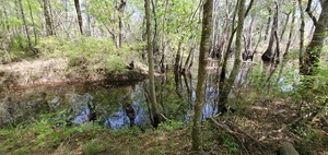
CATEGORIES: Tributary
LAYER: Other
OWNERSHIP: Public
ACCESS: Yes, PARKING: Free
WATER BODY: Withlacoochee River
MILE: 97.62
ADDRESS: 13766 Highway 37, Adel, GA 31620, Cook County.
DESCRIPTION: Youngs Mill Creek enters the Withlacoochee River on its right just upstream of the Shellie W. Parrish Memorial Bridge that carries GA 37 across the Withlacoochee River. Apparently there used to be a mill here
WEBSITE: https://wwals.net/pictures/2021-03-25–ray-city-little-river-ga-37
PHOTO: https://wwals.net/pictures/2021-03-25–ray-city-little-river-ga-37/20210325_125538.jpg
PHOTOSET: https://wwals.net/pictures/2021-03-25–ray-city-little-river-ga-37
PHOTO SOURCE: John S. Quarterman
PHONE NUMBER: (229) 242-0102
Suggestions: https://forms.gle/DipPgU2TP5atc2Rf9
Shellie W. Parrish Memorial Bridge
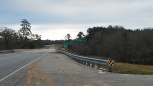
CATEGORIES: Bridge
LAYER: Bridge
GPS: 31.12022, -83.321241
OWNERSHIP: Public
ACCESS: No
WATER BODY: Withlacoochee River
MILE: 97.65
ADDRESS: On GA 37 between Adel and Ray City, GA, Cook, Berrien Counties.
DESCRIPTION: State highway bridge
AKA: GA 37 Withlacoochee Berrien Bridge or Shellie W. Parrish Memorial Bridge.
WEBSITE: https://uglybridges.com/1093589
PHOTO: https://wwals.net/pictures/2018-02-18–ga-37-withlacoochee/20180218_075649.jpg
PHOTOSET: https://wwals.net/pictures/2018-02-18–ga-37-withlacoochee/#GA37
PHOTO SOURCE: John S. Quarterman
PHONE NUMBER: (229) 242-0102
Suggestions: https://forms.gle/DipPgU2TP5atc2Rf9
Youngs Mill Creek Landing @ GA 37
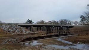
CATEGORIES: Landing
LAYER: Brochure
OWNERSHIP: Public
ACCESS: Yes, Launch: paved asphalt access road to sand riverbank, PARKING: Free
WATER BODY: Withlacoochee River
Lowest boatable: 122.6′
Highest safe: 131′
GAUGE: Skipper Bridge
MILE: 97.63
ADDRESS: Right bank, 13766 Highway 37, Adel, GA 31620, Cook County.
DESCRIPTION: East of Adel towards Ray City, GA, a paved access ramp leads almost to the riverside. Expect to get lost in the swamps at least once, and to have to portage over deadfalls. So be prepared to camp at least one night, while owls sing you to sleep and crows wake you up in the morning. In the new year expect yellow jessamine earliest, then wild native azaleas (Rhododendron canescens) blooming in their white to yellow or pink glory. In spring see red maple and white Grancy Greybeard and dogwood trees. In summer you may see the halberdleaf five-large-petaled swamp rose-mallow (Hibiscus laevis). Year-round, see loblolly pines, live oaks, water oaks, cypress, river birch, willow, and Spanish moss.
AKA: Youngs MIll Landing.
WEBSITE: https://wwals.net/pictures/2018-02-18–ga-37-withlacoochee/#YMCL
DOWNSTREAM: 12.95 miles from Youngs Mill Creek Landing to Hagan Bridge Landing
PHOTO: https://wwals.net/pictures/2018-02-18–ga-37-withlacoochee/20180218_075754.jpg
PHOTOSET: https://wwals.net/pictures/2018-02-18–ga-37-withlacoochee/
PHOTO SOURCE: John S. Quarterman
PHONE NUMBER: (229) 242-0102
PHOTO2: https://wwals.net/pictures/2020-09-26–drafts-metal-signs/Youngs-Mill-Creek-Landing-Sign-0001.jpg
Photoset2: https://wwals.net/pictures/2020-09-26–drafts-metal-signs/Youngs-Mill-Creek-Landing-Sign-0001.html
PHOTO2 SOURCE: WWALS
Photo2 Phone Number: 850-290-2350
Suggestions: https://forms.gle/DipPgU2TP5atc2Rf9

Ray City Landing @ GA 37
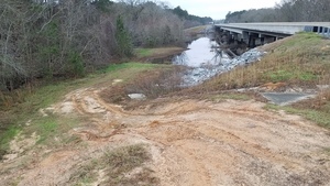
CATEGORIES: Landing
LAYER: Other
OWNERSHIP: Public
ACCESS: Yes, Launch: very steep dirt access road to sand riverbank, PARKING: Free
WATER BODY: Withlacoochee River
Lowest boatable: 122.6′
Highest safe: 131′
GAUGE: Skipper Bridge
MILE: 97.64
ADDRESS: Left bank, 1 GA 37, Nashville, GA 31639, Berrien County.
DESCRIPTION: West of Ray City towards Adel, GA, a very rougth dirt access road leads to the river bank. Expect to get lost in the swamps at least once, and to have to portage over deadfalls. So be prepared to camp at least one night, while owls sing you to sleep and crows wake you up in the morning. In the new year expect yellow jessamine earliest, then wild native azaleas (Rhododendron canescens) blooming in their white to yellow or pink glory. In spring see red maple and white Grancy Greybeard and dogwood trees. In summer you may see the halberdleaf five-large-petaled swamp rose-mallow (Hibiscus laevis). Year-round, see loblolly pines, live oaks, water oaks, cypress, river birch, willow, and Spanish moss.
AKA: GA 37 Withlacoochee Berrien.
WEBSITE: https://wwals.net/pictures/2018-02-18–ga-37-withlacoochee/#RCL
PHOTO: https://wwals.net/pictures/2018-02-18–ga-37-withlacoochee/20180218_080221.jpg
PHOTOSET: https://wwals.net/pictures/2018-02-18–ga-37-withlacoochee/
PHOTO SOURCE: John S. Quarterman
PHONE NUMBER: (229) 242-0102
PHOTO2: https://wwals.net/pictures/2020-09-26–drafts-metal-signs/Ray-City-Landing-Sign-0001.jpg
Photoset2: https://wwals.net/pictures/2020-09-26–drafts-metal-signs/Ray-City-Landing-Sign-0001.html
PHOTO2 SOURCE: WWALS
Photo2 Phone Number: 850-290-2350
Suggestions: https://forms.gle/DipPgU2TP5atc2Rf9

Hubert F. Comer Bridge
CATEGORIES: Bridge
LAYER: Bridge
OWNERSHIP: Public
WATER BODY: Cat Creek
MILE: 8.67
ADDRESS: 7762 GA-37, Ray City, GA 31645, Berrien County.
DESCRIPTION: GA 37 over Cat Creek just west of Ray City, GA
PHOTO: https://www.google.com/maps/@31.0738016, -83.2056007, 3a, 15y, 93.81h, 87.97t/data=!3m6!1e1!3m4!1s0lQANGUf1KJF545d0eyYvw!2e0!7i13312!8i6656
PHOTO SOURCE: Google streetview
PHONE NUMBER: (850) 290-2350
PHOTO2: https://www.google.com/maps/@31.0738016, -83.2056007, 3a, 15y, 93.81h, 87.97t/data=!3m6!1e1!3m4!1s0lQANGUf1KJF545d0eyYvw!2e0!7i13312!8i6656
PHOTO2 SOURCE: Ray City History Blog
Suggestions: https://forms.gle/DipPgU2TP5atc2Rf9
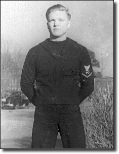
Ray’s Millpond

CATEGORIES: Lake
LAYER: Other
OWNERSHIP: Private
ACCESS: Yes, Launch: pond side from paved road, FOOD, WATER, RESTROOMS, SHELTER, PICNIC AREA, HANDICAPPED ACCESSIBLE
WATER BODY: Beaverdam Creek
MILE: 2.39
ADDRESS: 875 Rays Millpond Rd, Ray City, GA 31645, Berrien County.
DESCRIPTION: Old mill pond, with popular nearby catfish restaurant. Popular local restaurant.
WEBSITE: http://www.raysmillpond.com/
PHOTO: https://wwals.net/wp-content/themes/pianoblack/img/2016/04/98d6df9e9efedf22873c19f1a3a4fc45.jpg
PHOTOSET: https://wwals.net/2016/04/02/rays-mill-pond-2016-04-02/
PHOTO SOURCE: John S. Quarterman
PHONE NUMBER: (229) 242-0102
Suggestions: https://forms.gle/DipPgU2TP5atc2Rf9
Ramblinwood Road Beaverdam Creek Bridge

CATEGORIES: Bridge
LAYER: Bridge
OWNERSHIP: Public
WATER BODY: Beaverdam Creek
MILE: 2.13
ADDRESS: Between Rays Milpond Road (CR 268) and CR 124, more than two miles upstream from Cat Creek. Berrien County.
DESCRIPTION: First bridge on Beaverdam Creek below Rays Millpond.
PHOTO: https://www.wwals.net/pictures/2022-10-27–wq/2022-10-27–beaverwood–20221027_144600.jpg
PHOTOSET: https://www.wwals.net/pictures/2022-10-27–wq/#beaverwood
PHOTO SOURCE: Elizabeth Brunner
PHONE NUMBER: (850) 290-2350
Suggestions: https://forms.gle/DipPgU2TP5atc2Rf9
Main Street Beaverdam Creek Bridge

CATEGORIES: Bridge
LAYER: Bridge
OWNERSHIP: Public
WATER BODY: Beaverdam Creek
MILE: 1.56
ADDRESS: One mile east of Ray City, between Faountain Road and CR 270, about one and a half miles upstream from Cat Creek. Berrien County.
DESCRIPTION: 29.9-foot 3-span concrete culvert, built in 1986 on Main Street (GA 11 and US 129). Second bridge on Beaverdam Creek downstream from Rays Millpond.
AKA: SR 11 Beaverdam Creek Bridge or GA 11 Beaverdam Creek Bridge or US 129 Beaverdam Creek Bridge
WEBSITE: https://bridgereports.com/1090517
PHOTO: https://www.wwals.net/pictures/2022-10-27–wq/2022-10-27–beavermain–20221027_143920.jpg
PHOTOSET: https://www.wwals.net/pictures/2022-10-27–wq/#beavermain
PHOTO SOURCE: Elizabeth Brunner
PHONE NUMBER: (850) 290-2350
Suggestions: https://forms.gle/DipPgU2TP5atc2Rf9
Patten Avenue Beaverdam Creek Bridge
CATEGORIES: Bridge
LAYER: Bridge
GPS: 31.07293, -83.19913
OWNERSHIP: Public
WATER BODY: Beaverdam Creek
MILE: 0.45
ADDRESS: Between Main Street and Johnson Street, about half a mile upstream from Cat Creek. Berrien County.
DESCRIPTION: 21-foot dual concrete culvert over Beaverdam Creek on GA 125, aka Patten Avenue, built in 1940.
AKA: SR 125 Beaverdam Creek Bridge or GA 125 Beaverdam Creek Bridge
WEBSITE: https://bridgereports.com/1090536
Suggestions: https://forms.gle/DipPgU2TP5atc2Rf9
Park Street Beaverdam Creek Bridge
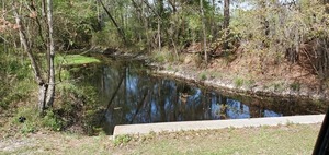
CATEGORIES: Bridge
LAYER: Bridge
OWNERSHIP: Public
ACCESS: No
WATER BODY: Beaverdam Creek
MILE: 0.23
ADDRESS: Between Main Street and Johnson Street, a quarter mile upstream from Cat Creek. Berrien County.
DESCRIPTION: 32.2-foot 3-span concrete culvert, built in 1980. Just upstream from the Ray City WPCP and Cat Creek, and downstream from Ray’s Millpond.
WEBSITE: https://bridgereports.com/1090564
PHOTO: https://wwals.net/pictures/2021-03-25–ray-city-little-river-ga-37/20210325_121838.jpg
PHOTOSET: https://wwals.net/pictures/2021-03-25–ray-city-little-river-ga-37/
PHOTO SOURCE: John S. Quarterman
PHONE NUMBER: (229) 242-0102
PHOTO2: https://www.wwals.net/pictures/2022-10-27–wq/2022-10-27–beaverpark–20221027_142949.jpg
Photoset2: https://www.wwals.net/pictures/2022-10-27–wq/#beaverpark
PHOTO2 SOURCE: Elizabeth Brunner
Suggestions: https://forms.gle/DipPgU2TP5atc2Rf9

Beaverdam Creek
CATEGORIES: Tributary
LAYER: Other
GPS: 31.070101, -83.20588
OWNERSHIP: Private, David Lee Swanson, PARCEL 077 120 000
ACCESS: No
WATER BODY: Cat Creek
MILE: 8.40
ADDRESS: A few hundred feet downstream of Hubert F. Comer Bridge. Berrien County.
DESCRIPTION: The creek that runs through Ray City.
Suggestions: https://forms.gle/DipPgU2TP5atc2Rf9
Ray City WPCP
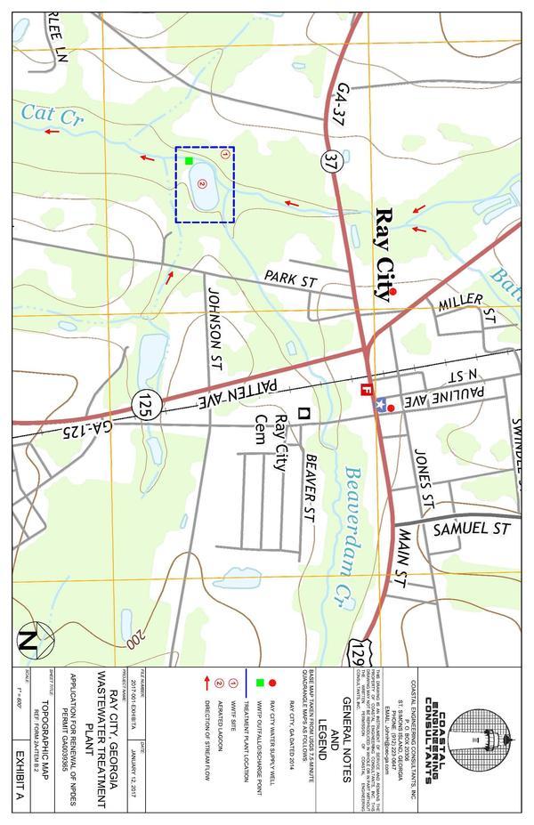
CATEGORIES: Wtp
LAYER: Brochure
GPS: 31.0693, -83.206
OWNERSHIP: Public, Ray City Sewage Plant, PARCEL 077 120 001
WATER BODY: Cat Creek
MILE: 8.36
ADDRESS: Entrance west off of Park Street, just north of Johnson Street. About 1500 feet downstream on Cat Creek from Hubert F. Comer Bridge on GA 37. Berrien County.
DESCRIPTION: A wastewater treatment pond backing up to Cat Creek, just downstream of the Beaverdam Creek Confluence. NPDES Permit No. GA0033553. ‘Up to 0.1 MGD of treated wastewater is being discharged to Cat Creek in the Suwannee River Basin.’ GA-EPD PUBLIC NOTICE NO. 2017–08 ML, May 2, 2017 https://epd.georgia.gov/document/publication/april-28thsent-out-may-1-2017docx
HISTORIC FACTS: Ray City has had a long string of wastewater violations, many each year, going back years, at its wastewater treatment plant on Cat Creek, just below Beaverdam Creek, and 8.36 Cat Creek miles upstream from the Withlacoochee River. https://wwals.net/?p=55268
AKA: Ray City Water Pollution Control Plant.
GRN: Yes
WEBSITE: https://wwals.net/pictures/2018-08-30–permits/ray-city/
PHOTOSET: https://wwals.net/pictures/2018-08-30–permits/ray-city/
PHOTO SOURCE: GA-EPD via WWALS
PHOTO2: https://wwals.net/pictures/2021-03-25–ray-city-little-river-ga-37/20210325_121945.jpg
Photoset2: https://wwals.net/pictures/2021-03-25–ray-city-little-river-ga-37/
PHOTO2 SOURCE: John S. Quarterman
Photo2 Phone Number: 229-242-0102
Suggestions: https://forms.gle/DipPgU2TP5atc2Rf9

Futchs Ferry Bridge

CATEGORIES: Bridge
LAYER: Bridge
OWNERSHIP: Public
WATER BODY: Withlacoochee River
MILE: 95.26
ADDRESS: Futchs Ferry Rd, Ray City, GA 31645, Berrien, Cook Counties.
DESCRIPTION: Old Coffee Road (CR 31), Hahira, GA 31632
WEBSITE: https://bridgereports.com/1093561
PHOTO: https://www.wwals.net/pictures/2023-03-21–futchs-ferry-landing/20230321_171646.jpg
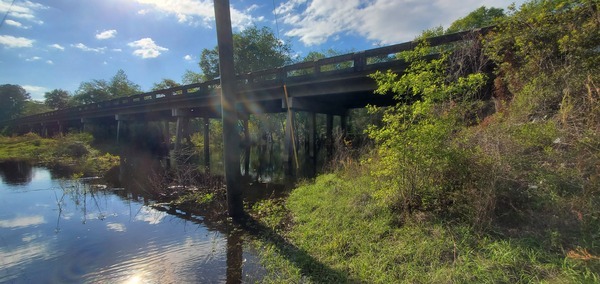
PHOTOSET: https://www.wwals.net/pictures/2023-03-21–futchs-ferry-landing/
PHOTO SOURCE: John S. Quarterman
PHONE NUMBER: (229) 242-0102
PHOTO2: https://www.wwals.net/pictures/2021-03-25–ray-city-little-river-ga-37/20210325_130834.jpg
Photoset2: https://www.wwals.net/pictures/2021-03-25–ray-city-little-river-ga-37
PHOTO2 SOURCE: John S. Quarterman
Photo2 Phone Number: 229-242-0102
Suggestions: https://forms.gle/DipPgU2TP5atc2Rf9

Futchs Ferry Landing

CATEGORIES: Landing
LAYER: Other
GPS: 31.0987079, -83.3133
OWNERSHIP: Public
ACCESS: Yes, Launch: riverbank down rough county road right of way. PARKING: Free
WATER BODY: Withlacoochee River
MILE: 95.26
ADDRESS: Futchs Ferry Rd, Ray City, GA 31645, south side of road, east side of river. Berrien County.
DESCRIPTION: Left bank, under the power line, Old Coffee Road (CR 31), Hahira, GA 31632
AKA: Old Coffee Road Landing
WEBSITE: https://bridgereports.com/1093561
PHOTO: https://www.wwals.net/pictures/2023-03-21–futchs-ferry-landing/20230321_171148.jpg
PHOTOSET: https://www.wwals.net/pictures/2023-03-21–futchs-ferry-landing/
PHOTO SOURCE: John S. Quarterman
PHONE NUMBER: (229) 242-0102
PHOTO2: https://www.wwals.net/pictures/2023-03-21–futchs-ferry-landing/20230321_171629.jpg
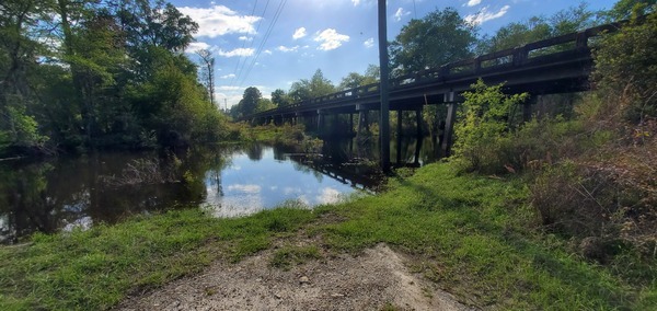
Photoset2: https://www.wwals.net/pictures/2023-03-21–futchs-ferry-landing/
PHOTO2 SOURCE: John S. Quarterman
Photo2 Phone Number: 229-242-0102
Suggestions: https://forms.gle/DipPgU2TP5atc2Rf9

Futchs Ferry Landing River GPS
CATEGORIES: Point Of Interest
LAYER: Point of Interest
OWNERSHIP: Public
ACCESS: Yes, Launch: riverbank down rough county road right of way. PARKING: Free
WATER BODY: Withlacoochee River
MILE: 95.25
ADDRESS: Futchs Ferry Rd, Ray City, GA 31645, south side of road, east side of river. Berrien County.
DESCRIPTION: Left bank, under the power line, Old Coffee Road (CR 31), Hahira, GA 31632
AKA: Old Coffee Road Landing River GPS
WEBSITE: https://bridgereports.com/1093561
PHOTO: https://www.wwals.net/pictures/2023-03-21–futchs-ferry-landing/20230321_171629.jpg
PHOTOSET: https://www.wwals.net/pictures/2023-03-21–futchs-ferry-landing/
PHOTO SOURCE: John S. Quarterman
PHONE NUMBER: (229) 242-0102
PHOTO2: https://www.wwals.net/pictures/2023-03-21–futchs-ferry-landing/20230321_171642.jpg
Photoset2: https://www.wwals.net/pictures/2023-03-21–futchs-ferry-landing
PHOTO2 SOURCE: John S. Quarterman
Photo2 Phone Number: 229-242-0102
Suggestions: https://forms.gle/DipPgU2TP5atc2Rf9

Futchs Ferry
CATEGORIES: Ferry
LAYER: Bridge
OWNERSHIP: Public
WATER BODY: Withlacoochee River
MILE: 95.12
ADDRESS: About 690 feet downstream of Futchs Ferry Bridge, Berrien, Cook Counties.
DESCRIPTION: Likely location of old Futchs Ferry, where it looks like the older path of Coffee Road crossed the Withlacoochee River.
HISTORIC FACTS: “”Futch’s Ferry was a later crossing at the Withlacoochee River on the Coffee Road.”” –Ray City History Blog https://raycityhistory.wordpress.com/2012/04/14/coffee-road-led-to-creation-of-lowndes-county/
WEBSITE: https://raycityhistory.wordpress.com/2012/04/14/coffee-road-led-to-creation-of-lowndes-county/
Suggestions: https://forms.gle/DipPgU2TP5atc2Rf9
Camp Tygart
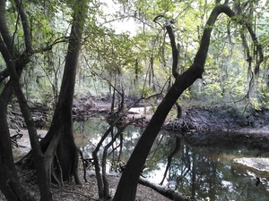
CATEGORIES: Point Of Interest
LAYER: Point of Interest
OWNERSHIP: Private, Camp J.D. Tygart Methodist Youth Camp, PARCEL 041 12 000, 041 11 000, 041 10 000
ACCESS: Yes, Launch: steep riverbank, SHELTER
WATER BODY: Withlacoochee River
MILE: 90.08
ADDRESS: 436 Woody Jackson Circle, Camp Tygart Road, Ray City, GA 31645, Berrien County.
DESCRIPTION: Methodist camp with river access. “”Camp Tygart is a non-profit organization supported and operated by the United Methodist Church.””
WEBSITE: http://www.camptygart.com/
PHOTO: https://wwals.net/wp-content/themes/pianoblack/img//2016/10/a9d0c90ae9249460fb5ef5c6e2d12cb8.jpg
PHOTOSET: https://wwals.net/2016/10/16/withlacoochee-river-at-camp-tygart-2016-10-15/
PHOTO SOURCE: John S. Quarterman
PHONE NUMBER: (229) 242-0102
Suggestions: https://forms.gle/DipPgU2TP5atc2Rf9
Banks Lake Outdoors 

CATEGORIES: Outfitter
LAYER: Other
OWNERSHIP: Public, U.S. Dept. of Interior, PARCEL 022 0023
ACCESS: No, CANOE, FOOD: Store, WATER, Port-A-Potties, PARKING: Free, SHELTER, PICNIC AREA, FISH BAIT, HANDICAPPED ACCESSIBLE
WATER BODY: Banks Lake
MILE: 1.00
ADDRESS: 307 Georgia 122, Lakeland, GA 31635, Lanier County.
DESCRIPTION: This business is operated by the Lanier County Board of Commissioners. It offers canoe, kayak, bass hunter, and Gheenoe rentals. Your live bait needs are covered with minnows, shiners, crickets, pond worms, and red wrigglers. Rents to the public for use on Banks Lake or elsewhere. Located next to Banks Lake Boat Ramp in Banks Lake National Wildlife Refuge.
GRN: Yes
WEBSITE: https://www.facebook.com/bankslakeoutdoors/
OTHER REFERENCE: http://www.fws.gov/uploadedFiles/BL_concession%281%29.pdf
PHOTO SOURCE: Michael Rivera
PHONE NUMBER: (229) 569-0147
Suggestions: https://forms.gle/DipPgU2TP5atc2Rf9
Gin Branch Creek
CATEGORIES: Tributary
LAYER: Other
OWNERSHIP: Public
WATER BODY: Withlacoochee River
MILE: 86.65
ADDRESS: North from GA 122 across Bradford Road, then west into the Withlacoochee River. Lanier County.
DESCRIPTION: A small agricultural creek. Name according to Della Gladieux 2024-07-26.
AKA: Tanner Bennett Creek 03110203000542
Suggestions: https://forms.gle/DipPgU2TP5atc2Rf9
“Lowndes, Cook, Berrien Counties”
CATEGORIES: Point Of Interest
LAYER: Other
OWNERSHIP: Public
WATER BODY: Withlacoochee River
MILE: 85.95
ADDRESS: About 300 feet upstream of Lindsey Branch, due east of Sumner Road. Lowndes, Cook, Berrien Counties.
DESCRIPTION: An artificial straight line somebody drew on a map.
Suggestions: https://forms.gle/DipPgU2TP5atc2Rf9
Lindsey Branch
CATEGORIES: Tributary
LAYER: Other
OWNERSHIP: Public
ACCESS: No
WATER BODY: Withlacoochee River
MILE: 85.87
ADDRESS: East of Louie Fletcher Road at the Cook-Lowndes County line, Cook County.
DESCRIPTION: Enters Withlacoochee River right, coming down across Futch Road.
Suggestions: https://forms.gle/DipPgU2TP5atc2Rf9
Owen Smith Cemetery
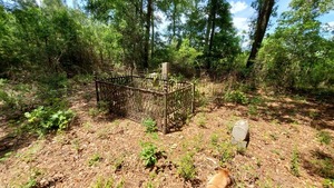
CATEGORIES: Cemetery
LAYER: Other
GPS: 31.0266, -83.2881
OWNERSHIP: Public, All the Lowndes County Tax Assessors Map says for owner is “”Cemetery””. PARCEL 0101 001
WATER BODY: Withlacoochee River
MILE: 85.95
ADDRESS: Due west of Edmonston Road, with its north side on the Lowndes-Berrien County Line. Lowndes County.
DESCRIPTION: Cemetery of the Smith family that owned more than three thousand acres in this area from at least 1831, shortly after the founding of Lowndes County, Georgia. Can be accessed through the Georgia Sheriffs’ Boys Ranch, 5671 Boys Ranch Road, Hahira, GA 31632. In a wooded one acre enclave within pecan trees on land owned by Shiloh Pecan Farms, bought from the Georgia Sheriff’s Boys Ranch in 2012. https://qpublic.schneidercorp.com/Application.aspx?AppID=631&LayerID=11201&PageTypeID=4&PageID=4604&KeyValue=0101%20%20004A
HISTORIC FACTS: Family cemetery of an early settler family. Starting in 1835, Owen Smith owned land on both sides of the Withlacoochee River and east to Cat Creek and at least briefly across that, too, according to the Wiregrass Region Digital History Project. https://sites.google.com/view/wiregrassrdhp/maps/1870-ga-property-maps?authuser=0
AKA: Hagan Cemetery
WEBSITE: https://www.findagrave.com/cemetery/2370646/memorial-search?page=2#sr-96113535
OTHER REFERENCE: Smith-Gray-Dupree Family Tree https://www.ancestry.com/family-tree/person/tree/45540923/person/24895200074/facts
ADDITIONAL INFO SOURCES: https://www.google.com/maps/d/u/0/viewer?mid=1uAP1zA0ExqRb01-n1PrZCuaiQDo&ll=31.015251761908953%2C-83.28769440398239&z=15
PHOTO: https://wwals.net/pictures/2021-04-26–owen-smith-cemetery-near-boys-ranch/20210426_143107.jpg
PHOTOSET: https://wwals.net/pictures/2021-04-26–owen-smith-cemetery-near-boys-ranch/
PHOTO SOURCE: John S. Quarterman
PHONE NUMBER: (229) 242-0102
Suggestions: https://forms.gle/DipPgU2TP5atc2Rf9
Georgia Sheriffs’ Boys Ranch
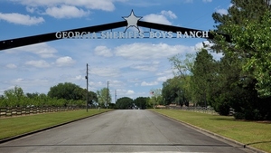
CATEGORIES: Point Of Interest
LAYER: Point of Interest
OWNERSHIP: Public, Georgia Sheriffs Boys Ranch, PARCEL 0101 004
WATER BODY: Withlacoochee River
MILE: 85.61
ADDRESS: 5671 Boys Ranch Road, Hahira, GA 31632, north of the main buildings. Lowndes County.
DESCRIPTION: “It is the perfect setting for boys and girls to experience the outdoor life of South Georgia. Over four hundred acres and five cottages offer children plenty of room to grow into well-rounded, productive young adults. The Ranch has a long history of providing quality care for its children.””, “”Many of the children at the Ranch have continued their education in the university setting. A number of former residents have made their homes in and around the community of Hahira. They have become dedicated parents and a part of the business community.”
HISTORIC FACTS: The oldest of five facilities operated by Georgia Sheriffs’ Youth.
WEBSITE: https://georgiasheriffsyouth.org/index.php/boys-ranch
PHOTO: https://wwals.net/pictures/2021-04-26–ga-sheriffs-boys-ranch-wpcp/20210426_144552.jpg
PHOTOSET: https://wwals.net/pictures/2021-04-26–ga-sheriffs-boys-ranch-wpcp/
PHOTO SOURCE: John S. Quarterman
PHONE NUMBER: (229) 242-0102
Suggestions: https://forms.gle/DipPgU2TP5atc2Rf9
Georgia Sheriffs’ Boys Ranch WPCP
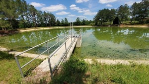
CATEGORIES: Wtp
LAYER: Brochure
OWNERSHIP: Public, Georgia Sheriffs Boys Ranch, PARCEL 0101 004
WATER BODY: Withlacoochee River
MILE: 85.61
ADDRESS: 5671 Boys Ranch Road, Hahira, GA 31632, north of the main buildings. Lowndes County.
DESCRIPTION: Wastewater treatment plant for a boys home operated by the state of Georgia. Settling and treatment pond. Reputed to be much bigger than needed, so unlikely to overflow. Public Notice 16 August 2016: “”Georgia Sheriffs Boys’ Ranch, 5671 Boys’ Ranch Road, Hahira, GA 31632; NPDES Permit No. GA0047228, for its water pollution control plant (WPCP) located at 5671 Boys’ Ranch Road, Hahira, GA 31632. Up to 0.025 MGD of treated wastewater is discharged to an unnamed tributary to the Withlacoochee River in the Suwannee River Basin.”
GRN: Yes
WEBSITE: https://wwals.net/pictures/2018-08-30–permits/boys-ranch
PHOTO: https://wwals.net/pictures/2021-04-26–ga-sheriffs-boys-ranch-wpcp/20210426_141822.jpg
PHOTOSET: https://wwals.net/pictures/2021-04-26–ga-sheriffs-boys-ranch-wpcp/
PHOTO SOURCE: John S. Quarterman
PHONE NUMBER: (229) 242-0102
Suggestions: https://forms.gle/DipPgU2TP5atc2Rf9
Outfall of Georgia Sheriffs’ Boys Ranch WPCP
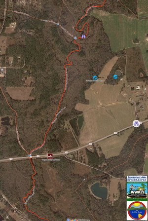
CATEGORIES: Wtp
LAYER: Other
OWNERSHIP: Public, Georgia Sheriffs Boys Ranch, PARCEL 0101 004
WATER BODY: Withlacoochee River
MILE: 85.61
ADDRESS: 5671 Boys Ranch Road, Hahira, GA 31632, north of the main buildings. Lowndes County.
DESCRIPTION: Outfall into WIthlacoochee River left of a wastewater treatment plant for a boys home operated by the state of Georgia. Settling and treatment pond. Reputed to be much bigger than needed, so unlikely to overflow. Public Notice 16 August 2016: “”Georgia Sheriffs Boys’ Ranch, 5671 Boys’ Ranch Road, Hahira, GA 31632; NPDES Permit No. GA0047228, for its water pollution control plant (WPCP) located at 5671 Boys’ Ranch Road, Hahira, GA 31632. Up to 0.025 MGD of treated wastewater is discharged to an unnamed tributary to the Withlacoochee River in the Suwannee River Basin.”
GRN: Yes
WEBSITE: https://wwals.net/pictures/2018-08-30–permits/boys-ranch
PHOTO: https://wwals.net/pictures/2021-04-26–ga-sheriffs-boys-ranch-wpcp/map-boys-ranch.jpg
PHOTOSET: https://wwals.net/pictures/2021-04-26–ga-sheriffs-boys-ranch-wpcp/
PHOTO SOURCE: WWALS
PHONE NUMBER: (850) 290-2350
Suggestions: https://forms.gle/DipPgU2TP5atc2Rf9
Hutchinson Pond
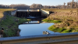
CATEGORIES: Pond
LAYER: Other
OWNERSHIP: Private
WATER BODY: Hutchinson Mill Creek
MILE: 4.77
ADDRESS: Hutchinson Pond, Georgia 31632, Cook County.
DESCRIPTION: A nice fishing pond between Old Coffee Road and Caulie Harris Road.
AKA: Hutchinson Mill Pond
WEBSITE: https://wwals.net/pictures/2020-12-10–hutchinson-mill-pond
ADDITIONAL INFO SOURCES: https://www.dnb.com/business-directory/company-profiles.fishing_club_of_south_georgia.6273e130d31bd978abb04058baa151fd.html
PHOTO: https://wwals.net/pictures/2020-12-10–hutchinson-mill-pond/20201210_162233.jpg
PHOTOSET: https://wwals.net/pictures/2020-12-10–hutchinson-mill-pond
PHOTO SOURCE: John S. Quarterman
PHONE NUMBER: (229) 242-0102
Suggestions: https://forms.gle/DipPgU2TP5atc2Rf9
Caulie Harris Road Bridge over Hutchinson Mill Creek
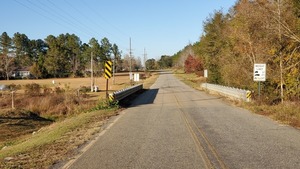
CATEGORIES: Bridge
LAYER: Bridge
OWNERSHIP: Public
WATER BODY: Hutchinson Mill Creek
MILE: 3.99
ADDRESS: 106-100 Caulie Harris Rd, Hahira, GA 31632, Cook County.
DESCRIPTION: Just below Hutchinson Pond.
WEBSITE: https://wwals.net/pictures/2020-12-10–hutchinson-mill-pond
PHOTO: https://wwals.net/pictures/2020-12-10–hutchinson-mill-pond/20201210_162215.jpg
PHOTOSET: https://wwals.net/pictures/2020-12-10–hutchinson-mill-pond
PHOTO SOURCE: John S. Quarterman
PHONE NUMBER: (229) 242-0102
Suggestions: https://forms.gle/DipPgU2TP5atc2Rf9
Skipper Bridge Road Bridge over Hutchinson Mill Creek

CATEGORIES: Bridge
LAYER: Bridge
GPS: 31.02273, -83.308347
OWNERSHIP: Public
WATER BODY: Hutchinson Mill Creek
MILE: 0.78
ADDRESS: 6470 Skipper Bridge Road, Hahira, GA 31632, Lowndes County.
DESCRIPTION: 49.9 ft. single-span steel girder bridge with concrete deck built in 2009 on major rural collector Skipper Bridge Road over Hutchinson Mill Creek.
HISTORIC FACTS: County road bridge closed during and rebuilt after 2009 floods due to deadfalls downstream on Hutchinson Mill Creek. http://www.okraparadisefarms.com/blog/2009/04/road-closings-lowndes-county-georgia-.html
WEBSITE: https://bridgereports.com/1099575
OTHER REFERENCE: http://www.okraparadisefarms.com/blog/2009/04/road-closings-lowndes-county-georgia-.html
PHOTOSET: https://www.wwals.net/pictures/2023-01-22–hutchinson-mill-creek-skipper-bridge-road/#HMCB
PHOTO SOURCE: John S. Quarterman
PHONE NUMBER: (229) 242-0102
Photoset2: https://www.wwals.net/pictures/2023-01-22–hutchinson-mill-creek-skipper-bridge-road/#HMCB
PHOTO2 SOURCE: John S. Quarterman
Photo2 Phone Number: 229-242-0102
Suggestions: https://forms.gle/DipPgU2TP5atc2Rf9

Skipper Bridge Road overflow Bridge over Hutchinson Mill Creek
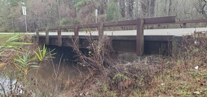
CATEGORIES: Bridge
LAYER: Bridge
GPS: 31.02174, -83.30849
OWNERSHIP: Public
WATER BODY: Hutchinson Mill Creek
MILE: 0.73
ADDRESS: 6449 Skipper Bridge Rd, Hahira, GA 31632, Lowndes County.
DESCRIPTION: 49.9 ft. single-span steel girder bridge with concrete deck built in 2009 on major rural collector Skipper Bridge Road over an overflow of Hutchinson Mill Creek.
HISTORIC FACTS: County road bridge closed during and rebuilt after 2009 floods due to deadfalls downstream on Hutchinson Mill Creek. http://www.okraparadisefarms.com/blog/2009/04/road-closings-lowndes-county-georgia-.html
WEBSITE: https://bridgereports.com/1099574
PHOTOSET: https://www.wwals.net/pictures/2023-01-22–hutchinson-mill-creek-skipper-bridge-road/#HMCOB
PHOTO SOURCE: John S. Quarterman
PHONE NUMBER: (229) 242-0102
Photoset2: https://www.wwals.net/pictures/2023-01-22–hutchinson-mill-creek-skipper-bridge-road/#HMCOB
PHOTO2 SOURCE: John S. Quarterman
Photo2 Phone Number: 229-242-0102
Suggestions: https://forms.gle/DipPgU2TP5atc2Rf9

Poley Branch Culvert
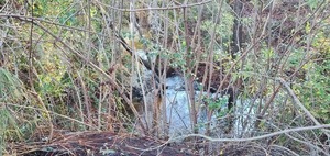
CATEGORIES: Bridge
LAYER: Bridge
OWNERSHIP: Public
WATER BODY: Hutchinson Mill Creek
ADDRESS: On Skipper Bridge Road 80 feet south of GA 122. Lowndes County.
DESCRIPTION: A culvert under Skipper Bridge that drains a pond upstream and also both GA 122 road ditches west of Skipper Bridge Road, into Poley Branch, which joins the Withlacoochee River downstream from Hagan Bridge Landing.
WEBSITE: https://www.wwals.net/pictures/2023-01-23–wwals-lowndes-county-dollar-general/#PB
PHOTO: https://www.wwals.net/pictures/2023-01-23–wwals-lowndes-county-dollar-general/20230123_090752.jpg
PHOTOSET: https://www.wwals.net/pictures/2023-01-23–wwals-lowndes-county-dollar-general/#PB
PHOTO SOURCE: John S. Quarterman
PHONE NUMBER: (229) 242-0102
PHOTO2: https://www.wwals.net/pictures/2023-01-23–wwals-lowndes-county-dollar-general/20230123_090819.jpg
Photoset2: https://www.wwals.net/pictures/2023-01-23–wwals-lowndes-county-dollar-general/#PB
PHOTO2 SOURCE: John S. Quarterman
Photo2 Phone Number: 229-242-0102
Suggestions: https://forms.gle/DipPgU2TP5atc2Rf9

Old Hagan Bridge

CATEGORIES: Bridgesite
LAYER: Bridge
OWNERSHIP: Public
WATER BODY: Withlacoochee River
GAUGE: Skipper Bridge
MILE: 84.67
ADDRESS: Just upstream from the current Hagan Bridge, Withlacoochee River. Lowndes County.
DESCRIPTION: Wood pilings of Old Hagan Bridge, visible at very low water, below about 2.5′ or 122.8′ NAVD88 on the Skipper Bridge Gauge.
PHOTO: https://www.wwals.net/pictures/2022-10-06–wq/2022-10-06–hagan-old-bridge-pilings-20221006_085354.jpg
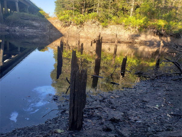
PHOTOSET: https://www.wwals.net/pictures/2022-10-06–wq/#HBL
PHOTO SOURCE: Elizabeth Brunner
PHONE NUMBER: (850) 290-2350
Suggestions: https://forms.gle/DipPgU2TP5atc2Rf9
Hutchinson Mill Creek
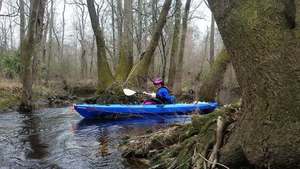
CATEGORIES: Tributary
LAYER: Other
OWNERSHIP: Public
ACCESS: Yes, PARKING: Free
WATER BODY: Withlacoochee River
MILE: 84.69
ADDRESS: 5110 GA Hwy 122 E, Hahira, GA 31632, Lowndes County.
DESCRIPTION: Entering Withlacoochee River right just upstream from Hagan Bridge Landing, this 14-mile creek drains much of the north edge of Lowndes County and the south edge of Cook County, GA. Deadfalls on this creek were one reason for the formation of WWALS
HISTORIC FACTS: Notorious for deadfalls backing up flood waters onto Skipper Bridge Road, espcially in the “”700-year”” floods in 2009 and 2013.
WEBSITE: https://wwals.net/pictures/2018-02-11–hagan-bridge-franklinville/#Hutchinson-Mill-Creek
PHOTO: https://wwals.net/pictures/2018-02-11–hagan-bridge-franklinville/20180211_105436.jpg
PHOTOSET: https://wwals.net/pictures/2018-02-11–hagan-bridge-franklinville/
PHOTO SOURCE: John S. Quarterman
PHONE NUMBER: (229) 242-0102
Suggestions: https://forms.gle/DipPgU2TP5atc2Rf9
Hagan Bridge Landing @ GA 122
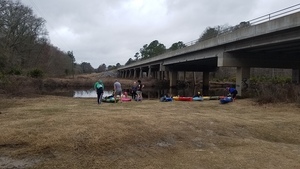
CATEGORIES: Landing
LAYER: Brochure
OWNERSHIP: Public
ACCESS: Yes, Launch: dirt access road to sand riverbank, PARKING: Free
WATER BODY: Withlacoochee River
Lowest boatable: 122.6′
Highest safe: 131′
GAUGE: Skipper Bridge
MILE: 84.68
ADDRESS: 5110 GA Hwy 122 E, Hahira, GA 31632, Lowndes County.
DESCRIPTION: This short stretch can take longer than you expect, if you take the Franklinville Roundabout more than once, or if you get lost in the woods, or if there are many deadfalls. In the new year expect blooming yellow jessamine, then wild native azaleas (Rhododendron canescens). In spring see red maple and white Grancy Greybeard and dogwood trees. Year-round, see resurrection fern, palmettos, pines, live and water oaks, cypress, tiver Bitch, willows and Spanish moss. Upstream: long, twisty, deadfalls, no takeouts for 13 miles. 5 miles east of Hahira, GA. Between Hahira and Lakeland.
AKA: GA 122 Withlacoochee Access.
WEBSITE: https://wwals.net/pictures/2018-02-11–hagan-bridge-franklinville/#Hagan-Bridge
ADDITIONAL INFO SOURCES: https://www.theswimguide.org/beachmanager/beaches/view?id=10197
UPSTREAM: 12.95 miles from Hagan Bridge Landing to Youngs Mill Creek Landing
DOWNSTREAM: 4.92 miles from Hagan Bridge Landing to Franklinville Landing
PHOTO: https://wwals.net/pictures/2018-02-11–hagan-bridge-franklinville/20180211_100603.jpg
PHOTOSET: https://wwals.net/pictures/2018-02-11–hagan-bridge-franklinville/
PHOTO SOURCE: John S. Quarterman
PHONE NUMBER: (229) 242-0102
PHOTO2: https://wwals.net/pictures/2020-09-26–drafts-metal-signs/Hagan-Bridge-Landing-Sign-0001.jpg
Photoset2: https://wwals.net/pictures/2020-09-26–drafts-metal-signs/Hagan-Bridge-Landing-Sign-0001.html
PHOTO2 SOURCE: WWALS
Photo2 Phone Number: 850-290-2350
Suggestions: https://forms.gle/DipPgU2TP5atc2Rf9

Hagan Bridge
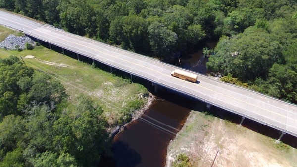
CATEGORIES: Bridge
LAYER: Bridge
OWNERSHIP: Public
ACCESS: No
WATER BODY: Withlacoochee River
MILE: 84.68
ADDRESS: 5110 GA Hwy 122 E, Hahira, GA 31632, Lowndes County.
DESCRIPTION: 600.1-foot 14-span pre-stressed concrete state highway bridge built in 2006 on GA 122 over the WIthlacoochee River seven miles east of Hahira, GA. Site of Hagan Bridge Landing. Between Hahira and Lakeland
WEBSITE: https://bridgereports.com/1099563
PHOTOSET: https://wwals.net/2017/05/28/ga-122-withlacoochee-river-2017-05-17/
PHOTO SOURCE: John S. Quarterman
PHONE NUMBER: (229) 242-0102
Suggestions: https://forms.gle/DipPgU2TP5atc2Rf9
Onice Davis Branch
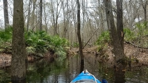
CATEGORIES: Tributary
LAYER: Other
OWNERSHIP: Private
WATER BODY: Withlacoochee River
MILE: 83.10
ADDRESS: Left bank, 1.58 miles downstream of Hagan Bridge. Lowndes County.
DESCRIPTION: Has no name on any map, but starts on property formerly owned by the late Onice Davis Coppage, south of GA 122 across from GA Sheriffs’ Boys’ Ranch, https://www.tributearchive.com/obituaries/2623788/Onice-Davis-Coppage
GRN: No
WEBSITE: https://wwals.net/pictures/2018-02-11–hagan-bridge-franklinville/#Onice-Davis-Branch
PHOTO: https://wwals.net/pictures/2018-02-11–hagan-bridge-franklinville/20180211_115828.jpg
PHOTOSET: https://wwals.net/pictures/2018-02-11–hagan-bridge-franklinville/
PHOTO SOURCE: John S. Quarterman
PHONE NUMBER: (229) 242-0102
Suggestions: https://forms.gle/DipPgU2TP5atc2Rf9
Emily Creek
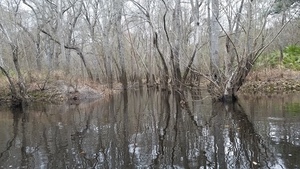
CATEGORIES: Tributary
LAYER: Other
OWNERSHIP: Private
WATER BODY: Withlacoochee River
MILE: 83.03
ADDRESS: Left bank, 1.65 miles downstream from Hagan Bridge. Lowndes County.
DESCRIPTION: Enters river left, coming down across Emily Lane in the nearby grandfathered-in subdivision. We don’t know its real name, if any, so we call it Emily Creek.
GRN: No
WEBSITE: https://wwals.net/pictures/2018-02-11–hagan-bridge-franklinville/
PHOTO: https://wwals.net/pictures/2018-02-11–hagan-bridge-franklinville//20180211_115943.jpg
PHOTOSET: https://wwals.net/pictures/2018-02-11–hagan-bridge-franklinville/
PHOTO SOURCE: John S. Quarterman
PHONE NUMBER: (229) 242-0102
Suggestions: https://forms.gle/DipPgU2TP5atc2Rf9
SONAT pipeline Withlacoochee River
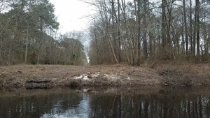
CATEGORIES: Pipeline
LAYER: Point of Interest
OWNERSHIP: Private
WATER BODY: Withlacoochee River
MILE: 82.79
ADDRESS: Between Emily Creek and Twin Creek, Lowndes County.
DESCRIPTION: Natural gas pipeline, east and north to Nashville, GA, and west to Southern Natural Gas Co. main line from Columbus and Albany past Valdosta to Florida.
WEBSITE: https://wwals.net/pictures/2018-02-11–hagan-bridge-franklinville/#SONAT-natural-gas-pipeline
PHOTO: https://wwals.net/pictures/2018-02-11–hagan-bridge-franklinville/20180211_120419.jpg
PHOTOSET: https://wwals.net/pictures/2018-02-11–hagan-bridge-franklinville/
PHOTO SOURCE: John S. Quarterman
PHONE NUMBER: (229) 242-0102
Suggestions: https://forms.gle/DipPgU2TP5atc2Rf9
Hollis Welch Creek Bridge
CATEGORIES: Bridge
LAYER: Bridge
OWNERSHIP: Public
WATER BODY: Hollis Welch Creek 03110203000770
MILE: 0.24
ADDRESS: 5643 Skipper Bridge Rd, Hahira, GA 31632, north of Coppage Road, Lowndes County.
DESCRIPTION: Box culvert north of Coppage Road under Skipper Bridge Road.
WEBSITE: https://www.google.com/maps/place/30%C2%B059’41.0%22N+83%C2%B017’31.9%22W/@30.9947151, -83.2927475, 232m/data=!3m2!1e3!4b1!4m6!3m5!1s0x0:0x9b9630e4f77edeb3!7e2!8m2!3d30.994714!4d-83.2921994
Suggestions: https://forms.gle/DipPgU2TP5atc2Rf9
Twin Creek Bridge
CATEGORIES: Bridge
LAYER: Bridge
OWNERSHIP: Public
WATER BODY: Twin Creek
MILE: 0.47
ADDRESS: 5571 Skipper Bridge Rd, Hahira, GA 31632, south of Coppage Road. Lowndes County.
DESCRIPTION: Box culvert south of Coppage Road under Skipper Bridge Road.
WEBSITE: https://www.google.com/maps/place/30%C2%B059’31.0%22N+83%C2%B017’31.7%22W/@30.9919491, -83.2932548, 232m/data=!3m2!1e3!4b1!4m14!1m7!3m6!1s0x88ee698237c9db37:0xa34c735844439ce9!2s5571+Skipper+Bridge+Rd, +Hahira, +GA+31632!3b1!8m2!3d30.9916009!4d-83.2924441!3m5!1s0x0:0xe86849150e88a649!7e2!8m2!3d30.991948!4d-83.2921347
Suggestions: https://forms.gle/DipPgU2TP5atc2Rf9
Twin Creek
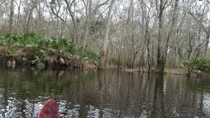
CATEGORIES: Tributary
LAYER: Other
OWNERSHIP: Private
WATER BODY: Withlacoochee River
MILE: 82.28
ADDRESS: Lowndes County.
DESCRIPTION: Enters river right, coming down from GA 122, Val Del Road, and Skipper Bridge Road.
WEBSITE: https://wwals.net/pictures/2018-02-11–hagan-bridge-franklinville/
PHOTO: https://wwals.net/pictures/2018-02-11–hagan-bridge-franklinville/20180211_121412.jpg
PHOTOSET: https://wwals.net/pictures/2018-02-11–hagan-bridge-franklinville/
PHOTO SOURCE: John S. Quarterman
PHONE NUMBER: (229) 242-0102
Suggestions: https://forms.gle/DipPgU2TP5atc2Rf9
WWALS Watershed Coalition
CATEGORIES: Point Of Interest
LAYER: Point of Interest
OWNERSHIP: Private
WATER BODY: All
ADDRESS: PO Box 88, Hahira, GA 31632, Many County.
DESCRIPTION: The Waterkeeper Alliance Member as Suwannee Riverkeeper for the Suwannee River watershed, including the Withlacoochee, Willacoochee, Alapaha, and Little Rivers.
WEBSITE: https://wwals.net
PHOTO: https://wwals.net/pictures/2019-11-21–wwals-logo-santa-fe/WWALS-Logo-Reworded-0001.jpg
PHOTOSET: https://wwals.net/
PHOTO SOURCE: WWALS Watershed Coalition
PHONE NUMBER: (850) 290-2350
Suggestions: https://forms.gle/DipPgU2TP5atc2Rf9
Franklinville Roundabout
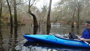
CATEGORIES: Point Of Interest
LAYER: Point of Interest
OWNERSHIP: Public
WATER BODY: Withlacoochee River
MILE: 80.93
ADDRESS: 1.17 river miles upstream from Franklinville Landing, Lowndes County.
DESCRIPTION: Neck through a loop of the river so that you can easily go around forever.
WEBSITE: https://wwals.net/pictures/2018-02-11–hagan-bridge-franklinville/#River-Roundabout
PHOTO: https://wwals.net/pictures/2018-02-11–hagan-bridge-franklinville/20180211_125656.jpg
PHOTOSET: https://wwals.net/pictures/2018-02-11–hagan-bridge-franklinville/
PHOTO SOURCE: John S. Quarterman
PHONE NUMBER: (229) 242-0102
Suggestions: https://forms.gle/DipPgU2TP5atc2Rf9
Double oak bow
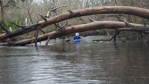
CATEGORIES: Point Of Interest
LAYER: Point of Interest
OWNERSHIP: Public
WATER BODY: Withlacoochee River
MILE: 80.44
ADDRESS: 0.68 river miles upstream from Franklinville Landing, Lowndes County.
DESCRIPTION: Two oaks bent concentrically across the river.
WEBSITE: https://wwals.net/pictures/2018-02-11–hagan-bridge-franklinville/#Double-oak-bow
PHOTO: https://wwals.net/pictures/2018-02-11–hagan-bridge-franklinville/20180211_130959.jpg
PHOTOSET: https://wwals.net/pictures/2018-02-11–hagan-bridge-franklinville/
PHOTO SOURCE: John S. Quarterman
PHONE NUMBER: (229) 242-0102
Suggestions: https://forms.gle/DipPgU2TP5atc2Rf9
Tricky oxbow
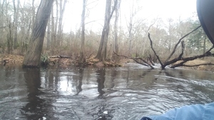
CATEGORIES: Point Of Interest
LAYER: Point of Interest
GPS: 30.985, -83.2722222
OWNERSHIP: Public
WATER BODY: Withlacoochee River
MILE: 80.18
ADDRESS: 0.43 river miles upstream from Franklinville Landing, Lowndes County.
DESCRIPTION: Narrow neck of an oxbow with overhanding limbs
WEBSITE: https://wwals.net/pictures/2018-02-11–hagan-bridge-franklinville/#Tricky-oxbow
PHOTO: https://wwals.net/pictures/2018-02-11–hagan-bridge-franklinville/20180211_131206.jpg
PHOTOSET: https://wwals.net/pictures/2018-02-11–hagan-bridge-franklinville/
PHOTO SOURCE: John S. Quarterman
PHONE NUMBER: (229) 242-0102
Suggestions: https://forms.gle/DipPgU2TP5atc2Rf9
Franklinville Monument
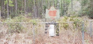
CATEGORIES: Town Site
LAYER: Point of Interest
GPS: 30.98292351, -83.27748871
OWNERSHIP: Public
ACCESS: No, PARKING: Free
WATER BODY: Withlacoochee River
MILE: 80.10
ADDRESS: 6359 Franklinville Road, Hahira, GA 31632, Lowndes County.
DESCRIPTION: In a chainlink fence, a 1936 D.A.R. monument and a 1961 Georgia Historical Society sign mark the site of Franklinville, the original Lowndes County seat, on the Withlacoochee River. This marker is easy to miss. Look left at the first bend in Franklinville Road.
HISTORIC FACTS: “”When Lowndes County was created December 23, 1825, Lawrence Folsom, Sion Hall, William Blair, John J. Underwood and Daniel McCauly were appointed Commissioners to select the capital of Lowndes County. The site which they chose, named Franklinville, was designated County Seat in 1828, and was located near the center of the Lowndes County are of 1825. In 1833, the County Seat was moved to Troupville, a small settlement about four miles west of present-day Valdosta. Georgia Historical Commission 1961″”
WEBSITE: https://wwals.net/pictures/2021-02-06–franklinville
PHOTO: https://wwals.net/pictures/2021-02-06–franklinville/20210206_115037.jpg
PHOTOSET: https://wwals.net/pictures/2021-02-06–franklinville/
PHOTO SOURCE: John S. Quarterman
PHONE NUMBER: (229) 242-0102
PHOTO2: https://wwals.net/pictures/2021-02-06–franklinville/20210206_115211.jpg
Photoset2: https://wwals.net/pictures/2021-02-06–franklinville/
PHOTO2 SOURCE: John S. Quarterman
Photo2 Phone Number: 229-242-0102
Suggestions: https://forms.gle/DipPgU2TP5atc2Rf9

Franklinville Landing @ Franklinville Road
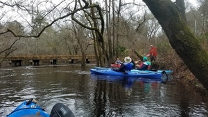
CATEGORIES: Landing
LAYER: Brochure
OWNERSHIP: Public
ACCESS: Yes, Launch: Riverside bank on dirt road, PARKING: Free
WATER BODY: Withlacoochee River
Lowest boatable: 122.6′
Highest safe: 131′
GAUGE: Skipper Bridge
MILE: 79.76
ADDRESS: 6560 Franklinville Road, Hahira, GA 31632. Lowndes County.
DESCRIPTION: Downstream it’s 11 miles to Langdale Park Boat Ramp. If there are no deadfalls, it should be no problem. In the new year expect blooming yellow jessamine, then wild native azaleas (Rhododendron canescens). In spring see red maple and white Grancy Greybeard and dogwood trees. Year-round, see resurrection fern, palmettos, pines, live and water oaks, cypress, tiver Bitch, willows and Spanish moss. Upstream it’s a little less than five miles to Hagan Bridge Landing, but there likely will be deadfalls, and beware of the Franklinville Roundabout, which can lead you in circles. Between Hahira and Moody AFB on Franklinville Road. Must enter from the west from Skipper Bridge Road.
HISTORIC FACTS: Tyler Bridge closed about in the 1990s per request of local landowners, so Franklinville Road now acts as a barrier to northward sprawl of subdivision development.
WEBSITE: https://wwals.net/pictures/2018-02-11–hagan-bridge-franklinville/
UPSTREAM: 4.92 miles from Franklinville Landing to Hagan Bridge Landing
DOWNSTREAM: 10.95 miles from Franklinville Landing to Langdale Park Boat Ramp
PHOTO: https://wwals.net/pictures/2018-02-11–hagan-bridge-franklinville/20180211_132521.jpg
PHOTOSET: https://wwals.net/pictures/2018-02-11–hagan-bridge-franklinville/
PHOTO SOURCE: John S. Quarterman
PHONE NUMBER: (229) 242-0102
PHOTO2: https://wwals.net/pictures/2020-09-26–drafts-metal-signs/Franklinville-Landing-Sign-0001.jpg
Photoset2: https://wwals.net/pictures/2020-09-26–drafts-metal-signs/Franklinville-Landing-Sign-0001.html
PHOTO2 SOURCE: WWALS
Photo2 Phone Number: 850-290-2350
Suggestions: https://forms.gle/DipPgU2TP5atc2Rf9

Tyler Bridge
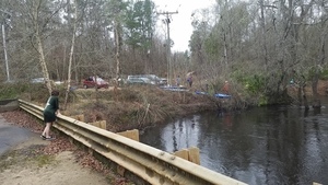
CATEGORIES: Bridgehistoric
LAYER: Bridge
OWNERSHIP: Public
ACCESS: No, PARKING: Free
WATER BODY: Withlacoochee River
MILE: 79.75
ADDRESS: 6560 Franklinville Road, Hahira, GA 31632. Lowndes County.
DESCRIPTION: Closed to vehicular traffic. Walkable. Between Hahira and Moody AFB on Franklinville Road.
HISTORIC FACTS: One of the few old stone (actually concrete) bridges left in this area. Kenna Walsh, Valdosta Daily Times, December 6, 2005, “”Commissioners vote to settle heated issue, “” “”Residents commented about the abandonment of Franklinville Road citing reasons for and against the motion. Tommy Stalvey Jr. asked commissioners to approve the abandonment, saying repairing the bridge, which is inoperable and closed, would be too costly a measure. Residents against the abandonment said they needed two points of access to their properties and emergency situations and additional mileage necessitated the road remain functional. Commissioners had to put the item on hold until their next meeting because an advertisement of the public hearing only ran once in The Valdosta Daily Times, and a mix-up prevented the item from running before the second hearing. Legal requirements necessitate the ad run before both public hearings. https://www.valdostadailytimes.com/news/local_news/commissioners-vote-to-settle-heated-issue/article_2c017c9a-3d72-5867-8c87-500316c40d2a.html
WEBSITE: https://wwals.net/pictures/2021-02-06–franklinville/
PHOTO: https://wwals.net/pictures/2018-02-11–hagan-bridge-franklinville/20180211_134036.jpg
PHOTOSET: https://wwals.net/pictures/2018-02-11–hagan-bridge-franklinville/
PHOTO SOURCE: John S. Quarterman
PHONE NUMBER: (229) 242-0102
Suggestions: https://forms.gle/DipPgU2TP5atc2Rf9
Tyler’s Ford
CATEGORIES: Ford
LAYER: Point of Interest
OWNERSHIP: Public
WATER BODY: Withlacoochee River
MILE: 79.66
ADDRESS: 6560 Franklinville Road, Hahira, GA 31632, about halfway between Tyler Bridge and Toms Branch. Lowndes County.
DESCRIPTION: Old ford in the 1870s, according to Wiregrass Region Digital History Project.
HISTORIC FACTS: There was a ford here in the 1870s, according to Wiregrass Region Digital History Project. https://www.google.com/maps/d/u/0/viewer?mid=1uAP1zA0ExqRb01-n1PrZCuaiQDo&ll=30.981918999999984%2C-83.266101&z=18
Suggestions: https://forms.gle/DipPgU2TP5atc2Rf9
Hambrick Culvert Redeye Creek
CATEGORIES: Bridge
LAYER: Bridge
OWNERSHIP: Public
WATER BODY: Redeye Creek
ADDRESS: Halfway between GA 122 and Cat Creek Road on Hambrick Road. Lowndes County.
DESCRIPTION: Has orange and black diagonal stream markers.
Suggestions: https://forms.gle/DipPgU2TP5atc2Rf9
Quarterman Culvert Redeye Creek
CATEGORIES: Bridge
LAYER: Bridge
OWNERSHIP: Public
WATER BODY: Redeye Creek
MILE: 0.07
ADDRESS: About 6030 Quarterman Road, about 1/3 of the way east along the south straight part. Lowndes County.
DESCRIPTION: Box culvert installed in 2009 when Quarterman Road was paved.
Suggestions: https://forms.gle/DipPgU2TP5atc2Rf9
Redeye Creek
CATEGORIES: Tributary
LAYER: Other
GPS: 30.99063589, -83.26939351
OWNERSHIP: Private, Scruggs, Ferrell & Pamela M. PARCEL 0143 012
WATER BODY: Toms Branch
ADDRESS: South of Quarterman Road, Lowndes County.
Suggestions: https://forms.gle/DipPgU2TP5atc2Rf9
Hambrick Culvert Toms Branch
CATEGORIES: Bridge
LAYER: Bridge
OWNERSHIP: Public
WATER BODY: Toms Branch
MILE: 2.78
ADDRESS: Hambrick Road, just east of the east end of Quarterman Road. Lowndes County.
DESCRIPTION: Culverts replacing a wood bridge that was there into the 1950s.
Suggestions: https://forms.gle/DipPgU2TP5atc2Rf9
Quarterman Road Ditch Toms Branch
CATEGORIES: Bridge
LAYER: Bridge
OWNERSHIP: Public
WATER BODY: Toms Branch
MILE: 1.53
ADDRESS: Southeast corner of Quarterman Road, Lowndes County.
DESCRIPTION: Tom’s Branch runs through the road ditch at high water.
Suggestions: https://forms.gle/DipPgU2TP5atc2Rf9
Toms Branch
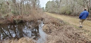
CATEGORIES: Tributary
LAYER: Other
OWNERSHIP: Public
ACCESS: Yes, PARKING: Free
WATER BODY: Withlacoochee River
MILE: 79.58
ADDRESS: South of Franklinville Road, just downstream from Tyler Bridge. Lowndes County.
DESCRIPTION: Its river left confluence with the Withlacoochee River is clearly visible from the closed portion of Franklinville Road east of the river.
WEBSITE: https://wwals.net/pictures/2021-02-06–franklinville/
PHOTO: https://wwals.net/pictures/2021-02-06–franklinville/20210206_120719.jpg
PHOTOSET: https://wwals.net/pictures/2021-02-06–franklinville/
PHOTO SOURCE: John S. Quarterman
PHONE NUMBER: (229) 242-0102
Suggestions: https://forms.gle/DipPgU2TP5atc2Rf9
Moody AFB Robinson Spill *
CATEGORIES: Spill
LAYER: Point of Interest
OWNERSHIP: PARCEL Lowndes
ACCESS: CANOE: Beatty Branch
WATER BODY: Public
ADDRESS: “On Main Base, 100 yards east of Hwy 125 adjacent to Beatty Creek in Valdosta, GA.”, GA County.
DESCRIPTION: * “10, 000 gallons of raw sewage spilled 2020-08-17
WEBSITE: according to GA-EPD Sewage Spills Report”
Suggestions: https://forms.gle/DipPgU2TP5atc2Rf9
Beatty Branch Bemiss Road Bridge

CATEGORIES: Bridge
LAYER: Bridge
OWNERSHIP: Public
WATER BODY: Beatty Branch
MILE: 2.85
ADDRESS: South of Moody Road and north of Prewitte Street (Mitchell Blvd.). Lowndes County.
DESCRIPTION: Upstream of the Moody WTP.
PHOTO: https://www.wwals.net/pictures/2022-10-27–wq/2022-10-27–beattybemiss–20221027_151020.jpg
PHOTOSET: https://www.wwals.net/pictures/2022-10-27–wq/#beattybemiss
PHOTO SOURCE: Elizabeth Brunner
PHONE NUMBER: (850) 290-2350
PHOTO2: https://www.google.com/maps/@30.9812007, -83.2080597, 3a, 68.6y, 298.61h, 87.42t/data=!3m6!1e1!3m4!1s8tAr22eI_XK__oG5tnPxuw!2e0!7i16384!8i8192
Photoset2: https://www.google.com/maps/place/30%C2%B058’52.4%22N+83%C2%B012’28.7%22W/@30.981218, -83.2090563, 292m/data=!3m1!1e3!4m13!1m6!3m5!1s0x88ee43c9dea8fdff:0x48d7f1d7c8fe677d!2sMoody+Air+Force+Base!8m2!3d30.9701459!4d-83.1965521!3m5!1s0x0:0x7c2f45350b660ad8!7e2!8m2!3d30.9812178!4d-83.2079623
PHOTO2 SOURCE: Google Streetview
Suggestions: https://forms.gle/DipPgU2TP5atc2Rf9
Moody WTP *
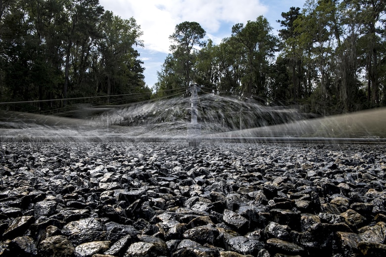
CATEGORIES: Wtp
LAYER: Brochure
OWNERSHIP: 0180 079, PARCEL Lowndes
ACCESS: No, Claims to have been “”the first Nanofiltration Water Treatment Plant placed in service in the State of Georgia.”” Operations transfered to Lowndes County October 3, 2016. Before then, spilled PFAS firefighting chemicals into Beatty Branch, which runs into Cat Creek and then the Withlacoochee River, and also leached into the ground. CANOE: Beatty Branch
WHITEWATER CLASS: https://www.hpepper.com/project-profiles/us-army-corps-engineers/water-treatment-plant-moody-air-force-baseScreen reader support enabled.Â
WATER BODY: Public
MILE: 2.63
ADDRESS: 5501 Moody Rd, Moody AFB, GA 31699, GA County.
DESCRIPTION: Built in the 1940s, “”uses low-rate trickling filter for biological treatment”, * contract for operation and maintenance by Lowndes County Utilties. Moody Air Force Base Water and Wastewater Treatment Plant.
HISTORIC FACTS: Yes
WEBSITE: https://wwals.net/pictures/2018-08-30–permits/moody-afb
ADDITIONAL INFO SOURCES: NPDES Permit No. GA0020001.
PHOTO: https://media.defense.gov/2016/Oct/05/2001644273/300/300/0/160930-F-LM051-048.JPG
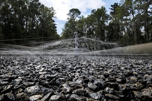
PHOTOSET: https://media.defense.gov/2016/Oct/05/2001644273/780/780/0/160930-F-LM051-048.JPG
PHOTO SOURCE: https://www.moody.af.mil/News/Article-Display/Article/964667/moody-finalizes-dod-initiative/
PHONE NUMBER: Airman 1st Class Janiqua P. Robinson for Moody AFB
Suggestions: https://forms.gle/DipPgU2TP5atc2Rf9
Beatty Branch Beatty Road Bridge

CATEGORIES: Bridge
LAYER: Bridge
OWNERSHIP: Public
WATER BODY: Beatty Branch
MILE: 1.98
ADDRESS: 0.4 miles south of New Bethel Road. Lowndes County.
DESCRIPTION: Dual concrete culverts over Beatty Creek, 0.65 miles downstream from Moody AFB WTP.
WEBSITE: https://www.wwals.net/pictures/2022-07-16–cat-creek-beatty-branch-bridges/
PHOTO: https://www.wwals.net/pictures/2022-07-16–cat-creek-beatty-branch-bridges/20220717_135140.jpg
PHOTOSET: https://www.wwals.net/pictures/2022-07-16–cat-creek-beatty-branch-bridges/
PHOTO SOURCE: John S. Quarterman
PHONE NUMBER: (229) 242-0102
PHOTO2: https://www.wwals.net/pictures/2022-07-16–cat-creek-beatty-branch-bridges/20220717_135004.jpg
Photoset2: https://www.wwals.net/pictures/2022-07-16–cat-creek-beatty-branch-bridges/
PHOTO2 SOURCE: John S. Quarterman
Photo2 Phone Number: 229-242-0102
Suggestions: https://forms.gle/DipPgU2TP5atc2Rf9

Beatty Branch Cat Creek Road Bridge
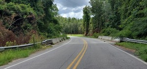
CATEGORIES: Bridge
LAYER: Bridge
OWNERSHIP: Public
WATER BODY: Beatty Branch
MILE: 0.24
ADDRESS: Just north of Old Radar Site Road, and a quarter mile upstream of the confluence of Beatty Branch with Cat Creek. Lowndes County.
DESCRIPTION: 120.1-foot concrete slab bridge with 34.8-foot-wide concrete precast deck, over Beatty Branch, in good condition.
WEBSITE: https://bridgereports.com/1684217
PHOTO: https://www.wwals.net/pictures/2022-07-16–cat-creek-beatty-branch-bridges/20220717_131909.jpg
PHOTOSET: https://www.wwals.net/pictures/2022-07-16–cat-creek-beatty-branch-bridges/
PHOTO SOURCE: John S. Quarterman
PHONE NUMBER: (229) 242-0102
PHOTO2: https://www.wwals.net/pictures/2022-07-16–cat-creek-beatty-branch-bridges/20220716_132739.jpg
Photoset2: https://www.wwals.net/pictures/2022-07-16–cat-creek-beatty-branch-bridges/
PHOTO2 SOURCE: John S. Quarterman
Photo2 Phone Number: 229-242-0102
Suggestions: https://forms.gle/DipPgU2TP5atc2Rf9

GA 122 Cat Creek Bridge

CATEGORIES: Bridge
LAYER: Bridge
GPS: 31.02557, -83.22425
OWNERSHIP: Public
WATER BODY: Cat Creek
MILE: 4.92
ADDRESS: 6738-6798 GA-122, Ray City, GA 31645, 9 miles east of Hahira on GA 122. Lowndes County.
DESCRIPTION: 279.9-foot 7-span concrete tee-beam bridge with 47.9 ft concrete cast-in-place deck, built in 2006, in good condition, on Cat Creek, a major tributary of the Withlacoochee River, downstream from Ray City, Georgia.
WEBSITE: https://bridgereports.com/1099564
PHOTO: https://www.wwals.net/pictures/2022-07-16–cat-creek-beatty-branch-bridges/20220717_140144.jpg
PHOTOSET: https://www.wwals.net/pictures/2022-07-16–cat-creek-beatty-branch-bridges/
PHOTO SOURCE: John S. Quarterman
PHONE NUMBER: (229) 242-0102
PHOTO2 SOURCE: Elizabeth Brunner
Suggestions: https://forms.gle/DipPgU2TP5atc2Rf9

Pondside RV Park

CATEGORIES: Camping
LAYER: Point of Interest
GPS: 31.02432, -83.222799
OWNERSHIP: Private, MOORE TIMOTHY B, PARCEL 0175 001A
ACCESS: CAMPING: RV Campsites
WATER BODY: Cat Creek
MILE: 4.87
ADDRESS: 6800 Georgia 122 E, Ray City, GA 31645, just east of Cat Creek, south side of GA 122. Lowndes County.
DESCRIPTION: “”Monthly RV sites available. Very quiet and peaceful with a beautiful view. Pet friendly to friendly pets. Only 5 min from Moody AFB.””
WEBSITE: https://www.facebook.com/Pondside-RV-Park-115020529856132/
PHOTOSET: https://www.wwals.net/pictures/2022-07-16–cat-creek-beatty-branch-bridges/
PHOTO SOURCE: John S. Quarterman
PHONE NUMBER: (229) 242-0102
Suggestions: https://forms.gle/DipPgU2TP5atc2Rf9
Site of Cat Creek Mill
CATEGORIES: Point Of Interest
LAYER: Point of Interest
GPS: 30.992712, -83.24501
OWNERSHIP: Private
ACCESS: No, WATER, RESTROOMS, PARKING: Free, SHELTER, PICNIC AREA
WATER BODY: Cat Creek
MILE: 2.11
ADDRESS: 5326 Cat Creek Rd, Ray City, GA 31645, Lowndes County.
DESCRIPTION: Millstone is at entrance to meeting hall, Historic mill
Suggestions: https://forms.gle/DipPgU2TP5atc2Rf9
Cat Creek Road Cat Creek Bridge

CATEGORIES: Bridge
LAYER: Bridge
GPS: 30.99013, -83.24495
OWNERSHIP: Public
WATER BODY: Cat Creek
MILE: 1.91
ADDRESS: 2.8 miles south of GA 122, 0.3 miles south of Franklinville Road, 0.2 miles north of New Bethel Road, 3 miles southwest of Barretts, GA. Lowndes County.
DESCRIPTION: 191.9-foot concrete stringer bridge with 43-foot-wide concrete deck, built in 2005, in good condition, over Cat Creek.
WEBSITE: https://bridgereports.com/1099561
PHOTO: https://www.wwals.net/pictures/2022-07-16–cat-creek-beatty-branch-bridges/20220716_133840.jpg
PHOTOSET: https://www.wwals.net/pictures/2022-07-16–cat-creek-beatty-branch-bridges/
PHOTO SOURCE: John S. Quarterman
PHONE NUMBER: (229) 242-0102
PHOTO2: https://www.wwals.net/pictures/2022-07-16–cat-creek-beatty-branch-bridges/20220716_133233.jpg
Photoset2: https://www.wwals.net/pictures/2022-07-16–cat-creek-beatty-branch-bridges/
PHOTO2 SOURCE: John S. Quarterman
Photo2 Phone Number: 229-242-0102
Suggestions: https://forms.gle/DipPgU2TP5atc2Rf9

Scruggs Private Boat Ramp
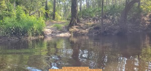
CATEGORIES: Landing Private
LAYER: Other
OWNERSHIP: Private, Scruggs, Ferrell & Pamela M. PARCEL 0143 012
ACCESS: Launch: narrow dirt ramp cut through wooded riverbank.
WATER BODY: Withlacoochee River
MILE: 79.01
ADDRESS: Lowndes County.
DESCRIPTION: A narrow dirt ramp through palmetto and hardwoods. Private: do not use without permission.
PHOTO: https://www.wwals.net/pictures/2025-08-16–franklinville-cleanup-pictures/20250816_112757.jpg
PHOTOSET: https://www.wwals.net/pictures/2025-08-16–franklinville-cleanup-pictures/#OSBR
PHOTO SOURCE: John S. Quarterman
PHONE NUMBER: (229) 242-0102
Suggestions: https://forms.gle/DipPgU2TP5atc2Rf9
Cat Creek

CATEGORIES: Tributary
LAYER: Other
OWNERSHIP: Private, Scruggs, Ferrell & Pamela M. PARCEL 0143 012
ACCESS: No
WATER BODY: Withlacoochee River
MILE: 78.84
ADDRESS: Downstream from Tyler Bridge on Franklinville Road. Lowndes County.
DESCRIPTION: Drains Rays Mill Pond down Beaverdam Creek, Ray City and its wastewater treatment plant, and Moody AFB with its wastewater plant on Beatty Branch.
PHOTO: https://www.wwals.net/pictures/2025-08-16–franklinville-cleanup-pictures/20250816_113838.jpg
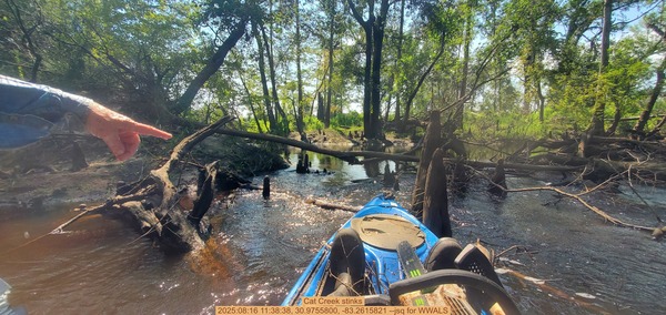
PHOTOSET: https://www.wwals.net/pictures/2025-08-16–franklinville-cleanup-pictures/#CCS
PHOTO SOURCE: John S. Quarterman
PHONE NUMBER: (229) 242-0102
Suggestions: https://forms.gle/DipPgU2TP5atc2Rf9
Cat Creek Deadfall

CATEGORIES: Deadfall
LAYER: Other
GPS: 30.97525, -83.26175
OWNERSHIP: Public
WATER BODY: Withlacoochee River
MILE: 78.82
ADDRESS: Just downstream from Cat Creek. Lowndes County.
DESCRIPTION: Several trees down across the Withlacoochee River.
PHOTO: https://www.wwals.net/pictures/2025-08-16–franklinville-cleanup-pictures/20250816_113806.jpg
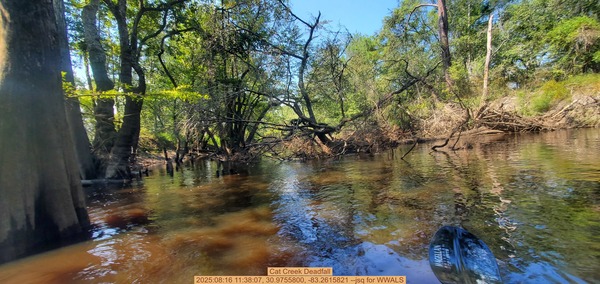
PHOTOSET: https://www.wwals.net/pictures/2025-08-16–franklinville-cleanup-pictures/#CCDF
PHOTO SOURCE: John S. Quarterman
PHONE NUMBER: (229) 242-0102
Suggestions: https://forms.gle/DipPgU2TP5atc2Rf9
Moody Air Force Base Equipment Rental

CATEGORIES: Outfitter
LAYER: Other
OWNERSHIP: Public
ACCESS: No, CANOE, CAMPING: Camp Rentals Available, WATER, Flush Toilet, PARKING: Free, SHELTER, HANDICAPPED ACCESSIBLE
WATER BODY: Mission Pond
ADDRESS: 4379 George St, Bldg 840, Moody AFB, GA 31699, Lowndes County.
DESCRIPTION: Moody AFB Equipment Rental “”is here to help make your recreation experience an enjoyable one by providing quality equipment and services to meet your needs.”” Services include: Lawn & Garden, Camping Equpiment, Fishing and Boating, RV storage, and sports equipment. Does rent boats and other equipment to the public, but military or veteran ID is required to get on base. “”Our facility is available to active duty members and their dependents 18 years and older with a valid ID card, retirees, reservists, long term contractors and DoD employees. A local address is required when renting equipment.Screen reader support enabled. ”
AKA: Moody Force Support Squadron or Moody FSS.
GRN: Yes
WEBSITE: http://moodyfss.com/equipment-rental/
PHOTO: https://www.flickr.com/photos/187730456@N03/51116063629/sizes/l/
PHOTOSET: http://moodyfss.com/equipment-rental/
PHOTO SOURCE: Moody AFB
PHONE NUMBER: (229) 257-2989
PHOTO2: http://moodyfss.com/wp-content/uploads/2018/08/the-SHOP.jpg
Photoset2: http://moodyfss.com/equipment-rental/
PHOTO2 SOURCE: Moody AFB
Photo2 Phone Number: (229) 257-2989
Suggestions: https://forms.gle/DipPgU2TP5atc2Rf9

NWXpeditions
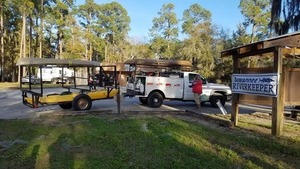
CATEGORIES: Outfitter
LAYER: Other
GPS: 30.967687, -83.5024
OWNERSHIP: Private
ACCESS: No, CANOE, CAMPING: Primitive Campsites, FOOD, WATER, PARKING: Free, SHELTER
WATER BODY: Bay Branch
ADDRESS: 13086 Adel Hwy, Barney, GA 31625, USA, Brooks County.
DESCRIPTION: “No Worries Expeditions will take u canoeing and camping on the rivers of S Georgia and N Florida. We custom design the canoe trip of your dreams.””, Has a variety of dive gear as well as boats.
GRN: Yes
WEBSITE: https://www.facebook.com/NWXExpeditions/
PHOTOSET: https://wwals.net/pictures/2020-02-09–banks-lake-full-moon/
PHOTO SOURCE: John S. Quarterman
PHONE NUMBER: (229) 289-5573
Suggestions: https://forms.gle/DipPgU2TP5atc2Rf9
Ford over Downing Creek
CATEGORIES: Ford
LAYER: Point of Interest
OWNERSHIP: Public
WATER BODY: Downing Creek
MILE: 4.11
ADDRESS: Between CR 47 and CR10 on Adel Highway, south of Morven, GA, four Downing Creek miles upstream from the Little River. Brooks County.
DESCRIPTION: There was a ford here in the 1870s, according to Wiregrass Region Digital History Project.
HISTORIC FACTS: Old ford in the 1870s, according to Wiregrass Region DIgital History Project. https://www.google.com/maps/d/u/0/viewer?mid=1uAP1zA0ExqRb01-n1PrZCuaiQDo&ll=30.897464900000013%2C-83.5026563&z=18
Suggestions: https://forms.gle/DipPgU2TP5atc2Rf9
Norman Hall Road Sinkhole

CATEGORIES: Sinkhole
LAYER: Point of Interest
GPS: 30.95506, -83.24762
OWNERSHIP: Private, MCCORMICK JACQUELYN A, PARCEL 0144 276
WATER BODY: Reed Road Creek
ADDRESS: 4326 Norman Hall Road, Valdosta, GA 31605, Lowndes County.
DESCRIPTION: Sinkhole in garage; opened within a year after Lowndes County dug a well about a mile away. Sinkhole under the shed: http://www.l-a-k-e.org/blog/2012/09/sinkhole-under-the-shed.html
WEBSITE: http://www.l-a-k-e.org/blog/2012/09/sinkhole-under-the-shed.html
PHOTO: https://live.staticflickr.com/8459/7889681796_3666d958a9_c.jpg
PHOTOSET: http://www.l-a-k-e.org/blog/2012/08/sinkhole-in-garage.html
PHOTO SOURCE: John S. Quarterman
PHONE NUMBER: (229) 242-0102
PHOTO2: https://live.staticflickr.com/8304/7894358188_c961a33f31_o.jpg
Photoset2: http://www.l-a-k-e.org/blog/2012/08/sinkholes-towards-the-house.html
PHOTO2 SOURCE: John S. Quarterman
Photo2 Phone Number: 229-242-0102
Suggestions: https://forms.gle/DipPgU2TP5atc2Rf9

Spring Creek Well 

CATEGORIES: Well
LAYER: Point of Interest
OWNERSHIP: Public, Lowndes County, PARCEL 0144 311
WATER BODY: Reed Road Creek
ADDRESS: 4245 Hattie Pl, Valdosta, GA 31605, Lowndes County.
DESCRIPTION: A Lowndes County drinking water well that has chronic problems with river water infiltration, causing the county to consider more costly nanofiltration methods. It also may be related to the nearby Norman Hall Sinkhole.
PHOTOSET: https://www.wwals.net/pictures/2025-03-26–groundwater-interchange/
PHOTO SOURCE: Google Streetview
PHONE NUMBER: (850) 290-2350
Suggestions: https://forms.gle/DipPgU2TP5atc2Rf9
Old Skipper Bridge
CATEGORIES: Bridgesite
LAYER: Bridge
GPS: 30.95705, -83.269801
OWNERSHIP: Private
ACCESS: No
WATER BODY: Withlacoochee River
MILE: 76.94
ADDRESS: 4253-4399 Reed Rd, Valdosta, GA 31605, Lowndes County.
DESCRIPTION: Permanently closed county road bridge, condemned after the “”700-year”” flood of April 2009, past the end of Reed Road, west of new Pine Grove Middle School. Probably nothing much left of it.
HISTORIC FACTS: Condemned during the “”700-year flood”” of 2009.
WEBSITE: https://en.wikipedia.org/wiki/Withlacoochee_River_(Suwannee_River)
OTHER REFERENCE: http://www.l-a-k-e.org/blog/2011/06/skipper-bridge-road-bridge-withlacoochee-river.html
Suggestions: https://forms.gle/DipPgU2TP5atc2Rf9
Skipper Bridge Gauge
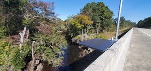
CATEGORIES: River Gauge
LAYER: River Gauge
GPS: 30.94908, -83.27188
OWNERSHIP: Public
WATER BODY: Withlacoochee River
Lowest boatable: 122.6′
Highest safe: 131′
GAUGE: Skipper Bridge
MILE: 76.24
ADDRESS: 4200 Skipper Bridge Road, Valdosta, GA 31605, Lowndes County.
DESCRIPTION: USGS 023177483, on the new Skipper Bridge. On the new Skipper Bridge, north side. Previously apparently was due west of River Road.
AKA: Bemiss Gauge.
WEBSITE: https://wwals.net/2014/05/06/flooding-charts-2/#Skipper-Bridge
PHOTO: https://www.wwals.net/pictures/2022-10-27–wq-jsq/20221027_144927.jpg
PHOTOSET: https://www.wwals.net/pictures/2022-10-27–wq-jsq/#SB
PHOTO SOURCE: John S. Quarterman
PHONE NUMBER: (229) 242-0102
PHOTO2: https://wwals.net/pictures/2015-12-27–withlacoochee-access/KIMG3218.jpg
Photoset2: https://wwals.net/pictures/2015-12-27–withlacoochee-access/
PHOTO2 SOURCE: WWALS
Photo2 Phone Number: 229-242-0102
Suggestions: https://forms.gle/DipPgU2TP5atc2Rf9

Skipper Bridge
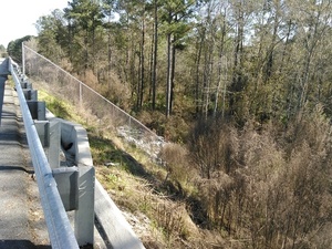
CATEGORIES: Bridge
LAYER: Bridge
OWNERSHIP: Public
ACCESS: No
WATER BODY: Withlacoochee River
MILE: 76.24
ADDRESS: 4200 Skipper Bridge Road, Valdosta, GA 31605, Lowndes County.
DESCRIPTION: New (2011) county road bridge, 8.6 miles north of Valdosta. 700.2′ long 7-span multi-beam prestressed concrete bridge, replacing one that was 0.8 miles up the river. The chain link fence prevents entering the river here. Unless you drive off the westbound road down the north side of the right of way to the left bank of the river.
HISTORIC FACTS: Built in June 2011 at a much different location than its predecessor.
WEBSITE: https://bridgereports.com/1647431
OTHER REFERENCE: http://www.l-a-k-e.org/blog/2011/06/skipper-bridge-road-bridge-withlacoochee-river.html
PHOTO: https://wwals.net/pictures/2015-12-27–withlacoochee-access/KIMG3217.jpg
PHOTOSET: https://wwals.net/pictures/2015-12-27–withlacoochee-access/
PHOTO SOURCE: John S. Quarterman
PHONE NUMBER: (229) 242-0102
Suggestions: https://forms.gle/DipPgU2TP5atc2Rf9
“Top of Flood Inundation Map, Skipper Bridge”
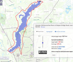
CATEGORIES: Point Of Interest
LAYER: Other
GPS: 30.9489, -83.2719
OWNERSHIP: Public
WATER BODY: Withlacoochee River
MILE: 76.24
ADDRESS: Just downstream of Skipper Bridge. Lowndes County.
DESCRIPTION: Uses LiDAR data paid for by Valdosta and Lowndes County.
WEBSITE: https://fim.wim.usgs.gov/fim/?site_no=023177483
PHOTO: https://wwals.net/pictures/2019-10-21–fim/19.7feet.jpg
PHOTOSET: https://wwals.net/pictures/2019-10-21–fim/
PHOTO SOURCE: John S. Quarterman
PHONE NUMBER: (229) 242-0102
Suggestions: https://forms.gle/DipPgU2TP5atc2Rf9
Crawford Branch

CATEGORIES: Tributary
LAYER: Other
OWNERSHIP: Private, CRAWFORD BRANCH HOMEOWNERS ASSOCIATION INC, PARCEL 0104 026B
WATER BODY: Withlacoochee River
MILE: 76.24
ADDRESS: Just downstream from Skipper Bridge, 3801 SKIPPER BRIDGE RD, VALDOSTA, GA 31605, Lowndes County.
DESCRIPTION: Drains houses across Skipper Bridge Road almost all the way to Bemiss Road. USGS 03110203000495.
HISTORIC FACTS: “”For most of the 1800s, it was called Shanks Mill Creek after James D Shanks, who owned a fair bit of land in the area and had a mill a bit further up the run of the creek. By 1908, it was called Crawford Branch. The Crawford family moved to the area in 1866 and purchased the land from the heirs of James D Shanks.”” —Phillip Williams 2022-11-05
AKA: Shanks Mill Creek or Ziegler 03110203000495 Creek
WEBSITE: https://valorgis.maps.arcgis.com/apps/webappviewer/index.html?id=46896a0dc6b34504a841368b703542b0
PHOTO: https://www.wwals.net/pictures/2022-11-03–wq/20221103_133632.jpg
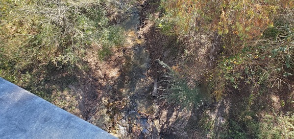
PHOTOSET: https://www.wwals.net/pictures/2022-11-03–wq/#ZC
PHOTO SOURCE: John S. Quarterman
PHONE NUMBER: (229) 242-0102
Suggestions: https://forms.gle/DipPgU2TP5atc2Rf9
Crawford Branch Bridge

CATEGORIES: Bridge
LAYER: Bridge
OWNERSHIP: Public
WATER BODY: Crawford Branch
MILE: 0.46
ADDRESS: 4049 Skipper Bridge Road, just south of Reed Road, almost half a mile upstream from the Withlacoochee River. Lowndes County.
DESCRIPTION: Probably culverts.
AKA: Shanks Mill Creek Bridge or Ziegler 03110203000495 Creek Bridge
PHOTO: https://www.wwals.net/pictures/2022-11-03–ziegler-creek/ziegler-creek-skipper-bridge-road.jpg
PHOTOSET: https://www.wwals.net/pictures/2022-11-03–ziegler-creek/
PHOTO SOURCE: Google streetview
PHONE NUMBER: (850) 290-2350
Suggestions: https://forms.gle/DipPgU2TP5atc2Rf9
Shanks Mill
CATEGORIES: Mill
LAYER: Point of Interest
OWNERSHIP: Private, ZEIGLER NANCY ETAL C/O GARY R ZEIGLER AS TR, PARCEL 0144 003
WATER BODY: Crawford Branch
MILE: 0.78
ADDRESS: 4044 Skipper Bridge Rd, Valdosta GA 31605, behind Ziegler’s Auto Body Shop, 3/4 of a mile upstream from the Withlacoochee River. Lowndes County.
DESCRIPTION: Appoximate location of historical Shanks Mill.
HISTORIC FACTS: The mill that gave the original name of Shanks Mill Creek to Crawford Branch. “”The deeds suggest somewhere in the WH of LL 99. LD 11. I have been locating it about here based upon the geography.”” —Phillip Williams 2022-11-05
Suggestions: https://forms.gle/DipPgU2TP5atc2Rf9
Crawford Pond
CATEGORIES: Tributary
LAYER: Other
OWNERSHIP: Private, CRAWFORD BRANCH HOMEOWNERS ASSOCIATION INC, PARCEL 0104 026B
WATER BODY: Withlacoochee River
MILE: 75.41
ADDRESS: Downstream from Crawford Branch and 3/4 of a mile down from Skipper Bridge, 3801 SKIPPER BRIDGE RD, VALDOSTA, GA 31605, Lowndes County.
DESCRIPTION: A large pond draining houses with septic tanks. Drains houses across Skipper Bridge Road. USGS 03110203000497.
WEBSITE: https://valorgis.maps.arcgis.com/apps/webappviewer/index.html?id=46896a0dc6b34504a841368b703542b0
Suggestions: https://forms.gle/DipPgU2TP5atc2Rf9
Staten Road Landing
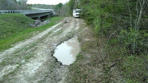
CATEGORIES: Landing Private
LAYER: Other
OWNERSHIP: Private
ACCESS: Launch: steep river bank on county road right of way
WATER BODY: Withlacoochee River
Lowest boatable: 122.6′
Highest safe: 131′
GAUGE: Skipper Bridge
MILE: 74.27
ADDRESS: Left bank, 4556 Staten Road, Valdosta, GA 31605, Lowndes County.
DESCRIPTION: Not recommended. Very steep road abutment takeout, and right of way access sometimes is blocked.
PHOTO SOURCE: John S. Quarterman
PHONE NUMBER: (229) 242-0102
Suggestions: https://forms.gle/DipPgU2TP5atc2Rf9
Staten Road Landing River GPS
CATEGORIES: Point Of Interest
LAYER: Other
GPS: 30.9329, -83.2889
OWNERSHIP: Private
ACCESS: Launch: steep river bank on county road right of way
WATER BODY: Withlacoochee River
Lowest boatable: 122.6′
Highest safe: 131′
GAUGE: Skipper Bridge
MILE: 74.27
ADDRESS: Left bank, 4556 Staten Road, Valdosta, GA 31605, Lowndes County.
DESCRIPTION: Not recommended. Very steep road abutment takeout, and right of way access sometimes is blocked.
PHOTO SOURCE: John S. Quarterman
PHONE NUMBER: (229) 242-0102
Suggestions: https://forms.gle/DipPgU2TP5atc2Rf9
Staten Road Bridge
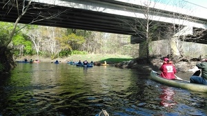
CATEGORIES: Bridge
LAYER: Bridge
OWNERSHIP: Public
ACCESS: No, PARKING: Free
WATER BODY: Withlacoochee River
MILE: 74.26
ADDRESS: 4556 Staten Road, Valdosta, GA 31605, Lowndes County.
DESCRIPTION: New (2009) county road bridge; actually three of them in a row.
HISTORIC FACTS: The new bridge opened in May 2009 after the old one was gone for more than fifteen years.
WEBSITE: https://wwals.net/2016/03/24/pictures-staten-road-to-langdale-park-withlacoochee-river/
OTHER REFERENCE: http://www.okraparadisefarms.com/blog/2009/05/staten-road-bridge-opens-after-15-years.html
PHOTOSET: https://wwals.net/2016/03/24/pictures-staten-road-to-langdale-park-withlacoochee-river/
PHOTO SOURCE: John S. Quarterman
PHONE NUMBER: (229) 242-0102
PHOTO2: https://farm6.static.flickr.com/5142/5807794093_b1396821f9.jpg
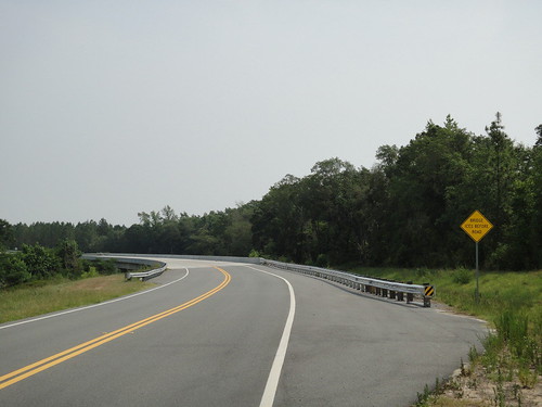
Photoset2: http://www.l-a-k-e.org/blog/2011/06/low-river.html
PHOTO2 SOURCE: John S. Quarterman
Photo2 Phone Number: 229-242-0102
Suggestions: https://forms.gle/DipPgU2TP5atc2Rf9
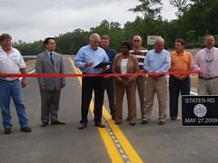
Walkers Ford
CATEGORIES: Ford
LAYER: Other
OWNERSHIP: Public
WATER BODY: Withlacoochee River
MILE: 74.25
ADDRESS: Towards the west side of the bridge, 4556 Staten Road, Valdosta, GA 31605, Lowndes County.
DESCRIPTION: Old ford across the Withlacoochee River in the 1860s.
HISTORIC FACTS: According to Wiregrass Region Digital History Project, there was a ford here in the 1860s.
Suggestions: https://forms.gle/DipPgU2TP5atc2Rf9
Fender Bridge site
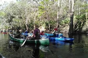
CATEGORIES: Bridgesite
LAYER: Bridge
OWNERSHIP: Public
WATER BODY: Withlacoochee River
MILE: 74.25
ADDRESS: 4556 Staten Road, Valdosta, GA 31605, Lowndes County.
DESCRIPTION: The old, defunct, Staten Road bridge, where the southernmost of the new bridges now is.
WEBSITE: https://en.wikipedia.org/wiki/Withlacoochee_River_(Suwannee_River)
PHOTO: https://wwals.net/pictures/2016-03-20–staten-road-langdale-park-withlacoochee-pictures/KVID3930.jpg
PHOTOSET: https://wwals.net/pictures/2016-03-20–staten-road-langdale-park-withlacoochee-pictures/
PHOTO SOURCE: John S. Quarterman
PHONE NUMBER: (229) 242-0102
Suggestions: https://forms.gle/DipPgU2TP5atc2Rf9
Thomasville-Valdosta Withlacoochee Power Line
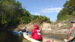
CATEGORIES: Power Line
LAYER: Point of Interest
GPS: 30.9288, -83.292668
OWNERSHIP: Private
ACCESS: No
WATER BODY: Withlacoochee River
MILE: 73.81
ADDRESS: Downstream from Staten Road. Lowndes County.
DESCRIPTION: Lowndes County’s water and sewer lines cross the river here.
WEBSITE: https://wwals.net/2016/03/24/pictures-staten-road-to-langdale-park-withlacoochee-river/
PHOTOSET: https://wwals.net/2016/03/24/pictures-staten-road-to-langdale-park-withlacoochee-river/
PHOTO SOURCE: John S. Quarterman
PHONE NUMBER: (229) 242-0102
Suggestions: https://forms.gle/DipPgU2TP5atc2Rf9
Bay Branch
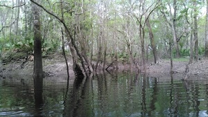
CATEGORIES: Tributary
LAYER: Other
OWNERSHIP: Public
ACCESS: No
WATER BODY: Withlacoochee River
MILE: 72.55
ADDRESS: Between Lucas-Richardson Road and Sermons Lane. Lowndes County.
DESCRIPTION: Enters river right after draining much of the land around Bethany Drive and Road, McMillan Road, and Val Del Road, all with many houses, some subdivisions, and where Lowndes County wants to keep developing.
WEBSITE: https://wwals.net/pictures/2016-03-20–staten-road-langdale-park-withlacoochee-pictures/
PHOTO: https://wwals.net/pictures/2016-03-20–staten-road-langdale-park-withlacoochee-pictures/KIMG3969.jpg
PHOTOSET: https://wwals.net/pictures/2016-03-20–staten-road-langdale-park-withlacoochee-pictures/
PHOTO SOURCE: John S. Quarterman
PHONE NUMBER: (229) 242-0102
Suggestions: https://forms.gle/DipPgU2TP5atc2Rf9
Sermons Branch
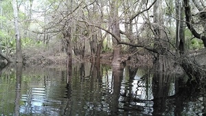
CATEGORIES: Tributary
LAYER: Other
GPS: 30.91849, -83.309506
OWNERSHIP: Private, Pauline Kincade, PARCEL 0071 054
ACCESS: No
WATER BODY: Withlacoochee River
MILE: 71.80
ADDRESS: 3816 Sermons Lane, Valdosta, GA, Lowndes County.
DESCRIPTION: Not sure of the real name of this creek that enters from river right, but since it comes down by Sermons Lane, we call it Sermons Branch.
WEBSITE: https://wwals.net/pictures/2016-03-20–staten-road-langdale-park-withlacoochee-pictures/
PHOTO: https://wwals.net/pictures/2016-03-20–staten-road-langdale-park-withlacoochee-pictures/KIMG3982.jpg
PHOTOSET: https://wwals.net/pictures/2016-03-20–staten-road-langdale-park-withlacoochee-pictures/
PHOTO SOURCE: John S. Quarterman
PHONE NUMBER: (229) 242-0102
Suggestions: https://forms.gle/DipPgU2TP5atc2Rf9
Moody Family Housing SInkhole

CATEGORIES: Sinkhole
LAYER: Brochure
GPS: 30.90837, -83.32807
OWNERSHIP: Private, DASHER HOWARD COMP INC, PARCEL 0072 191
WATER BODY: Sermons Branch
ADDRESS: Behind Allure Lane, off Val Del Road, Valdosta, GA 31062, in Lowndes County. Lowndes County.
DESCRIPTION: Labelled “Existing Sinkhole” on site plan for Phase II of Moody Family Housing.
PHOTO: http://www.l-a-k-e.org/govt/loco/rezoning/REZ-2013-09/mime/MoodyXAFBXValXDelXRoadXSiteXXXPlan.jpg
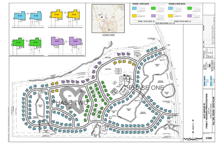
PHOTOSET: http://www.l-a-k-e.org/govt/loco/rezoning/REZ-2013-09/mime/
PHOTO SOURCE: Lowndes County
PHONE NUMBER: (850) 290-2350
Suggestions: https://forms.gle/DipPgU2TP5atc2Rf9
Shadrick Sink
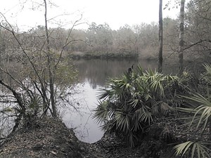
CATEGORIES: Sinkhole
LAYER: Brochure
OWNERSHIP: Public, Lowndes County, PARCEL 0072 023
ACCESS: Yes, PARKING: Free
WATER BODY: Withlacoochee River
MILE: 70.68
ADDRESS: 3526 River Chase Drive, Valdosta, GA 31602, Lowndes County.
DESCRIPTION: A 2.5 acre depression with two sinkholes at bottom that leak into the Floridan Aquifer.
HISTORIC FACTS: Has leaked into the aquifer for decades, causing Valdosta’s water wells to be sunk 400 feet deep to get below that level.
GRN: Yes
OTHER REFERENCE: https://wwals.net/2019/04/16/excluding-groundwater-makes-no-sense-above-the-florida-aquifer-wwals-to-epa-2019-04-15/#appendixa
PHOTO: https://wwals.net/wp-content/themes/pianoblack/img//2015/02/3eeba54647c4144febd85680f8946f34.jpg
PHOTO SOURCE: John S. Quarterman
PHONE NUMBER: (229) 242-0102
Suggestions: https://forms.gle/DipPgU2TP5atc2Rf9
Withlacoochee Slough at Cherry Creek 
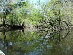
CATEGORIES: Obstacle
LAYER: Other
OWNERSHIP: Public, Lowndes County, PARCEL 0072 023
WATER BODY: Withlacoochee River
MILE: 70.65
ADDRESS: 3526 River Chase Drive, Valdosta, GA, Lowndes County.
DESCRIPTION: A slough of the Withlacoochee River, remaining after the main channel moved to the east.
PHOTO: https://wwals.net/pictures/2016-03-20–staten-road-langdale-park-withlacoochee-pictures/KIMG4015.jpg
PHOTOSET: https://wwals.net/pictures/2016-03-20–staten-road-langdale-park-withlacoochee-pictures/
PHOTO SOURCE: John S. Quarterman
PHONE NUMBER: (229) 242-0102
Photoset2: John S. Quarterman
PHOTO2 SOURCE: 229-242-0102
Suggestions: https://forms.gle/DipPgU2TP5atc2Rf9
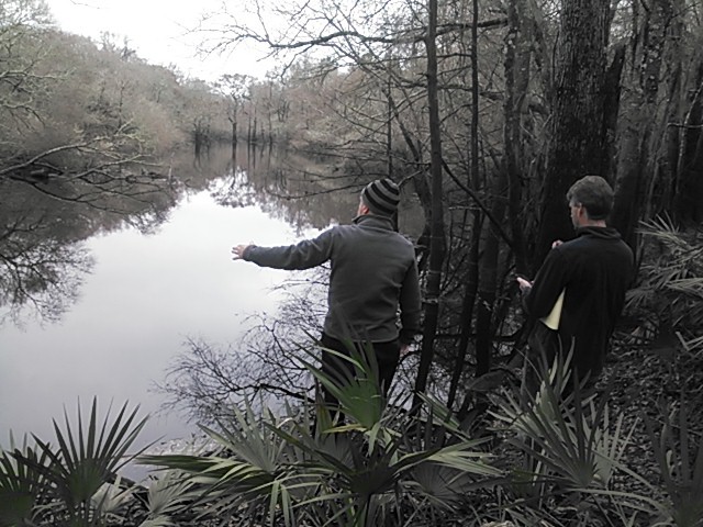
Entrance to Shadrick Sink

CATEGORIES: Public Land
LAYER: Other
OWNERSHIP: Public, Lowndes County, PARCEL 0072 023
WATER BODY: Withlacoochee River
MILE: 70.32
ADDRESS: 3526 River Chase Drive, Valdosta, GA 31602, Lowndes County.
DESCRIPTION: A cable secures the entrance to the county-owned 96.61 acre Lowndes County, GA, parcel 0072 023, which contains Shadrick Sink and the Withlacoochee Slough at Cherry Creek, which feeds Withlacoochee River water into the sink.
WEBSITE: https://www.wwals.net/pictures/2022-01-20–troupville-boat-ramp-broad-street-dogs/#RC
PHOTO: https://www.wwals.net/pictures/2022-01-20–troupville-boat-ramp-broad-street-dogs/20220120_101641.jpg
PHOTOSET: https://www.wwals.net/pictures/2022-01-20–troupville-boat-ramp-broad-street-dogs/#RC
PHOTO SOURCE: John S. Quarterman
PHONE NUMBER: (229) 242-0102
Suggestions: https://forms.gle/DipPgU2TP5atc2Rf9
Southern Paddling Guide
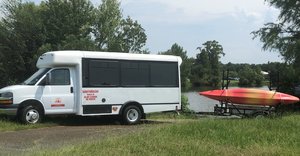
CATEGORIES: Outfitter
LAYER: Other
OWNERSHIP: Private
ACCESS: No, CANOE
WATER BODY: Cherry Creek
MILE: 6.29
ADDRESS: 3816 Saddlebred Ln, Valdosta, GA 31605, Lowndes County.
DESCRIPTION: “Providing of all the equipment needed for multi-day excursions with comfort and safety as our priority. Come relax and enjoy North Florida’s beautiful Suwannee River. Vacations are for relaxing, not standing in lines at a theme park.””, Dale Dauphinais, southernpaddling@yahoo.com
WEBSITE: https://www.southernpaddling.com/
PHOTOSET: https://www.southernpaddling.com/
PHOTO SOURCE: Southern Paddling Guide
PHONE NUMBER: (229) 630-8179
Suggestions: https://forms.gle/DipPgU2TP5atc2Rf9
Valdosta Water Plant 
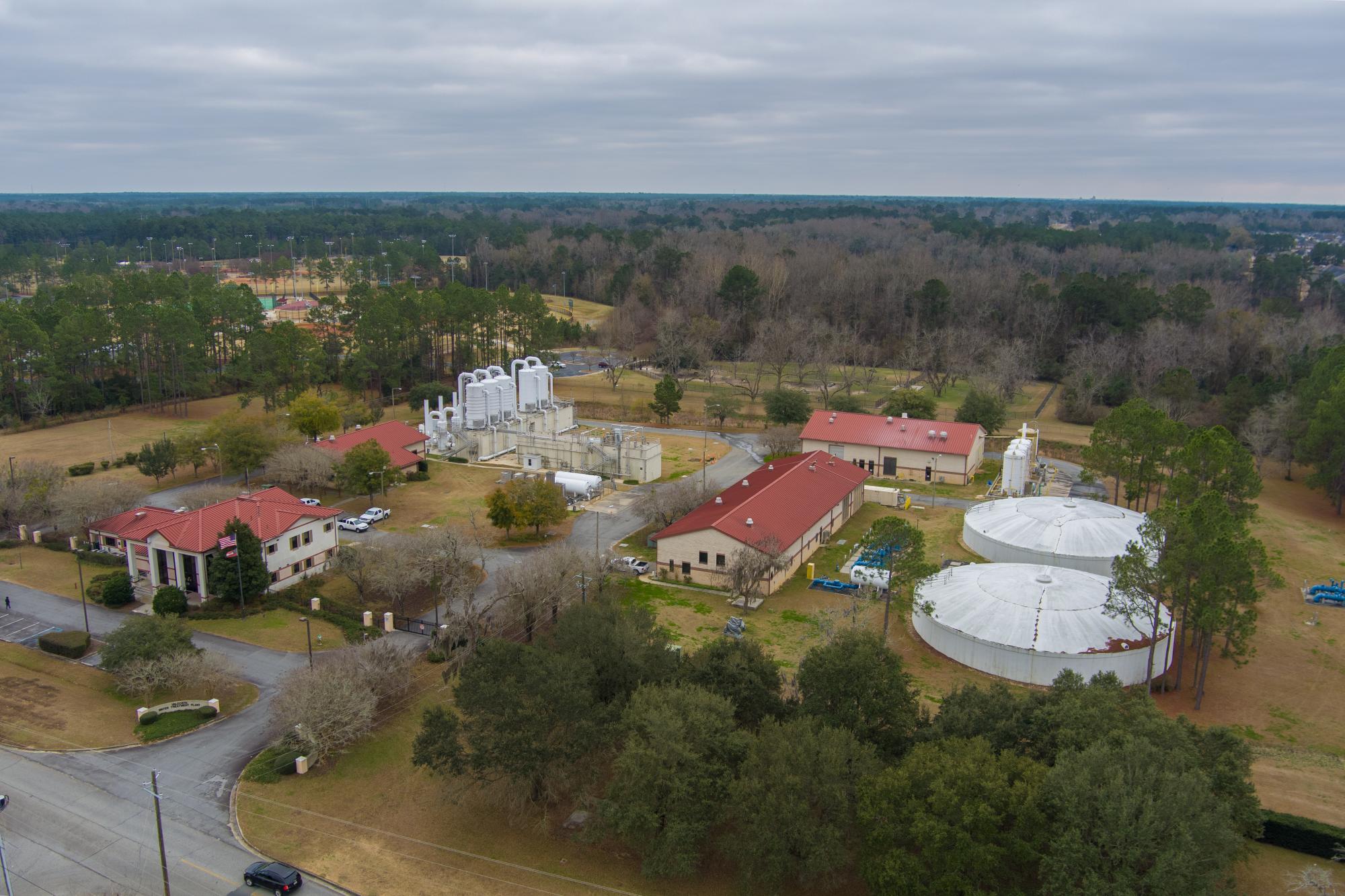
CATEGORIES: Muni Drinking Water
LAYER: Brochure
OWNERSHIP: Public
ACCESS: No, RESTROOMS, PARKING: Free, SHELTER, HANDICAPPED ACCESSIBLE
WATER BODY: Cherry Creek
MILE: 3.70
ADDRESS: 3863 Guest Rd, Valdosta, GA 31605, Lowndes County.
DESCRIPTION: Drinking water purification plant for the City of Valdosta.
HISTORIC FACTS: Valdosta’s water wells had to be sunk twice as deep (400 feet deep) to get below Withlacoochee River water leaching underground from Shadrick Sink on the other side of the river.
GRN: Yes
WEBSITE: http://www.valdostacity.com/water-treatment-plant
PHOTO: https://www.valdostacity.com/sites/default/files/uploads/max_1200-hdr.jpg
PHOTOSET: http://www.valdostacity.com/water-treatment-plant
PHOTO SOURCE: City of Valdosta
PHONE NUMBER: (229) 333-1881
Suggestions: https://forms.gle/DipPgU2TP5atc2Rf9
Freedom Park
CATEGORIES: Public Land
LAYER: Hiking Trail
GPS: 30.91430334, -83.24879174
OWNERSHIP: Public
ACCESS: No, FOOD, WATER, RESTROOMS, PARKING: Free, SHELTER, PICNIC AREA, HANDICAPPED ACCESSIBLE
WATER BODY: Cherry Creek
MILE: 3.85
ADDRESS: 3795 Guest Rd., Valdosta, GA 31605, Lowndes County.
DESCRIPTION: “Freedom Park is a huge multi-purpose facility with something for everyone! The parks 250-plus acres is conveniently located near Moody Air Force Base and features a large, beautifully maintained baseball/softball complex with 12 regulation adult softball fields, bathrooms, a concession stand, and a covered playground.””, It is also home to the Miracle Field, a boundless playground, and attached pavilion which are inclusive for people of all abilities. A paved walking track, a 20-hole Disc Golf course, a dog park for large and small breeds, a cross-country running course, and open field space round out the facility. Freedom Park hosts the regional Spring Olympics each year, dozens of baseball and softball tournaments, and disc golf tournaments.
WEBSITE: http://vlpra.com/199/Freedom-Park
PHOTO: http://vlpra.com/ImageRepository/Document?documentID=166
PHOTOSET: http://vlpra.com/199/Freedom-Park
PHOTO SOURCE: VLPRA
PHONE NUMBER: (229) 259-3507
Suggestions: https://forms.gle/DipPgU2TP5atc2Rf9
Valdosta Huntley Drive Spill
CATEGORIES: Spill
LAYER: Point of Interest
GPS: 30.906197, -83.26168
OWNERSHIP: Public
WATER BODY: Sugar Creek
MILE: 3.45
ADDRESS: 4051 Huntley Driver, Valdosta, GA 31605, Lowndes County.
DESCRIPTION: “”On April 9th, 2024, at 6:30 p.m., Utility Central Lines Personnel were dispatched to address a Sanitary Sewer Overflow at 4051 Huntley Drive. Central Lines Personnel promptly initiated measures to remove the blockage and safeguard the Stormwater collection system. The overflow, attributed to grease and rags, was swiftly mitigated by the Central Lines crew using high-pressure jetting equipment. The incident ceased at 8:30 p.m. the same day, after approximately 5, 000 gallons had been released into the Stormwater System. This system ultimately drains into a Detention Pond that discharges into the Withlacoochee River via Cherry Creek. All relevant agencies have been duly notified.””
WEBSITE: https://www.valdostacity.com/news/utility-central-lines-personnel-respond-sanitary-sewer-overflow
Suggestions: https://forms.gle/DipPgU2TP5atc2Rf9
Cherry Creek Church Road Spill
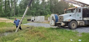
CATEGORIES: Spill
LAYER: Point of Interest
OWNERSHIP: Public
WATER BODY: Cherry Creek
MILE: 3.36
ADDRESS: 4123 Bemiss Road, Valdosta, GA 31605, Lowndes County.
DESCRIPTION: FOG (Fats Oils and Grease) sewage spill running down ditch on Cherry Creek Church Road from Bemiss Road near Cherry Creek in Valdosta, Georgia, April 9, 2020.
WEBSITE: https://wwals.net/2020/04/12/sewage-spill-cherry-creek-valdosta-fog-2020-04-09/
PHOTO: https://wwals.net/pictures/2020-04-09–cherry-creek-fog-spill/20200409_184120.jpg
PHOTOSET: https://wwals.net/pictures/2020-04-09–cherry-creek-fog-spill/
PHOTO SOURCE: John S. Quarterman
PHONE NUMBER: (229) 242-0102
Suggestions: https://forms.gle/DipPgU2TP5atc2Rf9
Goodyear Lift Station
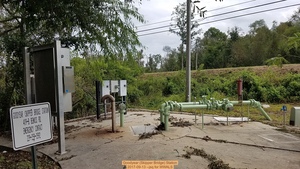
CATEGORIES: Liftstation
LAYER: Point of Interest
GPS: 30.91228, -83.26205
OWNERSHIP: Public, VALDOSTA CITY OF, PARCEL 0146A 094G
WATER BODY: Cherry Creek
MILE: 3.30
ADDRESS: 4119-B Bemiss Road, Valdosta, GA 31605, Lowndes County.
DESCRIPTION: A City of Valdosta sewage lift station near Cherry Creek, just upstream from the Skipper Bridge Road Cherry Creek Bridge.
WEBSITE: https://wwals.net/2017/09/14/valdosta-report-of-spill-at-cherry-creek-lift-station-2017-09-12/
PHOTO: https://www.wwals.net/pictures/2025-12-11–vcc-packet-water-wastewater/20170913_135209.jpg
PHOTOSET: https://www.wwals.net/pictures/2025-12-11–vcc-packet-water-wastewater/
PHOTO SOURCE: John S. Quarterman
PHONE NUMBER: (229) 242-0102
Suggestions: https://forms.gle/DipPgU2TP5atc2Rf9
Cherry Creek Skipper Bridge Road Bridge
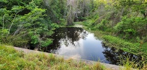
CATEGORIES: Bridge
LAYER: Bridge
OWNERSHIP: Public
WATER BODY: Cherry Creek
MILE: 3.22
ADDRESS: 3023 Skipper Bridge Rd, Valdosta, GA 31605, Lowndes County.
DESCRIPTION: More culverts than bridge. On Skipper Bridge Road (aka Creekhouse Drive) between Cherry Creek Church Road and Aslan Road.
WEBSITE: https://wwals.net/pictures/2020-04-09–cherry-creek-fog-spill/
PHOTO: https://wwals.net/pictures/2020-04-09–cherry-creek-fog-spill/20200409_185310.jpg
PHOTOSET: https://wwals.net/pictures/2020-04-09–cherry-creek-fog-spill/
PHOTO SOURCE: John S. Quarterman
PHONE NUMBER: (229) 242-0102
Suggestions: https://forms.gle/DipPgU2TP5atc2Rf9
Knights Academy Road Lift Station
CATEGORIES: Liftstation
LAYER: Point of Interest
GPS: 30.897365, -83.2652
OWNERSHIP: Public, PARK-HAWTHORNE DEVELOPMENT LLC, PARCEL 0146C 305A
WATER BODY: Cherry Creek
MILE: 2.79
ADDRESS: The north end Forrest Street Extension and Knights Academy Road. Lowndes County.
DESCRIPTION: A City of Valdosta sewage lift station on a feeder creek of Cherry Creek.
WEBSITE: https://www.valdostacity.com/sites/default/files/uploads/kardgoodyear-contractbidding_1.pdf
Suggestions: https://forms.gle/DipPgU2TP5atc2Rf9
Boys & Girls Club Lift Station Spill

CATEGORIES: Liftstation
LAYER: Point of Interest
GPS: 30.8974, -83.2799
OWNERSHIP: Public, VINEYARD OF VALDOSTA HOMEOWNERS ASSOCIATION INC THE, PARCEL 0108 234A
WATER BODY: Cherry Creek
MILE: 2.16
ADDRESS: 3658 Lake Laurie Drive, Valdosta, GA 31605, Lowndes County.
DESCRIPTION: One of Valdosta’s northernmost lift stations.
HISTORIC FACTS: Small sewage spill, 2, 800 gallons, 7:30 PM to 11:00 PM, Saturday, February 11, 2023. https://wwals.net/2023/02/13/cherry-creek-water-quality-sampling-after-valdosta-sewage-spill-2023-02-12/ Spill of 1, 500 gallons, 2023-12-17, “”Did not reach state waters.”” https://wwals.net/pictures/2018-10-31–ga-epd-spill-resolution/spills/2024-01-16–GA-EPD-Sewage-Spills-Report.html
WEBSITE: https://www.wwals.net/pictures/2023-02-12–cherry-creek-wq/#LLDLS
PHOTO: https://www.wwals.net/pictures/2023-02-12–cherry-creek-wq/20230212_173958.jpg
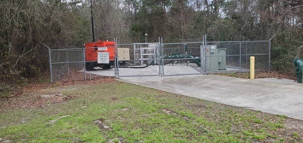
PHOTOSET: https://www.wwals.net/pictures/2023-02-12–cherry-creek-wq/#LLDLS
PHOTO SOURCE: John S. Quarterman
PHONE NUMBER: (229) 242-0102
Suggestions: https://forms.gle/DipPgU2TP5atc2Rf9
Cherry Creek Lake Laurie Drive Bridge

CATEGORIES: Bridge
LAYER: Point of Interest
GPS: 30.89505, -83.2826
OWNERSHIP: Public
WATER BODY: Cherry Creek
MILE: 1.02
ADDRESS: 400 feet north of Old Vine Way, Lowndes County.
DESCRIPTION: Four concrete culverts.
WEBSITE: https://www.wwals.net/pictures/2023-02-12–cherry-creek-wq/#LLD
PHOTO: https://www.wwals.net/pictures/2023-02-12–cherry-creek-wq/20230212_172750.jpg
PHOTOSET: https://www.wwals.net/pictures/2023-02-12–cherry-creek-wq/#LLD
PHOTO SOURCE: John S. Quarterman
PHONE NUMBER: (229) 242-0102
PHOTO2: https://www.wwals.net/pictures/2023-02-12–cherry-creek-wq/20230212_172821.jpg
Photoset2: https://www.wwals.net/pictures/2023-02-12–cherry-creek-wq/#LLD
PHOTO2 SOURCE: John S. Quarterman
Photo2 Phone Number: 229-242-0102
Suggestions: https://forms.gle/DipPgU2TP5atc2Rf9

Cherry Creek Bridge

CATEGORIES: Bridge
LAYER: Bridge
OWNERSHIP: Public
WATER BODY: Cherry Creek
MILE: 1.44
ADDRESS: 3910 Cherry Creek Rd, Valdosta, GA 31605, Lowndes County.
DESCRIPTION: 134.8 ft. 5-span concrete t-beam bridge with concrete cast-in-place deck built in 1961 over Cherry Creek, on Cherry Creek Road just south of Cherry Creek Drive, at the top of Lake Cleve, Valdosta, GA.
WEBSITE: https://bridgereports.com/1099497
PHOTO: https://www.wwals.net/pictures/2023-02-12–cherry-creek-wq/20230212_175444.jpg
PHOTOSET: https://www.wwals.net/pictures/2023-02-12–cherry-creek-wq/#CCR
PHOTO SOURCE: John S. Quarterman
PHONE NUMBER: (229) 242-0102
PHOTO2: https://www.wwals.net/pictures/2023-02-12–cherry-creek-wq/20230212_175357.jpg
Photoset2: https://www.wwals.net/pictures/2023-02-12–cherry-creek-wq/#CCR
PHOTO2 SOURCE: John S. Quarterman
Photo2 Phone Number: 229-242-0102
Suggestions: https://forms.gle/DipPgU2TP5atc2Rf9

Lake Cleve
CATEGORIES: Lake
LAYER: Point of Interest
OWNERSHIP: Private
WATER BODY: Cherry Creek
MILE: 1.02
ADDRESS: Lakeshore Drive, Valdosta, GA, Lowndes County.
DESCRIPTION: Subdivision lake, named for Cleve B. Watson, Jr., 1964.
AKA: Cherry Lake.
WEBSITE: https://wwals.net/2018/04/13/lake-cleve-on-cherry-creek-valdosta-ga-1964/
PHOTO: https://www.wwals.net/pictures/2023-02-12–cherry-creek-wq/20230212_175357.jpg
PHOTOSET: https://www.wwals.net/pictures/2023-02-12–cherry-creek-wq/#CCR
PHOTO SOURCE: John S. Quarterman
PHONE NUMBER: (229) 242-0102
PHOTO2: https://www.wwals.net/pictures/1964-01-01–lake-cleve-cherry-creek/lake-cleve.jpg
Photoset2: https://www.wwals.net/pictures/1964-01-01–lake-cleve-cherry-creek/
PHOTO2 SOURCE: WWALS
Suggestions: https://forms.gle/DipPgU2TP5atc2Rf9

Lake Cleve Historical Marker

CATEGORIES: Point Of Interest
LAYER: Point of Interest
GPS: 30.9045, -83.302
OWNERSHIP: Private
WATER BODY: Cherry Creek
MILE: 0.61
ADDRESS: Ridge Road, Valdosta, GA 31605, Lowndes County.
DESCRIPTION: “”Lake Cleve Named for Cleve B. Watson, Jr. 1964…””
HISTORIC FACTS: “”Lake Cleve Named for Cleve B. Watson, Jr. 1964; Design and Construction of Dam and Lake supervised by Julian V. Dupree, District Conservationist, Soil Conservation Service, U.S. Department of Agriculture; Cherry Creek Properties, Inc., Frank D. Rose, President and Treasurer, George B. Williams, Vice President, Annie Laurie Rose, Secretary, Annie Golden Williams, Asst. Secretary.””
WEBSITE: https://wwals.net/2018/04/13/lake-cleve-on-cherry-creek-valdosta-ga-1964/
PHOTOSET: https://www.wwals.net/pictures/1964-01-01–lake-cleve-cherry-creek/
PHOTO SOURCE: Scotti Jay
PHONE NUMBER: (850) 290-2350
PHOTO2: https://www.wwals.net/pictures/2023-02-12–cherry-creek-wq/20230212_181311.jpg
Photoset2: https://www.wwals.net/pictures/2023-02-12–cherry-creek-wq/#LC
PHOTO2 SOURCE: John S. Quarterman
Photo2 Phone Number: 229-242-0102
Suggestions: https://forms.gle/DipPgU2TP5atc2Rf9

The Dip

CATEGORIES: Dam
LAYER: Point of Interest
GPS: 30.903445, -83.30188
OWNERSHIP: Public, Cherry Creek Hills Property Owners Association, PARCEL 0106 069A
ACCESS: No, PARKING: Free
WATER BODY: Cherry Creek
MILE: 0.61
ADDRESS: Ridge Road, Valdosta, GA 31605, Lowndes County.
DESCRIPTION: Creek dam and spillway formerly famous for teenagers driving through the water. Now closed to public driving. Was famous local attraction
HISTORIC FACTS: Called “”the dip”” because when the road was open you could drive through water running over the dam.
AKA: Spillway of Lake Cleve Dam.
WEBSITE: https://www.google.com/maps/place/30%C2%B054’11.9%22N+83%C2%B018’06.7%22W/@30.903304, -83.3040557, 751m/data=!3m2!1e3!4b1!4m5!3m4!1s0x0:0x0!8m2!3d30.903304!4d-83.301867
PHOTO: https://www.wwals.net/pictures/2023-02-12–cherry-creek-wq/the-dip.jpg
PHOTOSET: https://www.wwals.net/pictures/2023-02-12–cherry-creek-wq/#TD
PHOTO SOURCE: John S. Quarterman
PHONE NUMBER: (229) 242-0102
Photoset2: https://www.facebook.com/groups/200086353383082/permalink/720792741312438/
PHOTO2 SOURCE: Charles Hinke
Suggestions: https://forms.gle/DipPgU2TP5atc2Rf9

Cherry Creek
CATEGORIES: Tributary
LAYER: Other
GPS: 30.901774, -83.31094
OWNERSHIP: Public, UVALDE LAND COMPANY LLC, PARCEL 0072 031
ACCESS: No
WATER BODY: Withlacoochee River
MILE: 70.45
ADDRESS: Downstream from Cherry Creek Drive. Lowndes County.
DESCRIPTION: Cherry Creek enters river left into the Withlacoochee River, after it drains much of the north edge of Valdosta, crosses Bemiss Road, aka Bemiss Highway, goes through Lake Cleve, draining its attendand subdivision.
WEBSITE: https://www.valdostacity.com/engineering/stormwater-division/master-stormwater-management-plan
Suggestions: https://forms.gle/DipPgU2TP5atc2Rf9
Cherry Creek Sink
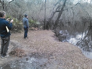
CATEGORIES: Sinkhole
LAYER: Other
OWNERSHIP: Public, Lowndes County, PARCEL 0072 023
WATER BODY: Withlacoochee River
MILE: 70.34
ADDRESS: 3526 River Chase Drive, Valdosta, GA, Lowndes County.
DESCRIPTION: A sinkhole into the Floridan Aquifer that opened in less than two months.
HISTORIC FACTS: Formed in a matter of months in spring 2012.
PHOTO SOURCE: John S. Quarterman
PHONE NUMBER: (229) 242-0102
Suggestions: https://forms.gle/DipPgU2TP5atc2Rf9
Stillhouse Branch
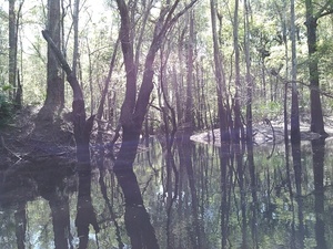
CATEGORIES: Tributary
LAYER: Other
GPS: 30.895699, -83.31483
OWNERSHIP: Private, Valdosta Country Club Inc. PARCEL 0074 001
ACCESS: No
WATER BODY: Withlacoochee River
MILE: 69.83
ADDRESS: 3500 Country Club Road, Valdosta, GA, Lowndes County.
DESCRIPTION: Drains Valdosta Country Club, and usually has trash where it enters the Withlacoochee River from river left.
WEBSITE: https://www.valdostacity.com/engineering/stormwater-division/master-stormwater-management-plan
ADDITIONAL INFO SOURCES: https://wwals.net/2019/08/25/valdosta-sewage-sign-golf-course-valdosta-country-club-stillhouse-branch-2019-08-23/
PHOTO: https://wwals.net/pictures/2016-03-20–staten-road-langdale-park-withlacoochee-pictures/KIMG4038.jpg
PHOTOSET: https://wwals.net/pictures/2016-03-20–staten-road-langdale-park-withlacoochee-pictures/
PHOTO SOURCE: John S. Quarterman
PHONE NUMBER: (229) 242-0102
Suggestions: https://forms.gle/DipPgU2TP5atc2Rf9
Valdosta Country Club sewer spill
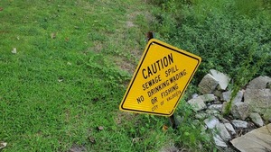
CATEGORIES: Spill
LAYER: Point of Interest
OWNERSHIP: Private, Valdosta Country Club Inc. PARCEL 0074 001
WATER BODY: Stillhouse Branch
MILE: 0.56
ADDRESS: 3500 Country Club Road, Valdosta, GA, Lowndes County.
DESCRIPTION: “”On August 21, 2019, the City of Valdosta Utilities Department responded to a call concerning a minor sanitary sewer spill at the 3300 block of Plantation Drive. The spill occurred on a golf course. The cause of the spill was determined to be a break in the sewer main resulting in approximately 1, 350 gallons of sewage to enter into a local stream. The break has been repaired, the site and its discharge point were cleaned and disinfected.””
HISTORIC FACTS: “It stinks, ” said a man on a golf cart on the green, as I was taking pictures, after we tracked down where Valdosta spilled sewage in August 2019, upstream from Stillhouse Branch.
PHOTO: https://wwals.net/pictures/2019-08-23–vld-country-club-sewer/20190823_152110.jpg
PHOTOSET: https://wwals.net/pictures/2019-08-23–vld-country-club-sewer/
PHOTO SOURCE: John S. Quarterman
PHONE NUMBER: (229) 242-0102
Suggestions: https://forms.gle/DipPgU2TP5atc2Rf9
US 41 Landing
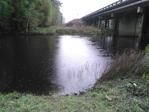
CATEGORIES: Landing
LAYER: Other
OWNERSHIP: Public
ACCESS: Yes, Launch: highway bridge right of way, PARKING: Free
WATER BODY: Withlacoochee River
Lowest boatable: 116′
Highest safe: 123′
GAUGE: Valdosta
MILE: 69.34
ADDRESS: 3966 N Valdosta Rd, Valdosta, GA 31602, Lowndes County.
DESCRIPTION: Off of US 41 (North Valdosta Road), turn north on Val Del Road, first right onto access road, which leads back to US 41 right of way under power line, down to the river right bank. If Langdale Park is open, much better to go to Langdale Park Boat Ramp instead.
AKA: North Valdosta Road Landing.
GRN: No
WEBSITE: https://wwals.net/2016/03/27/us-41-access-to-withlacoochee-river/
PHOTOSET: https://wwals.net/2016/03/27/us-41-access-to-withlacoochee-river/
PHOTO SOURCE: John S. Quarterman
PHONE NUMBER: (229) 242-0102
Suggestions: https://forms.gle/DipPgU2TP5atc2Rf9
US 41 Landing River GPS
CATEGORIES: Point Of Interest
LAYER: Point of Interest
GPS: 30.89285, -83.3188
OWNERSHIP: Public
ACCESS: Yes, Launch: highway bridge right of way, PARKING: Free
WATER BODY: Withlacoochee River
Lowest boatable: 116′
Highest safe: 123′
GAUGE: Valdosta
MILE: 69.34
ADDRESS: 3966 N Valdosta Rd, Valdosta, GA 31602, Lowndes County.
DESCRIPTION: Off of US 41 (North Valdosta Road), turn north on Val Del Road, first right onto access road, which leads back to US 41 right of way under power line, down to the river right bank. If Langdale Park is open, much better to go to Langdale Park Boat Ramp instead.
AKA: North Valdosta Road Landing River GPS.
GRN: No
WEBSITE: https://wwals.net/2016/03/27/us-41-access-to-withlacoochee-river/
PHOTOSET: https://wwals.net/2016/03/27/us-41-access-to-withlacoochee-river/
PHOTO SOURCE: John S. Quarterman
PHONE NUMBER: (229) 242-0102
Suggestions: https://forms.gle/DipPgU2TP5atc2Rf9
North Valdosta Road Bridge
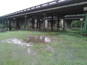
CATEGORIES: Bridge
LAYER: Bridge
OWNERSHIP: Public
ACCESS: No, PARKING: Free
WATER BODY: Withlacoochee River
MILE: 69.33
ADDRESS: 3850 N Valdosta Rd, Valdosta, GA 31602, Lowndes County.
DESCRIPTION: State highway bridge and northwest entrance to Valdosta from I-75 Exit 22.
AKA: Double Bridges (USGS), or US 41 Bridge, or GA 7 Bridge.
WEBSITE: https://wwals.net/2016/03/27/us-41-access-to-withlacoochee-river/
PHOTOSET: https://wwals.net/2016/03/27/us-41-access-to-withlacoochee-river/
PHOTO SOURCE: John S. Quarterman
PHONE NUMBER: (229) 242-0102
Suggestions: https://forms.gle/DipPgU2TP5atc2Rf9
Valdosta Gauge
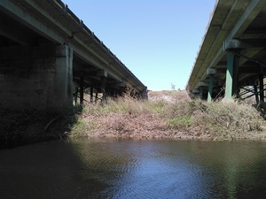
CATEGORIES: River Gauge
LAYER: River Gauge
GPS: 30.8925, -83.318889
OWNERSHIP: Public
WATER BODY: Withlacoochee River
Lowest boatable: 116′
Highest safe: 123′
GAUGE: Valdosta
MILE: 69.33
ADDRESS: 3850 N Valdosta Rd, Valdosta, GA 31602, Lowndes County.
DESCRIPTION: USGS 02317755
AKA: US 41 Gauge.
WEBSITE: https://wwals.net/2014/05/06/flooding-charts-2/#US-41
PHOTOSET: https://wwals.net/2014/05/06/flooding-charts-2/
PHOTO SOURCE: WWALS
PHONE NUMBER: (229) 242-0102
Suggestions: https://forms.gle/DipPgU2TP5atc2Rf9
Foxborough Lift Station
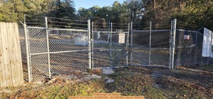
CATEGORIES: Liftstation
LAYER: Point of Interest
OWNERSHIP: Public, LOWNDES COUNTY, PARCEL 0073 041
WATER BODY: Withlacoochee River
MILE: 68.83
ADDRESS: Behind 4045 Foxborough Blvd., Valdosta, GA 31602, Lowndes County.
DESCRIPTION: A Lowndes County lift station near the southeast corner of the Foxborough subdivision in unincorporated Lowndes County, 760 feet from the Withlacoochee River, across from Langdale Park Boat Ramp.
WEBSITE: https://www.wwals.net/pictures/2026-01-18–wq/
PHOTO: https://www.wwals.net/pictures/2026-01-18–wq/20260118_170214.jpg
PHOTOSET: https://www.wwals.net/pictures/2026-01-18–wq/
PHOTO SOURCE: John S. Quarterman
PHONE NUMBER: (229) 242-0102
Suggestions: https://forms.gle/DipPgU2TP5atc2Rf9
Langdale Park
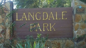
CATEGORIES: Public Land
LAYER: Hiking Trail
GPS: 30.8872, -83.314975
OWNERSHIP: Public
ACCESS: PARKING: Free, SHELTER, PICNIC AREA
WATER BODY: Withlacoochee River
MILE: 69.32
ADDRESS: 3781 N. Valdosta Rd., Valdosta, GA 31602, Lowndes County.
DESCRIPTION: “”Langdale Park is 178 acres of rustic beauty on the lazy Withlacoochee River. Miles of mountain bike trails zig zag through the South Georgia woods and wind around the lazy, picturesque river. Langdale Park offers fantastic nature viewing opportunities. You can spot deer, raccoons, opossums, and a variety of birds including birds of prey such as hawks, eagles, and owls. An array of indigenous plan life includes large oaks, poplars, river birch, pines, and sweet smelling wild honeysuckle and Carolina jasmine. The park features a boat ramp with river access as well as picnic tables and a picnic shelter that is available for rent through our main office.””
WEBSITE: http://vlpra.com/217/Langdale-Park
PHOTO: https://wwals.net/wp-content/themes/pianoblack/img//2017/11/64c3c24375acfc139537343606b305d2.jpg
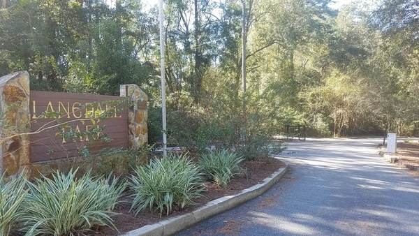
PHOTOSET: https://wwals.net/2017/11/24/langdale-park-open-2017-11-01/
PHOTO SOURCE: John S. Quarterman
PHONE NUMBER: (229) 242-0102
Suggestions: https://forms.gle/DipPgU2TP5atc2Rf9
Langdale Park Boat Ramp Upstream Deadfall

CATEGORIES: Deadfall
LAYER: Other
GPS: 30.88742, -83.3241
OWNERSHIP: Public
WATER BODY: Withlacoochee River
MILE: 68.82
ADDRESS: 3781 N. Valdosta Rd., Valdosta, GA 31602, Lowndes County.
DESCRIPTION: Just above the boat ramp, in the bottom of the river, only visible at low water.
WEBSITE: https://www.wwals.net/pictures/2024-09-04–wq/#LPBR
PHOTO: https://www.wwals.net/pictures/2024-09-04–wq/2024-09-05–langdale-other2-IMG_1605.jpg
PHOTOSET: https://www.wwals.net/pictures/2024-09-04–wq/
PHOTO SOURCE: Cindy Vedas
PHONE NUMBER: (850) 290-2350
Suggestions: https://forms.gle/DipPgU2TP5atc2Rf9
Langdale Park Boat Ramp
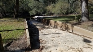
CATEGORIES: Landing
LAYER: Brochure
GPS: 30.88747, -83.32395
OWNERSHIP: Public, VLPRA
ACCESS: Yes, Ramp: Concrete at end of long dirt access road, PARKING: Free, SHELTER: For rent by VLPRA, PICNIC AREA
WATER BODY: Withlacoochee River
Lowest boatable: 116′
Highest safe: 123′
GAUGE: Valdosta
MILE: 68.81
ADDRESS: 3781 N. Valdosta Rd., Valdosta, GA 31602, downstream from the North Valdosta Road (US 41) Bridge. Lowndes County.
DESCRIPTION: Left bank. Except for the highways, a railroad, and downstream trash heaps on logjams, mostly you wouldn’t know you’re paddling next to the most populous city in the Suwannee River Basin, starting at this Valdosta-Lowndes County Parks & Rec. (VLPRA) Park. Downstream 6.7 miles around the Little River Confluence and up to Troupville Boat Ramp, also VLPRA. Or downstream 2.44 miles to Sugar Creek and 0.2 creek miles upstream to Salty Snapper Landing. Earliest, expect yellow jessamine, then wild native azaleas (Rhododendron canescens). In spring, see red maple and white Grancy Greybeard and dogwood. Year-round, see loblolly pines, live oaks, water oaks, cypress, river birch, willow, and Spanish moss.
WEBSITE: http://vlpra.com/217/Langdale-Park
ADDITIONAL INFO SOURCES: https://www.theswimguide.org/beach/9934
UPSTREAM: 10.95 miles from Langdale Park Boat Ramp to Franklinville Landing
DOWNSTREAM: 17.05 miles from Langdale Park Boat Ramp to US 84 Landing
PHOTO: https://wwals.net/wp-content/themes/pianoblack/img//2017/11/601cc8cde870315dc238ff6d8dd009da.jpg
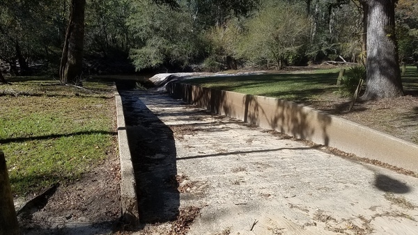
PHOTOSET: https://wwals.net/2017/11/24/langdale-park-open-2017-11-01/
PHOTO SOURCE: John S. Quarterman
PHONE NUMBER: (229) 242-0102
PHOTO2: https://wwals.net/pictures/2020-09-26–drafts-metal-signs/Langdale-Park-Boat-Ramp-Sign-0001.jpg
Photoset2: https://wwals.net/pictures/2020-09-26–drafts-metal-signs/
PHOTO2 SOURCE: WWALS
Photo2 Phone Number: 850-290-2350
Suggestions: https://forms.gle/DipPgU2TP5atc2Rf9

Langdale Park Boat Ramp Deadfall
CATEGORIES: Deadfall
LAYER: Other
GPS: 30.88722, -83.32389
OWNERSHIP: Public
WATER BODY: Withlacoochee River
MILE: 68.80
ADDRESS: 3781 N. Valdosta Rd., Valdosta, GA 31602, Lowndes County.
DESCRIPTION: Oak tree deadfall blocking the width of the river prevents upstream paddle.
GRN: No
PHOTO SOURCE: Aaron Sirmons
PHONE NUMBER: (478) 308-1777
Suggestions: https://forms.gle/DipPgU2TP5atc2Rf9
Last Deadfall of 2025-07-22

CATEGORIES: Deadfall
LAYER: Other
OWNERSHIP: Public
WATER BODY: Withlacoochee River
MILE: 68.49
ADDRESS: Lowndes County.
DESCRIPTION: Multiple trees pilled across the river.
PHOTO: https://www.wwals.net/pictures/2025-07-22–chainsaw-langdale-park-pictures/20250722_121207.jpg
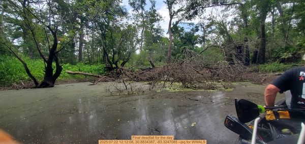
PHOTOSET: https://www.wwals.net/pictures/2025-07-22–chainsaw-langdale-park-pictures/
PHOTO SOURCE: John S. Quarterman
PHONE NUMBER: (229) 242-0102
Suggestions: https://forms.gle/DipPgU2TP5atc2Rf9
Hairpin Turn Deadfall
CATEGORIES: Deadfall
LAYER: Other
OWNERSHIP: Public
WATER BODY: Withlacoochee River
MILE: 68.30
ADDRESS: Lowndes County.
DESCRIPTION: Oak tree deadfall. Had to break up limbs to get through.
PHOTO SOURCE: Aaron Sirmons
PHONE NUMBER: (478) 308-1777
Suggestions: https://forms.gle/DipPgU2TP5atc2Rf9
Tire Pile
CATEGORIES: Point Of Interest
LAYER: Other
OWNERSHIP: Private
WATER BODY: Withlacoochee River
MILE: 68.16
ADDRESS: Lowndes County.
DESCRIPTION: Pile of tires stacked neatly about 25 yards from rivers edge
PHOTO SOURCE: Aaron Sirmons
PHONE NUMBER: (478) 308-1777
Suggestions: https://forms.gle/DipPgU2TP5atc2Rf9
Briggs Street Bridge

CATEGORIES: Bridge
LAYER: Bridge
OWNERSHIP: Public
WATER BODY: Three Mile Branch
MILE: 1.82
ADDRESS: NW side of Winn-Dixie parking lot, between North Valdosta Road and Smithbriar Drive, Lowndes County.
DESCRIPTION: Twin concrete box culverts under a city street around a grocery store parking lot, with two fast food outlets.
WEBSITE: https://www.wwals.net/pictures/2022-02-14–valdosta-creeks/#Briggs-Street-Culvert-Three-Mile-Branch
OTHER REFERENCE: https://wwals.net/2022/02/13/trash-on-threemile-branch-at-country-club-road-valdosta-ga-2022-02-13/
PHOTO: https://www.wwals.net/pictures/2022-02-14–valdosta-creeks/20220214_172459.jpg
PHOTOSET: https://www.wwals.net/pictures/2022-02-14–valdosta-creeks/#Briggs-Street-Culvert-Three-Mile-Branch
PHOTO SOURCE: John S. Quarterman
PHONE NUMBER: (229) 242-0102
Suggestions: https://forms.gle/DipPgU2TP5atc2Rf9
Castle Creek Place Bridge

CATEGORIES: Bridge
LAYER: Bridge
OWNERSHIP: Public
WATER BODY: Three Mile Branch
MILE: 1.68
ADDRESS: 2 Castle Creek Place, Valdosta, GA, between the Dollar General on North Valdosta Road and Pine Point Circle, Lowndes County.
DESCRIPTION: Triple round concrete culverts under a city street through a residential area, behind a commercial area on a major thoroughfare.
OTHER REFERENCE: https://wwals.net/2022/02/13/trash-on-threemile-branch-at-country-club-road-valdosta-ga-2022-02-13/
PHOTO: https://www.wwals.net/pictures/2022-02-14–valdosta-creeks/20220214_173038.jpg
PHOTOSET: https://www.wwals.net/pictures/2022-02-14–valdosta-creeks/
PHOTO SOURCE: John S. Quarterman
PHONE NUMBER: (229) 242-0102
Suggestions: https://forms.gle/DipPgU2TP5atc2Rf9
Country Club Drive Bridge

CATEGORIES: Bridge
LAYER: Bridge
OWNERSHIP: Public
WATER BODY: Three Mile Branch
MILE: 1.11
ADDRESS: 3111 Country Club Drive, Valdosta, GA, between Northwood Park Drive and Ramblewood Circle. Lowndes County.
DESCRIPTION: A concrete box culvert under a busy city street through a residential area, downhill from a major thoroughfare (North Valdosta Road).
WEBSITE: https://wwals.net/2022/02/13/trash-on-threemile-branch-at-country-club-road-valdosta-ga-2022-02-13/
OTHER REFERENCE: https://www.google.com/maps/@30.8758918, -83.2943913, 3a, 90y, 52.2h, 52.44t/data=!3m6!1e1!3m4!1sLMHdgFgXQMzEGpOv_pBZKw!2e0!7i16384!8i8192
PHOTO: https://www.wwals.net/pictures/2022-02-13–threemile-branch-trash/country-club-road.jpg
PHOTOSET: https://www.wwals.net/pictures/2022-02-13–threemile-branch-trash/
PHOTO SOURCE: Bobby McKenzie
PHONE NUMBER: (850) 290-2350
PHOTO2: https://www.wwals.net/pictures/2022-02-13–threemile-branch-trash/country-club-drive-bridge.jpg
Photoset2: https://www.wwals.net/pictures/2022-02-13–threemile-branch-trash/
PHOTO2 SOURCE: Google Streetview
Suggestions: https://forms.gle/DipPgU2TP5atc2Rf9

Williamsburg Drive Sewage Spill

CATEGORIES: Spill
LAYER: Point of Interest
OWNERSHIP: Public
WATER BODY: Three Mile Branch
MILE: 0.71
ADDRESS: 1019 Williamsburg Drive, Valdosta, GA 31602, Lowndes County.
DESCRIPTION: A 100, 000-gallon sewage spill (ten times major spill) from a manhole ‘on the backside of Williamsburg Drive’ into a ditch, past 213 (actually 215) Knob Hill Drive, into Three Mile Branch, through Langdale Park, to the Withlacoochee River, starting about January 10, 2024, ending 12:30 AM, January 12, 2024.
HISTORIC FACTS: A ten times major sewage spill, January 10-12, 2024. https://wwals.net/2024/01/13/valdosta-sewage-spill-three-mile-branch-withlacoochee-river-2024-01-10/
AKA: Knob Hill Road Valdosta Sewage Spill
WEBSITE: https://wwals.net/2024/01/13/valdosta-sewage-spill-three-mile-branch-withlacoochee-river-2024-01-10
PHOTOSET: https://www.wwals.net/pictures/2024-01-10–valdosta-sewage-spill-three-mile-branch/
PHOTO SOURCE: Google Streetview
PHONE NUMBER: (850) 290-2350
Photoset2: https://www.wwals.net/pictures/2024-01-10–valdosta-sewage-spill-three-mile-branch/
PHOTO2 SOURCE: VALORGIS
Suggestions: https://forms.gle/DipPgU2TP5atc2Rf9

Three Mile Branch

CATEGORIES: Tributary
LAYER: Other
OWNERSHIP: Public, VLPRA, PARCEL 0076C 025
ACCESS: No
WATER BODY: Withlacoochee River
MILE: 67.63
ADDRESS: A little more than a mile downstream from Langdale Park Boat Ramp is the confluence with Withlacoochee River in south edge of Langdale Park, Lowndes County.
DESCRIPTION: There is a river overlook here, on a path paralleling the creek, and another overlook slightly downstream at the end of Langdale Park Trail A. Three Mile Branch comes down across Countryh Club Drive as it drains the mostly-empty Five Points shopping center and much of North Valdosta Road.
OTHER REFERENCE: https://www.valdostacity.com/sites/default/files/uploads/depts/engineering/stormwater-mgmt-plan/three-mile-branch.pdf
PHOTO: https://www.wwals.net/pictures/2022-02-13–threemile-branch-trash/three-mile-branch-0003.jpg
PHOTOSET: https://www.wwals.net/pictures/2022-02-13–threemile-branch-trash/
PHOTO SOURCE: Valdosta Stormwater Divison
PHONE NUMBER: (229) 259-3530
PHOTO2: https://www.wwals.net/pictures/2022-02-13–threemile-branch-trash/three-mile-branch-0004.jpg
Photoset2: https://www.wwals.net/pictures/2022-02-13–threemile-branch-trash/
PHOTO2 SOURCE: Valdosta Stormwater Division
Photo2 Phone Number: (229) 259-3530
Suggestions: https://forms.gle/DipPgU2TP5atc2Rf9

South end of Langdale Park
CATEGORIES: Point Of Interest
LAYER: Other
GPS: 30.87529971, -83.32491778
OWNERSHIP: Public, VLPRA, PARCEL 0076C 025
WATER BODY: Withlacoochee River
MILE: 67.49
ADDRESS: There is a river overlook here, on a path paralleling the creek, and another overlook slightly downstream at the end of Langdale Park Trail A. Three Mile Branch comes down across Country Club Drive as it drains the mostly-empty Five Points shopping center and much of North Valdosta Road. Lowndes County.
DESCRIPTION: Private land from here downstream for many miles.
Suggestions: https://forms.gle/DipPgU2TP5atc2Rf9
Taylor-Cowart Park

CATEGORIES: Public Land
LAYER: Other
GPS: 30.8695, -83.278
OWNERSHIP: Public
WATER BODY: Two Mile Branch
MILE: 2.80
ADDRESS: 2413 Bemiss Road, Valdosta, GA 31602, Lowndes County.
DESCRIPTION: “”2.44 acres … under large shady oak and poplar trees. The park boasts a playground structure with separate swing set, gazebo and merry go round. There are several picnic tables within the park as well as a small picnic shelter that is available for rent through our main office.””
WEBSITE: https://vlpra.com/227/Taylor-Cowart-Park
PHOTO: https://www.wwals.net/pictures/2022-02-14–valdosta-creeks/20220214_170231.jpg
PHOTOSET: https://www.wwals.net/pictures/2022-02-14–valdosta-creeks/#TaylorCowart-Park
PHOTO SOURCE: John S. Quarterman
PHONE NUMBER: (229) 242-0102
Suggestions: https://forms.gle/DipPgU2TP5atc2Rf9
Bemiss Road Two Mile Branch Bridge

CATEGORIES: Bridge
LAYER: Bridge
GPS: 30.86963, -83.2786
OWNERSHIP: Public
WATER BODY: Two Mile Branch
MILE: 2.79
ADDRESS: 2465 Bemiss Road, Valdosta, GA 31602, between Habersham Road and Randolph Street. Lowndes County.
DESCRIPTION: Twin box culverts over Two Mile Branch.
WEBSITE: https://www.wwals.net/pictures/2022-02-14–valdosta-creeks/#Bemiss-Road-Bridge-Two-Mile-Branch
PHOTO: https://www.wwals.net/pictures/2022-02-14–valdosta-creeks/20220214_170310.jpg
PHOTOSET: https://www.wwals.net/pictures/2022-02-14–valdosta-creeks/
PHOTO SOURCE: John S. Quarterman
PHONE NUMBER: (229) 242-0102
Suggestions: https://forms.gle/DipPgU2TP5atc2Rf9
Seymour Street Bridge

CATEGORIES: Bridge
LAYER: Bridge
OWNERSHIP: Public
WATER BODY: Two Mile Branch
MILE: 2.70
ADDRESS: 2508 Seymour Street, Valdosta, GA 31602. Lowndes County.
DESCRIPTION: Three-span concrete box culvert over Two Mile Branch.
WEBSITE: https://www.wwals.net/pictures/2022-02-14–valdosta-creeks/#Seymour-Street-Bridge
PHOTO: https://www.wwals.net/pictures/2022-02-14–valdosta-creeks/20220214_164021.jpg
PHOTOSET: https://www.wwals.net/pictures/2022-02-14–valdosta-creeks/
PHOTO SOURCE: John S. Quarterman
PHONE NUMBER: (229) 242-0102
Suggestions: https://forms.gle/DipPgU2TP5atc2Rf9
University Drive Bridge

CATEGORIES: Bridge
LAYER: Bridge
OWNERSHIP: Public
WATER BODY: Two Mile Branch
MILE: 2.38
ADDRESS: 2510 University Drive, Valdosta, GA 31602. Lowndes County.
DESCRIPTION: Three-span concrete box culvert over Two Mile Branch.
WEBSITE: https://www.wwals.net/pictures/2022-02-14–valdosta-creeks/#University-Drive-Bridge-Two-Mile-Branch
PHOTO: https://www.wwals.net/pictures/2022-02-14–valdosta-creeks/20220214_163331.jpg
PHOTOSET: https://www.wwals.net/pictures/2022-02-14–valdosta-creeks/
PHOTO SOURCE: John S. Quarterman
PHONE NUMBER: (229) 242-0102
Suggestions: https://forms.gle/DipPgU2TP5atc2Rf9
Ashley Street Two Mile Branch Bridge

CATEGORIES: Bridge
LAYER: Bridge
OWNERSHIP: Public
WATER BODY: Two Mile Branch
MILE: 2.24
ADDRESS: 2615 N. Ashley Street, Valdosta, GA 31602, between Northside Drive and Emory Street. Lowndes County.
DESCRIPTION: Concrete box culvert over Two Mile Branch.
WEBSITE: https://www.wwals.net/pictures/2022-02-14–valdosta-creeks/#Ashley-Street-Bridge-Two-Mile-Branch
PHOTO: https://www.wwals.net/pictures/2022-02-14–valdosta-creeks/20220214_162609.jpg
PHOTOSET: https://www.wwals.net/pictures/2022-02-14–valdosta-creeks/
PHOTO SOURCE: John S. Quarterman
PHONE NUMBER: (229) 242-0102
Suggestions: https://forms.gle/DipPgU2TP5atc2Rf9
Chesley Sharpe Memorial Bridge

CATEGORIES: Bridge
LAYER: Bridge
OWNERSHIP: Public, University System of Georgia Board of Regents, PARCEL 0111D 120
WATER BODY: Two Mile Branch
MILE: 2.09
ADDRESS: North of Pendleton Drive in VSU North Campus. Lowndes County.
DESCRIPTION: A footbridge over One Mile Branch. The C.B. Sharpe Memorial Bridge, In memory of Miss Chesley Bostwick Sharpe, Class of 1930, whose family has established the C.B. Sharpe Memorial Fund for Campus Beautification, 1985
WEBSITE: https://www.mytopo.com/locations/index.cfm?fid=346216
PHOTOSET: https://commons.wikimedia.org/wiki/File:C.B._Sharpe_Memorial_Bridge_Plaque.JPG
PHOTO SOURCE: Michael Rivera
PHONE NUMBER: (850) 290-2350
Suggestions: https://forms.gle/DipPgU2TP5atc2Rf9
N Patterson Street Bridge
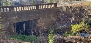
CATEGORIES: Bridge
LAYER: Bridge
OWNERSHIP: Public
WATER BODY: Two Mile Branch
MILE: 2.05
ADDRESS: N Patterson Street, Valdosta, GA 31602, between Burton Street and Roosevelt Drive. Lowndes County.
DESCRIPTION: Concrete box culvert over Two Mile Branch.
WEBSITE: https://www.wwals.net/pictures/2022-02-14–valdosta-creeks/#Patterson-Street-Bridge-Two-Mile-Branch
PHOTO: https://www.wwals.net/pictures/2022-02-14–valdosta-creeks/20220214_161627.jpg
PHOTOSET: https://www.wwals.net/pictures/2022-02-14–valdosta-creeks/
PHOTO SOURCE: John S. Quarterman
PHONE NUMBER: (229) 242-0102
Suggestions: https://forms.gle/DipPgU2TP5atc2Rf9
N Patterson Twomile Branch Spill
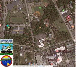
CATEGORIES: Spill
LAYER: Point of Interest
OWNERSHIP: Public
WATER BODY: Two Mile Branch
MILE: 2.03
ADDRESS: “2400 block of North Patterson Street”” Valdosta, GA 31602, Lowndes County.
DESCRIPTION: 200 gallons of raw sewage spilled into Towmile Branch, according to GA-EPD Sewer Spills Report.
PHOTO: https://wwals.net/pictures/2020-02-10–vld-fog-spill-patterson-st/2020-02-10–map-fog-spill.jpg
PHOTOSET: https://wwals.net/pictures/2020-02-10–vld-fog-spill-patterson-st/
PHOTO SOURCE: John S. Quarterman
PHONE NUMBER: (229) 242-0102
Suggestions: https://forms.gle/DipPgU2TP5atc2Rf9
McKey Park

CATEGORIES: Public Land
LAYER: Hiking Trail
OWNERSHIP: Public
WATER BODY: Two Mile Branch
MILE: 1.90
ADDRESS: 112 Burton Ave., Valdosta, GA 31602, Lowndes County.
DESCRIPTION: Tennis and playgrounds.
WEBSITE: http://vlpra.com/201/McKey-Park-HBA-Tennis-Center
PHOTOSET: https://commons.wikimedia.org/wiki/File:McKey_Park_(Valdosta, _Georgia)_2.jpg
PHOTO SOURCE: Michael Rivera
PHONE NUMBER: (850) 290-2350
Suggestions: https://forms.gle/DipPgU2TP5atc2Rf9
N Oak Street Bridge

CATEGORIES: Bridge
LAYER: Bridge
GPS: 30.8635, -83.2923
OWNERSHIP: Public
WATER BODY: Two Mile Branch
MILE: 1.80
ADDRESS: N Oak St., Valdosta, GA 31602, between Canna Drive and Roosevelt Drive. Lowndes County.
DESCRIPTION: 27.9-foot 3-span concrete culvert over Two Mile Branch, built in 1998.
WEBSITE: https://bridgereports.com/1099544
PHOTO: https://www.wwals.net/pictures/2022-02-14–valdosta-creeks/20220214_161006.jpg
PHOTOSET: https://www.wwals.net/pictures/2022-02-14–valdosta-creeks/
PHOTO SOURCE: John S. Quarterman
PHONE NUMBER: (229) 242-0102
PHOTO2: https://www.wwals.net/pictures/2022-02-14–valdosta-creeks/20220214_160958.jpg
Photoset2: https://www.wwals.net/pictures/2022-02-14–valdosta-creeks/
PHOTO2 SOURCE: John S. Quarterman
Photo2 Phone Number: 229-242-0102
Suggestions: https://forms.gle/DipPgU2TP5atc2Rf9

Newbern Park
CATEGORIES: Public Land
LAYER: Point of Interest
OWNERSHIP: Public
WATER BODY: Two Mile Branch
MILE: 1.50
ADDRESS: 2211 Newbern St., Valdosta, GA 31602, Lowndes County.
DESCRIPTION: “”Newbern Park is a half-acre neighborhood park featuring open space and a baseball backstop. It is ideal for recreational youth or adult sports and can be reserved through our main office.””
WEBSITE: http://vlpra.com/220/Newbern-Park
PHOTO: http://vlpra.com/ImageRepository/Document?documentID=519
PHOTOSET: http://vlpra.com/220/Newbern-Park
PHOTO SOURCE: VLPRA
PHONE NUMBER: (229) 259-3507
Suggestions: https://forms.gle/DipPgU2TP5atc2Rf9
Loganberry Circle Spill

CATEGORIES: Spill
LAYER: Point of Interest
OWNERSHIP: Private
WATER BODY: Two Mile Branch
MILE: 1.23
ADDRESS: Between Loganberry Circle and White Oak Drive, Valdosta, GA 31602, Lowndes County.
DESCRIPTION: In a house yard, which apparently drains to a ditch which seems to go north across Gornto Road into Twomile Branch.
HISTORIC FACTS: Sewage spill. City of Valdosta put lime on it, but did not list it among the sewage spills of 2021-07-07 during Tropical Storm Elsa.
WEBSITE: https://wwals.net/pictures/2021-07-08–sewage-spills-valdosta-starke
PHOTOSET: https://wwals.net/pictures/2021-07-08–sewage-spills-valdosta-starke
PHOTO SOURCE: Phillip Williams
PHONE NUMBER: (850) 290-2350
Suggestions: https://forms.gle/DipPgU2TP5atc2Rf9
800 Gornto Road Spill
CATEGORIES: Spill
LAYER: Point of Interest
OWNERSHIP: Public
WATER BODY: Two Mile Branch
MILE: 1.23
ADDRESS: 800 Block of Gornto Road, Valdosta, GA 31602, Lowndes County.
DESCRIPTION: Apparently in front of St. Johns Catholic Church, slightly uphill from Twomile Branch.
HISTORIC FACTS: Sewage spill, “”800 Block of Gornto Road = 43, 350 gallons”” July 7, 2021 during Tropical Storm Elsa.
WEBSITE: https://wwals.net/pictures/2021-07-08–sewage-spills-valdosta-starke
PHOTOSET: https://wwals.net/pictures/2021-07-08–sewage-spills-valdosta-starke
Suggestions: https://forms.gle/DipPgU2TP5atc2Rf9
Berkley Drive Bridge

CATEGORIES: Bridge
LAYER: Bridge
OWNERSHIP: Public
WATER BODY: Two Mile Branch
MILE: 1.15
ADDRESS: Berkley Drive, Valdosta, GA 31602, between Millpond Road and Howell Brook Drive. Lowndes County.
DESCRIPTION: 29.9-foot 3-span concrete culvert bridge over Two Mile Branch, built 1999.
WEBSITE: https://bridgereports.com/1099549
PHOTO: https://www.wwals.net/pictures/2022-02-14–valdosta-creeks/20220214_160253.jpg
PHOTOSET: https://www.wwals.net/pictures/2022-02-14–valdosta-creeks/
PHOTO SOURCE: John S. Quarterman
PHONE NUMBER: (229) 242-0102
Suggestions: https://forms.gle/DipPgU2TP5atc2Rf9
Berkley Drive Lift Station
CATEGORIES: Liftstation
LAYER: Point of Interest
GPS: 30.8625, -83.30199
OWNERSHIP: Public, VALDOSTA CITY OF, PARCEL 0113A 008A
WATER BODY: Two Mile Branch
MILE: 1.15
ADDRESS: West side of Berkley Drive, just south of Two Mile Branch. Lowndes County.
DESCRIPTION: 200 SQUARE FOOT LL 34 LD 11 PUMP STATION
Suggestions: https://forms.gle/DipPgU2TP5atc2Rf9
2700 Berkley Drive Spill *
CATEGORIES: Spill
LAYER: Point of Interest
OWNERSHIP: Lowndes, PARCEL GA
ACCESS: Two Mile Branch, TYPE OF LAUNCH, DOCK: “Sewage spill, “”2700 Block of Berkley Dr. = 2, 182 gallons”” July 7, 2021 during Tropical Storm Elsa. CANOE: Public
MILE: 1.13
ADDRESS: “”2700 Block of Berkley Dr.”
DESCRIPTION: GA 31602, * https://wwals.net/pictures/2021-07-08–sewage-spills-valdosta-starke
WEBSITE: Valdosta
OTHER REFERENCE: Slightly north of Twomile Branch. But was the spill really in the middle of the intersection with Millpond Road?
Suggestions: https://forms.gle/DipPgU2TP5atc2Rf9
817 Gornto Road Spill
CATEGORIES: Spill
LAYER: Point of Interest
OWNERSHIP: Public
WATER BODY: Two Mile Branch
MILE: 0.98
ADDRESS: 817 Gornto Road, Valdosta, GA 31602, Lowndes County.
DESCRIPTION: Site of a 60, 000 gallon sewage spill into Two Mile Branch on April 11, 2024.
WEBSITE: https://wwals.net/?p=64677
Suggestions: https://forms.gle/DipPgU2TP5atc2Rf9
Joree Millpond Dam

CATEGORIES: Dam
LAYER: Point of Interest
GPS: 30.8664, -83.30985
OWNERSHIP: Public
WATER BODY: Two Mile Branch
MILE: 0.63
ADDRESS: Jerry Jones Road, Valdosta, GA 31602, between Lake Drive and Westwood Drive. Lowndes County.
DESCRIPTION: Earthen dam with spillway from pond owned by City of Valdosta on Two Mile Branch.
WEBSITE: https://nationaldams.com/dams/lake-joree-millpond-dam-3g86r93
PHOTO: https://www.wwals.net/pictures/2020-07-28–wq/20200728_162534.jpg
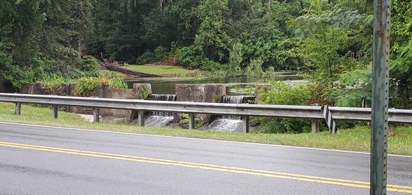
PHOTOSET: https://www.wwals.net/pictures/2020-07-28–wq/
PHOTO SOURCE: John S. Quarterman
PHONE NUMBER: (229) 242-0102
Suggestions: https://forms.gle/DipPgU2TP5atc2Rf9
Jerry Jones Road Bridge

CATEGORIES: Bridge
LAYER: Bridge
OWNERSHIP: Public
WATER BODY: Two Mile Branch
MILE: 0.62
ADDRESS: Jerry Jones Road, Valdosta, GA 31602, between Lake Drive and Westwood Drive. Lowndes County.
DESCRIPTION: Drains Joree Millpond. 25.9-foot three-span concrete culvert bridge built 1981, rebuilt 2003.
WEBSITE: https://bridgereports.com/1099496
PHOTO: https://www.wwals.net/pictures/2020-07-28–wq/20200728_162510.jpg
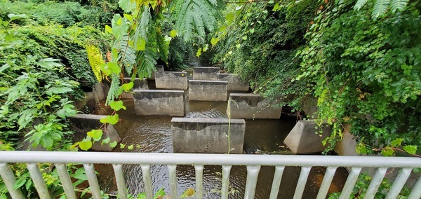
PHOTOSET: https://www.wwals.net/pictures/2020-07-28–wq/
PHOTO SOURCE: John S. Quarterman
PHONE NUMBER: (229) 242-0102
Suggestions: https://forms.gle/DipPgU2TP5atc2Rf9
Meadowbrook Drive Spill
CATEGORIES: Spill
LAYER: Point of Interest
OWNERSHIP: Public
WATER BODY: Two Mile Branch
MILE: 0.30
ADDRESS: 2426 Meadowbrook Dr, Valdosta, GA 31602, Lowndes County.
DESCRIPTION: Site of a 2, 000-gallon sewage spill into Two Mile Branch, starting 2024-11-26, that required additional personnel and equipment to fix.
OTHER REFERENCE: https://wwals.net/2024/12/02/valdosta-sewage-spill-meadowbrook-drive-two-mile-branch-2024-11-26/
Suggestions: https://forms.gle/DipPgU2TP5atc2Rf9
Two Mile Branch

CATEGORIES: Tributary
LAYER: Other
OWNERSHIP: Private, Estate of Georgia B. Eager, PARCEL 0078C 022
ACCESS: No
WATER BODY: Sugar Creek
MILE: 0.22
ADDRESS: Confluence with Sugar Creek north of Meadowbrook Drive, Lowndes County.
DESCRIPTION: Comes down from Ashley Street with its fast food stores, through Joree Millpond. This is the current location of the Twomile Branch Confluence, north of where USGS says it is.
HISTORIC FACTS: Infamous for flooding local houses, esp. in 2009.
AKA: Twomile Branch
PHOTO: https://www.wwals.net/pictures/2022-01-30–sugar-creek-boom2/20220130_163303.jpg
PHOTOSET: https://www.wwals.net/pictures/2022-01-30–sugar-creek-boom2/
PHOTO SOURCE: John S. Quarterman
PHONE NUMBER: (229) 242-0102
PHOTO2: https://www.wwals.net/pictures/2024-12-26–wq/2024-12-26–watergoat-other-20241226_173525.jpg
Photoset2: https://www.wwals.net/pictures/2024-12-26–wq/#WG
PHOTO2 SOURCE: John S. Quarterman
Photo2 Phone Number: 229-242-0102
Suggestions: https://forms.gle/DipPgU2TP5atc2Rf9

Old Two Mile Branch

CATEGORIES: Tributary
LAYER: Point of Interest
GPS: 30.861825, -83.3181
OWNERSHIP: Private, INGET RONALD PAUL, PARCEL 0080A 044
ACCESS: No
WATER BODY: Sugar Creek
MILE: 0.26
ADDRESS: Old Confluence with Sugar Creek north of Meadowbrook Drive, Lowndes County.
DESCRIPTION: USGS shows Sugar Creek coming down here.
HISTORIC FACTS: Apparently decades ago Twomile Branch used to come through here. High water still also runs through here in addition to the current Confluence with Sugar Creek.
AKA: Old Twomile Branch
WEBSITE: https://www.wwals.net/pictures/2022-01-30–sugar-creek-boom2/
PHOTO: https://www.wwals.net/pictures/2022-01-30–sugar-creek-boom2/20220130_163204.jpg
PHOTOSET: https://www.wwals.net/pictures/2022-01-30–sugar-creek-boom2/
PHOTO SOURCE: John S. Quarterman
PHONE NUMBER: (229) 242-0102
Suggestions: https://forms.gle/DipPgU2TP5atc2Rf9
Baytree Road Bridge
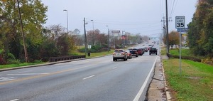
CATEGORIES: Bridge
LAYER: Bridge
OWNERSHIP: Public
WATER BODY: Sugar Creek
MILE: 1.39
ADDRESS: 1492 Baytree Road, Valdosta, GA 31602, Lowndes County.
DESCRIPTION: Small bridge over Sugar Creek, on a busy city street, built in 1974.
WEBSITE: https://www.google.com/maps/place/1492+Baytree+Rd, +Valdosta, +GA+31602/@30.8475193, -83.3149023, 163m/data=!3m1!1e3!4m5!3m4!1s0x88ee66ed27d300a7:0xc58c9d4627bca4c9!8m2!3d30.8475987!4d-83.314158
PHOTO: https://wwals.net/pictures/2019-12-13–vld-warning-signs/20191213_135356.jpg
PHOTOSET: https://www.google.com/maps/place/1492+Baytree+Rd, +Valdosta, +GA+31602/@30.8475193, -83.3149023, 163m/data=!3m1!1e3!4m5!3m4!1s0x88ee66ed27d300a7:0xc58c9d4627bca4c9!8m2!3d30.8475987!4d-83.314158
PHOTO SOURCE: John S. Quarterman
PHONE NUMBER: (229) 242-0102
PHOTO2: https://www.wwals.net/pictures/2025-01-02–wq/20250102_121713.jpg
Photoset2: https://www.wwals.net/pictures/2025-01-02–wq/#BR
PHOTO2 SOURCE: John S. Quarterman
Photo2 Phone Number: 229-242-0102
Suggestions: https://forms.gle/DipPgU2TP5atc2Rf9

Spring Creek Circle Sewer Line

CATEGORIES: Point Of Interest
LAYER: Point of Interest
GPS: 30.848765, -83.3139
OWNERSHIP: Public
WATER BODY: Sugar Creek
MILE: 1.26
ADDRESS: Downstream (south) of Baytree Road, east of Spring Creek Circle. Lowndes County.
DESCRIPTION: A sewer line that crosses Sugar Creek. Visible from the access road on the west side of the Norfolk Southern Railroad.
WEBSITE: https://www.wwals.net/pictures/2025-01-02–wq/#SCCSL
PHOTO: https://www.wwals.net/pictures/2025-01-02–wq/20250102_122732.jpg
PHOTOSET: https://www.wwals.net/pictures/2025-01-02–wq/#SCCSL
PHOTO SOURCE: John S. Quarterman
PHONE NUMBER: (229) 242-0102
Suggestions: https://forms.gle/DipPgU2TP5atc2Rf9
Westbrook Circle Sewer Line

CATEGORIES: Point Of Interest
LAYER: Point of Interest
GPS: 30.85045, -83.31443
OWNERSHIP: Public
WATER BODY: Sugar Creek
MILE: 1.13
ADDRESS: Downstream (south) of Baytree Road, east of Westbrook Circle. Lowndes County.
DESCRIPTION: A second sewer line that crosses Sugar Creek. Visible from the access road on the west side of the Norfolk Southern Railroad.
WEBSITE: https://www.wwals.net/pictures/2025-01-02–wq/#WCSL
PHOTO: https://www.wwals.net/pictures/2025-01-02–wq/20250102_131017.jpg
PHOTOSET: https://www.wwals.net/pictures/2025-01-02–wq/#WCSL
PHOTO SOURCE: John S. Quarterman
PHONE NUMBER: (229) 242-0102
Suggestions: https://forms.gle/DipPgU2TP5atc2Rf9
Westbrook Circle Sewer Spill
CATEGORIES: Spill
LAYER: Point of Interest
GPS: 30.85046, -83.31452
OWNERSHIP: Public
WATER BODY: Sugar Creek
MILE: 1.13
ADDRESS: Downstream (south) of Baytree Road, east of Westbrook Circle. Lowndes County.
DESCRIPTION: Valdosta Utilities reported 2025-11-20: On Wednesday, November 19, 2025, at approximately 1:30 PM, members of the City of Valdosta Utilities Department’s Environmental Services Watershed Team discovered a sanitary sewer overflow (SSO) occurring along Sugar Creek during routine monitoring activities. Personnel observed that an 8-inch sanitary sewer line had been damaged and was actively discharging into the creek. Utilities Director Jason Barnes was immediately notified, and a contracted response crew was dispatched to investigate. Crews were able to install a patch on the damaged line by approximately 2:30 PM. Current estimates indicate that between 1, 000 and 1, 500 gallons of wastewater entered Sugar Creek.
Suggestions: https://forms.gle/DipPgU2TP5atc2Rf9
Valdosta Sewer Pipe Shoals
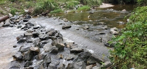
CATEGORIES: Shoal
LAYER: Other
GPS: 30.852028, -83.31483
OWNERSHIP: Public
WHITEWATER CLASS: Class I
WATER BODY: Sugar Creek
MILE: 1.02
ADDRESS: Just upstream from NSF RR Bridge. Lowndes County.
DESCRIPTION: A Valdosta sewer main forming a shoal in Sugar Creek.
WEBSITE: https://wwals.net/pictures/2021-07-10–sugar-creek-cleanup/20210710_102013.html
PHOTO: https://wwals.net/pictures/2021-07-10–sugar-creek-cleanup/20210710_102013.jpg
PHOTOSET: https://wwals.net/pictures/2021-07-10–sugar-creek-cleanup/
PHOTO SOURCE: John S. Quarterman
PHONE NUMBER: (229) 242-0102
PHOTO2: https://www.wwals.net/pictures/2025-01-02–wq/20250102_123909.jpg
Photoset2: https://www.wwals.net/pictures/2025-01-02–wq/#RRSL
PHOTO2 SOURCE: John S. Quarterman
Photo2 Phone Number: 229-242-0102
Suggestions: https://forms.gle/DipPgU2TP5atc2Rf9

NSFRR Sugar Creek Bridge
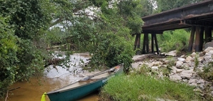
CATEGORIES: Railbridge
LAYER: Bridge
GPS: 30.85214, -83.31481
OWNERSHIP: Private
WATER BODY: Sugar Creek
MILE: 1.01
ADDRESS: East beyond Oakdale Drive and southwest behind Bland Park. Lowndes County.
DESCRIPTION: Norfolk Southern Railroad bridge over Sugar Creek.
AKA: Sugar Creek Railroad Trestle
WEBSITE: https://wwals.net/pictures/2021-07-10–sugar-creek-cleanup/
OTHER REFERENCE: https://www.valdostacity.com/engineering/stormwater-division/master-stormwater-management-plan
PHOTO: https://wwals.net/pictures/2021-07-10–sugar-creek-cleanup/20210710_101321.jpg
PHOTOSET: https://wwals.net/pictures/2021-07-10–sugar-creek-cleanup/
PHOTO SOURCE: John S. Quarterman
PHONE NUMBER: (229) 242-0102
Suggestions: https://forms.gle/DipPgU2TP5atc2Rf9
NSFRR Sugar Creek Logjam
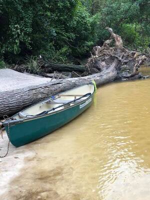
CATEGORIES: Deadfall
LAYER: Point of Interest
GPS: 30.8522, -83.3147
OWNERSHIP: Public
WATER BODY: Sugar Creek
MILE: 1.00
ADDRESS: Just below the NSF RR Bridge. Lowndes County.
DESCRIPTION: A two-foot diameter oak down across Sugar Creek.
WEBSITE: https://wwals.net/pictures/2021-07-10–sugar-creek-cleanup/rm-suwrk-canoe-creek.html
PHOTO: https://wwals.net/pictures/2021-07-10–sugar-creek-cleanup/rm-suwrk-canoe-creek.jpg
PHOTOSET: https://wwals.net/pictures/2021-07-10–sugar-creek-cleanup/
PHOTO SOURCE: Russell Allen McBride
PHONE NUMBER: (850) 290-2350
Suggestions: https://forms.gle/DipPgU2TP5atc2Rf9
Sherwood Drive feeder creek to Sugar Creek

CATEGORIES: Point Of Interest
LAYER: Point of Interest
GPS: 30.85259, -83.31505
OWNERSHIP: Public, NSF RR
WATER BODY: Sugar Creek
MILE: 0.98
ADDRESS: West of the NSF RR Bridge, Past Oakdale Drive across Sherwood Drive. Lowndes County.
DESCRIPTION: A side creek across a Valdosta Sewer main, with bad odor and color, into left bank of Sugar Creek.
AKA: Valdosta Sewer Main Possible Leak
WEBSITE: https://www.wwals.net/pictures/2025-01-02–wq/#SDSL
PHOTO: https://www.wwals.net/pictures/2025-01-02–wq/20250102_125249.jpg
PHOTOSET: https://www.wwals.net/pictures/2025-01-02–wq/#SDSL
PHOTO SOURCE: John S. Quarterman
PHONE NUMBER: (229) 242-0102
PHOTO2: https://wwals.net/pictures/2021-07-10–sugar-creek-cleanup/20210710_104117.jpg
Photoset2: https://wwals.net/pictures/2021-07-10–sugar-creek-cleanup/
PHOTO2 SOURCE: John S. Quarterman
Photo2 Phone Number: 229-242-0102
Suggestions: https://forms.gle/DipPgU2TP5atc2Rf9

Bland Park
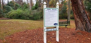
CATEGORIES: Public Land
LAYER: Hiking Trail
GPS: 30.85258, -83.3135
OWNERSHIP: Public, VALDOSTA LOWNDES COUNTY PARKS & RECREATION AUTHORITY, PARCEL 0082B 005
WATER BODY: Sugar Creek
MILE: 0.96
ADDRESS: 2204 Park Lane, Valdosta, GA 31602, Lowndes County.
DESCRIPTION: Tiny City Park with some swings. VLPRA map shows it backing up onto the right bank of Sugar Creek. Lowndes County Tax Assessors map shows VLPRA tract landlocked.
WEBSITE: http://vlpra.com/207/Bland-Park
OTHER REFERENCE: https://qpublic.schneidercorp.com/Application.aspx?AppID=631&LayerID=11201&PageTypeID=1&KeyValue=0082B%20005
PHOTO: https://wwals.net/pictures/2019-12-13–vld-warning-signs/20191213_134749.jpg
PHOTOSET: https://wwals.net/pictures/2019-12-13–vld-warning-signs/
PHOTO SOURCE: John S. Quarterman
PHONE NUMBER: (229) 242-0102
Suggestions: https://forms.gle/DipPgU2TP5atc2Rf9
The Shallows of Sugar Creek
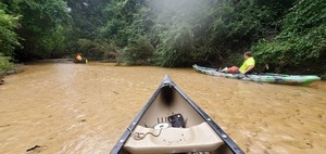
CATEGORIES: Obstacle
LAYER: Point of Interest
OWNERSHIP: Public
WATER BODY: Sugar Creek
MILE: 0.96
ADDRESS: Downstream from NSF RR Bridge and Bland Park. Lowndes County.
DESCRIPTION: Opportunity to pole your boat unless the water is really high.
WEBSITE: https://wwals.net/pictures/2021-07-10–sugar-creek-cleanup/20210710_104634.html
PHOTO: https://wwals.net/pictures/2021-07-10–sugar-creek-cleanup/20210710_104634.jpg
PHOTOSET: https://wwals.net/pictures/2021-07-10–sugar-creek-cleanup/
PHOTO SOURCE: John S. Quarterman
PHONE NUMBER: (229) 242-0102
Suggestions: https://forms.gle/DipPgU2TP5atc2Rf9
Sugar Creek RR Spill

CATEGORIES: Spill
LAYER: Point of Interest
OWNERSHIP: Public, CRANE FRANK F III, PARCEL 0080C 222
WATER BODY: Sugar Creek
MILE: 0.89
ADDRESS: 700 creek feet downstream (north) from the RR trestle. Lowndes County.
DESCRIPTION: Two sewer pipe ends separated in Sugar Creek, causing a two-month-long major sewage spill.
HISTORIC FACTS: Spilling sewage at least since the flash flood of 2024-11-07. https://wwals.net/2024/11/07/twelve-inches-of-rain-on-valdosta-causes-flooding-and-bridge-and-school-closures/ Location narrowed to within 2, 000 feet by WWALS 2025-01-04. https://wwals.net/2025/01/04/filthy-sugar-creek-and-withlacoochee-river-2025-01-02/ Leak finally located by Valdosta Utilities 2025-01-06. https://wwals.net/2025/01/06/valdosta-has-found-the-sugar-creek-sewage-leak-2024-01-06/
WEBSITE: https://wwals.net/2025/01/08/sewer-line-break-sugar-creek-2025-01-07/
PHOTO: https://www.wwals.net/pictures/2025-01-07–sewer-break-sugar-creek/20250107_152600.jpg
PHOTOSET: https://www.wwals.net/pictures/2025-01-07–sewer-break-sugar-creek/
PHOTO SOURCE: John S. Quarterman
PHONE NUMBER: (229) 242-0102
Suggestions: https://forms.gle/DipPgU2TP5atc2Rf9
Limbo Log
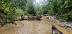
CATEGORIES: Deadfall
LAYER: Point of Interest
GPS: 30.85385, -83.3152
OWNERSHIP: Public, CITY OF VALDOSTA, PARCEL 0080C 221
WATER BODY: Sugar Creek
MILE: 0.88
ADDRESS: Downstream from The Shallows. Lowndes County.
DESCRIPTION: A deadfall you can limbo under.
WEBSITE: https://wwals.net/pictures/2021-07-10–sugar-creek-cleanup/20210710_105245.html
PHOTO: https://wwals.net/pictures/2021-07-10–sugar-creek-cleanup/20210710_105245.jpg
PHOTOSET: https://wwals.net/pictures/2021-07-10–sugar-creek-cleanup/
PHOTO SOURCE: John S. Quarterman
PHONE NUMBER: (229) 242-0102
Suggestions: https://forms.gle/DipPgU2TP5atc2Rf9
Valdosta Sewer Main by NSFRR
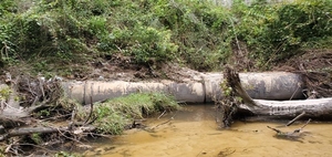
CATEGORIES: Point Of Interest
LAYER: Point of Interest
OWNERSHIP: Public, CRANE FRANK F III, PARCEL 0080C 222
WATER BODY: Sugar Creek
MILE: 0.88
ADDRESS: Across Park Lane from Brighton Road. Lowndes County.
DESCRIPTION: Exposed sewer main on Sugar Creek left bank, parallel to Norfolk & Southern Railroad.
WEBSITE: https://wwals.net/pictures/2021-07-10–sugar-creek-cleanup/
PHOTO: https://wwals.net/pictures/2021-07-10–sugar-creek-cleanup/20210710_100916.jpg
PHOTOSET: https://wwals.net/pictures/2021-07-10–sugar-creek-cleanup/
PHOTO SOURCE: John S. Quarterman
PHONE NUMBER: (229) 242-0102
Suggestions: https://forms.gle/DipPgU2TP5atc2Rf9
The Narrows of Sugar Creek

CATEGORIES: Obstacle
LAYER: Point of Interest
GPS: 30.854287, -83.31532
OWNERSHIP: Public, CITY OF VALDOSTA, PARCEL 0080C 221
WATER BODY: Sugar Creek
MILE: 0.85
ADDRESS: Between the Shallows and the Beach. Lowndes County.
DESCRIPTION: Narrow but deeper, so less of an obstacle than the Shallows.
WEBSITE: https://wwals.net/pictures/2021-07-10–sugar-creek-cleanup/20210710_105603.html
PHOTO: https://wwals.net/pictures/2021-07-10–sugar-creek-cleanup/20210710_105603.jpg
PHOTOSET: https://wwals.net/pictures/2021-07-10–sugar-creek-cleanup/20210710_105603.jpg
PHOTO SOURCE: John S. Quarterman
PHONE NUMBER: (229) 242-0102
Suggestions: https://forms.gle/DipPgU2TP5atc2Rf9
Sugar Creek Beach
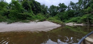
CATEGORIES: Point Of Interest
LAYER: Other
GPS: 30.85705, -83.3162
OWNERSHIP: Public, CITY OF VALDOSTA, PARCEL 0080C 221
WATER BODY: Sugar Creek
MILE: 0.65
ADDRESS: A quarter mile upstream from Gornto Road, on Valdosta City land. Lowndes County.
DESCRIPTION: A great picnic lunch beach on the right bank.
WEBSITE: https://wwals.net/pictures/2021-07-10–sugar-creek-cleanup/
PHOTO: https://wwals.net/pictures/2021-07-10–sugar-creek-cleanup/20210710_095444.jpg
PHOTOSET: https://wwals.net/pictures/2021-07-10–sugar-creek-cleanup/
PHOTO SOURCE: John S. Quarterman
PHONE NUMBER: (229) 242-0102
Suggestions: https://forms.gle/DipPgU2TP5atc2Rf9
RR feeder creek to Sugar Creek
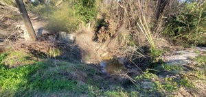
CATEGORIES: Tributary
LAYER: Point of Interest
OWNERSHIP: Public
WATER BODY: Sugar Creek
MILE: 0.63
ADDRESS: At the south edge of the Outdoor Living parking lot off of Gornto Road. Lowndes County.
DESCRIPTION: A tiny drain from along the west side of the Norfolk Southern Railroad that crosses under and goes east across a Valdosta sewer line to Sugar Creek.
WEBSITE: https://www.wwals.net/pictures/2025-01-07–sewer-break-sugar-creek/#RRFC
PHOTO: https://www.wwals.net/pictures/2025-01-07–sewer-break-sugar-creek/20250107_153801.jpg
PHOTOSET: https://www.wwals.net/pictures/2025-01-07–sewer-break-sugar-creek/#RRFC
PHOTO SOURCE: John S. Quarterman
PHONE NUMBER: (229) 242-0102
Suggestions: https://forms.gle/DipPgU2TP5atc2Rf9
Meadowbrook-Gornto sewage spill

CATEGORIES: Spill
LAYER: Point of Interest
OWNERSHIP: Public
WATER BODY: Sugar Creek
MILE: 0.44
ADDRESS: Meadowbrook Drive at Gornto Road, Valdosta, GA, Lowndes County.
DESCRIPTION: A sewage spill “”pouring out”” on Sunday, August 14, 2022, apparently fixed the same day by Valdosta Utilities. The report was by Valdosta’s Click ‘n’ Fix smartphone app, but apparently Utilities reacted when they got a telephone call.
HISTORIC FACTS: As reported by Blakely Calley about 4PM, Sunday, August 14, 2022: “”Corner of Meadowbrook drive and Gornto looks like the sewer overflow is stopped up. It’s pouring out.”” According to Valdosta Utilities Environmental Manager Scott Fowler about 9AM Monday morning, their on-call people went out Saturday and fixed it. It was a partial blockage. Also about 9AM Monday, Christine Espanol updated seeclickfix.com: “”Thank you for reporting. This issue was addressed on Saturday 8/13/22. We are following up on it this morning, but it is being monitored. If you have any questions, please call the Utilities Department at 229-259-3592.””
WEBSITE: https://seeclickfix.com/issues/12998963
OTHER REFERENCE: https://wwals.net/2022/08/15/valdosta-sewer-spill-meadowbrook-drive-at-gornto-road-2022-08-14/
PHOTO: https://www.wwals.net/pictures/2022-08-14–valdosta-sewer-spill-meadowbrook/many.jpg
PHOTOSET: https://www.wwals.net/pictures/2022-08-14–valdosta-sewer-spill-meadowbrook/
PHOTO SOURCE: John S. Quarterman
PHONE NUMBER: (229) 242-0102
Suggestions: https://forms.gle/DipPgU2TP5atc2Rf9
Earl Wetherington Foot Bridge
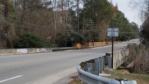
CATEGORIES: Bridge
LAYER: Bridge
OWNERSHIP: Public
WATER BODY: Sugar Creek
MILE: 0.44
ADDRESS: On Gornto Road, Valdosta, GA, less than half a mile upstream from the confluence. Lowndes County.
DESCRIPTION: A walkway along the south side of the Gornto Road Sugar Creek Bridge.
HISTORIC FACTS: Closed during floods of 2013 (and probably also of 2009).
WEBSITE: https://wwals.net/2018/01/09/earl-wetherington-foot-bridge/
PHOTO: https://wwals.net/wp-content/themes/pianoblack/img//2018/01/4152b0e255deea91dc83e5f414808d27.jpg
PHOTOSET: https://wwals.net/2018/01/09/earl-wetherington-foot-bridge/
PHOTO SOURCE: John S. Quarterman
PHONE NUMBER: (229) 242-0102
PHOTO2: https://www.wwals.net/pictures/2025-01-02–wq/20250102_135111.jpg
Photoset2: https://www.wwals.net/pictures/2025-01-02–wq/#GR
Suggestions: https://forms.gle/DipPgU2TP5atc2Rf9

Gornto Road Sugar Creek Bridge

CATEGORIES: Bridge
LAYER: Bridge
GPS: 30.8598, -83.3172
OWNERSHIP: Public
WATER BODY: Sugar Creek
MILE: 0.44
ADDRESS: On Gornto Road, between the NSF RR and Park Lane, less than half a mile upstream from the Sugar Creek Confluence with the Withlacoochee River. Lowndes County.
DESCRIPTION: 80.1-foot two-span box-beam concrete bridge with 47.9-foot-wide deck over Sugar Creek, built in 1981. Seriously eroded in the flash flood of 2024-11-07.
HISTORIC FACTS: Closed 2024-12-19 after erosion during flash flood 2024-11-07. https://wwals.net/?p=66617 Closed during floods of 2013 (and probably also of 2009).
WEBSITE: https://bridgereports.com/1099491
PHOTO: https://www.wwals.net/pictures/2024-12-26–wq/2024-12-26–gornto-erosion-20241226_174147.jpg
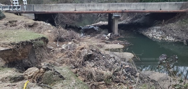
PHOTOSET: https://www.wwals.net/pictures/2024-12-26–wq/#GR
PHOTO SOURCE: John S. Quarterman
PHONE NUMBER: (229) 242-0102
PHOTO2: https://wwals.net/pictures/2021-07-10–sugar-creek-cleanup/20210710_094800.jpg
Photoset2: https://wwals.net/pictures/2021-07-10–sugar-creek-cleanup/
PHOTO2 SOURCE: John S. Quarterman
Photo2 Phone Number: 229-242-0102
Suggestions: https://forms.gle/DipPgU2TP5atc2Rf9

Sycamores of Sugar Creek
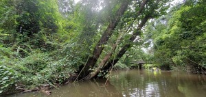
CATEGORIES: Point Of Interest
LAYER: Point of Interest
OWNERSHIP: Public
WATER BODY: Sugar Creek
MILE: 0.41
ADDRESS: Downstream within sight of Gornto Road Bridge. Lowndes County.
DESCRIPTION: Sycamore trees leaning over Sugar Creek from right bank.
WEBSITE: https://wwals.net/pictures/2021-07-10–sugar-creek-cleanup/big/20210710_113733.html
PHOTO: https://wwals.net/pictures/2021-07-10–sugar-creek-cleanup/20210710_113733.jpg
PHOTOSET: https://wwals.net/pictures/2021-07-10–sugar-creek-cleanup/
PHOTO SOURCE: John S. Quarterman
PHONE NUMBER: (229) 242-0102
Suggestions: https://forms.gle/DipPgU2TP5atc2Rf9
Bertas Beach

CATEGORIES: Point Of Interest
LAYER: Point of Interest
GPS: 30.8612498, -83.3179
OWNERSHIP: Public
WATER BODY: Sugar Creek
MILE: 0.32
ADDRESS: Directly in front (east) of the former Berta’s Pizza Kitchen (former Salty Snapper) past the manhole on Sugar Creek. Lowndes County.
DESCRIPTION: A nice creek beach, if it is ever not contaminated by sewage and trash.
WEBSITE: https://www.wwals.net/pictures/2024-12-26–wq/#BK
PHOTO: https://www.wwals.net/pictures/2024-12-26–wq/2024-12-26–bertas-upstream-20241226_172730.jpg
PHOTOSET: https://www.wwals.net/pictures/2024-12-26–wq/#BK
PHOTO SOURCE: John S. Quarterman
PHONE NUMBER: (229) 242-0102
PHOTO2: https://www.wwals.net/pictures/2025-01-02–wq/20250102_134039.jpg
Photoset2: https://www.wwals.net/pictures/2025-01-02–wq/#BK
PHOTO2 SOURCE: John S. Quarterman
Photo2 Phone Number: 229-242-0102
Suggestions: https://forms.gle/DipPgU2TP5atc2Rf9

Willows of Sugar Creek
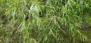
CATEGORIES: Point Of Interest
LAYER: Point of Interest
OWNERSHIP: Public, MANWELL SUGAR CREEK LLC, PARCEL 0080A 005
WATER BODY: Sugar Creek
MILE: 0.26
ADDRESS: Due east of the Salty Snapper. Lowndes County.
DESCRIPTION: Willow trees leaning over Sugar Creek from left bank.
WEBSITE: https://wwals.net/pictures/2021-07-10–sugar-creek-cleanup/20210710_114204.html
PHOTO: https://wwals.net/pictures/2021-07-10–sugar-creek-cleanup/20210710_114204.jpg
PHOTOSET: https://wwals.net/pictures/2021-07-10–sugar-creek-cleanup/
PHOTO SOURCE: John S. Quarterman
PHONE NUMBER: (229) 242-0102
Suggestions: https://forms.gle/DipPgU2TP5atc2Rf9
Salty Snapper Landing
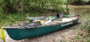
CATEGORIES: Landing Private
LAYER: Other
GPS: 30.862126, -83.31839
OWNERSHIP: Private, MANWELL SUGAR CREEK LLC, PARCEL 0080A 005
ACCESS: Launch: sandy slope creek off of short dirt access road from Salty Snapper parking lot.
WATER BODY: Sugar Creek
MILE: 0.24
ADDRESS: Northeast of the Salty Snapper, below its parking lot. Lowndes County.
DESCRIPTION: Private canoe and kayak access to left bank of Sugar Creek above Twomile Branch and the Trashjam. It’s on the Salty Snapper property.
WEBSITE: https://wwals.net/pictures/2021-07-10–sugar-creek-cleanup/20210710_133531.html
PHOTO: https://wwals.net/pictures/2021-07-10–sugar-creek-cleanup/20210710_133531.jpg
PHOTOSET: https://wwals.net/pictures/2021-07-10–sugar-creek-cleanup/
PHOTO SOURCE: John S. Quarterman
PHONE NUMBER: (229) 242-0102
Suggestions: https://forms.gle/DipPgU2TP5atc2Rf9
Trashjam of Sugar Creek 
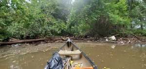
CATEGORIES: Clearedfall
LAYER: Other
OWNERSHIP: Public, MANWELL SUGAR CREEK LLC, PARCEL 0080A 005
WATER BODY: Sugar Creek
MILE: 0.22
ADDRESS: North by northeast of the Salty Snapper. Lowndes County.
DESCRIPTION: Former deadfalls across Sugar Creek, capturing large amounts of bottles, cans, and styrofoam, as well as larger trash. The left bank is Salty Snapper property inside Valdosta. The right bank is Eager River Property LLC, outside the city limits in Lowndes County. Valdosta Stormwater Division removed them.
HISTORIC FACTS: Cleanups here such as on 10 July 2021 temporarily relieve the trashjam, but it always comes back. Even if the logjam is freed, another one forms, with more trash. Trash traps are needed, as well as efforts by upstream businesses to contain trash in their parking lots, plus bottle deposits and styrofoam bans.
WEBSITE: https://wwals.net/pictures/2021-07-10–sugar-creek-cleanup/20210710_114436.html
ADDITIONAL INFO SOURCES: https://wwals.net/pictures/2021-07-10–sugar-creek-cleanup/
PHOTO: https://wwals.net/pictures/2021-07-10–sugar-creek-cleanup/20210710_114436.jpg
PHOTOSET: https://wwals.net/pictures/2021-07-10–sugar-creek-cleanup/
PHOTO SOURCE: John S. Quarterman
PHONE NUMBER: (229) 242-0102
Suggestions: https://forms.gle/DipPgU2TP5atc2Rf9
Salty Corner Landing

CATEGORIES: Landing Private
LAYER: Other
GPS: 30.8625, -83.31875
OWNERSHIP: Private, MANWELL SUGAR CREEK LLC, PARCEL 0080A 005
ACCESS: Launch: sandy slope creek off of short dirt access road from Salty Snapper parking lot.
WATER BODY: Sugar Creek
MILE: 0.20
ADDRESS: North of the former Bertas Kitchen (former Salty Snapper), below its parking lot. Upstream 2.64 Withlacoochee River miles to Langdale Park Boat Ramp. Downstream 4 miles around the Little River Confluence and up to Troupville Boat Ramp. Lowndes County.
DESCRIPTION: Private canoe and kayak access to left bank of Sugar Creek below Twomile Branch and the Trashjam. It’s on the Salty Snapper property and in the City Limits of Valdosta. Downstream is outside the city in Lowndes County.
HISTORIC FACTS: Deployment of WWALS trash booms in January 2022.
WEBSITE: https://www.wwals.net/pictures/2022-01-30–sugar-creek-boom2/
PHOTOSET: https://www.wwals.net/pictures/2022-01-30–sugar-creek-boom2/
PHOTO SOURCE: Suzy Hall
PHONE NUMBER: (850) 290-2350
Suggestions: https://forms.gle/DipPgU2TP5atc2Rf9
Sugar Creek WaterGoat
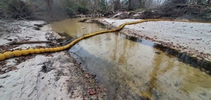
CATEGORIES: Point Of Interest
LAYER: Other
OWNERSHIP: Public, MANWELL SUGAR CREEK LLC, PARCEL 0080A 005
WATER BODY: Sugar Creek
MILE: 0.19
ADDRESS: North of the Salty Snapper, and just downstream from Salty Corner Landing. Lowndes County.
DESCRIPTION: A trash boom (steel cable with floats and 12-inch net below) across Sugar Creek, to stop trash from getting into the Withlacoochee River.
HISTORIC FACTS: Two years of politics for one-hour installation. https://wwals.net/issues/trash/
WEBSITE: https://www.wwals.net/pictures/2024-12-26–wq/#WG
OTHER REFERENCE: https://www.watergoat.org/
PHOTO: https://www.wwals.net/pictures/2024-12-26–wq/2024-12-26–watergoat–20241226_173522.jpg
PHOTOSET: https://www.wwals.net/pictures/2024-12-26–wq/#WG
PHOTO SOURCE: John S. Quarterman
PHONE NUMBER: (229) 242-0102
PHOTO2: https://www.wwals.net/pictures/2022-06-21–watergoat-sugar-creek/banners.jpg
Photoset2: https://www.wwals.net/pictures/2022-06-21–watergoat-sugar-creek/
PHOTO2 SOURCE: John S. Quarterman
Photo2 Phone Number: 229-242-0102
Suggestions: https://forms.gle/DipPgU2TP5atc2Rf9

Sugar Creek Confluence
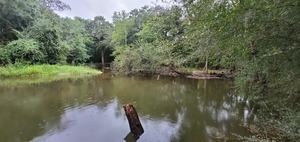
CATEGORIES: Tributary
LAYER: Other
OWNERSHIP: Public, EAGER RIVER PROPERTY LLC, PARCEL 0078C 022
ACCESS: No
WATER BODY: Withlacoochee River
MILE: 66.17
ADDRESS: Confluence with left bank of Withlacoochee River, downstream on Sugar Creek (north) from Gornto Road, Lowndes County.
DESCRIPTION: A very nice creek if Valdosta will deal with the trash and sewage situation. https://wwals.net/2020/05/04/three-weeks-to-comment-on-ga-epd-valdosta-wastewater-consent-order/
HISTORIC FACTS: Infamous for flooding, esp. in 2009 and 2013, inundating nearby back yards. Stinking for weeks after Vadosta’s notorious December 2019 sewage spill. See WWTP. Sugar Creek also has severe trash problems, since it drains about 80% of Valdosta, including major streets with fast food stores. WWALS is working with the City to clean that up, including getting the businesses that distribute single-use packaging to help.
WEBSITE: https://wwals.net/pictures/2020-08-29–twomile-branch-cleanup/big/20200829_105855.html
OTHER REFERENCE: https://wwals.net/2015/03/02/valdosta-spilled-into-alapaha-as-well-as-withlacoochee-watersheds-in-february/
PHOTO: https://wwals.net/pictures/2020-08-29–twomile-branch-cleanup/20200829_105855.jpg
PHOTOSET: https://wwals.net/pictures/2020-08-29–twomile-branch-cleanup/
PHOTO SOURCE: John S. Quarterman
PHONE NUMBER: (229) 242-0102
PHOTO2: https://wwals.net/pictures/2019-12-12–sara-jay-vld-spill-sugar-creek/downstream.jpg
Photoset2: https://wwals.net/pictures/2019-12-12–sara-jay-vld-spill-sugar-creek/
PHOTO2 SOURCE: Sara Jay
Suggestions: https://forms.gle/DipPgU2TP5atc2Rf9

Norfolk Southern RR Bridge

CATEGORIES: Railbridge
LAYER: Bridge
OWNERSHIP: Private
WATER BODY: Withlacoochee River
MILE: 66.08
ADDRESS: North of Gornto Road, just downstream from Sugar Creek, between the Salty Snapper and the YMCA. Lowndes County.
DESCRIPTION: Formerly Georgia Southern and Florida Railway bridge
WEBSITE: https://en.wikipedia.org/wiki/Withlacoochee_River_(Suwannee_River)
PHOTO: https://www.wwals.net/pictures/2022-05-29–chainsaw-cleanup-pictures/cleanup.jpg
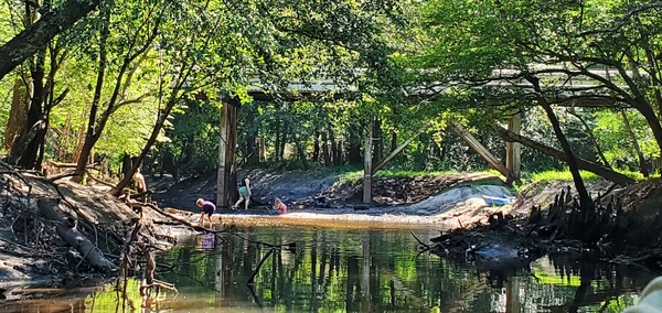
PHOTOSET: https://www.wwals.net/pictures/2022-05-29–chainsaw-cleanup-pictures/
PHOTO SOURCE: John S. Quarterman
PHONE NUMBER: (229) 242-0102
Suggestions: https://forms.gle/DipPgU2TP5atc2Rf9
NSRR Deadfall

CATEGORIES: Clearedfall
LAYER: Point of Interest
OWNERSHIP: Public
WATER BODY: Withlacoochee River
MILE: 66.04
ADDRESS: 200 feet downstream from Norfolk Southern RR Bridge. Lowndes County.
DESCRIPTION: Formerly a large oak tree blocking the Withlacoochee River on a sharp right turn just after the railroad tracks, downstream from Sugar Creek.
HISTORIC FACTS: Cleared by WWALS 2022-05-29 https://www.wwals.net/pictures/2022-05-29–chainsaw-cleanup-pictures/
GRN: No
WEBSITE: https://www.wwals.net/pictures/2022-05-29–chainsaw-cleanup-pictures/
PHOTO: https://www.wwals.net/pictures/2022-05-29–chainsaw-cleanup-pictures/20220529_094215.jpg
PHOTOSET: https://www.wwals.net/pictures/2022-05-29–chainsaw-cleanup-pictures/
PHOTO SOURCE: John S. Quarterman
PHONE NUMBER: (229) 242-0102
Suggestions: https://forms.gle/DipPgU2TP5atc2Rf9
YMCA Deadfall

CATEGORIES: Clearedfall
LAYER: Point of Interest
OWNERSHIP: Public
WATER BODY: Withlacoochee River
MILE: 65.88
ADDRESS: About 850 feet downstream from the Norfolk Southern RR Bridge. Lowndes County.
DESCRIPTION: Formerly a huge obstruction in the river caused by a tree falling from the left bank.
HISTORIC FACTS: Cleared by WWALS, 2022-06-05 https://wwals.net/?p=58633
WEBSITE: https://wwals.net/2022/06/05/pictures-chainsaw-cleanup-withlacoochee-2022-06-05/
PHOTOSET: https://www.wwals.net/pictures/2022-06-05–chainsaw-withlacoochee-pictures/
PHOTO SOURCE: Bobby McKenzie
PHONE NUMBER: (850) 290-2350
Suggestions: https://forms.gle/DipPgU2TP5atc2Rf9
YMCA2 Deadfall
CATEGORIES: Clearedfall
LAYER: Point of Interest
OWNERSHIP: Public
WATER BODY: Withlacoochee River
MILE: 65.73
ADDRESS: About a third of a mile downstream from the Railroad trestle. Lowndes County.
DESCRIPTION: Formerly a stack of deadfalls blocking the Withlacoochee River.
WEBSITE: https://wwals.net/pictures/2022-07-30–chainsaw-cleanup-pictures
Suggestions: https://forms.gle/DipPgU2TP5atc2Rf9
Gornto Road Pump Station
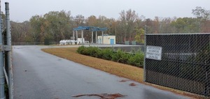
CATEGORIES: Liftstation
LAYER: Brochure
OWNERSHIP: Private, VALDOSTA LOWNDES COUNTY FAMILY YMCA INC and Lowndes County, PARCEL 0080A 001 and adjoining Lowndes County land.
WATER BODY: Withlacoochee River
MILE: 65.68
ADDRESS: 2412 Gornto Rd., Valdosta, GA 31602, Lowndes County.
DESCRIPTION: One of two main pump stations for Valdosta’s Force Main Project. The other is the Remer Lane Pump Station.
GRN: No
WEBSITE: https://www.valdostacity.com/utilities/sewer-system-improvements/force-main-project
PHOTO: https://wwals.net/pictures/2019-12-13–vld-warning-signs/20191213_133945.jpg
PHOTOSET: https://wwals.net/pictures/2019-12-13–vld-warning-signs/
PHOTO SOURCE: John S. Quarterman
PHONE NUMBER: (229) 242-0102
Suggestions: https://forms.gle/DipPgU2TP5atc2Rf9
Sugar Creek Landing @ Gornto Road
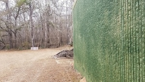
CATEGORIES: Landing No
LAYER: Brochure
GPS: 30.85857, -83.3206
OWNERSHIP: Public, Lowndes County
ACCESS: No, Launch: long walk through floodplain to riverbank. PARKING: YMCA parking lot.
WATER BODY: Withlacoochee River
Lowest boatable: 116′
Highest safe: 123′
GAUGE: Valdosta
MILE: 65.67
ADDRESS: 2410 Gornto Rd., Valdosta, GA 31602, Lowndes County.
DESCRIPTION: Sliver of public land just left of Valdosta sewage pump station. Not really usable for river access.
AKA: Gornto Road Landing.
WEBSITE: https://wwals.net/2018/01/29/gornto-road-valdosta-access-to-withlacoochee-river-2018-01-24/
PHOTO: https://wwals.net/wp-content/themes/pianoblack/img//2018/01/3ae32268ea80c1ef013bb208e2daa277.jpg
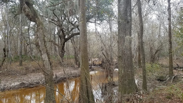
PHOTOSET: https://wwals.net/2018/01/29/gornto-road-valdosta-access-to-withlacoochee-river-2018-01-24/
PHOTO SOURCE: John S. Quarterman
PHONE NUMBER: (229) 242-0102
Suggestions: https://forms.gle/DipPgU2TP5atc2Rf9
Sugar Creek Landing River GPS @ Gornto Road
CATEGORIES: Point Of Interest
LAYER: Point of Interest
OWNERSHIP: Public, Lowndes County
ACCESS: No, Launch: long walk through floodplain to riverbank. PARKING: YMCA parking lot.
WATER BODY: Withlacoochee River
Lowest boatable: 116′
Highest safe: 123′
GAUGE: Valdosta
MILE: 65.67
ADDRESS: 2410 Gornto Rd., Valdosta, GA 31602, Lowndes County.
DESCRIPTION: Sliver of public land just left of Valdosta sewage pump station. Not really usable for river access.
AKA: Gornto Road Landing River GPS.
WEBSITE: https://wwals.net/2018/01/29/gornto-road-valdosta-access-to-withlacoochee-river-2018-01-24/
PHOTO: https://wwals.net/wp-content/themes/pianoblack/img//2018/01/3ae32268ea80c1ef013bb208e2daa277.jpg
PHOTOSET: https://wwals.net/2018/01/29/gornto-road-valdosta-access-to-withlacoochee-river-2018-01-24/
PHOTO SOURCE: John S. Quarterman
PHONE NUMBER: (229) 242-0102
Suggestions: https://forms.gle/DipPgU2TP5atc2Rf9
Holland Deadfall

CATEGORIES: Deadfall
LAYER: Point of Interest
OWNERSHIP: Public, HOLLAND WILLIAM E, PARCEL 0079B 001B
WATER BODY: Withlacoochee River
MILE: 65.36
ADDRESS: 0.8 miles downstream from Sugar Creek and 2.89 miles upstream from the Little River Confluence, Lowndes County.
DESCRIPTION: Large oak across the river, right bank to left
WEBSITE: https://www.wwals.net/pictures/2025-04-18–chainsaw-upstream-troupville-sugar-creek-pictures/#HDF
PHOTOSET: https://www.wwals.net/pictures/2025-04-18–chainsaw-upstream-troupville-sugar-creek-pictures/#HDF
PHOTO SOURCE: John S. Quarterman and Phil Royce
PHONE NUMBER: (850) 290-2350
Suggestions: https://forms.gle/DipPgU2TP5atc2Rf9
Pin Oak Circle Sewage Spill

CATEGORIES: Spill
LAYER: Point of Interest
OWNERSHIP: Public
WATER BODY: Sugar Creek
MILE: 3.14
ADDRESS: 2102 Pin Oak Cir, Valdosta, GA 31602, Lowndes County.
DESCRIPTION: A piece of asphalt in a sewer line caused a sewage spill during flooding in a flood plain at the top of One Mile Branch in Valdosta, upstream from Sugar Creek and the Withlacoochee River. 2023-12-03
PHOTO SOURCE: WWALS
PHONE NUMBER: (850) 290-2350
Suggestions: https://forms.gle/DipPgU2TP5atc2Rf9
Senior Center
CATEGORIES: Public Land
LAYER: Point of Interest
OWNERSHIP: Public
WATER BODY: One Mile Branch
MILE: 3.01
ADDRESS: 1360 East Park Ave., Valdosta, GA 31602, Lowndes County.
DESCRIPTION: Numerous facilities, mostly indoor.
WEBSITE: http://vlpra.com/166/Senior-Citizen-Center
Suggestions: https://forms.gle/DipPgU2TP5atc2Rf9
800 E Brookwood Drive Spill
CATEGORIES: Spill
LAYER: Point of Interest
OWNERSHIP: Public
WATER BODY: One Mile Branch
MILE: 2.52
ADDRESS: “800 block of E Brookwood Dr.””, Lowndes County.
DESCRIPTION: Very near the divide between the Withlacoochee and Alapaha watersheds; hard to tell where exactly by Valdosta’s “”800 block”” spill reporting.
HISTORIC FACTS: Sewage spill, “”800 Block of E Brookwood Dr. = 90 gallons”” 2021-07-07 during Tropical Storm Elsa.
WEBSITE: https://wwals.net/pictures/2021-07-08–sewage-spills-valdosta-starke
Suggestions: https://forms.gle/DipPgU2TP5atc2Rf9
Vallotton Youth Complex
CATEGORIES: Public Land
LAYER: Hiking Trail
OWNERSHIP: Public
WATER BODY: One Mile Branch
MILE: 2.49
ADDRESS: 700 Woodlawn Dr., Valdosta, GA 31602, Lowndes County.
DESCRIPTION: Extensive faclities.
WEBSITE: http://vlpra.com/205/Vallotton-Youth-Complex
Suggestions: https://forms.gle/DipPgU2TP5atc2Rf9
Vallotton Drive One Mile Branch Culvert
CATEGORIES: Bridge
LAYER: Bridge
GPS: 30.84953, -83.277371
OWNERSHIP: Public
WATER BODY: One Mile Branch
MILE: 2.34
ADDRESS: 600-646 Vallotton Dr, Valdosta, GA 31601, Lowndes County.
DESCRIPTION: A box culvert over One Mile Branch, just upstream from the Mega Mart and downstream from Vallotton Youth Complex.
Suggestions: https://forms.gle/DipPgU2TP5atc2Rf9
Lee Street Detention Pond Bridge

CATEGORIES: Bridge
LAYER: Bridge
GPS: 30.84672, -83.27783
OWNERSHIP: Public, City of Valdosta
WATER BODY: One Mile Branch
ADDRESS: 1400 N Lee St, Valdosta, GA 31601, Lowndes County.
DESCRIPTION: Single culvert upstream, street drains, double culvert downstream, leading through Lee Street Detention Pond Trash Trap into Lee Street Detention Pond.
PHOTO: https://www.wwals.net/pictures/2022-10-21–lee-st-click-n-fix-cleanup/20221018_091728.jpg
PHOTOSET: https://www.wwals.net/pictures/2022-10-21–lee-st-click-n-fix-cleanup/#TT
PHOTO SOURCE: John S. Quarterman
PHONE NUMBER: (229) 242-0102
PHOTO2: https://www.wwals.net/pictures/2022-10-21–lee-st-click-n-fix-cleanup/20221018_091710.jpg
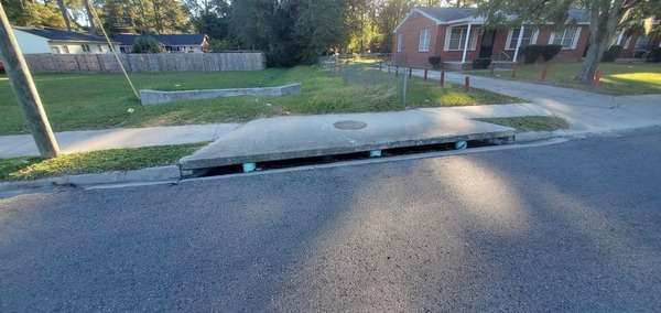
Photoset2: https://www.wwals.net/pictures/2022-10-21–lee-st-click-n-fix-cleanup/#TT
PHOTO2 SOURCE: John S. Quarterman
Photo2 Phone Number: 229-242-0102
Suggestions: https://forms.gle/DipPgU2TP5atc2Rf9

Lee Street Detention Pond Trash Trap

CATEGORIES: Point Of Interest
LAYER: Point of Interest
OWNERSHIP: Public, City of Valdosta, PARCEL 0116C 147
WATER BODY: One Mile Branch
ADDRESS: 1400 N Lee St, Valdosta, GA 31601, Lowndes County.
DESCRIPTION: Where Valdosta has built two versions of a trash trap between a drainage ditch culvert under Lee Street and the city’s detention pond that drains into One Mile Branch.
PHOTO: https://www.wwals.net/pictures/2023-02-09–valdosta-lee-street-trash-trap/image_67233281.jpg
PHOTOSET: https://www.wwals.net/pictures/2023-02-09–valdosta-lee-street-trash-trap
PHOTO SOURCE: Bobby McKenzie
PHONE NUMBER: (850) 290-2350
PHOTO2: https://www.wwals.net/pictures/2022-10-21–lee-st-click-n-fix-cleanup/20221018_091536.jpg
Photoset2: https://www.wwals.net/pictures/2022-10-21–lee-st-click-n-fix-cleanup/#TT
PHOTO2 SOURCE: John S. Quarterman
Photo2 Phone Number: 229-242-0102
Suggestions: https://forms.gle/DipPgU2TP5atc2Rf9

1200 Lee St. Spills *
CATEGORIES: Spill
LAYER: Point of Interest
OWNERSHIP: Lowndes, PARCEL GA
ACCESS: One Mile Branch, TYPE OF LAUNCH, DOCK: “Two sewage spills, “”1200 Block of Lee Street (A) = 4, 125 gallons”” and “”1200 Block of Lee Street (B) = 2, 733 gallons”” 2021-07-07 during Tropical Storm Elsa. CANOE: Public
MILE: 2.16
ADDRESS: “”1200 Block of Lee Street”
DESCRIPTION: GA 31601, * https://wwals.net/pictures/2021-07-08–sewage-spills-valdosta-starke
WEBSITE: Valdosta
OTHER REFERENCE: Apparently north of E. Ann St., across from Valdosta Housing Authority.
Suggestions: https://forms.gle/DipPgU2TP5atc2Rf9
Lee Street One Mile Branch Bridge
CATEGORIES: Bridge
LAYER: Bridge
GPS: 30.84872, -83.278137
OWNERSHIP: Public
WATER BODY: One Mile Branch
MILE: 2.26
ADDRESS: 1408 N Lee St, Valdosta, GA 31602, Lowndes County.
DESCRIPTION: Culverts carrying One Mile Branch under a two-lane city street, next to Azalea City Trail.
WEBSITE: https://maps.app.goo.gl/yr4gKRiR7MdjfVHi7
Suggestions: https://forms.gle/DipPgU2TP5atc2Rf9
Ashley Street One Mile Branch Bridge
CATEGORIES: Bridge
LAYER: Bridge
OWNERSHIP: Public
WATER BODY: One Mile Branch
MILE: 2.09
ADDRESS: 1380 N Ashley St, Valdosta, GA 31601, Lowndes County.
DESCRIPTION: Four-lane busy city street and US 41 Business over One Mile Branch.
WEBSITE: https://maps.app.goo.gl/s3JMeiWt6nmyvpuS8
Suggestions: https://forms.gle/DipPgU2TP5atc2Rf9
Iola Drive One Mile Branch Culvert
CATEGORIES: Bridge
LAYER: Bridge
OWNERSHIP: Public
WATER BODY: One Mile Branch
MILE: 1.99
ADDRESS: 1301-1499 Iola Dr, Valdosta, GA 31602, Lowndes County.
DESCRIPTION: A box culvert over One Mile Branch, one block upstream from Drexel Park.
Suggestions: https://forms.gle/DipPgU2TP5atc2Rf9
1600 Williams St. Spill

CATEGORIES: Spill
LAYER: Point of Interest
OWNERSHIP: Public
WATER BODY: One Mile Branch
MILE: 1.89
ADDRESS: 1600 Block of William St., Valdosta, GA 31602, which is Williams Street between E. College and E. Moore Streets. Lowndes County.
DESCRIPTION: A collapsed 8″” sewage main leaked into a stormwater drain, uphill from One Mile Branch. The Valdosta sewage spill sign is actually a couple of blocks south, at One Mile Branch on the north edge of Drexel Park. After going through Drexel Park and Valdosta State University, that creek joins Sugar Creek and then the Withlacoochee River.
HISTORIC FACTS: “”On Wednesday, June 21, 2023, the City of Valdosta Utilities Department received a call about murky water coming from a storm drain into One-Mile Branch Creek. After an intensive investigation and video inspections, the City Utilities Department located a collapse in an eight-inch sanitary sewer main. Due to the collapse and its proximity to an underground storm sewer main, sewer water had infiltrated the storm pipe, and subsequently, a diluted undetermined amount discharged from this storm pipe into One-Mile Branch Creek. As a safety precaution, the Utilities Department hired a local contractor to plug the storm drain, and rerouted the discharge to the nearby sanitary sewer system until repairs are complete Saturday, June 24, 2023. Georgia EPD has been notified of the issue, and signs were posted nearby at One-Mile Branch Creek to alert citizens to avoid the creek until further notice.”” But Valdosta did not send out that press release until three days later; it didn’t say where the spill occured, nor how much was spilled. https://wwals.net/?p=62421 Nobody from the City of Valdosta answered questions for another day and a half, when the Valdosta City Manager provided a block number. WWALS E.D. Gretchen Quarterman then photographed the situation.
WEBSITE: https://wwals.net/2023/06/26/valdosta-williams-street-one-mile-branch-sewage-spill-sign-2023-06-26/
PHOTO: https://www.wwals.net/pictures/gretchen/2023-06-26–valdosta-williams-st-sewage-spill/IMG_5910.jpg
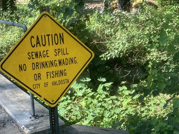
PHOTOSET: https://www.wwals.net/pictures/gretchen/2023-06-26–valdosta-williams-st-sewage-spill
PHOTO SOURCE: Gretchen Quarterman
PHONE NUMBER: (850) 290-2350
Photoset2: https://www.wwals.net/pictures/gretchen/2023-06-26–valdosta-williams-st-sewage-spill/
PHOTO2 SOURCE: Gretchen Quarterman
Suggestions: https://forms.gle/DipPgU2TP5atc2Rf9

1400 Williams St. Spill
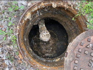
CATEGORIES: Spill
LAYER: Point of Interest
OWNERSHIP: Public
WATER BODY: One Mile Branch
MILE: 1.89
ADDRESS: 1400 Williams Street, Valdosta, GA 31602, Lowndes County.
DESCRIPTION: 150 gallon sewage spill into a storm drain leading to Onemile Branch because of grease blockage.
WEBSITE: https://wwals.net/2021/04/27/valdosta-fog-manhole-sewage-spill-2021-04-26/
PHOTO: https://wwals.net/pictures/2021-04-26–valdosta-fog-spill/vld-fog-eg.jpg
PHOTOSET: https://wwals.net/pictures/2021-04-26–valdosta-fog-spill/
PHOTO SOURCE: City of Valdosta
PHONE NUMBER: (229) 251-4779
Suggestions: https://forms.gle/DipPgU2TP5atc2Rf9
Williams Street One Mile Branch Culvert
CATEGORIES: Bridge
LAYER: Bridge
OWNERSHIP: Public
WATER BODY: One Mile Branch
MILE: 1.89
ADDRESS: 1413 Williams Street, Valdosta, GA 31602, Lowndes County.
DESCRIPTION: Culvert carrying One Mile Branch under Williams Street at the top of Drexel Park.
WEBSITE: https://maps.app.goo.gl/J4UevkE22qJNseS88
Suggestions: https://forms.gle/DipPgU2TP5atc2Rf9
Drexel Park Bridge
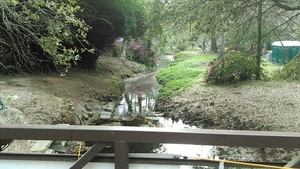
CATEGORIES: Bridge
LAYER: Bridge
OWNERSHIP: Public, VLPRA
ACCESS: Yes
WATER BODY: One Mile Branch
MILE: 1.81
ADDRESS: In Drexel Park, over One Mile Branch, between Slater Street and Brookwood Circle. Lowndes County.
DESCRIPTION: Footbridge over One Mile Branch.
WEBSITE: http://vlpra.com/198/Drexel-Park
PHOTO: https://wwals.net/wp-content/themes/pianoblack/img//2017/03/7bcb2e017626ba8197cda70e7b79c658-1.jpg
PHOTOSET: https://wwals.net/2017/03/08/pictures-azalea-festival-pictures-2016-03-12-13/
PHOTO SOURCE: John S. Quarterman
PHONE NUMBER: (229) 242-0102
Suggestions: https://forms.gle/DipPgU2TP5atc2Rf9
Drexel Park
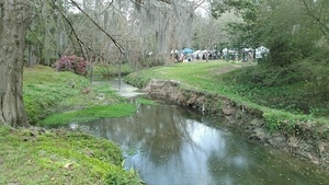
CATEGORIES: Public Land
LAYER: Hiking Trail
OWNERSHIP: Public, VLPRA
ACCESS: Yes
WATER BODY: One Mile Branch
MILE: 1.75
ADDRESS: 1401 N. Patterson Rd., Valdosta, GA 31601, Lowndes County.
DESCRIPTION: One Mile Branch runs through it. Site of annual Azalea Festival and many other events.
WEBSITE: http://vlpra.com/198/Drexel-Park
PHOTO: https://wwals.net/wp-content/themes/pianoblack/img//2017/03/4cd50fb9c934a1335268a93a836e1afc-1.jpg
PHOTOSET: https://wwals.net/2017/03/08/pictures-azalea-festival-pictures-2016-03-12-13/
PHOTO SOURCE: John S. Quarterman
PHONE NUMBER: (229) 242-0102
Suggestions: https://forms.gle/DipPgU2TP5atc2Rf9
Hyta’s Park
CATEGORIES: Public Land
LAYER: Hiking Trail
GPS: 30.84837936, -83.30372632
OWNERSHIP: Public
WATER BODY: One Mile Branch
MILE: 0.81
ADDRESS: 1804 Jerry Jones Dr., Valdosta, GA 31602, Lowndes County.
DESCRIPTION: “”Hyta’s Park is a small landscaped green space featuring a sculpture by local artist Wilby Coleman. The park is enhanced by a gazebo, benches, and lovely landscaping.””
WEBSITE: http://vlpra.com/215/Hytas-Park
Suggestions: https://forms.gle/DipPgU2TP5atc2Rf9
7.593 mgal Valdosta sewage spill
CATEGORIES: Spill
LAYER: Point of Interest
OWNERSHIP: Private, GF VALDOSTA MALL LLC, C/O GEM REALTY CAPITAL INC, 900 N MICHIGAN AVE SUITE 1450, CHICAGO IL 60611, PARCEL 0084B 025
WATER BODY: Sugar Creek
MILE: 1.69
ADDRESS: 1815 Norman Drive, Valdosta, GA 31601, “”Behind the Target, next to the creek.””, Lowndes County.
DESCRIPTION: 7, 592, 910 gallons of raw sewage into Sugar Creek, upstream from the Withlacoochee River. Valdosta’s biggest spill ever. More than all two dozen spills of the previous December. 3.45 times Valdosta’s previous biggest single incident. 42 times the biggest other spill in GA-EPD’s statewide Sewage Spills Report for the next day.
PHOTO SOURCE: John S. Quarterman
PHONE NUMBER: (229) 242-0102
Suggestions: https://forms.gle/DipPgU2TP5atc2Rf9
ILM Pond

CATEGORIES: Lake
LAYER: Point of Interest
GPS: 30.825928, -83.32635
OWNERSHIP: Private, INTERSTATE LAND MANAGEMENT LLC, PARCEL 0085 052
WATER BODY: Hightower Creek
MILE: 1.51
ADDRESS: 2114 Briarwood Road, Valdosta, GA 31601, Lowndes County.
DESCRIPTION: A private pond at the top of Hightower Creek.
PHOTO: https://www.wwals.net/pictures/2022-07-31–dollar-tree-trash/ilm-pond.jpg
PHOTOSET: https://www.wwals.net/pictures/2022-07-31–dollar-tree-trash/
PHOTO SOURCE: Google maps
PHONE NUMBER: (850) 290-2350
Suggestions: https://forms.gle/DipPgU2TP5atc2Rf9
I-75 Hightower Creek Culvert

CATEGORIES: Bridge
LAYER: Bridge
OWNERSHIP: Public
WATER BODY: Hightower Creek
MILE: 1.16
ADDRESS: I-75 mile 17, between US 84 and GA 133 exits. Lowndes County.
DESCRIPTION: Box culvert under I-75 for Hightower Creek (which USGS calls Sugar Creek).
PHOTO: https://www.wwals.net/pictures/2022-07-31–dollar-tree-trash/i-75-west-culvert.jpg
PHOTOSET: https://goo.gl/maps/cMrKv8G6hxiaC8ty6
PHOTO SOURCE: Google streetview
PHONE NUMBER: (850) 290-2350
PHOTO2: https://www.wwals.net/pictures/2022-07-31–dollar-tree-trash/i-75-east-culvert.jpg
Photoset2: https://goo.gl/maps/dy86WsGrYd7ka3hs9
PHOTO2 SOURCE: Google streetview
Suggestions: https://forms.gle/DipPgU2TP5atc2Rf9

Norman Drive Culvert

CATEGORIES: Bridge
LAYER: Bridge
OWNERSHIP: Public
WATER BODY: Hightower Creek
MILE: 0.95
ADDRESS: 950 Norman Drive, Valdosta, GA 31601, Lowndes County.
DESCRIPTION: Culvert under Norman Drive for Hightower Creek (which USGS calls Sugar Creek).
PHOTO: https://www.wwals.net/pictures/2022-07-31–dollar-tree-trash/norman-drive-culvert.jpg
PHOTO SOURCE: Google Streetview
PHONE NUMBER: (850) 290-2350
Suggestions: https://forms.gle/DipPgU2TP5atc2Rf9
River Street Spill

CATEGORIES: Spill
LAYER: Point of Interest
OWNERSHIP: Public
WATER BODY: Hightower Creek River Street Branch 03110203004691
ADDRESS: 1700 block of River Street, Valdosta, GA 31601, Lowndes County.
DESCRIPTION: Valdosta sewage spill due to pipe failure.
WEBSITE: https://wwals.net/2023/02/17/valdosta-river-street-sewage-spill-into-hightower-creek-2023-02-08/
PHOTOSET: https://www.wwals.net/pictures/2023-02-08–valdosta-river-st-spill/#MH
PHOTO SOURCE: Google Streetview
PHONE NUMBER: (850) 290-2350
Suggestions: https://forms.gle/DipPgU2TP5atc2Rf9
River Street Hightower Branch Culvert

CATEGORIES: Bridge
LAYER: Bridge
GPS: 30.8287, -83.3162
OWNERSHIP: Public
WATER BODY: Hightower Creek River Street Branch 03110203004691
ADDRESS: 1715 River Street, Valdosta, GA 31601, Lowndes County.
DESCRIPTION: Culvert under River Street for a branch of Hightower Creek, which then runs into Sugar Creek to the Withlacoochee River.
PHOTOSET: https://www.wwals.net/pictures/2023-02-08–valdosta-river-st-spill/#RSHBB
PHOTO SOURCE: Google Streetview
PHONE NUMBER: (850) 290-2350
Suggestions: https://forms.gle/DipPgU2TP5atc2Rf9
St. Augustine Road Culvert

CATEGORIES: Bridge
LAYER: Bridge
GPS: 30.836892, -83.31565
OWNERSHIP: Public
WATER BODY: Hightower Creek
MILE: 0.44
ADDRESS: 838 St. Augustine, Road, Valdosta, GA 31601, Lowndes County.
DESCRIPTION: Hightower Creek is channeled under St. Augustine, Road, aka GA 133.
WEBSITE: https://www.google.com/maps/place/838+St+Augustine+Rd, +Valdosta, +GA+31601/@30.8368434, -83.315849, 82m/data=!3m1!1e3!4m5!3m4!1s0x88ee66bfecd6097b:0x18ea93d505544cfd!8m2!3d30.8368728!4d-83.3156223
PHOTO: https://www.wwals.net/pictures/2022-07-31–dollar-tree-trash/st-augustine-road-culvert.jpg
PHOTOSET: https://goo.gl/maps/ZJ6FXitfn85CVC1D7
PHOTO SOURCE: Google maps
PHONE NUMBER: (850) 290-2350
Suggestions: https://forms.gle/DipPgU2TP5atc2Rf9
Dollar Tree Trash Pile

CATEGORIES: Point Of Interest
LAYER: Point of Interest
GPS: 30.84227, -83.316696
OWNERSHIP: Private, LEPAUL WATSON PROPERTIES LLLP, PARCEL 0084A 052
WATER BODY: Hightower Creek
MILE: 0.03
ADDRESS: 1801 Norman Drive, Valdosta, GA 31601, Lowndes County.
DESCRIPTION: Trash in parking lot and detention area behind Dollar Tree store, uphill from Hightower Creek, Sugar Creek, and the Withlacoochee River.
HISTORIC FACTS: Discovered 2022-07-31 by Bobby McKenzie. https://wwals.net/2022/08/01/dollar-tree-trash-pile-1801-norman-drive-valdosta-ga-2022-07-31/
WEBSITE: https://www.dollartree.com/locations/ga/valdosta/51/
PHOTO: https://www.wwals.net/pictures/2022-07-31–dollar-tree-trash/trash-drain.jpg
PHOTOSET: https://www.wwals.net/pictures/2022-07-31–dollar-tree-trash/trash-drain.jpg
PHOTO SOURCE: Bobby McKenzie
PHONE NUMBER: (850) 290-2350
PHOTO2: https://www.wwals.net/pictures/2022-07-31–dollar-tree-trash/store-gutter-trash.jpg
Photoset2: https://www.wwals.net/pictures/2022-07-31–dollar-tree-trash/
PHOTO2 SOURCE: Bobby McKenzie
Suggestions: https://forms.gle/DipPgU2TP5atc2Rf9

Hightower Creek Confluence
CATEGORIES: Tributary
LAYER: Other
OWNERSHIP: Private, Marlev Co. PARCEL 0084B 024
ACCESS: No
WATER BODY: Sugar Creek
MILE: 1.76
ADDRESS: Confluence with Sugar Creek behind 1407 BayTree Road, Lowndes County.
DESCRIPTION: Drains most of I-75 between St. Augustine Road and West Hill Avenue.
WEBSITE: www.valdostacity.com/Modules/ShowDocument.aspx?documentid=5034
Suggestions: https://forms.gle/DipPgU2TP5atc2Rf9
Remer Lane Pump Station
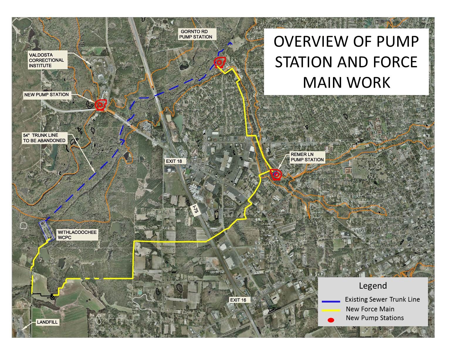
CATEGORIES: Liftstation
LAYER: Brochure
OWNERSHIP: Public, REMERTON CITY OF, PARCEL 0084B 001
WATER BODY: Sugar Creek
MILE: 1.84
ADDRESS: End of Remer Lane, Remerton, GA, Lowndes County.
DESCRIPTION: One of two main pump stations for Valdosta’s Force Main Project. The other is the Gornto Road Pump Station.
WEBSITE: https://www.valdostacity.com/utilities/sewer-system-improvements/force-main-project
PHOTO: https://www.valdostacity.com/sites/default/files/uploads/depts/utilities/project-area-map.jpg
PHOTOSET: https://www.valdostacity.com/utilities/sewer-system-improvements/force-main-project
PHOTO SOURCE: City of Valdosta
PHONE NUMBER: (229) 259-3592
Suggestions: https://forms.gle/DipPgU2TP5atc2Rf9
Lankford Circle WQ Testing Station 
CATEGORIES: Wq Testing
LAYER: Point of Interest
OWNERSHIP: Public
WATER BODY: Sugar Creek
MILE: 1.85
ADDRESS: West from Lankford Circle. Lowndes County.
DESCRIPTION: A WWALS water quality testing site upstream from Valdosta’s Remer Lane Pump Station.
Suggestions: https://forms.gle/DipPgU2TP5atc2Rf9
Lankford Drive Culvert
CATEGORIES: Bridge
LAYER: Bridge
GPS: 30.8383, -83.30658
OWNERSHIP: Public
WATER BODY: Sugar Creek
MILE: 1.85
ADDRESS: East of Rouse Road and west of the Norfolk Southern Railroad and W. Gordon Street. Lowndes County.
WEBSITE: https://www.valdostacity.com/engineering/stormwater-division/master-stormwater-management-plan
Suggestions: https://forms.gle/DipPgU2TP5atc2Rf9
Patterson Street One Mile Branch Bridge
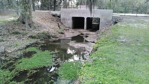
CATEGORIES: Bridge
LAYER: Bridge
OWNERSHIP: Public
WATER BODY: One Mile Branch
MILE: 1.70
ADDRESS: 1430 N Patterson St, Valdosta, GA 31602, Lowndes County.
DESCRIPTION: A double concrete culvert carries One Mile Branch under Patterson Street, from Drexel Park to the VSU campus.
PHOTOSET: https://wwals.net/2017/03/08/pictures-azalea-festival-pictures-2016-03-12-13/
PHOTO SOURCE: John S. Quarterman
PHONE NUMBER: (229) 242-0102
Suggestions: https://forms.gle/DipPgU2TP5atc2Rf9
Sewage bypass in One Mile Branch

CATEGORIES: Spill
LAYER: Point of Interest
OWNERSHIP: Public
WATER BODY: One Mile Branch
MILE: 1.67
ADDRESS: 1430 N Patterson St., Valdosta, GA 31602, Lowndes County.
DESCRIPTION: Generator, pump, and pipes bypassing sewage next to One Mile Branch.
WEBSITE: https://www.wwals.net/pictures/2022-09-23–one-mile-branch-fish-kill/#West-of-Patterson-Street
PHOTO: https://www.wwals.net/pictures/2022-09-23–one-mile-branch-fish-kill/twopipes.jpg
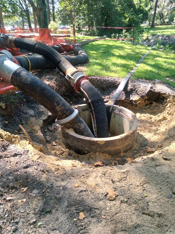
PHOTOSET: https://www.wwals.net/pictures/2022-09-23–one-mile-branch-fish-kill/
PHOTO SOURCE: Scotti Jay
PHONE NUMBER: (850) 290-2350
Suggestions: https://forms.gle/DipPgU2TP5atc2Rf9
VSU Odum Library Footbridge
CATEGORIES: Bridge
LAYER: Bridge
OWNERSHIP: Public
WATER BODY: One Mile Branch
MILE: 1.57
ADDRESS: 1500 N Patterson St, Valdosta, GA 31698, south of Odum Library. Lowndes County.
DESCRIPTION: A footbridge across One Mile Branch, between the College of Arts and the Odum Library.
Suggestions: https://forms.gle/DipPgU2TP5atc2Rf9
Oak Street One Mile Branch Bridge
CATEGORIES: Bridge
LAYER: Bridge
GPS: 30.846016, -83.29016
OWNERSHIP: Public
WATER BODY: One Mile Branch
MILE: 1.50
ADDRESS: 1410 N Oak St., Valdosta, GA 31602, under the street footbridge. Lowndes County.
DESCRIPTION: A 21-foot concrete double culvert built in 1950, reconstructed in 1974.
WEBSITE: https://bridgereports.com/1099493
Suggestions: https://forms.gle/DipPgU2TP5atc2Rf9
Dead fish by sewage bypass in One Mile Branch

CATEGORIES: Spill
LAYER: Point of Interest
OWNERSHIP: Public
WATER BODY: One Mile Branch
MILE: 1.45
ADDRESS: Not far downstream from Oak Street. Lowndes County.
DESCRIPTION: Dead fish next to sewage bypass pipe in One Mile Branch.
PHOTO: https://www.wwals.net/pictures/2022-09-23–one-mile-branch-fish-kill/deadfish-bypass-pipe.jpg
PHOTOSET: https://www.wwals.net/pictures/2022-09-23–one-mile-branch-fish-kill/
PHOTO SOURCE: Scotti Jay
PHONE NUMBER: (850) 290-2350
Suggestions: https://forms.gle/DipPgU2TP5atc2Rf9
Sewage bypass pipe in One Mile Branch

CATEGORIES: Spill
LAYER: Point of Interest
OWNERSHIP: Public
WATER BODY: One Mile Branch
MILE: 1.45
ADDRESS: Between VSU football practice field and Oak Street, Lowndes County.
DESCRIPTION: A sewage bypass pipe in One Mile Branch, upstream from many dead fish.
PHOTO: https://www.wwals.net/pictures/2022-09-23–one-mile-branch-fish-kill/creek.jpg
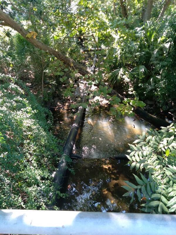
PHOTOSET: https://www.wwals.net/pictures/2022-09-23–one-mile-branch-fish-kill/
PHOTO SOURCE: Scotti Jay
PHONE NUMBER: (850) 290-2350
Suggestions: https://forms.gle/DipPgU2TP5atc2Rf9
Boone Drive Valdosta sewage spill
CATEGORIES: Spill
LAYER: Point of Interest
OWNERSHIP: Public
WATER BODY: One Mile Branch
MILE: 1.39
ADDRESS: Boone Drive at Baytree Road, Valdosta, GA, Lowndes County.
DESCRIPTION: 100-gallon sewage spill, Monday, February 19, 2022.
Suggestions: https://forms.gle/DipPgU2TP5atc2Rf9
Sewage bypass end below Oak St.

CATEGORIES: Spill
LAYER: Point of Interest
OWNERSHIP: Public
WATER BODY: One Mile Branch
MILE: 1.38
ADDRESS: Near VSU football practice field east of tennis courts and gym. Lowndes County.
DESCRIPTION: A single large pipe chained to an open manhole, upstream from many dead fish.
PHOTO: https://www.wwals.net/pictures/2022-09-23–one-mile-branch-fish-kill/pipe.jpg
PHOTOSET: https://www.wwals.net/pictures/2022-09-23–one-mile-branch-fish-kill/
PHOTO SOURCE: Scotti Jay
PHONE NUMBER: (850) 290-2350
Suggestions: https://forms.gle/DipPgU2TP5atc2Rf9
Sustella Ave. Bridge
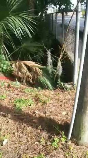
CATEGORIES: Bridge
LAYER: Bridge
OWNERSHIP: Public, City of Valdosta
WATER BODY: One Mile Branch
MILE: 1.20
ADDRESS: SE of Baytree Drive, before VSU Rec. Center, Lowndes County.
DESCRIPTION: More of a box culvert than a bridge. Sewage spill just downstream
WEBSITE: https://wwals.net/pictures/2020-06-02–one-mile-branch-spill
PHOTO: https://wwals.net/pictures/2020-06-02–one-mile-branch-spill/5208.jpg
PHOTOSET: https://wwals.net/pictures/2020-06-02–one-mile-branch-spill/
PHOTO SOURCE: Sara Jones for WWALS
PHONE NUMBER: (850) 290-2350
Suggestions: https://forms.gle/DipPgU2TP5atc2Rf9
Sustella Ave. Spill
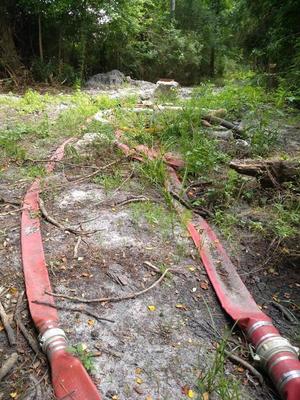
CATEGORIES: Spill
LAYER: Point of Interest
OWNERSHIP: Public, UNIVERSITY SYSTEM OF GA BOARD OF REGENTS, PARCEL 0115D 011
WATER BODY: One Mile Branch
MILE: 1.15
ADDRESS: North of VSU Recreation Center, 1300 Sustella Ave., Valdosta, GA 31601, Lowndes County.
DESCRIPTION: Sewage spill from at least one manhole behind VSU Rec. Center, discovered by WWALS testers by smell.
WEBSITE: https://wwals.net/pictures/2020-06-02–one-mile-branch-spill
PHOTO: https://wwals.net/pictures/2020-06-02–one-mile-branch-spill/5177.jpg
PHOTOSET: https://wwals.net/pictures/2020-06-02–one-mile-branch-spill
PHOTO SOURCE: Scotti and Sara Jay Jones for WWALS
PHONE NUMBER: (850) 290-2350
Suggestions: https://forms.gle/DipPgU2TP5atc2Rf9
VSU CORE
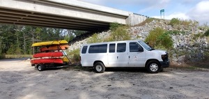
CATEGORIES: Outfitter
LAYER: Other
OWNERSHIP: Public
ACCESS: No, CANOE, CAMPING: Camp Rentals Available, FOOD: Snack Machine, WATER, Flush Toilet, PARKING: Free, SHELTER, HANDICAPPED ACCESSIBLE
WATER BODY: One Mile Branch
MILE: 1.04
ADDRESS: 1300 Sustella Ave., Valdosta, GA 31698, Lowndes County.
DESCRIPTION: “The Center for Outdoor Recreational Experiences (VSU CORE) is a place for VSU Students, faculty, and staff to learn about the outdoors, gain leadership skills, make new friends, and go on exciting outdoor adventures!””, University outfitter that also rents to the public.
WEBSITE: https://www.valdosta.edu/student/rec-wellness/campus-recreation/core/
PHOTO: https://wwals.net/pictures/2019-10-26–pictures-wwals-boomerang/20191026_101438.jpg
PHOTOSET: https://wwals.net/pictures/2019-10-26–pictures-wwals-boomerang/
PHOTO SOURCE: WWALS
PHONE NUMBER: (229) 245-2355
PHOTO2: https://wwals.net/pictures/2020-10-24–boomerang-front-videos/vsu-core.jpg
Photoset2: https://wwals.net/pictures/2020-10-24–boomerang-front-videos/
PHOTO2 SOURCE: WWALS
Photo2 Phone Number: 850-290-2350
Suggestions: https://forms.gle/DipPgU2TP5atc2Rf9

Wainwright Waterfall 

CATEGORIES: Waterfall
LAYER: Point of Interest
OWNERSHIP: Public, UNIVERSITY SYSTEM OF GA BOARD OF REGENTS, PARCEL 0115D 011
WATER BODY: One Mile Branch
MILE: 1.00
ADDRESS: Downstream from VSU Rec Center before Wainwright Drive, Lowndes County.
DESCRIPTION: Small waterfalls on an urban creek. On Azalea Trail
WEBSITE: https://wwals.net/2017/11/12/one-mile-branch-cleanup-2017-11-11/#waterfalls
PHOTOSET: https://wwals.net/2017/11/12/one-mile-branch-cleanup-2017-11-11/#waterfalls
PHOTO SOURCE: John S. Quarterman
PHONE NUMBER: (229) 242-0102
Suggestions: https://forms.gle/DipPgU2TP5atc2Rf9
Wainwright Waterfall dead fish

CATEGORIES: Spill
LAYER: Point of Interest
GPS: 30.843365, -83.2978
OWNERSHIP: Public
WATER BODY: One Mile Branch
MILE: 0.99
ADDRESS: Upstream from Wainwright Drive. Lowndes County.
DESCRIPTION: Dead fish near waterfall in One Mile Branch.
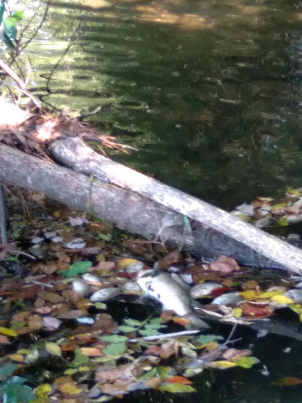
PHOTOSET: https://www.wwals.net/pictures/2022-09-23–one-mile-branch-fish-kill/
PHOTO SOURCE: Scotti Jay
PHONE NUMBER: (850) 290-2350
Suggestions: https://forms.gle/DipPgU2TP5atc2Rf9
Wainwright Drive dead fish

CATEGORIES: Spill
LAYER: Point of Interest
OWNERSHIP: Public
WATER BODY: One Mile Branch
MILE: 0.81
ADDRESS: In One Mile Branch at Wainwright Drive, Lowndes County.
DESCRIPTION: Dead fish in One Mile Branch.
WEBSITE: https://www.wwals.net/pictures/2022-09-23–one-mile-branch-fish-kill/#Wainwright-Drive
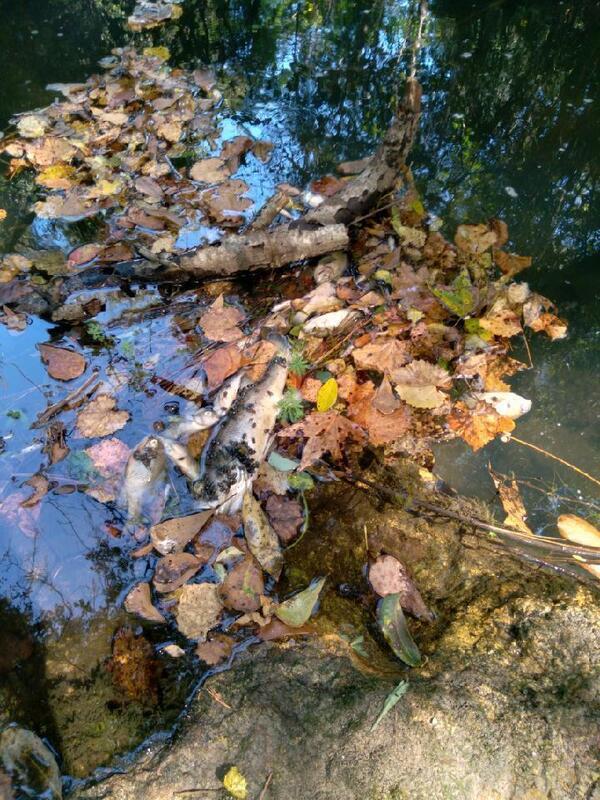
PHOTOSET: https://www.wwals.net/pictures/2022-09-23–one-mile-branch-fish-kill/
PHOTO SOURCE: Scotti Jay
PHONE NUMBER: (850) 290-2350
Suggestions: https://forms.gle/DipPgU2TP5atc2Rf9
Wainwright Drive Bridge
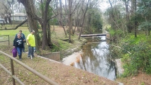
CATEGORIES: Bridge
LAYER: Bridge
GPS: 30.84287, -83.30113
OWNERSHIP: Public, City of Valdosta
WATER BODY: One Mile Branch
MILE: 0.81
ADDRESS: Between Baytree Drive and Brookhaven Drive. Lowndes County.
DESCRIPTION: More of a box culvert than a bridge. Numerous large raw sewage spills just downstream.
WEBSITE: https://www.valdostacity.com/engineering/stormwater-division/master-stormwater-management-plan
PHOTO: https://wwals.net/pictures/2019-02-10–wq-testing-one-mile-branch/20190210_161905.jpg
PHOTOSET: https://wwals.net/pictures/2019-02-10–wq-testing-one-mile-branch/
PHOTO SOURCE: John S. Quarterman
PHONE NUMBER: (229) 242-0102
Suggestions: https://forms.gle/DipPgU2TP5atc2Rf9
Wainwright Drive Manhole
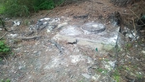
CATEGORIES: Spill
LAYER: Point of Interest
OWNERSHIP: Private
WATER BODY: One Mile Branch
MILE: 0.76
ADDRESS: 1208 Wainwright Drive, Valdosta, GA 31601, Lowndes County.
DESCRIPTION: Manhole from which hundreds of thousands of gallons of raw sewage have spilled into One Mile Branch, thus to Sugar Creek and the Withlacoochee River.
HISTORIC FACTS: One in a long series of sewage spills “”1200 Block of Wainwright Dr. = 37, 500 gallons”” 2021-07-07 during Tropical Storm Elsa.
WEBSITE: https://wwals.net/2019/02/11/testing-water-quality-one-mile-branch-valdosta-ga-2019-02-10/
OTHER REFERENCE: https://wwals.net/pictures/2021-07-08–sewage-spills-valdosta-starke
PHOTO: https://wwals.net/pictures/2019-02-10–wq-testing-one-mile-branch/20190210_171842.jpg
PHOTOSET: https://wwals.net/pictures/2019-02-10–wq-testing-one-mile-branch/
PHOTO SOURCE: John S. Quarterman
PHONE NUMBER: (229) 242-0102
Suggestions: https://forms.gle/DipPgU2TP5atc2Rf9
Melody Lane Culvert
CATEGORIES: Bridge
LAYER: Bridge
GPS: 30.84119, -83.30463
OWNERSHIP: Public
WATER BODY: One Mile Branch
MILE: 0.54
ADDRESS: 1050 Melody Lane, Valdosta, GA 31601, Lowndes County.
DESCRIPTION: Culvert just south of Peek Pavement Marking.
WEBSITE: https://www.valdostacity.com/engineering/stormwater-division/master-stormwater-management-plan
Suggestions: https://forms.gle/DipPgU2TP5atc2Rf9
Azalea City Trail

CATEGORIES: Hiking Trail
LAYER: Hiking Trail
OWNERSHIP: Public, VLPRA
WATER BODY: One Mile Branch
MILE: 0.53
ADDRESS: Craig Center, 1104 W. Gordon Street, Lowndes County.
DESCRIPTION: South along One Mile Branch through VSU, Drexel Park, and Vallotton Park, ending in Vallotton Youth Complex on Woodlawn Drive.
GRN: Yes
WEBSITE: https://vlpra.com/206/Azalea-City-Trail
OTHER REFERENCE: http://www.l-a-k-e.org/blog/2013/08/expansion-of-azalea-city-trail-for-bicycles.html
PHOTO: https://www.wwals.net/pictures/2021-03-13–azalea-festival-saturday-pictures/20210313_123636.jpg
PHOTOSET: https://www.wwals.net/pictures/2021-03-13–azalea-festival-saturday-pictures/
PHOTO SOURCE: VLPRA
PHONE NUMBER: (229) 259-3507
Suggestions: https://forms.gle/DipPgU2TP5atc2Rf9
Gordon Street dead fish

CATEGORIES: Spill
LAYER: Point of Interest
GPS: 30.8405, -83.3064
OWNERSHIP: Public
WATER BODY: One Mile Branch
MILE: 0.43
ADDRESS: Just upstream of Gordon Street in One Mile Branch, Lowndes County.
DESCRIPTION: Many dead fish in One Mile Branch.
WEBSITE: https://www.wwals.net/pictures/2022-09-23–one-mile-branch-fish-kill/#Gordon-Street-in-Remerton
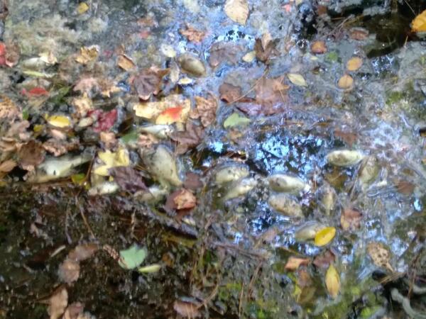
PHOTOSET: https://www.wwals.net/pictures/2022-09-23–one-mile-branch-fish-kill/
PHOTO SOURCE: Scotti Jay
PHONE NUMBER: (850) 290-2350
Suggestions: https://forms.gle/DipPgU2TP5atc2Rf9
W Gordon St Culvert
CATEGORIES: Bridge
LAYER: Bridge
GPS: 30.8404, -83.30656
OWNERSHIP: Public
WATER BODY: One Mile Branch
MILE: 0.42
ADDRESS: West of Melody Lane. Lowndes County.
DESCRIPTION: Apparently a box culvert.
WEBSITE: https://www.valdostacity.com/engineering/stormwater-division/master-stormwater-management-plan
Suggestions: https://forms.gle/DipPgU2TP5atc2Rf9
NSRR Onemile Branch Bridge
CATEGORIES: Railbridge
LAYER: Bridge
GPS: 30.8402, -83.30744
OWNERSHIP: Private
WATER BODY: One Mile Branch
MILE: 0.37
ADDRESS: North beyond the end of Lankford Circle. Lowndes County.
DESCRIPTION: Norfolk Southern Railroad Bridge over Onemile Branch.
WEBSITE: https://www.valdostacity.com/engineering/stormwater-division/master-stormwater-management-plan
Suggestions: https://forms.gle/DipPgU2TP5atc2Rf9
One Mile Branch Confluence
CATEGORIES: Tributary
LAYER: Other
GPS: 30.83959, -83.30844
OWNERSHIP: Private, Marlev Co. PARCEL 0082D 267
ACCESS: No
WATER BODY: Sugar Creek
MILE: 1.85
ADDRESS: NE beyond the end of Rouse Road and NW beyond the end of Lankford Circle. Lowndes County.
DESCRIPTION: Confluence of One Mile Branch with Sugar Creek. One Mile Branch drains Vallotton Park, Drexel Park, VSU, Sunset Hill Cemetery
AKA: Onemile Branch.
WEBSITE: https://www.valdostacity.com/engineering/stormwater-division/master-stormwater-management-plan
Suggestions: https://forms.gle/DipPgU2TP5atc2Rf9
Jackson Drive Sewage Spill
CATEGORIES: Spill
LAYER: Point of Interest
GPS: 30.81102673, -83.27182962
OWNERSHIP: Public
WATER BODY: Browns Canal
ADDRESS: 110 Jackson Drive, Valdosta, GA 31601, near the Lowndes County Sheriff Department and associated detention facilities. Lowndes County.
DESCRIPTION: Site of a 1, 800-gallon raw sewage spill due to debris. “”Did Not Enter State Waters.”” in the catchment of Dukes Bay Canal. Erroneously reported as on Jackson Street, which is In the catchment of Browns Canal.
Suggestions: https://forms.gle/DipPgU2TP5atc2Rf9
Magnolia Street Sewage Spill
CATEGORIES: Spill
LAYER: Point of Interest
OWNERSHIP: Public
WATER BODY: Browns Canal
ADDRESS: 201 W. Magnolia Street, Valdosta, GA 31601, apparently in the middle of the street. Lowndes County.
DESCRIPTION: Site of a 3, 000-gallon sewage spill into Browns Canal, Sugar Creek, Withlacoochee River, during the flash flood rain event of November 7, 2024.
WEBSITE: https://wwals.net/2024/11/08/valdosta-reports-seven-sewage-spills-two-ongoing-2024-11-08/
Suggestions: https://forms.gle/DipPgU2TP5atc2Rf9
Browns Canal
CATEGORIES: Tributary
LAYER: Other
OWNERSHIP: Private, Blanton Park LLC, PARCEL 0084B 072
ACCESS: No
WATER BODY: Sugar Creek
MILE: 1.93
ADDRESS: Confluence with Sugar Creek 1401 Lankford Dr, Lowndes County.
DESCRIPTION: Drains much of downtown and west Valdosta.
WEBSITE: http://www.valdostacity.com/Modules/ShowDocument.aspx?documentid=5024
Suggestions: https://forms.gle/DipPgU2TP5atc2Rf9
Alexis Deadfalls
CATEGORIES: Deadfall
LAYER: Point of Interest
OWNERSHIP: Public
WATER BODY: Withlacoochee River
MILE: 65.07
ADDRESS: 2306 Riverhill Drive, Valdosta, GA 31602, Lowndes County.
DESCRIPTION: Four big deadfalls close together at the top of Riverhill Drive Withlacoochee River frontage.
Suggestions: https://forms.gle/DipPgU2TP5atc2Rf9
John W. Saunders Memorial Park
CATEGORIES: Public Land
LAYER: Hiking Trail
OWNERSHIP: Public
ACCESS: No, PARKING: Free, SHELTER, PICNIC AREA, HANDICAPPED ACCESSIBLE
WATER BODY: Sugar Creek
ADDRESS: 1151 River St., Valdosta, GA 31601, Lowndes County.
DESCRIPTION: “Saunders Memorial Park is an ideal space for large gatherings as it houses 6 covered picnic shelters that are available for rent. The largest one holds up to 150 people with more than a dozen picnic tables and has its own designated restrooms. The other shelters hold two picnic tables each. Every shelter features electricity and a designated grill. A paved walking and nature trail leads from the largest shelter through a beautifully shaded wooded area. The park also boasts two regulation-sized outdoor basketball courts, a splash pad, a playground, and an amphitheater complete with electricity and stage lights that can seat hundreds of people. The shelters, amphitheater, and basketball courts are all available for rent.””, Home of Barber Spring site of historic Barber Pool.
HISTORIC FACTS: Originally called Barber Park, after the owner of the former swimming pool resort using water from the now-mostly-dry Barber Spring. Renamed in 2006 in memory of “”the first African-American county extension agent appointed in Lowndes County and founder of the Valdosta-Lowndes County Ham and Egg Show. He died in 1987.””
WEBSITE: https://vlpra.com/200/John-W-Saunders-Memorial-Park
Suggestions: https://forms.gle/DipPgU2TP5atc2Rf9
Riverhill Drive Deadfall

CATEGORIES: Clearedfall
LAYER: Point of Interest
OWNERSHIP: Public, BROWNING EMILY, PARCEL 0079B 001A
WATER BODY: Withlacoochee River
MILE: 64.92
ADDRESS: 2316 Riverhill Drive, Valdosta, GA 31602, 3/4 mile downstream from Sugar Creek, 1/3 mile upstream from I-75, 2.5 miles upstream from the Little River Confluence. Lowndes County.
DESCRIPTION: A large oak completely across the river, removed by WWALS 2022-10-16 at request of landowner.
WEBSITE: https://www.wwals.net/pictures/2022-07-30–chainsaw-cleanup-pictures/#RDDF2
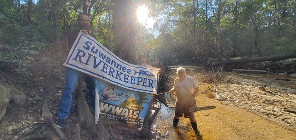
PHOTO SOURCE: John S. Quarterman
PHONE NUMBER: (229) 242-0102
Suggestions: https://forms.gle/DipPgU2TP5atc2Rf9
Springhill Drive Sheri Run Spill
CATEGORIES: Spill
LAYER: Point of Interest
OWNERSHIP: Public
WATER BODY: Sheri Run
MILE: 0.19
ADDRESS: 1600 Springhill Drive, Valdosta, GA 31601, Lowndes County.
DESCRIPTION: “”a ruptured sewer line caused a periodic discharge and an estimated 840 gallons was released into the local tributary. City staff were able to stop the discharge and began cleanup and disinfecting this location. All appropriate regulatory and public health agencies have been notified, and warning signs have been posted.””
HISTORIC FACTS: 840-gallon sewage spill, 2022-07-25. https://www.valdostacity.com/news/ruptured-sewer-line-causes-discharge
WEBSITE: https://www.valdostacity.com/news/ruptured-sewer-line-causes-discharge
Suggestions: https://forms.gle/DipPgU2TP5atc2Rf9
Sheri Run Trash Trap

CATEGORIES: Point Of Interest
LAYER: Point of Interest
OWNERSHIP: Public
WATER BODY: Sheri Run
MILE: 0.11
ADDRESS: 2133 Baytree Road, Valdosta, GA 31602, Lowndes County.
DESCRIPTION: A quarter-million-dollar concrete trash trap that keeps fast food containers and other waste from St. Augustine Road and Valdosta Mall from getting into Lake Sheri and the Withlacoochee River.
HISTORIC FACTS: The first trash trap installed on any creek in Valdosta.
PHOTO: https://www.wwals.net/pictures/2020-12-08–sheri-run-lake-sheri/20201208_101636.jpg
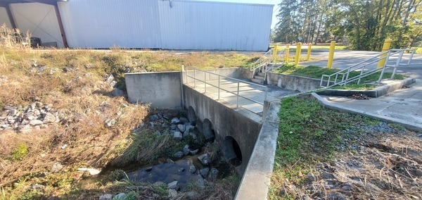
PHOTOSET: https://www.wwals.net/pictures/2020-12-08–sheri-run-lake-sheri/
PHOTO SOURCE: John S. Quarterman
PHONE NUMBER: (229) 242-0102
Suggestions: https://forms.gle/DipPgU2TP5atc2Rf9
River Hill Baptist Church Cemetery

CATEGORIES: Cemetery
LAYER: Point of Interest
GPS: 30.852674, -83.33222
OWNERSHIP: Private, CEMETERY AT WITHALOOCHEE RIVER NEXT TO ELKS CLUB ON PALLBEARERS LANE, PARCEL 0081B 002
WATER BODY: Withlacoochee River
MILE: 64.57
ADDRESS: 2198 Baytree Road, Valdosta, GA 31602, Lowndes County.
DESCRIPTION: Older cemetery with 46 known graves, 92 in all. The corresponding church is River Hill Missionary Baptist Church at 2884 James Rd, Valdosta, GA 31601.
AKA: River Hill Cemetery or CEMETERY AT WITHALOOCHEE RIVER NEXT TO ELKS CLUB ON PALLBEARERS LANE
WEBSITE: https://www.findagrave.com/cemetery/36618/river-hill-cemetery
PHOTO: http://www.l-a-k-e.org/blog/wp-content/uploads/2018/07/834f043d12f58552a654ad5e73f4b491.jpg
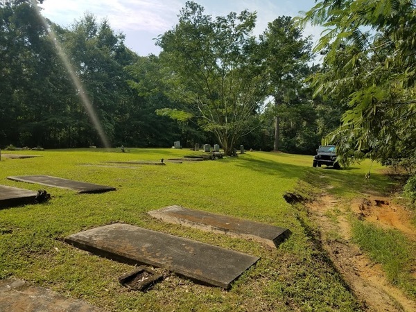
PHOTOSET: http://www.l-a-k-e.org/blog/2018/07/river-hill-cemetery-2018-07-21.html
PHOTO SOURCE: Aaron Sirmons
PHONE NUMBER: (478) 308-1777
Suggestions: https://forms.gle/DipPgU2TP5atc2Rf9
Sheri Run

CATEGORIES: Tributary
LAYER: Other
OWNERSHIP: Private, MAGIC MEDIA REAL ESTATE LLC, PARCEL 0081B 001
WATER BODY: Withlacoochee River
MILE: 64.57
ADDRESS: Left bank, about 845 feet upstream from the I-75 bridge, which you cannot see, but you can hear. Past the end of Baytree Road, Valdosta, GA 31602. Lowndes County.
DESCRIPTION: Drains Lake Sheri, running past River Hill Baptist Church Cemetery to the Withlacoochee River.
WEBSITE: https://www.wwals.net/pictures/2022-07-30–chainsaw-cleanup-pictures/#SR
PHOTO: https://www.wwals.net/pictures/2022-07-30–chainsaw-cleanup-pictures/20220730_141408.jpg
PHOTOSET: https://www.wwals.net/pictures/2022-07-30–chainsaw-cleanup-pictures/#SR
PHOTO SOURCE: John S. Quarterman
PHONE NUMBER: (229) 242-0102
Suggestions: https://forms.gle/DipPgU2TP5atc2Rf9
I-75 Landing

CATEGORIES: Landing Private
LAYER: Other
OWNERSHIP: Private, MAGIC MEDIA REAL ESTATE LLC, PARCEL 0081B 001
ACCESS: Launch: steep riverbank off of overgrown dirt access road from end of Baytree Road.
WATER BODY: Withlacoochee River
MILE: 64.55
ADDRESS: Left bank, about 740 feet upstream from the I-75 bridge; you can’t see the highway, but you can hear it. West on Baytree Road in Valdosta, follow the bend north past The Grove Apartments, bear left at the branch, continue to the river. Lowndes County.
DESCRIPTION: You could take out here in an emergency, up a steep but not tall slope to an overgrown dirt road. But it’s on private property, so don’t unless you have permission.
WEBSITE: https://www.wwals.net/pictures/2022-11-03–wq/#I75
PHOTO: https://www.wwals.net/pictures/2022-07-30–chainsaw-cleanup-pictures/20220730_141539.jpg
PHOTOSET: https://www.wwals.net/pictures/2022-07-30–chainsaw-cleanup-pictures/#MMR
PHOTO SOURCE: John S. Quarterman
PHONE NUMBER: (229) 242-0102
PHOTO2: https://www.wwals.net/pictures/2022-11-03–wq/20221103_114219.jpg
Photoset2: https://www.wwals.net/pictures/2022-11-03–wq/#I75
PHOTO2 SOURCE: John S. Quarterman
Photo2 Phone Number: 229-242-0102
Suggestions: https://forms.gle/DipPgU2TP5atc2Rf9

I-75 Bridge

CATEGORIES: Bridge
LAYER: Bridge
OWNERSHIP: Public
WATER BODY: Withlacoochee River
MILE: 64.41
ADDRESS: About a mile north of exit 18. Lowndes County.
DESCRIPTION: Possibly the most prominently signed Withlacoochee River bridge.507.9′ 14-span prestressed concrete multi-beam bridge built in 1961, reconstructed in 2004.
WEBSITE: https://bridgereports.com/1099474
PHOTO: https://www.wwals.net/pictures/2022-07-30–chainsaw-cleanup-pictures/20220730_141904.jpg
PHOTOSET: https://www.wwals.net/pictures/2022-07-30–chainsaw-cleanup-pictures/#I75B
PHOTO SOURCE: John S. Quarterman
PHONE NUMBER: (229) 242-0102
PHOTO2: https://www.wwals.net/pictures/2022-07-30–chainsaw-cleanup-pictures/20220730_142017.jpg
Photoset2: https://www.wwals.net/pictures/2022-07-30–chainsaw-cleanup-pictures/#I75B
PHOTO2 SOURCE: John S. Quarterman
Photo2 Phone Number: 229-242-0102
Suggestions: https://forms.gle/DipPgU2TP5atc2Rf9

Crowe Deadfall

CATEGORIES: Clearedfall
LAYER: Point of Interest
OWNERSHIP: Public, CROWE SEAN M & REBECCA W CROWE, PARCEL 0079C 002
WATER BODY: Withlacoochee River
MILE: 64.07
ADDRESS: Less than half a mile downstream from the I-75 Bridge, and a third of a mile upstream from the GA 133 Withlacoochee River Bridge. Lowndes County.
DESCRIPTION: A single large tree all the way across the river.
WEBSITE: https://www.wwals.net/pictures/2022-07-30–chainsaw-cleanup-pictures/#CroweDF
PHOTO: https://www.wwals.net/pictures/2022-07-30–chainsaw-cleanup-pictures/20220730_143304.jpg
PHOTOSET: https://www.wwals.net/pictures/2022-07-30–chainsaw-cleanup-pictures/#CroweDF
PHOTO SOURCE: John S. Quarterman
PHONE NUMBER: (229) 242-0102
Suggestions: https://forms.gle/DipPgU2TP5atc2Rf9
Val Tech Road Solar 

CATEGORIES: Solar
LAYER: Point of Interest
OWNERSHIP: Public
WATER BODY: Withlacoochee River
MILE: 63.97
ADDRESS: 3210 Val Tech Rd, Valdosta, GA 31602, Lowndes County.
DESCRIPTION: Solar panels on old closed landfill. Owned by City of Valdosta.
WEBSITE: http://www.l-a-k-e.org/blog/2017/09/valdosta-solar-power-on-val-tech-road.html
PHOTO: http://www.l-a-k-e.org/blog/wp-content/uploads/2017/09/e249320b55a0458c72115ad183e99736.jpg
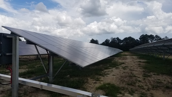
PHOTOSET: http://www.l-a-k-e.org/blog/2017/09/valdosta-solar-power-on-val-tech-road.html
PHOTO SOURCE: John S. Quarterman
PHONE NUMBER: (229) 242-0102
Suggestions: https://forms.gle/DipPgU2TP5atc2Rf9
Troupville Town Site Marker
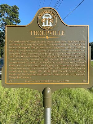
CATEGORIES: Town Site
LAYER: Point of Interest
OWNERSHIP: Public
ACCESS: PARKING: Free
WATER BODY: Withlacoochee River
MILE: 63.66
ADDRESS: On the north side of GA-133 (St. Augustine Road), west of I-75, just east of the Withlacoochee River. You can pull off an park right by the marker. Lowndes County.
DESCRIPTION: A replacement historical marker about the former town of Troupville. “”The settlement of Troupville once existed near here, about four miles northwest of present-day Valdosta. The town was named Troupville in honor of Georgie M. Troup, governor of Georgia from 1823 to 1827. In 1833, the county seat of Lowndes County moved from Franklinville to Troupville, which was incorporated in 1837 and continued as county seat until 1860. When the Atlantic and Gulf Railroad, running from Savannah toward Pensacola, surveyed for right-of-way in the area, the proposed route bypassed Troupville. Lowndes County established the new town of Valdosta on the new railroad line. Shortly after train operations began in 1860 the county seat transferred to Valdosta. Early residents of the town include the Ayer, Briggs, Ellis, Griffin, Hall, Howell, Jones, Morgan, Smith, and Treadwell families, many of whom are buried at the nearby Troupville Cemetery.
HISTORIC FACTS: “”Re-erected by the Georgia Historical Society in 2024″”
PHOTO: https://www.wwals.net/pictures/2024-10-23–troupville-marker/Troupville-scaled.jpg
PHOTOSET: https://www.wwals.net/pictures/2024-10-23–troupville-marker/
PHOTO SOURCE: Georgia Historical Society
PHONE NUMBER: (850) 290-2350
Suggestions: https://forms.gle/DipPgU2TP5atc2Rf9
GA 133 Withlacoochee Bridge
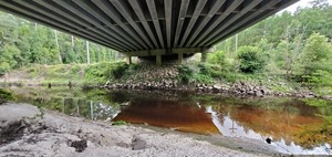
CATEGORIES: Bridge
LAYER: Bridge
OWNERSHIP: Public
WATER BODY: Withlacoochee River
MILE: 63.67
ADDRESS: 1599 St Augustine Rd, Valdosta, GA, Lowndes County.
DESCRIPTION: West of Valdosta off of I-75 exit 18. 460.0′ 5-span prestressed concrete multi-beam bridge built in 2000. There is no regular public access here. Go to Troupville Boat Ramp on the Little River instead; its entrance is a few hundred feet west on GA 133, at 19664 Valdosta Highway, Valdosta, Georgia, 31602.
HISTORIC FACTS: Site of frequent very high E. coli in test results by Valdosta in 2020. The problem seems to have stopped, although we never found who was dumping.
WEBSITE: https://bridgereports.com/1099551
ADDITIONAL INFO SOURCES: https://www.theswimguide.org/beach/9935
PHOTO: https://wwals.net/pictures/2020-12-21–wq/20200823_150853.jpg
PHOTOSET: https://wwals.net/pictures/2020-12-21–wq/
PHOTO SOURCE: John S. Quarterman
PHONE NUMBER: (229) 242-0102
PHOTO2: https://www.wwals.net/pictures/2022-07-30–chainsaw-cleanup-pictures/20220730_151512.jpg
Photoset2: https://www.wwals.net/pictures/2022-07-30–chainsaw-cleanup-pictures/#GA133L
PHOTO2 SOURCE: John S. Quarterman
Photo2 Phone Number: 229-242-0102
Suggestions: https://forms.gle/DipPgU2TP5atc2Rf9

“Bottom of Flood Inundation Map, GA 133 Bridge”
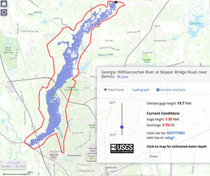
CATEGORIES: Point Of Interest
LAYER: Other
GPS: 30.8499, -83.3398
OWNERSHIP: Public
WATER BODY: Withlacoochee River
MILE: 63.66
ADDRESS: Just downstream of GA 133 Withlacoochee River Bridge. Lowndes County.
DESCRIPTION: Uses LiDAR data paid for by Valdosta and Lowndes County.
WEBSITE: https://fim.wim.usgs.gov/fim/?site_no=023177483
PHOTO: https://wwals.net/pictures/2019-10-21–fim/15.7feet.jpg
PHOTOSET: https://wwals.net/pictures/2019-10-21–fim/
PHOTO SOURCE: John S. Quarterman
PHONE NUMBER: (229) 242-0102
Suggestions: https://forms.gle/DipPgU2TP5atc2Rf9
GA 133 Power Line
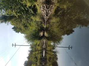
CATEGORIES: Power Line
LAYER: Point of Interest
GPS: 30.84985, -83.3399
OWNERSHIP: Public
WATER BODY: Withlacoochee River
MILE: 63.65
ADDRESS: Just downstream of GA 133 Withlacoochee River Bridge. Lowndes County.
DESCRIPTION: A new (2020) Lowndes County sewer force main crosses the Withlacoochee River here.
WEBSITE: https://wwals.net/2018/07/24/withlacoochee-river-near-troupville-2018-07-21/
PHOTO: https://wwals.net/wp-content/themes/pianoblack/img/2018/07/71955b63f4cfd1c2beedbfbe43d24a6c.jpg
PHOTOSET: https://wwals.net/2018/07/24/withlacoochee-river-near-troupville-2018-07-21/
PHOTO SOURCE: Aaron Sirmons
PHONE NUMBER: (478) 308-1777
Suggestions: https://forms.gle/DipPgU2TP5atc2Rf9
GA 133 Deadfall
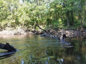
CATEGORIES: Clearedfall
LAYER: Other
OWNERSHIP: Public
WATER BODY: Withlacoochee RIver
MILE: 63.57
ADDRESS: 75 yards past GA 133, Lowndes County.
DESCRIPTION: Deadfall with large accumilation of trash and dead limbs, blocking half the river
WEBSITE: https://wwals.net/2018/07/24/withlacoochee-river-near-troupville-2018-07-21/
PHOTO: https://wwals.net/wp-content/themes/pianoblack/img/2018/07/ff65071f7e63b8eade7ac7b8dc06842e.jpg
PHOTOSET: https://wwals.net/2018/07/24/withlacoochee-river-near-troupville-2018-07-21/
PHOTO SOURCE: Aaron Sirmons
PHONE NUMBER: (478) 308-1777
Suggestions: https://forms.gle/DipPgU2TP5atc2Rf9
Morgan’s Spring 
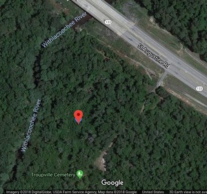
CATEGORIES: Spring
LAYER: Other
OWNERSHIP: Private
WATER BODY: Withlacoochee RIver
MILE: 63.55
ADDRESS: Left bank (east) of Withlacoochee River, between Troupville Cemetery and St. Augustine Road (GA 133), Valdosta, GA 31602, Lowndes County.
DESCRIPTION: Used by travelers on the stagecoach road through Troupville, the old county seat of Lowndes County. For access to cemetery only call 229-561-0606
HISTORIC FACTS: Used by residents of Troupville, the former seat of Lowndes County, and popular with travellers back then.
GRN: Yes
WEBSITE: https://wwals.net/2018/03/16/ockolocoochee-little-river-1889-01-29/
PHOTO: https://wwals.net/wp-content/themes/pianoblack/img//2018/04/86cf891afe613633554ebf309869f938.jpg
PHOTOSET: https://goo.gl/maps/pcGugrDRpxJ2
PHOTO SOURCE: Google maps
PHONE NUMBER: (850) 290-2350
Suggestions: https://forms.gle/DipPgU2TP5atc2Rf9
Troupville Cemetery
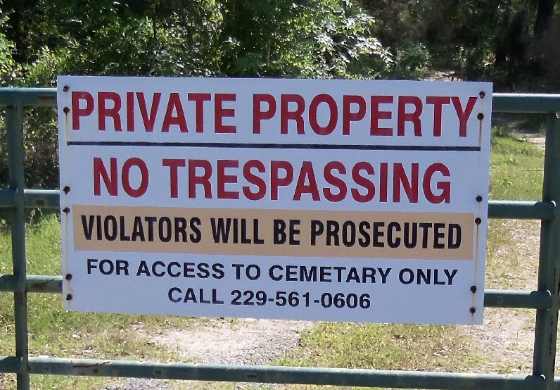
CATEGORIES: Cemetery
LAYER: Point of Interest
GPS: 30.8478, -83.339879
OWNERSHIP: Private
WATER BODY: Withlacoochee River
MILE: 63.51
ADDRESS: Left bank (east) of Withlacoochee River, south of St. Augustine Road (GA 133), Valdosta, GA 31602, Lowndes County.
DESCRIPTION: Historic cemetery of the previous county seat of Lowndes County. For access to cemetery only call 229-561-0606
HISTORIC FACTS: Used by residents of Troupville, the former seat of Lowndes County, before they moved their town to form present-day Valdosta.
WEBSITE: https://www.findagrave.com/cemetery/37432/troupville-cemetery
PHOTO: https://images.findagrave.com/photos/2012/116/CEM37432_133549590439.jpg
PHOTOSET: https://www.findagrave.com/cemetery/37432/troupville-cemetery
PHOTO SOURCE: Adam Conger
PHONE NUMBER: (850) 290-2350
Suggestions: https://forms.gle/DipPgU2TP5atc2Rf9
Troupville Cutoff
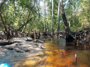
CATEGORIES: Point Of Interest
LAYER: Other
OWNERSHIP: Public
WATER BODY: Withlacoochee RIver
MILE: 63.38
ADDRESS: Left bank (east) of Withlacoochee River, Lowndes County.
DESCRIPTION: New cutoff forming before a meander, lots of water diverting to cutoff
WEBSITE: https://wwals.net/2018/07/24/withlacoochee-river-near-troupville-2018-07-21/
PHOTO: https://wwals.net/wp-content/themes/pianoblack/img/2018/07/1fcd42d88a2ff6cbc13ef5da88065594.jpg
PHOTOSET: https://wwals.net/2018/07/24/withlacoochee-river-near-troupville-2018-07-21/
PHOTO SOURCE: Aaron Sirmons
PHONE NUMBER: (478) 308-1777
PHOTO2: https://www.wwals.net/pictures/2022-07-30–chainsaw-cleanup-pictures/20220730_152619.jpg
Photoset2: https://www.wwals.net/pictures/2022-07-30–chainsaw-cleanup-pictures/#TVCO
PHOTO2 SOURCE: John S. Quarterman
Photo2 Phone Number: 229-242-0102
Suggestions: https://forms.gle/DipPgU2TP5atc2Rf9

Meander Deadfall

CATEGORIES: Clearedfall
LAYER: Other
OWNERSHIP: Public
WATER BODY: Withlacoochee RIver
MILE: 63.20
ADDRESS: At the end of sharp meander in Withlacoochee River, Lowndes County.
DESCRIPTION: Numerous deadfalls that block different spots of the river, leaving 5 feet wide area to paddle through
HISTORIC FACTS: Cleared with chainsaws by WWALS 2022-07-30. https://www.wwals.net/pictures/2022-07-30–chainsaw-cleanup-pictures/#TCDF
WEBSITE: https://wwals.net/2018/07/24/withlacoochee-river-near-troupville-2018-07-21/
PHOTO: https://wwals.net/wp-content/themes/pianoblack/img/2018/07/1e8e947d69fa89cd81317e0ec926a1a5-1.jpg
PHOTO SOURCE: Aaron Sirmons
PHONE NUMBER: (478) 308-1777
Suggestions: https://forms.gle/DipPgU2TP5atc2Rf9
Troupville Cutoff end
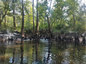
CATEGORIES: Point Of Interest
LAYER: Other
OWNERSHIP: Public
WATER BODY: Withlacoochee RIver
MILE: 63.12
ADDRESS: Downstream end of cutoff on left (east) bank of Withlacoochee River, just past sharp meander, Lowndes County.
DESCRIPTION: Downstream end of new cutoff, not able to paddle due to numerous cypress roots blocking cutoff
WEBSITE: https://wwals.net/2018/07/24/withlacoochee-river-near-troupville-2018-07-21/
PHOTO: https://wwals.net/wp-content/themes/pianoblack/img/2018/07/7b7b9029c5ce5d56fa452859beafe54a-1.jpg
PHOTOSET: https://wwals.net/2018/07/24/withlacoochee-river-near-troupville-2018-07-21/
PHOTO SOURCE: Aaron Sirmons
PHONE NUMBER: (478) 308-1777
PHOTO2: https://www.wwals.net/pictures/2022-07-30–chainsaw-cleanup-pictures/20220730_153342.jpg
Photoset2: https://www.wwals.net/pictures/2022-07-30–chainsaw-cleanup-pictures/#TVCO
PHOTO2 SOURCE: John S. Quarterman
Photo2 Phone Number: 229-242-0102
Suggestions: https://forms.gle/DipPgU2TP5atc2Rf9

Troupville Cutoff Deadfall

CATEGORIES: Clearedfall
LAYER: Point of Interest
OWNERSHIP: Public
WATER BODY: Withlacoochee River
MILE: 63.11
ADDRESS: Just downstream from Troupville Cutoff End, 0.56 miles downstream of the GA 133 Bridge and 0.64 miles upstream from the Little River Confluence. Lowndes County.
DESCRIPTION: Some deadfalls at Troupville Cutoff.
HISTORIC FACTS: Cleared with chainsaws by WWALS 2022-07-30. https://www.wwals.net/pictures/2022-07-30–chainsaw-cleanup-pictures/#TCDF
WEBSITE: https://www.wwals.net/pictures/2022-07-30–chainsaw-cleanup-pictures/#TCDF
PHOTO: https://www.wwals.net/pictures/2022-07-30–chainsaw-cleanup-pictures/20220730_153456.jpg
PHOTOSET: https://www.wwals.net/pictures/2022-07-30–chainsaw-cleanup-pictures/#TCDF
PHOTO SOURCE: John S. Quarterman
PHONE NUMBER: (229) 242-0102
Suggestions: https://forms.gle/DipPgU2TP5atc2Rf9
Loch Winn Run Trashjam

CATEGORIES: Point Of Interest
LAYER: Point of Interest
OWNERSHIP: Public
WATER BODY: Withlacoochee River
MILE: 63.05
ADDRESS: At confluence of Loch Winn Run, downstream of Troupville Cutoff. Lowndes County.
DESCRIPTION: Big floating trashjam.
WEBSITE: https://www.wwals.net/pictures/2022-07-30–chainsaw-cleanup-pictures/#LWRTJ
PHOTO: https://www.wwals.net/pictures/2022-07-30–chainsaw-cleanup-pictures/20220730_154712.jpg
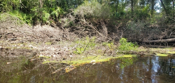
PHOTOSET: https://www.wwals.net/pictures/2022-07-30–chainsaw-cleanup-pictures/#LWRTJ
PHOTO SOURCE: John S. Quarterman
PHONE NUMBER: (229) 242-0102
Suggestions: https://forms.gle/DipPgU2TP5atc2Rf9
CiHiG Deadfall

CATEGORIES: Deadfall
LAYER: Point of Interest
OWNERSHIP: Public
WATER BODY: Withlacoochee River
MILE: 62.82
ADDRESS: A fifth of a mile upstream from DF3 and a third of a mile upstream from the Little River Confluence. Lowndes County.
DESCRIPTION: A big log cleared, but a slightly smaller one underneath: Cut it Here, I Guess Deadfall.
HISTORIC FACTS: The big log cleared with chainsaws by WWALS 2022-11-23 Need to return at lower water to get the lower log. https://www.wwals.net/pictures/2024-11-23–withlacoochee-chainsaw-cleanup-troupville-pictures/#CiHiG
AKA: Cut it Here, I Guess Deadfall
WEBSITE: https://www.wwals.net/pictures/2024-11-23–withlacoochee-chainsaw-cleanup-troupville-pictures/#CiHiG
PHOTOSET: https://www.wwals.net/pictures/2024-11-23–withlacoochee-chainsaw-cleanup-troupville-pictures/#CiHiG
PHOTO SOURCE: John S. Quarterman
PHONE NUMBER: (229) 242-0102
Suggestions: https://forms.gle/DipPgU2TP5atc2Rf9
MTS Deadfall

CATEGORIES: Clearedfall
LAYER: Point of Interest
OWNERSHIP: Public
WATER BODY: Withlacoochee River
MILE: 62.65
ADDRESS: Right bank, just upstream from DF3, 0.18 miles upstream from Little River Confluence, Lowndes County.
DESCRIPTION: A branching deadfall obstructing the best passage through some shallows, now cleared.
HISTORIC FACTS: Cleared with chainsaws by WWALS 2022-11-23 https://www.wwals.net/pictures/2024-11-23–withlacoochee-chainsaw-cleanup-troupville-pictures/#MTS
WEBSITE: https://www.wwals.net/pictures/2024-11-23–withlacoochee-chainsaw-cleanup-troupville-pictures/#MTS
PHOTOSET: https://www.wwals.net/pictures/2024-11-23–withlacoochee-chainsaw-cleanup-troupville-pictures/#MTS
PHOTO SOURCE: Phil Royce
PHONE NUMBER: (850) 290-2350
Suggestions: https://forms.gle/DipPgU2TP5atc2Rf9
DF3

CATEGORIES: Clearedfall
LAYER: Point of Interest
OWNERSHIP: Public
WATER BODY: Withlacoochee River
MILE: 62.65
ADDRESS: Stump sticking out from right bank, 0.18 miles upstream from Little River Confluence. Lowndes County.
DESCRIPTION: A quite large tree across the Withlacoochee River; cleared now.
HISTORIC FACTS: Cleared with chainsaws by WWALS 2022-06-25. https://wwals.net/pictures/2022-06-25–chainsaw-cleanup-pictures/#DF3
WEBSITE: https://wwals.net/pictures/2022-06-25–chainsaw-cleanup-pictures/#DF3
PHOTO: https://wwals.net/pictures/2022-06-25–chainsaw-cleanup-pictures/20220625_131732.jpg
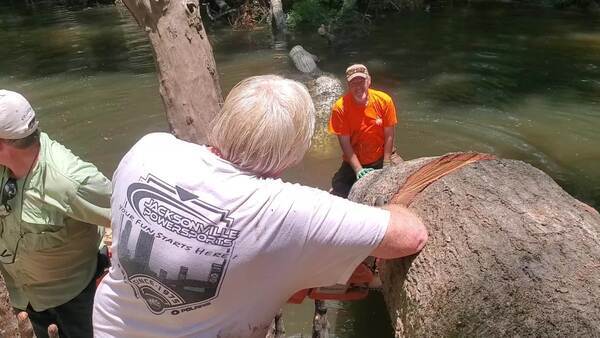
PHOTOSET: https://wwals.net/pictures/2022-06-25–chainsaw-cleanup-pictures/#DF3
PHOTO SOURCE: John S. Quarterman
PHONE NUMBER: (229) 242-0102
PHOTO2: https://wwals.net/pictures/2022-06-25–chainsaw-cleanup-pictures/Last-Jam.jpg
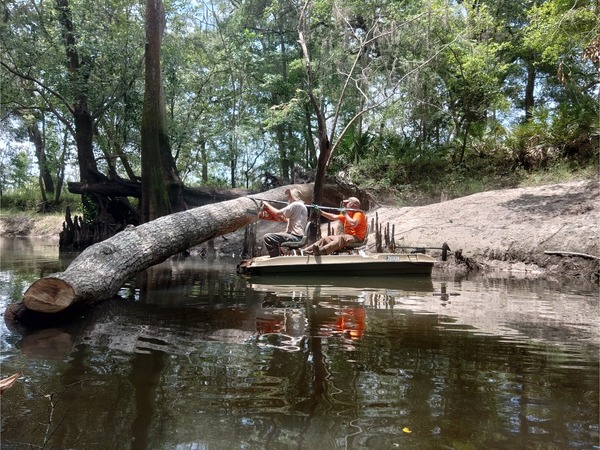
Photoset2: https://wwals.net/pictures/2022-06-25–chainsaw-cleanup-pictures/#DF3
PHOTO2 SOURCE: Phil Royce
Suggestions: https://forms.gle/DipPgU2TP5atc2Rf9

Oak Clearing

CATEGORIES: Point Of Interest
LAYER: Point of Interest
OWNERSHIP: Private, BETWEEN THE RIVERS LLC & T W PAINE, PARCEL 0057 003
WATER BODY: Withlacoochee River
MILE: 62.59
ADDRESS: 0.18 miles upstream from Little River Confluence, or 850 feet down the path south from the Confluence. Lowndes County.
DESCRIPTION: A clearing in the woods, under some big oaks.
WEBSITE: https://www.wwals.net/pictures/2022-07-02–troupville-river-park/#DF2
PHOTO: https://www.wwals.net/pictures/2022-07-02–troupville-river-park/20220702_094646.jpg
PHOTOSET: https://www.wwals.net/pictures/2022-07-02–troupville-river-park/#DF2
PHOTO SOURCE: John S. Quarterman
PHONE NUMBER: (229) 242-0102
Photoset2: https://www.wwals.net/pictures/2021-10-14–ga-al-land-trust-land-between-the-rivers/#TRC
PHOTO2 SOURCE: John S. Quarterman
Photo2 Phone Number: 229-242-0102
Suggestions: https://forms.gle/DipPgU2TP5atc2Rf9

DF2
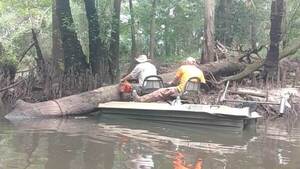
CATEGORIES: Clearedfall
LAYER: Point of Interest
OWNERSHIP: Public
WATER BODY: Withlacoochee River
MILE: 62.59
ADDRESS: 0.12 miles upstream from Little River Confluence. Lowndes County.
DESCRIPTION: A large tree across the Withlacoochee River; cleared now.
HISTORIC FACTS: Cleared with chainsaws by WWALS 2022-06-25. https://wwals.net/pictures/2022-06-25–chainsaw-cleanup-pictures/#DF2
WEBSITE: https://wwals.net/pictures/2022-06-25–chainsaw-cleanup-pictures/#DF2
PHOTO: https://wwals.net/pictures/2022-06-25–chainsaw-cleanup-pictures/secondjam4.jpg
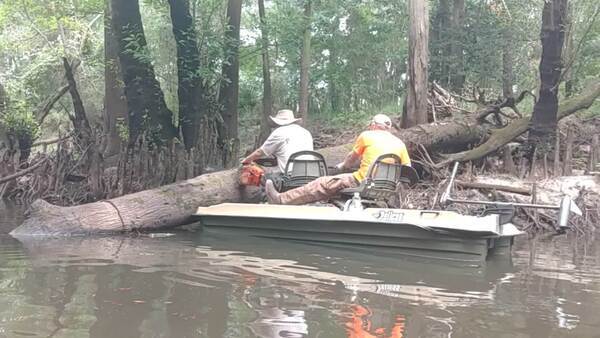
PHOTOSET: https://wwals.net/pictures/2022-06-25–chainsaw-cleanup-pictures/#DF2
PHOTO SOURCE: Phil Royce
PHONE NUMBER: (850) 290-2350
PHOTO2: https://wwals.net/pictures/2022-06-25–chainsaw-cleanup-pictures/Second-jam2.jpg
Photoset2: https://wwals.net/pictures/2022-06-25–chainsaw-cleanup-pictures/#DF2
PHOTO2 SOURCE: Phil Royce
Suggestions: https://forms.gle/DipPgU2TP5atc2Rf9

Big log above deadfall

CATEGORIES: Deadfall
LAYER: Point of Interest
OWNERSHIP: Public
WATER BODY: Withlacoochee River
MILE: 62.57
ADDRESS: 0.1 miles upstream from Little River Confluence, Lowndes County.
DESCRIPTION: A big log deadfall high enough to paddle under at most water levels.
HISTORIC FACTS: WWALS removed smaller deadfall underneath to enable paddling. 2024-11-23 https://www.wwals.net/pictures/2024-11-23–withlacoochee-chainsaw-cleanup-troupville-pictures/#PRBL
WEBSITE: https://www.wwals.net/pictures/2024-11-23–withlacoochee-chainsaw-cleanup-troupville-pictures/#PRBL
PHOTOSET: https://www.wwals.net/pictures/2024-11-23–withlacoochee-chainsaw-cleanup-troupville-pictures/
PHOTO SOURCE: John S. Quarterman
PHONE NUMBER: (229) 242-0102
Suggestions: https://forms.gle/DipPgU2TP5atc2Rf9
DF1

CATEGORIES: Clearedfall
LAYER: Point of Interest
OWNERSHIP: Public
WATER BODY: Withlacoochee River
MILE: 62.55
ADDRESS: 0.8 miles upstream from Little River Confluence. Lowndes County.
DESCRIPTION: A sizeable logjam just upstream from the planned site of Troupville River Camp on the Withlacoochee River.
HISTORIC FACTS: Cleared with chainsaws by WWALS 2022-06-25. https://wwals.net/pictures/2022-06-25–chainsaw-cleanup-pictures/#DF1
WEBSITE: https://wwals.net/pictures/2022-06-25–chainsaw-cleanup-pictures/#DF1
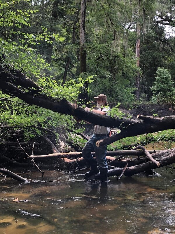
PHOTOSET: https://wwals.net/pictures/2022-06-25–chainsaw-cleanup-pictures/#DF1
PHOTO SOURCE: Russell Allen McBride
PHONE NUMBER: (850) 290-2350
PHOTO2: https://wwals.net/pictures/2022-06-25–chainsaw-cleanup-pictures/20220625_101659.jpg
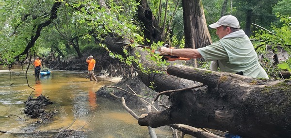
Photoset2: https://wwals.net/pictures/2022-06-25–chainsaw-cleanup-pictures/#DF1
PHOTO2 SOURCE: John S. Quarterman
Photo2 Phone Number: 229-242-0102
Suggestions: https://forms.gle/DipPgU2TP5atc2Rf9

TRC Sandbar
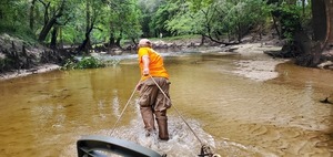
CATEGORIES: Obstacle
LAYER: Point of Interest
OWNERSHIP: Public
WATER BODY: Withlacoochee River
MILE: 62.53
ADDRESS: Just above proposed Troupville River Camp talkeout, and 0.6 miles upstream from Little River Confluence. Lowndes County.
DESCRIPTION: A sandbar requiring dragging boats at low water, just above the planned site of Troupville River Camp.
WEBSITE: https://wwals.net/pictures/2022-06-25–chainsaw-cleanup-pictures/#TRCsandbar
PHOTO: https://wwals.net/pictures/2022-06-25–chainsaw-cleanup-pictures/20220625_100603.jpg
PHOTOSET: https://wwals.net/pictures/2022-06-25–chainsaw-cleanup-pictures/#TRCsandbar
PHOTO SOURCE: John S. Quarterman
PHONE NUMBER: (229) 242-0102
PHOTO2: https://www.wwals.net/pictures/2022-07-02–troupville-river-park/20220702_094031.jpg
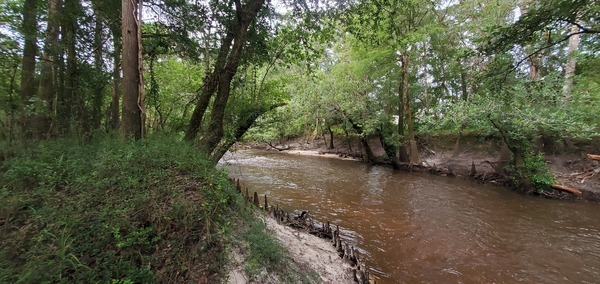
Photoset2: https://www.wwals.net/pictures/2022-07-02–troupville-river-park/#TRCSandbar
PHOTO2 SOURCE: John S. Quarterman
Photo2 Phone Number: 229-242-0102
Suggestions: https://forms.gle/DipPgU2TP5atc2Rf9

Troupville River Park (Planned) 

CATEGORIES: Public Land
LAYER: Brochure
GPS: 30.8463, -83.34735
OWNERSHIP: Public
ACCESS: Pending, DOCK: Maybe, CANOE: Pending, CAMPING, WATER, Flush Toilets, PARKING, SHELTER, PICNIC AREA, HANDICAPPED ACCESSIBLE
WATER BODY: Withlacoochee River, Little
MILE: 62.52
ADDRESS: 19664 Valdosta Hwy, Valdosta, GA 31602: on GA 133 off I-75 exit 18. Lowndes County.
DESCRIPTION: A planned 123-acre nature preserve and multi-use destination park including swimming, in the historic site of Troupville, former Lowndes County seat, on the Little and Withlacoochee Rivers down to Little River Confluence. Can host outdoor classes on botany, forestry, geology, archaeology, art. Can be implemented in phases, including Troupville River Camp. First: Valdosta and Lowndes County are finding funds to purchase the 74.14 acres of Land Between the Rivers to add to the existing 49.36 acre VLPRA park around Troupville Boat Ramp. Planned with river access both at Troupville Boat Ramp and paddle boat access at Troupville River Camp.
HISTORIC FACTS: On the site of historic Troupville, the former seat of Lowndes County, GA.
OTHER REFERENCE: https://wwals.net/2019/06/17/valdosta-and-lowndes-county-greet-paddle-georgia-at-land-between-the-rivers-2019-06-15/
ADDITIONAL INFO SOURCES: https://wwals.net/pictures/2019-10-31–wwals-gosp-troupville-river-camp/
PHOTO: https://www.wwals.net/pictures/2020-08-27–troupville-river-park-walkaround/20200827_095640.jpg
PHOTOSET: https://wwals.net/2020/08/28/pictures-troupville-river-camp-site-gretchen-quarterman-2020-08-27/
PHOTO SOURCE: Gretchen Quarterman
PHONE NUMBER: (850) 290-2350
PHOTO2: https://www.wwals.net/pictures/2022-07-02–troupville-river-park/20220702_093537.jpg
Photoset2: https://www.wwals.net/pictures/2022-07-02–troupville-river-park/#LRC
PHOTO2 SOURCE: John S. Quarterman
Photo2 Phone Number: 229-242-0102
Suggestions: https://forms.gle/DipPgU2TP5atc2Rf9
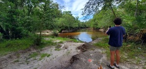
Troupville River Camp (Planned)

CATEGORIES: Public Land
LAYER: Brochure
GPS: 30.84655, -83.34735
OWNERSHIP: Public, BETWEEN THE RIVERS LLC & T W PAINE, PARCEL 0057 003
ACCESS: Pending, CAMPING, WATER, Flush Toilets, SHELTER, PICNIC AREA, HANDICAPPED ACCESSIBLE
WATER BODY: Withlacoochee River, Little River
MILE: 62.51
ADDRESS: Two hundred feet up the Withlacoochee River from the Little River Confluence. Lowndes County.
DESCRIPTION: Swimming location next to planned paddle boat takeout, boat racks, bathrooms with hot and cold water and air conditioning, a dining pavilion, and five screened-in sleeping platforms with electricity, modeled after the Suwannee River Camps. Planned as part of Troupville River Park.
HISTORIC FACTS: On the site of historic Troupville, the former seat of Lowndes County, GA.
WEBSITE: https://wwals.net/pictures/2019-10-31–wwals-gosp-troupville-river-camp/
OTHER REFERENCE: https://wwals.net/2019/06/17/valdosta-and-lowndes-county-greet-paddle-georgia-at-land-between-the-rivers-2019-06-15/
PHOTO: https://www.wwals.net/pictures/2022-07-02–troupville-river-park/20220702_093909.jpg
PHOTOSET: https://www.wwals.net/pictures/2022-07-02–troupville-river-park/#TRC
PHOTO SOURCE: John S. Quarterman
PHONE NUMBER: (229) 242-0102
PHOTO2: https://wwals.net/pictures/2022-06-25–chainsaw-cleanup-pictures/20220625_100446.jpg
Photoset2: https://wwals.net/pictures/2022-06-25–chainsaw-cleanup-pictures/#TRC
PHOTO2 SOURCE: John S. Quarterman
Photo2 Phone Number: 229-242-0102
Suggestions: https://forms.gle/DipPgU2TP5atc2Rf9

Little River Confluence
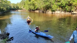
CATEGORIES: Tributary
LAYER: Other
OWNERSHIP: Public, BETWEEN THE RIVERS LLC & T W PAINE, PARCEL 0057 003
ACCESS: No
WATER BODY: Withlacoochee River
MILE: 62.47
ADDRESS: Right bank of the Withlacoochee River, about 2300 feet down the Little River from Troupville Boat Ramp. Lowndes County.
DESCRIPTION: A picturesque viewscape where the Little River joins the Withlacoochee River, which continues south. At the bottom of the site of historic Troupville, former Lowndes County seat. Future apex of Troupville River Camp.
HISTORIC FACTS: The two rivers are the reason Lowndes County put its seat Troupville there. The Little River was previously known by various names, including Ockolocoochee River, Suwanee River, Withlockoochee River, Withlacuchee River, and Sawannee River. It seems to have settled down to Little River by about 1846.
OTHER REFERENCE: https://wwals.net/2018/03/16/ockolocoochee-little-river-1889-01-29/
ADDITIONAL INFO SOURCES: https://wwals.net/pictures/2019-10-31–wwals-gosp-troupville-river-camp/
PHOTO: https://wwals.net/pictures/2019-06-15–troupville-confluence-spook-bridge/20190615_091429.jpg
PHOTOSET: https://wwals.net/pictures/2019-06-15–troupville-confluence-spook-bridge/
PHOTO SOURCE: John S. Quarterman
PHONE NUMBER: (229) 242-0102
PHOTO2 SOURCE: Bobby McKenzie
Suggestions: https://forms.gle/DipPgU2TP5atc2Rf9

Trashy Shoals

CATEGORIES: Shoal
LAYER: Other
OWNERSHIP: Public
WATER BODY: Withlacoochee River
MILE: 62.15
ADDRESS: About 2/3 of a mile downstream from Troupville Boat Ramp, or 1/3 of a mile downstream from the Little River Confluence. Brooks County.
DESCRIPTION: Shoals at low water that tend to accumulate trash from Valdosta.
HISTORIC FACTS: Trash seen on 2022 WWALS Chairman and Mayor’s Paddle, and cleaned up 2022-11-13 by Bobby McKenzie and Russell Allen McBride. https://wwals.net/pictures/2022-11-13–trash-troupville-boat-ramp
WEBSITE: https://wwals.net/pictures/2022-11-13–trash-troupville-boat-ramp
PHOTO: https://www.wwals.net/pictures/2022-11-13–trash-troupville-boat-ramp/bm-trashy-shoals-crop.jpg
PHOTOSET: https://www.wwals.net/pictures/2022-11-13–trash-troupville-boat-ramp/
PHOTO SOURCE: Bobby McKenzie
PHONE NUMBER: (850) 290-2350
PHOTO2: https://www.wwals.net/pictures/2022-11-13–trash-troupville-boat-ramp/20221113_170017.jpg
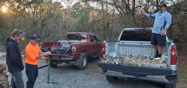
Photoset2: https://www.wwals.net/pictures/2022-11-13–trash-troupville-boat-ramp/
PHOTO2 SOURCE: John S. Quarterman
Photo2 Phone Number: 229-242-0102
Suggestions: https://forms.gle/DipPgU2TP5atc2Rf9

VMW RR Bridge

CATEGORIES: Railbridgesite
LAYER: Bridge
GPS: 30.841114, -83.35347
OWNERSHIP: Private
WATER BODY: Withlacoochee River
MILE: 61.68
ADDRESS: About 2200 feet downstream from Little River Confluence, so about 0.85 mile downstream from Troupville Boat Ramp. Lowndes, Brooks Counties.
DESCRIPTION: Nothing remains but some concrete from the bridge abutments.
HISTORIC FACTS: “”The Valdosta, Moultrie, and Western rail line was established in the first decade of the 20th century and was planned to go all the way to Arizona. Although it never went past Moultrie, it was relatively successful during the 1910s as it served many small towns in the area.””
AKA: Valdosta, Moultrie & Western Railroad Bridge.
WEBSITE: https://en.wikipedia.org/wiki/Withlacoochee_River_(Suwannee_River)
OTHER REFERENCE: http://www.okraparadisefarms.com/blog/2008/08/valdosta-moultrie-western-railroad-ga-133-and-corridor-z.html
ADDITIONAL INFO SOURCES: https://valdostamuseum.com/exhibitions/online-exhibits-2/transportation/railroads/
PHOTO: https://www.wwals.net/pictures/2021-03-27–mayors-paddle-pictures/20210327_103605.jpg
PHOTOSET: https://www.wwals.net/pictures/2021-03-27–mayors-paddle-pictures/
PHOTO SOURCE: John S. Quarterman
PHONE NUMBER: (229) 242-0102
Suggestions: https://forms.gle/DipPgU2TP5atc2Rf9
Lastinger-Scruggs Private Boat Ramp
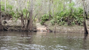
CATEGORIES: Landing Private
LAYER: Point of Interest
OWNERSHIP: Private, SUZANNE MARIE & LASTINGER SCRUGGS, JAMES KENNETH JR, PARCEL 146 0023
ACCESS: Launch: narrow dirt ramp cut through wooded riverbank, with reinforcement towards the bottom.
WATER BODY: Withlacoochee River
MILE: 61.62
ADDRESS: Right bank, 0.85 miles downstream from Little River Confluence. 1030 Riverland Drive, Valdosta, GA 31602. Brooks County.
DESCRIPTION: Narrow private boat ramp through riverbank. Do not use without permission.
WEBSITE: https://www.wwals.net/pictures/2021-03-27–mayors-paddle-pictures/
PHOTO: https://www.wwals.net/pictures/2021-03-27–mayors-paddle-pictures/20210327_103737.jpg
PHOTOSET: https://www.wwals.net/pictures/2021-03-27–mayors-paddle-pictures/
PHOTO SOURCE: John S. Quarterman
PHONE NUMBER: (229) 242-0102
Suggestions: https://forms.gle/DipPgU2TP5atc2Rf9
Barber Spring
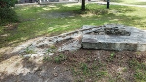
CATEGORIES: Spring
LAYER: Brochure
OWNERSHIP: Public, City of Valdosta, PARCEL 0119A 025
WATER BODY: Sugar Creek
ADDRESS: In John W. Saunders Park, 1151 River Street, Valdosta, GA 31603-1125, Lowndes County.
DESCRIPTION: Now-dry spring that fed Barber Pool in early 20th century
AKA: Okapilco River
GRN: Yes
WEBSITE: https://wwals.net/2017/10/24/barber-pool-early-20th-century/
PHOTO: http://www.l-a-k-e.org/blog/wp-content/uploads/2017/10/00e0e430b4647bfced9d412aa67e6b30.jpg
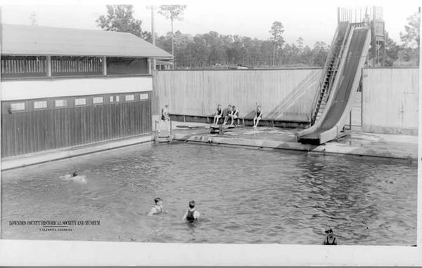
PHOTOSET: https://wwals.net/2017/10/24/barber-pool-early-20th-century/
PHOTO SOURCE: John S. Quarterman and Lowndes County Historical Society and Museum
PHONE NUMBER: (229) 242-0102
Suggestions: https://forms.gle/DipPgU2TP5atc2Rf9
Source of Okapilco Creek
CATEGORIES: Source
LAYER: Other
OWNERSHIP: Private
WATER BODY: Okapilco Creek
MILE: 63.15
ADDRESS: East of GA 33 N of Minton Road, N of Anderson City, GA, Worth County.
WEBSITE: https://www.google.com/maps/place/31%C2%B022’54.7%22N+83%C2%B051’06.9%22W/@31.3776559, -83.8591912, 2391m/data=!3m1!1e3!4m5!3m4!1s0x0:0x0!8m2!3d31.381851!4d-83.851917?hl=en
Suggestions: https://forms.gle/DipPgU2TP5atc2Rf9
Minton Road Culvert
CATEGORIES: Bridge
LAYER: Bridge
GPS: 31.380203, -83.84955
OWNERSHIP: Public
WATER BODY: Okapilco Creek
MILE: 62.95
ADDRESS: 1535-1453 Minton Rd, Sylvester, GA 31791, Worth County.
DESCRIPTION: First road crossing of Okapilco Creek.
WEBSITE: https://www.google.com/maps/place/31%C2%B022’48.7%22N+83%C2%B050’58.4%22W/@31.380203, -83.84955, 539m/data=!3m2!1e3!4b1!4m14!1m7!3m6!1s0x0:0x0!2zMzHCsDIyJzU0LjciTiA4M8KwNTEnMDYuOSJX!3b1!8m2!3d31.381851!4d-83.851917!3m5!1s0x0:0x0!7e2!8m2!3d31.3802034!4d-83.84955
Suggestions: https://forms.gle/DipPgU2TP5atc2Rf9
Goodroe Road Culvert
CATEGORIES: Bridge
LAYER: Bridge
OWNERSHIP: Public
WATER BODY: Okapilco Creek
MILE: 62.47
ADDRESS: 154-126 Goodroe Rd, Sylvester, GA 31791, Worth County.
DESCRIPTION: Second road crossing of Okapilco Creek.
WEBSITE: https://www.google.com/maps/place/31%C2%B022’24.0%22N+83%C2%B050’52.9%22W/@31.373347, -83.8567513, 5301m/data=!3m2!1e3!4b1!4m6!3m5!1s0x0:0x0!7e2!8m2!3d31.3733285!4d-83.8480185
Suggestions: https://forms.gle/DipPgU2TP5atc2Rf9
Phillip Causey Road Bridge
CATEGORIES: Bridge
LAYER: Bridge
GPS: 31.371777, -83.84875
OWNERSHIP: Public
WATER BODY: Okapilco Creek
MILE: 62.34
ADDRESS: 100-198 Phillip Causey Rd, Sylvester, GA 31791, Worth County.
DESCRIPTION: Third road crossing of Okapilco Creek.
WEBSITE: https://www.google.com/maps/place/31%C2%B022’18.4%22N+83%C2%B050’55.5%22W/@31.371801, -83.8574833, 5301m/data=!3m2!1e3!4b1!4m6!3m5!1s0x0:0x0!7e2!8m2!3d31.3717829!4d-83.8487503
Suggestions: https://forms.gle/DipPgU2TP5atc2Rf9
Oak Piled Road Bridge
CATEGORIES: Bridge
LAYER: Bridge
OWNERSHIP: Public
WATER BODY: Okapilco Creek
MILE: 62.01
ADDRESS: Oak Piled Rd, Sylvester, GA 31791, Worth County.
WEBSITE: https://www.google.com/maps/place/31%C2%B022’05.9%22N+83%C2%B050’44.2%22W/@31.368313, -83.8543293, 5301m/data=!3m2!1e3!4b1!4m6!3m5!1s0x0:0x0!7e2!8m2!3d31.3682948!4d-83.8455957
Suggestions: https://forms.gle/DipPgU2TP5atc2Rf9
Hancock Road Bridge
CATEGORIES: Bridge
LAYER: Bridge
OWNERSHIP: Public
WATER BODY: Okapilco Creek
MILE: 60.26
ADDRESS: Hancock Rd, Sylvester, GA 31791, Worth County.
WEBSITE: https://www.google.com/maps/place/31%C2%B020’46.0%22N+83%C2%B050’33.1%22W/@31.346133, -83.8512463, 5302m/data=!3m2!1e3!4b1!4m6!3m5!1s0x0:0x0!7e2!8m2!3d31.346115!4d-83.8425126
Suggestions: https://forms.gle/DipPgU2TP5atc2Rf9
Massey Road Bridge
CATEGORIES: Bridge
LAYER: Bridge
OWNERSHIP: Public
WATER BODY: Okapilco Creek
MILE: 59.51
ADDRESS: Massey Rd, Doerun, GA 31744, Worth County.
WEBSITE: https://www.google.com/maps/place/31%C2%B020’12.5%22N+83%C2%B050’24.2%22W/@31.33683, -83.8487923, 5303m/data=!3m2!1e3!4b1!4m6!3m5!1s0x0:0x0!7e2!8m2!3d31.3368117!4d-83.8400588
Suggestions: https://forms.gle/DipPgU2TP5atc2Rf9
Mobley Plant Co. Dam
CATEGORIES: Dam
LAYER: Point of Interest
OWNERSHIP: Private, MOBLEY PLANT CO INC, PARCEL C026 004A
WATER BODY: Okapilco Creek
MILE: 58.76
ADDRESS: Bob Sims Rd, Doerun, GA 31744, Colquitt County.
DESCRIPTION: Most upstream dam on Okapilco Creek.
WEBSITE: https://www.google.com/maps/place/31%C2%B019’38.6%22N+83%C2%B050’08.2%22W/@31.327413, -83.8443473, 5303m/data=!3m2!1e3!4b1!4m6!3m5!1s0x0:0x0!7e2!8m2!3d31.3273953!4d-83.8356142
Suggestions: https://forms.gle/DipPgU2TP5atc2Rf9
Bob Sims Road Bridge
CATEGORIES: Bridge
LAYER: Bridge
GPS: 31.32614, -83.83651
OWNERSHIP: Public
WATER BODY: Okapilco Creek
MILE: 58.69
ADDRESS: Bob Sims Rd, Doerun, GA 31744, Colquitt County.
WEBSITE: https://www.google.com/maps/place/31%C2%B020’12.5%22N+83%C2%B050’24.2%22W/@31.33683, -83.8487923, 5303m/data=!3m2!1e3!4b1!4m6!3m5!1s0x0:0x0!7e2!8m2!3d31.3368117!4d-83.8400588
Suggestions: https://forms.gle/DipPgU2TP5atc2Rf9
Horne Farms Dam
CATEGORIES: Dam
LAYER: Point of Interest
OWNERSHIP: Private, DONALD HORNE FARMS, LLLP, PARCEL C026 026
WATER BODY: Okapilco Creek
MILE: 58.05
ADDRESS: 5908 GA HWY 33 N, Doerun, GA 31744, Colquitt County.
DESCRIPTION: Second most upstream dam on Okapilco Creek.
WEBSITE: https://www.google.com/maps/place/31%C2%B019’09.3%22N+83%C2%B049’44.9%22W/@31.31927, -83.8378813, 5304m/data=!3m2!1e3!4b1!4m6!3m5!1s0x0:0x0!7e2!8m2!3d31.3192521!4d-83.8291478
Suggestions: https://forms.gle/DipPgU2TP5atc2Rf9
Mac Massey Road Bridge
CATEGORIES: Bridge
LAYER: Bridge
OWNERSHIP: Public
WATER BODY: Okapilco Creek
MILE: 57.12
ADDRESS: 923-735 Mac Massey Rd, Doerun, GA 31744, Colquitt County.
WEBSITE: https://www.google.com/maps/place/31%C2%B018’42.1%22N+83%C2%B049’07.2%22W/@31.311699, -83.8274043, 5304m/data=!3m2!1e3!4b1!4m6!3m5!1s0x0:0x0!7e2!8m2!3d31.3116807!4d-83.8186713
Suggestions: https://forms.gle/DipPgU2TP5atc2Rf9
Doerun Norman Park Road Bridge
CATEGORIES: Bridge
LAYER: Bridge
OWNERSHIP: Public
WATER BODY: Okapilco Creek
MILE: 56.12
ADDRESS: 4369-4349 Doerun Norman Park Rd, Moultrie, GA 31768, Colquitt County.
WEBSITE: https://www.google.com/maps/place/31%C2%B018’17.4%22N+83%C2%B048’26.5%22W/@31.304847, -83.8160963, 5304m/data=!3m2!1e3!4b1!4m6!3m5!1s0x0:0x0!7e2!8m2!3d31.3048287!4d-83.8073628
Suggestions: https://forms.gle/DipPgU2TP5atc2Rf9
Ladson Road Bridge
CATEGORIES: Bridge
LAYER: Bridge
OWNERSHIP: Public
WATER BODY: Okapilco Creek
MILE: 54.09
ADDRESS: 905-607 Ladson Rd, Moultrie, GA 31768, Colquitt County.
WEBSITE: https://www.google.com/maps/place/31%C2%B016’49.0%22N+83%C2%B047’56.3%22W/@31.28029, -83.8076913, 5306m/data=!3m2!1e3!4b1!4m14!1m7!3m6!1s0x88edefd4c5c43e2f:0x1b6ebe9d1a4966a8!2sLadson+Rd, +Georgia+31768!3b1!8m2!3d31.2903758!4d-83.7946558!3m5!1s0x0:0x0!7e2!8m2!3d31.2802715!4d-83.7989581
Suggestions: https://forms.gle/DipPgU2TP5atc2Rf9
James Buckner Road Bridge
CATEGORIES: Bridge
LAYER: Bridge
OWNERSHIP: Public
WATER BODY: Okapilco Creek
MILE: 52.07
ADDRESS: James Buckner Road, Colquitt County, GA 31768, Colquitt County.
WEBSITE: https://www.google.com/maps/place/31%C2%B015’17.8%22N+83%C2%B047’38.5%22W/@31.2538973, -83.7984969, 2654m/data=!3m1!1e3!4m14!1m7!3m6!1s0x88edefd4c5c43e2f:0x1b6ebe9d1a4966a8!2sLadson+Rd, +Georgia+31768!3b1!8m2!3d31.2903758!4d-83.7946558!3m5!1s0x0:0x0!7e2!8m2!3d31.2549336!4d-83.7940228
Suggestions: https://forms.gle/DipPgU2TP5atc2Rf9
GFRR Bridge

CATEGORIES: Railbridge
LAYER: Bridge
OWNERSHIP: Private
WATER BODY: Okapilco Creek
MILE: 50.01
ADDRESS: Colquitt County, GA 31768, Colquitt County.
WEBSITE: https://www.google.com/maps/place/31%C2%B013’40.0%22N+83%C2%B047’19.9%22W/@31.2278081, -83.7976118, 5309m/data=!3m2!1e3!4b1!4m14!1m7!3m6!1s0x88edefd4c5c43e2f:0x1b6ebe9d1a4966a8!2sLadson+Rd, +Georgia+31768!3b1!8m2!3d31.2903758!4d-83.7946558!3m5!1s0x0:0x0!7e2!8m2!3d31.2277904!4d-83.7888572
PHOTO: https://upload.wikimedia.org/wikipedia/commons/thumb/2/29/GFRR_map.png/519px-GFRR_map.png
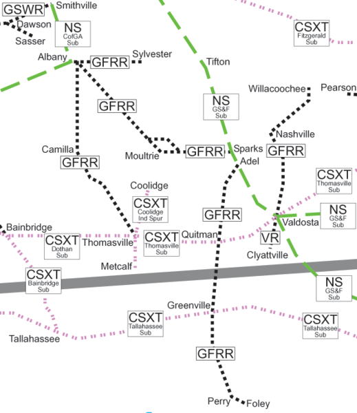
PHOTOSET: https://en.wikipedia.org/wiki/File:GFRR_map.png
PHOTO SOURCE: Wikimedia user:SPUI
PHONE NUMBER: (850) 290-2350
Suggestions: https://forms.gle/DipPgU2TP5atc2Rf9
Albany-Moultrie Power Line
CATEGORIES: Power Line
LAYER: Point of Interest
GPS: 31.22197, -83.784128
OWNERSHIP: Private
WATER BODY: Okapilco Creek
MILE: 49.45
ADDRESS: Moultrie, GA 31768, Colquitt County.
WEBSITE: https://www.google.com/maps/place/31%C2%B013’19.1%22N+83%C2%B047’02.9%22W/@31.2219881, -83.7928828, 5309m/data=!3m2!1e3!4b1!4m14!1m7!3m6!1s0x88edefd4c5c43e2f:0x1b6ebe9d1a4966a8!2sLadson+Rd, +Georgia+31768!3b1!8m2!3d31.2903758!4d-83.7946558!3m5!1s0x0:0x0!7e2!8m2!3d31.2219695!4d-83.784128
Suggestions: https://forms.gle/DipPgU2TP5atc2Rf9
Woodmen Road Bridge
CATEGORIES: Bridge
LAYER: Bridge
GPS: 31.216327, -83.78361
OWNERSHIP: Public
WATER BODY: Okapilco Creek
MILE: 49.04
ADDRESS: Woodmen Road, Moultrie, GA 31768, Colquitt County.
WEBSITE: https://www.google.com/maps/place/31%C2%B012’58.8%22N+83%C2%B047’01.0%22W/@31.2163451, -83.7923648, 5309m/data=!3m2!1e3!4b1!4m14!1m7!3m6!1s0x88edefd4c5c43e2f:0x1b6ebe9d1a4966a8!2sLadson+Rd, +Georgia+31768!3b1!8m2!3d31.2903758!4d-83.7946558!3m5!1s0x0:0x0!7e2!8m2!3d31.216327!4d-83.7836104
Suggestions: https://forms.gle/DipPgU2TP5atc2Rf9
GA 33 Okapilco Creek Bridge
CATEGORIES: Bridge
LAYER: Bridge
OWNERSHIP: Public
WATER BODY: Okapilco Creek
MILE: 48.90
ADDRESS: GA 133, Moultrie, GA 31768, Colquitt County.
WEBSITE: https://www.google.com/maps/place/31%C2%B012’51.8%22N+83%C2%B047’02.8%22W/@31.2144091, -83.7928588, 5310m/data=!3m2!1e3!4b1!4m14!1m7!3m6!1s0x88edefd4c5c43e2f:0x1b6ebe9d1a4966a8!2sLadson+Rd, +Georgia+31768!3b1!8m2!3d31.2903758!4d-83.7946558!3m5!1s0x0:0x0!7e2!8m2!3d31.2143907!4d-83.7841035
Suggestions: https://forms.gle/DipPgU2TP5atc2Rf9
Bus. US 319 Okapilco Creek Bridge
CATEGORIES: Bridge
LAYER: Bridge
OWNERSHIP: Public
WATER BODY: Okapilco Creek
MILE: 48.00
ADDRESS: Bus. US 319, Moultrie, GA 31768, Colquitt County.
WEBSITE: https://www.google.com/maps/place/31%C2%B012’07.6%22N+83%C2%B047’06.2%22W/@31.2021241, -83.7937998, 5310m/data=!3m2!1e3!4b1!4m14!1m7!3m6!1s0x88edefd4c5c43e2f:0x1b6ebe9d1a4966a8!2sLadson+Rd, +Georgia+31768!3b1!8m2!3d31.2903758!4d-83.7946558!3m5!1s0x0:0x0!7e2!8m2!3d31.202106!4d-83.7850455
Suggestions: https://forms.gle/DipPgU2TP5atc2Rf9
4th Ave NE Bridge
CATEGORIES: Bridge
LAYER: Bridge
OWNERSHIP: Public
WATER BODY: Okapilco Creek
MILE: 46.37
ADDRESS: 4th Ave. NE, Moultrie, GA 31768, Colquitt County.
WEBSITE: https://www.google.com/maps/place/31%C2%B011’01.7%22N+83%C2%B046’24.5%22W/@31.1838141, -83.7822338, 5311m/data=!3m2!1e3!4b1!4m14!1m7!3m6!1s0x88edefd4c5c43e2f:0x1b6ebe9d1a4966a8!2sLadson+Rd, +Georgia+31768!3b1!8m2!3d31.2903758!4d-83.7946558!3m5!1s0x0:0x0!7e2!8m2!3d31.1837961!4d-83.7734793
Suggestions: https://forms.gle/DipPgU2TP5atc2Rf9
GA 37 Okapilco Creek Bridge
CATEGORIES: Bridge
LAYER: Bridge
OWNERSHIP: Public
WATER BODY: Okapilco Creek
MILE: 46.00
ADDRESS: GA 37 (1st Ave. SE), Moultrie, GA 31768, Colquitt County.
WEBSITE: https://www.google.com/maps/place/31%C2%B012’51.8%22N+83%C2%B047’02.8%22W/@31.2144091, -83.7928588, 5310m/data=!3m2!1e3!4b1!4m14!1m7!3m6!1s0x88edefd4c5c43e2f:0x1b6ebe9d1a4966a8!2sLadson+Rd, +Georgia+31768!3b1!8m2!3d31.2903758!4d-83.7946558!3m5!1s0x0:0x0!7e2!8m2!3d31.2143907!4d-83.7841035
Suggestions: https://forms.gle/DipPgU2TP5atc2Rf9
5th Ave SE Bridge
CATEGORIES: Bridge
LAYER: Bridge
GPS: 31.174192, -83.77212
OWNERSHIP: Public
WATER BODY: Okapilco Creek
MILE: 45.61
ADDRESS: 5th Ave. SE, Moultrie, GA 31768, Colquitt County.
WEBSITE: https://www.google.com/maps/place/31%C2%B010’27.1%22N+83%C2%B046’19.6%22W/@31.1742101, -83.7808748, 5312m/data=!3m2!1e3!4b1!4m14!1m7!3m6!1s0x88edefd4c5c43e2f:0x1b6ebe9d1a4966a8!2sLadson+Rd, +Georgia+31768!3b1!8m2!3d31.2903758!4d-83.7946558!3m5!1s0x0:0x0!7e2!8m2!3d31.1741915!4d-83.7721196
Suggestions: https://forms.gle/DipPgU2TP5atc2Rf9
US 319 Okapilco Creek Bridge
CATEGORIES: Bridge
LAYER: Bridge
GPS: 31.16329, -83.761686
OWNERSHIP: Public
WATER BODY: Okapilco Creek
MILE: 44.53
ADDRESS: US 319 (E Bypass), Moultrie, GA 31768, Colquitt County.
WEBSITE: https://www.google.com/maps/place/31%C2%B009’47.8%22N+83%C2%B045’42.1%22W/@31.1633081, -83.7704408, 5312m/data=!3m2!1e3!4b1!4m14!1m7!3m6!1s0x88edefd4c5c43e2f:0x1b6ebe9d1a4966a8!2sLadson+Rd, +Georgia+31768!3b1!8m2!3d31.2903758!4d-83.7946558!3m5!1s0x0:0x0!7e2!8m2!3d31.1632903!4d-83.7616862
Suggestions: https://forms.gle/DipPgU2TP5atc2Rf9
Sunbelt Ag Expo
CATEGORIES: Point Of Interest
LAYER: Point of Interest
OWNERSHIP: Private
WATER BODY: Okapilco Creek
MILE: 42.20
ADDRESS: 290-G Harper Blvd, Moultrie, GA 31788, Colquitt County.
DESCRIPTION: Annual huge agricultural exposition. Also UGA weather gauge. Located in Spence Airport-MUL. On a tributary of Little Creek, which runs into Okapilco Creek.
WEBSITE: https://sunbeltexpo.com/
Suggestions: https://forms.gle/DipPgU2TP5atc2Rf9
Culbertson Road Bridge
CATEGORIES: Bridge
LAYER: Bridge
OWNERSHIP: Public
WATER BODY: Okapilco Creek
MILE: 39.68
ADDRESS: Culbertson Road, Colquitt County, GA 31788, Colquitt County.
WEBSITE: https://www.google.com/maps/place/31%C2%B006’21.0%22N+83%C2%B043’54.9%22W/@31.1058551, -83.7406728, 5316m/data=!3m2!1e3!4b1!4m14!1m7!3m6!1s0x88edefd4c5c43e2f:0x1b6ebe9d1a4966a8!2sLadson+Rd, +Georgia+31768!3b1!8m2!3d31.2903758!4d-83.7946558!3m5!1s0x0:0x0!7e2!8m2!3d31.1058372!4d-83.7319175
Suggestions: https://forms.gle/DipPgU2TP5atc2Rf9
Old Berlin Road Bridge
CATEGORIES: Bridge
LAYER: Bridge
OWNERSHIP: Public
WATER BODY: Okapilco Creek
MILE: 39.26
ADDRESS: Old Berlin Road, Colquitt County, GA 31788, Colquitt County.
WEBSITE: https://www.google.com/maps/place/31%C2%B006’03.5%22N+83%C2%B043’41.5%22W/@31.1010001, -83.7369388, 5316m/data=!3m2!1e3!4b1!4m14!1m7!3m6!1s0x88edefd4c5c43e2f:0x1b6ebe9d1a4966a8!2sLadson+Rd, +Georgia+31768!3b1!8m2!3d31.2903758!4d-83.7946558!3m5!1s0x0:0x0!7e2!8m2!3d31.1009817!4d-83.7281844
Suggestions: https://forms.gle/DipPgU2TP5atc2Rf9
Hog Creek
CATEGORIES: Tributary
LAYER: Point of Interest
OWNERSHIP: Private
WATER BODY: Okapilco Creek
MILE: 35.46
ADDRESS: North of Crum Road @ Tallokas Road, Colquitt County, GA 31788, Colquitt County.
WEBSITE: https://www.google.com/maps/place/31%C2%B003’34.5%22N+83%C2%B042’25.5%22W/@31.0595941, -83.7158328, 5318m/data=!3m2!1e3!4b1!4m5!3m4!1s0x0:0x0!8m2!3d31.059576!4d-83.707078
Suggestions: https://forms.gle/DipPgU2TP5atc2Rf9
Cook Road Bridge
CATEGORIES: Bridge
LAYER: Bridge
GPS: 31.065954, -83.689
OWNERSHIP: Public
WATER BODY: Okapilco Creek
MILE: 34.20
ADDRESS: Cook Road, Colquitt County, GA 31788, Colquitt County.
WEBSITE: https://www.google.com/maps/place/31%C2%B003’57.4%22N+83%C2%B041’20.4%22W/@31.0659721, -83.6977548, 5318m/data=!3m2!1e3!4b1!4m14!1m7!3m6!1s0x0:0x0!2zMzHCsDAzJzM0LjUiTiA4M8KwNDInMjUuNSJX!3b1!8m2!3d31.059576!4d-83.707078!3m5!1s0x0:0x0!7e2!8m2!3d31.0659538!4d-83.6889999
Suggestions: https://forms.gle/DipPgU2TP5atc2Rf9
Perry Road Bridge
CATEGORIES: Bridge
LAYER: Bridge
OWNERSHIP: Public
WATER BODY: Okapilco Creek
MILE: 32.31
ADDRESS: Perry Road, Colquitt County, GA 31788, Colquitt County.
WEBSITE: https://www.google.com/maps/place/31%C2%B003’33.6%22N+83%C2%B039’38.9%22W/@31.0593551, -83.6695488, 5318m/data=!3m2!1e3!4b1!4m6!3m5!1s0x0:0x0!7e2!8m2!3d31.0593366!4d-83.6607939
Suggestions: https://forms.gle/DipPgU2TP5atc2Rf9
Wesley Chapel Road Okapilco Creek Bridge
CATEGORIES: Bridge
LAYER: Bridge
GPS: 31.047282, -83.63031
OWNERSHIP: Public
WATER BODY: Okapilco Creek
MILE: 29.86
ADDRESS: Wesley Chapel Road, Moultrie, GA 31788, Colquitt County.
WEBSITE: https://www.google.com/maps/place/31%C2%B002’50.1%22N+83%C2%B037’49.1%22W/@31.0472791, -83.6390648, 5319m/data=!3m2!1e3!4b1!4m6!3m5!1s0x0:0x0!7e2!8m2!3d31.0472613!4d-83.63031
Suggestions: https://forms.gle/DipPgU2TP5atc2Rf9
Sawmill Road Okapilco Creek Bridge
CATEGORIES: Bridge
LAYER: Bridge
OWNERSHIP: Public
WATER BODY: Okapilco Creek
MILE: 28.92
ADDRESS: 879-759 Sawmill Rd, Moultrie, GA31788, Colquitt County.
WEBSITE: https://www.google.com/maps/@31.0447152, -83.6204449, 2660m/data=!3m1!1e3
Suggestions: https://forms.gle/DipPgU2TP5atc2Rf9
Bernie’s Bridge
CATEGORIES: Bridge
LAYER: Bridge
OWNERSHIP: Public
WATER BODY: Okapilco Creek
MILE: 27.10
ADDRESS: 794 Hempstead Church Rd, Pavo, GA 31778, Brooks County.
DESCRIPTION: 160.1 ft. 5-span steel girder bridge with wood deck, built in 1930, reconstructed in 1990, over Okapilco Creek.
AKA: Hempstead Church Road Okapilco Creek Bridge
WEBSITE: https://bridgereports.com/1090992
OTHER REFERENCE: https://www.google.com/maps/@31.0288117, -83.6013922, 665m/data=!3m1!1e3
Suggestions: https://forms.gle/DipPgU2TP5atc2Rf9
GA 133 Alderman Road Creek Bridge
CATEGORIES: Bridge
LAYER: Bridge
GPS: 31.02436, -83.57872
OWNERSHIP: Public
WATER BODY: Alderman Road Creek
ADDRESS: Just north of GA 333 (Moultrie Highway). Brooks County.
DESCRIPTION: 25.9 ft. 3-span concrete culvert, built in 1931, reconstructed in 2017, over Alderman Road Creek (USGS 03110203000842).
WEBSITE: https://bridgereports.com/1090928
Suggestions: https://forms.gle/DipPgU2TP5atc2Rf9
Rockhill Road Okapilco Creek Bridge
CATEGORIES: Bridge
LAYER: Bridge
OWNERSHIP: Public
WATER BODY: Okapilco Creek
MILE: 25.37
ADDRESS: Rockhill Road, Barney, GA 31625, Brooks County.
WEBSITE: https://www.google.com/maps/place/31%C2%B000’25.4%22N+83%C2%B035’54.2%22W/@31.0070731, -83.6071538, 5321m/data=!3m2!1e3!4b1!4m5!3m4!1s0x0:0x0!8m2!3d31.007055!4d-83.598399
Suggestions: https://forms.gle/DipPgU2TP5atc2Rf9
Brice Pond Tributary Bridge

CATEGORIES: Bridge
LAYER: Bridge
OWNERSHIP: Public
WATER BODY: Brice Pond Tributary
MILE: 0.60
ADDRESS: GA-122, Barney, GA 31625, Brooks County.
DESCRIPTION: Concrete bridge over a small creek. Rebuilt in summer 2023.
HISTORIC FACTS: Closed and replaced April 10, 2023 through July 31, 2024 by Georgia Department of Transportation (GDOT). https://wwals.net/2023/05/27/okapilco-creek-bridge-closed-between-pavo-and-barney-ga-2023-04-07/
WEBSITE: https://wwals.net/2023/05/27/okapilco-creek-bridge-closed-between-pavo-and-barney-ga-2023-04-07/
OTHER REFERENCE: https://mailchi.mp/dot/brooks-county-two-bridges-on-sr-122-closed-beginning-next-week
PHOTOSET: https://www.wwals.net/pictures/2023-04-07–ga-122-okapilco-creek-road-closure/#GSV
PHOTO SOURCE: Google Streetview
PHONE NUMBER: (850) 290-2350
Suggestions: https://forms.gle/DipPgU2TP5atc2Rf9
GA 122 Okapilco Creek Bridge

CATEGORIES: Bridge
LAYER: Bridge
OWNERSHIP: Public
WATER BODY: Okapilco Creek
MILE: 24.45
ADDRESS: GA-122, Barney, GA 31625, Brooks County.
DESCRIPTION: Concrete bridge over Okapilco Creek. Rebuilt in summer 2023.
HISTORIC FACTS: Closed and replaced April 10, 2023 through July 31, 2024 by Georgia Department of Transportation (GDOT). https://wwals.net/2023/05/27/okapilco-creek-bridge-closed-between-pavo-and-barney-ga-2023-04-07/
WEBSITE: https://wwals.net/2023/05/27/okapilco-creek-bridge-closed-between-pavo-and-barney-ga-2023-04-07/
OTHER REFERENCE: https://mailchi.mp/dot/brooks-county-two-bridges-on-sr-122-closed-beginning-next-week
PHOTOSET: https://www.wwals.net/pictures/2023-04-07–ga-122-okapilco-creek-road-closure/#GSV
PHOTO SOURCE: Google Streetview
PHONE NUMBER: (850) 290-2350
Suggestions: https://forms.gle/DipPgU2TP5atc2Rf9
Connall Road Okapilco Creek Bridge
CATEGORIES: Bridge
LAYER: Bridge
OWNERSHIP: Public
WATER BODY: Okapilco Creek
MILE: 21.17
ADDRESS: Connall Rd (CR 210), Barney, GA 31625, Brooks County.
WEBSITE: https://www.google.com/maps/place/30%C2%B057’28.1%22N+83%C2%B035’39.4%22W/@30.9578261, -83.6030268, 5324m/data=!3m2!1e3!4b1!4m14!1m7!3m6!1s0x0:0x0!2zMzDCsDU1JzQ3LjEiTiA4M8KwMzUnMDMuNyJX!3b1!8m2!3d30.929752!4d-83.584348!3m5!1s0x0:0x0!7e2!8m2!3d30.9578081!4d-83.5942722
Suggestions: https://forms.gle/DipPgU2TP5atc2Rf9
Rainy Creek
CATEGORIES: Tributary
LAYER: Point of Interest
GPS: 30.952859, -83.58996
OWNERSHIP: Public
WATER BODY: Okapilco Creek
MILE: 20.69
ADDRESS: South of Connal Rd (CR 210), Barney, GA 31625, Brooks County.
WEBSITE: https://www.google.com/maps/place/30%C2%B057’10.3%22N+83%C2%B035’23.9%22W/@30.9528771, -83.5987148, 5324m/data=!3m2!1e3!4b1!4m5!3m4!1s0x0:0x0!8m2!3d30.952859!4d-83.58996
Suggestions: https://forms.gle/DipPgU2TP5atc2Rf9
Gum Creek (Okapilco Cr.)
CATEGORIES: Tributary
LAYER: Point of Interest
OWNERSHIP: Public
WATER BODY: Okapilco Creek
MILE: 18.94
ADDRESS: North of Cofee Road, Quitman, GA 31643, Brooks County.
WEBSITE: https://www.google.com/maps/place/30%C2%B055’47.1%22N+83%C2%B035’03.7%22W/@30.9297701, -83.5931028, 5326m/data=!3m2!1e3!4b1!4m5!3m4!1s0x0:0x0!8m2!3d30.929752!4d-83.584348
Suggestions: https://forms.gle/DipPgU2TP5atc2Rf9
Coffee Road Little Creek Bridge
CATEGORIES: Bridge
LAYER: Bridge
OWNERSHIP: Public
WATER BODY: Little Creek 00317018
ADDRESS: Coffee Rd, Quitman, GA 31643, 5 miles west of Morven. Brooks County.
DESCRIPTION: 136.2 ft. 4-span concrete t-beam bridge built in 1959 over Little Creek 00317018.
WEBSITE: https://bridgereports.com/1090954
OTHER REFERENCE: https://www.google.com/maps/place/30%C2%B055’08.5%22N+83%C2%B035’44.3%22W/@30.9190441, -83.6043818, 5326m/data=!3m2!1e3!4b1!4m6!3m5!1s0x0:0x0!7e2!8m2!3d30.9190262!4d-83.5956267
Suggestions: https://forms.gle/DipPgU2TP5atc2Rf9
Coffee Road Okapilco Creek Bridge
CATEGORIES: Bridge
LAYER: Bridge
OWNERSHIP: Public
WATER BODY: Okapilco Creek
MILE: 17.94
ADDRESS: Coffee Rd, Quitman, GA 31643, 5 miles west of Morven. Brooks County.
DESCRIPTION: 136.2 ft. 4-span concrete t-beam bridge built in 1959 over Okapilco Creek.
WEBSITE: https://bridgereports.com/1090957
OTHER REFERENCE: https://www.google.com/maps/place/30%C2%B054’59.8%22N+83%C2%B035’11.3%22W/@30.9166331, -83.5952298, 5326m/data=!3m2!1e3!4b1!4m14!1m7!3m6!1s0x0:0x0!2zMzDCsDUzJzE4LjciTiA4M8KwMzYnMjkuMSJX!3b1!8m2!3d30.888538!4d-83.608083!3m5!1s0x0:0x0!7e2!8m2!3d30.9166154!4d-83.5864751
Suggestions: https://forms.gle/DipPgU2TP5atc2Rf9
Little Creek 00317018
CATEGORIES: Tributary
LAYER: Point of Interest
OWNERSHIP: Public
WATER BODY: Okapilco Creek
MILE: 16.30
ADDRESS: South of Coffee Road, Quitman, GA 31643, Brooks County.
WEBSITE: https://www.google.com/maps/place/30%C2%B054’02.4%22N+83%C2%B036’07.8%22W/@30.9006711, -83.6109068, 5327m/data=!3m2!1e3!4b1!4m5!3m4!1s0x0:0x0!8m2!3d30.900653!4d-83.602152
Suggestions: https://forms.gle/DipPgU2TP5atc2Rf9
Mule Creek
CATEGORIES: Tributary
LAYER: Point of Interest
OWNERSHIP: Public
WATER BODY: Okapilco Creek
MILE: 15.32
ADDRESS: Downstream of Little Creek 00317018, South of Coffee Road, Quitman, GA 31643, Brooks County.
WEBSITE: https://www.google.com/maps/place/30%C2%B053’18.7%22N+83%C2%B036’29.1%22W/@30.8809231, -83.6484342, 21313m/data=!3m1!1e3!4m5!3m4!1s0x0:0x0!8m2!3d30.888538!4d-83.608083
Suggestions: https://forms.gle/DipPgU2TP5atc2Rf9
Quitman Solar I

CATEGORIES: Solar
LAYER: Point of Interest
GPS: 30.86277778, -83.63888889
OWNERSHIP: Private, BROOKS COUNTY DEVELOPMENT AUTHORITY, PARCEL 050 00087
WATER BODY: Okapilco Creek
ADDRESS: On Barwick Road, northwest and southeast of Tallokas Road, northwest of Quitman, GA, uphill from tributaries of Okapilco Creek. Brooks County.
DESCRIPTION: A 150-megawatt (MW) 532, 494-panel 1, 099-acre solar farm in Brooks County, Georgia, by NextEra, parent of FPL of Florida.
WEBSITE: https://www.wwals.net/pictures/2018-07-31–quitman-solar-i/
PHOTOSET: https://www.wwals.net/pictures/2018-07-31–quitman-solar-i/
PHOTO SOURCE: Quitman Solar LLC
PHONE NUMBER: (850) 290-2350
Suggestions: https://forms.gle/DipPgU2TP5atc2Rf9
Quitman Solar II

CATEGORIES: Solar
LAYER: Point of Interest
GPS: 30.860406, -83.66
OWNERSHIP: Private, BROOKS COUNTY DEVELOPMENT AUTHORITY, PARCEL 050 0008
WATER BODY: Piscola Creek
ADDRESS: On Hodges Road, between Barwick Road and Dry Lake Road, immediately west of Quitman Solar I, northwest of Quitman, GA, on tributaries of Pride Branch of Piscola Creek. Brooks County.
DESCRIPTION: A 150-megawatt (MW) 1, 698-acre solar farm on wooded wetlands in Brooks County, Georgia, by NextEra, parent of FPL of Florida. Going by 2024 aerial maps, it has not yet been built.
WEBSITE: https://www.wwals.net/pictures/2019-05-31–quitman-solar-ii/
PHOTOSET: https://www.wwals.net/pictures/2018-07-31–quitman-solar-i/
PHOTO SOURCE: Quitman II Solar
PHONE NUMBER: (850) 290-2350
Suggestions: https://forms.gle/DipPgU2TP5atc2Rf9
Possum Branch
CATEGORIES: Tributary
LAYER: Point of Interest
OWNERSHIP: Public
WATER BODY: Okapilco Creek
MILE: 9.37
ADDRESS: Upstream of Coon Creek and GA 133, Brooks County, GA 31643, Brooks County.
WEBSITE: https://www.google.com/maps/place/30%C2%B050’04.4%22N+83%C2%B034’17.1%22W/@30.8345851, -83.5801678, 5331m/data=!3m2!1e3!4b1!4m5!3m4!1s0x0:0x0!8m2!3d30.834567!4d-83.571413
Suggestions: https://forms.gle/DipPgU2TP5atc2Rf9
Coon Creek
CATEGORIES: Tributary
LAYER: Point of Interest
GPS: 30.83307, -83.571087
OWNERSHIP: Public
WATER BODY: Okapilco Creek
MILE: 9.21
ADDRESS: Upstream of GA 133, Brooks County, GA 31643, Brooks County.
WEBSITE: https://www.google.com/maps/place/30%C2%B049’59.1%22N+83%C2%B034’15.9%22W/@30.8330881, -83.5798418, 5331m/data=!3m2!1e3!4b1!4m5!3m4!1s0x0:0x0!8m2!3d30.83307!4d-83.571087
Suggestions: https://forms.gle/DipPgU2TP5atc2Rf9
GA 333 Okapilco Creek Bridge
CATEGORIES: Bridge
LAYER: Bridge
GPS: 30.825768, -83.56243
OWNERSHIP: Public
WATER BODY: Okapilco Creek
MILE: 8.22
ADDRESS: On GA 333 Moultrie Road north of Quitman, Brooks County.
OTHER REFERENCE: https://www.google.com/maps/place/30%C2%B049’31.9%22N+83%C2%B033’45.0%22W/@30.8255511, -83.5712498, 5331m/data=!3m2!1e3!4b1!4m5!3m4!1s0x0:0x0!8m2!3d30.825533!4d-83.562495
Suggestions: https://forms.gle/DipPgU2TP5atc2Rf9
Okapilco Creek Gauge
CATEGORIES: River Gauge
LAYER: River Gauge
OWNERSHIP: Public
WATER BODY: Okapilco Creek
MILE: 8.21
ADDRESS: On GA 333 Moultrie Road north of Quitman, Brooks County.
DESCRIPTION: USGS 02318700, Currently not operational, due to lack of funding.
WEBSITE: https://wwals.net/2014/05/06/flooding-charts-2/#Okapilco-Creek
PHOTO: http://waterwatch.usgs.gov/wwapps/ww_chart.php?i=nwis&vt=uv&site_no=02318700&p_cd=00065
PHOTOSET: https://wwals.net/2014/05/06/flooding-charts-2/
PHOTO SOURCE: WWALS
PHONE NUMBER: (229) 242-0102
Suggestions: https://forms.gle/DipPgU2TP5atc2Rf9
Brooks County High School
CATEGORIES: Spill
LAYER: Point of Interest
GPS: 30.809995, -83.56194
OWNERSHIP: Public
WATER BODY: Okapilco Creek
MILE: 6.85
ADDRESS: 1801 Moultrie Hwy, Quitman, GA 31643, Brooks County.
DESCRIPTION: County high school and site of several Quitman, GA, sewage spills.
HISTORIC FACTS: 500 gallon raw sewage spill due to debris 2024-05-22, reported in GA-EPD Sewage Spills Report 2024-05-28 https://wwals.net/pictures/2018-10-31–ga-epd-spill-resolution/spills/2024-05-28–GA-EPD-Sewage-Spills-Report-basin.html
WEBSITE: https://www.brooks.k12.ga.us/o/highschool
Suggestions: https://forms.gle/DipPgU2TP5atc2Rf9
GAFLRR Bridge
CATEGORIES: Railbridge
LAYER: Bridge
GPS: 30.813847, -83.54734
OWNERSHIP: Private
WATER BODY: Okapilco Creek
MILE: 6.66
ADDRESS: Between GA 333 and GA 76 on Okapilco Creek, Brooks County.
DESCRIPTION: Georgia & Florida Raiway, LLC, railbridge between Quitman and Adel.
WEBSITE: https://omnitrax.com/our-company/our-railroads/georgia-florida-railway-llc/
Suggestions: https://forms.gle/DipPgU2TP5atc2Rf9
1401 N. Washington St. Spill

CATEGORIES: Spill
LAYER: Point of Interest
OWNERSHIP: Public
WATER BODY: Okapilco Creek
MILE: 5.70
ADDRESS: 1401 N. Washington Street (Quitman Highway), Quitman, GA 31643, Brooks County.
DESCRIPTION: 3, 000 gallon raw sewage spill on June 27, 2023, due to pipe failure, into a drainage ditch above Okapilco Creek, which leads to the Withlacoochee River.
PHOTO: https://www.wwals.net/pictures/2023-06-27–quitman-sewage-spill/many.jpg
PHOTOSET: https://www.wwals.net/pictures/2023-06-27–quitman-sewage-spill/
PHOTO SOURCE: Google streetview and GA-EPD
PHONE NUMBER: (850) 290-2350
Suggestions: https://forms.gle/DipPgU2TP5atc2Rf9
1401 N. Washington St. Lift Station

CATEGORIES: Liftstation
LAYER: Point of Interest
GPS: 30.7998, -83.5566
OWNERSHIP: Public
WATER BODY: Okapilco Creek
MILE: 5.70
ADDRESS: 1401 N. Washington Street (Quitman Highway), Quitman, GA 31643, Brooks County.
DESCRIPTION: Lift station. Maybe Lift Station No. 8 (old 5).
HISTORIC FACTS: See 1401 N. Washington St. Spill.
PHOTOSET: https://www.wwals.net/pictures/2023-06-27–quitman-sewage-spill/
PHOTO SOURCE: Google streetview
PHONE NUMBER: (850) 290-2350
Suggestions: https://forms.gle/DipPgU2TP5atc2Rf9
GA 76 Okapilco Creek Bridge
CATEGORIES: Bridge
LAYER: Bridge
OWNERSHIP: Public
WATER BODY: Okapilco Creek
MILE: 5.32
ADDRESS: Between Troupeville Road and Quitman, GA 31643, Brooks County.
WEBSITE: https://www.google.com/maps/place/30%C2%B047’59.5%22N+83%C2%B032’21.8%22W/@30.7998651, -83.5481398, 5333m/data=!3m2!1e3!4b1!4m6!3m5!1s0x0:0x0!7e2!8m2!3d30.7998475!4d-83.5393855
Suggestions: https://forms.gle/DipPgU2TP5atc2Rf9
Quitman settling ponds
CATEGORIES: Wtp
LAYER: Brochure
GPS: 30.793477, -83.54436
OWNERSHIP: Public, City of Quitman, PARCEL 093 0024
WATER BODY: Okapilco Creek
MILE: 4.98
ADDRESS: 618 N. Highland Road, Quitman, GA 31643. Past the animal shelter. Brooks County.
DESCRIPTION: Sewage settling ponds. NPDES permit. https://wwals.net/pictures/2018-08-30–permits/quitman/
WEBSITE: https://wwals.net/pictures/2018-08-30–permits/quitman/
Suggestions: https://forms.gle/DipPgU2TP5atc2Rf9
Quitman Lift Station No. 13
CATEGORIES: Liftstation
LAYER: Point of Interest
GPS: 30.7936, -83.544317
OWNERSHIP: Public, City of Quitman, PARCEL 093 0024
WATER BODY: Okapilco Creek
MILE: 4.98
ADDRESS: 618 N. Highland Road, Quitman, GA 31643. Past the animal shelter. Brooks County.
DESCRIPTION: Sewage lift station between the two Quitman settling ponds off Highland Ave.
WEBSITE: https://wwals.net/pictures/2022-01-03–quitman-utility-map/QUITMAN-COLORED-24×36-0001.html
Suggestions: https://forms.gle/DipPgU2TP5atc2Rf9
Quitman Lift Station No. 15
CATEGORIES: Liftstation
LAYER: Point of Interest
GPS: 30.78927, -83.539725
OWNERSHIP: Public, City of Quitman, PARCEL Q22 0002
WATER BODY: Okapilco Creek
MILE: 4.66
ADDRESS: Beyond the east end of Holloway Drive, a quarter mile northeast into the woods. Brooks County.
DESCRIPTION: Very near Okapilco Creek, with a branch between it and the settling ponds. Lift Station No. 15 in the 2019 map; No. 6 in the 1986 map.
WEBSITE: https://wwals.net/pictures/2022-01-03–quitman-utility-map
Suggestions: https://forms.gle/DipPgU2TP5atc2Rf9
Quitman Lift Station No. 7

CATEGORIES: Liftstation
LAYER: Point of Interest
OWNERSHIP: Public, PARCEL No information is available
WATER BODY: Okapilco Creek
MILE: 4.66
ADDRESS: In the median of N. Court Street north of Foundry Street. Brooks County.
DESCRIPTION: Hard to miss once you see it. Lift Station No. 7 on the 2019 map; No. 9 on the 1986 map.
WEBSITE: https://wwals.net/pictures/2022-01-03–quitman-utility-map
PHOTOSET: https://www.wwals.net/pictures/2022-01-03–quitman-utility-map/
PHOTO SOURCE: Google Streetview
PHONE NUMBER: (850) 290-2350
Suggestions: https://forms.gle/DipPgU2TP5atc2Rf9
Quitman Lift Station No. 8
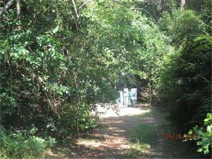
CATEGORIES: Liftstation
LAYER: Point of Interest
GPS: 30.802642, -83.55944
OWNERSHIP: Public, City of Quitman, PARCEL Q27 0072
WATER BODY: Okapilco Creek
MILE: 6.28
ADDRESS: West of Court Street just south of Moultrie Highway. Brooks County.
DESCRIPTION: Can’t see it on Google streetview or satellite maps. Next to a branch of Okapilco Creek. Lift Station No. 8 on the 2019 map; No. 5 on the 1986 map.
WEBSITE: https://wwals.net/pictures/2022-01-03–quitman-utility-map
PHOTO SOURCE: Brooks County Tax Assessors
PHONE NUMBER: (850) 290-2350
Suggestions: https://forms.gle/DipPgU2TP5atc2Rf9
Quitman Lift Station No. 9
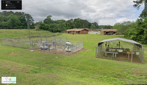
CATEGORIES: Liftstation
LAYER: Point of Interest
OWNERSHIP: Public, City of Quitman, PARCEL Q28 0091
WATER BODY: Okapilco Creek
ADDRESS: West of Reddick Street, north of Courtland Ave. Brooks County.
DESCRIPTION: Next to a branch of Okapilco Creek. Lift Station No. 9 on the 2019 map; No. 8 on the 1986 map.
WEBSITE: https://wwals.net/pictures/2022-01-03–quitman-utility-map
PHOTOSET: https://www.wwals.net/pictures/2022-01-03–quitman-utility-map/
PHOTO SOURCE: Google Streetview
PHONE NUMBER: (850) 290-2350
Suggestions: https://forms.gle/DipPgU2TP5atc2Rf9
Quitman Lift Station No. 10

CATEGORIES: Liftstation
LAYER: Point of Interest
OWNERSHIP: Public, PARCEL Not clear
WATER BODY: Piscola Creek
ADDRESS: West of Barwick Road, across from and north of Holly Ave. Brooks County.
DESCRIPTION: Can’t really see it in google streetview or satellite maps. Drains into a tributary of Pride Branch into Piscola Creek and the Withlacoochee River. Lift Station No. 10 on the 2019 map; No. 4 on the 1986 map.
WEBSITE: https://wwals.net/pictures/2022-01-03–quitman-utility-map
PHOTOSET: https://www.wwals.net/pictures/2022-01-03–quitman-utility-map/
PHOTO SOURCE: Google Streetview
PHONE NUMBER: (850) 290-2350
Suggestions: https://forms.gle/DipPgU2TP5atc2Rf9
Quitman Lift Station No. 12

CATEGORIES: Liftstation
LAYER: Point of Interest
OWNERSHIP: Public, PARCEL No information is available
WATER BODY: Piscola Creek
ADDRESS: Beyond the south end of E. Lake Drive, west into the woods, then north. Brooks County.
DESCRIPTION: Next to a tributary of Pride Branch, which runs into Piscola Creek and the Withlacoochee River. Lift Station No. 12 on the 2019 map, but No. 3 on the 1986 map. Appears to be on right of way for a road that was never built.
WEBSITE: https://wwals.net/pictures/2022-01-03–quitman-utility-map
PHOTOSET: https://www.wwals.net/pictures/2022-01-03–quitman-utility-map/
PHOTO SOURCE: Google Streetview
PHONE NUMBER: (850) 290-2350
Suggestions: https://forms.gle/DipPgU2TP5atc2Rf9
Quitman Lift Station No. 3

CATEGORIES: Liftstation
LAYER: Point of Interest
OWNERSHIP: Public, City of Quitman, PARCEL Q7 0076
WATER BODY: Piscola Creek
MILE: 5.78
ADDRESS: Southeast corner of Green Street (Avery Street) and Carney Road. Brooks County.
DESCRIPTION: Drains into a tributary of Pride Branch, which runs into Piscola Creek and the Withlacoochee River. Lift Station No. 3 on the 2019 map, but No. 7 on the 1986 map.
WEBSITE: https://wwals.net/pictures/2022-01-03–quitman-utility-map
PHOTOSET: https://www.wwals.net/pictures/2022-01-03–quitman-utility-map/
PHOTO SOURCE: Google Streetview
PHONE NUMBER: (850) 290-2350
Suggestions: https://forms.gle/DipPgU2TP5atc2Rf9
Quitman N Walker Street Spill *
CATEGORIES: Spill
LAYER: Point of Interest
OWNERSHIP: GA
ACCESS: Public, CAMPING: Okapilco Creek
ADDRESS: 614 N Walker Street, Quitman, GA 31643
DESCRIPTION: Spilled 4, 000 gallons of raw sewage due to “”Wet weather”, * 2024-04-10
OTHER REFERENCE: into a drainage ditch that ends up in Okapilco Creek. Spilled 4
Suggestions: https://forms.gle/DipPgU2TP5atc2Rf9
Quitman S Walker Street Spill *
CATEGORIES: Spill
LAYER: Point of Interest
OWNERSHIP: PARCEL Brooks
ACCESS: CANOE: Piscola Creek
WATER BODY: Public
ADDRESS: 412 S Walker St, Quitman, GA 31643, GA County.
DESCRIPTION: Spilled 4, 600 gallons of raw sewage due to “”Wet weather”, * in the watershed of Piscola Creek. 2024-08-05.
WEBSITE: https://epa.maps.arcgis.com/apps/webappviewer/index.html?id=074cfede236341b6a1e03779c2bd0692
Suggestions: https://forms.gle/DipPgU2TP5atc2Rf9
Quitman Lift Station No. 1

CATEGORIES: Liftstation
LAYER: Point of Interest
OWNERSHIP: Public, City of Quitman, PARCEL Q14 0208
WATER BODY: Okapilco Creek
MILE: 4.66
ADDRESS: South of E Bay Street, just east of S. Court Street, Brooks County.
DESCRIPTION: Maybe has not spilled any sewage lately. Same number on 2019 and 1986 maps.
WEBSITE: https://wwals.net/pictures/2022-01-03–quitman-utility-map
PHOTOSET: https://www.wwals.net/pictures/2022-01-03–quitman-utility-map/
PHOTO SOURCE: Google Streetview
PHONE NUMBER: (850) 290-2350
Suggestions: https://forms.gle/DipPgU2TP5atc2Rf9
Quitman N Washington Street Spill
CATEGORIES: Spill
LAYER: Point of Interest
OWNERSHIP: Public
WATER BODY: Okapilco Creek
ADDRESS: 500 North Washington Street, Quitman, GA 31643, Brooks County.
DESCRIPTION: Spilled 1, 400 gallons of raw sewage, 2024-04-10, into a drainage ditch that ends up in Okapilco Creek.
Suggestions: https://forms.gle/DipPgU2TP5atc2Rf9
MCR sewage pond
CATEGORIES: Wtp
LAYER: Brochure
OWNERSHIP: Private, Brooksco Dairy, LLC, PARCEL 107 0003
WATER BODY: Crooked Creek
ADDRESS: Monument Church Road, SE of Troupeville Road, Brooks County, Georgia. Brooks County.
DESCRIPTION: Sewage pond between dairy and Crooked Creek (feeder of Okapilco Creek).
Suggestions: https://forms.gle/DipPgU2TP5atc2Rf9
Monument Church Road Crooked Creek Bridge

CATEGORIES: Bridge
LAYER: Bridge
GPS: 30.80827, -83.503932
OWNERSHIP: Public
WATER BODY: Crooked Creek
ADDRESS: Monument Church Road, SE of Troupeville Road, Brooks County, Georgia. Brooks County.
DESCRIPTION: Culverts just west of Brooksco Dairy.
AKA: Crooked Creek @ Monument Church Road
PHOTO: https://wwals.net/pictures/2020-02-21–WWALS-wq-brooks-co/20200221_172509.jpg
PHOTO SOURCE: WWALS
PHONE NUMBER: (850) 290-2350
Suggestions: https://forms.gle/DipPgU2TP5atc2Rf9
Quitman Forsyth Street Spill
CATEGORIES: Spill
LAYER: Point of Interest
OWNERSHIP: Public
WATER BODY: Okapilco Creek
ADDRESS: 1100 E. Forsyth St., Quitman, GA 31643, Brooks County.
DESCRIPTION: Spilled 4, 400 gallons of raw sewage due to “”Wet weather”” 2024-04-10, apparently behind the Dollar General, into a drainage ditch that runs into Okapilco Creek.
Suggestions: https://forms.gle/DipPgU2TP5atc2Rf9
Quitman LAS
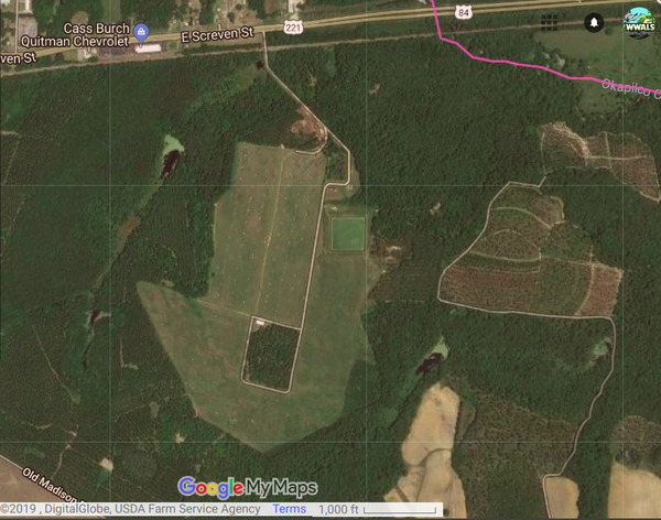
CATEGORIES: Wtp
LAYER: Brochure
OWNERSHIP: Public, City of Quitman, PARCEL 095 0001B
WATER BODY: Okapilco Creek
MILE: 4.38
ADDRESS: 12318 E US 84, Quitman, GA 31643. On US 84 east of Quitman, turn right just before Okapilco Creek. Brooks County.
DESCRIPTION: Land Application Site (LAS) aka spray field where raw sewage is sprayed onto land that grows hay. NPDES permit: https://wwals.net/pictures/2018-08-30–permits/quitman/, Private operator is ESG, 106 N Lee St., Quitman, GA 31634, Project Manager David Frost, also Scott Fowler, 229-375-9305. https://www.inframark.com/operation-maintenance/esg-operations-inc/ Used to be Tindall Enterprises, 912-449-0999 http://www.tindallenterprises.net/ https://tri-ssi.com/recent-projects
GRN: Yes
WEBSITE: https://wwals.net/2019/01/15/quitman-spill-amount-2019-01-14-for-2019-01-03/
PHOTO: https://wwals.net/wp-content/themes/pianoblack/img//2019/01/67c009e5dbcd9c3ea2c91054bcf98df1.jpg
PHOTOSET: https://wwals.net/2019/01/04/quitman-las-spills-again-2019-01-03/
PHOTO SOURCE: Google Maps
PHONE NUMBER: (850) 290-2350
Suggestions: https://forms.gle/DipPgU2TP5atc2Rf9
Quitman Highland Road Lift Station
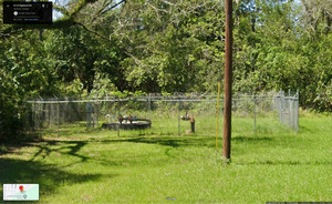
CATEGORIES: Liftstation
LAYER: Point of Interest
OWNERSHIP: Public, City of Quitman, PARCEL Q15 0045
WATER BODY: Okapilco Creek
MILE: 4.58
ADDRESS: Just south of 411 South Highland Road, Quitman, GA 31643, west of the road, north of the GAFL railroad tracks. Brooks County.
DESCRIPTION: Apparent location of Quitman raw sewage spill of 125, 000 gallons, in a triangle of City of Quitman land, north of the railroad tracks, west of Highland Road.
AKA: Quitman Lift Station No. 2.
GRN: Yes
PHOTOSET: https://www.wwals.net/pictures/2022-01-03–quitman-utility-map/
PHOTO SOURCE: Google Streetview
PHONE NUMBER: (850) 290-2350
Suggestions: https://forms.gle/DipPgU2TP5atc2Rf9
US 84 Okapilco Creek Bridge
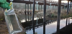
CATEGORIES: Bridge
LAYER: Bridge
OWNERSHIP: Public
WATER BODY: Okapilco Creek
MILE: 3.88
ADDRESS: U.S. 84 1.5 miles east of Quitman, GA. Brooks County.
DESCRIPTION: Double highway bridges, each 400.0 ft. 10-span concrete T beams with concrete cast-in-place deck, built in 1989 over Okapilco Creek.
AKA: Okapilco Creek @ US 84
WEBSITE: https://bridgereports.com/1090966
OTHER REFERENCE: https://wwals.net/pictures/2020-01-16–wq-sampling-vww/
PHOTO: https://wwals.net/pictures/2020-01-16–wq-sampling-vww/20200116_174819.jpg
PHOTOSET: https://wwals.net/pictures/2020-01-16–wq-sampling-vww/
PHOTO SOURCE: John S. Quarterman
PHONE NUMBER: (229) 242-0102
Suggestions: https://forms.gle/DipPgU2TP5atc2Rf9
McCracken Creek 03110203004556
CATEGORIES: Tributary
LAYER: Point of Interest
GPS: 30.81, -83.504234
OWNERSHIP: Private, BROOKSCO DAIRY, LLC, PARCEL 107 0003
WATER BODY: Crooked Creek
ADDRESS: Between Troupeville Road and Monument Church Road, Quitman, GA 31643, Brooks County.
DESCRIPTION: David A McCracken moved to the area about 1900. He purchased 135 acres of LL 259. LD 12. on 28 December 1899 from J B Underwood. He purchased 115 acres of the same land lot in 1900 from J F Whipple. Source: Phillip Williams
WEBSITE: https://www.google.com/maps/place/30%C2%B048’57.7%22N+83%C2%B030’05.3%22W/@30.8160401, -83.5102368, 5332m/data=!3m2!1e3!4b1!4m5!3m4!1s0x0:0x0!8m2!3d30.816022!4d-83.501482
Suggestions: https://forms.gle/DipPgU2TP5atc2Rf9
Devane Road Crooked Creek Bridge
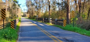
CATEGORIES: Bridge
LAYER: Bridge
OWNERSHIP: Public
WATER BODY: Crooked Creek
MILE: 0.78
ADDRESS: On Devane Road, just north of US 84. Brooks County.
DESCRIPTION: Narrow two-lane 64.0 ft. concrete bridge built in 1922 over Crooked Creek.
AKA: Crooked Creek @ Devane Road
WEBSITE: https://bridgereports.com/1090993
PHOTO: https://wwals.net/pictures/2020-02-21–WWALS-wq-brooks-co/20200221_165055.jpg
PHOTO SOURCE: John S. Quarterman
PHONE NUMBER: (229) 242-0102
Suggestions: https://forms.gle/DipPgU2TP5atc2Rf9
Crooked Creek Confluence
CATEGORIES: Tributary
LAYER: Other
GPS: 30.78135, -83.51125
OWNERSHIP: Private, June H. O’Neal, PARCEL 106 0001
WATER BODY: Okapilco Creek
MILE: 2.87
ADDRESS: South of US 84, west of Devane Road and Crooked Creek Lane. Brooks County.
DESCRIPTION: Feeder creek with dairy and sewage pond upstream.
Suggestions: https://forms.gle/DipPgU2TP5atc2Rf9
Bray Prop. WQ Monitoring
CATEGORIES: Point Of Interest
LAYER: Point of Interest
GPS: 30.76416, -83.497054
OWNERSHIP: Private, HAMMOCK BLUFF LLC, PARCEL 095 0003
WATER BODY: Okapilco Creek
MILE: 1.32
ADDRESS: Morton Lane, Quitman, GA 31643, Brooks County.
DESCRIPTION: Where Lowndes County monitored water quality on Okapilco Creek (probable location).
WEBSITE: https://www.google.com/maps/place/30%C2%B045’51.0%22N+83%C2%B029’49.4%22W/@30.7675523, -83.5179109, 10669m/data=!3m1!1e3!4m6!3m5!1s0x0:0x0!7e2!8m2!3d30.7641595!4d-83.497054
Suggestions: https://forms.gle/DipPgU2TP5atc2Rf9
Outfall of WWTP
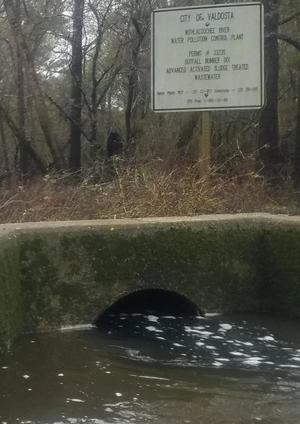
CATEGORIES: Wtp
LAYER: Other
OWNERSHIP: Public
WATER BODY: Withlacoochee River
MILE: 61.17
ADDRESS: Downhill from 3352 Wetherington Ln, Valdosta, GA 31601, Lowndes County.
DESCRIPTION: Withlacoochee River water usually tests cleaner downstream from this river left entry of treated wastewater from Valdosta’s Withlacoochee Wastewater Treatment Plant (WWTP), NPDES Permit No. GA0033235. One of two Valdosta plants (the other is in the Alapaha River Basin).
HISTORIC FACTS: The WWTP is notorious for chronic sewage spills; see also Old Closed WWTP. The new WWTP, uphill out of the flood plain, still spilled several more years. Remarkably, the WWTP was not the source of Valdosta’s notorious December 2019 sewage spill, but it was involved in previous incidents. In 2020, the Georgia Environmental Protection Division (GA-EPD) finally levied a Consent Order on Valdosta, with a fine, and a requirement for Valdosta to test and publish water quality results thrice-weekly on 40 river miles from US 41 to the GA-FL line. Those results helped enable finding other sources of E. coli contamination, combined with others from Lowndes County, WWALS, Florida’s Suwannee River Water Management District (SRWMD), Florida Department of Health (FDOH), Florida Department of Environmental Protection (FDEP). FDEP DNA marker and chemical tracer results indicate most contamination episodes come from ruminants on Okapilco Creek, which runs from Colquitt through Brooks Counties, Georgia. WWALS DNA marker test indicates those ruminants are cattle. Some of the dairy farmers have been implementing Best Management Practices (BMPs) which are having an effect: E. coli numbers during 2021 episodes were about half those of 2020. And Valdosta has had very few and only much smaller sewage spills since 2019.
WEBSITE: https://wwals.net/issues/vww/
ADDITIONAL INFO SOURCES: https://wwals.net/2020/05/04/three-weeks-to-comment-on-ga-epd-valdosta-wastewater-consent-order/
PHOTO: https://wwals.net/pictures/2019-02-03–troupville-spook-outing/wwtp.jpg
PHOTOSET: https://wwals.net/pictures/2019-02-03–troupville-spook-outing/
PHOTO SOURCE: John S. Quarterman
PHONE NUMBER: (229) 242-0102
PHOTO2: https://www.wwals.net/pictures/2021-03-27–mayors-paddle-pictures/20210327_104450.jpg
Photoset2: https://www.wwals.net/pictures/2021-03-27–mayors-paddle-pictures/
PHOTO2 SOURCE: John S. Quarterman
Photo2 Phone Number: 229-242-0102
Suggestions: https://forms.gle/DipPgU2TP5atc2Rf9

Solar panels on old WWTP site
CATEGORIES: Solar
LAYER: Point of Interest
OWNERSHIP: Public
WATER BODY: Withlacoochee River
ADDRESS: 3352 Wetherington Ln, Valdosta, GA 31601, Lowndes County.
DESCRIPTION: Solar panels on site of old close Valdosta Withlacoochee Wastewater Treatment Plant, Publicly owned, but inside locked fence.
HISTORIC FACTS: Shortly after this old wastewater plant closed in 2016, Valdosta put solar panels on its site.
GRN: Yes
Suggestions: https://forms.gle/DipPgU2TP5atc2Rf9
Old Closed WWTP

CATEGORIES: Wtp
LAYER: Point of Interest
OWNERSHIP: Public, City of Valdosta, PARCEL 0058 001
ACCESS: No
WATER BODY: Withlacoochee River
ADDRESS: 3352 Wetherington Ln, Valdosta, GA 31601, Lowndes County.
DESCRIPTION: Famously overflowed in 2009 and 2013, now replaced by new Withlacoochee Wastewater Treatment Plant, Many solar panels on site now.
HISTORIC FACTS: This is the wastewater plant that was underwater in 2009 and 2013. It has been closed since 2016.
AKA: Valdosta Sewer Plant.
GRN: Yes
WEBSITE: https://wwals.net/issues/vww/
PHOTO: http://www.l-a-k-e.org/topics/water/vldssw/img7.png
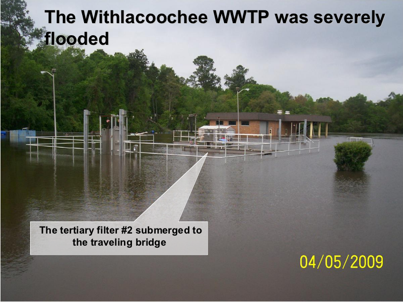
PHOTOSET: http://www.l-a-k-e.org/topics/water/vldssw/Water_Council_PresentationX2X.html
PHOTO SOURCE: City of Valdosta
PHONE NUMBER: (229) 333-1857
Suggestions: https://forms.gle/DipPgU2TP5atc2Rf9
Wetherington Branch Culvert

CATEGORIES: Bridge
LAYER: Bridge
GPS: 30.8292, -83.35768
OWNERSHIP: Public
WATER BODY: Wetherington Branch
ADDRESS: On Wetherington Lane just before the old closed Valdosta Withlacoochee Wastewater Plant. Lowndes County.
DESCRIPTION: This creek, named nowhere else, runs down from the current WWTP through two ponds, across Wetherington Lane, to the Withlacoochee River.
PHOTO: https://www.wwals.net/pictures/2024-04-16–wq/20240414_183409.jpg
PHOTOSET: https://www.wwals.net/pictures/2024-04-16–wq/
PHOTO SOURCE: John S. Quarterman
PHONE NUMBER: (229) 242-0102
Suggestions: https://forms.gle/DipPgU2TP5atc2Rf9
Evergreen Landfill 

CATEGORIES: Landfill
LAYER: Point of Interest
OWNERSHIP: Private, Advanced Disposal Services, Evergreen Landfill Inc. PARCEL 0058 002B
ACCESS: No, RESTROOMS, PARKING: Free, SHELTER
WATER BODY: Withlacoochee River
ADDRESS: 3163 Wetherington Ln, Valdosta, GA 31601, Lowndes County.
DESCRIPTION: Open landfill for Lowndes, Lanier, and Echols Counties, owned by Advanced Disposal Services (ADS), which was recently bought by Waste Management.. “”Evergreen Landfill is an MSW landfill that was opened November 2010 and currently accepts 1000- 2, 000 tons per day.”” Lightly overseen by Deep South Solid Waste Authority (DSSWA).
GRN: Yes
WEBSITE: https://www.advanceddisposal.com/ga/valdosta/evergreen-landfill
PHOTO: http://www.l-a-k-e.org/blog/wp-content/uploads/2017/08/e1ed4022a5eeb53dd4d6b93fda9d836a.jpg
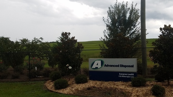
PHOTOSET: http://www.l-a-k-e.org/blog/2017/08/landfill-solar-on-wetherington-lane-lowndes-county-georgia.html
PHOTO SOURCE: John S. Quarterman
PHONE NUMBER: (229) 242-0102
Suggestions: https://forms.gle/DipPgU2TP5atc2Rf9
Landfill Pond
CATEGORIES: Lake
LAYER: Other
OWNERSHIP: Private, VEOLIA ES SOLID WASTE INC, PARCEL 0058 003
ACCESS: No
WATER BODY: Landfill Run
ADDRESS: 3087 Wetherington Ln, Valdosta, GA 31601, Lowndes County.
DESCRIPTION: Dammed pond on Landfill Run. ADS ran a pipeline through it to connect the landfills for methane power plant purposes.
Suggestions: https://forms.gle/DipPgU2TP5atc2Rf9
Wetherington Pond
CATEGORIES: Lake
LAYER: Other
OWNERSHIP: Private, Robert Charles Wetherington Jr. PARCEL 0058 005B
ACCESS: No
WATER BODY: Landfill Run
ADDRESS: 2859 Wetherington Ln, Valdosta, GA 31601, Lowndes County.
DESCRIPTION: Dammed pond on Landfill Run.
Suggestions: https://forms.gle/DipPgU2TP5atc2Rf9
Landfill Run
CATEGORIES: Tributary
LAYER: Other
OWNERSHIP: Private, The Langdale Company, PARCEL 0036 001A
ACCESS: No
WATER BODY: Spring Branch
MILE: 2.09
ADDRESS: Right bank, between 3087 Wetherington Lane and Spring Branch Circle, Valdosta, GA 31601, Lowndes County.
DESCRIPTION: Comes down from Valdosta’s Withlacoochee Wastewater Treatment Plant (WWTP) and Evergreen Landfill. Downstream from Landfill Pond.
AKA: USGS 03110203000480
Suggestions: https://forms.gle/DipPgU2TP5atc2Rf9
Landfill WTP Solar

CATEGORIES: Solar
LAYER: Point of Interest
OWNERSHIP: Public
WATER BODY: Withlacoochee River
ADDRESS: 3108 Wetherington Lane, Valdosta, GA 31601, Lowndes County.
DESCRIPTION: Solar panels feeding new Valdosta Withlacoochee Wastewater Treatment Plant.
GRN: Yes
WEBSITE: http://www.l-a-k-e.org/blog/2017/08/landfill-solar-on-wetherington-lane-lowndes-county-georgia.html
PHOTO: http://www.l-a-k-e.org/blog/wp-content/uploads/2017/08/ddc5ef7a3d91373d7174ddcec376e3d1.jpg
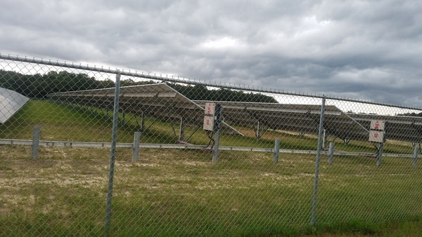
PHOTOSET: http://www.l-a-k-e.org/blog/2017/08/landfill-solar-on-wetherington-lane-lowndes-county-georgia.html
PHOTO SOURCE: John S. Quarterman
PHONE NUMBER: (229) 242-0102
Suggestions: https://forms.gle/DipPgU2TP5atc2Rf9
Withlacoochee Wastewater Treatment Plant

CATEGORIES: Wtp
LAYER: Brochure
OWNERSHIP: Public
ACCESS: No, RESTROOMS, PARKING: Free, SHELTER, HANDICAPPED ACCESSIBLE
WATER BODY: Withlacoochee River
ADDRESS: 3108 Wetherington Lane, Valdosta, GA 31601, Lowndes County.
DESCRIPTION: New (2016) sewer plant uphill out of the floodplain, apparently now fixed so that it won’t leak anymore (everyone hopes). The “”new Withlacoochee WPCP provides the city with a state-of-the-art wastewater treatment for an ADF of 12 MGD, with the capability to treat peak flows of 18 MGD. When high flows require the use of the new six-million-gallon equalization basin, the plant can treat a peak hourly flow of 38 MGD. The new plant uses a Sequencing Batch Reactor (SBR) System to treat wastewater while effectively removing nutrients and reducing phosphorous. Screen reader support enabled.””, See https://wwals.net/issues/vww/. Many solar panels on site power the plant during the day.
HISTORIC FACTS: This and the preceding Old Closed WWTP had chronic major sewage spills for decades. In 2020, the Georgia Environmental Protection Division (GA-EPD) finally levied a Consent Order on Valdosta, with a fine, and a requirement for Valdosta to test and publish water quality results thrice-weekly on 40 river miles from US 41 to the GA-FL line. See WWTP Outfall.
AKA: WWTP, Withlacoochee Sewer Plant, Withlacoochee Water Pollution Control Plant, or Withlacoochee WPCP.
GRN: Yes
WEBSITE: https://www.valdostacity.com/utilities/wastewater-treatment-plants/withlacoochee
ADDITIONAL INFO SOURCES: https://wwals.net/2020/05/04/three-weeks-to-comment-on-ga-epd-valdosta-wastewater-consent-order/
PHOTO: https://www.wwals.net/pictures/2024-04-16–wq/20240414_183052.jpg
PHOTOSET: https://www.wwals.net/pictures/2024-04-16–wq/
PHOTO SOURCE: John S. Quarterman
PHONE NUMBER: (229) 242-0102
PHOTO2: https://www.valdostacity.com/sites/default/files/uploads/max_1350-hdr.jpg
Photoset2: https://www.valdostacity.com/utilities/wastewater-treatment-plants/withlacoochee
PHOTO2 SOURCE: City of Valdosta
Photo2 Phone Number: 229-333-1857
Suggestions: https://forms.gle/DipPgU2TP5atc2Rf9
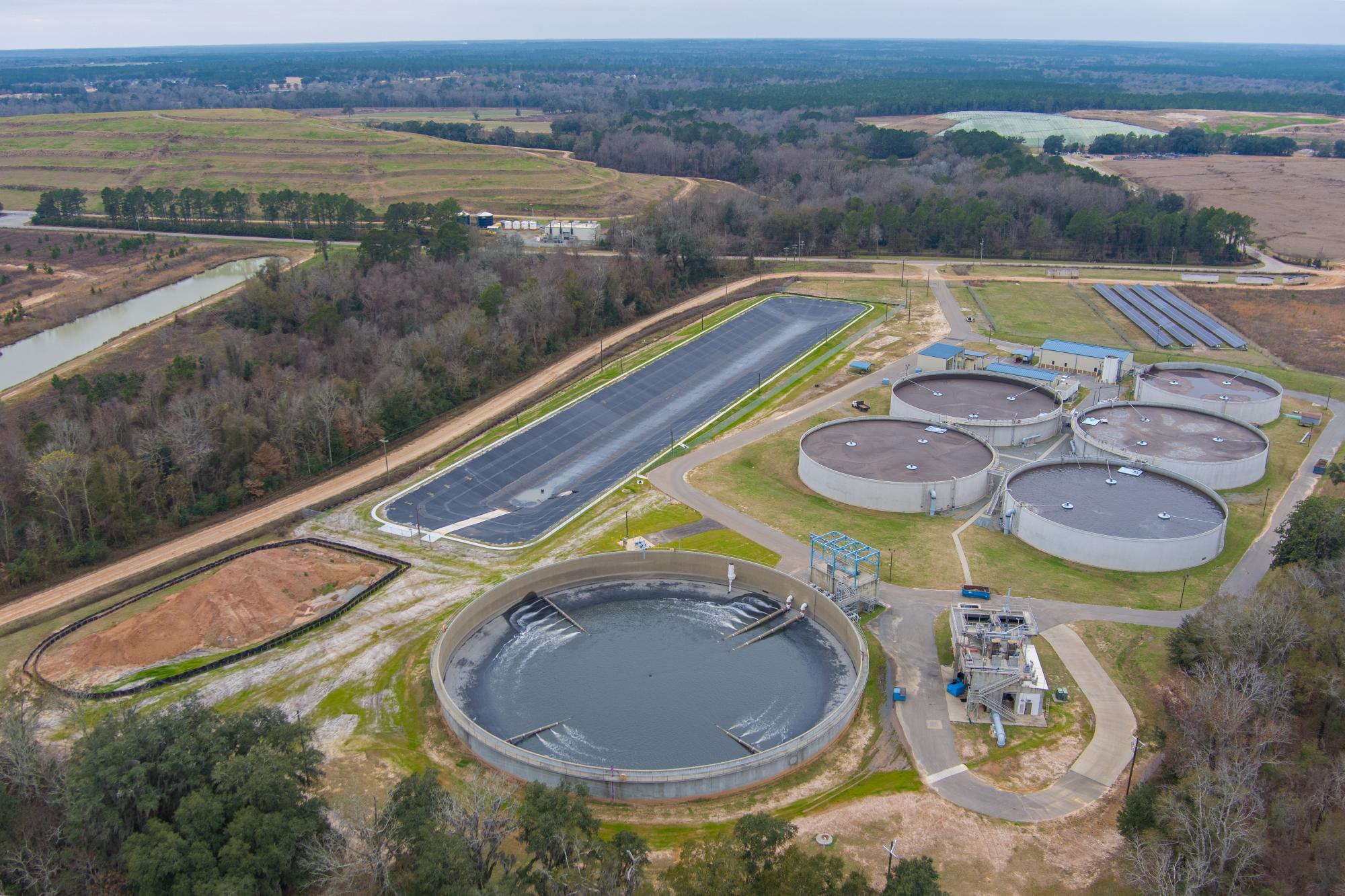
Spring Branch Culvert
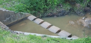
CATEGORIES: Bridge
LAYER: Bridge
GPS: 30.8204, -83.359886
OWNERSHIP: Public
WATER BODY: Spring Branch
ADDRESS: On Wetherington Lane just before the Valdosta Withlacoochee Wastewater Plant (WWTP). Lowndes County.
DESCRIPTION: This creek runs by the WWTP, across Wetherington Lane, by the open landfill, by the Kinderlou Golf Course, into the Withlacoochee River.
PHOTO: https://www.wwals.net/pictures/2024-04-16–wq/20240414_182457.jpg
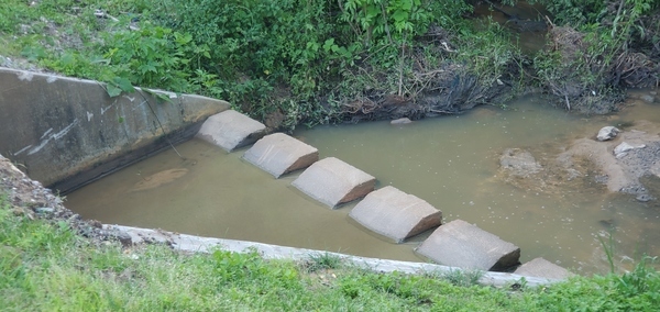
PHOTOSET: https://www.wwals.net/pictures/2024-04-16–wq/
PHOTO SOURCE: John S. Quarterman
PHONE NUMBER: (229) 242-0102
Suggestions: https://forms.gle/DipPgU2TP5atc2Rf9
Veolia Pecan Row Landfill

CATEGORIES: Landfill
LAYER: Point of Interest
OWNERSHIP: Private, Veolia ES Pecan Row Landfill LLC, PARCEL 0058 004
ACCESS: No, PARKING: Free
WATER BODY: Withlacoochee River
ADDRESS: 2995 Wetherington Ln, Valdosta, GA 31601, Lowndes County.
DESCRIPTION: Old closed landfill with PCBs, coal ash, and superfund wastewater.
HISTORIC FACTS: Significant fine by GA-EPD for accepting PCBs. Also accepted coal ash from Tennessee and Florida. The current operator says it does not want any more coal ash because it costs too much to make lined cells for it. Started generating electricity from landfill gas, May 2, 2014.
GRN: Yes
WEBSITE: http://www.l-a-k-e.org/blog/?s=pecan+row+landfill
ADDITIONAL INFO SOURCES: https://www.wastetodaymagazine.com/article/advanced-disposal-esg-georgia-lfg-electricity/
PHOTO: https://farm8.staticflickr.com/7393/9736362095_f4ef2e3af4_n.jpg?w=625
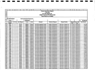
PHOTOSET: http://www.l-a-k-e.org/blog/2017/08/landfill-solar-on-wetherington-lane-lowndes-county-georgia.html
PHOTO SOURCE: EPA
PHONE NUMBER: (229) 241-8440
Suggestions: https://forms.gle/DipPgU2TP5atc2Rf9
Beltline Energy Solar Project

CATEGORIES: Solar
LAYER: Point of Interest
GPS: 30.81002, -83.36766
OWNERSHIP: Private, Robert Charles Wetherington, Jr. PARCEL 0058 005B
WATER BODY: Spring Branch
ADDRESS: Wetherington Ln, Valdosta, GA 31601, Lowndes County.
DESCRIPTION: Solar farm on old pecan grove, Requested variance to cut down pecan trees and to put up short vegetative buffer.
PHOTO: http://www.l-a-k-e.org/govt/zboa/2019-12-03–zboa-packet/VAR-2019-15XTBDXSolarXProject-0003.jpg
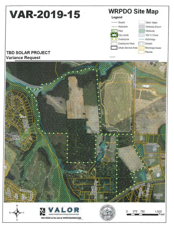
PHOTO SOURCE: Beltline Energy Solar Project
PHONE NUMBER: (850) 290-2350
Suggestions: https://forms.gle/DipPgU2TP5atc2Rf9
May Private Landing

CATEGORIES: Landing Private
LAYER: Point of Interest
OWNERSHIP: Private, MAY PROPERTIES, LLC,, PARCEL 146 0031A
ACCESS: Launch: very rough riverbank access from unknown woods road.
WATER BODY: Withlacoochee River
MILE: 60.65
ADDRESS: Right bank, 1.82 miles downstream from Little River Confluence; 0.52 miles downstream from Valdosta’s WWTP outfall and 0.10 miles upstream from Wetherington Branch. Brooks County.
DESCRIPTION: Very rough access from unknown woods road. Private, do not use without permission.
WEBSITE: https://www.wwals.net/pictures/2021-03-27–mayors-paddle-pictures/
PHOTO: https://www.wwals.net/pictures/2021-03-27–mayors-paddle-pictures/20210327_105543.jpg
PHOTOSET: https://www.wwals.net/pictures/2021-03-27–mayors-paddle-pictures/
PHOTO SOURCE: John S. Quarterman
PHONE NUMBER: (229) 242-0102
Suggestions: https://forms.gle/DipPgU2TP5atc2Rf9
Wetherington Branch

CATEGORIES: Tributary
LAYER: Point of Interest
OWNERSHIP: Public, LOCH-WINN FARMS LTD, C/O DR TOM H SMITH, PARCEL 0057 005
WATER BODY: Withlacoochee River
MILE: 60.55
ADDRESS: Left bank, 1.92 miles downstream from Little River Confluence and 0.62 miles downstream from Valdosta’s WWTP Outfall. Lowndes County.
DESCRIPTION: Comes from current Valdosta WWTP and closed landfill.
WEBSITE: https://www.wwals.net/pictures/2021-03-27–mayors-paddle-pictures/#WB
PHOTO: https://www.wwals.net/pictures/2021-03-27–mayors-paddle-pictures/20210327_105715.jpg
PHOTOSET: https://www.wwals.net/pictures/2021-03-27–mayors-paddle-pictures/
PHOTO SOURCE: John S. Quarterman
PHONE NUMBER: (229) 242-0102
Suggestions: https://forms.gle/DipPgU2TP5atc2Rf9
Deloach Private Boat Ramp 

CATEGORIES: Landing Private
LAYER: Point of Interest
OWNERSHIP: Private, PAUL & JENNIFER DELOACH, PARCEL 146 00351
ACCESS: Ramp: Concrete ramp from woods dirt woods road.
WATER BODY: Withlacoochee River
MILE: 60.18
ADDRESS: Right bank, 2.29 miles downstream from Little River Confluence and 0.99 miles downstream from Valdosta’s WWTP Outfall. 11012 TROUPEVILLE RD, VALDOSTA, GA 31602, Brooks County.
DESCRIPTION: Wide concrete ramp from woods road. Private: do not use without permission.
WEBSITE: https://www.wwals.net/pictures/2021-03-27–mayors-paddle-pictures/#DPBR
PHOTO: https://www.wwals.net/pictures/2021-03-27–mayors-paddle-pictures/20210327_110357.jpg
PHOTOSET: https://www.wwals.net/pictures/2021-03-27–mayors-paddle-pictures/
PHOTO SOURCE: John S. Quarterman
PHONE NUMBER: (229) 242-0102
PHOTO2: https://www.wwals.net/pictures/2021-03-27–mayors-paddle-pictures/20210327_110401.jpg
Photoset2: https://www.wwals.net/pictures/2021-03-27–mayors-paddle-pictures/
PHOTO2 SOURCE: John S. Quarterman
Photo2 Phone Number: 229-242-0102
Suggestions: https://forms.gle/DipPgU2TP5atc2Rf9

Langdale Pothole Private Ramp
CATEGORIES: Landing Private
LAYER: Point of Interest
OWNERSHIP: Private, LANGDALE CO, PARCEL 0057 006
ACCESS: Ramp: wide dirt ramp with big pothole
WATER BODY: Withlacoochee River
MILE: 60.02
ADDRESS: Left bank, 2.45 miles downstream from Little River Confluence and 0.16 miles downstream from Deloach Private Boat Ramp. Lowndes County.
DESCRIPTION: A dirt boat ramp with a big pothole, also partly hidden behind trees.
PHOTO SOURCE: John S. Quarterman
PHONE NUMBER: (229) 242-0102
Suggestions: https://forms.gle/DipPgU2TP5atc2Rf9
Tillman Private Landing

CATEGORIES: Landing Private
LAYER: Point of Interest
OWNERSHIP: Private, EMERY LEE & JAMES G TILLMAN, PARCEL 146 0036
ACCESS: Launch: wide cut in riverbank from dirt woods road.
WATER BODY: Withlacoochee River
MILE: 59.96
ADDRESS: Right bank, 2.51 miles downstream from Little River Confluence and 1.21 miles downstream from Valdosta’s WWTP Outfall. 10854 TROUPEVILLE RD, VALDOSTA, GA 31602. Brooks County.
DESCRIPTION: Riverbank access from woods road. Private: do not use without permission.
WEBSITE: https://www.wwals.net/pictures/2021-03-27–mayors-paddle-pictures/20210327_110706.jpg
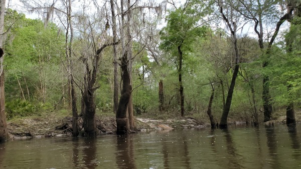
PHOTO: https://www.wwals.net/pictures/2021-03-27–mayors-paddle-pictures/20210327_110706.jpg
PHOTOSET: https://www.wwals.net/pictures/2021-03-27–mayors-paddle-pictures/
PHOTO SOURCE: John S. Quarterman
PHONE NUMBER: (229) 242-0102
Suggestions: https://forms.gle/DipPgU2TP5atc2Rf9
Landfill Branch
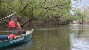
CATEGORIES: Tributary
LAYER: Point of Interest
OWNERSHIP: Public, LANGDALE COMPANY THE, PARCEL 0036 001A
WATER BODY: Withlacoochee River
MILE: 59.13
ADDRESS: Left bank, 3.34 miles downstream from Little River Confluence and 2.04 miles downstream from Valdosta’s WWTP Outfall. Lowndes County.
DESCRIPTION: Comes from current Lowndes County landfill.
WEBSITE: https://www.wwals.net/pictures/2021-03-27–mayors-paddle-pictures/#LB
PHOTO: https://www.wwals.net/pictures/2021-03-27–mayors-paddle-pictures/20210327_112301.jpg
PHOTOSET: https://www.wwals.net/pictures/2021-03-27–mayors-paddle-pictures/
PHOTO SOURCE: John S. Quarterman
PHONE NUMBER: (229) 242-0102
Suggestions: https://forms.gle/DipPgU2TP5atc2Rf9
Langdale Capital Assets Troupeville Road Private Ramp

CATEGORIES: Landing Private
LAYER: Point of Interest
OWNERSHIP: Private, LANGDALE CAPITAL ASSETS, INC, PARCEL 140 00052
ACCESS: Ramp: wide dirt ramp off of good dirt woods road.
WATER BODY: Withlacoochee River
MILE: 59.01
ADDRESS: Right bank, 3.46 miles downstream from Little River Confluence, 2.16 miles downstream from Valdosta’s WWTP Outfall. Brooks County.
DESCRIPTION: Sandy dirt ramp down from good woods road. Private: do not use without permission.
WEBSITE: https://www.wwals.net/pictures/2021-03-27–mayors-paddle-pictures/#LTRPR
PHOTO: https://www.wwals.net/pictures/2021-03-27–mayors-paddle-pictures/20210327_112440.jpg
PHOTOSET: https://www.wwals.net/pictures/2021-03-27–mayors-paddle-pictures/
PHOTO SOURCE: John S. Quarterman
PHONE NUMBER: (229) 242-0102
PHOTO2: https://www.wwals.net/pictures/2021-03-27–mayors-paddle-pictures/20210327_112442.jpg
Photoset2: https://www.wwals.net/pictures/2021-03-27–mayors-paddle-pictures/
PHOTO2 SOURCE: John S. Quarterman
Photo2 Phone Number: 229-242-0102
Suggestions: https://forms.gle/DipPgU2TP5atc2Rf9

Island Creek
CATEGORIES: Tributary
LAYER: Point of Interest
OWNERSHIP: Private, KINDERLOU FOREST GOLF CLUB INC, PARCEL 0059 156
WATER BODY: Spring Branch
MILE: 1.06
ADDRESS: Left bank, near top of Spring Branch. Lowndes County.
DESCRIPTION: Comes out of ponds above and below Live Oak Circle.
AKA: USGS 03110203004695
Suggestions: https://forms.gle/DipPgU2TP5atc2Rf9
Bland Pond
CATEGORIES: Lake
LAYER: Other
GPS: 30.8073, -83.368
OWNERSHIP: Private, O’NEAL JUNE H, PARCEL 0059 007
WATER BODY: Spring Branch
MILE: 1.78
ADDRESS: Right bank, across from Kinderlou. Near end of Pecan Plantation Road. Lowndes County.
DESCRIPTION: A run through a large private pond.
AKA: USGS 03110203004689
Suggestions: https://forms.gle/DipPgU2TP5atc2Rf9
Spring Branch
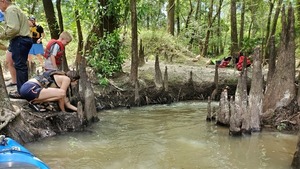
CATEGORIES: Tributary
LAYER: Other
OWNERSHIP: Private, LANGDALE COMPANY THE, PARCEL 0036 001A
WATER BODY: Withlacoochee River
MILE: 58.72
ADDRESS: 4345-4187 Spring Branch Cir, Valdosta, GA 31601. Lowndes County.
DESCRIPTION: This 3.6-mile creek joins the left side of the Withlacoochee River, coming down from Valdosta’s Withlacoochee Wastewater Treatment Plant, a landfill, and the Kinderlou golf course.
HISTORIC FACTS: During Paddle Georgia on June 15, 2019, GA-EPD got very high E. coli results at the Spring Branch Confluence. WWALS assigned an intern to sample several locations up and down Spring Branch frequently, and did not see any recurrence of that problem.
WEBSITE: https://wwals.net/pictures/2019-06-15–troupville-confluence-spook-bridge/
ADDITIONAL INFO SOURCES: https://wwals.net/issues/testing/
PHOTO: https://wwals.net/pictures/2019-06-15–troupville-confluence-spook-bridge/20190615_121646.jpg
PHOTOSET: https://wwals.net/pictures/2019-06-15–troupville-confluence-spook-bridge/
PHOTO SOURCE: John S. Quarterman
PHONE NUMBER: (229) 242-0102
PHOTO2: https://www.wwals.net/pictures/2021-03-27–mayors-paddle-pictures/20210327_112832.jpg
Photoset2: https://www.wwals.net/pictures/2021-03-27–mayors-paddle-pictures/#SBranch
PHOTO2 SOURCE: John S. Quarterman
Photo2 Phone Number: 229-242-0102
Suggestions: https://forms.gle/DipPgU2TP5atc2Rf9

Kinderlou Pond Creek
CATEGORIES: Tributary
LAYER: Point of Interest
OWNERSHIP: Private, LANGDALE COMPANY THE, PARCEL 0036 001A
WATER BODY: Withlacoochee River
MILE: 57.84
ADDRESS: Left bank, 4.63 miles downstream from Little River Confluence. Lowndes County.
DESCRIPTION: A small creek apparently draining from the pond with dam on Trailwood Court in Kinderlou Subdivision.
PHOTO SOURCE: John S. Quarterman
PHONE NUMBER: (229) 242-0102
Suggestions: https://forms.gle/DipPgU2TP5atc2Rf9
Kinderlou #2 Private Landing

CATEGORIES: Landing Private
LAYER: Other
OWNERSHIP: Private, LANGDALE COMPANY THE, PARCEL 0036 001A
ACCESS: Launch: dirt ramp from dirt road.
WATER BODY: Withlacoochee River
MILE: 57.85
ADDRESS: Left bank, 4.62 miles downstream from Little River Confluence and 3.32 miles downstream from Valdosta’s WWTP Outfall; private launch below Trailwood Ct, Valdosta, Georgia 31601. Lowndes County.
DESCRIPTION: River access from the Kinderlou gated subdivision. Private: do not use without permission.
WEBSITE: https://www.wwals.net/pictures/2021-03-27–mayors-paddle-pictures/#KL
PHOTO: https://www.wwals.net/pictures/2021-03-27–mayors-paddle-pictures/20210327_114318.jpg
PHOTOSET: https://www.wwals.net/pictures/2021-03-27–mayors-paddle-pictures/
PHOTO SOURCE: John S. Quarterman
PHONE NUMBER: (229) 242-0102
Suggestions: https://forms.gle/DipPgU2TP5atc2Rf9
Langdale Partition Creek

CATEGORIES: Tributary
LAYER: Other
OWNERSHIP: Public, LANGDALE COMPANY THE, PARCEL 0016 001
WATER BODY: Withlacoochee River
MILE: 57.01
ADDRESS: Right bank, 5.46 miles downstream from the Little River Confluence. Brooks County.
DESCRIPTION: Comes out under a big oak tree. The border between parcels owned by The Langdale Company and Langdale Capital Assets, Inc. Two branches of it come down across Troupeville Road.
AKA: USGS 03110203000783
PHOTO: https://www.wwals.net/pictures/2022-02-19–mayor-chairmans-paddle-pictures/20220219_122230.jpg
PHOTOSET: https://www.wwals.net/pictures/2022-02-19–mayor-chairmans-paddle-pictures/#LPC
PHOTO SOURCE: John S. Quarterman
PHONE NUMBER: (229) 242-0102
Suggestions: https://forms.gle/DipPgU2TP5atc2Rf9
Mcree Tract Creek
CATEGORIES: Tributary
LAYER: Point of Interest
OWNERSHIP: Private, LANGDALE COMPANY THE, PARCEL 0016 001
WATER BODY: Withlacoochee River
MILE: 56.02
ADDRESS: Left bank, 6.45 miles downstream from Little River Confluence. Lowndes County.
DESCRIPTION: A trickle out of a v-shaped cleft in the riverbank, apparently coming down from the pond on the Langdale Co. Mcree Tract.
PHOTO SOURCE: John S. Quarterman
PHONE NUMBER: (229) 242-0102
Suggestions: https://forms.gle/DipPgU2TP5atc2Rf9
Withlacoochee Hunt Club Boat Ramp

CATEGORIES: Landing Private
LAYER: Point of Interest
OWNERSHIP: Private, LANGDALE COMPANY THE, PARCEL 0016 001
ACCESS: Ramp: wide dirt ramp off of good but very sandy dirt woods road.
WATER BODY: Withlacoochee River
MILE: 55.55
ADDRESS: Left bank, 6.92 miles downstream from Little River Confluence. Road access is off of US 84 through locked gate. Lowndes County.
DESCRIPTION: Good dirt ramp off of very sandy woods road. Private: do not use without permission.
HISTORIC FACTS: Traditional lunch spot for annual late winter Chairman and Mayor’s Paddle.
AKA: Langdale Midpoint Ramp
WEBSITE: https://www.wwals.net/pictures/2021-03-27–mayors-paddle-pictures/#LS
PHOTO: https://www.wwals.net/pictures/2021-03-27–mayors-paddle-pictures/20210327_121957.jpg
PHOTOSET: https://www.wwals.net/pictures/2021-03-27–mayors-paddle-pictures/
PHOTO SOURCE: John S. Quarterman
PHONE NUMBER: (229) 242-0102
PHOTO2: https://www.wwals.net/pictures/2022-02-19–mayor-chairmans-paddle-pictures/20220219_124627.jpg
Photoset2: https://www.wwals.net/pictures/2022-02-19–mayor-chairmans-paddle-pictures/#LS
PHOTO2 SOURCE: John S. Quarterman
Photo2 Phone Number: 229-242-0102
Suggestions: https://forms.gle/DipPgU2TP5atc2Rf9

Millrace Creek
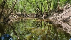
CATEGORIES: Tributary
LAYER: Other
OWNERSHIP: Private
WATER BODY: Withlacoochee River
MILE: 54.57
ADDRESS: Right bank, 7.9 miles downstream from Little River Confluence and 2.81 miles upstream from US 84 Landing. North of US 84; south of Troupville Highway. Brooks County.
DESCRIPTION: On the right bank, this usually-low-water 7.4-mile creek nonetheless often has enough river water in it to paddle up a bit. When the Withlacoochee River is high, Millrace Creek is hard to spot.
WEBSITE: https://wwals.net/pictures/2019-06-15–troupville-confluence-spook-bridge/
ADDITIONAL INFO SOURCES: https://wwals.net/issues/testing/
PHOTO: https://wwals.net/pictures/2019-06-15–troupville-confluence-spook-bridge/20190615_142712.jpg
PHOTOSET: https://wwals.net/pictures/2019-06-15–troupville-confluence-spook-bridge/
PHOTO SOURCE: John S. Quarterman
PHONE NUMBER: (229) 242-0102
PHOTO2: https://wwals.net/pictures/2021-02-27–tiny-mayors-paddle-pictures/20210227_115928.jpg
Photoset2: https://wwals.net/pictures/2021-02-27–tiny-mayors-paddle-pictures/
PHOTO2 SOURCE: John S. Quarterman
Photo2 Phone Number: 229-242-0102
Suggestions: https://forms.gle/DipPgU2TP5atc2Rf9

Rotten Egg Branch
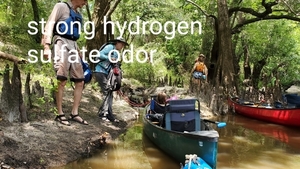
CATEGORIES: Tributary
LAYER: Other
OWNERSHIP: Private, The Langdale Company, PARCEL 140 0005
WATER BODY: Withlacoochee River
MILE: 53.79
ADDRESS: South of Blaine Circle, off of Troupeville Road. Brooks County.
DESCRIPTION: Joining the Withlacoochee River on river right, this tiny branch that seems to have problems.
HISTORIC FACTS: During Paddle Georgia on June 15, 2019, this creek had a very strong odor of hydrogen sulphate (rotten eggs).
AKA: USGS 03110203004587
WEBSITE: https://wwals.net/pictures/2019-06-15–troupville-confluence-spook-bridge/
PHOTO: https://wwals.net/pictures/2019-06-15–troupville-confluence-spook-bridge/20190615_145142.jpg
PHOTOSET: https://wwals.net/pictures/2019-06-15–troupville-confluence-spook-bridge/
PHOTO SOURCE: John S. Quarterman
PHONE NUMBER: (229) 242-0102
Suggestions: https://forms.gle/DipPgU2TP5atc2Rf9
Dykes Lane Creek

CATEGORIES: Tributary
LAYER: Other
GPS: 30.8101, -83.4506
OWNERSHIP: Public, The Langdale Company, PARCEL 140 0005
WATER BODY: Withlacoochee River
MILE: 53.19
ADDRESS: Right bank, 0.6 miles downstream from Rotten Egg Branch, 2.36 miles downstream from Langdale Midpoint Ramp, 9.28 miles downstream from Little River Confluence, 1.46 miles upstream from US 84 bridge. Brooks County.
DESCRIPTION: Comes out of a tangle of small trees. Starts near Dykes Lane and runs about 2 kilometers.
AKA: USGS 03110203000800
PHOTO: https://www.wwals.net/pictures/2022-02-19–mayor-chairmans-paddle-pictures/20220219_150322.jpg
PHOTOSET: https://www.wwals.net/pictures/2022-02-19–mayor-chairmans-paddle-pictures/#DLC
PHOTO SOURCE: John S. Quarterman
PHONE NUMBER: (229) 242-0102
PHOTO2 SOURCE: John S. Quarterman
Photo2 Phone Number: 229-242-0102
Suggestions: https://forms.gle/DipPgU2TP5atc2Rf9
Morningstar Church Creek
CATEGORIES: Tributary
LAYER: Other
GPS: 30.8099, -83.45063
OWNERSHIP: Public, The Langdale Company, PARCEL 140 0005
WATER BODY: Withlacoochee River
MILE: 53.19
ADDRESS: Right bank, a few feet downstream from Dykes Lane Creek. Brooks County.
DESCRIPTION: Comes down from Morningstar Church Road.
AKA: USGS 03110203000801
PHOTO SOURCE: John S. Quarterman
PHONE NUMBER: (229) 242-0102
PHOTO2 SOURCE: John S. Quarterman
Photo2 Phone Number: 229-242-0102
Suggestions: https://forms.gle/DipPgU2TP5atc2Rf9
Sabal Trail Pipeline

CATEGORIES: Pipeline
LAYER: Point of Interest
OWNERSHIP: Private, The Langdale Company, PARCEL 140 0005
WATER BODY: Withlacoochee River
MILE: 51.88
ADDRESS: About 1, 000 feet upstream from US 84 Bridge, Brooks, Lowndes Counties.
DESCRIPTION: Yard-wide fracked methane pipeline drilled under the Withlacoochee River. Signs visible on either bank.
HISTORIC FACTS: Notorious for leaking drilling fluid up from its pilot hole into the Withlacoochee River, October 22, 2016. Used federal eminent domain provided by the Federal Energy Regulatory Commission (FERC) to take local lands. Lost every jury trial about that, usually having to pay five times as much as offered, but any one-time payment is still a pittance compared to the pipeline company’s daily profits and the risks to the river, lands, air, and life.
WEBSITE: https://wwals.net/issues/stt/
PHOTO: https://wwals.net/pictures/2021-02-27–tiny-mayors-paddle-pictures/20210227_123921.jpg
PHOTOSET: https://wwals.net/pictures/2021-02-27–tiny-mayors-paddle-pictures/20210227_123921.jpg
PHOTO SOURCE: John S. Quarterman
PHONE NUMBER: (229) 242-0102
PHOTO2: https://wwals.net/wp-content/themes/pianoblack/img//2016/11/754a83779a6a2b2bd72a941b54b4659d.jpg
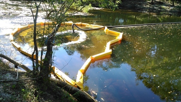
PHOTO2 SOURCE: John S. Quarterman
Photo2 Phone Number: 229-242-0102
Suggestions: https://forms.gle/DipPgU2TP5atc2Rf9

US 84 Withlacoochee Rapids
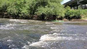
CATEGORIES: Shoal
LAYER: Other
GPS: 30.79382, -83.45334
OWNERSHIP: Public
WHITEWATER CLASS: Class I
WATER BODY: Withlacoochee River
MILE: 51.75
ADDRESS: Just above the US 84 bridge. Brooks County.
DESCRIPTION: Keep to the left and sail through. Go right and get hung on rocks. Invisible at high water; only walkable at low water.
WEBSITE: https://wwals.net/pictures/2019-06-15–troupville-confluence-spook-bridge/
PHOTO: https://wwals.net/pictures/2019-06-15–troupville-confluence-spook-bridge/20190615_154602.jpg
PHOTOSET: https://wwals.net/pictures/2019-06-15–troupville-confluence-spook-bridge/
PHOTO SOURCE: John S. Quarterman
PHONE NUMBER: (229) 242-0102
Suggestions: https://forms.gle/DipPgU2TP5atc2Rf9
US 84 Landing
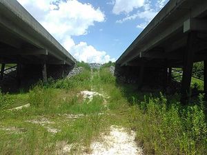
CATEGORIES: Landing
LAYER: Brochure
OWNERSHIP: Public
ACCESS: Yes, Launch: wooded riverbank reached from between twin state highway bridges.
WATER BODY: Withlacoochee River
Lowest boatable: 85.5′
Highest safe: 94′
GAUGE: Quitman
MILE: 51.76
ADDRESS: 5092 US 84 W, Valdosta, GA 31601, Lowndes County.
DESCRIPTION: Between the twin highway bridges on the Lowndes County side, scramble down and stay to the right for this problematical access to the subtropical blackwater Withlacoochee River. No ramp, no launch, plenty of catbriars, blackberry thorns, skeeters, and chiggers; ticks, too, if you’re lucky. Park in the median between the two bridges. Better: shuttle your vehicle on down to the takeout.
AKA: Quitman Landing.
ADDITIONAL INFO SOURCES: https://www.theswimguide.org/beach/9589
UPSTREAM: 17.05 miles from US 84 Landing to Langdale Park Boat Ramp
DOWNSTREAM: 8.51 miles from US 84 Landing to Knights Ferry Boat Ramp
PHOTO: https://wwals.net/wp-content/themes/pianoblack/img//2015/08/db3ecb1f3bcd2a77fe0bd5f186544f5e.jpg
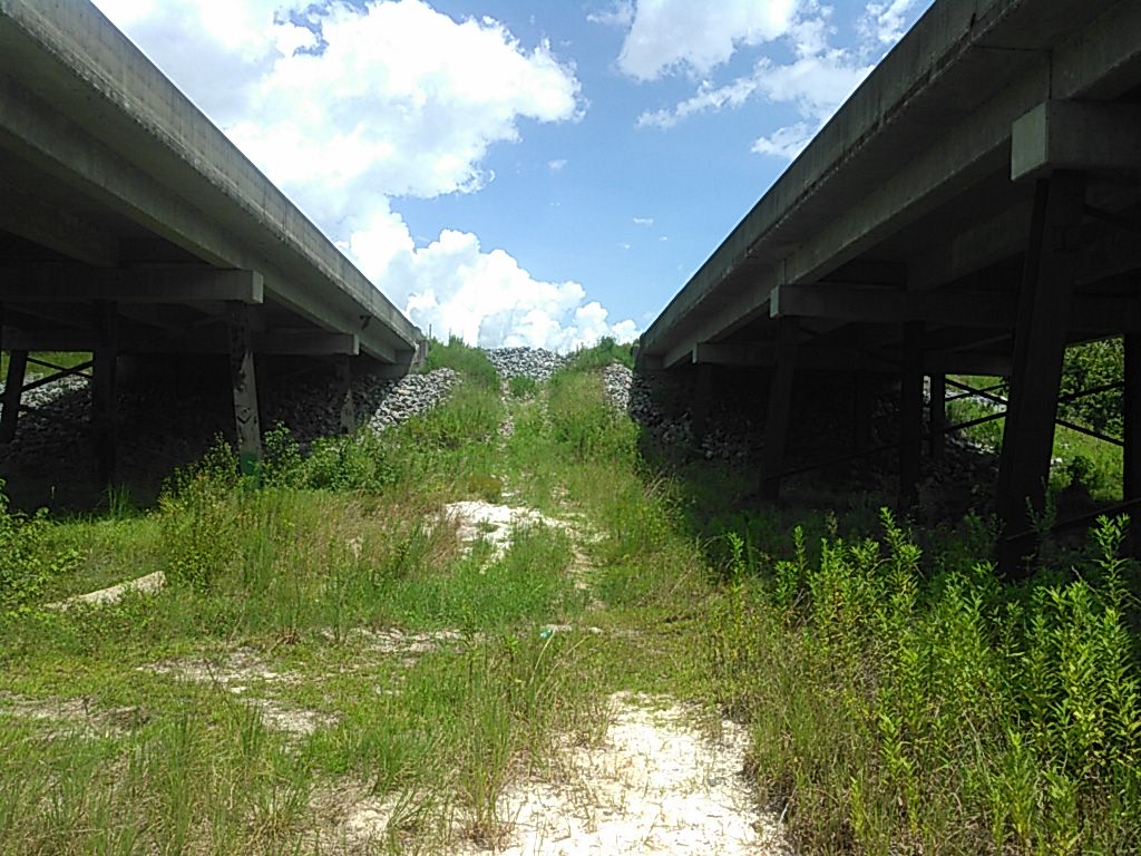
PHOTOSET: https://wwals.net/2015/08/21/withlacoochee-river-at-us-84/
PHOTO SOURCE: John S. Quarterman
PHONE NUMBER: (229) 242-0102
PHOTO2: https://wwals.net/wp-content/themes/pianoblack/img//2015/08/fdb8d58502f0f717b3a7c6aff38bdb0d.jpg
Photoset2: https://wwals.net/2015/08/21/withlacoochee-river-at-us-84/
PHOTO2 SOURCE: John S. Quarterman
Photo2 Phone Number: 229-242-0102
Suggestions: https://forms.gle/DipPgU2TP5atc2Rf9
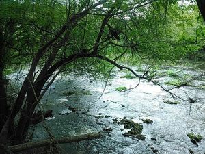
US 84 Bridge
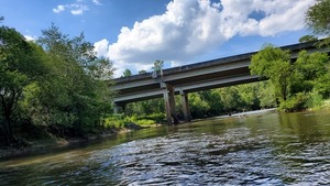
CATEGORIES: Bridge
LAYER: Bridge
OWNERSHIP: Public
WATER BODY: Withlacoochee River
MILE: 51.73
ADDRESS: Between Quitman and Valdosta. Lowndes, Brooks Counties.
DESCRIPTION: Federal highway twin bridges, each 920.0 ft. 3-span steel girders with concrete cast-in-place deck over the Withlacoochee River, built in 1989.
HISTORIC FACTS: Replaced Spook Bridge.
AKA: GA 38 Bridge or US 221 Bridge.
WEBSITE: https://bridgereports.com/1090969
OTHER REFERENCE: https://bridgereports.com/1090968
PHOTO: https://wwals.net/pictures/2019-06-15–troupville-confluence-spook-bridge/20190615_154814.jpg
PHOTOSET: https://wwals.net/pictures/2019-06-15–troupville-confluence-spook-bridge/
PHOTO SOURCE: John S. Quarterman
PHONE NUMBER: (229) 242-0102
PHOTO2: https://www.wwals.net/pictures/2022-02-19–mayor-chairmans-paddle-pictures/20220219_152842.jpg
Photoset2: https://www.wwals.net/pictures/2022-02-19–mayor-chairmans-paddle-pictures/#RRB
PHOTO2 SOURCE: John S. Quarterman
Photo2 Phone Number: 229-242-0102
Suggestions: https://forms.gle/DipPgU2TP5atc2Rf9

Quitman Gauge
CATEGORIES: River Gauge
LAYER: River Gauge
OWNERSHIP: Public
WATER BODY: Withlacoochee River
Lowest boatable: 85.5′
Highest safe: 94′
GAUGE: Quitman
MILE: 51.70
ADDRESS: Between US 84 bridge and CSX rail bridge, Brooks County.
DESCRIPTION: USGS 02318500
AKA: US 84 Gauge.
WEBSITE: https://wwals.net/2014/05/06/flooding-charts-2/#US-84
PHOTOSET: https://wwals.net/2014/05/06/flooding-charts-2/
PHOTO SOURCE: WWALS
PHONE NUMBER: (229) 242-0102
Suggestions: https://forms.gle/DipPgU2TP5atc2Rf9
CSX Rail Bridge

CATEGORIES: Railbridge
LAYER: Bridge
OWNERSHIP: Private
ACCESS: No
WATER BODY: Withlacoochee River
MILE: 51.68
ADDRESS: Between Quitman and Valdosta, just south of the US 84 bridge, Brooks, Lowndes Counties.
DESCRIPTION: A busy east-west freight railroad. The original rail line through this area.
HISTORIC FACTS: This is the path of the Atlantic Coast Line Railway from Savannah to Thomasville that caused the residents of Troupville to pick up their buildings and move to what is now Valdosta in 1860, taking the Lowndes County seat with them.
PHOTO: https://www.wwals.net/pictures/2022-02-19–mayor-chairmans-paddle-pictures/20220219_152927.jpg
PHOTOSET: https://www.wwals.net/pictures/2022-02-19–mayor-chairmans-paddle-pictures/#CSXRR
PHOTO SOURCE: John S. Quarterman
PHONE NUMBER: (229) 242-0102
PHOTO2: https://www.wwals.net/pictures/2022-02-19–mayor-chairmans-paddle-pictures/20220219_152939.jpg
Photoset2: https://www.wwals.net/pictures/2022-02-19–mayor-chairmans-paddle-pictures/#CSXRR
PHOTO2 SOURCE: John S. Quarterman
Photo2 Phone Number: 229-242-0102
Suggestions: https://forms.gle/DipPgU2TP5atc2Rf9

Wade Spring
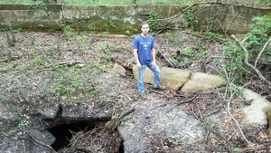
CATEGORIES: Spring
LAYER: Brochure
OWNERSHIP: Private, Walter Cunningham, PARCEL 124 0002
ACCESS: No
WATER BODY: Withlacoochee River
ADDRESS: East of Quitman, GA, on Blue Springs Road, at a culvert maybe a hundred feet before the fallen tree and the washout. Brooks County.
DESCRIPTION: It’s private property now, so stay on the road. This is as far as you can drive on the way to Spook Bridge across the Withlacoochee River.
HISTORIC FACTS: This historic spring once hosted a famous resort with a rail station on a railroad built to get there from Valdosta and Quitman.
WEBSITE: https://wwals.net/2017/05/28/wade-spring-2017-05-21/
PHOTOSET: https://wwals.net/2017/05/28/wade-spring-2017-05-21/
PHOTO SOURCE: John S. Quarterman
PHONE NUMBER: (229) 242-0102
Suggestions: https://forms.gle/DipPgU2TP5atc2Rf9
Spook Bridge
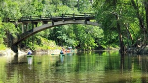
CATEGORIES: Bridgehistoric
LAYER: Bridge
OWNERSHIP: Public
ACCESS: No, PARKING: Free
WATER BODY: Withlacoochee River
MILE: 51.44
ADDRESS: On Old Quitman Road; walkable but closed to vehicular traffic. Brooks, Lowndes Counties.
DESCRIPTION: Nice antique stone bridge with railing and ghost stories. Has its own horror movie, Spook Bridge.
HISTORIC FACTS: The former US 84 highway bridge. Known to generations of teenagers for scary visits.
AKA: Old US 84 Bridge.
WEBSITE: http://en.wikipedia.org/wiki/Spook_Bridge
ADDITIONAL INFO SOURCES: https://www.imdb.com/title/tt6610168/
PHOTO: https://wwals.net/pictures/2019-06-15–troupville-confluence-spook-bridge/20190615_155146.jpg
PHOTOSET: https://wwals.net/pictures/2019-06-15–troupville-confluence-spook-bridge/
PHOTO SOURCE: John S. Quarterman
PHONE NUMBER: (229) 242-0102
PHOTO2: http://bridgehunter.com/photos/19/17/191726-M.jpg
Photoset2: http://bridgehunter.com/ga/lowndes/spook/
Suggestions: https://forms.gle/DipPgU2TP5atc2Rf9

Spook Bridge Landing

CATEGORIES: Landing Private
LAYER: Point of Interest
OWNERSHIP: Private, LANGDALE COMPANY THE, PARCEL 0018 002
ACCESS: Launch: steep riverbank bluff on power line right of way down abandoned state highway right of way with sketchy inland bridge.
WATER BODY: Withlacoochee River
MILE: 51.41
ADDRESS: Left bank, 150 feet downstream from Spook Bridge. Through locked gate from end of Old Quitman Highway. Lowndes County.
DESCRIPTION: Even with the steep riverbank bluff this is much better access than US 84 Landing. Private, do not use without permission.
HISTORIC FACTS: Traditional takeout for the annual Mayor and Chairman’s Paddle.
WEBSITE: https://www.wwals.net/pictures/2021-03-27–mayors-paddle-pictures/#Takeout
PHOTO: https://www.wwals.net/pictures/2021-03-27–mayors-paddle-pictures/20210327_134749.jpg
PHOTOSET: https://www.wwals.net/pictures/2021-03-27–mayors-paddle-pictures/
PHOTO SOURCE: John S. Quarterman
PHONE NUMBER: (229) 242-0102
PHOTO2: https://www.wwals.net/pictures/2021-03-27–mayors-paddle-pictures/20210327_142034.jpg
Photoset2: https://www.wwals.net/pictures/2021-03-27–mayors-paddle-pictures/
PHOTO2 SOURCE: John S. Quarterman
Photo2 Phone Number: 229-242-0102
Suggestions: https://forms.gle/DipPgU2TP5atc2Rf9

Langboard Solar

CATEGORIES: Solar
LAYER: Point of Interest
OWNERSHIP: Private
WATER BODY: Withlacoochee River
ADDRESS: 320 Langboard Ln, Quitman, GA 31643, Brooks County.
DESCRIPTION: Behind Langboard plant. Built by SolAmerica Energy on land leased from Langboard.
WEBSITE: http://www.l-a-k-e.org/blog/2017/09/solar-panels-at-langboard-brooks-county-ga.html
PHOTOSET: http://www.l-a-k-e.org/blog/2017/09/solar-panels-at-langboard-brooks-county-ga.html
PHOTO SOURCE: Google maps
PHONE NUMBER: (850) 290-2350
Suggestions: https://forms.gle/DipPgU2TP5atc2Rf9
Belue Island
CATEGORIES: Point Of Interest
LAYER: Point of Interest
GPS: 30.7794, -83.459
OWNERSHIP: Private, The Langdale Company, PARCEL 0018 002
WATER BODY: Withlacoochee River
MILE: 50.34
ADDRESS: 1.42 river miles downstream from US 84. Lowndes County.
DESCRIPTION: A wooded island big enough for camping (about 1/3 acre), with a slough around it on the right, just before the river turns 90 degrees left.
Suggestions: https://forms.gle/DipPgU2TP5atc2Rf9
Rock Ledge Spring
CATEGORIES: Spring
LAYER: Point of Interest
OWNERSHIP: Private
WATER BODY: Withlacoochee River
MILE: 50.12
ADDRESS: A fifth of a mile downstream from Belue Island. Brooks County.
DESCRIPTION: A spring on a one-foot rock shelf on the right (west) bank of the river, under the shade of the trees. Has cave-dwelling crayfish. The shelf and spring are only visible at low water.
Suggestions: https://forms.gle/DipPgU2TP5atc2Rf9
Bowen Mill Pond
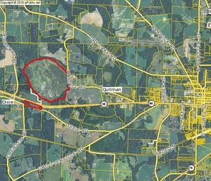
CATEGORIES: Lake
LAYER: Brochure
OWNERSHIP: Public, Georgia Department of Transportation, PARCEL 048 0027
ACCESS: Yes, PARKING: Free
WATER BODY: Bowen Mill Pond
ADDRESS: Bowen Mill Pond Road, Quitman, GA, Brooks County.
DESCRIPTION: Heading west on US 84 through Quitman, turn right on Barwick Road between the Harveys and the Rite Aid, or right on Shiver Road. Then turn left on Dry Lake Road, and eventually turn left on Bowen Mill Pond road. You’ll see the pond on your right after a while.
WEBSITE: https://wwals.net/2014/09/29/bowen-mill-pond-brooks-county-georgia/
PHOTOSET: https://wwals.net/2014/09/29/bowen-mill-pond-brooks-county-georgia/
PHOTO SOURCE: John S. Quarterman
PHONE NUMBER: (229) 242-0102
Suggestions: https://forms.gle/DipPgU2TP5atc2Rf9
Source of Piscola Creek
CATEGORIES: Source
LAYER: Other
OWNERSHIP: Private
WATER BODY: Piscola Creek
MILE: 34.19
ADDRESS: South of Harts Mill Road, east of Simmons Road, west of Salem Road and Pavo, GA, Thomas County.
WEBSITE: https://www.google.com/maps/place/30%C2%B057’38.6%22N+83%C2%B046’28.0%22W/@30.9588115, -83.7789581, 4804m/data=!3m1!1e3!4m5!3m4!1s0x0:0x0!8m2!3d30.960716!4d-83.774452?hl=en
Suggestions: https://forms.gle/DipPgU2TP5atc2Rf9
Salem Rd Piscola Creek Bridge
CATEGORIES: Bridge
LAYER: Bridge
OWNERSHIP: Public
WATER BODY: Piscola Creek
MILE: 32.87
ADDRESS: 11376 Salem Rd, Pavo, GA 31778, Thomas County.
Suggestions: https://forms.gle/DipPgU2TP5atc2Rf9
Shady Grove Rd Piscola Creek Bridge
CATEGORIES: Bridge
LAYER: Bridge
OWNERSHIP: Public
WATER BODY: Piscola Creek
MILE: 30.82
ADDRESS: West of Kelly Woods Road. Thomas County.
Suggestions: https://forms.gle/DipPgU2TP5atc2Rf9
GA 122 Piscola Creek Bridge
CATEGORIES: Bridge
LAYER: Bridge
OWNERSHIP: Public
WATER BODY: Piscola Creek
MILE: 32.25
ADDRESS: 15228 GA-122, Pavo, GA 31778, Thomas County.
Suggestions: https://forms.gle/DipPgU2TP5atc2Rf9
Pope Rd Piscola Creek Bridge
CATEGORIES: Bridge
LAYER: Bridge
OWNERSHIP: Public
WATER BODY: Piscola Creek
MILE: 30.25
ADDRESS: Between Salem Road and GA 33. Thomas County.
Suggestions: https://forms.gle/DipPgU2TP5atc2Rf9
Coffee Rd Piscola Creek Bridge
CATEGORIES: Bridge
LAYER: Bridge
OWNERSHIP: Public
WATER BODY: Piscola Creek
MILE: 27.64
ADDRESS: 6600 Coffee Road, Boston, GA 31626, Thomas County.
DESCRIPTION: East of Salem Road, west of Barwick.
Suggestions: https://forms.gle/DipPgU2TP5atc2Rf9
Ozell Rd Piscola Creek Bridge
CATEGORIES: Bridge
LAYER: Bridge
OWNERSHIP: Public
WATER BODY: Piscola Creek
MILE: 25.09
ADDRESS: 8000 Ozell Road, Boston, GA 31626, Thomas County.
DESCRIPTION: Just downstream from Whitlock Branch.
Suggestions: https://forms.gle/DipPgU2TP5atc2Rf9
GA 33 Piscola Creek Bridge
CATEGORIES: Bridge
LAYER: Bridge
OWNERSHIP: Public
WATER BODY: Piscola Creek
MILE: 23.42
ADDRESS: Between Boston and Barwick. Thomas County.
Suggestions: https://forms.gle/DipPgU2TP5atc2Rf9
Old Quitman Rd Piscola Creek Bridge
CATEGORIES: Bridge
LAYER: Bridge
OWNERSHIP: Public
WATER BODY: Piscola Creek
MILE: 21.45
ADDRESS: Northeast of Boston, GA. Thomas County.
Suggestions: https://forms.gle/DipPgU2TP5atc2Rf9
Pidcock Rd Piscola Creek Bridge
CATEGORIES: Bridge
LAYER: Bridge
GPS: 30.799692, -83.71722
OWNERSHIP: Public
WATER BODY: Piscola Creek
MILE: 18.75
ADDRESS: North of Pidcock and US 84 and south of Old Quitman Road. Brooks County.
Suggestions: https://forms.gle/DipPgU2TP5atc2Rf9
Quitman-Thomasville Powerline Piscola Creek
CATEGORIES: Power Line
LAYER: Point of Interest
OWNERSHIP: Private
WATER BODY: Piscola Creek
MILE: 18.65
ADDRESS: Just downstream from Pidcock Rd (CR 91). Brooks County.
Suggestions: https://forms.gle/DipPgU2TP5atc2Rf9
US 84 Piscola Creek Bridge
CATEGORIES: Bridge
LAYER: Bridge
OWNERSHIP: Public
WATER BODY: Piscola Creek
MILE: 17.80
ADDRESS: West of Dixie, just north of Pidcock. Brooks County.
Suggestions: https://forms.gle/DipPgU2TP5atc2Rf9
CSX RR Piscola Creek Bridge
CATEGORIES: Railbridge
LAYER: Bridge
OWNERSHIP: Public
WATER BODY: Piscola Creek
MILE: 16.33
ADDRESS: Halfway between US 84 and Dixe Road. Brooks County.
Suggestions: https://forms.gle/DipPgU2TP5atc2Rf9
Thompson Farms
CATEGORIES: Point Of Interest
LAYER: Point of Interest
OWNERSHIP: Private
WATER BODY: Piscola Creek
MILE: 15.42
ADDRESS: 2538 Dixie Rd, Dixie, GA 31629, Brooks County.
DESCRIPTION: Has large hog waste lagoon.
WEBSITE: https://www.thompsonfarms.com/
Suggestions: https://forms.gle/DipPgU2TP5atc2Rf9
Dixie Rd Piscola Creek Bridge
CATEGORIES: Bridge
LAYER: Bridge
GPS: 30.7763, -83.678676
OWNERSHIP: Public
WATER BODY: Piscola Creek
MILE: 15.22
ADDRESS: West of Dixie, GA. Brooks County.
DESCRIPTION: Aka Old Thomasville Rd.
Suggestions: https://forms.gle/DipPgU2TP5atc2Rf9
Dixie GA Weather
CATEGORIES: Point Of Interest
LAYER: Point of Interest
OWNERSHIP: Private
WATER BODY: Allen Branch
MILE: 14.03
ADDRESS: 4281 US-84, Dixie, GA 31629, Brooks County.
DESCRIPTION: Boston Tractor Co., in UGA Weather
WEBSITE: http://georgiaweather.net/index.php?content=gp&site=DIXIE
Suggestions: https://forms.gle/DipPgU2TP5atc2Rf9
Hickory Head Rd Piscola Creek Bridge
CATEGORIES: Bridge
LAYER: Bridge
GPS: 30.77379, -83.660374
OWNERSHIP: Public
WATER BODY: Piscola Creek
MILE: 13.49
ADDRESS: Between Dixie Road and Grooverville Road. Brooks County.
Suggestions: https://forms.gle/DipPgU2TP5atc2Rf9
Gooverville Rd Piscola Creek Bridge
CATEGORIES: Bridge
LAYER: Bridge
OWNERSHIP: Public
WATER BODY: Piscola Creek
MILE: 11.49
ADDRESS: Just west of Emerson Crossing, southwest of Quitman. Brooks County.
Suggestions: https://forms.gle/DipPgU2TP5atc2Rf9
US 221 Piscola Creek Bridge
CATEGORIES: Bridge
LAYER: Bridge
GPS: 30.744973, -83.59117
OWNERSHIP: Public
WATER BODY: Piscola Creek
MILE: 7.77
ADDRESS: Between CR 53 and Bethlehem Church Road, Southwest of Quitman. Brooks County.
DESCRIPTION: Concrete bridge over Piscola Creek.
AKA: GA 76 Piscola Creek Bridge or Greenville Hwy Bridge
Suggestions: https://forms.gle/DipPgU2TP5atc2Rf9
Jones Ford
CATEGORIES: Ford
LAYER: Point of Interest
OWNERSHIP: Public
WATER BODY: Piscola Creek
MILE: 7.77
ADDRESS: Where US 221 Piscola Creek Bridge is now, between CR 53 and Bethlehem Church Road, Southwest of Quitman.. Brooks County.
DESCRIPTION: Ford here in the 1870s, according to Wiregrass History Digital History Project.
HISTORIC FACTS: There was a ford here in the 1870s, according to Wiregrass Region Digital History Project. https://www.google.com/maps/d/u/0/viewer?mid=1uAP1zA0ExqRb01-n1PrZCuaiQDo&ll=30.745158300000032%2C-83.5910429&z=18
Suggestions: https://forms.gle/DipPgU2TP5atc2Rf9
Empress Rd Piscola Creek Bridge
CATEGORIES: Bridge
LAYER: Bridge
OWNERSHIP: Public
WATER BODY: Piscola Creek
MILE: 5.63
ADDRESS: East of Empress Road, between Hamlin Rd and Johnson Short Rd, south of Quitman. Brooks County.
Suggestions: https://forms.gle/DipPgU2TP5atc2Rf9
GAFL RR Piscola Creek Bridge
CATEGORIES: Railbridge
LAYER: Bridge
OWNERSHIP: Public
WATER BODY: Piscola Creek
MILE: 5.22
ADDRESS: Between Hamlin Rd and Johnson Short Rd, south of Quitman. Brooks County.
Suggestions: https://forms.gle/DipPgU2TP5atc2Rf9
Brooks Co. Ind. Park Lift Station No. 1

CATEGORIES: Liftstation
LAYER: Point of Interest
OWNERSHIP: Public
WATER BODY: Piscola Creek
ADDRESS: North corner of GA 133 and GAFL RR, Quitman, GA. Brooks County.
DESCRIPTION: A sewage lift station marked on 2006 maps for building Brooks County Industrial Park, and visible from the highway.
WEBSITE: https://wwals.net/pictures/2006-05-09–brooks-county-industrial-park
OTHER REFERENCE: https://brookscoda.com/164/Industrial-Park
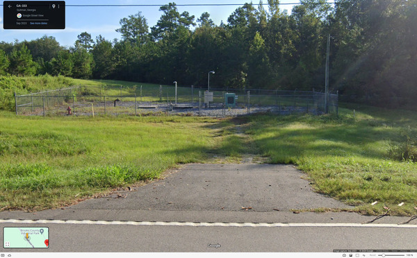
PHOTOSET: https://maps.app.goo.gl/62ZwVK1SfdA9M5AC6
PHOTO SOURCE: Google Streetview
PHONE NUMBER: (229) 263-9085
Suggestions: https://forms.gle/DipPgU2TP5atc2Rf9
Brooks Co. Ind. Park Lift Station No. 2

CATEGORIES: Liftstation
LAYER: Point of Interest
OWNERSHIP: Public
WATER BODY: Piscola Creek
ADDRESS: North corner of GA 133 and Gateway Drive, Quitman, GA. Brooks County.
DESCRIPTION: A sewage lift station marked on 2006 maps for building Brooks County Industrial Park, but not visible on the ground or on satellite maps.
WEBSITE: https://wwals.net/pictures/2006-05-09–brooks-county-industrial-park
OTHER REFERENCE: https://brookscoda.com/164/Industrial-Park
PHOTOSET: https://maps.app.goo.gl/K9Z2943WjF94Ptx56
PHOTO SOURCE: Google Streetview
PHONE NUMBER: (229) 263-9085
Suggestions: https://forms.gle/DipPgU2TP5atc2Rf9
GA 333 Piscola Creek Bridge
CATEGORIES: Bridge
LAYER: Bridge
OWNERSHIP: Public
WATER BODY: Piscola Creek
MILE: 3.80
ADDRESS: Between CR 294 and Johnson Short Rd, southeast of Quitman. Brooks County.
DESCRIPTION: Aka Madison Hwy.
Suggestions: https://forms.gle/DipPgU2TP5atc2Rf9
Old Madison Rd Piscola Creek Bridge
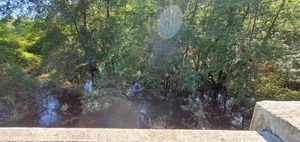
CATEGORIES: Bridge
LAYER: Bridge
OWNERSHIP: Public
WATER BODY: Piscola Creek
MILE: 2.95
ADDRESS: Between Dewey Rd and Johnson Short Rd, southeast of Quitman. Brooks County.
DESCRIPTION: Aka CR 245.
PHOTO: https://wwals.net/pictures/2020-05-01–brooks-co-streams/20200501_165352.jpg
PHOTOSET: https://wwals.net/pictures/2020-05-01–brooks-co-streams/
PHOTO SOURCE: John S. Quarterman
PHONE NUMBER: (229) 242-0102
Suggestions: https://forms.gle/DipPgU2TP5atc2Rf9
Piscola Creek
CATEGORIES: Tributary
LAYER: Other
GPS: 30.75648, -83.491864
OWNERSHIP: Private
WATER BODY: Okapilco Creek
MILE: 0.63
ADDRESS: Near Dewey Road. Brooks County.
DESCRIPTION: This 54-mile creek comes down through Thomas and Brooks Counties and joins the right side of Okapilco Creek just before the Withlacoochee River.
GRN: Yes
WEBSITE: https://wwals.net/maps/#Piscola-Creek
Suggestions: https://forms.gle/DipPgU2TP5atc2Rf9
Okapilco Creek
CATEGORIES: Tributary
LAYER: Other
OWNERSHIP: Private
ACCESS: No
WATER BODY: Withlacoochee River
MILE: 46.93
ADDRESS: Near Dewey Road. Brooks County.
DESCRIPTION: On Withlacoochee River right, very hard to spot, this 101-mile creek comes down from Colquitt County, which calls it the Okapilco River, and Brooks County. In both counties there is a chronic but now-improving problem of rains washing cattle manure into the creek and thus into the Withlacoochee River. The City of Quitman, Brooks County, GA, has had quite a few sewage spills into Okapilco Creek.
AKA: Okapilco River.
WEBSITE: https://wwals.net/maps/#Okapilco-Creek
ADDITIONAL INFO SOURCES: https://wwals.net/issues/testing/
Suggestions: https://forms.gle/DipPgU2TP5atc2Rf9
Historic Spains Bridge
CATEGORIES: Bridgesite
LAYER: Bridge
GPS: 30.7497, -83.4828
OWNERSHIP: Public
WATER BODY: Withlacoochee River
MILE: 46.66
ADDRESS: Beyond end of Spains Ferry Road, Lowndes, Brooks Counties.
DESCRIPTION: Built 1843, according to Wiregrass Region Digital History Project.
Suggestions: https://forms.gle/DipPgU2TP5atc2Rf9
Spains Ferry
CATEGORIES: Ferry
LAYER: Bridge
OWNERSHIP: Private
WATER BODY: Withlacoochee River
MILE: 46.65
ADDRESS: Lowndes, Brooks Counties.
DESCRIPTION: Where Spains Ferry Road used to cross the Withlacoochee River.
WEBSITE: https://en.wikipedia.org/wiki/Withlacoochee_River_(Suwannee_River)
Suggestions: https://forms.gle/DipPgU2TP5atc2Rf9
Mt Zion United Methodist Church Spring
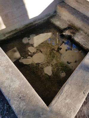
CATEGORIES: Spring
LAYER: Other
OWNERSHIP: Private, Mt. Zion United Methodist Church, PARCEL 0061 003
ACCESS: Yes
WATER BODY: Withlacoochee River
ADDRESS: 4535 Mt. Zion Rd., Valdosta, GA 31601, Lowndes County.
DESCRIPTION: Northwest of Clyattville, Georgia. across the road from the church building, same south side of the road as the cemetery, but east along the road, in the woods. On private church property, but publicly accessible.
WEBSITE: https://www.google.com/maps/place/Mt+Zion+United+Methodist+Spring/@30.7447327, -83.37064, 3a, 75y, 90t/data=!3m8!1e2!3m6!1sAF1QipO2Revf3ZifNsahY3xTKkaXp0kk4gAZ0bazo9hZ!2e10!3e12!6shttps:%2F%2Flh5.googleusercontent.com%2Fp%2FAF1QipO2Revf3ZifNsahY3xTKkaXp0kk4gAZ0bazo9hZ%3Dw152-h86-k-no!7i5312!8i2988!4m13!1m7!3m6!1s0x88ee626691fefb29:0x102e81d6f17c26bf!2s4536+Mt+Zion+Rd, +Valdosta, +GA+31601!3b1!8m2!3d30.7450018!4d-83.3716061!3m4!1s0x88ee62667cb6cf3f:0x55d2fcef904ef2b5!8m2!3d30.7445796!4d-83.3706562
PHOTO: https://wwals.net/wp-content/themes/pianoblack/img//2017/11/12fa0ad8e03bd541aafa6f8ba94cac9a.jpg
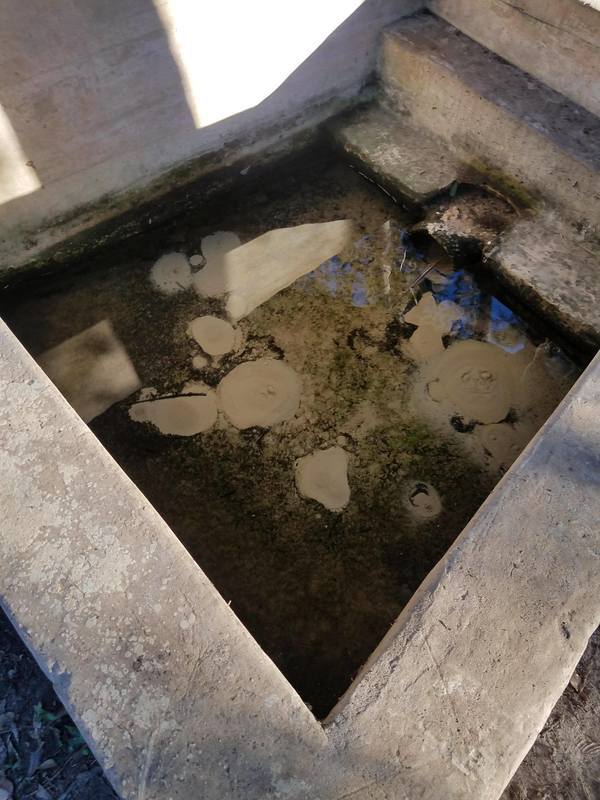
PHOTOSET: https://wwals.net/2017/11/28/mt-zion-united-methodist-church-spring-clyattville-ga/
PHOTO SOURCE: Aaron Sirmons
PHONE NUMBER: (850) 290-2350
Suggestions: https://forms.gle/DipPgU2TP5atc2Rf9
Lake Louise

CATEGORIES: Lake
LAYER: Other
OWNERSHIP: Private, Board of Regents of the University System of Georgia, PARCEL 0169 006
WATER BODY: Lake Louise
ADDRESS: Touchton Road, Lake Park, GA 31636, Lowndes County.
DESCRIPTION: A blackwater sinkhole lake research station of Valdosta State University. It drains to Jumping Gully Creek. Owned by Valdosta State University. The property is gated, and a key is required to enter. http://mushroomobserver.org/location/show_location/9020
PHOTO: http://www.valdosta.edu/colleges/arts-sciences/physics-astronomy-geosciences/images/lake_l1.jpg
PHOTOSET: http://www.valdosta.edu/colleges/arts-sciences/physics-astronomy-geosciences/geo-fac-lake-louise.php
PHOTO SOURCE: VSU
PHONE NUMBER: (229) 333-5752
Suggestions: https://forms.gle/DipPgU2TP5atc2Rf9
Grassy Pond Boat Ramp

CATEGORIES: Landing
LAYER: Other
GPS: 30.6545, -83.23495
OWNERSHIP: Public
ACCESS: Yes, Ramp: Concrete, WATER, RESTROOMS, PARKING: Park entry is FREE for DoD cardholders and $5 per vehicle up to six people for the public and $2 per each additional person. SHELTER, PICNIC AREA
WATER BODY: Grassy Pond
ADDRESS: 5360 Grassy Pond Dr., Lake Park, GA 31636, Lowndes County.
DESCRIPTION: A good ramp in a park affiliated with Moody Air Force Base, now open to the public for daily enjoyment.
WEBSITE: http://moodyfss.com/grassy-pond/
PHOTO: http://www.militarycampgrounds.us/media/reviews/photos/original/a3/2f/fc/grassy%20pond%20ga.jpg
PHOTOSET: http://www.militarycampgrounds.us/georgia/grassy-pond-recreation-area
PHOTO SOURCE: Moody AFB
PHONE NUMBER: (229) 559-5840
Suggestions: https://forms.gle/DipPgU2TP5atc2Rf9
Grassy Pond
CATEGORIES: Lake
LAYER: Other
OWNERSHIP: Public
ACCESS: Yes, PARKING: Park entry is FREE for DoD cardholders and $5 per vehicle up to six people for the public and $2 per each additional person. SHELTER, PICNIC AREA
WATER BODY: Grassy Pond
ADDRESS: 5360 Grassy Pond Dr., Lake Park, GA 31636, Lowndes County.
DESCRIPTION: An affiliate of Moody Air Force Base, now open to the public for daily enjoyment.
WEBSITE: https://wwals.net/2015/01/19/grassy-pond-opened-public-moody-afb/
PHOTO: http://www.moodyfss.com/content/areas/c423/misc/dock%20web.jpg
PHOTOSET: https://wwals.net/2015/01/19/grassy-pond-opened-public-moody-afb/
PHOTO SOURCE: Moody AFB
PHONE NUMBER: (229) 559-5840
Suggestions: https://forms.gle/DipPgU2TP5atc2Rf9
Knights Ferry Creek
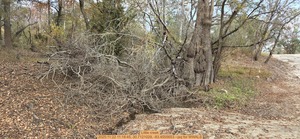
CATEGORIES: Tributary
LAYER: Point of Interest
GPS: 30.71225, -83.45545
OWNERSHIP: Public, VLPRA, PARCEL 0020 009
WATER BODY: Withlacoochee River
MILE: 43.25
ADDRESS: Upstream side of the boat ramp, 6499 Knights Ferry Rd, Valdosta, GA 31601, Lowndes County.
DESCRIPTION: A tiny creek that runs even in severe droughts, on the upstream side of Knights Ferry Boat Ramp.
PHOTO: https://www.wwals.net/pictures/2025-11-22–kf-nankin-cleanup-pictures/20251122_111845.jpg
PHOTOSET: https://www.wwals.net/pictures/2025-11-22–kf-nankin-cleanup-pictures/#LC
PHOTO SOURCE: John S. Quarterman
PHONE NUMBER: (229) 242-0102
PHOTO2: https://www.wwals.net/pictures/2025-11-22–kf-nankin-cleanup-pictures/20251122_111848.jpg
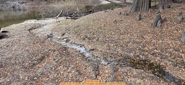
Photoset2: https://www.wwals.net/pictures/2025-11-22–kf-nankin-cleanup-pictures/#LC
PHOTO2 SOURCE: John S. Quarterman
Photo2 Phone Number: 229-242-0102
Suggestions: https://forms.gle/DipPgU2TP5atc2Rf9

Knights Ferry Boat Ramp
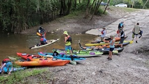
CATEGORIES: Landing
LAYER: Brochure
GPS: 30.71205, -83.45554
OWNERSHIP: Public, VLPRA, PARCEL 0020 009
ACCESS: Yes, Ramp: Concrete in a 2-acre park at the end of a dirt county road. PARKING: Free, PICNIC AREA
WATER BODY: Withlacoochee River
Lowest boatable: 85.5′
Highest safe: 94′
GAUGE: Quitman
MILE: 43.25
ADDRESS: 6499 Knights Ferry Rd, Valdosta, GA 31601, GA County.
DESCRIPTION: At the end of a dirt road in the woods, this bucolic boat ramp is a great place to put in for a 6.65-mile paddle downstream on the subtropical blackwater Withlacoochee River, past cypress knees, tupelo trees, and wild azaleas in the spring. Alligators are not often seen here, but turtles are common. You might see a great blue heron. Paddle time will vary from about 3.5 hours if the water level is good, to dragging the boat if it’s too low (2.0′ or 85.5′ NAVD88), to very fast if it’s high (highest safe 10.5′ or 94′ NAVD88), or on the Quitman USGS gauge at US 84. If the parking lot is flooded, come back another day.
WEBSITE: http://vlpra.com/230/Knights-Ferry-Boat-Ramp
ADDITIONAL INFO SOURCES: https://www.theswimguide.org/beach/9586
UPSTREAM: 8.51 miles from Knights Ferry Boat Ramp to US 84 Landing
DOWNSTREAM: 6.58 miles from Knights Ferry Boat Ramp to Clyattville-Nankin Boat Ramp
PHOTO: https://wwals.net/pictures/2019-06-16–paddle-ga-day-2/20190616_104932.jpg
PHOTOSET: https://wwals.net/pictures/2019-06-16–paddle-ga-day-2/20190616_104932.html
PHOTO SOURCE: John S. Quarterman
PHONE NUMBER: (229) 242-0102
PHOTO2: https://wwals.net/pictures/2020-09-26–drafts-metal-signs/Knights-Ferry-Boat-Ramp-Sign-0001.jpg
Photoset2: https://wwals.net/pictures/2020-09-26–drafts-metal-signs/Knights-Ferry-Boat-Ramp-Sign-0001.html
PHOTO2 SOURCE: WWALS
Photo2 Phone Number: 850-290-2350
Suggestions: https://forms.gle/DipPgU2TP5atc2Rf9

Knights Ferry

CATEGORIES: Ferry
LAYER: Bridge
OWNERSHIP: Private
WATER BODY: Withlacoochee River
MILE: 43.19
ADDRESS: 300 feet downstream of Knights Ferry Road, Quitman, GA, Lowndes, Brooks Counties.
DESCRIPTION: Where Knights Ferry Road used to cross the Withlacoochee River.
WEBSITE: https://en.wikipedia.org/wiki/Withlacoochee_River_(Suwannee_River)
PHOTO: https://www.wwals.net/pictures/2022-12-03–kf-nankin-cleanup-pictures/20221203_102432.jpg
PHOTOSET: https://www.wwals.net/pictures/2022-12-03–kf-nankin-cleanup-pictures/#KB
PHOTO SOURCE: John S. Quarterman
PHONE NUMBER: (229) 242-0102
Suggestions: https://forms.gle/DipPgU2TP5atc2Rf9
Knight Bridge

CATEGORIES: Bridgesite
LAYER: Bridge
OWNERSHIP: Public
WATER BODY: Withlacoochee River
MILE: 43.16
ADDRESS: 475 feet downstream of Knights Ferry Road, Quitman, GA, Lowndes, Brooks Counties.
DESCRIPTION: Wood piers are visible in the river at low water.
PHOTO: https://www.wwals.net/pictures/2022-12-03–kf-nankin-cleanup-pictures/20221203_102346.jpg
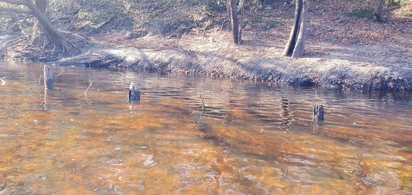
PHOTOSET: https://www.wwals.net/pictures/2022-12-03–kf-nankin-cleanup-pictures/#KB
PHOTO SOURCE: John S. Quarterman
PHONE NUMBER: (229) 242-0102
PHOTO2: https://wwals.net/pictures/2007-01-01–brooks-compplan/Brooks_County_Community_Assessment-0115.jpg
PHOTO2 SOURCE: Brooks County Comprehensive Plan 2007
Suggestions: https://forms.gle/DipPgU2TP5atc2Rf9
Fern Pond
CATEGORIES: Lake
LAYER: Point of Interest
OWNERSHIP: Private, EXIT 13 DEVCON LLC & N L BASSFORD JR, PARCEL 0130C 001
WATER BODY: Bevel Creek
ADDRESS: Exit 13, I-75, Valdosta, GA 31601, Lowndes County.
DESCRIPTION: A circular pond next to Valdosta Airport. Uphill from Bevel Creek, HUC 12-0311-02030901, 2025-12-20 —USGS The National Map
Suggestions: https://forms.gle/DipPgU2TP5atc2Rf9
Valdosta Water Plant 2
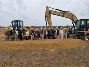
CATEGORIES: Muni Drinking Water
LAYER: Brochure
OWNERSHIP: Public, CITY OF VALDOSTA, PARCEL 0132B 007
ACCESS: No, PARKING: Free
WATER BODY: Bevel Creek
ADDRESS: Race Track Road SE, Valdosta, GA 31601, between Madison Highway and I-75, just south of the Valdosta Airport. Lowndes County.
DESCRIPTION: A second drinking water purification plant for the City of Valdosta. Uphill from Bevel Creek, HUC 12-0311-02030901, 2025-12-20 —USGS The National Map
WEBSITE: https://www.valdostacity.com/news/city-valdosta-breaks-ground-water-treatment-plant-2
PHOTO: https://www.wwals.net/pictures/2025-12-18–valdosta-drinking-water-plant/vld-drinking-water-pr.jpg
PHOTOSET: https://www.valdostacity.com/news/city-valdosta-breaks-ground-water-treatment-plant-2
PHOTO SOURCE: City of Valdosta
PHONE NUMBER: (229) 333-1881
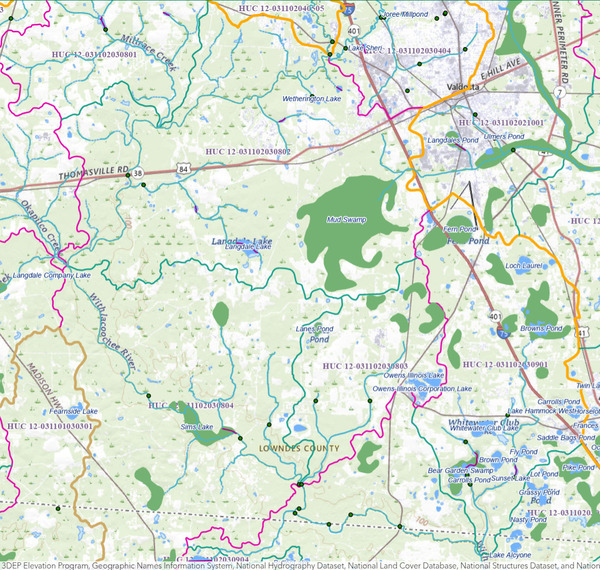
Photoset2: https://www.wwals.net/pictures/2025-12-18–valdosta-drinking-water-plant/
PHOTO2 SOURCE: The National Map by USGS
Suggestions: https://forms.gle/DipPgU2TP5atc2Rf9

Bevel Creek Lift Station
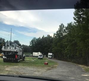
CATEGORIES: Liftstation
LAYER: Point of Interest
GPS: 30.682771, -83.23865
OWNERSHIP: Public, Lowndes County, PARCEL 0171 177 & 0171 178
WATER BODY: Bevel Creek
ADDRESS: East (left) bank of Bevel Creek (creek is in power line right of way), on north side of GA 376, west of Loch Laurel Road, off of I-75 Exit 5. Lowndes County.
DESCRIPTION: Lowndes County lift station, repaired in September 2020 after a manhole collapse. In 7.89 + 2.63 acres owned by Lowndes County.
PHOTO: https://wwals.net/pictures/2020-09-02–ga-376-pump-station/equipment-power-line.jpg
PHOTOSET: https://wwals.net/pictures/2020-09-02–ga-376-pump-station/
PHOTO SOURCE: Amy Jackson
PHONE NUMBER: (850) 290-2350
Suggestions: https://forms.gle/DipPgU2TP5atc2Rf9
Flowering Cleome houtteana

CATEGORIES: Point Of Interest
LAYER: Point of Interest
OWNERSHIP: Public
WATER BODY: Withlacoochee River
MILE: 42.56
ADDRESS: Right (west) bank. Brooks County.
DESCRIPTION: Native to southern south America: spider flower, spider plant, or pink queen. Pink flowers in a sea of plants.
WEBSITE: https://wwals.net/pictures/2022-12-03–kf-nankin-cleanup-pictures#FICH
PHOTO: https://www.wwals.net/pictures/2022-12-03–kf-nankin-cleanup-pictures/20221203_104508.jpg
PHOTOSET: https://www.wwals.net/pictures/2022-12-03–kf-nankin-cleanup-pictures/#FICH
PHOTO SOURCE: John S. Quarterman
PHONE NUMBER: (229) 242-0102
Suggestions: https://forms.gle/DipPgU2TP5atc2Rf9
Langdale corner marker

CATEGORIES: Point Of Interest
LAYER: Point of Interest
OWNERSHIP: Private, Langdale Company OUSLEY TRACT, PARCEL 0018 002
WATER BODY: Withlacoochee River
MILE: 41.89
ADDRESS: Left (northwest) bank, off of Spain Ferry Road. Lowndes County.
DESCRIPTION: Concrete corner marker imprinted Langdale, plus steel post, apparently marking the south corner of the Ousley Tract.
WEBSITE: https://wwals.net/pictures/2022-12-03–kf-nankin-cleanup-pictures#LCM
PHOTO: https://www.wwals.net/pictures/2022-12-03–kf-nankin-cleanup-pictures/20221203_120510.jpg
PHOTOSET: https://www.wwals.net/pictures/2022-12-03–kf-nankin-cleanup-pictures/#LCM
PHOTO SOURCE: John S. Quarterman
PHONE NUMBER: (229) 242-0102
Suggestions: https://forms.gle/DipPgU2TP5atc2Rf9
End of big trash jam
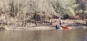
CATEGORIES: Point Of Interest
LAYER: Point of Interest
OWNERSHIP: Public, ZIPPERER O ROBERT, PARCEL 0021 001F
WATER BODY: Withlacoochee River
MILE: 41.83
ADDRESS: Left (north) bank; end of a tenth of a mile of trash. Lowndes County.
DESCRIPTION: Trash from Valdosta, mostly cleaned up by WWALS outing on December 3, 2022.
WEBSITE: https://wwals.net/pictures/2022-12-03–kf-nankin-cleanup-pictures#ETJ
PHOTO: https://www.wwals.net/pictures/2022-12-03–kf-nankin-cleanup-pictures/20221203_112542.jpg
PHOTOSET: https://www.wwals.net/pictures/2022-12-03–kf-nankin-cleanup-pictures/#ETJ
PHOTO SOURCE: John S. Quarterman
PHONE NUMBER: (229) 242-0102
PHOTO2: https://www.wwals.net/pictures/2022-12-03–kf-nankin-cleanup-pictures/20221203_114025.jpg
PHOTO2 SOURCE: John S. Quarterman
Photo2 Phone Number: 229-242-0102
Suggestions: https://forms.gle/DipPgU2TP5atc2Rf9

Garrett Road Wrested Vegetation

CATEGORIES: Point Of Interest
LAYER: Point of Interest
OWNERSHIP: Public, BRADYWOOD PLANTATION LLC. 700 WILDWOOD PLANTATION, VALDOSTA, GA 31602, PARCEL 127 0009
WATER BODY: Withlacoochee River
MILE: 41.74
ADDRESS: Right (south) bank, off of Garrett Road. Brooks County.
DESCRIPTION: In Georgia wrested vegetation defines the edge of a river. The bluff is riverbank and thus presumably public. Above the bank is private property.
WEBSITE: https://wwals.net/pictures/2022-12-03–kf-nankin-cleanup-pictures#WV
PHOTO: https://www.wwals.net/pictures/2022-12-03–kf-nankin-cleanup-pictures/20221203_122453.jpg
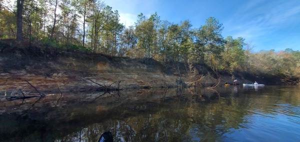
PHOTOSET: https://www.wwals.net/pictures/2022-12-03–kf-nankin-cleanup-pictures/#WV
PHOTO SOURCE: John S. Quarterman
PHONE NUMBER: (229) 242-0102
Suggestions: https://forms.gle/DipPgU2TP5atc2Rf9
Garrett Road Floating Trash Jam
CATEGORIES: Point Of Interest
LAYER: Point of Interest
OWNERSHIP: Public
WATER BODY: Withlacoochee River
MILE: 41.06
ADDRESS: 2.19 miles downstream from Knights Ferry Boat Ramp, extending from the right bank most of the way across the river. Brooks County.
DESCRIPTION: Most of the river obstructed by deadfalls covered with trash.
HISTORIC FACTS: Much of it cleared on a WWALS cleanup, with chainsaws, 2023-04-08. https://wwals.net/2023/05/02/pictures-cleanup-below-knights-ferry-withlacoochee-river-2023-04-08/
WEBSITE: https://wwals.net/pictures/2023-04-08–kf-cleanup-withlacoochee-river-pictures
PHOTO SOURCE: John S. Quarterman
PHONE NUMBER: (229) 242-0102
Suggestions: https://forms.gle/DipPgU2TP5atc2Rf9
Garrett Road Trash Jam

CATEGORIES: Point Of Interest
LAYER: Point of Interest
OWNERSHIP: Public, RIVER BEND PLANTATION, INC, C/O KELLETT & COMPANY, 3450 RIDGEWOOD ROAD, NW, ATLANTA, GA 30327, PARCEL 131 0006A
WATER BODY: Withlacoochee River
MILE: 41.00
ADDRESS: Right (southwest) bank, off of Garrett Roat. Brooks County.
DESCRIPTION: Another trash jam, bigger than the previous big one. WWALS did not have time on December 3, 2022, to clean it all up. We shall return.
WEBSITE: https://wwals.net/pictures/2022-12-03–kf-nankin-cleanup-pictures#GRTJ
OTHER REFERENCE: https://wwals.net/2022/12/05/pictures-knights-ferry-to-nankin-cleanup-withlacoochee-river-2022-12-03/
PHOTO: https://www.wwals.net/pictures/2022-12-03–kf-nankin-cleanup-pictures/20221203_133434.jpg
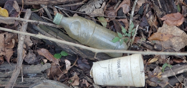
PHOTOSET: https://www.wwals.net/pictures/2022-12-03–kf-nankin-cleanup-pictures/#GRTJ
PHOTO SOURCE: John S. Quarterman
PHONE NUMBER: (229) 242-0102
PHOTO2: https://www.wwals.net/pictures/2022-12-17–kf-nankin-cleanup-pictures/20221217_112613.jpg
Photoset2: https://www.wwals.net/pictures/2022-12-17–kf-nankin-cleanup-pictures/#GRTJ
PHOTO2 SOURCE: John S. Quarterman
Photo2 Phone Number: 229-242-0102
Suggestions: https://forms.gle/DipPgU2TP5atc2Rf9
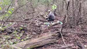
Garrett Road Landing

CATEGORIES: Landing Private
LAYER: Other
OWNERSHIP: Private, RIVER BEND PLANTATION, INC, C/O KELLETT & COMPANY, 3450 RIDGEWOOD ROAD, NW, ATLANTA, GA 30327, PARCEL 131 0006A
ACCESS: Launch: Dirt road to riverbank.
WATER BODY: Withlacoochee River
MILE: 40.08
ADDRESS: Right (south) bank, about 3/5 from Knights Ferry to Nankin. Land access off of Garrett Road (CR 81). Brooks County.
DESCRIPTION: Dirt road to riverbank. Private: do not use without permission.
WEBSITE: https://wwals.net/pictures/2022-12-03–kf-nankin-cleanup-pictures#GR
PHOTO: https://www.wwals.net/pictures/2022-12-03–kf-nankin-cleanup-pictures/20221203_142152.jpg
PHOTOSET: https://www.wwals.net/pictures/2022-12-03–kf-nankin-cleanup-pictures/#GRTJ
PHOTO SOURCE: John S. Quarterman
PHONE NUMBER: (229) 242-0102
Suggestions: https://forms.gle/DipPgU2TP5atc2Rf9
Garrett Cut-through Trash Jam

CATEGORIES: Point Of Interest
LAYER: Point of Interest
OWNERSHIP: Public, LANGDALE COMPANY, THE, PARCEL 132 0002
WATER BODY: Withlacoochee River
MILE: 39.85
ADDRESS: Right (north) bank, 3.4 miles downstream from Knights Ferry Boat Ramp, 0.23 miles downstream from Garrett Road Landing, and 3.18 miles upstream from Nankin Boat Ramp. Brooks County.
PHOTO: https://www.wwals.net/pictures/2022-12-17–kf-nankin-cleanup-pictures/20221217_135054.jpg
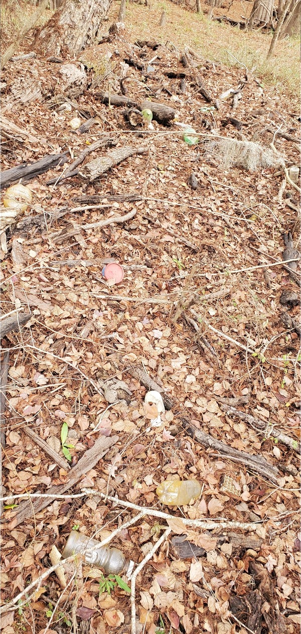
PHOTOSET: https://www.wwals.net/pictures/2022-12-17–kf-nankin-cleanup-pictures/#GRCTTJ
PHOTO SOURCE: John S. Quarterman
PHONE NUMBER: (229) 242-0102
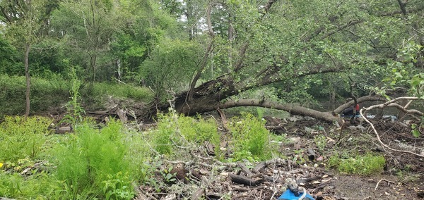
Photoset2: https://www.wwals.net/pictures/2023-04-08–kf-cleanup-withlacoochee-river-pictures/#GCTTJ
PHOTO2 SOURCE: John S. Quarterman
Photo2 Phone Number: 229-242-0102
Suggestions: https://forms.gle/DipPgU2TP5atc2Rf9

Floating Marsh Pennywort

CATEGORIES: Point Of Interest
LAYER: Point of Interest
OWNERSHIP: Public
WATER BODY: Withlacoochee River
MILE: 39.64
ADDRESS: Near left (north) bank, in a sheltered crook of the river. Brooks County.
DESCRIPTION: Native to North and South America and parts of Africa. There is more downstream under limbs.
WEBSITE: https://wwals.net/pictures/2022-12-03–kf-nankin-cleanup-pictures#FMPW
PHOTO: https://www.wwals.net/pictures/2022-12-03–kf-nankin-cleanup-pictures/20221203_144203.jpg
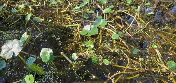
PHOTOSET: https://www.wwals.net/pictures/2022-12-03–kf-nankin-cleanup-pictures/#FMPW
PHOTO SOURCE: John S. Quarterman
PHONE NUMBER: (229) 242-0102
Suggestions: https://forms.gle/DipPgU2TP5atc2Rf9
Langdale Redland Landing

CATEGORIES: Landing Private
LAYER: Other
OWNERSHIP: Private, LANGDALE COMPANY, THE, PARCEL 142 0004
ACCESS: Launch: dirt road to riverbank.
WATER BODY: Withlacoochee River
MILE: 39.25
ADDRESS: Left (east) bank, about 2/3 from Knights Ferry to Nankin. Lowndes County.
DESCRIPTION: Hard-to-see, nestled among cypress and oaks, leaf-covered dirt slope from woods road. Private: do not use without permission.
PHOTO: https://www.wwals.net/pictures/2022-12-17–kf-nankin-cleanup-pictures/20221217_142242.jpg
PHOTOSET: https://www.wwals.net/pictures/2022-12-17–kf-nankin-cleanup-pictures/#LRL
PHOTO SOURCE: John S. Quarterman
PHONE NUMBER: (229) 242-0102
Suggestions: https://forms.gle/DipPgU2TP5atc2Rf9
Langdale Rocky Ford Boat Ramp

CATEGORIES: Landing Private
LAYER: Other
OWNERSHIP: Private, LANGDALE COMPANY THE, PARCEL 0041 002
ACCESS: Ramp: wide graveled ramp on dirt woods road.
WATER BODY: Withlacoochee River
MILE: 38.69
ADDRESS: Left (east) bank, about 2/3 from Knights Ferry to Nankin. Lowndes County.
DESCRIPTION: A wide, graveled, landing on a dirt woods road. Private: do not use without permission.
WEBSITE: https://wwals.net/pictures/2022-12-03–kf-nankin-cleanup-pictures#LRFL
PHOTO: https://www.wwals.net/pictures/2022-12-03–kf-nankin-cleanup-pictures/20221203_150250.jpg
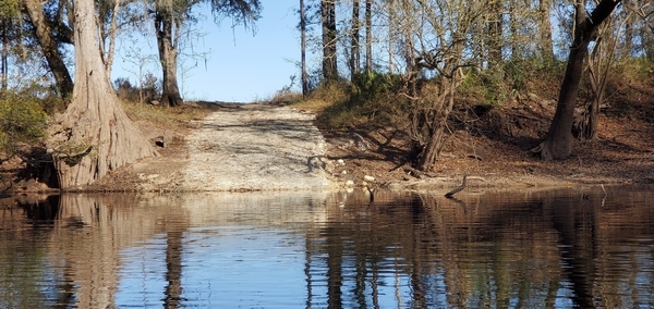
PHOTOSET: https://www.wwals.net/pictures/2022-12-03–kf-nankin-cleanup-pictures/#LRFL
PHOTO SOURCE: John S. Quarterman
PHONE NUMBER: (229) 242-0102
Suggestions: https://forms.gle/DipPgU2TP5atc2Rf9
Blue pool noodle

CATEGORIES: Point Of Interest
LAYER: Point of Interest
OWNERSHIP: Public
WATER BODY: Withlacoochee River
MILE: 38.66
ADDRESS: Right (west) bank, 160 feet downstream from Langdale Rocky Ford Boat Ramp and 1.99 miles upstream from Nankin Boat Ramp. Brooks County.
PHOTO: https://www.wwals.net/pictures/2022-12-17–kf-nankin-cleanup-pictures/20221217_144422.jpg
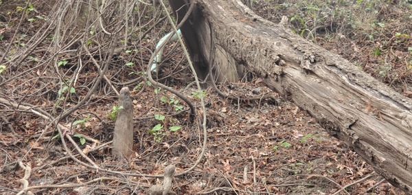
PHOTOSET: https://www.wwals.net/pictures/2022-12-17–kf-nankin-cleanup-pictures/#BPN
PHOTO SOURCE: John S. Quarterman
PHONE NUMBER: (229) 242-0102
Suggestions: https://forms.gle/DipPgU2TP5atc2Rf9
Godwin Bluff Hunt Shack

CATEGORIES: Point Of Interest
LAYER: Point of Interest
OWNERSHIP: Private, RIVER BEND PLANTATION, INC, C/O KELLETT & COMPANY, 3450 RIDGEWOOD ROAD, NW, ATLANTA, GA 30327, PARCEL 131 0006A
WATER BODY: Withlacoochee River
MILE: 38.45
ADDRESS: Right (west) bank, not far upstream from Nankin Boat Ramp. Brooks County.
DESCRIPTION: Enclosed building with raised deck and what looks like an outhouse, on Godwin Bluff. Private. Do not approach without permission.
WEBSITE: https://wwals.net/pictures/2022-12-03–kf-nankin-cleanup-pictures#GBHS
PHOTO: https://www.wwals.net/pictures/2022-12-03–kf-nankin-cleanup-pictures/20221203_150912.jpg
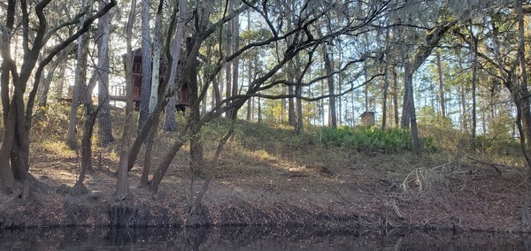
PHOTOSET: https://www.wwals.net/pictures/2022-12-03–kf-nankin-cleanup-pictures/#GBHS
PHOTO SOURCE: John S. Quarterman
PHONE NUMBER: (229) 242-0102
Suggestions: https://forms.gle/DipPgU2TP5atc2Rf9
River Bend Plantation Creek

CATEGORIES: Tributary
LAYER: Other
OWNERSHIP: Private, RIVER BEND PLANTATION, INC, C/O KELLETT & COMPANY, 3450 RIDGEWOOD ROAD, NW, ATLANTA, GA 30327, PARCEL 131 0006A
WATER BODY: Withlacoochee River
MILE: 38.18
ADDRESS: Right (west) bank, downstream from Godwin Bluff. Brooks County.
DESCRIPTION: Hard to see because it angles to enter the river at almost the same direction as the river current. This small, fast, creek comes down across GA 333 (Madison Highway of Brooks County), CR 86, and Clyattville Road, draining most of River Bend Plantation. USGS 03110203001118.
WEBSITE: https://wwals.net/pictures/2022-12-03–kf-nankin-cleanup-pictures#RBPC
PHOTO: https://www.wwals.net/pictures/2022-12-03–kf-nankin-cleanup-pictures/20221203_151656.jpg
PHOTOSET: https://www.wwals.net/pictures/2022-12-03–kf-nankin-cleanup-pictures/#RBPC
PHOTO SOURCE: John S. Quarterman
PHONE NUMBER: (229) 242-0102
Suggestions: https://forms.gle/DipPgU2TP5atc2Rf9
Langdale Nankin Road Landing

CATEGORIES: Landing Private
LAYER: Other
OWNERSHIP: Private, LANGDALE COMPANY, THE, PARCEL 142 0004
ACCESS: Launch: dirt road to riverbank.
WATER BODY: Withlacoochee River
MILE: 37.20
ADDRESS: Right (south) bank, a few thousand feet upstream from Nankin Boat Ramp. Brooks County.
DESCRIPTION: Dirt road to riverbank. Private: do not use without permission.
WEBSITE: https://wwals.net/pictures/2022-12-03–kf-nankin-cleanup-pictures#LNRL
PHOTO: https://www.wwals.net/pictures/2022-12-03–kf-nankin-cleanup-pictures/20221203_153711.jpg
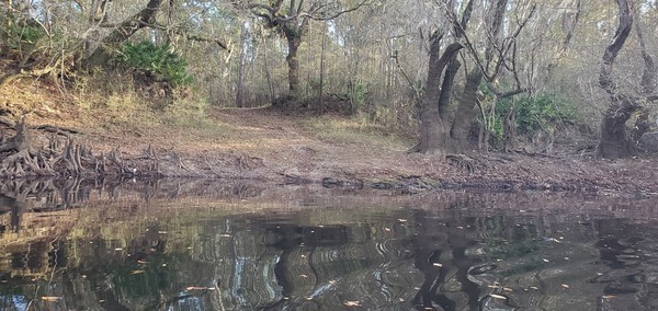
PHOTOSET: https://www.wwals.net/pictures/2022-12-03–kf-nankin-cleanup-pictures/#LNRL
PHOTO SOURCE: John S. Quarterman
PHONE NUMBER: (229) 242-0102
Suggestions: https://forms.gle/DipPgU2TP5atc2Rf9
Redland Creek

CATEGORIES: Tributary
LAYER: Other
OWNERSHIP: Private, Numerous
WATER BODY: Redland Creek
MILE: 37.12
ADDRESS: Left (north) bank, 400 feet downstream from Langdale Nankin Road Landing and 0.45 miles upstream from Nankin Boat Ramp. Lowndes County.
DESCRIPTION: Small creek with numerous dams. Crosses Ousley Road twice, then Rowland Lane. https://www.google.com/maps/place/30%C2%B040’31.9%22N+83%C2%B024’19.7%22W/@30.6755196, -83.407659, 641m/data=!3m2!1e3!4b1!4m2!3m1!1s0x0:0x0
PHOTO: https://www.wwals.net/pictures/2022-12-17–kf-nankin-cleanup-pictures/20221217_152445.jpg
PHOTOSET: https://www.wwals.net/pictures/2022-12-17–kf-nankin-cleanup-pictures/#RC
PHOTO SOURCE: John S. Quarterman
PHONE NUMBER: (229) 242-0102
Suggestions: https://forms.gle/DipPgU2TP5atc2Rf9
Clyattville-Nankin Shoal

CATEGORIES: Shoal
LAYER: Other
OWNERSHIP: Public
WHITEWATER CLASS: Class I
WATER BODY: Withlacoochee River
MILE: 36.73
ADDRESS: Last rapids before Nankin Boat Ramp. Lowndes, Brooks Counties.
DESCRIPTION: “”One small rapid, complete with surfing wave, is found upstream of the Clyattsville[sic]-Nankin Road bridge.””
WEBSITE: http://www.brownsguides.com/blog/withlacoochee-river-paddling-guide/
PHOTO: https://www.wwals.net/pictures/2022-12-03–kf-nankin-cleanup-pictures/GSBB7948.jpg
PHOTOSET: https://www.wwals.net/pictures/2022-12-03–kf-nankin-cleanup-pictures/#CNS
PHOTO SOURCE: John S. Quarterman
PHONE NUMBER: (229) 242-0102
Suggestions: https://forms.gle/DipPgU2TP5atc2Rf9
Rocky Ford Bridge

CATEGORIES: Bridge
LAYER: Bridge
OWNERSHIP: Public
WATER BODY: Withlacoochee River
MILE: 36.67
ADDRESS: 6899 Clyattville-Nankin Road, Valdosta, GA 31601 or Clyattville Road, Quitman, GA 31643. Lowndes, Brooks Counties.
DESCRIPTION: 585.0 ft. 15-span steel girder bridge with concrete cast-in-place deck, built in 1957 over the Withlacoochee River. Rocky Ford Road joins on each side of the bridge
WEBSITE: https://bridgereports.com/1090947
PHOTO: https://www.wwals.net/pictures/2022-12-03–kf-nankin-cleanup-pictures/GSBB7961.jpg
PHOTOSET: https://www.wwals.net/pictures/2022-12-03–kf-nankin-cleanup-pictures/#RFB
PHOTO SOURCE: John S. Quarterman
PHONE NUMBER: (229) 242-0102
PHOTO2: https://wwals.net/pictures/2007-01-01–brooks-compplan/Brooks_County_Community_Assessment-0115.jpg
PHOTO2 SOURCE: Brooks County Comprehensive Plan 2007
Suggestions: https://forms.gle/DipPgU2TP5atc2Rf9
Rocky Ford
CATEGORIES: Ford
LAYER: Point of Interest
OWNERSHIP: Public
WATER BODY: Withlacoochee River
MILE: 36.67
ADDRESS: 6899 Clyattville-Nankin Road, Valdosta, GA 31601, Lowndes, Brooks Counties.
DESCRIPTION: Approximate location of the 1870s ford.
HISTORIC FACTS: There was a ford here in the 1870s, according to Wiregrass Region Digital History Project. https://www.google.com/maps/d/u/0/viewer?mid=1uAP1zA0ExqRb01-n1PrZCuaiQDo&ll=30.674845000000023%2C-83.39451800000002&z=19
Suggestions: https://forms.gle/DipPgU2TP5atc2Rf9
Clyattville-Nankin Boat Ramp
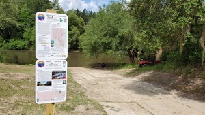
CATEGORIES: Landing
LAYER: Brochure
OWNERSHIP: Public, VALDOSTA LOWNDES COUNTY PARKS & RECREATION AUTHORITY, PARCEL 0042 001
ACCESS: Yes, Ramp: Concrete in 1-acre park with asphalt on first steep slope down from the main road. PARKING: Free, PICNIC AREA
WATER BODY: Withlacoochee River
Lowest boatable: 85.25′
Highest safe: 99′
GAUGE: Quitman
MILE: 36.67
ADDRESS: 6899 Clyattville-Nankin Road, Valdosta, GA 31601, Lowndes County.
DESCRIPTION: Good put-in for an 8.9-mile paddle downstream past springs and rapids to the GA-FL state line on the subtropical blackwater Withlacoochee River. Don’t miss McIntyre Spring, on the right, about halfway down. It’s one of only six second-magnitude springs in Georgia, and another is farther along: Arnold Springs. You may see an otter; you will very likely see turtles and many fish. In the summer you may see the swamp rosemallow that blooms only one day per bloom in June. In the spring you will see red maple and wild azalea. Buzzards will follow you, but don’t worry: the alligators are more scared of you. Paddle times will vary from nope when the parking lot is flooded, very fast (4 miles per hour) if the water is near the highest safe on the Quitman (US 84) gauge, or dragging the boat if it’s below the low water recommendation.
AKA: Nankin Boat Ramp or Clyattville-Nankin Landing
WEBSITE: http://vlpra.com/232/Nankin-Boat-Ramp
OTHER REFERENCE: https://wwals.net/2021/08/08/four-miles-an-hour-nankin-to-sullivan-withlacoochee-river-2021-08-07/
ADDITIONAL INFO SOURCES: https://www.theswimguide.org/beach/9587
UPSTREAM: 6.58 miles from Clyattville-Nankin Boat Ramp to Knights Ferry Boat Ramp
DOWNSTREAM: 8.88 miles from Clyattville-Nankin Boat Ramp to State Line Boat Ramp
PHOTO: https://wwals.net/pictures/2019-06-16–paddle-ga-day-2/20190616_110937.jpg
PHOTOSET: https://wwals.net/pictures/2019-06-16–paddle-ga-day-2/
PHOTO SOURCE: John S. Quarterman
PHONE NUMBER: (229) 242-0102
PHOTO2: https://www.wwals.net/pictures/2023-06-08–wq-sampling/20230608_131610.jpg
Photoset2: https://www.wwals.net/pictures/2023-06-08–wq-sampling/
PHOTO2 SOURCE: WWALS
Photo2 Phone Number: 850-290-2350
Suggestions: https://forms.gle/DipPgU2TP5atc2Rf9

Clyattville-Nankin Boat Ramp River GPS

CATEGORIES: Point Of Interest
LAYER: Point of Interest
OWNERSHIP: Public, VALDOSTA LOWNDES COUNTY PARKS & RECREATION AUTHORITY, PARCEL 0042 001
ACCESS: Yes, Ramp: Concrete in 1-acre park with asphalt on first steep slope down from the main road. PARKING: Free, PICNIC AREA
WATER BODY: Withlacoochee River
Lowest boatable: 85.25′
Highest safe: 99′
GAUGE: Quitman
MILE: 36.67
ADDRESS: Left bank, just below Clyattville-Nankin Road Bridge, 6899 Clyattville-Nankin Road, Valdosta, GA 31601. Lowndes County.
DESCRIPTION: Good put-in for an 8.9-mile paddle downstream past springs and rapids to the GA-FL state line on the subtropical blackwater Withlacoochee River. Don’t miss McIntyre Spring, on the right, about halfway down. It’s one of only six second-magnitude springs in Georgia, and another is farther along: Arnold Springs. You may see an otter; you will very likely see turtles and many fish. In the summer you may see the swamp rosemallow that blooms only one day per bloom in June. In the spring you will see red maple and wild azalea. Buzzards will follow you, but don’t worry: the alligators are more scared of you. Paddle times will vary from nope when the parking lot is flooded, very fast (4 miles per hour) if the water is near the highest safe on the Quitman (US 84) gauge, or dragging the boat if it’s below the low water recommendation.
AKA: Nankin Boat Ramp River GPS or Clyattville-Nankin Landing River GPS
WEBSITE: http://vlpra.com/232/Nankin-Boat-Ramp
OTHER REFERENCE: https://wwals.net/2021/08/08/four-miles-an-hour-nankin-to-sullivan-withlacoochee-river-2021-08-07/
ADDITIONAL INFO SOURCES: https://www.theswimguide.org/beach/9587
PHOTO: https://www.wwals.net/pictures/2021-08-07–nankin-state-line-sullivan-pictures/20210807_102645.jpg
PHOTOSET: https://www.wwals.net/pictures/2021-08-07–nankin-state-line-sullivan-pictures/#Preparing-in-the-rain
PHOTO SOURCE: John S. Quarterman
PHONE NUMBER: (229) 242-0102
PHOTO2: https://wwals.net/pictures/2020-09-26–drafts-metal-signs/Nankin-Boat-Ramp-Sign-0001.jpg
Photoset2: https://wwals.net/pictures/2020-09-26–drafts-metal-signs/Nankin-Boat-Ramp-Sign-0001.html
PHOTO2 SOURCE: WWALS
Photo2 Phone Number: 850-290-2350
Suggestions: https://forms.gle/DipPgU2TP5atc2Rf9

River Bend Shoal

CATEGORIES: Shoal
LAYER: Other
GPS: 30.6673, -83.38707
OWNERSHIP: Public
WHITEWATER CLASS: Class I
WATER BODY: Withlacoochee River
MILE: 35.57
ADDRESS: 1.1 miles downstream of Rocky Ford Bridge, Brooks County.
DESCRIPTION: Small shoals.
PHOTO: https://wwals.net/wp-content/themes/pianoblack/img//2017/12/d6892c3d6dbc8bd31cd4d780e660f742.jpg
PHOTOSET: https://wwals.net/wp-content/themes/pianoblack/img//2017/12/7533dd720abef0cbd4ad3a61fd2b5540.jpg
PHOTO SOURCE: John S. Quarterman
PHONE NUMBER: (229) 242-0102
Photoset2: John S. Quarterman
PHOTO2 SOURCE: 229-242-0102
Suggestions: https://forms.gle/DipPgU2TP5atc2Rf9

Wrested Vegetation
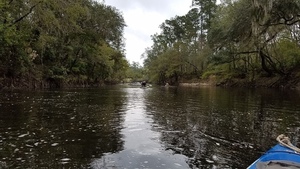
CATEGORIES: Point Of Interest
LAYER: Other
GPS: 30.65682, -83.36707
OWNERSHIP: Public
WATER BODY: Withlacoochee River
MILE: 34.04
ADDRESS: 2.67 miles downstream of Rocky Ford Bridge, Lowndes County.
DESCRIPTION: Both banks, an example of something important in Georgia riparian law.
PHOTO: https://wwals.net/wp-content/themes/pianoblack/img//2017/12/9c595f0d806bad17f9a2746499d8f410.jpg
PHOTO SOURCE: John S. Quarterman
PHONE NUMBER: (229) 242-0102
Suggestions: https://forms.gle/DipPgU2TP5atc2Rf9
JLH Creek
CATEGORIES: Tributary
LAYER: Other
GPS: 30.65832, -83.36538
OWNERSHIP: Public, JLH Land Company, PARCEL 0065 002
WATER BODY: Withlacoochee River
MILE: 33.90
ADDRESS: 2.82 miles downstream of Rocky Ford Bridge, Lowndes County.
DESCRIPTION: Left bank, creek that crosses Ousley Rd and Clyattville-Nankin Rd. Need the real name of this creek. Name used here is from the landowner along much of it: JLH Land Company, of Valdosta, GA.
Suggestions: https://forms.gle/DipPgU2TP5atc2Rf9
Tween Creeks Shoal
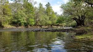
CATEGORIES: Shoal
LAYER: Other
OWNERSHIP: Public
WHITEWATER CLASS: Class I
WATER BODY: Withlacoochee River
MILE: 33.48
ADDRESS: 3.24 miles downstream of Rocky Ford Bridge, Lowndes County.
DESCRIPTION: Small shoals between two creeks.
PHOTO: https://wwals.net/wp-content/themes/pianoblack/img//2017/12/3a97ce31c5b754c19587b241e2de050b.jpg
PHOTO SOURCE: John S. Quarterman
PHONE NUMBER: (229) 242-0102
Suggestions: https://forms.gle/DipPgU2TP5atc2Rf9
Clyatt Mill Creek
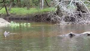
CATEGORIES: Tributary
LAYER: Other
GPS: 30.65369, -83.36265
OWNERSHIP: Public
WATER BODY: Withlacoochee River
MILE: 33.30
ADDRESS: 3.44 miles downstream of Rocky Ford Bridge; 0.2 miles downstream from Tween Creeks Shoal. Lowndes County.
DESCRIPTION: Entering Withlacoochee River left, this 11-mile creek runs out of Clyattville, GA.
PHOTO: https://wwals.net/wp-content/themes/pianoblack/img//2017/12/0bafa1ee365967b4a1d93016c330fb72.jpg
PHOTO SOURCE: John S. Quarterman
PHONE NUMBER: (229) 242-0102
Suggestions: https://forms.gle/DipPgU2TP5atc2Rf9
Oris Blackburn Memorial Park

CATEGORIES: Landing
LAYER: Other
GPS: 30.665647, -83.32
OWNERSHIP: Public, VLPRA
ACCESS: Yes, Ramp: Concrete, PARKING: Free, PICNIC AREA
WATER BODY: Oris Blackburn Pond
ADDRESS: 5750 Madison Hwy, Clyattville, GA 31601, Lowndes County.
DESCRIPTION: There is a boat ramp for jonboat access to the five-acre pond.
WEBSITE: https://vlpra.com/203/Oris-Blackburn-Memorial-Park
PHOTOSET: https://commons.wikimedia.org/wiki/File:Oris_Blackburn_Memorial_Park_boat_ramp.JPG
PHOTO SOURCE: Michael Rivera
PHONE NUMBER: (850) 290-2350
Suggestions: https://forms.gle/DipPgU2TP5atc2Rf9
LAS north Lowndes County
CATEGORIES: Wtp
LAYER: Brochure
OWNERSHIP: Public, Lowndes County, PARCEL 0172 119
WATER BODY: Withlacoochee River
ADDRESS: East of Loch Laurel Road between Clearwater Circle and Grassy Pond Road. Lowndes County.
DESCRIPTION: Field with pond in the middle.
PHOTO SOURCE: Lowndes County Tax Assessors
Suggestions: https://forms.gle/DipPgU2TP5atc2Rf9
Lowndes County Spray Field
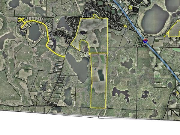
CATEGORIES: Wtp
LAYER: Brochure
OWNERSHIP: Public, Lowndes County, PARCEL 0204 001
WATER BODY: Withlacoochee River
ADDRESS: GA 376 & Grassy Pond Rd. Lowndes County.
DESCRIPTION: Spray field for sewer waste; Lowndes County does not have a wastewater treatment plant.
GRN: Yes
PHOTO: https://wwals.net/wp-content/themes/pianoblack/img//2018/06/map.jpg
PHOTO SOURCE: Lowndes County Tax Assessors
PHONE NUMBER: (850) 290-2350
Suggestions: https://forms.gle/DipPgU2TP5atc2Rf9
PCA WPCP
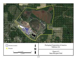
CATEGORIES: Wtp
LAYER: Brochure
OWNERSHIP: Private, PACKAGING CORPORATION OF AMERICA C/O DON POPE, PARCEL 0137 001
WATER BODY: PCA Creek
ADDRESS: 5495 Clyattville Lake Park Road, Clyattville, Georgia, 31603, Lowndes County.
DESCRIPTION: Land Application System for industrial containerboard plant. “”The Mill operates a Florida Department of Environmental Protection (FDEP) — NPDES permitted wastewater treatment plant that treats process wastewater from the Mill prior to discharge to the Withlacoochee River in Florida. The wastewater treatment process includes primary clarification with sludge dewatering ponds and mechanical dewatering presses for the wastewater residuals. The clarified wastewater undergoes secondary biological treatment in a series of facultative and aerated impoundments, followed by polishing aeration prior to discharge to the receiving stream. The Mill also operates a GEPD-permitted back-up land application system.””, NPDES Permit No. GA01-451
GRN: Yes
WEBSITE: https://www.packagingcorp.com/valdosta-containerboard-mill
OTHER REFERENCE: https://wwals.net/pictures/2018-08-30–permits/pca
PHOTO: https://wwals.net/pictures/2018-08-30–permits/pca/application/18500001Application-0067.jpg
PHOTOSET: https://wwals.net/pictures/2018-08-30–permits/pca/application/
PHOTO SOURCE: PCA
PHONE NUMBER: (850) 290-2350
Suggestions: https://forms.gle/DipPgU2TP5atc2Rf9
McIntyre Spring
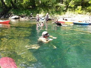
CATEGORIES: Spring
LAYER: Brochure
GPS: 30.64159, -83.36618
OWNERSHIP: Public
ACCESS: No
WATER BODY: Withlacoochee River
MILE: 32.09
ADDRESS: Near Brooks County side (right bank) of Withlacoochee River. Brooks County.
DESCRIPTION: 4610-foot explored cave system from a spring in the bottom of the Withlacoochee RIver. One of only two second magnitude springs in the Suwannee River Basin in Georgia, of only six in the entire state.
WEBSITE: https://wwals.net/2016/06/08/4610-foot-explored-cave-at-mcintyre-spring-withlacoochee-river-georgia/
PHOTO SOURCE: John S. Quarterman
PHONE NUMBER: (229) 242-0102
PHOTO2: https://www.wwals.net/pictures/2021-08-07–nankin-state-line-sullivan-pictures/20210807_113732.jpg
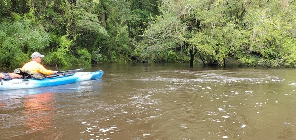
Photoset2: https://www.wwals.net/pictures/2021-08-07–nankin-state-line-sullivan-pictures/
PHOTO2 SOURCE: John S. Quarterman
Photo2 Phone Number: 229-242-0102
Suggestions: https://forms.gle/DipPgU2TP5atc2Rf9

Georgia into Florida First Time

CATEGORIES: Point Of Interest
LAYER: Point of Interest
GPS: 30.63733, -83.35722
OWNERSHIP: Public
WATER BODY: Withlacoochee River
MILE: 31.50
ADDRESS: Near west end of Peppermint Trail, Madison County, FL. Lowndes, Madison Counties.
DESCRIPTION: Keep paddling, you’ll re-enter Georgia and then Florida again.
PHOTO: https://wwals.net/wp-content/themes/pianoblack/img//2017/02/3f0f78339379add319a8ffd2c422e4f1.jpg
PHOTO SOURCE: John S. Quarterman
PHONE NUMBER: (229) 242-0102
Suggestions: https://forms.gle/DipPgU2TP5atc2Rf9
Pear Way Boat Ramp
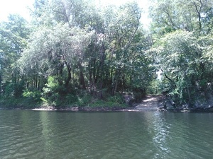
CATEGORIES: Landing Private
LAYER: Other
GPS: 30.63688, -83.35592
OWNERSHIP: Private, John & Jeannie Baker, PARCEL 00-3N-10-6108-019-000
ACCESS: Ramp: concrete at end of paved road
WATER BODY: Withlacoochee River
MILE: 31.40
ADDRESS: At end of Pear Way, 108 NE West Peppermint Trail, Pinetta, FL 32350, Madison County.
DESCRIPTION: Apparently private boat ramp at end of Pear Way.
PHOTO SOURCE: John S. Quarterman
PHONE NUMBER: (229) 242-0102
Suggestions: https://forms.gle/DipPgU2TP5atc2Rf9
Four Freedoms Trail
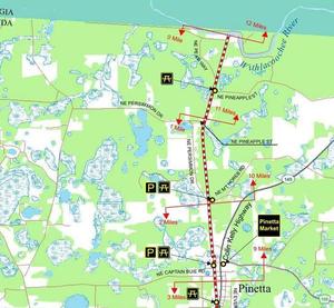
CATEGORIES: Hiking Trail
LAYER: Hiking Trail
GPS: 30.636033, -83.3507
OWNERSHIP: Public, Madison County, Florida, PARCEL 00-3N-10-6108-001-000
ACCESS: Yes, PARKING: Free, SHELTER
WATER BODY: Withlacoochee River
MILE: 31.05
ADDRESS: NE Peppermint Trail, Pinetta, FL, Madison County.
DESCRIPTION: The Four Freedoms Trail in Madison County was constructed as a joint effort between the County, Suwannee River Water Management District, the Office of Greenways and Trails, and the Florida Department of Transportation. As a result, the Trail was created without using any of Madison County’s ad valorem tax dollars. The 12 mile recreational trail extends north from the city limits of Madison to the Withlacoochee River at the Florida-Georgia border. People can enjoy walking, biking and horseback riding along the paved trail, which provides covered rest areas along the way. On the former right of way of the Valdosta Railway, formerly Georgia and Florida Railroad, built in the late 19th century as Florida Midland and Georgia Railroad .
GRN: Yes
WEBSITE: https://madisoncountyfl.com/recreation-department/?a=viewPost&PostID=3423
PHOTO: https://wwals.net/wp-content/themes/pianoblack/img//2017/12/2edde41e8b03b2394d1fbe7d2dc85483.jpg
PHOTOSET: https://wwals.net/2017/12/06/four-freedoms-trail-madison-fl-to-withlacoochee-river/
PHOTO SOURCE: John S. Quarterman
PHONE NUMBER: (850) 290-2350
Suggestions: https://forms.gle/DipPgU2TP5atc2Rf9
Valdosta Railway Bridge
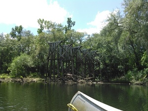
CATEGORIES: Railbridgesite
LAYER: Bridge
OWNERSHIP: Private
WATER BODY: Withlacoochee River
MILE: 31.06
ADDRESS: Shortly after the river crosses the state line into Florida the first time, at the end of the Four Freedoms Trail in Madison County, Florida.. Madison County.
DESCRIPTION: Closed 1973; only wooden trestles remain. The same railroad is still in use from Valdosta to Clyattville, Lowndes County, Georgia. https://www.gwrr.com/railroads/north_america/valdosta_railway#m_tab-one-panel
WEBSITE: https://en.wikipedia.org/wiki/Withlacoochee_River_(Suwannee_River)
PHOTO: https://wwals.net/wp-content/themes/pianoblack/img//2017/02/37ad5eabf7cc819e135ccd81895a5c1c.jpg
PHOTO SOURCE: John S. Quarterman
PHONE NUMBER: (229) 242-0102
PHOTO2: https://wwals.net/pictures/gretchen/2019-11-16–wwals-nankin/IMG_7158.jpg
Photoset2: https://wwals.net/pictures/gretchen/2019-11-16–wwals-nankin
PHOTO2 SOURCE: Gretchen Quarterman
Suggestions: https://forms.gle/DipPgU2TP5atc2Rf9

Georgia into Florida Second Time

CATEGORIES: Point Of Interest
LAYER: Point of Interest
GPS: 30.63663, -83.34857
OWNERSHIP: Public
WATER BODY: Withlacoochee River
MILE: 30.96
ADDRESS: Madison County.
DESCRIPTION: Bending south, the river is now entirely in Madison County, Florida.
PHOTO: https://wwals.net/wp-content/themes/pianoblack/img//2017/12/57ac3b804542b8be3999f9373ef56111-1.jpg
PHOTO SOURCE: WWALS
PHONE NUMBER: (850) 290-2350
Suggestions: https://forms.gle/DipPgU2TP5atc2Rf9
Tannin Shoal
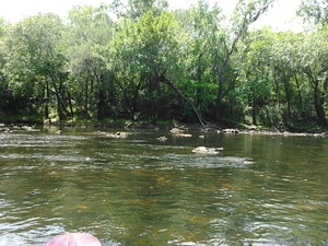
CATEGORIES: Shoal
LAYER: Other
GPS: 30.63247, -83.34582
OWNERSHIP: Public
WHITEWATER CLASS: Class I
WATER BODY: Withlacoochee River
MILE: 30.58
ADDRESS: At southmost loop into Florida. Madison, Hamilton Counties.
DESCRIPTION: A nice little shoal, with enough sands for the tea color of the tannic acid water to be quite visible.
PHOTO SOURCE: John S. Quarterman
PHONE NUMBER: (229) 242-0102
Suggestions: https://forms.gle/DipPgU2TP5atc2Rf9
State Line Shoals

CATEGORIES: Shoal
LAYER: Brochure
GPS: 30.63358, -83.34212
OWNERSHIP: Public
WHITEWATER CLASS: Class II
WATER BODY: Withlacoochee River
MILE: 30.33
ADDRESS: Three quarters of a mile after the railway trestle and Four Freedoms Trail. Lowndes, Madison Counties.
DESCRIPTION: The biggest shoals on this stretch, with at their end Georgia left bank, Florida right bank. The book Canoeing and Kayaking Georgia, by Susanne Welander, Bob Sehlinger, and Don Otey (2004) says: “”The limestone shoal that forms the foundation of this rapid is jagged; avoid contact with it by running this on the left…. The current is moderate, and other than the small shoals mentioned, deadfalls create the only hazard to navigation.””, The river is the state line here: left bank Lowndes County, Georgia; right bank Madison County, Florida.
WEBSITE: http://www.brownsguides.com/blog/withlacoochee-river-paddling-guide/
PHOTO: https://www.wwals.net/pictures/2016-07-09–nankin-ga-fl-line/KIMG5987.jpg
PHOTOSET: https://www.wwals.net/pictures/2016-07-09–nankin-ga-fl-line/#SLShoals
PHOTO SOURCE: John S. Quarterman
PHONE NUMBER: (229) 242-0102
Photoset2: https://wwals.net/pictures/2021-05-28–swimming-for-epd/#State-Line-Shoals
PHOTO2 SOURCE: Bobby McKenzie
Suggestions: https://forms.gle/DipPgU2TP5atc2Rf9

Florida into Georgia
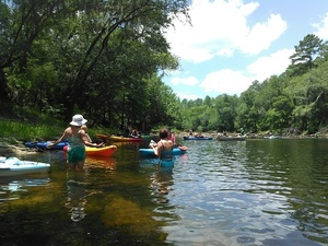
CATEGORIES: Point Of Interest
LAYER: Other
GPS: 30.63635, -83.34091
OWNERSHIP: Public
WATER BODY: Withlacoochee River
MILE: 30.13
ADDRESS: Returning to Georgia. Lowndes, Brooks Counties.
DESCRIPTION: Left bank is in Lowndes County, GA; right bank is in Brooks County, GA: accessible by land only from Madison County, Florida.
PHOTO: https://wwals.net/wp-content/themes/pianoblack/img//2017/02/1918be11704ed790813e2d8a12c924ad.jpg
PHOTO SOURCE: John S. Quarterman
PHONE NUMBER: (229) 242-0102
Suggestions: https://forms.gle/DipPgU2TP5atc2Rf9
Back to Georgia Shoal
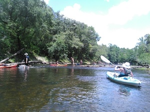
CATEGORIES: Shoal
LAYER: Other
OWNERSHIP: Public
WHITEWATER CLASS: Class I
WATER BODY: Withlacoochee River
MILE: 30.02
ADDRESS: Just afer the river flows back into Georgia. Brooks County.
DESCRIPTION: Small shoals with logs but no problem.
PHOTO SOURCE: John S. Quarterman
PHONE NUMBER: (229) 242-0102
Suggestions: https://forms.gle/DipPgU2TP5atc2Rf9
Arnold Springs
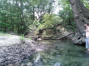
CATEGORIES: Spring
LAYER: Brochure
OWNERSHIP: Private, Arnold Springs Corp. PARCEL 0099 014
ACCESS: No
WATER BODY: Withlacoochee River
MILE: 29.67
ADDRESS: At the end of Olympia Trail, Valdosta, GA, just downstream of Back to Georgia Shoal. Brooks County.
DESCRIPTION: Actually three small springs next to each other. Privately owned: do not climb up the bank. One of only two second magnitude springs in the Suwannee River Basin in Georgia, of only six in the entire state. Arnold Springs is publicly accessible in the Withlacoochee River. It is in Brooks County, since the county line is on the east bank. The buildings are on private land in Lowndes County.
PHOTO: https://wwals.net/wp-content/themes/pianoblack/img//2017/02/4baacbe704d3d8352ed048c08c8477c5.jpg
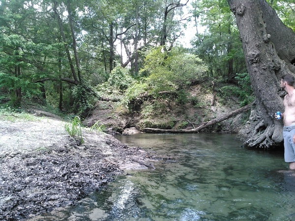
PHOTO SOURCE: John S. Quarterman
PHONE NUMBER: (229) 242-0102
PHOTO2: https://www.wwals.net/pictures/2021-08-07–nankin-state-line-sullivan-pictures/20210807_120902.jpg
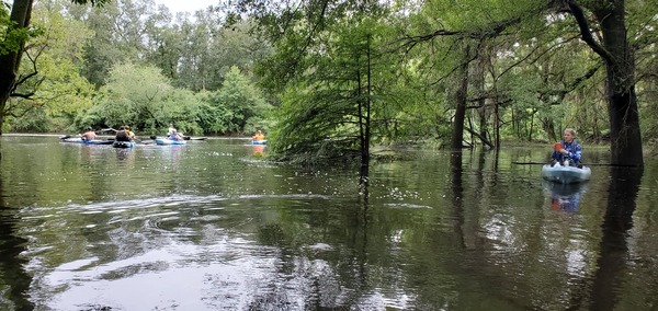
Photoset2: https://www.wwals.net/pictures/2021-08-07–nankin-state-line-sullivan-pictures/
PHOTO2 SOURCE: John S. Quarterman
Photo2 Phone Number: 229-242-0102
Suggestions: https://forms.gle/DipPgU2TP5atc2Rf9

Old Clyattville Road Bridge
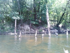
CATEGORIES: Bridgesite
LAYER: Bridge
OWNERSHIP: Public
WATER BODY: Withlacoochee River
MILE: 29.39
ADDRESS: Slightly downstream of 4 Old Clyattville Rd. Lowndes, Brooks Counties.
DESCRIPTION: Nothing but posts in the river; which look like they could have been only a dock.
PHOTO SOURCE: John S. Quarterman
PHONE NUMBER: (229) 242-0102
Suggestions: https://forms.gle/DipPgU2TP5atc2Rf9
Olympia Bend Shooting Range


CATEGORIES: Shooting Range
LAYER: Point of Interest
OWNERSHIP: Private, Cowart & Cowart LLC, PARCEL 0099 025A
WATER BODY: Withlacoochee River
MILE: 28.60
ADDRESS: 6514 Olympia Rd, Valdosta, GA 31601, Lowndes County.
DESCRIPTION: Very loud.
AKA: World War III.
WEBSITE: http://www.olympiabendplantation.com/
PHOTO: http://www.olympiabendplantation.com/image/66961782.png
PHOTOSET: http://www.olympiabendplantation.com/
PHOTO SOURCE: Olympia Bend Plantation
PHONE NUMBER: (478) 284-2903
Suggestions: https://forms.gle/DipPgU2TP5atc2Rf9
Halberdleaf Rosemallow
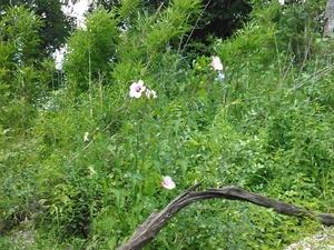
CATEGORIES: Point Of Interest
LAYER: Point of Interest
OWNERSHIP: Private, Cowart & Cowart LLC, PARCEL 0099 025A
WATER BODY: Withlacoochee River
MILE: 28.45
ADDRESS: Below Olympia Bend Shooting Range, Lowndes County.
DESCRIPTION: Hibiscus laevis All., each flower blooms for only one day.
PHOTO SOURCE: John S. Quarterman
PHONE NUMBER: (229) 242-0102
Suggestions: https://forms.gle/DipPgU2TP5atc2Rf9
GA 31 Bridge
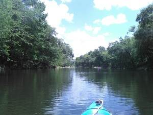
CATEGORIES: Bridge
LAYER: Bridge
GPS: 30.635392, -83.3115
OWNERSHIP: Public
WATER BODY: Withlacoochee River
MILE: 28.80
ADDRESS: GA 31 Madison Highway just north of FL state line, Lowndes, Brooks Counties.
DESCRIPTION: From Pinetta, Madison County, FL, travel north on CR 145; over the Withlacoochee River is this 779.9-foot six-span pre-stressed concrete bridge with a concrete cast-in-place deck.
AKA: Horns Ferry Bridge or Horn Bridge or Horne Bridge.
WEBSITE: https://bridgereports.com/1702902
PHOTO SOURCE: John S. Quarterman
PHONE NUMBER: (229) 242-0102
PHOTO2: https://www.wwals.net/pictures/2021-08-07–nankin-state-line-sullivan-pictures/20210807_123423.jpg
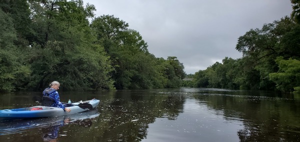
Photoset2: https://www.wwals.net/pictures/2021-08-07–nankin-state-line-sullivan-pictures/
PHOTO2 SOURCE: John S. Quarterman
Photo2 Phone Number: 229-242-0102
Suggestions: https://forms.gle/DipPgU2TP5atc2Rf9

Mozell’s Place

CATEGORIES: Point Of Interest
LAYER: Point of Interest
GPS: 30.6361, -83.311
OWNERSHIP: Private
WATER BODY: Withlacoochee River
MILE: 27.79
ADDRESS: 6461 Madison Hwy, Valdosta, GA 31601 near the Georgia-Florida State Line. Lowndes County.
DESCRIPTION: Site of a popular sea food restaurant that also served river fish. It’s the reason State Line Boat Ramp is commonly called Mozell Spells. The man’s name was Mozell Spell; he is buried in Sunset Hill Cemetery, Valdosta, Georgia.
AKA: Mozell’s Spell’s Sea Foods
PHOTO SOURCE: Postcard brought by Don Sirmans to Lowndes County Museum
PHONE NUMBER: (850) 290-2350
Suggestions: https://forms.gle/DipPgU2TP5atc2Rf9
State Line Boat Ramp @ GA 31
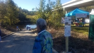
CATEGORIES: Landing
LAYER: Brochure
OWNERSHIP: Public, VLPRA
ACCESS: Yes, Ramp: Concrete on paved entrance driveway. PARKING: Free, PICNIC AREA
WATER BODY: Withlacoochee River
Lowest boatable: 85.25′
Highest safe: 99′
GAUGE: Quitman
MILE: 27.79
ADDRESS: 6461 Madison Hwy, Valdosta, GA 31601 near the Georgia-Florida State Line. Lowndes County.
DESCRIPTION: Down this GA-DNR boat ramp, just past those old bridge posts and around that bend, is the state line, on the blackwater Withlacoochee River. Site of the annual autumn WWALS Boomerang paddle race, from Georgia into Florida and back again. There’s almost always enough water, more than 1.8′ or 85.25′ NAVD88 on the Quitman (US 84) gauge. Best to avoid above 10.5′ or 94′ NAVD88. From Pinetta, Madison County, FL, travel north on CR 145; cross the Withlacoochee River; at the end of the bridge turn left and follow road to ramp in Hamilton County, FL. From Georgia, take I-75 south to Exit 11. Turn right onto Madison Highway. Go 8.7 miles. Turn right at the boat ramp sign.
HISTORIC FACTS: Mozell Spell had a restaurant called Mozell’s Catfish and Spell’s Seafood, usually called Mozell Spell’s. https://wwals.net/2019/06/17/at-the-ga-fl-line-2019-06-17/ The name stuck for the river access, although the apostrophe is usually omitted. Mozell Spell is buried in Sunset Hill Cemetery in Valdosta.
AKA: Mozell Spells (local people) or Madison Highway Boat Ramp (VLPRA) or State Line Ramp (GA DNR) or GA 31 Ramp (SRWMD) or CR 145 Bridge Launch (FDEP).
WEBSITE: http://vlpra.com/233/Madison-Highway-Boat-Ramp
OTHER REFERENCE: https://wwals.net/pictures/2020-09-26–drafts-metal-signs/State-Line-Boat-Ramp-Sign-0001.html
ADDITIONAL INFO SOURCES: https://www.theswimguide.org/beach/9588
UPSTREAM: 8.88 miles from State Line Boat Ramp to Clyattville-Nankin Boat Ramp
DOWNSTREAM: 5.34 miles from State Line Boat Ramp to Sullivan Launch
PHOTO: https://wwals.net/pictures/2018-11-03–wwals-boomerang-pictures/20181103_105635.jpg
PHOTOSET: https://wwals.net/pictures/2020-10-24–boomerang-front-videos/final-finishers.html
PHOTO SOURCE: John S. Quarterman
PHONE NUMBER: (229) 242-0102
PHOTO2 SOURCE: WWALS
Photo2 Phone Number: 850-290-2350
Suggestions: https://forms.gle/DipPgU2TP5atc2Rf9

State Line Boat Ramp River GPS @ GA 31
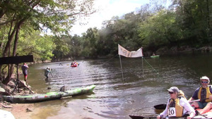
CATEGORIES: Point Of Interest
LAYER: Point of Interest
GPS: 30.63565, -83.31123
OWNERSHIP: Public, VLPRA
ACCESS: Yes, Ramp: Concrete on paved entrance driveway. PARKING: Free, PICNIC AREA
WATER BODY: Withlacoochee River
Lowest boatable: 85.25′
Highest safe: 99′
GAUGE: Quitman
MILE: 27.79
ADDRESS: 6461 Madison Hwy, Valdosta, GA 31601 near the Georgia-Florida State Line. Lowndes County.
DESCRIPTION: Down this GA-DNR boat ramp, just past those old bridge posts and around that bend, is the state line, on the blackwater Withlacoochee River. Site of the annual autumn WWALS Boomerang paddle race, from Georgia into Florida and back again. There’s almost always enough water, more than 1.8′ or 85.25′ NAVD88 on the Quitman (US 84) gauge. Best to avoid above 10.5′ or 94′ NAVD88. From Pinetta, Madison County, FL, travel north on CR 145; cross the Withlacoochee River; at the end of the bridge turn left and follow road to ramp in Hamilton County, FL. From Georgia, take I-75 south to Exit 11. Turn right onto Madison Highway. Go 8.7 miles. Turn right at the boat ramp sign.
HISTORIC FACTS: Mozell Spell had a restaurant called Mozell’s Catfish and Spell’s Seafood, usually called Mozell Spell’s. https://wwals.net/2019/06/17/at-the-ga-fl-line-2019-06-17/ The name stuck for the river access, although the apostrophe is usually omitted. Mozell Spell is buried in Sunset Hill Cemetery in Valdosta.
AKA: Mozell Spells (local people) or Madison Highway Boat Ramp (VLPRA) or State Line Ramp (GA DNR) or GA 31 Ramp (SRWMD) or CR 145 Bridge Launch (FDEP).
WEBSITE: http://vlpra.com/233/Madison-Highway-Boat-Ramp
OTHER REFERENCE: https://wwals.net/pictures/2020-09-26–drafts-metal-signs/State-Line-Boat-Ramp-Sign-0001.html
ADDITIONAL INFO SOURCES: https://www.theswimguide.org/beach/9588
PHOTO: https://wwals.net/pictures/2020-10-24–boomerang-front-videos/final-finishers.jpg
PHOTOSET: https://wwals.net/pictures/2020-10-24–boomerang-front-videos/final-finishers.html
PHOTO SOURCE: John S. Quarterman
PHONE NUMBER: (229) 242-0102
PHOTO2 SOURCE: WWALS
Photo2 Phone Number: 850-290-2350
Suggestions: https://forms.gle/DipPgU2TP5atc2Rf9
Old Horns Ferry Bridge
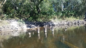
CATEGORIES: Bridgesite
LAYER: Bridge
OWNERSHIP: Private
WATER BODY: Withlacoochee River
MILE: 27.70
ADDRESS: Just downstream from GA 31 Bridge. Lowndes, Brooks Counties.
DESCRIPTION: At low water wooden piers of this old bridge are visible; built 1895, closed 1940, defunct.
HISTORIC FACTS: Wiregrass Digital History Project has it also listed as Lane’s Ferry (1830s); Warner’s Ferry (1830s-1850s); Lane’s Ferry (1850s-); Lane’s Bridge (1876-187?); Starlng’s Ferry (by 1879) https://www.google.com/maps/d/u/0/viewer?mid=1uAP1zA0ExqRb01-n1PrZCuaiQDo&ll=30.634949417436022%2C-83.31027763123372&z=19
WEBSITE: https://en.wikipedia.org/wiki/Withlacoochee_River_(Suwannee_River)
PHOTO: https://wwals.net/pictures/2018-11-03–wwals-boomerang-pictures/small/20181103_124008.jpg
PHOTOSET: https://wwals.net/pictures/2018-11-03–wwals-boomerang-pictures/
PHOTO SOURCE: John S. Quarterman
PHONE NUMBER: (229) 242-0102
Suggestions: https://forms.gle/DipPgU2TP5atc2Rf9
Begin GA Withlacoochee East Conservation Area
CATEGORIES: Public Land
LAYER: Other
GPS: 30.6352, -83.30871
OWNERSHIP: Public
WATER BODY: Withlacoochee River
MILE: 27.67
ADDRESS: At the first bend. Lowndes County.
DESCRIPTION: Left bank. It’s a Florida conservation area, but it starts in Lowndes County, Georgia
Suggestions: https://forms.gle/DipPgU2TP5atc2Rf9
GA-FL Line
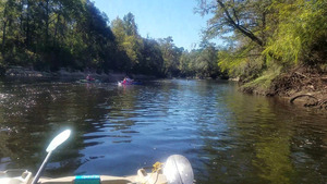
CATEGORIES: Point Of Interest
LAYER: Point of Interest
GPS: 30.63441, -83.30942
OWNERSHIP: Public
WATER BODY: Withlacoochee River
MILE: 27.60
ADDRESS: About 100 feet past the first bend. Brooks, Lowndes, Madison, Hamilton Counties.
DESCRIPTION: This is the third time the Withlacoochee River goes from Georgia into Florida.
PHOTO: https://wwals.net/pictures/2018-11-03–wwals-boomerang-pictures/shot0028.jpg
PHOTOSET: https://wwals.net/pictures/2018-11-03–wwals-boomerang-pictures/
PHOTO SOURCE: John S. Quarterman
PHONE NUMBER: (229) 242-0102
Suggestions: https://forms.gle/DipPgU2TP5atc2Rf9
Begin FL Withlacoochee East Conservation Area
CATEGORIES: Public Land
LAYER: Other
GPS: 30.6344, -83.3092
OWNERSHIP: Public, SRWMD, PARCEL 5098-410 and numerous other parcels
WATER BODY: Withlacoochee River
MILE: 27.60
ADDRESS: Hamilton County.
DESCRIPTION: This Florida part is in Hamilton County, Florida, for about two river miles
Suggestions: https://forms.gle/DipPgU2TP5atc2Rf9
Clump of Japanese Climbing Fern
CATEGORIES: Point Of Interest
LAYER: Point of Interest
OWNERSHIP: Public, Myra Keeling, PARCEL 00-3N-10-6118-002-000
WATER BODY: Withlacoochee River
MILE: 27.46
ADDRESS: Madison County.
DESCRIPTION: On the right bank, this is the first of far too many clumps of Lygodium japonicum. Spreads by roots underground and by spores. Fire doesn’t kill it.
Suggestions: https://forms.gle/DipPgU2TP5atc2Rf9
Welcome to Florida Shoals
CATEGORIES: Shoal
LAYER: Other
GPS: 30.63252, -83.30809
OWNERSHIP: Public
WHITEWATER CLASS: Class I
WATER BODY: Withlacoochee River
MILE: 27.41
ADDRESS: Hamilton, Madison Counties.
DESCRIPTION: Easy to float over going down; harder to get over going upstream.
Suggestions: https://forms.gle/DipPgU2TP5atc2Rf9
Boomerang Mile 1 
CATEGORIES: Boomerangmile1
LAYER: Point of Interest
OWNERSHIP: Public
WATER BODY: Withlacoochee River
MILE: 26.82
ADDRESS: Mile 1 of 2018 WWALS Boomerang Paddle Race, Hamilton, Madison Counties.
DESCRIPTION: Near the end of the second sharp right bend, before a slight left bend.
WEBSITE: https://wwals.net/2018/10/28/now-at-state-line-ramp-wwals-boomerang-paddle-race-2018-11-03/
Suggestions: https://forms.gle/DipPgU2TP5atc2Rf9
Deadfall fern
CATEGORIES: Point Of Interest
LAYER: Point of Interest
OWNERSHIP: Public, BST FAMILY PROPERTIES, PARCEL 00-3N-10-6122-000-000
WATER BODY: Withlacoochee River
MILE: 26.72
ADDRESS: Madison County.
DESCRIPTION: A deadfall on right bank with Japanese climbing fern behind it.
WEBSITE: https://wwals.net/2018/10/28/now-at-state-line-ramp-wwals-boomerang-paddle-race-2018-11-03/
Suggestions: https://forms.gle/DipPgU2TP5atc2Rf9
End Withlacoochee East Conservation Area
CATEGORIES: Public Land
LAYER: Other
GPS: 30.62972, -83.28569
OWNERSHIP: Public, Eva Maria Schwarz, PARCEL 5099-200
WATER BODY: Withlacoochee River
MILE: 25.78
ADDRESS: Hamilton County.
DESCRIPTION: Left bank. Left bank from here down past Jumping Gully Creek is owned by Packaging Corporation of America.
Suggestions: https://forms.gle/DipPgU2TP5atc2Rf9
Boomerang Mile 2 
CATEGORIES: Boomerangmile2
LAYER: Point of Interest
GPS: 30.62884, -83.2855
OWNERSHIP: Public
WATER BODY: Withlacoochee River
MILE: 25.71
ADDRESS: Mile 2 of 2018 WWALS Boomerang Paddle Race, Hamilton, Madison Counties.
DESCRIPTION: Between a right bend and a left bend, with sloping limestone on right bank, about 300 feet downstream of end of Withlacoochee East Conservation Area
WEBSITE: https://wwals.net/2018/10/28/now-at-state-line-ramp-wwals-boomerang-paddle-race-2018-11-03/
Suggestions: https://forms.gle/DipPgU2TP5atc2Rf9
Langdale Madison Private Landing

CATEGORIES: Landing Private
LAYER: Point of Interest
GPS: 30.62605, -83.2723
OWNERSHIP: Private
ACCESS: Launch: Sandy riverbank down dirt road.
WATER BODY: Withlacoochee River
MILE: 24.76
ADDRESS: Hickory Grove Road, Madison County, Florida. Madison County.
DESCRIPTION: Private access, right bank, slightly less than three miles downstream from State Line Boat Ramp.
WEBSITE: https://www.wwals.net/pictures/2021-08-07–nankin-state-line-sullivan-pictures/
PHOTO: https://www.wwals.net/pictures/2021-08-07–nankin-state-line-sullivan-pictures/20210807_135931.jpg
PHOTOSET: https://www.wwals.net/pictures/2021-08-07–nankin-state-line-sullivan-pictures/
PHOTO SOURCE: John S. Quarterman
PHONE NUMBER: (229) 242-0102
Suggestions: https://forms.gle/DipPgU2TP5atc2Rf9
Boomerang Mile 3 
CATEGORIES: Boomerangmile3
LAYER: Point of Interest
GPS: 30.62475, -83.27231
OWNERSHIP: Public
WATER BODY: Withlacoochee River
MILE: 24.69
ADDRESS: Mile 3 of 2018 WWALS Boomerang Paddle Race, Hamilton, Madison Counties.
DESCRIPTION: Has a nice deadfall by the side to mark it.
WEBSITE: https://wwals.net/2018/10/28/now-at-state-line-ramp-wwals-boomerang-paddle-race-2018-11-03/
Suggestions: https://forms.gle/DipPgU2TP5atc2Rf9
PCA steel steps

CATEGORIES: Point Of Interest
LAYER: Point of Interest
OWNERSHIP: Private
WATER BODY: Withlacoochee River
MILE: 24.48
ADDRESS: About 260 feet upstream from Jumping Gully Creek. Hamilton County.
DESCRIPTION: Left bank, steel steps owned by Packaging Corporation of America, with walkway from bridge over Jumping Gully Creek.
WEBSITE: https://www.wwals.net/pictures/2021-08-07–nankin-state-line-sullivan-pictures
PHOTO: https://www.wwals.net/pictures/2021-08-07–nankin-state-line-sullivan-pictures/20210807_140402.jpg
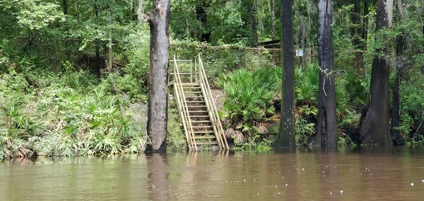
PHOTOSET: https://www.wwals.net/pictures/2021-08-07–nankin-state-line-sullivan-pictures
PHOTO SOURCE: John S. Quarterman
PHONE NUMBER: (229) 242-0102
Suggestions: https://forms.gle/DipPgU2TP5atc2Rf9
Jumping Gully Creek

CATEGORIES: Tributary
LAYER: Other
GPS: 30.62255, -83.26937
OWNERSHIP: Private, Packaging Corporation of America, PARCEL 5062-000
WATER BODY: Withlacoochee River
MILE: 24.43
ADDRESS: On left bank, about 3.25 miles below State Line Ramp. Hamilton County.
DESCRIPTION: Creek owned by Packaging Corporation of America in Florida, coming from PCA in Georgia, crossed by the Sabal Trail fracked methane pipeline in Florida.
WEBSITE: https://www.wwals.net/pictures/2021-08-07–nankin-state-line-sullivan-pictures
PHOTO: https://www.wwals.net/pictures/2021-08-07–nankin-state-line-sullivan-pictures/20210807_140442.jpg
PHOTOSET: https://www.wwals.net/pictures/2021-08-07–nankin-state-line-sullivan-pictures/
PHOTO SOURCE: John S. Quarterman
PHONE NUMBER: (229) 242-0102
PHOTO2: https://www.wwals.net/pictures/2021-08-07–nankin-state-line-sullivan-pictures/20210807_140703.jpg
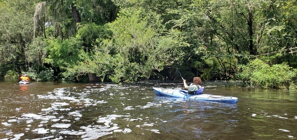
Photoset2: https://www.wwals.net/pictures/2021-08-07–nankin-state-line-sullivan-pictures/
PHOTO2 SOURCE: John S. Quarterman
Photo2 Phone Number: 229-242-0102
Suggestions: https://forms.gle/DipPgU2TP5atc2Rf9

Begin Sullivan Tract
CATEGORIES: Public Land
LAYER: Other
GPS: 30.61072, -83.26802
OWNERSHIP: Public, SRWMD, PARCEL 01-2N-10-5802-003-000
WATER BODY: Withlacoochee River
MILE: 23.60
ADDRESS: Madison County.
DESCRIPTION: Right bank. Part of Twin Rivers State Park. NE 195 Ave. runs through it.
WEBSITE: https://www.freshfromflorida.com/content/download/29794/752867/Twin_Rivers.pdf
Suggestions: https://forms.gle/DipPgU2TP5atc2Rf9
Sullivan Shoals
CATEGORIES: Shoal
LAYER: Other
GPS: 30.60957, -83.26752
OWNERSHIP: Public
WHITEWATER CLASS: Class I
WATER BODY: Withlacoochee River
MILE: 23.51
ADDRESS: About 450 feet downstream of beginning of Sullivan Tract. Madison, Hamilton Counties.
DESCRIPTION: First of a series of shoals starts here.
Suggestions: https://forms.gle/DipPgU2TP5atc2Rf9
Begin Deese Tract
CATEGORIES: Public Land
LAYER: Other
GPS: 30.60806, -83.26627
OWNERSHIP: Public, SRWMD, PARCEL 4783-000
WATER BODY: Withlacoochee River
MILE: 23.39
ADDRESS: On left bank, about 1200 feet downstream from beginning of Sullivan Tract. Hamilton County.
DESCRIPTION: Part of Twin Rivers State Park. Natural forest that appears to have access from NW 16th Ave.
WEBSITE: https://www.freshfromflorida.com/content/download/29794/752867/Twin_Rivers.pdf
Suggestions: https://forms.gle/DipPgU2TP5atc2Rf9
Sullivan Tract Creek
CATEGORIES: Tributary
LAYER: Other
GPS: 30.60909, -83.26749
OWNERSHIP: Public, SRWMD, PARCEL 01-2N-10-5802-003-000
WATER BODY: Withlacoochee River
MILE: 23.48
ADDRESS: On right bank, in SRWMD Sullivan Tract of Twin Rivers State Park. Madison County.
DESCRIPTION: USGS knows it only as Flowline:Permanet 133685313, ReachCode 03110203004747.
Suggestions: https://forms.gle/DipPgU2TP5atc2Rf9
End Deese Tract
CATEGORIES: Public Land
LAYER: Other
GPS: 30.60706, -83.26586
OWNERSHIP: Public, SRWMD, PARCEL 4783-000
WATER BODY: Withlacoochee River
MILE: 23.31
ADDRESS: On left bank, about 380 feet downstream from beginning of Deese Tract. Hamilton County.
DESCRIPTION: Part of Twin Rivers State Park. Natural forest that appears to have access from NW 16th Ave.
WEBSITE: https://www.freshfromflorida.com/content/download/29794/752867/Twin_Rivers.pdf
Suggestions: https://forms.gle/DipPgU2TP5atc2Rf9
Begin Sullivan Tract Second Parcel
CATEGORIES: Public Land
LAYER: Other
GPS: 30.60674, -83.26625
OWNERSHIP: Public, SRWMD, PARCEL 06-2N-11-6237-000-000
ACCESS: PICNIC AREA
WATER BODY: Withlacoochee River
MILE: 23.29
ADDRESS: On right bank, about 0.3 miles downstream from start of first Sullivan Tract parcel. Madison County.
DESCRIPTION: Part of Twin Rivers State Park. NE 195 Ave. runs through it.
WEBSITE: https://www.freshfromflorida.com/content/download/29794/752867/Twin_Rivers.pdf
Suggestions: https://forms.gle/DipPgU2TP5atc2Rf9
Deas Brothers Farms Inc.

CATEGORIES: Point Of Interest
LAYER: Other
OWNERSHIP: Private, Deas Brothers Farms, Inc. PARCEL 4781-070
WATER BODY: Withlacoochee River
MILE: 23.20
ADDRESS: On left bank, about three quarters of a mile upstream from the CR 150 bridge. Hamilton County.
DESCRIPTION: Cow pasture with extensive eroded slopes down into the river.
PHOTO: https://www.wwals.net/pictures/2021-08-07–nankin-state-line-sullivan-pictures/20210807_142425.jpg
PHOTOSET: https://www.wwals.net/pictures/2021-08-07–nankin-state-line-sullivan-pictures/
PHOTO SOURCE: John S. Quarterman
PHONE NUMBER: (229) 242-0102
Suggestions: https://forms.gle/DipPgU2TP5atc2Rf9
Sullivan Tract Park
CATEGORIES: Public Land
LAYER: Other
OWNERSHIP: Public, SRWMD, PARCEL 06-2N-11-6237-000-000
WATER BODY: Withlacoochee River
MILE: 23.07
ADDRESS: 5776 NE Bellville Road, Pinetta, FL 32350, Madison County.
DESCRIPTION: Fishing and picnicking site with potential canoe and kayak access in the woods. Hiking is easy along either access road, although there are no designated trails. SRWMD: “”The Sullivan and Deese tracts are part of Twin Rivers State Forest. For more information, call or visit: 386-208-1460.”” TRSF: “”The Sullivan Tract consists of 378 acres of upland pine and bottomland forest along the western bank of the Withlacoochee River. A public road provides access to the recreational area on the northeast corner of the tract for picnicking and fishing. This site also provides access to the river. Overnight vehicle parking is not available in this location. On the southern side of County Road 150, a day-use parking area allows access to the river for fishing and canoe/kayak launch.””
WEBSITE: https://www.mysuwanneeriver.com/DocumentCenter/View/10771/Withlacoochee-Hills-Sullivan-Deese?bidId=
OTHER REFERENCE: https://www.fdacs.gov/Forest-Wildfire/Our-Forests/State-Forests/Twin-Rivers-State-Forest/Recreation-at-Twin-Rivers-State-Forest#sullivan
PHOTO2: https://www.wwals.net/pictures/2022-08-14–sulak-sullivan/20220814_123017.jpg
Photoset2: https://www.wwals.net/pictures/2022-08-14–sulak-sullivan
PHOTO2 SOURCE: John S. Quarterman
Photo2 Phone Number: 229-242-0102
Suggestions: https://forms.gle/DipPgU2TP5atc2Rf9

Deas Brothers Farms Pasture

CATEGORIES: Point Of Interest
LAYER: Other
OWNERSHIP: Private, Deas Brothers Farms, Inc. PARCEL 4781-050
WATER BODY: Withlacoochee River
MILE: 22.79
ADDRESS: On left bank, about a third of a mile upstream from the CR 150 Bridge. Hamilton County.
DESCRIPTION: Cow prints down into the river from cow pasture.
PHOTO: https://www.wwals.net/pictures/2021-08-07–nankin-state-line-sullivan-pictures/20210807_143001.jpg
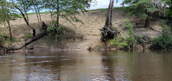
PHOTOSET: https://www.wwals.net/pictures/2021-08-07–nankin-state-line-sullivan-pictures/
PHOTO SOURCE: John S. Quarterman
PHONE NUMBER: (229) 242-0102
Suggestions: https://forms.gle/DipPgU2TP5atc2Rf9
Deese Tract Creek
CATEGORIES: Tributary
LAYER: Other
GPS: 30.59724, -83.26022
OWNERSHIP: Public, J. Harriett and J. Michael Ross, PARCEL 4784-030
WATER BODY: Withlacoochee River
MILE: 22.55
ADDRESS: On left bank, about 200 feet upstream from the CR 150 Bridge. Hamilton County.
DESCRIPTION: Abitrary name because upstream it comes through the Deese Tract. Known to USGS only as Flowline:Permanent 133685316, ReachCode 03110203004750. Originates in Langdale Jake White Tract in Lowndes County, Georgia.
Suggestions: https://forms.gle/DipPgU2TP5atc2Rf9
CR 150 Bridge

CATEGORIES: Bridge
LAYER: Bridge
OWNERSHIP: Public
WATER BODY: Withlacoochee River
MILE: 22.48
ADDRESS: CR 150 East of Pinetta; Belleville Road in Madison County, NW 13th Drive in Hamilton County. Madison, Hamilton Counties.
DESCRIPTION: 1, 000 foot cast-in-place concrete deck on pre-stressed concrete girders. South of NW 16th Ave. and Loch Laurel Road in Lowndes County, GA.
HISTORIC FACTS: Built 1984 to replace previous Belleville Bridge, remains of which are just downstream of Sullivan Launch and the Pinetta Gauge.
AKA: Belleville Road Bridge or NW 13th Drive Bridge.
WEBSITE: https://bridgereports.com/1082062
PHOTO: https://www.wwals.net/pictures/2021-08-07–nankin-state-line-sullivan-pictures/20210807_143309.jpg
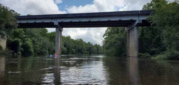
PHOTOSET: https://www.wwals.net/pictures/2021-08-07–nankin-state-line-sullivan-pictures/
PHOTO SOURCE: John S. Quarterman
PHONE NUMBER: (229) 242-0102
Suggestions: https://forms.gle/DipPgU2TP5atc2Rf9
Sullivan Launch @ CR 150
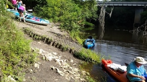
CATEGORIES: Landing
LAYER: Brochure
GPS: 30.595667, -83.26
OWNERSHIP: Public, SRWMD
ACCESS: Yes, Launch: Concrete, PARKING: Free, PICNIC AREA
WATER BODY: Withlacoochee River
Lowest boatable: 52.5′
Highest safe: 61.5
GAUGE: Pinetta
MILE: 22.45
ADDRESS: From CR 150 (NE Bellville Road) east of Pinetta, south of the road, downstream of river bridge, right (west) bank. Madison County.
DESCRIPTION: The first public access point in Florida to the blackwater Withlacoochee River, Sullivan launch is a narrow concrete launch with free parking and a picnic area, but no picnic tables. It is in the Sullivan Tract of Twin Rivers State Park. From Pinetta, Madison County, FL, travel east on CR 150; turn right at the bridge and follow road to the launch south of the river bridge. Downstream it’s 8.8 miles or about 4.4 miles to paddle to Florida Campsites Ramp. First thing you’ll see is the twisted remains of the old Bellville Bridge, and on the right bank the Pinetta gauge.
AKA: CR 150 Bridge Launch (FDEP).
GRN: Yes
WEBSITE: https://www.mysuwanneeriver.com/documentcenter/home/view/31
OTHER REFERENCE: https://www.fdacs.gov/Forest-Wildfire/Our-Forests/State-Forests/Twin-Rivers-State-Forest/Recreation-at-Twin-Rivers-State-Forest#sullivan
ADDITIONAL INFO SOURCES: https://www.theswimguide.org/beach/9632
UPSTREAM: 5.34 miles from Sullivan Launch to State Line Boat Ramp
DOWNSTREAM: 8.81 miles from Sullivan Launch to Florida Campsites Ramp
PHOTO: https://wwals.net/wp-content/themes/pianoblack/img//2017/06/046acc0648a43a9da28be0e16a93db4d.jpg
PHOTO SOURCE: John S. Quarterman
PHONE NUMBER: (229) 242-0102
Suggestions: https://forms.gle/DipPgU2TP5atc2Rf9

Bellville Bridge

CATEGORIES: Bridgesite
LAYER: Bridge
GPS: 30.59583, -83.259471
OWNERSHIP: Public
WATER BODY: Withlacoochee River
MILE: 22.43
ADDRESS: Downstream (south) of Sullivan Launch, Madison, Hamilton Counties.
DESCRIPTION: Remains of a steel bridge.
HISTORIC FACTS: “”A camelback truss bridge, built in 1912 by the Converse Bridge Co. at a cost of $4, 297.”” Was a popular hangout for college students in the 1960s. Was still standing, although not usable for traffic, at least until 1981.
WEBSITE: https://en.wikipedia.org/wiki/Withlacoochee_River_(Suwannee_River)
PHOTO: http://wwals.com/blog/wp-content/themes/pianoblack/img//2015/11/1d62d2690a88bf8f7278823843ee26f0.jpg
PHOTO SOURCE: John S. Quarterman
PHONE NUMBER: (229) 242-0102
PHOTO2: https://www.floridamemory.com/fpc/dg/DG01486.jpg
Photoset2: https://www.floridamemory.com/items/show/264410
PHOTO2 SOURCE: Mercer, Evelyn L. Bridge near Bellville crossing the Withlacoochee River. 1984. State Archives of Florida, Florida Memory
Suggestions: https://forms.gle/DipPgU2TP5atc2Rf9

Pinetta Gauge
CATEGORIES: River Gauge
LAYER: River Gauge
OWNERSHIP: Public
WATER BODY: Withlacoochee River
Lowest boatable: 52.5′
Highest safe: 61.5
GAUGE: Pinetta
MILE: 22.42
ADDRESS: South of CR 150 NE Bellville Road east of Pinetta. Madison County.
DESCRIPTION: USGS 02319000
WEBSITE: https://wwals.net/2014/05/06/flooding-charts-2/#Pinetta
PHOTO: http://waterwatch.usgs.gov/wwapps/ww_chart.php?i=nwis&vt=uv&site_no=02319000&p_cd=00065
PHOTOSET: https://wwals.net/2014/05/06/flooding-charts-2/
PHOTO SOURCE: WWALS
PHONE NUMBER: (229) 242-0102
Suggestions: https://forms.gle/DipPgU2TP5atc2Rf9
NE Fir St Shoals

CATEGORIES: Shoal
LAYER: Other
OWNERSHIP: Public
WATER BODY: Withlacoochee River
MILE: 21.41
ADDRESS: First shoals downstream from Sullivan Launch. At the end of NE Fir Street in Madison County, and the end of NW Reid Trail in Hamilton County. Madison, Hamilton Counties.
DESCRIPTION: Small shoals.
PHOTO: https://www.wwals.net/pictures/2023-07-15–withlacoochee-springs-slough-pictures/20230715_105647.jpg
PHOTOSET: https://www.wwals.net/pictures/2023-07-15–withlacoochee-springs-slough-pictures/#S1
PHOTO SOURCE: John S. Quarterman
PHONE NUMBER: (229) 242-0102
Suggestions: https://forms.gle/DipPgU2TP5atc2Rf9
Twin Rivers State Forest Road Shoals

CATEGORIES: Shoal
LAYER: Other
OWNERSHIP: Public
WATER BODY: Withlacoochee River
MILE: 21.20
ADDRESS: Second shoals downstream from Sullivan Launch. At the end of Twin Rivers State Forest Road. Madison, Hamilton Counties.
DESCRIPTION: Small shoals.
PHOTO: https://www.wwals.net/pictures/2015-10-24–wwals-withlacoochee/big/KIMG2710.jpg
PHOTOSET: https://www.wwals.net/pictures/2015-10-24–wwals-withlacoochee/#Second-Shoals
PHOTO SOURCE: John S. Quarterman
PHONE NUMBER: (229) 242-0102
Suggestions: https://forms.gle/DipPgU2TP5atc2Rf9
Coffee Spring
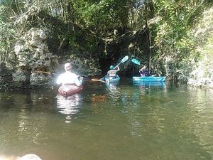
CATEGORIES: Spring
LAYER: Other
GPS: 30.57734, -83.2619
OWNERSHIP: Public, SRWMD
ACCESS: No
WATER BODY: Withlacoochee River
MILE: 20.89
ADDRESS: Twin Rivers State Forest Road, Madison County.
DESCRIPTION: Small spring close to the river. “”Phillip [Moore] said that it was called Coffee Springs due to being on an old stagecoach route. The stagecoach used to stop at the spring to allow passengers to stretch their legs and drink coffee.”” —Guy Bryant
HISTORIC FACTS: 964 feet of caves mapped by Guy Bryant in 1984. https://guybryantcavedivingblog.wordpress.com/2015/11/11/coffee-springscoffee-pot-sink/
WEBSITE: https://guybryantcavedivingblog.wordpress.com/2015/11/11/coffee-springscoffee-pot-sink/
PHOTO: https://wwals.net/wp-content/themes/pianoblack/img//2015/10/ab642001493488bdb554a303c2deae4b.jpg
PHOTO SOURCE: John S. Quarterman
PHONE NUMBER: (229) 242-0102
PHOTO2: https://guybryantcavedivingblog.files.wordpress.com/2015/11/coffee-springs-map1.jpg?w=1460
Photoset2: https://guybryantcavedivingblog.wordpress.com/2015/11/11/coffee-springscoffee-pot-sink/
PHOTO2 SOURCE: Guy Bryant
Suggestions: https://forms.gle/DipPgU2TP5atc2Rf9
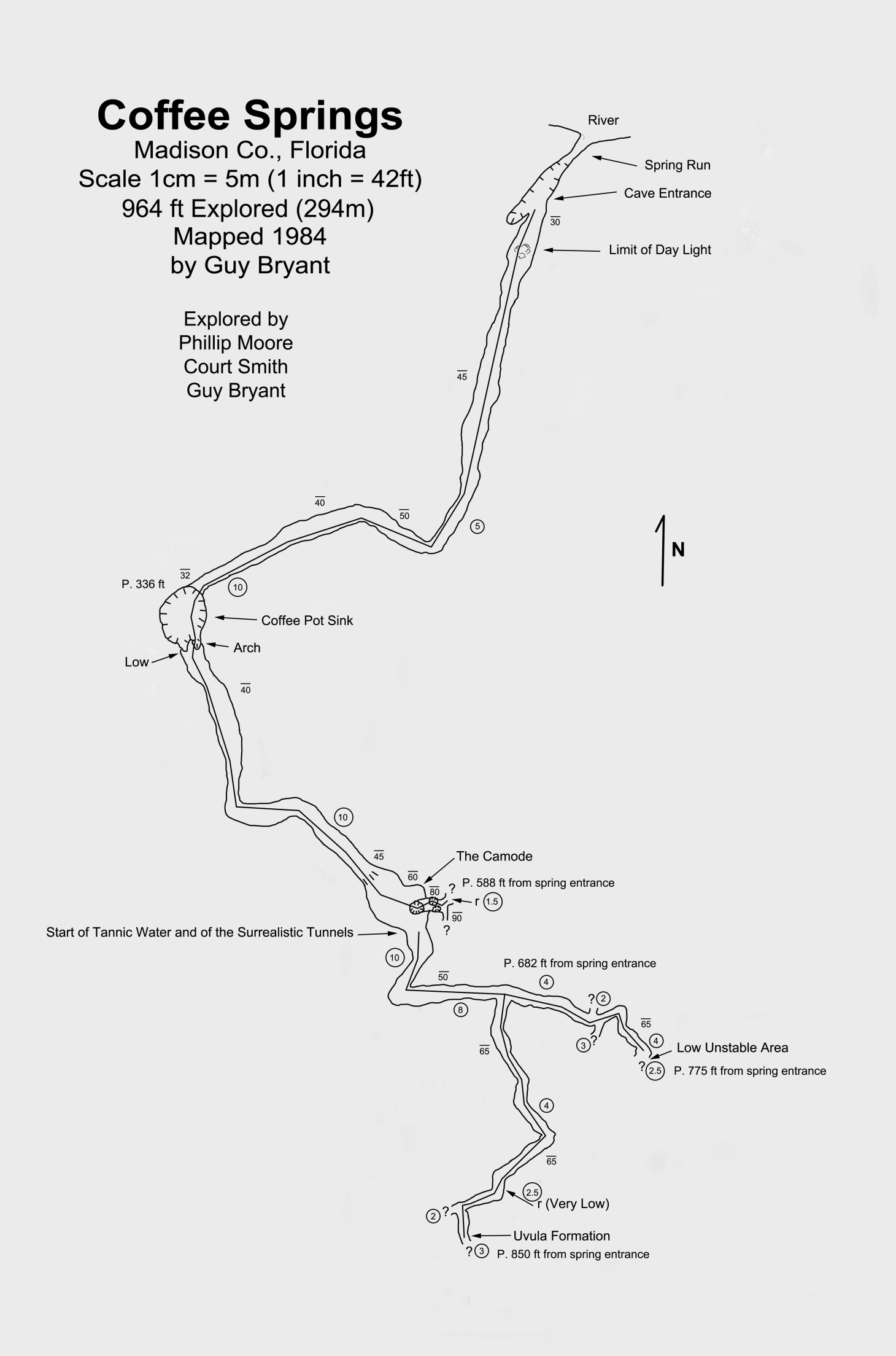
Coffee Pot Sink
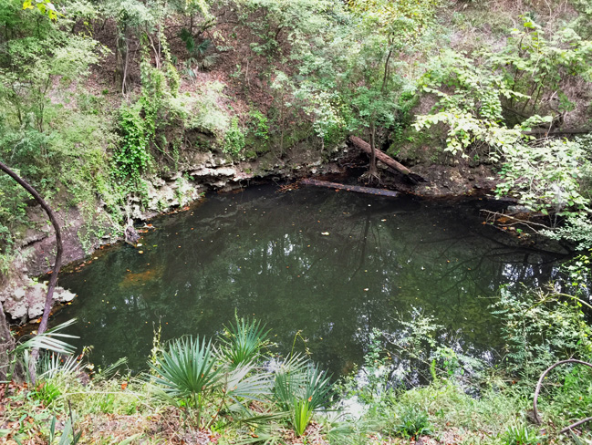
CATEGORIES: Sinkhole
LAYER: Other
OWNERSHIP: Public, SRWMD
WATER BODY: Withlacoochee River
MILE: 20.85
ADDRESS: Twin Rivers State Forest Road, Madison County.
DESCRIPTION: Sink connected to Coffee Spring. About 25 yards through thick brush off trail.
HISTORIC FACTS: 964 feet of caves mapped by Guy Bryant in 1984. https://guybryantcavedivingblog.wordpress.com/2015/11/11/coffee-springscoffee-pot-sink/
AKA: Coffee Spring Sink
WEBSITE: https://guybryantcavedivingblog.wordpress.com/2015/11/11/coffee-springscoffee-pot-sink/
PHOTO: https://guybryantcavedivingblog.files.wordpress.com/2015/11/coffee-sink-img_1810.jpg
PHOTOSET: https://guybryantcavedivingblog.wordpress.com/2015/11/11/coffee-springscoffee-pot-sink/
PHOTO SOURCE: Guy Brant
PHONE NUMBER: (850) 290-2350
PHOTO2: https://guybryantcavedivingblog.files.wordpress.com/2015/11/coffee-springs-map1.jpg?w=1460
Photoset2: https://guybryantcavedivingblog.wordpress.com/2015/11/11/coffee-springscoffee-pot-sink/
PHOTO2 SOURCE: Guy Bryant
Suggestions: https://forms.gle/DipPgU2TP5atc2Rf9
Reid Shoals

CATEGORIES: Shoal
LAYER: Other
OWNERSHIP: Public
WATER BODY: Withlacoochee River
MILE: 20.42
ADDRESS: Third shoals downstream from Sullivan Launch, downstream from Coffee Spring. Madison County.
DESCRIPTION: Very small shoals. Right bank is SRWMD NW Hickory Grove Road tract. Left bank is Reid Family Partnership LP.
PHOTO: https://www.wwals.net/pictures/2023-07-15–withlacoochee-springs-slough-pictures/20230715_112259.jpg
PHOTOSET: https://www.wwals.net/pictures/2023-07-15–withlacoochee-springs-slough-pictures/#S3
PHOTO SOURCE: John S. Quarterman
PHONE NUMBER: (229) 242-0102
Suggestions: https://forms.gle/DipPgU2TP5atc2Rf9
Coffee Shoals

CATEGORIES: Shoal
LAYER: Other
OWNERSHIP: Public
WATER BODY: Withlacoochee River
MILE: 20.22
ADDRESS: Fourth shoals downstream from Sullivan Launch, second downstream from Coffee Spring. Madison County.
DESCRIPTION: Bear right, left, right. Has a capsized boat in it.
PHOTO: https://www.wwals.net/pictures/2023-07-15–withlacoochee-springs-slough-pictures/20230715_112453.jpg
PHOTOSET: https://www.wwals.net/pictures/2023-07-15–withlacoochee-springs-slough-pictures/#CS
PHOTO SOURCE: John S. Quarterman
PHONE NUMBER: (229) 242-0102
Suggestions: https://forms.gle/DipPgU2TP5atc2Rf9
Island Shoals

CATEGORIES: Shoal
LAYER: Other
OWNERSHIP: Public
WATER BODY: Withlacoochee River
MILE: 19.69
ADDRESS: Fifth shoals downstream from Sullivan Launch, third downstream from Coffee Spring. Madison, Hamilton Counties.
DESCRIPTION: Either way works, but most people paddle right of the island.
PHOTO: https://www.wwals.net/pictures/2023-07-15–withlacoochee-springs-slough-pictures/20230715_113850.jpg
PHOTOSET: https://www.wwals.net/pictures/2023-07-15–withlacoochee-springs-slough-pictures/#IIS
PHOTO SOURCE: John S. Quarterman
PHONE NUMBER: (229) 242-0102
Suggestions: https://forms.gle/DipPgU2TP5atc2Rf9
Musgrove Island

CATEGORIES: Point Of Interest
LAYER: Point of Interest
GPS: 30.563, -83.2565
OWNERSHIP: Public, SUWANNEE RIVER WATER MANAGEMENT DISTRICT, PARCEL 4872-020
WATER BODY: Withlacoochee River
MILE: 19.65
ADDRESS: At the fifth shoals downstream from Sullivan Launch, third downstream from Coffee Spring. Hamilton County.
DESCRIPTION: Neither county claims it, but it’s towards the left bank, so Hamilton County, in SRWMD land.
PHOTO: https://www.wwals.net/pictures/2023-07-15–withlacoochee-springs-slough-pictures/20230715_113812.jpg
PHOTOSET: https://www.wwals.net/pictures/2023-07-15–withlacoochee-springs-slough-pictures/#IIS
PHOTO SOURCE: John S. Quarterman
PHONE NUMBER: (229) 242-0102
Suggestions: https://forms.gle/DipPgU2TP5atc2Rf9
Foxglove Shoals

CATEGORIES: Shoal
LAYER: Other
OWNERSHIP: Public
WATER BODY: Withlacoochee River
MILE: 19.11
ADDRESS: Sixth shoals downstream from Sullivan Launch, fourth downstream from Coffee Spring. Madison, Hamilton Counties.
DESCRIPTION: Go far left. Beware of overhanging brnaches. Site easily recognizable by house on right bluff.
PHOTO: https://www.wwals.net/pictures/2023-07-15–withlacoochee-springs-slough-pictures/20230715_114845.jpg
PHOTOSET: https://www.wwals.net/pictures/2023-07-15–withlacoochee-springs-slough-pictures/#S6
PHOTO SOURCE: John S. Quarterman
PHONE NUMBER: (229) 242-0102
Suggestions: https://forms.gle/DipPgU2TP5atc2Rf9
Stuart Spring

CATEGORIES: Spring
LAYER: Other
GPS: 30.5546, -83.2626
OWNERSHIP: Private, RIVER VIEW FARMS INC, PARCEL 19-2N-11-6241-000-000
WATER BODY: Withlacoochee River
MILE: 18.87
ADDRESS: Between Foxglove Shoals and HAM54012 west of the Withlacoochee River in Madison County on River View Farms property. Madison County.
DESCRIPTION: Third-magnitude inland spring.
PHOTOSET: https://www.wwals.net/pictures/2025-03-29–ellaville-tract-land-swap/
PHOTO SOURCE: SRWMD
PHONE NUMBER: (850) 290-2350
Suggestions: https://forms.gle/DipPgU2TP5atc2Rf9
Hardee Spring
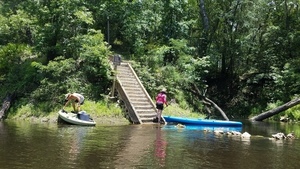
CATEGORIES: Spring
LAYER: Other
GPS: 30.5444, -83.2501
OWNERSHIP: Public, BOARD OF TRUSTEES OF THE INTERNAL IMPROVEMENT TRUST FND C/O DIV OF STATE LANDS, PARCEL 4940-000, 4939-030, 4940-030, 4941-000
WATER BODY: Withlacoochee River
GAUGE: Pinetta
MILE: 17.90
ADDRESS: Hardee Camp Road (NW 34th Street), Jennings, Fl 32053, Hamilton County.
DESCRIPTION: Second magnitude Hardee Spring is easily recognizable by the steep stairs on the left of the spring run. “”There is a 3 ft (0.9 m) high, man-made, limestone wall at the mouth of the spring run intended to capture water for swimming.”” “”Rossetter Spring emerges directly from a small cave at the base of 25 ft (7.6 m) high limestone and sand banks. The small, circular pool is 15 ft (4.6 m) in diameter. The depth of the spring measured near the cave opening is 4.5 ft (1.4 m). The shallow run is L-shaped and it flows 60 ft (18.3 m) south then turns sharply west, flowing another 60 ft (18.3 m) until reaching the river. It has a sand and rock bottom with some detritus deposition.”” [FGS Bulletin No. 66]
HISTORIC FACTS: Bought by state of Florida in early 2019. “”The water was slightly turbid, greenish colored, and had abundant filamentous algae in August 2002. During the August 2002 visit, the Withlacoochee River was at historically low levels, and the rock wall was entirely exposed with only a small amount of spring water trickling through the cracks.”” [FGS Bulletin No. 66]
AKA: Rosseter Spring
WEBSITE: https://wwals.net/2019/02/27/florida-buys-hardee-spring-on-the-withlacoochee-river/
PHOTO: https://wwals.net/wp-content/themes/pianoblack/img//2017/06/40363611add3bba13ae93671a70043a0.jpg
PHOTO SOURCE: John S. Quarterman
PHONE NUMBER: (229) 242-0102
PHOTO2 SOURCE: John S. Quarterman
Photo2 Phone Number: 229-242-0102
Suggestions: https://forms.gle/DipPgU2TP5atc2Rf9
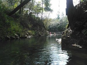
Jasper-Greenville Power Line
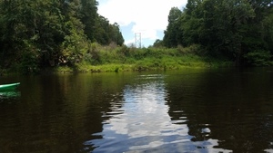
CATEGORIES: Power Line
LAYER: Point of Interest
GPS: 30.52028, -83.23962
OWNERSHIP: Public
WATER BODY: Withlacoochee River
MILE: 15.61
ADDRESS: NW 34th Street, Jennings, Fl 32053 (NE Chitty Bend Trail, Lee, FL, 32059), Madison, Hamilton Counties.
DESCRIPTION: A power line, accessible on the left (east) bank by a brief hike from a public road inside the Chitty Bend East Tract of Twin River State Park.
WEBSITE: https://wwals.net/2021/12/27/kur-m2-blue-cave-system-madison-county-florida/
PHOTO: https://wwals.net/wp-content/themes/pianoblack/img//2017/06/99f6ab8c2a0831cd6cae0b7549b60d7c.jpg
PHOTO SOURCE: John S. Quarterman
PHONE NUMBER: (229) 242-0102
Suggestions: https://forms.gle/DipPgU2TP5atc2Rf9
Fennels Funnel
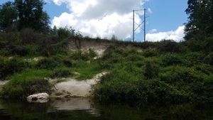
CATEGORIES: Sinkhole
LAYER: Other
GPS: 30.52034, -83.23998
OWNERSHIP: Public
WATER BODY: Withlacoochee River
MILE: 15.62
ADDRESS: On right bank, in the power line right of way, Madison County.
DESCRIPTION: A blue siphon leading to the extensive M2 Blue cave system.
HISTORIC FACTS: Extensive exploration by Karst Underwater Research (KUR) in 2015 and 2016 has revealed thousands of feet of caves, mostly underwater, in the M2 Blue cave system https://sites.google.com/view/karstunderwater/projects/m2-blue.
AKA: Fennel’s Funnel or Fannell’s Funnel
WEBSITE: https://wwals.net/2021/12/27/kur-m2-blue-cave-system-madison-county-florida/
ADDITIONAL INFO SOURCES: https://sites.google.com/view/karstunderwater/projects/m2-blue
PHOTO: https://wwals.net/wp-content/themes/pianoblack/img//2017/06/8d6ccd85b8f3cd0fc49ddc71f7e97286.jpg
PHOTO SOURCE: John S. Quarterman
PHONE NUMBER: (229) 242-0102
Suggestions: https://forms.gle/DipPgU2TP5atc2Rf9
Chitty Bend East Distributary

CATEGORIES: Tributary
LAYER: Other
GPS: 30.51769, -83.23865
OWNERSHIP: Public
WATER BODY: Withlacoochee River
MILE: 15.42
ADDRESS: Off NW 34th Street, Jennings, FL 32052, Hamilton County.
DESCRIPTION: Withlacoochee River water rushes into a creek, a distributary, about 100 yards into the woods into a sinkhole. Do not paddle in here!
WEBSITE: https://www.mysuwanneeriver.com/238/Westwood-Chitty-Bend-Withlacoochee-Nekoo
ADDITIONAL INFO SOURCES: https://sites.google.com/view/karstunderwater/projects/m2-blue
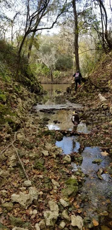
PHOTOSET: https://www.wwals.net/pictures/2021-01-01–withlacoochee-distributary/
PHOTO SOURCE: Susan Liden
PHONE NUMBER: (850) 290-2350
Suggestions: https://forms.gle/DipPgU2TP5atc2Rf9
Chitty Bend East Swallet

CATEGORIES: Sinkhole
LAYER: Other
OWNERSHIP: Public
WATER BODY: Withlacoochee River
MILE: 15.42
ADDRESS: Off NW 34th Street, Jennings, FL 32052, Hamilton County.
DESCRIPTION: Along a distributary from the Withlacoochee River, the aquifer is visible in this swallet. Do not paddle in here!
WEBSITE: https://www.mysuwanneeriver.com/238/Westwood-Chitty-Bend-Withlacoochee-Nekoo
ADDITIONAL INFO SOURCES: https://sites.google.com/view/karstunderwater/projects/m2-blue
PHOTO: https://www.wwals.net/pictures/2022-01-07–chitty-bend-east-distributary-shirley-kokidko/IMG_8668.jpg
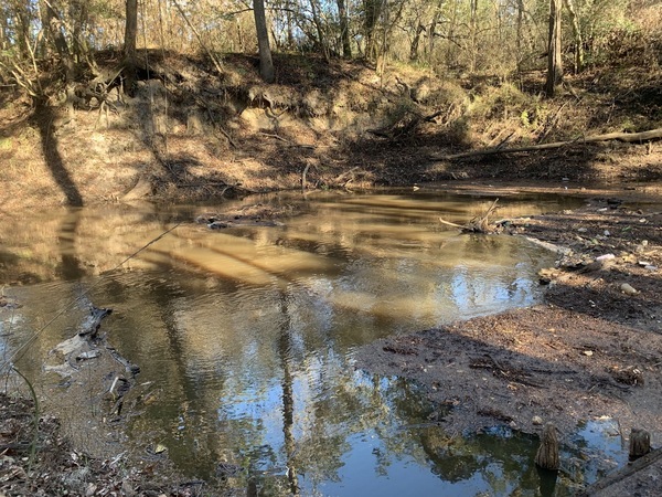
PHOTOSET: https://www.wwals.net/pictures/2022-01-07–chitty-bend-east-distributary-shirley-kokidko/
PHOTO SOURCE: Shirley Kokidko
PHONE NUMBER: (850) 290-2350
Suggestions: https://forms.gle/DipPgU2TP5atc2Rf9
Chitty Bend East Sinkhole

CATEGORIES: Sinkhole
LAYER: Other
GPS: 30.51595, -83.238383
OWNERSHIP: Public
WATER BODY: Withlacoochee River
MILE: 15.42
ADDRESS: Off NW 34th Street, Jennings, FL 32052, Hamilton County.
DESCRIPTION: At the end of a distributary from the Withlacoochee River, it goes into this sinkhole. Do not paddle in here!
WEBSITE: https://www.mysuwanneeriver.com/238/Westwood-Chitty-Bend-Withlacoochee-Nekoo
ADDITIONAL INFO SOURCES: https://sites.google.com/view/karstunderwater/projects/m2-blue
PHOTO: https://www.wwals.net/pictures/2022-01-07–chitty-bend-east-distributary-shirley-kokidko/IMG_8675.jpg
PHOTOSET: https://www.wwals.net/pictures/2022-01-07–chitty-bend-east-distributary-shirley-kokidko/
PHOTO SOURCE: Shirley Kokidko
PHONE NUMBER: (850) 290-2350
Suggestions: https://forms.gle/DipPgU2TP5atc2Rf9
Monkey Tree Sandbar
CATEGORIES: Point Of Interest
LAYER: Point of Interest
OWNERSHIP: Public, SUWANNEE RIVER WATER MANAGEMENT DISTRICT, PARCEL 4401-010
WATER BODY: Withlacoochee River
MILE: 14.59
ADDRESS: Left bank, a bit less than a mile upstream from Florida Campsites Ramp, 7.86 miles downstream from Sullivan Launch, west of the westmost bend of NW 21st Ct., , Jasper, FL 32052, Hamilton County.
DESCRIPTION: A popular sandy beach on a peninsula at low water. In Twin Rivers State Forest, in the Chitty Bend East Tract owned by SRWMD.
Suggestions: https://forms.gle/DipPgU2TP5atc2Rf9
Chitty Bend West Tract Entrance
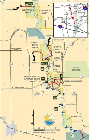
CATEGORIES: Point Of Interest
LAYER: Point of Interest
GPS: 30.519382, -83.26614
OWNERSHIP: Public
WATER BODY: Withlacoochee River
MILE: 14.55
ADDRESS: Entrance just east of 3397 Cottonwood St, Pinetta, FL 32350, east of NE Old Blue Springs Road. Madison County.
DESCRIPTION: Access to Chitty Bend West Fishing.
PHOTOSET: https://www.wwals.net/pictures/2021-01-01–withlacoochee-distributary/#Maps
PHOTO SOURCE: Twin Rivers State Forest
PHONE NUMBER: (850) 290-2350
Suggestions: https://forms.gle/DipPgU2TP5atc2Rf9
Chitty Bend West Fishing
CATEGORIES: Fishing
LAYER: Point of Interest
OWNERSHIP: Public, SRWM DISTRICT, PARCEL 05-1N-11-6167-000-000
ACCESS: PICNIC AREA
WATER BODY: Withlacoochee River
MILE: 14.55
ADDRESS: Right bank, just downstream from Monkey Tree Sandbar, 0.91 miles upstream from Florida Campsites Ramp, 7.9 miles downstream from Sullivan Launch. Madison County.
DESCRIPTION: Fishing access with picnic table and benches, accessible from Chitty Bend West Tract Entrance through Cottonwood Street and NE Chitty Bend Trail, maybe also from NE Chervil Drive.
PHOTOSET: https://www.wwals.net/pictures/2021-01-01–withlacoochee-distributary/#Maps
PHOTO SOURCE: Twin Rivers State Forest
PHONE NUMBER: (850) 290-2350
Suggestions: https://forms.gle/DipPgU2TP5atc2Rf9
NW 21st Ct Private Boat Ramp

CATEGORIES: Landing Private
LAYER: Point of Interest
OWNERSHIP: Private
ACCESS: Launch: concrete below gravel.
WATER BODY: Withlacoochee River
MILE: 14.14
ADDRESS: Left bank, shortly upstream from Florida Campsites Ramp. Hamilton County.
DESCRIPTION: Concrete at the bottom, below gravel. Private: do not use without permission.
PHOTO: https://www.wwals.net/pictures/2023-07-15–withlacoochee-springs-slough-pictures/20230715_150105.jpg
PHOTOSET: https://www.wwals.net/pictures/2023-07-15–withlacoochee-springs-slough-pictures/#PBR21
PHOTO SOURCE: John S. Quarterman
PHONE NUMBER: (229) 242-0102
Suggestions: https://forms.gle/DipPgU2TP5atc2Rf9
Florida Campsites Ramp @ NW 47th St
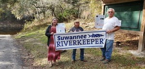
CATEGORIES: Landing
LAYER: Brochure
OWNERSHIP: Public, Hamilton County
ACCESS: Yes, Ramp: Concrete, PARKING: Free, PICNIC AREA
WATER BODY: Withlacoochee River
Lowest boatable: 52.5′
Highest safe: 61.5
GAUGE: Pinetta
MILE: 13.64
ADDRESS: 2137 NW 47th St, Jasper, FL 32052, Hamilton County.
DESCRIPTION: A less-frequented concrete boat ramp on the blackwater Withlacoochee River. From Jasper, Hamilton County, FL, travel north on US 41 to SR 6; turn left; travel west on SR 6 to CR 143; turn right and travel north to NW 44 Street; turn left; follow road to NW 45 Street; turn right; follow road to NW 22 Avenue; turn left and follow road to NW 21 Place and ramp is on the right. Only 1.68 miles or about an hour downstream to Madison Blue Spring State Park Launch.
AKA: Hamilton Ramp or Withlacoochee River—NW 47th Street Boat Ramp (boatzia) or Barking Dog Boat Ramp or Florida Campsites Boat Ramp
WEBSITE: https://www.wwals.net/pictures/2022-06-04–florida-campsites-withlacoochee-pictures/#Banners
ADDITIONAL INFO SOURCES: https://www.theswimguide.org/beach/9633
UPSTREAM: 8.81 miles from Florida Campsites Ramp to Sullivan Launch
DOWNSTREAM: 1.67 miles from Florida Campsites Ramp to Madison Blue Spring State Park Launch
PHOTO: https://wwals.net/pictures/2019-12-16–wq-testing-fl-campsites-us84/20191216_145328.jpg
PHOTOSET: https://wwals.net/pictures/2019-12-16–wq-testing-fl-campsites-us84/
PHOTO SOURCE: John S. Quarterman
PHONE NUMBER: (229) 242-0102
Photoset2: https://www.wwals.net/pictures/2022-06-04–florida-campsites-withlacoochee-pictures/
PHOTO2 SOURCE: John S. Quarterman
Photo2 Phone Number: 229-242-0102
Suggestions: https://forms.gle/DipPgU2TP5atc2Rf9

Turtle Rock Island

CATEGORIES: Point Of Interest
LAYER: Point of Interest
OWNERSHIP: Public
WATER BODY: Withlacoochee River
MILE: 13.03
ADDRESS: By the south end of NE Edgewater Circle, Lee, FL 32059, a mile upstream from the FL 6 bridge. Hamilton County.
DESCRIPTION: A tiny rocky island in the middle of the Withlacoochee River.
PHOTOSET: https://www.wwals.net/pictures/2022-06-04–florida-campsites-withlacoochee-pictures/#RI
PHOTO SOURCE: Shirley Kokidko
PHONE NUMBER: (850) 290-2350
Suggestions: https://forms.gle/DipPgU2TP5atc2Rf9
Sullivan Blue Sink

CATEGORIES: Sinkhole
LAYER: Other
GPS: 30.49608506, -83.24854275
OWNERSHIP: Private, BRUGGEMAN JERRY L JR & BRUGGEMAN VALERIE L, PARCEL 08-1N-11-6181-002-000
WATER BODY: Withlacoochee River
MILE: 12.81
ADDRESS: Off NE Chervil Drive at the north end of Edgewater Circle, north of FL 6, Lee, FL 32059, Madison County.
DESCRIPTION: The sinkhole into which Withlacoochee River water comes 2/3 of a mile up a distributary. The entire waterway is private land.
AKA: Chervil Drive Sinkhole
WEBSITE: https://wwals.net/2022/01/17/chervil-drive-distributary-withlacoochee-river-2022-01-13/
PHOTOSET: https://www.wwals.net/pictures/2021-01-18–sullivan-slough/
PHOTO SOURCE: Susan Liden
PHONE NUMBER: (850) 290-2350
PHOTO2: https://www.wwals.net/pictures/2022-01-13–chervil-distributary/chervil-distributary.jpg
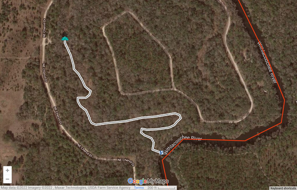
Photoset2: https://wwals.net/2022/01/17/chervil-drive-distributary-withlacoochee-river-2022-01-13/
PHOTO2 SOURCE: WWALS
Suggestions: https://forms.gle/DipPgU2TP5atc2Rf9

Sullivan Slough

CATEGORIES: Tributary
LAYER: Other
GPS: 30.49244238, -83.24501883
OWNERSHIP: Private, JOINER LESLIE SULLIVAN, PARCEL 17-1N-11-6182-001-000
WATER BODY: Withlacoochee River
MILE: 12.81
ADDRESS: Between NE Chervil Drive and Edgewater Circle, north of FL 6, Lee, FL 32059, Madison County.
DESCRIPTION: Withlacoochee River water runs into a creek, a distributary, about 2/3 of a mile into the woods into a sinkhole. The entire waterway is private land.
AKA: Chervil Drive Distributary
WEBSITE: https://wwals.net/2022/01/17/chervil-drive-distributary-withlacoochee-river-2022-01-13/
PHOTOSET: https://www.wwals.net/pictures/2021-01-18–sullivan-slough/
PHOTO SOURCE: Susan Liden
PHONE NUMBER: (850) 290-2350
PHOTO2: https://www.wwals.net/pictures/2022-01-13–chervil-distributary/chervil-distributary.jpg
Photoset2: https://wwals.net/2022/01/17/chervil-drive-distributary-withlacoochee-river-2022-01-13/
PHOTO2 SOURCE: WWALS
Suggestions: https://forms.gle/DipPgU2TP5atc2Rf9
Chervil Island
CATEGORIES: Point Of Interest
LAYER: Point of Interest
OWNERSHIP: Public
WATER BODY: Withlacoochee River
MILE: 12.66
ADDRESS: Off the middle of NE Chervil Drive, Lee, FL 32059, half a mile upstream from FL 6. Hamilton County.
DESCRIPTION: A narrow but long wooded island.
Suggestions: https://forms.gle/DipPgU2TP5atc2Rf9
Old Madison Steel Bridge
CATEGORIES: Bridgesite
LAYER: Bridge
OWNERSHIP: Public
WATER BODY: Withlacoochee River
MILE: 12.11
ADDRESS: About 100 meters upstream of the current FL 6 Bridge. Madison, Hamilton Counties.
DESCRIPTION: “”I think the old steel bridge at Madison Blue Springs was the first steel bridge. It stood of crudely made site-mixed concrete and broken brick piers. One of those remains, toppled, just about 100 m upstream of the existing SR6 highway bridge. The bowstring design was structurally weak, with only a single overhead strut connecting the two sides. Few were built.”” —Ken Sulak, 28 November 2022
HISTORIC FACTS: Possibly the oldest steel bridge in Florida.
Suggestions: https://forms.gle/DipPgU2TP5atc2Rf9
FL-6 Bridge
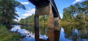
CATEGORIES: Bridge
LAYER: Bridge
GPS: 30.482252, -83.24353
OWNERSHIP: Public
WATER BODY: Withlacoochee River
MILE: 12.08
ADDRESS: 10.2 miles east of Madison. West of the river, turn north off of FL 6 onto Withlacoochee Shores Lane. Stay right to stay on that. Turn right on NE Chervil Drive to the FL 6 right of way. Turn left to go to the river. Madison, Hamilton Counties.
DESCRIPTION: A 279.9 ft. 8-span steel stringer bridge with concrete-cast-in-place deck, built in 1950, just upstream from Madison Blue Spring.
AKA: FL 6 Bridge or Madison Blue Spring Bridge
WEBSITE: https://bridgereports.com/1082035
PHOTO: https://wwals.net/pictures/2020-10-16–suwannee-fl-6-sl/20201016_163931.jpg
PHOTOSET: https://wwals.net/pictures/2020-10-16–suwannee-fl-6-sl/
PHOTO SOURCE: John S. Quarterman
PHONE NUMBER: (229) 242-0102
Suggestions: https://forms.gle/DipPgU2TP5atc2Rf9
Madison Gauge
CATEGORIES: River Gauge
LAYER: River Gauge
OWNERSHIP: Public
WATER BODY: Withlacoochee River
Lowest boatable: 40.1′
Highest safe: 50′
GAUGE: Madison
MILE: 12.08
ADDRESS: On left bank 260 ft below bridge on State Highway 6, 10.2 mi east of Madison and 12 mi upstream from mouth. Madison County.
DESCRIPTION: USGS 02319300
WEBSITE: https://wwals.net/2014/05/06/flooding-charts-2/#Madison
PHOTO: http://waterwatch.usgs.gov/wwapps/ww_chart.php?i=nwis&vt=uv&site_no=02319300&p_cd=00065
PHOTOSET: https://wwals.net/2014/05/06/flooding-charts-2/
PHOTO SOURCE: WWALS
PHONE NUMBER: (850) 290-2350
Suggestions: https://forms.gle/DipPgU2TP5atc2Rf9
Madison Blue Island

CATEGORIES: Point Of Interest
LAYER: Point of Interest
OWNERSHIP: Public
WATER BODY: Withlacoochee River
MILE: 12.05
ADDRESS: Near right bank, between FL 6 bridge and Madison Blue Spring. Madison County.
DESCRIPTION: Tiny island.
PHOTOSET: https://www.wwals.net/pictures/2022-06-04–florida-campsites-withlacoochee-pictures/
PHOTO SOURCE: John S. Quarterman
PHONE NUMBER: (229) 242-0102
Suggestions: https://forms.gle/DipPgU2TP5atc2Rf9
Madison Blue Spring

CATEGORIES: Spring
LAYER: Other
GPS: 30.48077, -83.244296
OWNERSHIP: Public
WATER BODY: Withlacoochee River
MILE: 11.98
ADDRESS: 8300 NE SR 6, Lee, FL 32059, Madison County.
DESCRIPTION: First magnitude spring in state park.
WEBSITE: https://www.floridastateparks.org/index.php/parks-and-trails/madison-blue-spring-state-park
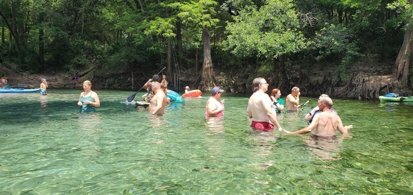
PHOTOSET: https://www.wwals.net/pictures/2022-06-04–florida-campsites-withlacoochee-pictures
PHOTO SOURCE: John S. Quarterman
PHONE NUMBER: (229) 242-0102
Suggestions: https://forms.gle/DipPgU2TP5atc2Rf9
Madison Blue Spring State Park
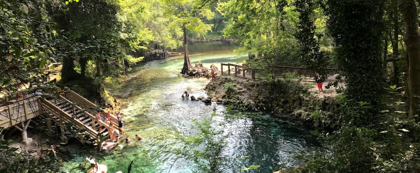
CATEGORIES: Public Land
LAYER: Hiking Trail
OWNERSHIP: Public
WATER BODY: Withlacoochee River
GAUGE: Madison
MILE: 11.99
ADDRESS: 8300 NE SR 6, Lee, FL 32059, Madison County.
DESCRIPTION: One of Florida’s newest state parks.
WEBSITE: https://www.floridastateparks.org/index.php/parks-and-trails/madison-blue-spring-state-park
PHOTOSET: https://www.floridastateparks.org/index.php/parks-and-trails/madison-blue-spring-state-park
PHOTO SOURCE: Florida State Parks
PHONE NUMBER: (850) 290-2350
Suggestions: https://forms.gle/DipPgU2TP5atc2Rf9
Madison Blue Spring State Park Launch @ FL-6 
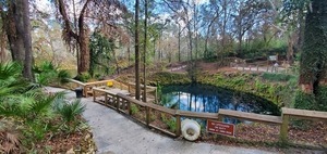
CATEGORIES: Landing
LAYER: Brochure
OWNERSHIP: Public, SRWMD
ACCESS: Yes, Stairs: Wooden steps, PARKING: Free, PICNIC AREA
WATER BODY: Withlacoochee River
Lowest boatable: 40.1′
Highest safe: 50′
GAUGE: Madison
MILE: 11.97
ADDRESS: 8300 FL-6, Lee, FL 32059, Madison County.
DESCRIPTION: The first and only first-magnitude spring on the Withlacoochee River, or the Withlacoochee (north) River as it is sometimes known in Florida. The spring is an easy paddle in from the river. Takeout from the spring is by steep stairs and a long boardwalk. There is a parking fee, because this is a state park, Madison Blue Spring State Park. From Madison, Madison County, FL, travel east on SR 6 to the Withlacoochee River and Madison Blue Springs State Park is on the right. There’s almost always enough water in the river to paddle, but the park may be closed at very high water. Downstream it’s only 1.99 miles or about an hour paddle to Madison Boat Ramp, which is a much better takeout.
WEBSITE: https://www.floridastateparks.org/index.php/parks-and-trails/madison-blue-spring-state-park
ADDITIONAL INFO SOURCES: https://www.theswimguide.org/beach/9634
UPSTREAM: 1.67 miles from Madison Blue Spring State Park Launch to Florida Campsites Ramp
DOWNSTREAM: 1.99 miles from Madison Blue Spring State Park Launch to Madison Boat Ramp
PHOTO: https://wwals.net/pictures/2019-12-16–wq-testing-fl-campsites-us84/20191216_140645.jpg
PHOTOSET: https://wwals.net/pictures/2019-12-16–wq-testing-fl-campsites-us84/
PHOTO SOURCE: John S. Quarterman
PHONE NUMBER: (229) 242-0102
Photoset2: https://www.floridastateparks.org/park/Madison-Blue-Spring
PHOTO2 SOURCE: Florida State Parks
Suggestions: https://forms.gle/DipPgU2TP5atc2Rf9
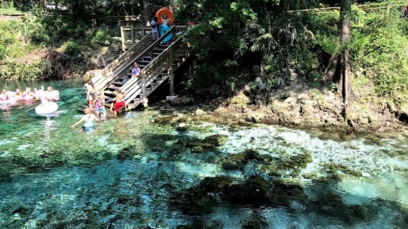
Madison Outpost Adventures
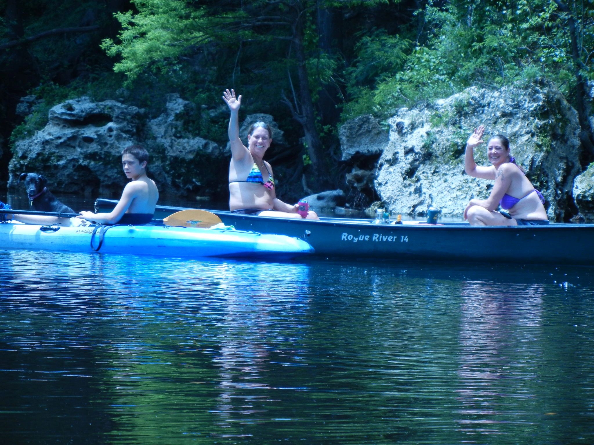
CATEGORIES: Outfitter
LAYER: Other
GPS: 30.4764, -83.2488
OWNERSHIP: Private
WATER BODY: Withlacoochee River
MILE: 11.52
ADDRESS: 485 Northeast Blue Springs Church Road, Lee, Florida 32059, Madison County.
DESCRIPTION: “”We offer a variety of kayaks and canoes to rent. If you want to rent by the hour or all day, you pick your time. We offer shuttle runs to the Withlachoochee River for a fun day of exploring the beautiful springs that are located all along the river.””
GRN: Yes
WEBSITE: https://paddle.today/
PHOTO: https://isteam.wsimg.com/ip/b632248f-08d8-4233-80b1-d98e0af14ca8/DSCN1643.JPG
PHOTOSET: https://paddle.today/
PHOTO SOURCE: Madison Outpost Adventures
PHONE NUMBER: (904) 416-5102
Suggestions: https://forms.gle/DipPgU2TP5atc2Rf9
D & L’s Cozy Camping

CATEGORIES: Camping
LAYER: Other
GPS: 30.476405, -83.25004
OWNERSHIP: Private
WATER BODY: Withlacoochee River
MILE: 11.52
ADDRESS: 485 NE Blue Springs Church Rd, Lee, FL 32059-4364, Madison County.
DESCRIPTION: “”It’s a small private secluded place. Power and water at each site. We will be teaming up with Madison Outpost Adventures for a package deal for campsites and a shuttled kayak, canoe or tube day on the beautiful Withlachoochee River.””
HISTORIC FACTS: Grand opening April 30, 2021 https://www.facebook.com/events/768813927171824/
WEBSITE: https://www.facebook.com/outpostadventures/
PHOTOSET: https://paddle.today/
PHOTO SOURCE: Madison Outpost Adventures
PHONE NUMBER: (904) 416-5102
Suggestions: https://forms.gle/DipPgU2TP5atc2Rf9
David’s Disappointment Spring

CATEGORIES: Spring
LAYER: Other
OWNERSHIP: Public
WATER BODY: Withlacoochee River
GAUGE: Madison
MILE: 11.45
ADDRESS: About 370 feet downstream from Madison Blue Spring on the left bank of the Withlacoochee River. Hamilton County.
DESCRIPTION: Guy Bryant wrote, “”David’s Disappointment spring is named after David Nolan who was the first person to explore its small cave.””
AKA: Ham612982 (Hamilton) 3rd Magnitude Spring.
WEBSITE: https://wwals.net/2022/08/08/pictures-davids-disappointment-spring-withlacoochee-river-2022-06-04/
OTHER REFERENCE: https://guybryantcavedivingblog.wordpress.com/2015/12/03/davids-disappointment-spring/
PHOTOSET: https://www.wwals.net/pictures/2022-06-04–florida-campsites-withlacoochee-pictures/
PHOTO SOURCE: John S. Quarterman
PHONE NUMBER: (229) 242-0102
Suggestions: https://forms.gle/DipPgU2TP5atc2Rf9
Beach across from MAD612982 Spring

CATEGORIES: Point Of Interest
LAYER: Point of Interest
GPS: 30.4731, -83.2432
OWNERSHIP: Public
WATER BODY: Withlacoochee River
GAUGE: Madison
MILE: 11.32
ADDRESS: On the left bank of the Withlacoochee River, across from Mad612982 Spring. Hamilton County.
DESCRIPTION: A nice sloping beach perfect for a break or lunch.
PHOTOSET: https://www.wwals.net/pictures/2022-06-04–florida-campsites-withlacoochee-pictures/
PHOTO SOURCE: John S. Quarterman
PHONE NUMBER: (229) 242-0102
Suggestions: https://forms.gle/DipPgU2TP5atc2Rf9
Mad612982 Spring

CATEGORIES: Spring
LAYER: Other
OWNERSHIP: Public
WATER BODY: Withlacoochee River
GAUGE: Madison
MILE: 11.30
ADDRESS: A bit more than half way from Madison Blue Spring to Pot Spring on right bank of the Withlacoochee River. Madison County.
DESCRIPTION: A second magnitude spring burbling out of the karst riverbank.
PHOTOSET: https://www.wwals.net/pictures/2022-06-04–florida-campsites-withlacoochee-pictures/
PHOTO SOURCE: John S. Quarterman
PHONE NUMBER: (229) 242-0102
Suggestions: https://forms.gle/DipPgU2TP5atc2Rf9
Pot Spring Boat Ramp
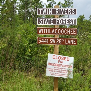
CATEGORIES: Landing
LAYER: Other
OWNERSHIP: Public
ACCESS: Yes, Stairs: Wooden Steps, CAMPING: Primitive Campsites, PARKING: Free
WATER BODY: Withlacoochee River
Lowest boatable: 40.1′
Highest safe: 50′
GAUGE: Madison
MILE: 10.74
ADDRESS: 5441 SW 28th Lane, Jennings, FL, SW of Jennings, Florida, off of FL 6, 11 miles west of I-75 exit 460. Hamilton County.
DESCRIPTION: Popular for access to Pot Spring. Occasional takeout downstream from Madison Blue Spring or Florida Campsites Ramp. “”The Withlacoochee Tract, locally known as the Pot Springs Tract, is 1, 156 acres of upland and bottomland pine forest along the eastern bank of the Withlacoochee River. Pot Springs, nestled on the riverbank, is a popular day-use recreation area. Additionally, there is a primitive campsite on the river available for overnight camping by paddlers…. For camping information and reservations, visit ReserveAmerica.com or call 1-877-879-3859.”
HISTORIC FACTS: This Twin Rivers State Park tract was closed in summer 2020 for thinning of pine trees. https://wwals.net/2020/07/27/why-pot-spring-is-closed-2020-07-20/
AKA: Pot Spring Launch
WEBSITE: https://boatzia.com/florida/hamilton/twin-rivers-state-forest-pot-spring-canoe-kayak-access/
ADDITIONAL INFO SOURCES: https://www.fdacs.gov/Forest-Wildfire/Our-Forests/State-Forests/Twin-Rivers-State-Forest/Recreation-at-Twin-Rivers-State-Forest
PHOTOSET: https://wwals.net/pictures/2020-07-29–state-line-madison-utilities-blue-spring-stt-pot-spring/
PHOTO SOURCE: John S. Quarterman
PHONE NUMBER: (229) 242-0102
Suggestions: https://forms.gle/DipPgU2TP5atc2Rf9
Pot Spring Boat Ramp River GPS
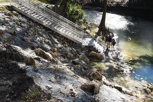
CATEGORIES: Point Of Interest
LAYER: Other
GPS: 30.4708, -83.23434
OWNERSHIP: Public
ACCESS: Yes, Stairs: Wooden Steps, CAMPING: Primitive Campsites, PARKING: Free
WATER BODY: Withlacoochee River
Lowest boatable: 40.1′
Highest safe: 50′
GAUGE: Madison
MILE: 10.74
ADDRESS: 5441 SW 28th Lane, Jennings, FL, SW of Jennings, Florida, off of FL 6, 11 miles west of I-75 exit 460. Hamilton County.
DESCRIPTION: Popular for access to Pot Spring. Occasional takeout downstream from Madison Blue Spring or Florida Campsites Ramp. “”The Withlacoochee Tract, locally known as the Pot Springs Tract, is 1, 156 acres of upland and bottomland pine forest along the eastern bank of the Withlacoochee River. Pot Springs, nestled on the riverbank, is a popular day-use recreation area. Additionally, there is a primitive campsite on the river available for overnight camping by paddlers…. For camping information and reservations, visit ReserveAmerica.com or call 1-877-879-3859.”
HISTORIC FACTS: This Twin Rivers State Park tract was closed in summer 2020 for thinning of pine trees. https://wwals.net/2020/07/27/why-pot-spring-is-closed-2020-07-20/
AKA: Pot Spring Launch
WEBSITE: https://boatzia.com/florida/hamilton/twin-rivers-state-forest-pot-spring-canoe-kayak-access/
ADDITIONAL INFO SOURCES: https://www.fdacs.gov/Forest-Wildfire/Our-Forests/State-Forests/Twin-Rivers-State-Forest/Recreation-at-Twin-Rivers-State-Forest
PHOTO: https://wwals.net/pictures/2020-07-20–pot-springs-closed/srwmd-pot-spring-stairs.jpg
PHOTOSET: https://wwals.net/pictures/2020-07-20–pot-springs-closed/
PHOTO SOURCE: SRWMD
PHONE NUMBER: (229) 242-0102
PHOTO2: https://www.facebook.com/watch/?v=4763631010315119
Photoset2: NWXpeditions
PHOTO2 SOURCE: (229) 289-5573
Suggestions: https://forms.gle/DipPgU2TP5atc2Rf9
Party Rocks

CATEGORIES: Point Of Interest
LAYER: Point of Interest
OWNERSHIP: Public
WATER BODY: Withlacoochee River
GAUGE: Madison
MILE: 10.25
ADDRESS: A quarter mile downstream from Pot Spring on the Withlacoochee River. Madison, Hamilton Counties.
DESCRIPTION: When the river is low enough, a good spot to stick up an umbrella and lawn chairs for a party.
PHOTOSET: https://www.wwals.net/pictures/2022-06-04–florida-campsites-withlacoochee-pictures/
PHOTO SOURCE: John S. Quarterman
PHONE NUMBER: (229) 242-0102
Suggestions: https://forms.gle/DipPgU2TP5atc2Rf9
Madison Boat Ramp @ NE River Park Rd
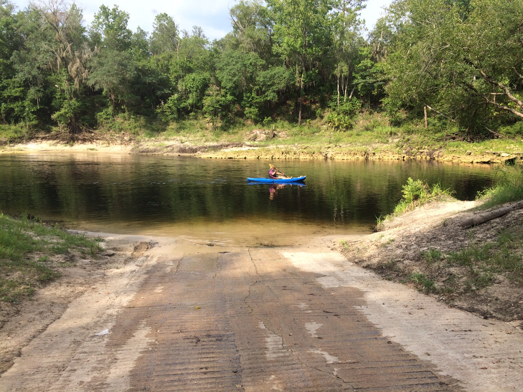
CATEGORIES: Landing
LAYER: Brochure
OWNERSHIP: Public, Madison County
ACCESS: Yes, Ramp: Concrete, PARKING: Free, PICNIC AREA
WATER BODY: Withlacoochee River
Lowest boatable: 40.1′
Highest safe: 50′
GAUGE: Madison
MILE: 9.98
ADDRESS: 1307 NE River Park Rd, Lee, FL 32059, Madison County.
DESCRIPTION: Madison Boat Ramp is a nice concrete ramp, and a much better kayak or canoe takeout than the stairs at Madison Blue Spring Launch. From the city of Madison in Madison County, FL, travel east on SR 6 to Old Blue Springs Road; turn right, travel east to NE Ivy Drive; turn left and travel east to NE Juniper Drive; turn right and follow to NE River Park Road; turn left and travel east; cross over NE Timber River Loop and into county park.
AKA: Madison Ramp or Withlacoochee Ramp (SRWMD) or Lee Boat Ramp or Lee Ramp (SRWMD) or Water Plant Ramp.
WEBSITE: http://www.dep.state.fl.us/gwt/guide/designated_paddle/withn_guide.pdf
ADDITIONAL INFO SOURCES: https://www.theswimguide.org/beach/9635
UPSTREAM: 1.99 miles from Madison Boat Ramp to Madison Blue Spring State Park Launch
DOWNSTREAM: 1.73 miles from Madison Boat Ramp to Allen Ramp
PHOTO: https://wwals.net/wp-content/themes/pianoblack/img//2015/07/image9.jpg
PHOTO SOURCE: Chris Mericle
PHONE NUMBER: (850) 290-2350
Suggestions: https://forms.gle/DipPgU2TP5atc2Rf9
Tanner Spring

CATEGORIES: Spring
LAYER: Other
OWNERSHIP: Public
WATER BODY: Withlacoochee River
GAUGE: Madison
MILE: 9.59
ADDRESS: About 2, 000 feet downstream from Madison Boat Ramp on left bank of the Withlacoochee River. Hamilton County.
DESCRIPTION: A 30-foot diameter round pool with a 24-foot deep second magnitude spring vent in its center.
AKA: HAM612981 Spring.
WEBSITE: https://www.wwals.net/pictures/2022-06-04–florida-campsites-withlacoochee-pictures/#TS
PHOTOSET: https://www.wwals.net/pictures/2022-06-04–florida-campsites-withlacoochee-pictures/
PHOTO SOURCE: John S. Quarterman
PHONE NUMBER: (229) 242-0102
Suggestions: https://forms.gle/DipPgU2TP5atc2Rf9
Mad612981 Spring

CATEGORIES: Spring
LAYER: Other
OWNERSHIP: Public
WATER BODY: Withlacoochee River
GAUGE: Madison
MILE: 8.42
ADDRESS: About 900 feet upstream from Allen Ramp, on the right bank of the Withlacoochee River. Madison County.
DESCRIPTION: A series of small spring vents from the karst right bank of the Withlacoochee River, adding up to a second magnitude spring.
WEBSITE: https://www.wwals.net/pictures/2022-06-04–florida-campsites-withlacoochee-pictures/#Mad612981-Spring
PHOTOSET: https://www.wwals.net/pictures/2022-06-04–florida-campsites-withlacoochee-pictures/
PHOTO SOURCE: John S. Quarterman
PHONE NUMBER: (229) 242-0102
Suggestions: https://forms.gle/DipPgU2TP5atc2Rf9
Hamilton Solar Plant
CATEGORIES: Solar
LAYER: Other
OWNERSHIP: Private
WATER BODY: Withlacoochee River
MILE: 8.25
ADDRESS: SW 69th Dr & SW 40th Ave, Jasper, FL 32052, Hamilton County.
DESCRIPTION: 65 megawatt solar plant by Duke energy right next to Sabal Trail pipeline
WEBSITE: https://wwals.net/2017/11/08/hamilton-solar-farm-by-duke-energy-at-sabal-trail-pipeline/
Suggestions: https://forms.gle/DipPgU2TP5atc2Rf9
Allen Ramp @ SW 64th Way
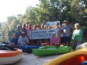
CATEGORIES: Landing
LAYER: Brochure
OWNERSHIP: Public, Hamilton County
ACCESS: Yes, Ramp: Concrete on dirt access road, PARKING: Free, PICNIC AREA
WATER BODY: Withlacoochee River
Lowest boatable: 40.1′
Highest safe: 50′
GAUGE: Madison
MILE: 8.25
ADDRESS: 2726 SW 64th Way Jasper, FL 32052, Hamilton County.
DESCRIPTION: This concrete ramp on a dirt road is a great put-in for springs, including Powerline, Fairy, and second magnitude Suwannacoochee Spring. There are several shoals, Battery, Wipe-out, Deer, and the notorious Melvin Shoals. From Jasper, travel north on US 41 to SR 6; turn left; travel south on SW CR 141 to SW CR 143; turn right and follow SW CR 143 to SW 64 Way and follow to ramp. After the bridge on CR 141, it’s only a couple more miles to the Suwannee River, and then a short paddle upstream to Suwannee River State Park, for 8.47 river miles in all. Don’t forget to picnic on one of the white sand beaches along the way.
AKA: CR 143 ramp (SRWMD) or Hamilton County Road 143 Boat Ramp (Natural Atlas) or Broke Boat Ramp (people with boat trailers).
WEBSITE: https://www.mysuwanneeriver.com/documentcenter/home/view/31
OTHER REFERENCE: https://naturalatlas.com/boat-launches/hamilton-county-road-143-2090335
ADDITIONAL INFO SOURCES: https://www.theswimguide.org/beach/9953
UPSTREAM: 1.73 miles from Allen Ramp to Madison Boat Ramp
DOWNSTREAM: 8.45 miles from Allen Ramp to Suwannee River State Park Ramp
PHOTO: https://wwals.net/pictures/gretchen/2019-06-01–wwals-withlacoochee/P6010772.jpg
PHOTOSET: https://wwals.net/pictures/gretchen/2019-06-01–wwals-withlacoochee/
PHOTO SOURCE: Gretchen Quarterman
PHONE NUMBER: (850) 290-2350
Suggestions: https://forms.gle/DipPgU2TP5atc2Rf9
Ham610984 (Hamilton) 2nd Magnitude

CATEGORIES: Spring
LAYER: Other
OWNERSHIP: Public
WATER BODY: Withlacoochee River
GAUGE: Madison
MILE: 7.36
ADDRESS: Left bank. “”HAM610984 occupies a small cove in the high riverbanks along the east side of the Withlacoochee River.””, Hamilton County.
DESCRIPTION: “”The spring vent produces a prominent boil, and spring water discharges directly into the Withlacoochee River from the east. Moss and fern-covered limestone is exposed along both sides of the river, and the riverbanks reach heights of approximately 12 ft (3.7 m) above current water level. The spring is surrounded by heavily-forested state lands. [FGS Bulletin No. 66]””
WEBSITE: http://publicfiles.dep.state.fl.us/FGS/FGS_Publications/B/B66_2004/
OTHER REFERENCE: https://www.wwals.net/pictures/gretchen/2019-06-01–wwals-withlacoochee/#Onwards
PHOTO: https://www.wwals.net/pictures/gretchen/2019-06-01–wwals-withlacoochee/20190601_102118.jpg
PHOTOSET: https://www.wwals.net/pictures/gretchen/2019-06-01–wwals-withlacoochee/#Onwards
PHOTO SOURCE: Gretchen Quarterman
PHONE NUMBER: (850) 290-2350
Suggestions: https://forms.gle/DipPgU2TP5atc2Rf9
Withla Lunch Beach
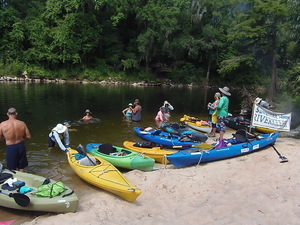
CATEGORIES: Point Of Interest
LAYER: Point of Interest
GPS: 30.42355, -83.2218
OWNERSHIP: Public, SRWMD, PARCEL 5074-000
WATER BODY: Withlacoochee River
GAUGE: Madison
MILE: 5.86
ADDRESS: Left bank beach on SRWMD land across from 1080 NE WITHLA BLUFFS WAY, LEE, FL 32059, Hamilton County.
DESCRIPTION: Big enough for a few dozen people to beach kayaks and lunch, depending on water levels, of course.
WEBSITE: https://www.wwals.net/pictures/gretchen/2019-06-01–wwals-withlacoochee/#Lunch
PHOTO: https://www.wwals.net/pictures/gretchen/2019-06-01–wwals-withlacoochee/P6010912.jpg
PHOTOSET: https://www.wwals.net/pictures/gretchen/2019-06-01–wwals-withlacoochee/#Lunch
PHOTO SOURCE: John S. Quarterman
PHONE NUMBER: (229) 242-0102
Suggestions: https://forms.gle/DipPgU2TP5atc2Rf9
Battery Shoals

CATEGORIES: Shoal
LAYER: Other
OWNERSHIP: Public
WHITEWATER CLASS: Class I
WATER BODY: Withlacoochee River
GAUGE: Madison
MILE: 5.59
ADDRESS: 2 2/3 miles downstream from Allen Ramp, just below 690 NE WITHLABLUFFS WAY, LEE, FL 32059, Hamilton, Madison Counties.
DESCRIPTION: Stay to the right. Source: Chris Mericle of Blackwater River Guide.
WEBSITE: https://www.wwals.net/pictures/gretchen/2019-06-01–wwals-withlacoochee/#Battery-Shoals
PHOTO: https://www.wwals.net/pictures/gretchen/2019-06-01–wwals-withlacoochee/P6010940.jpg
PHOTOSET: https://www.wwals.net/pictures/gretchen/2019-06-01–wwals-withlacoochee/#Battery-Shoals
PHOTO SOURCE: Gretchen Quarterman
PHONE NUMBER: (850) 290-2350
Suggestions: https://forms.gle/DipPgU2TP5atc2Rf9
Wipe-out Shoals

CATEGORIES: Shoal
LAYER: Other
OWNERSHIP: Public
WHITEWATER CLASS: Class I
WATER BODY: Withlacoochee River
GAUGE: Madison
MILE: 5.25
ADDRESS: 3 miles downstream from Allen Ramp, beyond the end of NE Maypop Ave. Hamilton, Madison Counties.
DESCRIPTION: An easy shoal. Go down the middle. Source: Chris Mericle of Blackwater River Guide.
WEBSITE: https://www.wwals.net/pictures/gretchen/2019-06-01–wwals-withlacoochee/#WipeOut-Shoals
PHOTO: https://www.wwals.net/pictures/gretchen/2019-06-01–wwals-withlacoochee/20190601_114210.jpg
PHOTOSET: https://www.wwals.net/pictures/gretchen/2019-06-01–wwals-withlacoochee/#WipeOut-Shoals
PHOTO SOURCE: Gretchen Quarterman
PHONE NUMBER: (850) 290-2350
Suggestions: https://forms.gle/DipPgU2TP5atc2Rf9
Double Door Spring

CATEGORIES: Spring
LAYER: Other
OWNERSHIP: Public
WATER BODY: Withlacoochee River
GAUGE: Madison
MILE: 5.10
ADDRESS: Left (northwest) bank, 3.15 miles downstream from Allen Ramp and 0.1 miles downstream from Wipe-out Shoals, beyond the end of Maypop Ave. Hamilton County.
DESCRIPTION: Second magnitude. “”The spring consists of two caves at the base of the riverbank, encompassing an area of about 18 ft (5.5 m) on the north side of the Withlacoochee River. The first cave is about 6 ft (1.8 m) wide and 3 ft (0.9 m) high, while the second cave is approximately 2 ft (0.6 m) wide and 4 ft (1.2 m) high.””
AKA: Double Window Spring or HAM610983
WEBSITE: http://publicfiles.dep.state.fl.us/FGS/FGS_Publications/B/B66_2004/
OTHER REFERENCE: https://www.wwals.net/pictures/gretchen/2019-06-01–wwals-withlacoochee/#Double-Window-Spring
PHOTO: https://www.wwals.net/pictures/gretchen/2019-06-01–wwals-withlacoochee/20190601_114616.jpg
PHOTOSET: https://www.wwals.net/pictures/gretchen/2019-06-01–wwals-withlacoochee/#Double-Window-Spring
PHOTO SOURCE: Gretchen Quarterman
PHONE NUMBER: (850) 290-2350
Suggestions: https://forms.gle/DipPgU2TP5atc2Rf9
Morgan Spring Run

CATEGORIES: Spring
LAYER: Other
OWNERSHIP: Public, MCALISTER DONALD R, PARCEL 5074-010
WATER BODY: Withlacoochee River
GAUGE: Madison
MILE: 4.66
ADDRESS: Left (northeast) bank, 3.59 miles downstream from Allen Ramp. Hamilton County.
DESCRIPTION: Where water enters the Withlacoochee River from second magnitude Morgan Spring, a viewing platform is visible from the river above karst rocks. “”Morgan Spring has a man-made dam about 9.0 ft (3.0 m) long which impounds the spring and creates the spring pool. There is a large wooden deck around the spring pool. The vent is located roughly in the center of the pool. The spring pool is oval shaped and measures 81.0 ft (24.7 m) long and 66.0 ft (20.1 m) wide. The depth is 19.2 ft (5.8 m)…””, The end of the spring run is public; the spring itself is on private property.
WEBSITE: http://publicfiles.dep.state.fl.us/FGS/FGS_Publications/B/B66_2004/
PHOTO: https://www.wwals.net/pictures/gretchen/2019-06-01–wwals-withlacoochee/P6010979.jpg
PHOTOSET: https://www.wwals.net/pictures/gretchen/2019-06-01–wwals-withlacoochee/#Morgan-Spring-Run
PHOTO SOURCE: Gretchen Quarterman
PHONE NUMBER: (850) 290-2350
Suggestions: https://forms.gle/DipPgU2TP5atc2Rf9
Deer Shoals

CATEGORIES: Shoal
LAYER: Other
GPS: 30.415753, -83.20754
OWNERSHIP: Public
WHITEWATER CLASS: Class I
WATER BODY: Withlacoochee River
GAUGE: Madison
MILE: 4.38
ADDRESS: 3.87 miles downstream from Allen Ramp, beyond the end of SW 76th Drive. Hamilton, Madison Counties.
DESCRIPTION: Go left, and immediately cross to the right. Source: Chris Mericle of Blackwater River Guide.
WEBSITE: https://www.wwals.net/pictures/gretchen/2019-06-01–wwals-withlacoochee/#Deer-Shoals
PHOTO: https://www.wwals.net/pictures/gretchen/2019-06-01–wwals-withlacoochee/20190601_120555.jpg
PHOTOSET: https://www.wwals.net/pictures/gretchen/2019-06-01–wwals-withlacoochee/#Deer-Shoals
PHOTO SOURCE: Gretchen Quarterman
PHONE NUMBER: (850) 290-2350
Suggestions: https://forms.gle/DipPgU2TP5atc2Rf9
Holly Point
CATEGORIES: Point Of Interest
LAYER: Point of Interest
GPS: 30.4136, -83.2069
OWNERSHIP: Private, TATUM RUSSELL, PARCEL 5074-150
WATER BODY: Withlacoochee River
GAUGE: Madison
MILE: 4.04
ADDRESS: Left (east) bank, 4 1/4 miles downstream from Allen Ramp, 7723 SW 32nd Lane, Jasper, FL 32052, Hamilton County.
DESCRIPTION: GA Adopt-A-Stream water quality testing site S-7734.
WEBSITE: https://aas.gaepd.org/Site.aspx?id=7734
Suggestions: https://forms.gle/DipPgU2TP5atc2Rf9
Blackwater River Guide

CATEGORIES: Outfitter
LAYER: Other
GPS: 30.4142, -83.2044
OWNERSHIP: Private
ACCESS: No
WATER BODY: All
GAUGE: Madison
MILE: 3.85
ADDRESS: 7712 SW 32nd Lane, Jasper, FL 32052, Hamilton County.
DESCRIPTION: Apparently no longer in business.
GRN: No
WEBSITE: https://blackwaterriverguide.com/
PHOTO: https://www.wwals.net/pictures/gretchen/2019-06-01–wwals-withlacoochee/P6010996.jpg
PHOTOSET: https://www.wwals.net/pictures/gretchen/2019-06-01–wwals-withlacoochee/#Mericle-residence
PHOTO SOURCE: Chris Mericle
PHONE NUMBER: (386) 855-5096
Suggestions: https://forms.gle/DipPgU2TP5atc2Rf9
SW 76th Blvd Power Line

CATEGORIES: Power Line
LAYER: Point of Interest
OWNERSHIP: Public, SRWMD, PARCEL 10-1S-11-1520-000-000
WATER BODY: Withlacoochee River
GAUGE: Madison
MILE: 3.68
ADDRESS: Beyond the end of NW Willow Bend Terraces. Hamilton, Madison Counties.
DESCRIPTION: In Twin Rivers State Park on the right (south) bank; private land on the left bank.
WEBSITE: https://www.wwals.net/pictures/gretchen/2019-06-01–wwals-withlacoochee/#SW-76th-Blvd-Power-Line
PHOTO: https://www.wwals.net/pictures/gretchen/2019-06-01–wwals-withlacoochee/20190601_122208.jpg
PHOTOSET: https://www.wwals.net/pictures/gretchen/2019-06-01–wwals-withlacoochee/#SW-76th-Blvd-Power-Line
PHOTO SOURCE: John S. Quarterman
PHONE NUMBER: (229) 242-0102
PHOTO2: https://www.wwals.net/pictures/gretchen/2019-06-01–wwals-withlacoochee/IMG_3781.jpg
Photoset2: https://www.wwals.net/pictures/gretchen/2019-06-01–wwals-withlacoochee/#SW-76th-Blvd-Power-Line
PHOTO2 SOURCE: John S. Quarterman
Photo2 Phone Number: 229-242-0102
Suggestions: https://forms.gle/DipPgU2TP5atc2Rf9

Powerline Spring
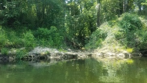
CATEGORIES: Spring
LAYER: Other
OWNERSHIP: Public, SRWMD, PARCEL 10-1S-11-1520-000-000
WATER BODY: Withlacoochee River
GAUGE: Madison
MILE: 3.68
ADDRESS: Right (south) bank, in the power line right of way. Madison County.
DESCRIPTION: Second magnitude spring flowing out of the right bank, on SRWMD land, in Twin Rivers State Forest, Madison County.
WEBSITE: http://publicfiles.dep.state.fl.us/FGS/FGS_Publications/B/B66_2004/
PHOTO: https://www.wwals.net/pictures/gretchen/2019-06-01–wwals-withlacoochee/20190601_122329.jpg
PHOTOSET: https://www.wwals.net/pictures/gretchen/2019-06-01–wwals-withlacoochee/#Powerline-Spring
PHOTO SOURCE: John S. Quarterman
PHONE NUMBER: (229) 242-0102
Suggestions: https://forms.gle/DipPgU2TP5atc2Rf9
Fairy Spring
CATEGORIES: Spring
LAYER: Other
GPS: 30.4148, -83.201328
OWNERSHIP: Public
WATER BODY: Withlacoochee River
GAUGE: Madison
MILE: 3.66
ADDRESS: Twin Rivers State Forest, Madison Co. Madison County.
DESCRIPTION: Spring with a short run flowing into the river, on SRWMD land, in Twin Rivers State Forest, Madison County.
WEBSITE: http://publicfiles.dep.state.fl.us/FGS/FGS_Publications/B/B66_2004/
OTHER REFERENCE: https://wwals.net/2014/07/30/video-withlacoochee-river-springs-sabal-trail-pipeline-cross/
PHOTOSET: https://wwals.net/2014/07/30/video-withlacoochee-river-springs-sabal-trail-pipeline-cross/
PHOTO SOURCE: Chris Mericle
Suggestions: https://forms.gle/DipPgU2TP5atc2Rf9
Corbett Spring

CATEGORIES: Spring
LAYER: Other
GPS: 30.4159, -83.199214
OWNERSHIP: Public
WATER BODY: Withlacoochee River
GAUGE: Madison
MILE: 3.53
ADDRESS: Left (north) bank, 0.15 miles downstream from SW 76th Blvd Power Line, below private property on SW 77th Blvd. Hamilton County.
DESCRIPTION: A second magnitude spring flowing out of the left bank. The riverbank above the high water line is private property.
WEBSITE: http://publicfiles.dep.state.fl.us/FGS/FGS_Publications/B/B66_2004/
OTHER REFERENCE: https://wwals.net/2014/08/27/resolution-14-10-hamilton-county-fl-19-august-2014/
PHOTO: https://www.wwals.net/pictures/gretchen/2019-06-01–wwals-withlacoochee/20190601_122645.jpg
PHOTOSET: https://www.wwals.net/pictures/gretchen/2019-06-01–wwals-withlacoochee/#Corbett-Spring
PHOTO SOURCE: John S. Quarterman
PHONE NUMBER: (229) 242-0102
PHOTO2: https://www.wwals.net/pictures/gretchen/2019-06-01–wwals-withlacoochee/IMG_3784.jpg
Photoset2: https://www.wwals.net/pictures/gretchen/2019-06-01–wwals-withlacoochee/#Corbett-Spring
PHOTO2 SOURCE: John S. Quarterman
Photo2 Phone Number: 229-242-0102
Suggestions: https://forms.gle/DipPgU2TP5atc2Rf9

Twin Rivers Ellaville

CATEGORIES: Public Land
LAYER: Other
GPS: 30.40639, -83.188809
OWNERSHIP: Public, SRWMD, PARCEL 11-1S-11-1524-000-000
WATER BODY: Withlacoochee River
GAUGE: Lee
MILE: 3.19
ADDRESS: On the north side of FL 141 (Myrrh Road), about a quarter mile west of the Withlacoochee River. Madison County.
DESCRIPTION: Land entrance for Ellaville Landing and recreation site.
WEBSITE: wwals.net/pictures/2020-10-01—ellaville-tract
OTHER REFERENCE: https://map.mysuwanneeriver.com/tracts/ellaville-58/
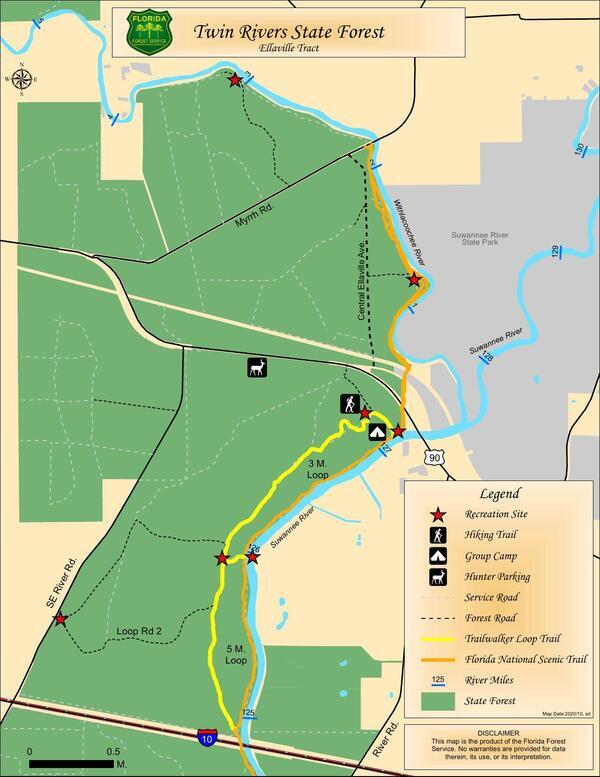
PHOTOSET: https://www.wwals.net/pictures/2020-10-01–ellaville-tract/
PHOTO SOURCE: Florida Forest Service
PHONE NUMBER: (850) 290-2350
PHOTO2: https://www.wwals.net/pictures/2020-10-01–ellaville-tract/2022-12-04–srwmd-ellaville-tract.jpg
Photoset2: https://www.wwals.net/pictures/2020-10-01–ellaville-tract/
PHOTO2 SOURCE: SRWMD
Suggestions: https://forms.gle/DipPgU2TP5atc2Rf9

Ellaville Landing
CATEGORIES: Landing
LAYER: Other
GPS: 30.41629, -83.194495
OWNERSHIP: Public, SRWMD, PARCEL 11-1S-11-1524-000-000
ACCESS: Yes, Launch: riverside off of dirt access road, PARKING: Free, PICNIC AREA
WATER BODY: Withlacoochee River
GAUGE: Lee
MILE: 3.19
ADDRESS: Right bank, a mile upstream from FL 141 (Myrrh Rd.); half a mile upstream from Melvin Shoals. Land entrace off of FL 141; see Twin Rivers Ellaville. Madison County.
DESCRIPTION: Last place to take out before Melvin Shoals. At a recreation area area in the Ellaville Tract of Twin Rivers State Park.
WEBSITE: wwals.net/pictures/2020-10-01—ellaville-tract
OTHER REFERENCE: https://map.mysuwanneeriver.com/tracts/ellaville-58/
PHOTOSET: https://www.wwals.net/pictures/2020-10-01–ellaville-tract/
PHOTO SOURCE: Florida Forest Service
PHONE NUMBER: (850) 290-2350
PHOTO2: https://www.wwals.net/pictures/2020-10-01–ellaville-tract/2022-12-04–srwmd-ellaville-tract.jpg
Photoset2: https://www.wwals.net/pictures/2020-10-01–ellaville-tract/
PHOTO2 SOURCE: SRWMD
Suggestions: https://forms.gle/DipPgU2TP5atc2Rf9
Melvin Snack Beach

CATEGORIES: Point Of Interest
LAYER: Point of Interest
OWNERSHIP: Public, SRWMD, PARCEL 11-1S-11-1524-000-000
WATER BODY: Withlacoochee River
GAUGE: Lee
MILE: 3.10
ADDRESS: Right (south) bank, a quarter mile before Melvin Shoals, 0.58 miles below the SW 76th Blvd Power Line, and 5.15 miles downstream from Allen Ramp. Madison County.
DESCRIPTION: A convenient place to snack on SRWMD land and swim before tackling Melvin Shoals.
WEBSITE: https://www.wwals.net/pictures/gretchen/2019-06-01–wwals-withlacoochee/#Snacks-before-shoals
PHOTO: https://www.wwals.net/pictures/gretchen/2019-06-01–wwals-withlacoochee/20190601_130237.jpg
PHOTOSET: https://www.wwals.net/pictures/gretchen/2019-06-01–wwals-withlacoochee/#Snacks-before-shoals
PHOTO SOURCE: John S. Quarterman
PHONE NUMBER: (229) 242-0102
Suggestions: https://forms.gle/DipPgU2TP5atc2Rf9
Melvin Shoals

CATEGORIES: Shoal
LAYER: Other
OWNERSHIP: Public, SRWMD, PARCEL 11-1S-11-1524-000-000
WHITEWATER CLASS: Class II
WATER BODY: Withlacoochee River
Lowest boatable: 30′
GAUGE: Lee
MILE: 2.82
ADDRESS: 5.43 miles downstream from Allen Ramp and 0.86 miles downstream from the SW 76th Blvd Power Line. Madison, Hamilton Counties.
DESCRIPTION: The last major shoals before the Withlacoochee meets the Suwannee. May have to be ported around at times of low water (below 30′ at Ellaville gauge). The center channel has proven to be the best route when paddling thru the shoal. Accessible by land through SRWMD woods road near West Bridge (FL 141) in Madison County.
AKA: Big Melvin or Melvin’s Shoals
WEBSITE: https://news.google.com/newspapers?nid=1320&dat=20000518&id=mVFWAAAAIBAJ&sjid=bewDAAAAIBAJ&pg=4424, 4567358&hl=en
PHOTO: https://www.wwals.net/pictures/gretchen/2019-06-01–wwals-withlacoochee/IMG_3789.jpg
PHOTOSET: https://www.wwals.net/pictures/gretchen/2019-06-01–wwals-withlacoochee/#Melvin-Shoals
PHOTO SOURCE: Gretchen Quarterman
PHONE NUMBER: (850) 290-2350
Suggestions: https://forms.gle/DipPgU2TP5atc2Rf9
Banjo sign

CATEGORIES: Point Of Interest
LAYER: Point of Interest
OWNERSHIP: Private, LECLERC JOSEE & ALAIN DANIEL, PARCEL 5077-050
WATER BODY: Withlacoochee River
GAUGE: Lee
MILE: 2.45
ADDRESS: Left (north) bank, between Melvin Shoals and West Bridge. Hamilton County.
DESCRIPTION: Famous sign: “”Paddle faster; I hear banjos””.
WEBSITE: https://www.wwals.net/pictures/gretchen/2019-06-01–wwals-withlacoochee/#Famous-sign
PHOTO: https://www.wwals.net/pictures/gretchen/2019-06-01–wwals-withlacoochee/IMG_3794.jpg
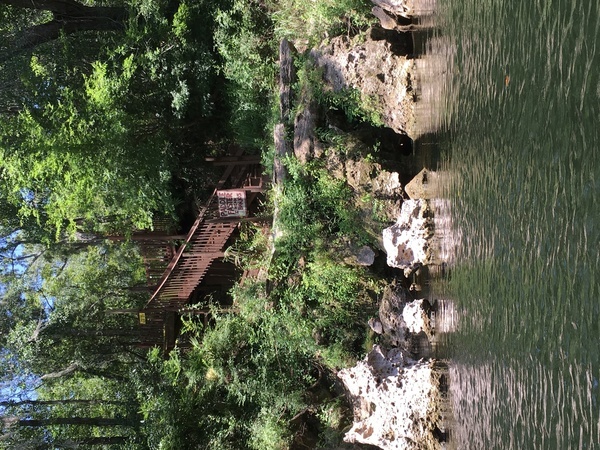
PHOTOSET: https://www.wwals.net/pictures/gretchen/2019-06-01–wwals-withlacoochee/#Famous-sign
PHOTO SOURCE: Gretchen Quarterman
PHONE NUMBER: (850) 290-2350
Suggestions: https://forms.gle/DipPgU2TP5atc2Rf9
“Ellaville, West Lake & Jennings RR Bridge”

CATEGORIES: Railbridgesite
LAYER: Bridge
OWNERSHIP: Public, SRWMD, PARCEL 11-1S-11-1524-000-000
WATER BODY: Withlacoochee River
GAUGE: Lee
MILE: 2.45
ADDRESS: Right (south) bank, a quarter mile upstream from and within sight of West Bridge. Madison County.
DESCRIPTION: Massive concrete piling from the Ellaville, West Lake & Jennings Railroad, according to Ken Sulak.
HISTORIC FACTS: “”The West brothers operated a mill at West Lake, brought in logs from the Ellaville area to the SW and Jennings area to the NE. A shortline lumber Railroad. ram’s 1902 Map FCIT labels this ‘Withlacoochee Bridge’. 17 Oct 2020 KJS exploration found many vertical timber pilings cutoff and remaining in riverbed near concrete piers, and some midriver. Trestle originally timber, rebuilt on site with massive concrete pyramid piers and steel strut span.”” –Ken Sulak https://wwals.net/2022/11/28/ellaville-westlake-jennings-rr-bridge-withlacoochee-river-fl-141-2022-11-26/
OTHER REFERENCE: http://www.railwaystationlists.co.uk/pdfusarr/floridarrs.pdf
PHOTO: https://www.wwals.net/pictures/gretchen/2019-06-01–wwals-withlacoochee/P6011026.jpg
PHOTOSET: https://www.wwals.net/pictures/gretchen/2019-06-01–wwals-withlacoochee/#Old-CR-141-bridge-piling
PHOTO SOURCE: Gretchen Quarterman
PHONE NUMBER: (850) 290-2350
PHOTO2: https://www.wwals.net/pictures/gretchen/2019-06-01–wwals-withlacoochee/IMG_3797.jpg
Photoset2: https://www.wwals.net/pictures/gretchen/2019-06-01–wwals-withlacoochee/#Old-CR-141-bridge-piling
PHOTO2 SOURCE: Gretchen Quarterman
Suggestions: https://forms.gle/DipPgU2TP5atc2Rf9

SE 44th Ave. Power Line

CATEGORIES: Power Line
LAYER: Point of Interest
OWNERSHIP: Public
WATER BODY: Withlacoochee River
GAUGE: Lee
MILE: 2.29
ADDRESS: 400 feet upstream from West Bridge. Madison, Hamilton Counties.
DESCRIPTION: A sight to see just before West Bridge. The right (south) bank is on SRWMD land.
WEBSITE: https://www.wwals.net/pictures/gretchen/2019-06-01–wwals-withlacoochee/#SE-44th-Ave-Power-Line
PHOTO: https://www.wwals.net/pictures/gretchen/2019-06-01–wwals-withlacoochee/IMG_3802.jpg
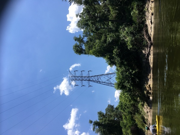
PHOTOSET: https://www.wwals.net/pictures/gretchen/2019-06-01–wwals-withlacoochee/#SE-44th-Ave-Power-Line
PHOTO SOURCE: Gretchen Quarterman
PHONE NUMBER: (850) 290-2350
Suggestions: https://forms.gle/DipPgU2TP5atc2Rf9
Lee Bowstring Bridge site

CATEGORIES: Bridgesite
LAYER: Bridge
GPS: 30.4101, -83.180236
OWNERSHIP: Public
WATER BODY: Withlacoochee River
GAUGE: Lee
MILE: 2.21
ADDRESS: Right (west) bank, under the current West Bridge. Madison, Hamilton Counties.
DESCRIPTION: Almost vertical Lally column remaining from a two-span built sometime around 1898-1908 according to Ken Sulak. Probably one of only two steel bowstring bridges built in Florida.
HISTORIC FACTS: “”…the Lee Bridge had to be built no earlier than 1898. Only two such bowstring design bridges were built in Florida as far as I can determine. Maybe the Lee Bridge built sometime between 1898-1908…?”” –Ken Sulak https://wwals.net/2022/11/28/ellaville-westlake-jennings-rr-bridge-withlacoochee-river-fl-141-2022-11-26/
PHOTO: https://www.wwals.net/pictures/2022-11-26–ewj-rr-bridge/lee-bridge-lally-column.jpg
PHOTOSET: https://www.wwals.net/pictures/2022-11-26–ewj-rr-bridge/#LB
PHOTO SOURCE: Ken Sulak
PHONE NUMBER: (850) 290-2350
Suggestions: https://forms.gle/DipPgU2TP5atc2Rf9
West Bridge

CATEGORIES: Bridge
LAYER: Bridge
OWNERSHIP: Public
WATER BODY: Withlacoochee River
GAUGE: Lee
MILE: 2.21
ADDRESS: 7.3 miles east of Lee, FL on FL 141, 1.8 road miles northeast of US 90, and 2.21 miles upstream from WIthlacoochee River Confluence. Madison, Hamilton Counties.
DESCRIPTION: 400.9 ft. 6-span prestressed concrete stringer bridge, built in 1971 over Withlacoochee River.
AKA: NE Myrhh St. Bridge or (erroneously) CR 141 Bridge
WEBSITE: https://bridgereports.com/1082033
OTHER REFERENCE: https://en.wikipedia.org/wiki/Withlacoochee_River_(Suwannee_River)
PHOTO: https://www.wwals.net/pictures/gretchen/2019-06-01–wwals-withlacoochee/IMG_3804.jpg
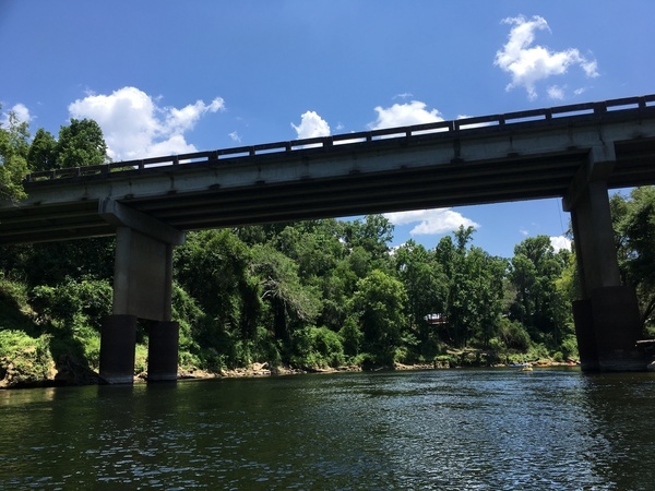
PHOTOSET: https://www.wwals.net/pictures/gretchen/2019-06-01–wwals-withlacoochee/#CR-141-Bridge
PHOTO SOURCE: Gretchen Quarterman
PHONE NUMBER: (850) 290-2350
Suggestions: https://forms.gle/DipPgU2TP5atc2Rf9
Lee Gauge
CATEGORIES: River Gauge
LAYER: River Gauge
OWNERSHIP: Public
WATER BODY: Withlacoochee River
Lowest boatable: 29.5′
Highest safe: 44′
GAUGE: Lee
MILE: 2.20
ADDRESS: On downstream (south) side of West Bridge on FL 141 and Myrrh Road, 2.3 mi upstream from mouth, and 7.3 mi east of Lee. Madison County.
DESCRIPTION: USGS 02319394, USGS gives coordinates north of the bridge, but the Lee Gauge is visible on the south side of West Bridge.
WEBSITE: https://wwals.net/2014/05/06/flooding-charts-2/#Lee
PHOTO: https://goo.gl/maps/sgNNJXN2atUue5o59
PHOTOSET: https://www.google.com/maps/place/30%C2%B025’24.8%22N+83%C2%B013’18.5%22W/@30.410143, -83.1801855, 58m/data=!3m1!1e3!4m5!3m4!1s0x0:0x6384f24ec927d0fb!8m2!3d30.42355!4d-83.2218
PHOTO SOURCE: Google Streetview
PHONE NUMBER: (850) 290-2350
PHOTO2: http://waterwatch.usgs.gov/wwapps/ww_chart.php?i=nwis&vt=uv&site_no=02319394&p_cd=00065
Photoset2: https://wwals.net/2014/05/06/flooding-charts-2/
PHOTO2 SOURCE: WWALS
Suggestions: https://forms.gle/DipPgU2TP5atc2Rf9
Withlacoochee River Campsite
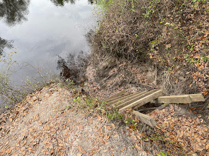
CATEGORIES: Landing
LAYER: Other
GPS: 30.398186, -83.17501
OWNERSHIP: Public, SRWMD, PARCEL 13-1S-11-1526-000-000
ACCESS: Yes, Stairs: a wooden pallet on a riverside slope off of dirt access road, CAMPING, PARKING: Free, PICNIC AREA
WATER BODY: Withlacoochee River
GAUGE: Lee
MILE: 1.31
ADDRESS: Right bank, almost a mile downstream from West Bridge. 650 NE Ellaville Central Ave., Lee, FL, turn south from FL 141 a few hundred feet west of West Bridge, continue until the left turn for the site. Madison County.
DESCRIPTION: “There is 1 picnic table and a small make shift grill / fire pit. A trail that leads down to the river except the last 2 feet. A wooden pallet has been transformed into a adder / stair case to the landing by the river. Mosquitoes are terrible so make sure to bring your OFF. OTHER than that quiet, peaceful and definitely secluded.”” —Jerri Moore Dutton, 2021, via google maps, “”Nice remote campsite along the river. Quiet and isolated. Easy access to the river and trails.”” —Jay Boucher, March 2022, via google maps
WEBSITE: https://www.google.com/maps/place/Withlacoochee+River+Campsite/@30.3979967, -83.1760324, 215m/data=!3m1!1e3!4m7!3m6!1s0x88eeebb4f7bd47ab:0x8348db2bbdd8eb3a!8m2!3d30.398198!4d-83.1750105!9m1!1b1
OTHER REFERENCE: https://map.mysuwanneeriver.com/tracts/ellaville-58/
PHOTO: https://lh5.googleusercontent.com/p/AF1QipOEJ5KjGeFNfBpPa0KPrsrlrDF7eBUaCdW3vWfB=w408-h306-k-no
PHOTOSET: https://goo.gl/maps/QhvqLbnj1ZFnYDWLA
PHOTO SOURCE: Jay Boucher
PHONE NUMBER: (850) 290-2350
Photoset2: https://www.wwals.net/pictures/2020-10-01–ellaville-tract/
PHOTO2 SOURCE: SRWMD
Suggestions: https://forms.gle/DipPgU2TP5atc2Rf9
Twin Rivers State Forest

CATEGORIES: Public Land
LAYER: Hiking Trail
OWNERSHIP: Public
WATER BODY: Withlacoochee River
MILE: 0.50
ADDRESS: 14798 East Hwy US 90, Lee, FL 32059, Hamilton, Madison, Suwannee Counties.
DESCRIPTION: Extensive park system up the Withlacoochee River and down from its confluence with the Suwannee River.
PHOTO SOURCE: FDACS
PHONE NUMBER: (850) 290-2350
Suggestions: https://forms.gle/DipPgU2TP5atc2Rf9
Drew Mansion Site

CATEGORIES: Point Of Interest
LAYER: Other
GPS: 30.39218, -83.18306
OWNERSHIP: Public, SRWMD, PARCEL 14-1S-11-1528-000-000
WATER BODY: Withlacoochee River
MILE: 0.81
ADDRESS: West of CR 277, just north of the railroad. Madison County.
DESCRIPTION: Not much but a bit of foundation left. There’s also a graveyard nearby.
HISTORIC FACTS: A two-story mansion with formal gardens, constructed starting in 1868, by Florida Governor George F. Drew, in the logging town he founded, Ellaville, Florida, named after his African-American servant, Ella.
WEBSITE: https://www.youtube.com/watch?v=EBWJDJldb9o
PHOTO: https://www.floridamemory.com/fpc/general/n030190.jpg
PHOTOSET: http://www.floridamemory.com/items/show/139764
PHOTO SOURCE: Florida Memory
PHONE NUMBER: (850) 290-2350
Suggestions: https://forms.gle/DipPgU2TP5atc2Rf9
Suwannacoochee Spring

CATEGORIES: Spring
LAYER: Other
GPS: 30.3866, -83.1717
OWNERSHIP: Public
WATER BODY: Withlacoochee River
GAUGE: Lee
MILE: 0.04
ADDRESS: Just upstream from the Withlacoochee River Confluence with the Suwannee River. Madison County.
DESCRIPTION: Spring with old grist mill ruins.
WEBSITE: https://wwals.net/2015/01/31/springs-flow-suwannee-river-next-withlacoochee-river/
PHOTO: https://www.wwals.net/pictures/gretchen/2019-06-01–wwals-withlacoochee/P6011051.jpg
PHOTOSET: https://www.wwals.net/pictures/gretchen/2019-06-01–wwals-withlacoochee/#Suwanacoochee-Spring
PHOTO SOURCE: Gretchen Quarterman
PHONE NUMBER: (850) 290-2350
Photoset2: https://wwals.net/2015/01/31/springs-flow-suwannee-river-next-withlacoochee-river/
PHOTO2 SOURCE: SRWMD
Suggestions: https://forms.gle/DipPgU2TP5atc2Rf9

Suwannee Canoe Outpost
CATEGORIES: Outfitter
LAYER: Brochure
GPS: 30.4058, -82.948765
OWNERSHIP: Private
ACCESS: Yes, Ramp: Concrete, CANOE, CAMPING: “Yes, Outposts, Outpost toilet, PARKING: Free, SHELTER, PICNIC AREA, HANDICAPPED ACCESSIBLE
WATER BODY: Suwannee River
GAUGE: Suwannee Springs
MILE: 148.50
ADDRESS: 2461 95th Dr, Live Oak, FL 32060, Suwannee County.
DESCRIPTION: On the left bank: “”The Suwannee Canoe Outpost is the original premier canoe outfitter on the Suwannee River! We have been at our current location in the Spirit of the Suwannee Music Park since 1993. We are fortunate to be located at a boat ramp, so we can maximize customer satisfaction while minimizing shuttle times! We offer canoe rental and shuttle service on three of the most exciting and remote rivers in Florida, the Suwannee, North Withlacoochee, and Alapaha Rivers!
HISTORIC FACTS: The oldest outfitter in the Suwannee River Basin.
GRN: Yes
WEBSITE: http://shop.suwanneeoutpost.com/
PHOTO: https://wwals.net/pictures/2018-02-18–ga-37-withlacoochee/20180218_084006.jpg
PHOTOSET: https://wwals.net/pictures/2018-02-18–ga-37-withlacoochee/
PHOTO SOURCE: John S. Quarterman
PHONE NUMBER: (386) 364-4991
PHOTO2: https://www.wwals.net/pictures/2020-10-16–suwannee-fl-6-sl/20201016_151342.jpg
Photoset2: https://www.wwals.net/pictures/2020-10-16–suwannee-fl-6-sl/
PHOTO2 SOURCE: John S. Quarterman
Photo2 Phone Number: 229-242-0102
Suggestions: https://forms.gle/DipPgU2TP5atc2Rf9

Suwannee River State Park Ramp
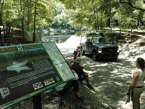
CATEGORIES: Landing
LAYER: Brochure
GPS: 30.3877, -83.1688
OWNERSHIP: Public, SRWMD
ACCESS: Yes, Launch: Concrete, CAMPING, WATER, RESTROOMS, PARKING: $5.00/vehicle, SHELTER, PICNIC AREA
WATER BODY: Suwannee River
GAUGE: Ellaville
MILE: 127.70
ADDRESS: Left bank, 3631 201st Path, Live Oak, FL 32060, Suwannee County.
DESCRIPTION: Slightly upstream from the Withlacoochee River Confluence with the Suwannee River.
WEBSITE: https://www.floridastateparks.org/park/Suwannee-River
DOWNSTREAM: 3.30 miles from Suwannee River State Park Ramp to Anderson Spring Launch
PHOTO: https://wwals.net/wp-content/themes/pianoblack/img//2015/08/69d2ffd7fa67b505d9a5ee0658c5e8f31.jpg
PHOTO SOURCE: John S. Quarterman
PHONE NUMBER: (229) 242-0102
Suggestions: https://forms.gle/DipPgU2TP5atc2Rf9
NE end Ellaville log boom

CATEGORIES: Point Of Interest
LAYER: Point of Interest
OWNERSHIP: Public
WATER BODY: Suwannee River
GAUGE: Ellaville
MILE: 127.54
ADDRESS: On the left (east) bank of the mouth of the Withlacoochee River. Hamilton County.
DESCRIPTION: Site of one end of the log boom that caught pine trees floated down the Withlacoochee River.
HISTORIC FACTS: The log boom fed the timber mill that was the prosperity of Ellaville.
WEBSITE: https://wwals.net/2022/12/01/county-bridge-hillman-bridge-suwannee-river-2022-11-26/
PHOTOSET: https://www.wwals.net/pictures/2022-11-26–county-bridge-hillman-bridge-suwannee-river/#Maps
PHOTO SOURCE: Ken Sulak
PHONE NUMBER: (850) 290-2350
Suggestions: https://forms.gle/DipPgU2TP5atc2Rf9
Withlacoochee River Confluence
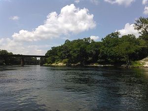
CATEGORIES: Tributary
LAYER: Brochure
OWNERSHIP: Public
WATER BODY: Suwannee River
GAUGE: Ellaville
MILE: 127.50
ADDRESS: About a quarter mile past the ranger station, a high bluff overlooks the spot where the Withlacoochee River comes in river right to join the Suwannee River about a thousand feet downstream from SRSP Boat Ramp, on its way to the Gulf of Mexico. Hamilton, Madison, Suwannee Counties.
DESCRIPTION: The tea-colored tannic acid water of the Withlacoochee River quickly gets lost in the deeper blackwater Suwannee River.
WEBSITE: https://www.floridastateparks.org/park/Suwannee-River
PHOTO: https://wwals.net/wp-content/themes/pianoblack/img//2015/08/998b9be46550e514053d60b9cf7c438c1.jpg
PHOTO SOURCE: John S. Quarterman
PHONE NUMBER: (229) 242-0102
Suggestions: https://forms.gle/DipPgU2TP5atc2Rf9
NW end Ellaville log boom
CATEGORIES: Point Of Interest
LAYER: Point of Interest
OWNERSHIP: Public
WATER BODY: Suwannee River
GAUGE: Ellaville
MILE: 127.50
ADDRESS: On the right (west) bank of the mouth of the Withlacoochee River. Madison County.
DESCRIPTION: Site of one end of the log boom that caught pine trees floated down the Withlacoochee River.
HISTORIC FACTS: The log boom fed the timber mill that was the prosperity of Ellaville.
WEBSITE: https://wwals.net/2022/12/01/county-bridge-hillman-bridge-suwannee-river-2022-11-26/
PHOTOSET: https://www.wwals.net/pictures/2022-11-26–county-bridge-hillman-bridge-suwannee-river/#Maps
PHOTO SOURCE: Ken Sulak
PHONE NUMBER: (850) 290-2350
Suggestions: https://forms.gle/DipPgU2TP5atc2Rf9
Ellaville Suwannee River Ferry
CATEGORIES: Ferry
LAYER: Bridge
OWNERSHIP: Public
WATER BODY: Suwannee River
GAUGE: Ellaville
MILE: 127.49
ADDRESS: Just upstream from the Ellaville Gauge. Madison, Suwannee Counties.
DESCRIPTION: Site of the ferry before the County Bridge and the Hillman Bridge.
HISTORIC FACTS: Before the County Bridge was built in 1908, this ferry was the method to cross the Suwannee River below Ellaville.
WEBSITE: https://wwals.net/2022/12/01/county-bridge-hillman-bridge-suwannee-river-2022-11-26/
PHOTOSET: https://www.wwals.net/pictures/2022-11-26–county-bridge-hillman-bridge-suwannee-river/#Maps
PHOTO SOURCE: Ken Sulak
PHONE NUMBER: (850) 290-2350
Suggestions: https://forms.gle/DipPgU2TP5atc2Rf9
Ellaville Gauge

CATEGORIES: River Gauge
LAYER: River Gauge
OWNERSHIP: Public, TIITF/REC & PARKS & PARKS SUWANNEE RIVER ST PK, PARCEL 24-01S-11E-10898-000000 (90)
WATER BODY: Suwannee River
GAUGE: Ellaville
MILE: 127.49
ADDRESS: Left bank, just upstream from CSX RR bridge, upstream from Hillman Bridge and US 90. Suwannee County.
DESCRIPTION: USGS 02319500 SUWANNEE RIVER AT ELLAVILLE, FLA
HISTORIC FACTS: “”The fact that the gauge station is right next to the old bridge site tells me that the gauge station was put in place also in 1908. It was left there but rebuilt in 1925 when the Hillman Bridge was built further downstream.”” —Ken Sulak
WEBSITE: https://water.weather.gov/ahps2/hydrograph.php?wfo=tae&gage=ellf1
PHOTO: https://water.weather.gov/resources/hydrographs/ellf1_hg.png
PHOTOSET: https://water.weather.gov/ahps2/hydrograph.php?gage=ellf1&wfo=tae
PHOTO SOURCE: National Weather Service
PHONE NUMBER: (850) 290-2350
Suggestions: https://forms.gle/DipPgU2TP5atc2Rf9
Ellaville County Bridge Site

CATEGORIES: Bridge
LAYER: Bridge
OWNERSHIP: Public, TIITF/REC & PARKS & PARKS SUWANNEE RIVER ST PK, PARCEL 24-01S-11E-10898-000000 (90)
WATER BODY: Suwannee River
GAUGE: Ellaville
MILE: 127.49
ADDRESS: Just upstream from the CSX RR Bridge on the left (south) bank is a remaining abutment of the Ellaville County Bridge. Madison, Suwannee Counties.
DESCRIPTION: “”The County Bridge rested upon concrete abutments and lally column supports, but there were also some tall timber pilings on the Madison County (north) side. A few of these very tall timber pilings still remain submerged in the river next to the base of the old County Bridge. Used to be about 8 of these in the mid-1990s. At least 2 remain and can be seen easily at very low water.”” —Ken Sulak
HISTORIC FACTS: Built in 1908 to replace the ferry. Itself replaced by the Hillman Bridge in 1928.
AKA: Ellaville County Bridge
WEBSITE: https://wwals.net/2022/12/01/county-bridge-hillman-bridge-suwannee-river-2022-11-26/
PHOTOSET: https://www.wwals.net/pictures/2022-11-26–county-bridge-hillman-bridge-suwannee-river/#CB
PHOTO SOURCE: Ken Sulak
PHONE NUMBER: (850) 290-2350
Photoset2: https://www.wwals.net/pictures/2022-11-26–county-bridge-hillman-bridge-suwannee-river/#Maps
PHOTO2 SOURCE: Ken Sulak
Suggestions: https://forms.gle/DipPgU2TP5atc2Rf9
CSX RR Bridge

CATEGORIES: Railbridge
LAYER: Bridge
OWNERSHIP: Public
WATER BODY: Suwannee River
GAUGE: Ellaville
MILE: 127.44
ADDRESS: 370 feet downstream from the Withlacoochee River Confluence. Madison, Suwannee Counties.
DESCRIPTION: Bridge actively used by CSX Railroad. Formerly the Pensacola and Georgia Railroad.
WEBSITE: https://www.wwals.net/pictures/gretchen/2019-06-01–wwals-withlacoochee/#Suwannee-River
PHOTO: https://www.wwals.net/pictures/gretchen/2019-06-01–wwals-withlacoochee/P6011062.jpg
PHOTOSET: https://www.wwals.net/pictures/gretchen/2019-06-01–wwals-withlacoochee/#Suwannee-River
PHOTO SOURCE: Gretchen Quarterman
PHONE NUMBER: (850) 290-2350
PHOTO2: https://www.wwals.net/pictures/gretchen/2019-06-01–wwals-withlacoochee/P6011064.jpg
Photoset2: https://www.wwals.net/pictures/gretchen/2019-06-01–wwals-withlacoochee/#Suwannee-River
PHOTO2 SOURCE: Gretchen Quarterman
Suggestions: https://forms.gle/DipPgU2TP5atc2Rf9

Historic Hillman Bridge

CATEGORIES: Bridgehistoric
LAYER: Bridge
OWNERSHIP: Public
WATER BODY: Suwannee River
GAUGE: Ellaville
MILE: 127.31
ADDRESS: A fifth of a mile downstream from the Withlacoochee River Confluence, between the CSX RR Bridge and the US 90 Bridge, NE Drew Way, Live Oak, FL 32060, Madison, Suwannee Counties.
DESCRIPTION: Built 1926, abandoned 1983, 916.0-foot 3-span Metal 7 Panel Rivet-Connected Pratt Through Truss bridge over the Suwannee River.
HISTORIC FACTS: “”Hillman Bridge is a through truss bridge located in the small town of Ellaville, once a thriving sawmill and manufacturing center owned by George Franklin Drew, Florida’s governor between 1877 to 1881. Built as a federal aid project in 1925-1926 by the R.H.H. Blackwell Co. of East Aurora, N.Y., it was named “Hillman Bridge†during its construction after W.J. Hillman of Live Oak, a member of the State Road Department who had helped push for the construction of the bridge.”” https://www.abandonedfl.com/hillman-bridge/
AKA: Hillman Bridge or Old US 90 Bridge
WEBSITE: https://www.abandonedfl.com/hillman-bridge/
OTHER REFERENCE: https://historicbridges.org/bridges/browser/?bridgebrowser=florida/ellaville/
PHOTO: https://www.wwals.net/pictures/gretchen/2019-06-01–wwals-withlacoochee/P6011066.jpg
PHOTOSET: https://www.wwals.net/pictures/gretchen/2019-06-01–wwals-withlacoochee/#Suwannee-River
PHOTO SOURCE: Gretchen Quarterman
PHONE NUMBER: (850) 290-2350
Suggestions: https://forms.gle/DipPgU2TP5atc2Rf9
US 90 Suwannee River Bridge
CATEGORIES: Bridge
LAYER: Bridge
GPS: 30.3846, -83.17574
OWNERSHIP: Public
WATER BODY: Suwannee River
GAUGE: Ellaville
MILE: 127.24
ADDRESS: A quarter mile downstream from the Withlacoochee River Confluence. Madison, Suwannee Counties.
DESCRIPTION: 761.2 ft. 10-span prestressed concrete stringer bridge built in 1986 over the Suwannee River.
AKA: FL 10 Suwannee River Bridge
WEBSITE: https://bridgereports.com/1082061
PHOTO: https://goo.gl/maps/Jexnmzw2J44yykyu8
PHOTOSET: https://www.google.com/maps/@30.38497, -83.174671, 467m/data=!3m1!1e3
PHOTO SOURCE: Google streetview
PHONE NUMBER: (850) 290-2350
Suggestions: https://forms.gle/DipPgU2TP5atc2Rf9
Suwannee River Canoe Rental
CATEGORIES: Outfitter
LAYER: Brochure
OWNERSHIP: Private
WATER BODY: Suwannee River
GAUGE: Ellaville
MILE: 127.60
ADDRESS: 4404 193rd Dr, Live Oak, FL 32060, Suwannee County.
DESCRIPTION: Est. 1986.
GRN: No
WEBSITE: http://www.suwanneerivercanoerental.com/
PHOTOSET: http://www.suwanneerivercanoerental.com/About-Us.html
PHOTO SOURCE: Suwannee River Canoe Rental
PHONE NUMBER: (386) 364-4185
Suggestions: https://forms.gle/DipPgU2TP5atc2Rf9
Suwannee Plant Intake
CATEGORIES: Tributary
LAYER: Point of Interest
OWNERSHIP: Private, Duke Energy
WATER BODY: Suwannee River
GAUGE: Ellaville
MILE: 126.78
ADDRESS: 3880 River Rd, Live Oak, FL 32060, Suwannee County.
DESCRIPTION: Cooling water intake for natural gas power plant
WEBSITE: https://www.industrynet.com/listing/3810806/duke-energy-florida-inc-suwannee-river-plant
Suggestions: https://forms.gle/DipPgU2TP5atc2Rf9
Suwannee Plant
CATEGORIES: Point Of Interest
LAYER: Other
OWNERSHIP: Private, Duke Energy
WATER BODY: Suwannee River
GAUGE: Ellaville
MILE: 126.74
ADDRESS: 3880 River Rd, Live Oak, FL 32060, Suwannee County.
DESCRIPTION: The Duke Energy Suwannee River Natural gas power plant has 3 generators that generated 17.2 GWh during the 3-month period between September 2024 to December 2024.
HISTORIC FACTS: “”Peaking plant; all 3 gas turbines were retired in December 2016, reducing MW tot capacity to 155.”” https://www.industrynet.com/listing/3810806/duke-energy-florida-inc-suwannee-river-plant
WEBSITE: https://www.industrynet.com/listing/3810806/duke-energy-florida-inc-suwannee-river-plant
OTHER REFERENCE: https://www.gridinfo.com/plant/suwannee-river/638
Suggestions: https://forms.gle/DipPgU2TP5atc2Rf9
Suwannee Plant Outflow
CATEGORIES: Tributary
LAYER: Point of Interest
OWNERSHIP: Private, Duke Energy
WATER BODY: Suwannee River
GAUGE: Ellaville
MILE: 126.45
ADDRESS: 3880 River Rd, Live Oak, FL 32060, Suwannee County.
DESCRIPTION: Cooling water outflow from natural gas power plant
WEBSITE: https://www.industrynet.com/listing/3810806/duke-energy-florida-inc-suwannee-river-plant
Suggestions: https://forms.gle/DipPgU2TP5atc2Rf9
Suwannee Solar Plant

CATEGORIES: Solar
LAYER: Other
OWNERSHIP: Private, Duke Energy, PARCEL 25-01S-11E-1090700.0000
WATER BODY: Suwannee River
GAUGE: Ellaville
MILE: 127.36
ADDRESS: River Road, Live Oak, FL 32060, east across from Duke Suwannee River Power Plant. Suwannee County.
DESCRIPTION: 8.8 megawatt solar plant on 62 acres.
WEBSITE: https://wwals.net/2017/04/24/suwannee-bocc-approves-duke-solar-plant-2017-04-18/
PHOTO: http://wwals.com/wp-content/themes/pianoblack/img//2017/04/a6c027f5faee8c0ad55dbbabfa9592f5.jpg
PHOTOSET: https://wwals.net/2017/04/24/suwannee-bocc-approves-duke-solar-plant-2017-04-18/
PHOTO SOURCE: Suwannee County Property Appraiser
PHONE NUMBER: (850) 290-2350
PHOTO2: https://www.wwals.net/pictures/2025-12-20–pilgrims-pride-outfall-suwannee-river/20251220_113725.jpg
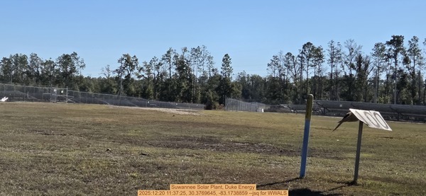
Photoset2: https://www.wwals.net/pictures/2025-12-20–pilgrims-pride-outfall-suwannee-river/
PHOTO2 SOURCE: John S. Quarterman
Suggestions: https://forms.gle/DipPgU2TP5atc2Rf9
Anderson Spring Launch
CATEGORIES: Landing
LAYER: Brochure
GPS: 30.352967, -83.18937
OWNERSHIP: Public
ACCESS: Yes, Launch: riverbank
WATER BODY: Suwannee River
GAUGE: Ellaville
MILE: 124.40
ADDRESS: From Live Oak, go west on US 90; turn left onto River Road; entrance to Anderson Springs will be on your right. Suwannee County.
UPSTREAM: 3.30 miles from Anderson Spring Launch to Suwannee River State Park Ramp
Suggestions: https://forms.gle/DipPgU2TP5atc2Rf9