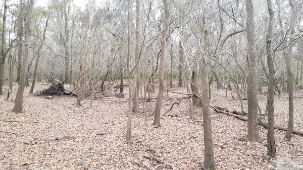
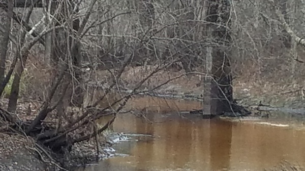
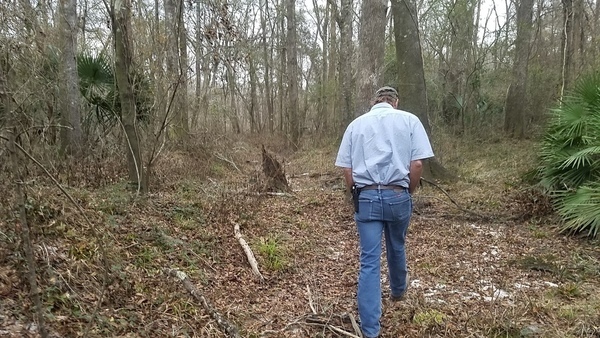
It could use some markers to keep people on it and off private property, and maybe some loaner kayak wheels, but there is public access to the Withlacoochee River off of Gornto Road in Valdosta.
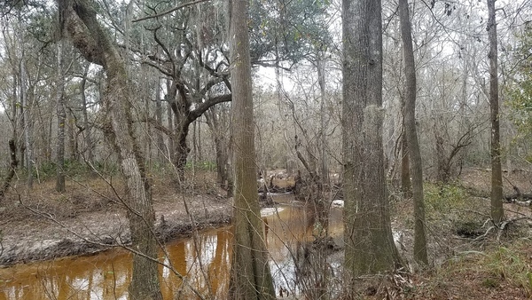
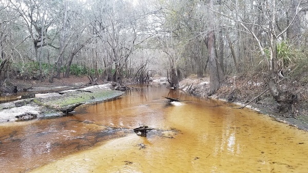
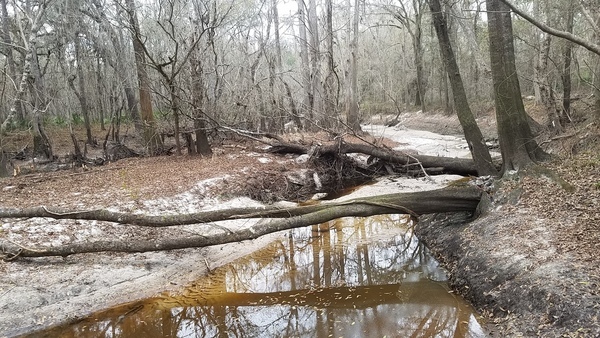
Tea-colored water, 16:22:37,, Withlacoochee River 30.8623900, -83.3224600
And a very nice blackwater river it is.

Movie: Upstream and down (15M),, Withlacoochee River 30.8623900, -83.3224500

TV monitor, 16:24:02,, Withlacoochee River 30.8623900, -83.3224600

Typical view, 16:24:03,, Withlacoochee River 30.8623900, -83.3224600
Nice yellow tannic acid river water, 16:26:51,, Tea-colored water 30.8620271, -83.3225940
It’s the very picture of a blackwater river.

Blackwater river winter, 16:26:55,, Tea-colored water 30.8620271, -83.3225940

Eddies, 16:27:03,, Tea-colored water 30.8620271, -83.3225940

Swirls, 16:27:06,, Tea-colored water 30.8620271, -83.3225940
It’s about 1300 feet (a quarter of a mile) from the road to the river, but you could easily wiggle back and forth a few more hundred feet to get there.
Looking back to Gornto, 16:17:16,, Walking down 30.8589737, -83.3211810
That’s nothing compared to hauling kayaks up and down the loose rock embankment at US 84 or the sand bank at Mayday, but it’s still a long way to drag a kayak.
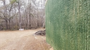
Looking down towards the river, 16:17:19,, Walking down 30.8589737, -83.3211810

Below the lift station, 16:17:41,, Walking down 30.8623900, -83.3224600
Tiny run, 16:17:50,, Wetlands 30.8623900, -83.3224600
So wheels would be useful.

Blocks to cross on, 16:18:05,, Wetlands 30.8623900, -83.3224700

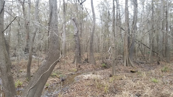
Titi and blackgum, 16:18:06,, Wetlands 30.8623900, -83.3224800

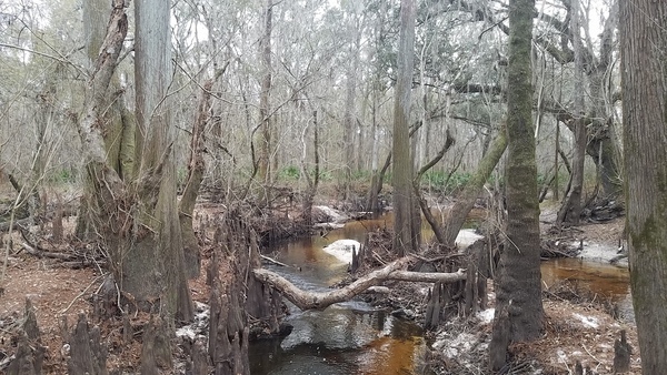
Plenty of cypress knees, 16:18:14,, Wetlands 30.8623900, -83.3224900

Deadfall, 16:20:09,, Downed tree 30.8603582, -83.3226704

Probably Hurricane Irma did this, 16:20:42,, Downed tree 30.8603580, -83.3226700
Lowndes County Tax Assessors,, Maps 30.8602300, -83.3237400
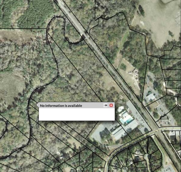
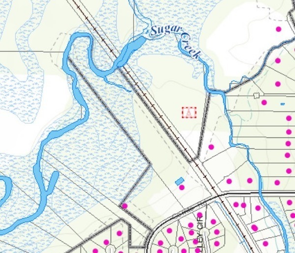
The Lowndes County Tax Assessors online database doesn’t know anything about this parcel, not even a parcel number. I called their office, and they don’t know who owns it.
VALOR GIS,, Maps 30.8593700, -83.3223500
VALOR GIS doesn’t know either, although it does show most of that sliver as NWI wetlands (and floodplain). Also note the grey line indicating Valdosta City Limits does not include that sliver of land.
Valdosta City Council districts, Maps
The City of Valdosta didn’t know, either, when I called them. Not even Larry Hanson knew.
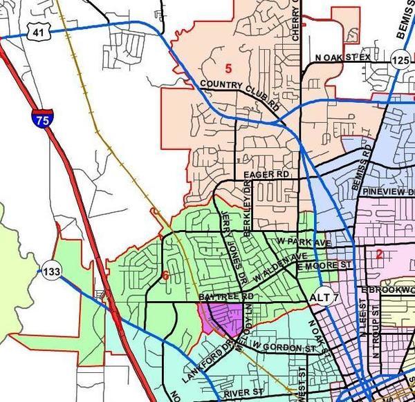
Valdosta’s City Council District Map also shows a cutout right up to Gornto Road, leaving that sliver in the county. It’s just outside City Council District 6, to which Andy Gibbs was just elected.
Lowndes County Commission districts, Maps
Nobody at the county knew when I called them.
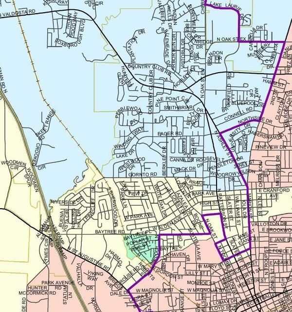
However, if nobody else owns it, presumably the county does. According to Lowndes County’s Commissioner District Map, it’s in District 3 (Mark Wisenbaker) and Super District 5 (Clay Griner). The jagged purple line is the boundary between Super District 5 (west) and Super District 4 (east). The green line is Valdosta City Limits. The Withlacoochee River is indicated in part as the boundary between County Commission District 3 and District 2 (Scottie Orenstein).
Google Streetview,, Maps 30.8585700, -83.3206000
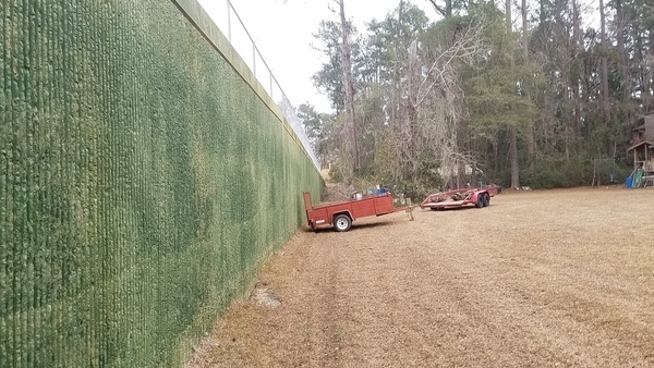
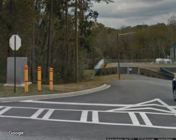
With google maps, 2410 Gornto Road, Valdosta, GA, gets you to the right place, which is just southwest of the entrance to the YMCA, below the fence of Valdosta’s big new sewer system pump station.
This pump station, pushing sewage uphill through a force main out of the local neighborhoods, is a key piece of Valdosta’s tens of million dollar plan, mostly now completed, to fix its sewage spills.

Google Maps,, Maps 30.8605700, -83.3240700

Google Maps Satellite,, Maps 30.8631000, -83.3216700
Thanks to Valdosta-Lowndes County Family YMCA, specifically Cheryl Maddox, Programs Director, and to Sidney Rigdon, Property Manager, for discovering this public access and organizing WWALS visiting it.
In a row, 16:24:08,, Deadfalls 30.8623900, -83.3224600
There are a few impediments to paddling.

Could get stuck on that, 16:24:18,, Deadfalls 30.8623900, -83.3224600

Open to the left, 16:25:41,, Deadfalls 30.8615425, -83.3226081

Movie: View of deadfalls, 16:39:20, (5.0M), Deadfalls 30.8615420, -83.3226080
Trash on deadfall, 16:27:26,, Paddling impediment 30.8620271, -83.3225940
Could use some cleanups.

Island, 16:27:28,, Paddling impediment 30.8620271, -83.3225940

Watch out for limbs, 16:27:23,, Paddling impediment 30.8620271, -83.3225940

Duck, 16:28:16,, Paddling impediment 30.8620271, -83.3225940

Trash on left bank, 16:28:25,, Paddling impediment 30.8620271, -83.3225940

Bigger limb to duck under, 16:28:27,, Paddling impediment 30.8620271, -83.3225940
Sand and oak arches, 16:28:29,, In the river 30.8620271, -83.3225940
When the water’s high, duck!

Cypress knees and river, 16:28:44,, In the river 30.8620271, -83.3225940

Sidney Rigdon (YMCA Property Manager), Bobby McKenzie (WWALS), Tom Potter (WWALS Board), 16:29:14,, In the river 30.8619291, -83.3225616
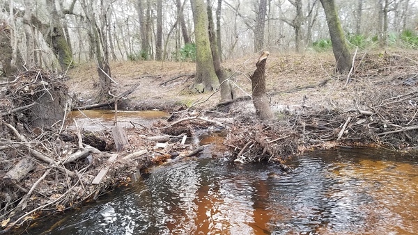
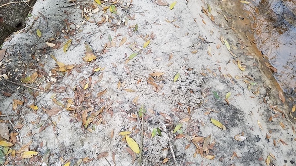
Tracks, 16:31:58,, Beaver 30.8629100, -83.3221510
Didn’t see any beaver dams, but there were other signs.

Gnaws, 16:32:31,, Beaver 30.8629110, -83.3221500
TV again, 16:35:55,, Heading back 30.8623900, -83.3224600
People could take their trash out with them.

Trash chair, 16:38:14,, Heading back 30.8623900, -83.3224500

Trash chair closeup, 16:51:05,, Heading back 30.8623900, -83.3224400

Hunting blind, 16:39:20,, Heading back 30.8626790, -83.3221928
RR bridge pylons, 16:42:07,, River near RR 30.8626557, -83.3222330
Norfolk Southern Railroad Bridge.

Railroad tracks, 16:37:29,, River near RR 30.8626555, -83.3222330

Deadfalls and foam, 16:41:59,, River near RR 30.8626557, -83.3222330

Foam closeup, 16:42:02,, River near RR 30.8626557, -83.3222330
That’s natural foam from tannic acid from oak leaves.
Upwards, 16:50:52,, Out 30.8627130, -83.3221936
And back out the way we came. Paddlers arriving from upstream could really use some markers to find their way to the egress.

Plenty of palmetto, 16:51:33,, Out 30.8627130, -83.3221930

Leaves and roots, 16:51:54,, Out 30.8627120, -83.3221936

Fence post, 16:52:16,, Out 30.8619591, -83.3219463

Four-wheeler trail, 16:52:28,, Out 30.8619591, -83.3219463

Runoff, 16:53:15,, Out 30.8619591, -83.3219460
Valdosta City Council
The next day, I explained the significance of this find to Valdosta’s Mayor and Council:
It turns out there is public access to the Withlacoochee River off of Gornto Road. That’s in Council Gibbs district, actually. There’s a little sliver of land just to the left of the lift station that actually, according to a map the YMCA has, has always been public access. So I regard that as good news.

Suwannee Riverkeeper John S. Quarterman to Valdosta Mayor and Council, 2018-01-25, courtesy Lowndes Area Knowledge Exchange (LAKE).You can put in at Langdale Park and paddle down, a nice short paddle. Or go down from there to what many people call the prison boat ramp, at Troupville Landing. There’s a number of possibilities there. Recreation on the river, right in Valdosta.
 I believe Mayor John Gayle agreed that was good news.
This area is also within the project area of the U.S. Army Corps of Engineers May 2014 proposal to put a levee at Sugar Creek, on the other side of the Norfolk Southern railroad bridge. Fortunately, the Valdosta City Council rejected that Corps plan. The Corps sought funding for a larger flooding study, but no funding has materialized. At least it’s pretty clear nobody will be building in that flood plain anymore.
It’s a welcome addition to the Withlacoochee and Little River Water Trail.
The idea of searching for access to the Withlacoochee River from Gornto Road came from Phil Hubbard, WWALS Outings Committee Chair. He couldn’t get off work for this hike to the river, but he’s involved in further activities here.
-jsq, John S. Quarterman, Suwannee RIVERKEEPER®
You can join this fun and work by becoming a WWALS member today!
Short Link:

