Spilling sewage into the Withlacoochee River apparently wasn’t enough
 for Valdosta: in February it also spilled three times into the
Alapaha River watershed.
At least once this was due to rains directly on Valdosta,
for which
the
levee proposed by the Army Corps of Engineers on Sugar Creek
at the Withlacoochee River wouldn’t help.
It’s time for Valdosta to move along with fixing its wastewater problems.
More transparency from Valdosta would also help.
And I, for one, would like to see that promised Corps flooding study
of the entire Suwannee River Basin.
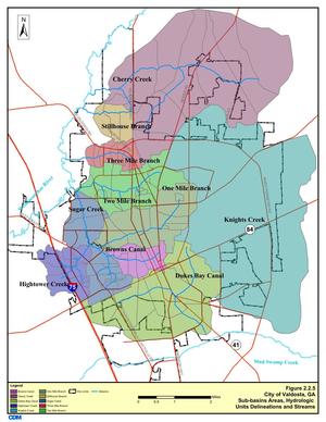
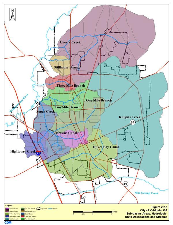
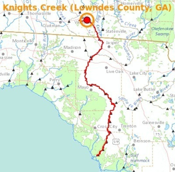
In three different reports in February, Valdosta mentioned sewage overflows into either Knights Creek or Dukes Bay Canal, without mentioning that those flow into Mud Swamp Creek, which joins with Grand Bay Creek to form the Alapahoochee River, which joins the Alapaha River, which flows into the Suwannee River. The Florida Department of Health apparently didn’t know that, since it didn’t mention the Alapaha River in its advisories for counties downstream. But Valdosta should know, according to its own SWMP Update Phase 1 Final Report, Section 2 Methodology, 2011-01-14, that about half of Valdosta is drained by Knights Creek and Dukes Bay Canal:
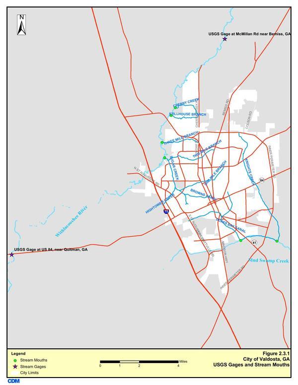
That same report includes a map of USGS Gages and Stream Mouths, which clearly shows the connections to Mud Swamp Creek:
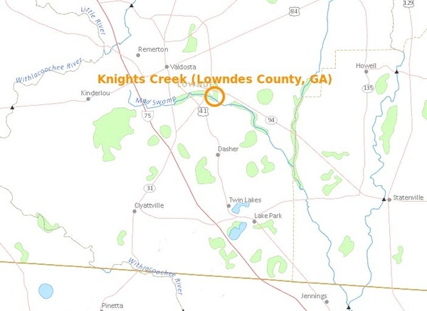
USGS Streamer shows Mud Swamp Creek joining with Grand Bay Creek to form the Alapahoochee River, which then joins the Alapaha River:
And Streamer shows the Alapaha River flowing into the Suwannee River, and on to the Gulf of Mexico:
Maybe the result is similar once the water gets to the Suwannee River, but residents in eastern Lowndes County, western Echols County, and eastern Hamilton County might be interested in being warned.
-jsq
Short Link:

Thank you for this information. I didn’t know we were having problems east of the city.
Valdosta is spending $32 million to move the Withlacoochee Wastewater Plant, that they hope to complete by next spring, I think, so they don’t continue to foul the river and watershed on the west side of the city.
Pingback: Withlacoochee River levels follow rainfall - WWALS Watershed Coalition
Pingback: Alapaha River precipitation and levels - WWALS Watershed Coalition