
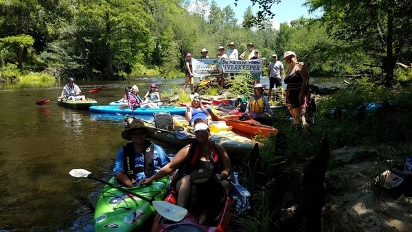
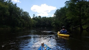
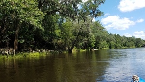
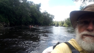
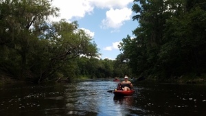
Nineteen paddlers had a good time on a breezy summer Withlacoochee River Saturday from Sullivan Launch to Madison Blue Spring. The water was a foot higher (41.27 feet) than two years ago (42.56 feet at the USGS Madison (FL 6) gage), but there were still plenty of rapids, which gained us three new Fallers!
 Say water bottle!
No, don’t, you’ll fall in!
Hm, but then
you’ll win a Fallers Award.
Say water bottle!
No, don’t, you’ll fall in!
Hm, but then
you’ll win a Fallers Award.
Every WWALS outing is also a cleanup, and we collected two bags of trash, at both landings and along the river in between.
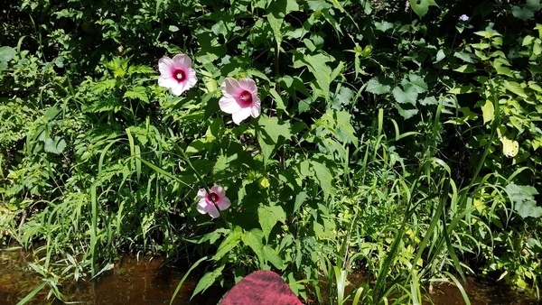
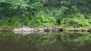
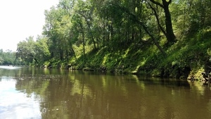
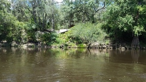
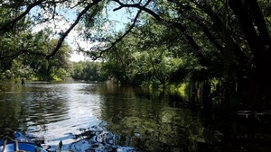
We saw a couple of springs, jumping fish, several turtles, a small variety of birds, longleaf, cypress, swamp mallow blooming, some invasive mimosa, and a stretch of both banks carpeted with Japanese climbing fern.
Here are some pictures, a few videos, and a link to pictures from two years ago. Also a Google map of pictures from this year and two years ago. Thanks to all who helped, especially expedition leader and WWALS Outings Chair Phil Hubbard.
Swamp mallow closeup, 30.5833956, -83.2625654
Each flower of swamp rosemallow, Hibiscus moscheutos, blooms for only one day. Sure, more may bloom, but if you missed the one day of the last bloom, you may have to wait ’till next June.
Movie: We have a swimmer, 30.5679200, -83.2608200

Longleaf above boater, west bank, 30.5669300, -83.2599300

Turtle on west bank, 30.5632100, -83.2572100

Shirley gets her boat in Hardee Spring, 30.5446892, -83.2511847

Mimosa, Albizia julibrissin Durazz, 30.5368461, -83.2467964

Boath banks coated with climbing fern, 30.5321984, -83.2488966

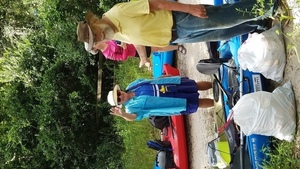
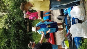
Kerry Sullivan with trash we collected (Shirley Kokidko in background), 30.4801400, -83.2446600

Tom Potter (drink can), Julie Bowland (fishing float), Shirley Kokidko (puzzled expression), jsq with trash collected, 30.4801200, -83.2448200

Phil Hubbard, and three new Fallers, 30.4801100, -83.2448800
Two of them were overachievers who fell in twice. Phil Hubbard designed and made the WWALS Faller Award they received. Not sold in stores! You can only get it by falling in on a WWALS Outing. No, swimming doesn’t count.

-jsq, John S. Quarterman, Suwannee RIVERKEEPER®
You can join this fun and work by becoming a WWALS member today!
Pictures
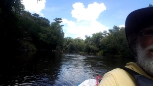
These pictures are by John S. Quarterman. See also the excellent photographs on facebook by Julie Bowland.

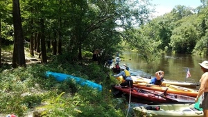
Twin Rivers State Forest, Sullivan Landing, 5776 NE Bellville Road, 30.5961364, -83.2621522
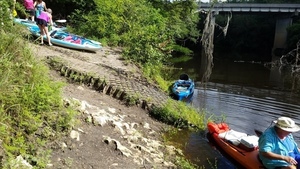
Julies on the river, more getting ready, 30.5960199, -83.2598133

More boats preparing, 30.5959054, -83.2598005

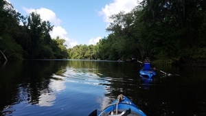
Boats pouring into the Withlacoochee River, 30.5958765, -83.2591289

A dock, 30.5956600, -83.2591600

Remains of Belleville Bridge, Hamilton County, FL, 30.5955000, -83.2591400

Belleville Bridge, dock, Sullivan Landing, Madison County, FL, 30.5955000, -83.2591400

Undercut rock, 30.5934800, -83.2590400

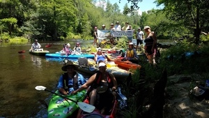
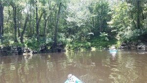
Boats as far as the eye can see, 30.5934242, -83.2590691

Ladder, 30.5928341, -83.2588421
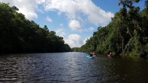
Boat parade, 30.5928341, -83.2588421

Water oak? 30.5928341, -83.2588421

Upstream to bridge at Belleville Road, 30.5928348, -83.2588360

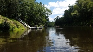
Very slanting dock (approx. location), 30.5877500, -83.2571200

Slanting dock closer, 30.5877500, -83.2580000

Slanting dock with stairs, 30.5878000, -83.2571200

Rocks and field on left bank, 30.5877500, -83.2570000

Float on right bank, 30.5856300, -83.2605000

Float closeup, 30.5856300, -83.2610000
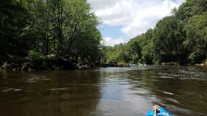
Shoals coming up, 30.5844700, -83.2616700

Tom Potter digging in, 30.5844300, -83.2617000

At the shoals, 30.5842600, -83.2618200

Rapids, 30.5841300, -83.2619000

Movie: White water (37M), 30.5842200, -83.2619700

Swamp mallow, 30.5837702, -83.2620839

Swamp mallow closeup, 30.5833956, -83.2625654

Swamp mallow portrait with pods, 30.5833730, -83.2625477

Tom Potter at more rapids, 30.5813000, -83.2628200

Movie: Tom Potter shoots some rapids (51M), 30.5813500, -83.2628300

Pods on vine with opposite pointy leaves, 30.5722918, -83.2605833

Vine context 30.5723080, -83.2606062
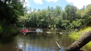
Floated right over those shoals, 30.5692693, -83.2620686

Movie: Water boiling a bit (7.2M), 30.5691300, -83.2620400

No problem, 30.5689227, -83.2619890

Movie: We have a swimmer, 30.5679200, -83.2608200

Hanging on the side, 30.5675834, -83.2603626

Longleaf above boater, west bank, 30.5669300, -83.2599300

Longleaf on east bank, 30.5669301, -83.2597336

Island, 30.5634400, -83.2571800

Turtle on west bank, 30.5632100, -83.2572100

Movie: Island shoals (9.0M), 30.5626300, -83.2564800

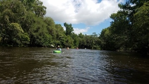
Everybody past island shoals, 30.5622205, -83.2560137

Movie: Discussing past island shoals (6.3M), 30.5622121, -83.2560027

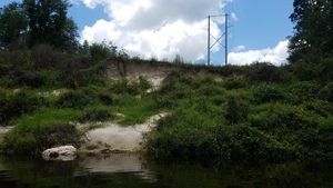
Building high up, 30.5622121, -83.2560027
Best go to the left, 30.5622121, -83.2560027

Movie: Tom then Julie through the rapids (72M), 30.5622121, -83.2560027

Julie through the rapids, 30.5570735, -83.2600238
I remember these rocks, 30.5571434, -83.2601221

More coming over the rapids, 30.5569444, -83.2600000
Lunch break, 30.5571434, -83.2601221

Gathering photo-op, 30.5560342, -83.2601554

Banners: say water bottle, 30.5560342, -83.2601554
Banners picture, 30.5560233, -83.2601457

Phil Hubbard through the 34th St rapids, 30.5536380, -83.2610033

More boaters through 34th St rapids, 30.5536513, -83.2610161

Path down from east bank, apparenlty from NW 34th St, 30.5536380, -83.2610033

Heading for Hardee Spring, 30.5452267, -83.2514651

Shirley Kokidko at Hardee Spring, 30.5446892, -83.2511847
Shirley gets her boat in Hardee Spring, 30.5446892, -83.2511847

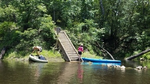
Hardee Spring sign and stairs, 30.5441667, -83.2500000

Hardee Spring run, 30.5446151, -83.2500201

Julie Bowland painting Hardee Spring, 30.5446151, -83.2500201
Looking out from Hardee Spring, 30.5445029, -83.2499702

Onwards from Hardee Spring, 30.5445078, -83.2499586

Beach, 30.5399200, -83.2468500

Japanese climbing fern right down to the water, 30.5372656, -83.2471994

Lygodium japonicum carpeting grape vine and smilax, 30.5372656, -83.2471994
Mimosa, Albizia julibrissin Durazz, 30.5368461, -83.2467964

Bigger Mimosa, 30.5368461, -83.2467964

Steel deck, east bank, 30.5368461, -83.2467964

Climbing fern coating the left bank, 30.5339700, -83.2467500
Climbing fern down the bank, 30.5339400, -83.2467800

Movie: Left bank coated with climbing fern (4.8M), 30.5339100, -83.2468200

Nothing but rock resisting climbing fern, 30.5338751, -83.2469481

Climbing fern in rock crevices, 30.5338485, -83.2468324

Tree roots cracking rock, 30.5338338, -83.2481854

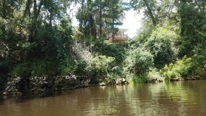
Theres a red house over yonder, 30.5338571, -83.2483952
Nice deck, 30.5338070, -83.2486865

Around the bend, 30.5338635, -83.2487573

Tethered Boat, 30.5338808, -83.2482779

Longleaf, 30.5338808, -83.2482779

Spring? 30.5338808, -83.2482779
Dock, 30.5319100, -83.2492800
Climbing fern again, 30.5317200, -83.2493100

Climbing fern closeup, 30.5317100, -83.2492600

Dock straight on, 30.5321984, -83.2488966

Right bank coated with climbing fern, 30.5321984, -83.2488966
And more climbing fern, 30.5321984, -83.2488966

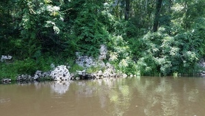
Boath banks coated with climbing fern, 30.5321984, -83.2488966
Power line, right bank, 30.5203671, -83.2399187
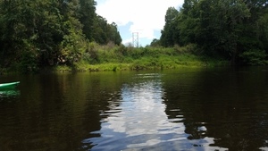
Power line, left bank, 30.5203671, -83.2399187

Mid-stream rock, 30.5131016, -83.2447605
Deadfalls not in the way, 30.5131016, -83.2447605
A pack following, 30.5130500, -83.2448100

Stream marker, 30.5129772, -83.2450214
Shattered deck, 30.5034100, -83.2421900

Chervil Drive private access? 30.5033500, -83.2422200

Seeing around the bend, 30.5030700, -83.2424300

Eroded bluff, 30.5029600, -83.2424800

Big mimosa trees, 30.5029100, -83.2425000

Metal steps, left bank, 30.5028600, -83.2425100

On downstream, 30.5028100, -83.2425400

Completely fallen dock, 30.5027200, -83.2425900

Under tree, 30.5048740, -83.2408712

House on bank, 30.5024700, -83.2425900

Some boards still sticking out, 30.5024100, -83.2426100
Overhanging branches, 30.5023000, -83.2429200

Grape vine with grapes 30 feet up, 30.5025000, -83.2425800

Stairs, 30.5021500, -83.2427400
Approaching Florida Campsites Ramp, 30.5018400, -83.2427200

Florida Campsites Ramp, 30.5013220, -83.2426116

Florida Campsites Kiosk, 30.5011400, -83.2426000

Gorilla in the woods, 30.4967200, -83.2419100

Gorilla rock, 30.4966763, -83.2419077

Pipe and stairs (approx.) 30.4802483, -83.2514370

Pipe and stairs context (approx.) 30.4954300, -83.2413700

Around some rocks, 30.4954100, -83.2412300

Rock dock, 30.4924088, -83.2445702
Around more rocks (approx.), 30.4899400, -83.2441400
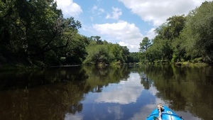
Having a good time on the river, 30.4898900, -83.2441000

Bridge in sight, 30.4849155, -83.2436141

FL 6 bridge, 30.4831600, -83.2437000

Did we bring that many people? 30.4812100, -83.2435700

Saturday crowd at Madison Blue Spring, 30.4811500, -83.2435900

Upstream to FL 6 Bridge, 30.4811500, -83.2435900
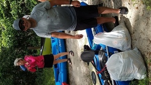
Kerry Sullivan with trash we collected (Shirley Kokidko in background), 30.4801400, -83.2446600

jsq with trash we collected (Phil Hubbard in background), 30.4801300, -83.2447000
Julie Bowland with the fishing float she collected, 30.4801200, -83.2447500
Tom Potter (drink can), Julie Bowland (fishing float), Shirley Kokidko (puzzled expression), jsq with trash collected, 30.4801200, -83.2448200

Phil Hubbard, and three new Fallers, 30.4801100, -83.2448800
Videos
WWALS video playlist:
Two years ago
Some of the GPS coordinates on these pictures from 24 October 2015 are a bit off, such as the first rapid is far too far north. But most of them are comparable to this year’s pictures.
Google Map
Follow this link for the interactive google map of pictures from this year and two years ago, or it’s also embedded below.
-jsq, John S. Quarterman, Suwannee RIVERKEEPER®
You can join this fun and work by becoming a WWALS member today!
Short Link: