
WWALS board member Chris Mericle just asked FERC:
Why the huge discrepancy….? [W]hy should we believe that the information Sabal Trail provided anywhere is correct?
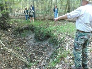 Apparently unlike FERC, Chris knows what he’s talking about, from
on-the-ground observation to a local study by a geologist, to Sabal Trail’s own docuemnts.
Apparently unlike FERC, Chris knows what he’s talking about, from
on-the-ground observation to a local study by a geologist, to Sabal Trail’s own docuemnts.
Filed with FERC as Accession Number: 20151207-5015, “Comment of Christopher J Mericle in Docket(s)/Project(s) CP15-17-000 Submission Date: 12/6/2015”, Continue reading