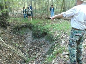
WWALS board member Chris Mericle just asked FERC:
Why the huge discrepancy….? [W]hy should we believe that the information Sabal Trail provided anywhere is correct?
 Apparently unlike FERC, Chris knows what he’s talking about, from
on-the-ground observation to a local study by a geologist, to Sabal Trail’s own docuemnts.
Filed with FERC as Accession Number: 20151207-5015, “Comment of Christopher J Mericle in Docket(s)/Project(s) CP15-17-000 Submission Date: 12/6/2015”,
Christopher J Mericle, Jasper, FL.
Ms. Kimberly D. Bose, 12/06/2015
Secretary Federal Energy Regulatory Commission
888 First Street NE
Washington, DC 20426RE: Sabal Trail Transmission, LLC, Docket No. CP15-17-000
Dear Ms. Bose,
On November 9, 2015 Sabal Trail Transmission, LLC filed with FERC “Response to Comments on the Draft Environmental Impact Statement”, Accession number 20151109-5209. In this filing Sabal Trail clarified that Table 6.5-1 “Karst Features within 0.25 mile of the Sabal Trail Pipeline Route” is applicable to the current proposed route, including the proposed crossing of the Suwannee River.
The current proposed route, according to Sabal Trail aerial view Drawing number 1657-PL-FL-DG-72026, crosses the Suwannee River State Park property between MP 266.8 and MP 267.3. Table 6.5-1 identifies 17 “closed topo depressions” between MP 266.8 and MP 267.3, a distance of .5 miles(2,640′) and a width of .5 miles(1/4 mile each side of the proposed route).
In the geology report of the Suwannee River crossing site by Professional Geologist Dennis Price, Accession number 20151027-5034, figure 2 shows a LiDAR image of approximately 1,000 feet of the proposed pipeline route through the Suwannee River State Park property. The green dots are GPS located sinkholes, the blue are other non-GPS located sinkholes. Mr. Price describes the LiDAR image as such: “…the entire floodplain area exhibited active sinkhole features too numerous to locate but very evident on the LiDAR map (every blue feature).” Upon taking a look at figure two I was able to count at least 30 sinkhole features. Mr. Price’s LiDAR image is only a fraction of the proposed route that crosses the Suwannee River State Park property.
Why the huge discrepancy between table 6.5-1 and findings in Mr. Price’s report? If the information provided to FERC from Sabal Trail on this small but very critical and sensitive site is wrong, why should we believe that the information Sabal Trail provided anywhere is correct? What is the process that FERC uses to verify that the information Sabal Trail is providing is correct? According to FERC River crossings are of utmost importance. Has anyone from FERC visited the Suwannee River Crossing site to verify Sabal Trail’s findings in Table 6.5-1?
Furthermore, page 16 number 9 of Sabal Trail’s response says LiDAR was used to evaluate major HDD Crossing Sites. It goes on to say, “In addition to these detailed complex site-specific investigations, LiDAR data was used to evaluate the entire route through karst areas. The LiDAR is a screening tool that was augmented with geophysical and geotechnical evaluations, as well as field surveys, which provide more detailed site specific data.”
Sabal Trail has repeatedly stated that LiDAR was used to evaluate the proposed route. I have repeatedly asked for the LiDAR images and data to be produced and I am asking again for all LiDAR images and data of the proposed route to be produced. If LiDAR was in fact used to evaluate the Suwannee River crossing Site by Sabal Trail, would not the same data be found by Sabal Trail as was found By Mr. Price? Also, field surveys (which are more detailed according to Sabal Trail) should have revealed the sinkholes in figure two of Mr. Price’s report. Only a small number of depressions were reported by Sabal Trail. There are in fact several active sinkholes very close to the proposed route pictured in Mr. Price’s report, these are not indicated on table 6.5-1. I have personally walked this site multiple times and can tell you that the data in table 6.5-1 is inaccurate.
It is FERC’s responsibility to ensure proper due diligence is being performed by Sabal Trail. Who, beside the public, is checking the data Sabal Trail is providing?
Sincerely,
Chris Mericle
WWALS Watershed Coalition Board Member
Waterkeeper Affiliate for the upper Suwannee River
 You can see Dennis Price testifying about his report
in the WWALS videos of the October hearing in Jasper, FL,
starting with
this one.
All the exhibits from that hearing are also
available on the WWALS dropbox.
Dennis Price’s report is in the WWALS Exhibits folder, as Exhibit R.
WWALS did due diligence including gathering numerous witnesses and hiring attorneys to examine Sabal Trail’s evidence and found it wanting. How about FERC starting doing its job? And if FERC does that job, it should reject any permit for that invading pipeline.
-jsq
Short Link:

Pingback: No pipeline! Suwannee County to FERC, Army Corps, and Florida | WWALS Watershed Coalition
Pingback: FERC, EPA rubbestamp Sabal Trail fracked methane pipeline: opposition continues –VDT | WWALS Watershed Coalition