
Please go directly to the current WRWT Access Points.
Access points on the WRWT Map 2015-05-04.
Florida miles are from the Suwannee Wilderness Trail.
Georgia access point distances are from Canoeing & Kayaking Georgia
By Suzanne Welander, Bob Sehlinger, Don Otey.
The 57.5 miles for Kinard Bridge Road on the Little River
matches Brown’s Guide.
The
distances for the Little River Boat Ramp and the GA 133 Bridge were measured.
All other distances are interpolations thus far.
See also All points and Categories.
Summary Access Table
* Paddle Time: hours est. for high water at 2 mph (1 mph or slower at low water). Access,
 Landing,
 Canoe Rental,
 Camping,
 Food,
Food,
 Water,
 Restrooms,
 Shelter,
 Picnic Area,
 Handicapped Accessible
Distances between Access points
0.20 mile from US 84 to Old Quitman Road0.50 mile from Reed Bingham SP (West) to Reed Bingham SP (East)
0.82 mile from Staten Road to Franklinville Road
1.60 miles from Withlacoochee Ramp to Madison Blue Springs State Park Launch
1.70 miles from Madison Boat Ramp to CR 143 Ramp
2.00 miles from Madison Blue Springs State Park Launch to Madison Boat Ramp
2.48 miles from Suwannee River State Park to CR 141 Ramp
3.00 miles from Red Roberts Landing to Reed Bingham SP (West)
4.25 miles from GA 122 Little River to Lawson Mill Pond Road
4.28 miles from Franklinville Road to Langdale Park Boat Ramp
5.30 miles from Madison Highway Boat Ramp to Sullivan Launch
5.50 miles from Kinard Bridge Road to Red Roberts Landing
5.90 miles from Cook County Landing to GA 122 Little River
6.40 miles from Knights Ferry Boat Ramp to Nankin Boat Ramp
8.22 miles from CR 143 Ramp to Suwannee River State Park
8.60 miles from Antioch Road to Cook County Landing
8.60 miles from Sullivan Launch to Withlacoochee Ramp
9.10 miles from Nankin Boat Ramp to Madison Highway Boat Ramp
9.50 miles from Reed Bingham SP (East) to Antioch Road
10 miles from Langdale Park Boat Ramp to US 84
11.1 miles from GA 122 Withlacoochee to Staten Road
13.6 miles from GA 37 Withlacoochee Berrien to GA 122 Withlacoochee
15.3 miles from Old Quitman Road to Knights Ferry Boat Ramp
18.1 miles from CR 141 Ramp to Spirit of Suwannee Music Park Ramp.
19.86 miles from Lawson Mill Pond Road to Little River Boat Ramp
Descriptions
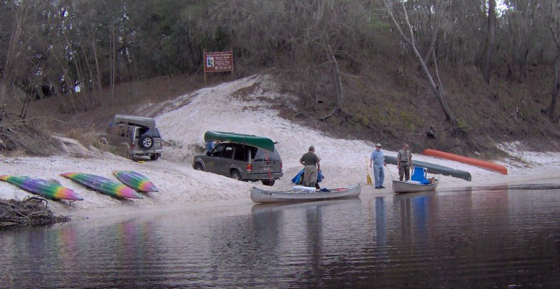
Kinard Bridge Road
CATEGORIES: Access
LAYER: Brochure
GPS: 31.2543, -83.507861
ACCESS: Yes
WATER BODY: Little River
ADDRESS: MILE 57.5, I-75 exit 49, west on Central Avenue becomes Kinard Bridge Road, 3 miles to bridge. Cook County
WEBSITE: http://www.brownsguides.com/blog/little-river-of-southern-georgia-paddling-guide/
PHOTO SOURCE: Marcus Roberts
OWNERSHIP: Public
DOWNSTREAM: 5.50 miles from Kinard Bridge Road to Red Roberts Landing
Red Roberts Landing 

CATEGORIES: Access
LAYER: Brochure
ACCESS: Yes, PARKING: Free, PICNIC AREA
WATER BODY: Little River
ADDRESS: MILE 52, At Rountree Bridge on Rountree Bridge Road (CR 251) west of Adel; exit 41 off I-75, Cook County
WEBSITE: /events-2/?ee=9
PHOTOSET: /2014/03/30/pictures-gretchen-quarterman-big-little-river-paddle-event-2014-03-29/
PHOTO SOURCE: Gretchen Quarterman
OWNERSHIP: Public
UPSTREAM: 5.50 miles from Red Roberts Landing to Kinard Bridge Road
DOWNSTREAM: 3.00 miles from Red Roberts Landing to Reed Bingham SP (West)
Reed Bingham SP (West)
CATEGORIES: Landing
LAYER: Brochure
GPS: 31.16703, -83.54647
ACCESS: Yes, PARKING: $, SHELTER, PICNIC AREA, HANDICAPPED ACCESSIBLE
WATER BODY: Little River
ADDRESS: MILE 49, GA 37 to CR 99 to CR 221, Colquitt County
WEBSITE: http://www.georgiawildlife.com/sites/default/files/uploads/wildlife/maps/ramps/boatramp_locator.html
OWNERSHIP: Public
UPSTREAM: 3.00 miles from Reed Bingham SP (West) to Red Roberts Landing
DOWNSTREAM: 0.50 mile from Reed Bingham SP (West) to Reed Bingham SP (East)
Reed Bingham SP (East)
CATEGORIES: Landing
LAYER: Brochure
GPS: 31.16253, -83.54123
ACCESS: Yes, PARKING: $, SHELTER, PICNIC AREA, HANDICAPPED ACCESSIBLE
WATER BODY: Little River
ADDRESS: MILE 48.5, GA 37 to CR 99 to CR 221, Cook County
WEBSITE: http://www.georgiawildlife.com/sites/default/files/uploads/wildlife/maps/ramps/boatramp_locator.html
DESCRIPTION: On Reed Bingham State Park Lake
OWNERSHIP: Public
UPSTREAM: 0.50 mile from Reed Bingham SP (East) to Reed Bingham SP (West)
DOWNSTREAM: 9.50 miles from Reed Bingham SP (East) to Antioch Road
Antioch Road
CATEGORIES: Access
LAYER: Brochure
ACCESS: Yes, PARKING: Free
WATER BODY: Little River
ADDRESS: MILE 39, Southwest of Adel, NW side of Antioch Road, NE side of river, Cook County
OWNERSHIP: Public
UPSTREAM: 9.50 miles from Antioch Road to Reed Bingham SP (East)
DOWNSTREAM: 8.60 miles from Antioch Road to Cook County Landing
Cook County Landing

CATEGORIES: Landing
LAYER: Brochure
ACCESS: Yes, PARKING: Free
WATER BODY: Little River
ADDRESS: MILE 30.4, Between Adel and Barney, east side of GA 37, north side of Little River, Cook County
WEBSITE: http://www.georgiawildlife.com/sites/default/files/uploads/wildlife/maps/ramps/boatramp_locator.html
PHOTO: http://www.georgiawildlife.com/sites/default/files/uploads/wildlife/maps/ramps/images/6127.jpg
PHOTOSET: http://www.georgiawildlife.com/sites/default/files/uploads/wildlife/maps/ramps/boatramp_locator.html
PHOTO SOURCE: GA DNR
OWNERSHIP: Public
UPSTREAM: 8.60 miles from Cook County Landing to Antioch Road
DOWNSTREAM: 5.90 miles from Cook County Landing to GA 122 Little River
GA 122 Little River 
CATEGORIES: Access
LAYER: Brochure
ACCESS: Yes, PARKING: Free, HISTORIC ATTRACTION
WATER BODY: Little River
ADDRESS: MILE 24.5, Between Hahira and Barney, south side of GA 122, east side of river, Lowndes County
DESCRIPTION: Sand bank next to state highway bridge
OWNERSHIP: Public
UPSTREAM: 5.90 miles from GA 122 Little River to Cook County Landing
DOWNSTREAM: 4.25 miles from GA 122 Little River to Lawson Mill Pond Road
Lawson Mill Pond Road
CATEGORIES: Access
LAYER: Brochure
ACCESS: Yes, PARKING: Free
WATER BODY: Little River
ADDRESS: MILE 20.25, Between Morven and Hahira, south side of Lawson Pond Road, west side of river, Brooks County
DESCRIPTION: Sand bank next to county road bridge.
OWNERSHIP: Public, PARCEL 118 0004
UPSTREAM: 4.25 miles from Lawson Mill Pond Road to GA 122 Little River
DOWNSTREAM: 19.86 miles from Lawson Mill Pond Road to Little River Boat Ramp
Little River Boat Ramp
CATEGORIES: Landing
LAYER: Brochure
ACCESS: Yes, PARKING: Free, PICNIC AREA
WATER BODY: Little River
ADDRESS: MILE 0.39, @ GA 133 off I-75 exit 18. Lowndes County
WEBSITE: http://vlpra.rec1.net/location/2831
DESCRIPTION: Aka Troupville Landing (GA DNR)
OWNERSHIP: Public, VLPRA
UPSTREAM: 19.86 miles from Little River Boat Ramp to Lawson Mill Pond Road
GA 37 Withlacoochee Berrien
CATEGORIES: Access
LAYER: Brochure
ACCESS: Yes, PARKING: Free
WATER BODY: Withlacoochee River
ADDRESS: MILE 98, Between Adel and Ray City, GA, Berrien County
OWNERSHIP: Public
DOWNSTREAM: 13.6 miles from GA 37 Withlacoochee Berrien to GA 122 Withlacoochee
GA 122 Withlacoochee
CATEGORIES: Access
LAYER: Brochure
ACCESS: Yes, PARKING: Free
WATER BODY: Withlacoochee River
ADDRESS: MILE 84.4, 7 miles east of Hahira, GA, Lowndes County
DESCRIPTION: , Between Hahira and Lakeland
OWNERSHIP: Public
UPSTREAM: 13.6 miles from GA 122 Withlacoochee to GA 37 Withlacoochee Berrien
DOWNSTREAM: 11.1 miles from GA 122 Withlacoochee to Staten Road
Staten Road
CATEGORIES: Access
LAYER: Brochure
ACCESS: Yes, PARKING: Free
WATER BODY: Withlacoochee River
ADDRESS: MILE 73.3, 7.1 miles north of Valdosta, Lowndes County
DESCRIPTION: , Only for the Athletic
OWNERSHIP: Public
UPSTREAM: 11.1 miles from Staten Road to GA 122 Withlacoochee
DOWNSTREAM: 0.82 mile from Staten Road to Franklinville Road
Franklinville Road
CATEGORIES: Access
LAYER: Brochure
ACCESS: Yes, PARKING: Free, HISTORIC ATTRACTION
WATER BODY: Withlacoochee River
ADDRESS: MILE 72.48, Between Hahira and Moody AFB, Lowndes County
DESCRIPTION: Riverside bank on dirt road, Historic bridge, now closed
OWNERSHIP: Public
UPSTREAM: 0.82 mile from Franklinville Road to Staten Road
DOWNSTREAM: 4.28 miles from Franklinville Road to Langdale Park Boat Ramp
Langdale Park Boat Ramp
CATEGORIES: Landing
LAYER: Brochure
GPS: 30.88747, -83.32395
ACCESS: Yes, PARKING: Free, SHELTER, PICNIC AREA
WATER BODY: Withlacoochee River
ADDRESS: MILE 68.2, 3781 N. Valdosta Rd., Valdosta, GA 31602, Lowndes County
WEBSITE: http://vlpra.rec1.net/location/2830
DESCRIPTION: concrete boat ramp on dirt road in 100+ acre park
OWNERSHIP: Public, VLPRA
UPSTREAM: 4.28 miles from Langdale Park Boat Ramp to Franklinville Road
DOWNSTREAM: 10 miles from Langdale Park Boat Ramp to US 84
US 84
CATEGORIES: Access
LAYER: Brochure
ACCESS: Yes
WATER BODY: Withlacoochee River
ADDRESS: MILE 58.2, Between the twin highway bridges on the Lowndes County side, Lowndes County
DESCRIPTION: Problematical access from busy highway right of way
OWNERSHIP: Public
UPSTREAM: 10 miles from US 84 to Langdale Park Boat Ramp
DOWNSTREAM: 0.20 mile from US 84 to Old Quitman Road
Old Quitman Road
CATEGORIES: Access
LAYER: Brochure
ACCESS: Yes, PARKING: Free, HISTORIC ATTRACTION
WATER BODY: Withlacoochee River
ADDRESS: MILE 58, On the Brooks County side (just south of US 84). Paved road, then walk a few hundred feet to Spook Bridge. Brooks County
DESCRIPTION: Not very practical as river access.
OWNERSHIP: Public
UPSTREAM: 0.20 mile from Old Quitman Road to US 84
DOWNSTREAM: 15.3 miles from Old Quitman Road to Knights Ferry Boat Ramp
Knights Ferry Boat Ramp
CATEGORIES: Landing
LAYER: Brochure
GPS: 30.71238, -83.455443
ACCESS: Yes, PARKING: Free, PICNIC AREA
WATER BODY: Withlacoochee River
ADDRESS: MILE 42.7, 6499 Knights Ferry Rd, Valdosta, GA 31601, Lowndes County
WEBSITE: http://vlpra.com/location/2828
DESCRIPTION: concrete boat ramp in 1 acre park
OWNERSHIP: Public, VLPRA
UPSTREAM: 15.3 miles from Knights Ferry Boat Ramp to Old Quitman Road
DOWNSTREAM: 6.40 miles from Knights Ferry Boat Ramp to Nankin Boat Ramp
Nankin Boat Ramp
CATEGORIES: Landing
LAYER: Brochure
ACCESS: Yes, PARKING: Free, PICNIC AREA
WATER BODY: Withlacoochee River
ADDRESS: MILE 36.3, 6899 Clyattville-Nankin Rd, Valdosta, GA 31601, Lowndes County
WEBSITE: http://vlpra.rec1.net/location/2834
DESCRIPTION: concrete boat ramp in 1 acre park
OWNERSHIP: Public, VLPRA
UPSTREAM: 6.40 miles from Nankin Boat Ramp to Knights Ferry Boat Ramp
DOWNSTREAM: 9.10 miles from Nankin Boat Ramp to Madison Highway Boat Ramp
Madison Highway Boat Ramp
CATEGORIES: Landing
LAYER: Brochure
ACCESS: Yes, PARKING: Free, PICNIC AREA
WATER BODY: Withlacoochee River
ADDRESS: MILE 27.2, Madison Highway at the Florida State Line. Lowndes County
WEBSITE: http://vlpra.rec1.net/location/2833
DESCRIPTION: From Pinetta, Madison County, FL, travel north on CR 145; cross the Withlacoochee River; at the end of the bridge turn left and follow road to ramp in Hamilton County, FL. Also known as GA 31 Ramp or State Line Ramp (GA DNR).
PHOTOSET: http://www.srwmd.state.fl.us/documentcenter/home/view/31
OWNERSHIP: Public, VLPRA
UPSTREAM: 9.10 miles from Madison Highway Boat Ramp to Nankin Boat Ramp
DOWNSTREAM: 5.30 miles from Madison Highway Boat Ramp to Sullivan Launch
Sullivan Launch
CATEGORIES: Landing
LAYER: Brochure
GPS: 30.595667, -83.26
ACCESS: Yes, PARKING: Free, PICNIC AREA
WATER BODY: Withlacoochee River
ADDRESS: MILE 21.9, South of CR150 downstream of river bridge. Madison County
WEBSITE: http://www.srwmd.state.fl.us/documentcenter/home/view/31
DESCRIPTION: From Pinetta, Madison County, FL, travel east on CR 150; turn right at the bridge and follow road to launch. Also known as CR 150 Bridge Launch. In Twin Rivers State Park.
OWNERSHIP: Public, SRWMD
UPSTREAM: 5.30 miles from Sullivan Launch to Madison Highway Boat Ramp
DOWNSTREAM: 8.60 miles from Sullivan Launch to Withlacoochee Ramp
Withlacoochee Ramp
CATEGORIES: Landing
LAYER: Brochure
ACCESS: Yes, PARKING: Free, PICNIC AREA
WATER BODY: Withlacoochee River
ADDRESS: MILE 13.3, 4658 NW 21st Pl, Jasper, FL 32052, Hamilton County
WEBSITE: http://www.srwmd.state.fl.us/documentcenter/home/view/31
DESCRIPTION: From Jasper, Hamilton County, FL, travel north on US 41 to SR 6; turn left; travel west on SR 6 to CR 143; turn right and travel north to NW 44 Street; turn left; follow road to NW 45 Street; turn right; follow road to NW 22 Avenue; turn left and follow road to NW 21 Place and ramp is on the right.
OWNERSHIP: Public, Hamilton County
UPSTREAM: 8.60 miles from Withlacoochee Ramp to Sullivan Launch
DOWNSTREAM: 1.60 miles from Withlacoochee Ramp to Madison Blue Springs State Park Launch
Madison Blue Springs State Park Launch

CATEGORIES: Landing
LAYER: Brochure
ACCESS: Yes, PARKING: Free, PICNIC AREA
WATER BODY: Withlacoochee River
ADDRESS: MILE 11.7, 8300 FL-6, Lee, FL 32059, Madison County
WEBSITE: https://www.floridastateparks.org/park/Madison-Blue-Spring
DESCRIPTION: From Madison, Madison County, FL, travel east on SR 6 to the Withlacoochee River and Madison Blue Springs State Park is on the right.
PHOTOSET: https://www.floridastateparks.org/park/Madison-Blue-Spring
PHOTO SOURCE: SRWMD
OWNERSHIP: Public, SRWMD
UPSTREAM: 1.60 miles from Madison Blue Springs State Park Launch to Withlacoochee Ramp
DOWNSTREAM: 2.00 miles from Madison Blue Springs State Park Launch to Madison Boat Ramp
Madison Boat Ramp
CATEGORIES: Landing
LAYER: Brochure
ACCESS: Yes, PARKING: Free, PICNIC AREA
WATER BODY: Withlacoochee River
ADDRESS: MILE 9.7, 1307 NE River Park Rd, Lee, FL 32059, Madison County
WEBSITE: http://www.dep.state.fl.us/gwt/guide/designated_paddle/withn_guide.pdf
DESCRIPTION: From Madison, Madison County, FL, travel east on SR 6 to Old Blue Springs Road; turn right, travel east to NE Ivy Drive; turn left and travel east to NE Juniper Drive; turn right and follow to NE River Park Road; turn left and travel east; cross over NE Timber River Loop and into county park.
PHOTO SOURCE: Madison County
OWNERSHIP: Public, Madison County
UPSTREAM: 2.00 miles from Madison Boat Ramp to Madison Blue Springs State Park Launch
DOWNSTREAM: 1.70 miles from Madison Boat Ramp to CR 143 Ramp
CR 143 Ramp
CATEGORIES: Landing
LAYER: Brochure
ACCESS: Yes, PARKING: Free, PICNIC AREA
WATER BODY: Withlacoochee River
ADDRESS: MILE 8, From Jasper, travel north on US 41 to SR 6; turn left; travel south on SW CR 141 to SW CR 143; turn right and follow SW CR 143 to SW 64 Way and follow to ramp. Hamilton County
WEBSITE: http://www.srwmd.state.fl.us/documentcenter/home/view/31
DESCRIPTION: Also known as Allen Landing
OWNERSHIP: Public, Hamilton County
UPSTREAM: 1.70 miles from CR 143 Ramp to Madison Boat Ramp
DOWNSTREAM: 8.22 miles from CR 143 Ramp to Suwannee River State Park
Suwannee River State Park

CATEGORIES: Landing
LAYER: Brochure
GPS: 30.3877, -83.1688
ACCESS: Yes, PARKING: $5.00/vehicle, SHELTER, PICNIC AREA
WATER BODY: Suwannee River
ADDRESS: MILE -0.22, 3631 201st Path, Live Oak, FL 32060, Suwannee County
WEBSITE: https://www.floridastateparks.org/park/Suwannee-River
DESCRIPTION: Slightly upstream from confluence of Withlacoochee and Suwannee Rivers
PHOTOSET: https://www.floridastateparks.org/park/Suwannee-River
PHOTO SOURCE: SRWMD
OWNERSHIP: Public, SRWMD
UPSTREAM: 8.22 miles from Suwannee River State Park to CR 143 Ramp
DOWNSTREAM: 2.48 miles from Suwannee River State Park to CR 141 Ramp
CR 141 Ramp
CATEGORIES: Landing
LAYER: Brochure
GPS: 30.414, -83.159167
ACCESS: Yes, PARKING: Free
WATER BODY: Suwannee River
ADDRESS: MILE -2.7, SW 46th Ave., Jasper, FL 32052, Hamilton County
DESCRIPTION: From US 90, turn right onto NE Myrrh Street; cross the Withlacoochee River (road becomes CR 141); turn right on SW 74 Street; turn right on SW 44 Lane; travel south to SW 77 Street; turn left and follow to boat ramp. Government Owned for General Public Use
OWNERSHIP: Public, SRWMD? PARCEL 5555-555
UPSTREAM: 2.48 miles from CR 141 Ramp to Suwannee River State Park
DOWNSTREAM: 18.1 miles from CR 141 Ramp to Spirit of Suwannee Music Park Ramp.
Spirit of Suwannee Music Park Ramp.
CATEGORIES: Landing Public?
LAYER: Brochure
ACCESS: Yes, CAMPING: “RV, Tent, WATER, RESTROOMS, PARKING: Free, SHELTER, PICNIC AREA
WATER BODY: Suwannee River
ADDRESS: MILE -20.8, 2461 95th Dr, Live Oak, FL 32060, From Live Oak, travel north on US 129 to Spirit of Suwannee Music Park; turn left on 95 Drive and follow road to boat ramp. Suwannee County
DESCRIPTION: Poured in place concrete, Inside Spirit of Suwannee Music Park
PHOTO: http://www.otariinae.net/Stanley/Suwannee/soc.jpg
PHOTOSET: http://www.otariinae.net/Stanley/Suwannee/index.htm
PHOTO SOURCE: SRWMD
OWNERSHIP: Public?
UPSTREAM: 18.1 miles from Spirit of Suwannee Music Park Ramp. to CR 141 Ramp