Tag Archives: Blue Sink

Water low but passable, White Springs to Swift Creek, Suwannee River 2017-05-20

Update 2017-05-17: OK, the water’s gotten too low at the original location, so we’re moving downstream to Woods Ferry Tract Launch to Suwannee Springs.

Hands Across the Sand on the Suwannee Saturday! The river is quite low (48.78 feet NAVD on the White Springs gage), but it looks doable from the put-in and take-out. A ranger at Stephen Foster State Park told me paddling from White Springs to Swift Creek would be doable, perhaps with a few dry spots. I’ll also call a local outfitter or two for their opinions.

White Springs down from ramp

White Springs down from ramp

Meanwhile, bring bug spray (gnats) and a rope (to pull your boat over sand bars), and we’re still on for 9AM Saturday 20 May 2017. See the outing announcement for more details.

Plus: that’s the day of Hands Across the Sand, “Say NO to dirty fuels and YES to clean energy”. WWALS has been saying that for years, so somewhere on the Suwannee we will stop and do Hands Across the Sand against the Sabal Trail fracked methane pipeline and for solar power.

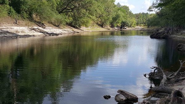
White Springs low spot

Continue reading

White Springs to Swift Creek, Suwannee River, 2017-05-20

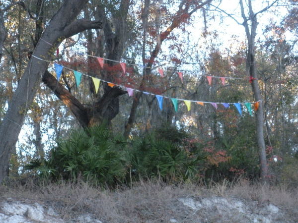
Because SRWMD tells us Blue Sink Launch is closed, our May Suwannee River outing will take out slightly downstream at Swift Creek Lunch, which should be easy to recognize from the river because American Canoe Adventures has put up these nice triangular flags:

Flags by ACA
Photo: Jesse Wilkes, November 23, 2016

The put in at White Springs Wayside Park and everything else is the same; see the updated outing announcement for all the details.

We’re bringing bon-bons. See you there in May!

 -jsq, John S. Quarterman, Suwannee RIVERKEEPER®

You can join this fun and work by becoming a WWALS member today!

White Springs to Blue SInk Swift Creek Launch, Suwannee River, 2017-05-20

Update 2017-05-17: OK, the water’s gotten too low at the original location, so we’re moving downstream to Woods Ferry Tract Launch to Suwannee Springs.

Update 2017-05-15: The water’s low, but so far it’s a go, plus it’s Hands across the Sands on the Suwannee against the Sabal Trail fracked methane pipeline and for solar power.
Update 2017-04-06: SRWMD tells us Blue Sink Launch is closed, so we’ll be taking out nearby at Swift Creek Launch.

Join WWALS for a brief paddle 8 miles on the Suwannee River through White Springs down to Blue Sink Swift Creek Launch. This shouldn’t take more than 4 hours paddling or 5 hours including shuttle. With lunch, swim stops, and bon-bons, of course.

Bring the usual personal flotation device, boat paddles, food, drinking water, warm clothes, and first aid kit. If you don’t have a boat, there are many outfitters, or let us know and many of us have spare boats.

When: 9AM Saturday 20 May 2017

Put In: Suwannee River Wayside Park Ramp, river mile 171.0
From White Springs, travel south on US 41 to the river; the ramp is on the south side in the town park.

GPS: 30.3255398,-82.7413685

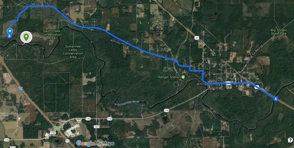
Shuttle
This map drawn using landing directions from the Suwannee River Wilderness Trail map of Boat Ramps & Canoe Launches and SRWMD’s Blue Sink, Rocky Creek, Swift Creek.

Duration: 5 hours

Events: facebook, meetup.

Free: This outing is Free! And we recommend you support the work of WWALS by becoming a WWALS member today!

Shuttle Distance: Continue reading