
Update 23 Aug 2014: New picture and clarifications in new blog post.

On August 24, 2014 WWALS is having an outing on the Alapaha river. Are you up for a 1.27 mile paddle? Bring your canoe, kayak or small Jon boat to the Alapaha River.


We will launch from the Lanier County side of the Hotchkiss Bridge Crossing and get off just south of the 84 bridge and railroad tracks on the Lowndes County side near Lake Alapaha subdivision. We will pass by the location for the new Lowndes County boat ramp and public access point. This is a relatively short paddle but it could take as long as 2 hours if the water level stays low.
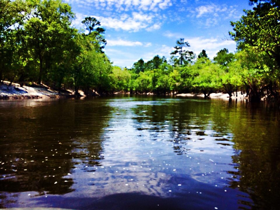

These pictures were taken 8 June 2014 when the river was higher; the river is much lower now.
Meet up at 1:30. Get on water at 2:00.
We will drop the boats off @ Hotchkiss Crossing and then drop the vehicles off @ the end point on a public right of way, where the road is gravel.
Here’s how to get to this WWALS outing. I listed a few surrounding cities: Tifton, Ga., Hahira, Ga, Valdosta, Ga., Lake Park, Ga. and Madison, Fl. So just scroll down to find yours. Hope to see y’all there.
Directions from Tifton, GA
- Head west on E 5th St toward Main St S
138 ft - Take the 1st left onto Main St S/U.S. 41 S
Continue to follow U.S. 41 S
1.9 mi - Turn left onto GA-125 S
21.8 mi - Slight left onto W Marion Ave
0.2 mi - Take the 3rd right onto GA-11 S/US-129 S/S Davis St
Continue to follow GA-11 S/US-129 S
9.9 mi - Turn left onto GA-37 E/Main St
Continue to follow GA-37 E
10.8 mi - Turn right onto GA-11/US-129
7.9 mi - Turn right onto US-84 W
0.8 mi - Turn right onto Hotchkiss Rd
0.3 mi
You will take Hotchkiss Rd till it dead end @ the Alapaha river.
Directions from Hahira, GA
- Head north on S Church St toward E Main St
23 ft - Take the 1st right onto GA-122 E/E Main St
Continue to follow GA-122 E
21.1 mi - Continue onto GA-11 S/GA-37 E/US-129 S
Continue to follow GA-37 E
0.5 mi - Turn right onto GA-11/US-129
7.9 mi - Turn right onto US-84 W
0.8 mi - Turn right onto Hotchkiss Rd
0.3 mi
You will take Hotchkiss Rd till it dead end @ the Alapaha river.
Directions from Valdosta, GA
- Head northwest on N Ashley St toward E Valley St
174 ft - Turn right onto E Valley St
492 ft - Turn right onto N Lee St
0.1 mi - Turn left at the 2nd cross street onto US-84 E/E Hill Ave
Continue to follow US-84 E
16.8 mi - Turn left onto Hotchkiss Rd
0.3 mi
You will take Hotchkiss Rd till it dead end @ the Alapaha river.
Directions from Lake Park, GA
- Head east on W Marion Ave toward N Essa St
0.3 mi - Turn left onto GA-376 E/N East St
Continue to follow GA-376 E
7.5 mi - Turn left onto GA-135 N
0.2 mi - Take the 1st right onto GA-94 E
2.0 mi - Turn left onto GA-11 N/US-129 N
16.4 mi - Turn left onto US-84 W
0.7 mi - Turn right onto Hotchkiss Rd
0.3 mi
You will take Hotchkiss Rd till it dead end @ the Alapaha river.
Directions from Madison, FL
- Head east on Base Street toward Shelby St
292 ft - Continue onto E Base St
0.1 mi - Turn left onto Duval St
0.2 mi - Turn right onto FL-145 N
Entering Georgia
13.6 mi - Continue onto GA-31 N
10.2 mi - Turn right onto GA-31 N/Inner Perimeter Rd
6.3 mi - Turn right onto US-84 E
13.7 - Turn left onto Hotchkiss Rd
0.3 mi
You will take Hotchkiss Rd till it dead end @ the Alapaha river.
Here’s a map of the section of the Alapaha river we will paddle on that day.

This event is FREE! All we ask is that you are a current member of WWALS Watershed Coalition. If not, its easy to join online today at /donations/.
You can also let us know you’re coming by signing up for the facebook event.
-Christopher
Short Link:
Pingback: Springs, shoals, and pipeline: Withlacoochee and Suwannee Rivers 21 Sep 2014 - WWALS Watershed Coalition