
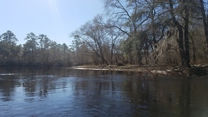
12 + 4 boats and about 18 paddlers went even faster down the Alapaha River than we expected: six hours on the water between GA 168 and GA 122, including a lunch stop. That’s about 3 miles per hour on a chilly morning and a fine breezy warm day. And there were bon-bons and kumquats!
WWALS banner at lunch stop; picture by Gretchen Quarterman for WWALS.
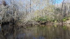
Lots of native vegetation, no invasive species, some birds (buzzards, ducks, heron, flycatcher, cardinals), no animals on the land or in the water. People fishing at Lakeland said they didn’t even get a nibble. I did see a few fish beds below a creek confluence.
The water level was about 9.25 feet on the Alapaha, GA gage and about 10 feet on the Statenville gage, which puts it towards the high end of the WWALS recommended levels for the Alapaha River Water Trail.
Below are many pictures and a google map showing where they were taken. See also the facebook albums by Gretchen Quarterman, Bret Wagenhorst, and Shawn Michaels.
See the WWALS Calendar for more WWALS outings and events.
-jsq, John S. Quarterman, Suwannee RIVERKEEPER®
You can join this fun and work by becoming a WWALS member today!
Pictures
Pictures by John S. Quarterman for WWALS.

Moonrise CR 76 @ GA 135, 31.1624875, -83.0876177

Moonrise among trees, 31.1624875, -83.0876177

Berrien Beach Landing @ GA 168, 31.1572337, -83.0400049

Silhouette waiting for shuttle return, 074026 31.1572337, -83.0400616

Shade and sun, 31.1572337, -83.0400616

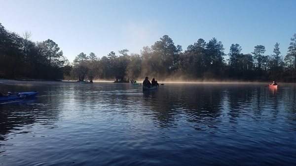
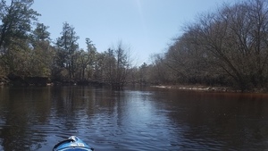
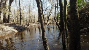
Heading downstream in the lingering fog, 31.1557268, -83.0404113

Berrien Beach, 31.1553272, -83.0403347

Longleaf pine and boats 31.1422653, -83.0357925
Gretchen photographing 31.1419444, -83.0355556

Movie: Looking around (4.5M), 31.1279975, -83.0397930

Red maple 31.1279975, -83.0397930

Does this go through? 31.1275887, -83.0402208

Movie: A bit narrow, but yes it goes through (5.5M), 31.1275887, -83.0402208

Phil and a field, 31.1212420, -83.0448810
Phil, bluff, field, 31.1202161, -83.0460034
Saw palmetto, 31.1202650, -83.0459875

Log sticking out of the water 31.1202650, -83.0459875

Spanish moss 31.1202650, -83.0459875

More palmetto 31.1202650, -83.0459875

Movie: So slow theyre behind me, says Gretchen (4.0M), 31.1202650, -83.0459875

Movie: Pan around (11M), 31.1223801, -83.0578571

Deanna and Chris Mericle 31.1223801, -83.0578571

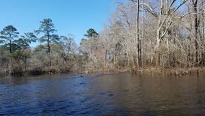
Boats behind 31.1149381, -83.0563344

Movie: Bluff (5.8M), 31.1284686, -83.0395834

Bluff with blocks 31.1080834, -83.0596195

Blocks highlighted 31.1080707, -83.0596088

Oaks at bluff 31.1080707, -83.0596088

Does this one go through? 31.0712414, -83.0530099

Yes, it did 31.1018567, -83.0604886

Movie: Paddling (3.1M), 31.1018567, -83.0604886

Beach with tipi 31.0958944, -83.0588516

Phil around some brush 31.0945983, -83.0595318

Phil again 31.0945983, -83.0595318

Tangled limbs 31.0945983, -83.0595318

Yellow tannin water 31.0946142, -83.0595327

Orange tannin water 31.0946142, -83.0595327

Red tannin water 31.0946142, -83.0595327

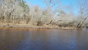
Tannin water and beach 31.0917208, -83.0624208

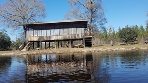
House on stilts 31.0896196, -83.0647137

House with beach 31.0896084, -83.0646488
Beach with structure 31.0886527, -83.0637307

Structure on beach 31.0886939, -83.0636685

Beach and fancy paddle 31.0884656, -83.0635215

Lunch on the beach by Gretchen Quarterman 31.0884656, -83.0635215

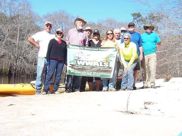
WWALS banner by Gretchen Quarterman 31.0884656, -83.0635215
Palmetto 31.0869872, -83.0613816

Movie: Behind and ahead(15M) 31.0869872, -83.0613816

Planted pines 31.0874663, -83.0610453

Palmetto and planted pines 31.0874663, -83.0610453

Movie: Bend in the river(3.8M) 31.0874663, -83.0610453

Red roof 31.0896196, -83.0647137

House 31.0896196, -83.0647137

Bluff, house, and birdhouse 31.0836279, -83.0577607

Bluff downstream of house 31.0836279, -83.0577607

Bluff to beach 31.0836279, -83.0577607

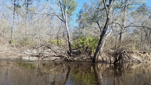
Bluff with deadfalls 31.0836797, -83.0568327
Onwards again 31.0836797, -83.0568327

Palmettos, and a sycamore? 31.0776920, -83.0546910

Movie: Green boat (6.3M), 31.0776920, -83.0546910

Beach in front of pines 31.0762963, -83.0537024

Beach -0 31.0762963, -83.0537024

Beach again 124530 31.0762963, -83.0537024

Gnarly limbs 31.0762963, -83.0537024

House, stilts, stairs 31.0760954, -83.0531062

House, pipes in water 31.0760954, -83.0531062

Joining trees 31.0760954, -83.0531062
House front 31.0762963, -83.0537024


Happy red paddler 31.0741667, -83.0513889

Bend to the left 31.0743367, -83.0519545

Movie: Birds singing (3.4M), 31.0743367, -83.0519545

Boaters over beach 31.0740575, -83.0542926

Framed by tree limbs 31.0735429, -83.0532801

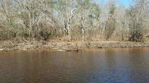
Tannin 31.0722900, -83.0529684
Tannin shore 31.0722900, -83.0529684
Movie: Bend to the right (7.8M), 31.0722900, -83.0529684

Yes, here goes 31.0708333, -83.0530556
Quite a bit of current 31.0706043, -83.0531197

Movie: Through an oxbow neck (6.8M), 31.0706043, -83.0531197

Mostly through 31.0706043, -83.0531197

And back into the river 31.0703875, -83.0530435

Climbing tree 31.0697355, -83.0537719

High bluff 31.0697667, -83.0537263

Up the bluff 31.0697667, -83.0537263

Movie: Bluff on the right (20M), 31.0697667, -83.0537263

Former river bed? 31.0680910, -83.0515885

Mistletoe 31.0680699, -83.0515196

Yellow boat 31.0679365, -83.0511619

Palmetto behind 131832 31.0677778, -83.0511111

Limb across 31.0678273, -83.0513011

Yellow boat below cypress 31.0678379, -83.0513454

Gnarled oak 31.0637800, -83.0465365

Yellow boat beyond gnarled oak 31.0637800, -83.0465365

Bend to the left with tall trees to the right 31.0604966, -83.0468492

20170211 133517 31.0604966, -83.0468492

20170211 133522 31.0602778, -83.0466667
Pines and red maple 31.0604966, -83.0468492

Maybe theres a way through in there 31.0623923, -83.0443666

No, there was not 31.0613292, -83.0440376

Oak, beach, palmetto 31.0596694, -83.0445746

Dark oaks, bright palmettos 31.0596639, -83.0445826

Boater in the distance 31.0596568, -83.0445865
Bluff and palmettoes 31.0581150, -83.0411468

Exposed roots 31.0581150, -83.0411468

Roots closeup 31.0581150, -83.0411468

Tangled beach 31.0581150, -83.0411468

Two boats moving right along past a pole 31.0565969, -83.0393420

Katherine at the pole 31.0563889, -83.0391667

Remains of bridge pilings? near end of Shaw Road, Lanier County Road 104, 31.0550112, -83.0393459

Large concrete fragment 31.0550112, -83.0393459

Small and large fragments 31.0550112, -83.0393459

Large fragments 31.0550112, -83.0393459

On down the river 31.0550415, -83.0394543

And boats behind 31.0550000, -83.0394444

GA 122 bridge east of Lakeland 31.0473200, -83.0437900

Lakeland Boat Ramp, 31.0458792, -83.0438072

Warning, high pressure gas line under river 31.0458849, -83.0439222

Atlanta Gas Light, an AGL Resources Company, 800-427-5463, 31.0458849, -83.0439222
Google Map
Follow this link for the google map, or it’s also embedded below.
Short Link: