
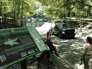
Access points on the SRWT map
Last update: 2026-02-02
Suggest changes, additions, etc. in pictures or text through this form.
See also All points and Categories.
Summary Access Table
* Paddle Time: hours est. for high water at 2 mph (1 mph or slower at low water).† Advisory estimates for feet above sea level (NAVD88) on the indicated Gauge of:
Low: lowest boatable without a lot of dragging; at or slightly above NWS Low Stage
High: highest safe; at or slightly below NWS Action Stage
1 , “”permitted to accept non-hazardous municipal solid waste, including household garbage, commercial waste and special waste.””
2 Paddlers are permitted to take food and drink on the Ichetucknee River in non-disposable containers only.
3 Paddlers are permitted to take food and drink on the Ichetucknee River in non-disposable containers only.
4 Paddlers are permitted to take food and drink on the Ichetucknee River in non-disposable containers only.
5 Paddlers are permitted to take food and drink on the Ichetucknee River in non-disposable containers only.
6 https://wwals.net/pictures/2021-07-08–sewage-spills-valdosta-starke
7 https://wwals.net/pictures/2021-07-08–sewage-spills-valdosta-starke
8 https://wwals.net/pictures/2021-07-08–sewage-spills-valdosta-starke
9 https://wwals.net/pictures/2021-07-08–sewage-spills-valdosta-starke
10 https://wwals.net/pictures/2021-07-08–sewage-spills-valdosta-starke
Distances between Access points
0.10 mile from Charles Spring Ramp to Ezell Landing Ramp0.12 mile from Anderson Landing Ramp to Miller’s Marina of Suwannee Ramp
0.15 mile from Suwannee Marina Ramp to Anderson Landing Ramp
0.17 mile from Swift Creek Launch to Blue Sink Launch
0.23 mile from Dowling Park River Camp to Dowling Park Ramp
0.30 mile from US 129 Ramp to Sandy Point Campground Ramp
0.50 mile from NW 967 Street Ramp to Rock Bluff Ramp
0.50 mile from Manatee Springs State Park Launch to Usher Landing Ramp
0.50 mile from Camp Azalea Ramp to Yellow Jacket Ramp
0.50 mile from FL 47 Ramp to Hollingsworth Bluff Ramp
0.51 mile from Ginnie Springs Ramp to Eddins Boat Ramp
0.60 mile from New Pine Landing Ramp to New Clay Landing Ramp
0.60 mile from El Sea’s Fish Camp to Horseshoe Beach Park and Boat Ramp
0.62 mile from North Fork Suwannee River Landing to Suwannee River Sill Landing
0.73 mile from Calloway Boat Ramp to Hirsh Landing Ramp
0.78 mile from Suwannee River Sill Landing to Suwannee River Sill Ramp
0.80 mile from Hal W. Adams Bridge Ramp to Telford Springs Ramp
0.80 mile from Fowlers Bluff Ramp to Weeks Landing Launch
0.80 mile from Sandy Point Campground Ramp to Ellie Ray’s River Landing Ramp
0.90 mile from Turner Point Landing Ramp to Hart Springs Ramp
1.00 mile from Sims Landing Ramp (North Lafayette County) to Christian Tract Launch
1.00 mile from Hardenbergh Ramp to Suwannee River Rendezvous Ramp
1.00 mile from Purvis Landing Ramp to Shingle Landing Ramp
1.02 miles from Wanamake Ramp to Dorothy Land Ramp
1.05 miles from Dampier’s Landing to South Launch Ichetucknee S.S.P.
1.20 miles from Spirit of Suwannee Music Park Ramp to Deese-Howard Ramp
1.20 miles from Ellie Ray’s River Landing Ramp to Wanamake Ramp
1.21 miles from Woods Ferry River Camp to Woods Ferry Tract Launch
1.32 miles from Stephen C. Foster State Park Ramp to Mixon’s Hammock Canoe Shelter
1.34 miles from Ft. Macomb Ramp to Adams Tract River Camp
1.40 miles from Suwannee Canal Boat Ramp to Cedar Hammock Canoe Shelter
1.40 miles from Usher Landing Ramp to Camp Azalea Ramp
1.40 miles from Butler Island Campsite to El Sea’s Fish Camp
1.50 miles from Suwannee Springs Launch to Spirit of Suwannee Music Park Ramp
1.50 miles from Suwannee River Rendezvous Ramp to Royal Springs Ramp
1.50 miles from Old Pine Landing Ramp to New Pine Landing Ramp
1.56 miles from Adams Tract River Camp to Walker Tract Launch
1.57 miles from Poe Springs Ramp to Rum Island Ramp
1.60 miles from Blue Sink Launch to Rocky Creek Launch
1.60 miles from Rock Bluff Ramp to Gornto Spring Ramp
1.60 miles from Suwannee Gables Ramp to Joe Anderson Jr. Ramp
1.68 miles from Rum Island Ramp to Ginnie Springs Ramp
1.70 miles from Walker Tract Launch to Ruth Springs Launch
1.72 miles from Telford Springs Ramp to Peacock Slough River Camp
1.73 miles from Billys Island Landing to Stephen C. Foster State Park Ramp
1.80 miles from Dowling Park Ramp to Sims Landing Ramp (North Lafayette County)
1.80 miles from Hinton Landing Ramp to Old Pine Landing Ramp
1.84 miles from Turner Bridge Ramp to Cypress Creek South Launch
1.90 miles from BW Turner Boat Ramp to Ira Bea Oasis Ramp
2.00 miles from Eula Landing Ramp to Turner Point Landing Ramp
2.04 miles from North Launch Ichetucknee S.S.P. to Dampier’s Landing
2.10 miles from Log Landing Ramp to Wannee Ramp
2.10 miles from Hart Springs Ramp to Purvis Landing Ramp
2.10 miles from US 27 Ramp to Poe Springs Ramp
2.20 miles from Joe Anderson Jr. Ramp to Hinton Landing Ramp
2.37 miles from Boundary Bend Ramp to Dowling Park River Camp
2.46 miles from Mixon’s Hammock Canoe Shelter to North Fork Suwannee River Landing
2.50 miles from Hirsh Landing Ramp to NW 967 Street Ramp
2.50 miles from FLCT Anderson Landing Ramp to Cat Island rest stop
2.51 miles from Rocky Creek Launch to Woods Ferry River Camp
2.70 miles from Suwannee River Sill Ramp to Griffis Fish Camp Landing
2.70 miles from Suwannee River Wayside Park Ramp to Stephen Foster Folk Culture Center State Park Launch
2.70 miles from Suwannee River Campsites Ramp to Suwannee River State Park Ramp
2.70 miles from Hollingsworth Bluff Ramp to BW Turner Boat Ramp
2.78 miles from Peacock Slough River Camp to Hardenbergh Ramp
2.87 miles from Sims Landing Ramp to Calloway Boat Ramp
2.94 miles from Eddins Boat Ramp to FL 47 Ramp
3.00 miles from Ruth Springs Launch to Patrician Oaks Ramp
3.00 miles from Patrician Oaks Ramp to Ivey Memorial Park Ramp
3.00 miles from Gornto Spring Ramp to Log Landing Ramp
3.00 miles from New Clay Landing Ramp to Manatee Springs State Park Launch
3.00 miles from High Springs Ramp to US 27 Ramp
3.10 miles from Minnies Lake Canoe Shelter to Billys Island Landing
3.10 miles from Round Top Canoe Shelter to Canal Run Campsite
3.10 miles from Ezell Landing Ramp to Lafayette Blue Springs State Park Ramp
3.12 miles from Bible Camp Road Ramp to O’Leno Canoe Launch
3.30 miles from Suwannee River State Park Ramp to Anderson Spring Launch
3.50 miles from Dorothy Land Ramp to Sims Landing Ramp
3.55 miles from Munden Creek Primitive Ramp to Suwannee Marina Ramp
3.70 miles from Christian Tract Launch to Charles Spring Ramp
3.80 miles from Royal Springs Ramp to Ft. Macomb Ramp
3.90 miles from Wannee Ramp to Eula Landing Ramp
3.99 miles from South Launch Ichetucknee S.S.P. to North Launch Ichetucknee S.S.P.
4.00 miles from Coffee Bay Day Use Shelter to Round Top Canoe Shelter
4.20 miles from Shingle Landing Ramp to Suwannee Gables Ramp
4.30 miles from Roline Boat Ramp to Turner Bridge Ramp
4.81 miles from Stephen Foster Folk Culture Center State Park Launch to Swift Creek Launch
5.00 miles from Gibson Park Ramp to Suwannee River Campsites Ramp
5.00 miles from Cedar Key Number 4 Bridge Boat Ramp to Shell Mound Park and Public Boat Ramp
5.00 miles from Shired Island Public Boat Ramp to Butler Island Campsite
5.10 miles from Lafayette Blue Springs State Park Ramp to Hal W. Adams Bridge Ramp
5.10 miles from Cat Island rest stop to Shired Island Public Boat Ramp
5.68 miles from Holton Creek River Camp to Gibson Park Ramp
5.90 miles from Yellow Jacket Ramp to Fowlers Bluff Ramp
6.10 miles from Big Shoals Tract Launch to Suwannee River Wayside Park Ramp
6.22 miles from Deese-Howard Ramp to Holton Creek River Camp
6.38 miles from O’Leno Canoe Launch to High Springs Ramp
6.85 miles from Big Water Canoe Shelter to Minnies Lake Canoe Shelter
8.00 miles from Bluff Lake Canoe Shelter to Floyds Island Cabin
8.00 miles from Woods Ferry Tract Launch to Suwannee Springs Launch
8.30 miles from Ira Bea Oasis Ramp to US 129 Ramp
8.40 miles from Weeks Landing Launch to Munden Creek Primitive Ramp
8.60 miles from Cedar Hammock Canoe Shelter to Coffee Bay Day Use Shelter
8.80 miles from Anderson Spring Launch to Boundary Bend Ramp
9.30 miles from Ivey Memorial Park Ramp to Dorothy Land Ramp
9.36 miles from Cypress Creek South Launch to Cone Bridge Road Ramp
9.40 miles from Cone Bridge Road Ramp to Big Shoals Tract Launch
11 miles from Maul Hammock Canoe Shelter to Big Water Canoe Shelter
12 miles from Kingfisher Landing to Maul Hammock Canoe Shelter
12 miles from Worthington Springs Ramp to Bible Camp Road Ramp
12.3 miles from Shell Mound Park and Public Boat Ramp to FLCT Anderson Landing Ramp
14.17 miles from Griffis Fish Camp Landing to Fargo Ramp
19 miles from Fargo Ramp to Roline Boat Ramp
Spreadsheet Details
Descriptions
Kingfisher Landing 


CATEGORIES: Landing
LAYER: Brochure
GPS: 30.95473, -82.137655
OWNERSHIP: Public, USFWS
ACCESS: Yes, Ramp: Concrete, CAMPING, WATER, RESTROOMS, SHELTER, PICNIC AREA
WATER BODY: Middle Fork Suwannee River
MILE: 32.31
ADDRESS: About 13 miles north of Folkston, on US Route 1/GA Hwy 121. Charlton County.
DESCRIPTION: It features a boat ramp, information kiosk, and restroom facilities for day-use and overnight visitors. Access to the Red and Green trails. Visitors must sign in and out of the landing, for their own protection. Entrance fees are required at Kingfisher Landing.
WEBSITE: http://www.n-georgia.com/okefenokee-nwr-entrances.html
DOWNSTREAM: 12 miles from Kingfisher Landing to Maul Hammock Canoe Shelter
PHONE NUMBER: (912) 496-7836
Suggestions: https://forms.gle/DipPgU2TP5atc2Rf9
Maul Hammock Canoe Shelter 

CATEGORIES: Landing
LAYER: Brochure
OWNERSHIP: Public, USFWS
ACCESS: Yes, Launch: overnight platform shelter, CAMPING, RESTROOMS, PARKING: $15/person, SHELTER, PICNIC AREA
WATER BODY: Middle Fork Suwannee River
MILE: 20.31
ADDRESS: This platform is located on the left edge of Maul Hammock Lake, so be sure to look behind you to find your overnight stop. Charlton County.
DESCRIPTION: The lake, and the other lakes along the Red Trail, provide good fishing opportunities, and this site is one of the most remote locations along the overnight camping trails. Enjoy beautiful night sky viewing from this location.
WEBSITE: http://canoeing.com/kingfisher-landing-spirit-suwannee-park/
UPSTREAM: 12 miles from Maul Hammock Canoe Shelter to Kingfisher Landing
DOWNSTREAM: 11 miles from Maul Hammock Canoe Shelter to Big Water Canoe Shelter
Suggestions: https://forms.gle/DipPgU2TP5atc2Rf9
Big Water Canoe Shelter
CATEGORIES: Landing
LAYER: Brochure
OWNERSHIP: Public, USFWS
ACCESS: Yes, Launch: overnight platform shelter, CAMPING, RESTROOMS, PARKING: $15/person, SHELTER, PICNIC AREA
WATER BODY: Middle Fork Suwannee River
MILE: 9.31
ADDRESS: The platform, located on the red trail, is at the north end of Big Water Lake. Charlton County.
DESCRIPTION: The area provides great fishing opportunities (seasonally). Night sky and sunrise/sunset viewing opportunities.
WEBSITE: http://canoeing.com/kingfisher-landing-spirit-suwannee-park/
UPSTREAM: 11 miles from Big Water Canoe Shelter to Maul Hammock Canoe Shelter
DOWNSTREAM: 6.85 miles from Big Water Canoe Shelter to Minnies Lake Canoe Shelter
Suggestions: https://forms.gle/DipPgU2TP5atc2Rf9
Minnies Lake Canoe Shelter

CATEGORIES: Landing
LAYER: Brochure
OWNERSHIP: Public, USFWS
ACCESS: Yes, Launch: day platform shelter, CAMPING, RESTROOMS, SHELTER, PICNIC AREA
WATER BODY: Middle Fork Suwannee River
MILE: 2.46
ADDRESS: Two and a half miles up the Middle Fork of the Suwannee River. Charlton County.
DESCRIPTION: Very nice for a day trip.
WEBSITE: https://www.google.com/maps/place/Minnies+Lake+Canoe+Shelter/@30.8612425, -82.3256656, 672m/data=!3m2!1e3!4b1!4m5!3m4!1s0x88ef8f5d6281bb7d:0x6149813879306dc7!8m2!3d30.8612425!4d-82.3234769
UPSTREAM: 6.85 miles from Minnies Lake Canoe Shelter to Big Water Canoe Shelter
DOWNSTREAM: 3.10 miles from Minnies Lake Canoe Shelter to Billys Island Landing
PHOTO: https://lh5.googleusercontent.com/p/AF1QipMTgQotZH8GmWXwQ4AhqOvhcUxQONZqWErdO8nL=w408-h306-k-no
PHOTOSET: https://www.google.com/maps/place/Minnies+Lake+Canoe+Shelter/@30.8612425, -82.3256656, 672m/data=!3m2!1e3!4b1!4m5!3m4!1s0x88ef8f5d6281bb7d:0x6149813879306dc7!8m2!3d30.8612425!4d-82.3234769
PHOTO SOURCE: Google maps
PHONE NUMBER: (850) 290-2350
Suggestions: https://forms.gle/DipPgU2TP5atc2Rf9
Bluff Lake Canoe Shelter
CATEGORIES: Landing
LAYER: Brochure
OWNERSHIP: Public, USFWS
ACCESS: Yes, Launch: overnight platform shelter, CAMPING, RESTROOMS, PARKING: $15/person, SHELTER, PICNIC AREA
WATER BODY: Green Trail Okefenokee Swamp
MILE: 12.00
ADDRESS: This site is located on the Green Trail (accessible from Kingfisher Landing). Paddle across Bluff Lake to get to the overnight shelter. Charlton County.
DESCRIPTION: Stars are beautiful on a dark night.
WEBSITE: https://www.recreation.gov/camping/campsites/583321
DOWNSTREAM: 8.00 miles from Bluff Lake Canoe Shelter to Floyds Island Cabin
PHOTO: https://lh5.googleusercontent.com/p/AF1QipOPtALFHEbhk09-pRwhRP_Ptr0z_1TjdugXNRUq=w408-h839-k-no
PHOTOSET: https://www.google.com/maps/place/Bluff+Lake+Canoe+Shelter/@30.8782046, -82.152764, 17z/data=!3m1!4b1!4m5!3m4!1s0x88e5630d26bac585:0x5f3f8c6fcdbc569f!8m2!3d30.8782046!4d-82.1505753
PHOTO SOURCE: Google maps
PHONE NUMBER: (850) 290-2350
Suggestions: https://forms.gle/DipPgU2TP5atc2Rf9
Floyds Island Cabin 

CATEGORIES: Landing
LAYER: Brochure
GPS: 30.8566, -82.2653916
OWNERSHIP: Public, USFWS
ACCESS: Yes, Launch: island bank, CAMPING, RESTROOMS, PARKING: $15/person, SHELTER, PICNIC AREA
WATER BODY: Green Trail Okefenokee Swamp
MILE: 4.00
ADDRESS: This island is located on the Green Trail. If you are camping on Floyds Island as a through trip, you must portage across the island. The portage is approximately 1/4 mile. Charlton County.
DESCRIPTION: The Floyds Island cabin is deep in the heart of the Okefenokee National Wildlife Refuge. This historic cabin was built by the Hebard Cypress Company and is now on the National Register of Historic Places. **Currently, the historic Floyds Cabin is off-limits to visitors due to severe damage from a fallen tree early in 2019. The campsite is located immediately in front of the cabin.
UPSTREAM: 8.00 miles from Floyds Island Cabin to Bluff Lake Canoe Shelter
PHOTO SOURCE: Okefenokee NWR
PHONE NUMBER: (850) 290-2350
Suggestions: https://forms.gle/DipPgU2TP5atc2Rf9
Monkey Lake Canoe Shelter
CATEGORIES: Landing
LAYER: Brochure
OWNERSHIP: Public, USFWS
ACCESS: Yes, Launch: overnight platform shelter, CAMPING, RESTROOMS, PARKING: $15/person, SHELTER, PICNIC AREA
WATER BODY: Pink Trail Okefenokee Swamp
MILE: 24.00
ADDRESS: Located in Grand Prairie on the Pink Trail on the edge of Monkey Lake, Ware County.
DESCRIPTION: with the back of the platform surrounded by scrub/shrub habitat. Be sure to take the time to paddle past the overnight stop to Buzzards Roost—this wide open lake provides great wildlife viewing and fishing opportunities.
WEBSITE: https://www.recreation.gov/camping/campsites/583272
Suggestions: https://forms.gle/DipPgU2TP5atc2Rf9
Suwannee Canal Boat Ramp 
CATEGORIES: Landing
LAYER: Brochure
GPS: 30.73848915, -82.14082336
OWNERSHIP: Public, USFWS
ACCESS: Yes, Ramp: Concrete, CANOE, CAMPING, WATER, RESTROOMS, SHELTER, PICNIC AREA
WATER BODY: Suwannee Canal
MILE: 18.40
ADDRESS: 4159 Suwannee Canal Road, Folkston, GA 31537. From Folkston, travel south on GA Hwy. 121/23 and follow the signs 8 miles to the entrance. Charlton County.
DESCRIPTION: “”Okefenokee Adventures (concession operation) offers guided boat tours, canoe/kayak rentals, boat rentals, and a gift shop are all available to visitors. Okefenokee Adventures also provides food service on-site and is a great place to stop in and pick up any last minute items for your trip in the swamp and to check out what the most recent wildlife sightings have been. For information about the refuge, call the Visitor Center at 912-496-7836. For information about guided boat tours and boat rentals, contact Okefenokee Adventures at 912-496-7156.””
WEBSITE: https://sherpaguides.com/georgia/wildlife_viewing/colonial_coast/76.html
OTHER REFERENCE: https://www.fws.gov/refuge/Okefenokee/visit/plan_your_visit.html
DOWNSTREAM: 1.40 miles from Suwannee Canal Boat Ramp to Cedar Hammock Canoe Shelter
PHOTO: https://wwals.net/wp-content/themes/pianoblack/img//2016/11/b806818906dc60d13f33e2a138dbd0a9.jpg
PHOTOSET: https://wwals.net/2016/11/22/pictures-pioneer-day-okefenokee-nwr-2016-11-19/
PHOTO SOURCE: John S. Quarterman
PHONE NUMBER: (912) 496-7836
Suggestions: https://forms.gle/DipPgU2TP5atc2Rf9
Cedar Hammock Canoe Shelter
CATEGORIES: Landing
LAYER: Brochure
OWNERSHIP: Public, USFWS
ACCESS: Yes, Launch: platform shelter, CAMPING, RESTROOMS, PARKING: $15/person, SHELTER, PICNIC AREA
WATER BODY: Suwannee Canal
MILE: 17.00
ADDRESS: This floating platform is located in Mizell Prairie on the yellow trail. Only three miles from the boat ramp at the Suwannee Canal Recreation Area (SCRA),, Ware County.
DESCRIPTION: this location is great for less experienced paddlers and/or families with children!
WEBSITE: https://www.recreation.gov/camping/campsites/583273
UPSTREAM: 1.40 miles from Cedar Hammock Canoe Shelter to Suwannee Canal Boat Ramp
DOWNSTREAM: 8.60 miles from Cedar Hammock Canoe Shelter to Coffee Bay Day Use Shelter
Suggestions: https://forms.gle/DipPgU2TP5atc2Rf9
Coffee Bay Day Use Shelter
CATEGORIES: Landing
LAYER: Brochure
GPS: 30.7616351, -82.227
OWNERSHIP: Public, USFWS
ACCESS: Yes, Launch: day platform shelter, CAMPING, RESTROOMS, SHELTER, PICNIC AREA
WATER BODY: Suwannee Canal
MILE: 8.40
ADDRESS: Only a few miles down Suwannee Canal. Ware County.
DESCRIPTION: “”It was just a high strip of ground between the swamp and the canal, but had a covered picnic area and a composting toilet.””
UPSTREAM: 8.60 miles from Coffee Bay Day Use Shelter to Cedar Hammock Canoe Shelter
DOWNSTREAM: 4.00 miles from Coffee Bay Day Use Shelter to Round Top Canoe Shelter
Suggestions: https://forms.gle/DipPgU2TP5atc2Rf9
Round Top Canoe Shelter
CATEGORIES: Landing
LAYER: Brochure
OWNERSHIP: Public, USFWS
ACCESS: Yes, Launch: overnight platform shelter, CAMPING, RESTROOMS, PARKING: $15/person, SHELTER, PICNIC AREA
WATER BODY: Suwannee Canal
MILE: 4.40
ADDRESS: Located on the Purple Trail in Chase Prairie, Charlton County.
DESCRIPTION: this site has a 360 degree view that doesn’t disappoint. This site provides some of the most beautiful sunrises and sunsets.
WEBSITE: https://www.recreation.gov/camping/campsites/583270
UPSTREAM: 4.00 miles from Round Top Canoe Shelter to Coffee Bay Day Use Shelter
DOWNSTREAM: 3.10 miles from Round Top Canoe Shelter to Canal Run Campsite
PHOTO: https://lh5.googleusercontent.com/p/AF1QipPTbtM7MjkfPG3_Qx1L90k-yDfoOejZCOfs2WTT=w493-h240-k-no
PHOTOSET: https://www.google.com/maps/place/Round+Top+Canoe+Shelter/@30.8019079, -82.2312566, 13.5z/data=!4m5!3m4!1s0x88ef8781635d58e1:0x16ed01c6dc9751c7!8m2!3d30.8036186!4d-82.2199942
PHOTO SOURCE: Google maps
PHONE NUMBER: (850) 290-2350
Suggestions: https://forms.gle/DipPgU2TP5atc2Rf9
Canal Run Campsite

CATEGORIES: Landing
LAYER: Brochure
OWNERSHIP: Public, USFWS
ACCESS: Yes, Launch: overnight platform shelter, CAMPING, RESTROOMS, PARKING: $15/person, SHELTER, PICNIC AREA
WATER BODY: Suwannee Canal
MILE: 1.30
ADDRESS: On the edge of the historic Suwannee Canal on the Orange Trail. Charlton County.
DESCRIPTION: Surrounded by pines, cypress, and loblolly bays dripping with spanish moss. Campfires, in the provided fire ring, are permitted here.
WEBSITE: https://www.recreation.gov/camping/campsites/583271
UPSTREAM: 3.10 miles from Canal Run Campsite to Round Top Canoe Shelter
PHOTO: https://lh5.googleusercontent.com/p/AF1QipPJP1lBbS8DV-yJYIbBc6vyRGlZeIymmBnpZMBD=w408-h839-k-no
PHOTOSET: https://www.google.com/maps/place/Canal+run+campsite/@30.815353, -82.2551582, 17z/data=!3m1!4b1!4m5!3m4!1s0x88ef864c2bd87877:0xe6d400936c4b1b2e!8m2!3d30.815353!4d-82.2529695
PHOTO SOURCE: Google maps
PHONE NUMBER: (850) 290-2350
Suggestions: https://forms.gle/DipPgU2TP5atc2Rf9
Billys Island Landing

CATEGORIES: Landing
LAYER: Brochure
OWNERSHIP: Public, USFWS
ACCESS: Yes, Launch: steps to wooden dock, DOCK
WATER BODY: Suwannee River
MILE: 244.78
ADDRESS: Only two miles up the Suwannee River from Stephen C. Foster State Park. Charlton County.
DESCRIPTION: About 2/3 of a mile up the East Fork Suwannee River from where the Middle Fork turns off, put in at some wood steps to see remnants of a logging operation and a cemetery.
HISTORIC FACTS: Native Americans long lived in the Land of the Trembling Earth. During the Seminole Wars in the early nineteenth century, Billy Bowlegs was the leader of a party of Indians, escaped slaves, and AWOL soldiers who used Billys Island as a base. By 1838, the U.S. Army had taken over the island. In the 1850s the Lee family moved to the island, farming, fishing, hunting, and foraging. The Georgia land sale of the entire swamp in 1889 to the Suwannee Canal Company did not disturb the Lees. Once that failed, the Hebard family bought he Swamp in 1901 and started logging all the cypress in the swamp and pine trees on the islands they could get. The island briefly boombed with movies, a church, and whisky stills. The Lees sued, lost, and left. The loggers left in 1926 and the Lees returned. The U.S. purchased the Swamp in 1937. Persuaded by scientific research since 1912 and especially naturalist Francis Lee, President Franklin D. Roosevelt created the Okefenokee Wildlife Refuge by executive order in 1937.
WEBSITE: https://wwals.net/2017/02/05/wwals-okefenokee-billys-island-outing-2016-12-10/
ADDITIONAL INFO SOURCES: https://traveltips.usatoday.com/history-billys-island-okefenokee-swamp-georgia-55056.html
DOWNSTREAM: 1.73 miles from Billys Island Landing to Stephen C. Foster State Park Ramp
PHOTO: https://wwals.net/wp-content/themes/pianoblack/img//2017/02/afa2f3ca3fdb686465e3c08f032d7acd.jpg
PHOTOSET: https://wwals.net/2017/02/05/wwals-okefenokee-billys-island-outing-2016-12-10/
PHOTO SOURCE: John S. Quarterman
PHONE NUMBER: (229) 242-0102
Suggestions: https://forms.gle/DipPgU2TP5atc2Rf9
Stephen C. Foster State Park Ramp @ GA 177 


CATEGORIES: Landing
LAYER: Brochure
OWNERSHIP: Public, USFWS
ACCESS: Yes, Ramp: Concrete on paved access road, plus grassy canal side, DOCK, CANOE, CAMPING: “RV, Tent, and Primitive, FOOD: Store, WATER, Flush Toilet, PARKING: State park fees, SHELTER, PICNIC AREA, FISH BAIT, HANDICAPPED ACCESSIBLE
WATER BODY: Suwannee River
GAUGE: SCFSP
MILE: 243.05
ADDRESS: 17515 GA-177, Fargo, GA 31631. From Fargo, travel south on US 441 to CR 177; turn left and travel to Stephen C. Foster State Park. Charlton County.
DESCRIPTION: Paddlers usually put in down the access road from the ramp, at the west entrance to the one-of-a-kind Okefenokee Swamp. “”This remote park is a primary entrance to the legendary Okefenokee Swamp—one of Georgia’s seven natural wonders. Spanish moss-laced trees reflect off the black swamp waters, while cypress knees rise upward from the glass-like surface. Here, paddlers and photographers will enjoy breathtaking scenery and abundant wildlife. Alligators, turtles, raccoons, black bears, deer, ibis, herons, wood storks, red-cockaded woodpeckers and numerous other creatures make their homes in the 402, 000 acre refuge. Stargazers will appreciate the particularly dark sky.””
WEBSITE: https://www.fws.gov/refuge/Okefenokee/visit/plan_your_visit.html
UPSTREAM: 1.73 miles from Stephen C. Foster State Park Ramp to Billys Island Landing
DOWNSTREAM: 1.32 miles from Stephen C. Foster State Park Ramp to Mixon’s Hammock Canoe Shelter
PHOTO: https://wwals.net/wp-content/themes/pianoblack/img//2017/12/0abc6626c5eda845369f5e6c00d635c2.jpg
PHOTOSET: https://wwals.net/2017/12/11/one-alligator-some-turtles-many-birds-cold-and-clear-okefenokee-outing/
PHOTO SOURCE: John S. Quarterman
PHONE NUMBER: (912) 637-5274
Suggestions: https://forms.gle/DipPgU2TP5atc2Rf9
Mixon’s Hammock Canoe Shelter
CATEGORIES: Landing
LAYER: Brochure
OWNERSHIP: Public, USFWS
ACCESS: Yes, Launch: overnight platform shelter, CAMPING, RESTROOMS, PARKING: $15/person, SHELTER, PICNIC AREA
WATER BODY: Suwannee River
GAUGE: SCFSP
MILE: 241.73
ADDRESS: Located at the west end of Billys Lake before the River Narrows on the Brown Trail. Charlton County.
DESCRIPTION: The only canoe shelter on the Suwannee River proper. “”You can spend the afternoon hiking around the island rich with history and cooking hotdogs over a campfire (fire ring provided on the island).”” “”This island is a great opportunity for less experienced paddlers and families with children to do an overnight in the swamp—only two miles from Stephen C. Foster State Park boat launch.””
GRN: Yes
WEBSITE: https://www.recreation.gov/camping/campsites/583221
UPSTREAM: 1.32 miles from Mixon’s Hammock Canoe Shelter to Stephen C. Foster State Park Ramp
DOWNSTREAM: 2.46 miles from Mixon’s Hammock Canoe Shelter to North Fork Suwannee River Landing
PHOTO: https://lh5.googleusercontent.com/p/AF1QipNDxBRg2JBwNi3P2Q70O8_XR5LJSHzSHGAqbidx=w408-h306-k-no
PHOTOSET: https://www.google.com/maps/place/Mixon’s+Hammock+Canoe+Shelter/@30.8243092, -82.3838401, 672m/data=!3m2!1e3!4b1!4m5!3m4!1s0x88ef85310cf47705:0x7012c453bc9908e7!8m2!3d30.8243092!4d-82.3816514
PHOTO SOURCE: Google maps
PHONE NUMBER: (850) 290-2350
Suggestions: https://forms.gle/DipPgU2TP5atc2Rf9
North Fork Suwannee River Landing @ Suwannee River Sill Road
CATEGORIES: Landing
LAYER: Brochure
GPS: 30.81875, -82.41392
OWNERSHIP: Public
ACCESS: Yes, Launch: riverbank, PARKING: $5 parking pass
WATER BODY: Suwannee River
GAUGE: SCFSP
MILE: 239.27
ADDRESS: From Fargo, travel south on US 441 to CR 177; turn left and travel towards Stephen C. Foster State Park. Go 11.2 miles and turn left on Suwannee River Sill. Charlton County.
DESCRIPTION: Walk up the sill and put in where the North Fork of the Suwannee River meets the main branch of the Suwannee River.
AKA: North Fork Suwannee River Confluence or North Fork Suwannee River at the Sill
UPSTREAM: 2.46 miles from North Fork Suwannee River Landing to Mixon’s Hammock Canoe Shelter
DOWNSTREAM: 0.62 mile from North Fork Suwannee River Landing to Suwannee River Sill Landing
Suggestions: https://forms.gle/DipPgU2TP5atc2Rf9
Suwannee River Sill Landing @ Suwannee River Sill Road

CATEGORIES: Landing
LAYER: Brochure
OWNERSHIP: Public
ACCESS: Yes, Launch: grassy dam riverbank, PARKING: $5 parking pass
WATER BODY: Suwannee River
GAUGE: SCFSP
MILE: 238.65
ADDRESS: Slightly northeast of the first gate in the Suwannee River Sill. Charlton County.
DESCRIPTION: Where you first reach the Sill coming downstream on the Suwannee River. You can turn left and go 3/4 of a mile through the first gate (or over the Sill) to the Suwannee River Sill Ramp. (Miles upstream from Suwannee River Sill Landing are counted this way.) Or you can turn right and go a mile up the Sill, through the second gate, and 1.4 miles down to the Suwannee River Sill Ramp. Or turn right, go a mile up the Sill, and continue 5.14 miles up the North Fork of the Suwannee River to Cravens Hammock.
HISTORIC FACTS: Built by the federal government in 1960, this five-mile-long dirt dam was intended to keep water in the Swamp during droughts, because of wildfires in the 1950s. It didn’t work: it only affected about one percent of the Swamp. In 1998 U.S. FWS concluded that the Sill should be breached and its gates removed. Meanwhile, the structure is popular as an access road to the Suwannee River and the Okefenokee Swamp, and there is resistance to it being completely removed. Meanwhile, its gates (flow outlets) are always open.
GRN: Yes
WEBSITE: https://www.fws.gov/refuge/Okefenokee/visit/plan_your_visit.html
OTHER REFERENCE: https://www.exploresouthernhistory.com/suwanneesill.html
ADDITIONAL INFO SOURCES: https://www.sciencedirect.com/science/article/abs/pii/002216949290011J
UPSTREAM: 0.62 mile from Suwannee River Sill Landing to North Fork Suwannee River Landing
DOWNSTREAM: 0.78 mile from Suwannee River Sill Landing to Suwannee River Sill Ramp
PHOTO: https://www.wwals.net/pictures/2023-12-09–griffis-fish-camp-suwannee-pictures/20231209_112520.jpg
PHOTOSET: https://www.wwals.net/pictures/2023-12-09–griffis-fish-camp-suwannee-pictures/
PHOTO SOURCE: John S. Quarterman
PHONE NUMBER: (229) 242-0102
Suggestions: https://forms.gle/DipPgU2TP5atc2Rf9
Suwannee River Sill Ramp @ Suwannee River Sill Road

CATEGORIES: Landing
LAYER: Brochure
OWNERSHIP: Public
ACCESS: Yes, Launch: concrete ramp on paved road below the sill; riverbank on the dam above. PARKING: $5 parking pass, HANDICAPPED ACCESSIBLE
WATER BODY: Suwannee River
GAUGE: Fargo
MILE: 237.87
ADDRESS: From Fargo, travel south on US 441 to GA 177; turn left and travel towards Stephen C. Foster State Park. Go 11.2 miles and turn left on Suwannee River Sill. Charlton County.
DESCRIPTION: Parking is below the Sill gates. You can put in below the gates on the concrete ramp, or on the dam side above. It’s an unusual location, on a five-mile-long dirt dam that seemed like a good idea at the time, but whose gates are now always left open; it that may soon be demolished. See Suwannee River Sill.
HISTORIC FACTS: See Suwannee River Sill.
AKA: Suwannee River Sill Landing
WEBSITE: https://www.fws.gov/refuge/Okefenokee/visit/plan_your_visit.html
OTHER REFERENCE: https://www.exploresouthernhistory.com/suwanneesill.html
UPSTREAM: 0.78 mile from Suwannee River Sill Ramp to Suwannee River Sill Landing
DOWNSTREAM: 2.70 miles from Suwannee River Sill Ramp to Griffis Fish Camp Landing
PHOTOSET: https://wwals.net/pictures/2019-12-08–okefenokee-griffis-fish-camp-suwannee-paddle/
PHOTO SOURCE: John S. Quarterman
PHONE NUMBER: (912) 637-5274
Suggestions: https://forms.gle/DipPgU2TP5atc2Rf9
Griffis Fish Camp Landing @ GA 177

CATEGORIES: Landing Private
LAYER: Brochure
GPS: 30.7845, -82.446333
OWNERSHIP: Private, Edwin Alphin Griffis Estate, et al. PARCEL 177 003
ACCESS: Yes, Launch: riverbank down dirt access road, CAMPING: “RV, Tent, and Primitive, WATER, Flush Toilet, PARKING: $2 boat launch; camping fees, SHELTER, PICNIC AREA
WATER BODY: Suwannee River
GAUGE: Fargo
MILE: 235.17
ADDRESS: 10333 Ga Highway 177 Fargo, Georgia 31631. From Fargo, travel south on US 441 to CR 177; turn left and travel 10 miles northeast; Griffis Fish Camp is on left. Clinch County.
DESCRIPTION: The river can be quite high up the dirt access road, but it’s still easily accessible on this very gentle slope, at this family-owned fish camp. Put in here for nineteen idyllic river miles with little human in evidence beyond timber company signs on the right bank and an even more private fish camp on the left bank, before Fargo Ramp. There is a small charge for river access. Call 229-512-0558 for campsite or pavilion reservations. Call in advance to reserve campsites or pavillions: 229-412-0558
AKA: 10257 GA 177, Fargo, GA 31631
GRN: Yes
UPSTREAM: 2.70 miles from Griffis Fish Camp Landing to Suwannee River Sill Ramp
DOWNSTREAM: 14.17 miles from Griffis Fish Camp Landing to Fargo Ramp
PHOTOSET: https://wwals.net/pictures/2019-12-08–okefenokee-griffis-fish-camp-suwannee-paddle/
PHOTO SOURCE: John S. Quarterman
PHONE NUMBER: (229) 242-0102
PHOTO2: https://www.wwals.net/pictures/2020-11-07–okefenokee-floyds-island/20201106_151924.jpg
Photoset2: https://www.wwals.net/pictures/2020-11-07–okefenokee-floyds-island/
PHOTO2 SOURCE: John S. Quarterman
Photo2 Phone Number: 229-242-0102
Suggestions: https://forms.gle/DipPgU2TP5atc2Rf9

Fargo Ramp @ US 441

CATEGORIES: Landing
LAYER: Brochure
OWNERSHIP: Public, SUPERIOR PINE PRODUCTS CO, PARCEL F03 001
ACCESS: Yes, Ramp: Concrete, HANDICAPPED ACCESSIBLE
WATER BODY: Suwannee River
Lowest boatable: 92.5
Highest safe: 100
GAUGE: Fargo
MILE: 221.00
ADDRESS: Half a mile southeast of Fargo on US 441, the boat ramp is on the northeast side of US 441 and on the west (right bank) of the Suwannee River. Clinch County.
DESCRIPTION: Nice concrete ramp, good access road, plenty of parking. Downstream there are plenty of turtles, cypress, oaks, pines, some creeks, many white sand beaches, maybe a small shoal if the water is low enough, and no roads for 26 river miles in Georgia and Florida.
AKA: Fargo Boat Ramp
ADDITIONAL INFO SOURCES: http://www.suwanneeoutpost.com/waterlevels.html
UPSTREAM: 14.17 miles from Fargo Ramp to Griffis Fish Camp Landing
DOWNSTREAM: 19 miles from Fargo Ramp to Roline Boat Ramp
PHOTO: https://wwals.net/pictures/2017-03-18–fargo-roline-wwals/20170318_073044.jpg
PHOTOSET: https://wwals.net/pictures/2017-03-18–fargo-roline-wwals/
PHOTO SOURCE: John S. Quarterman
PHONE NUMBER: (229) 242-0102
Suggestions: https://forms.gle/DipPgU2TP5atc2Rf9
Roline Boat Ramp @ NE 25 Way

CATEGORIES: Landing
LAYER: Brochure
OWNERSHIP: Public, SUWANNEE RIVER WATER MANAGEMENT DISTRICT, PARCEL 1130-010
ACCESS: Yes, Ramp: narrow, smooth, and sandy down a dirt access road
WATER BODY: Suwannee River
Lowest boatable: 52
Highest safe: 68
GAUGE: White Springs
MILE: 202.00
ADDRESS: From White Springs, travel north on SE CR 135; cross over SE CR 6 onto NE 180 Boulevard (Woodpecker Route); travel north to NE 25 Way; turn right and follow road to ramp. Hamilton County.
DESCRIPTION: On the right (west) bank, this is the first take-out in Florida, for small boats only. The ramp and the land around it is owned by the Suwannee River Water Management District, in its Roline tract, part of the Cypress Creek Conservation Area. East across the river is private property, but the beach below the mean high water mark is public property in Florida.
AKA: Roline Launch or Roline Ramp
GRN: Yes
WEBSITE: https://www.mysuwanneeriver.com/225/Turner-Bridge-Roline-Cypress-Creek-South
OTHER REFERENCE: http://www.suwanneeoutpost.com/waterlevels.html
ADDITIONAL INFO SOURCES: http://suwanneeoutpost.com/reportfargotoconebridgefeb08.html
UPSTREAM: 19 miles from Roline Boat Ramp to Fargo Ramp
DOWNSTREAM: 4.30 miles from Roline Boat Ramp to Turner Bridge Ramp
PHOTO: https://www.wwals.net/pictures/2017-03-18–fargo-roline-wwals/20170318_164846.jpg
PHOTOSET: https://www.wwals.net/pictures/2017-03-18–fargo-roline-wwals/
PHOTO SOURCE: John S. Quarterman
PHONE NUMBER: (229) 242-0102
PHOTO2: https://www.wwals.net/pictures/2022-03-06–roline-turner-bridge-suwannee-river/img0619.jpg
Photoset2: https://www.wwals.net/pictures/2022-03-06–roline-turner-bridge-suwannee-river/
PHOTO2 SOURCE: John S. Quarterman
Photo2 Phone Number: 229-242-0102
Suggestions: https://forms.gle/DipPgU2TP5atc2Rf9

Turner Bridge Ramp @ NE 38 Trail

CATEGORIES: Landing
LAYER: Brochure
OWNERSHIP: Public, SUWANNEE RIVER WATER MANAGEMENT DISTRICT, PARCEL 1008-000
ACCESS: Yes, Ramp: Concrete
WATER BODY: Suwannee River
Lowest boatable: 52
Highest safe: 68
GAUGE: White Springs
MILE: 197.70
ADDRESS: From White Springs, travel north on SE CR 135; cross over SE CR 6 onto NE 180 Boulevard (Woodpecker Route); travel north to NE 38 Trail; turn right and follow road to ramp. Hamilton County.
DESCRIPTION: On the right (west) bank, this is a good concrete ramp on a dirt road with ample parking.
HISTORIC FACTS: See Turner Bridge.
AKA: Turner Bridge Boat Ramp
WEBSITE: https://www.mysuwanneeriver.com/225/Turner-Bridge-Roline-Cypress-Creek-South
ADDITIONAL INFO SOURCES: http://www.suwanneeoutpost.com/waterlevels.html
UPSTREAM: 4.30 miles from Turner Bridge Ramp to Roline Boat Ramp
DOWNSTREAM: 1.84 miles from Turner Bridge Ramp to Cypress Creek South Launch
PHOTO: https://www.wwals.net/pictures/2022-03-06–roline-turner-bridge-suwannee-river/20220306_130122.jpg
PHOTOSET: https://www.wwals.net/pictures/2022-03-06–roline-turner-bridge-suwannee-river/
PHOTO SOURCE: John S. Quarterman
PHONE NUMBER: (229) 242-0102
Suggestions: https://forms.gle/DipPgU2TP5atc2Rf9
Cypress Creek South Launch @ FL 6

CATEGORIES: Landing
LAYER: Brochure
GPS: 30.50737, -82.71711
OWNERSHIP: Public
ACCESS: Yes, Launch: riverbank
WATER BODY: Suwannee River
Lowest boatable: 52
Highest safe: 68
GAUGE: White Springs
MILE: 195.86
ADDRESS: From White Springs, Travel north on CR 135 to SR 6, turn right; travel east to the bridge. At the foot of the bridge, turn left onto road shoulder and follow the road to the river. Hamilton County.
DESCRIPTION: Rustic launch next to busy county road in 21-acre SRWMD tract.
WEBSITE: https://www.mysuwanneeriver.com/225/Turner-Bridge-Roline-Cypress-Creek-South
ADDITIONAL INFO SOURCES: http://www.suwanneeoutpost.com/waterlevels.html
UPSTREAM: 1.84 miles from Cypress Creek South Launch to Turner Bridge Ramp
DOWNSTREAM: 9.36 miles from Cypress Creek South Launch to Cone Bridge Road Ramp
PHOTOSET: https://wwals.net/2017/01/01/redoux-suwannee-river-roline-to-cypress-creek/
PHOTO SOURCE: John S. Quarterman
PHONE NUMBER: (229) 242-0102
PHOTO2: https://wwals.net/wp-content/themes/pianoblack/img//2015/11/44a86df8d28bbbbb0e9bcc7df58d220c.jpg
Photoset2: https://wwals.net/2015/11/23/pictures-fl-6-to-cone-bridge-suwannee-river-gretchen-quarterman/
PHOTO2 SOURCE: Gretchen Quarterman
Suggestions: https://forms.gle/DipPgU2TP5atc2Rf9

Cone Bridge Road Ramp @ NW Cone Bridge Road

CATEGORIES: Landing
LAYER: Brochure
OWNERSHIP: Public
ACCESS: Yes, Ramp: Concrete
WATER BODY: Suwannee River
Lowest boatable: 51
Highest safe: 68
GAUGE: White Springs
MILE: 186.50
ADDRESS: From Lake City, travel north on US 441 to NW Cone Bridge Road; turn left and follow road to ramp. Columbia County.
DESCRIPTION: A wide concrete ramp with ample parking.
HISTORIC FACTS: See History of Cone Bridge and the Cone family –Dr. Ken Sulak 2020-12-31 https://wwals.net/?p=54537
AKA: Cone Bridge Road Boat Ramp
ADDITIONAL INFO SOURCES: http://www.suwanneeoutpost.com/waterlevels.html
UPSTREAM: 9.36 miles from Cone Bridge Road Ramp to Cypress Creek South Launch
DOWNSTREAM: 9.40 miles from Cone Bridge Road Ramp to Big Shoals Tract Launch
PHOTO: https://wwals.net/wp-content/themes/pianoblack/img//2015/11/028c77fe95bd125ea2c428a9629d1a1c.jpg
PHOTOSET: https://wwals.net/2015/11/23/pictures-fl-6-to-cone-bridge-suwannee-river-gretchen-quarterman/
PHOTO SOURCE: Gretchen Quarterman
PHONE NUMBER: (850) 290-2350
Suggestions: https://forms.gle/DipPgU2TP5atc2Rf9
Big Shoals Tract Launch @ Godwin Bridge Road

CATEGORIES: Landing
LAYER: Brochure
OWNERSHIP: Public
ACCESS: Yes, Launch: dock and steps down long walk from parking area. HANDICAPPED ACCESSIBLE
WATER BODY: Suwannee River
Lowest boatable: 51
Highest safe: 65
GAUGE: White Springs
MILE: 177.10
ADDRESS: Right bank. From White Springs, travel north on CR 135 to SE 94 Street (Godwin Bridge Road); turn right and follow road to Big Shoals. Hamilton County.
DESCRIPTION: Dock, steps, and ramp after long walk from parking.
HISTORIC FACTS: Built in 2017 by George & Associates Consulting Engineers. https://gaceng.net/portfolio/big-shoals-state-park-kayak-canoe-launch/
AKA: Big Shoals canoe launch
WEBSITE: https://map.mysuwanneeriver.com/tracts/big-shoals-25/
OTHER REFERENCE: https://wwals.net/pictures/2021-05-19–big-shoals-pictures/#Land
ADDITIONAL INFO SOURCES: http://www.suwanneeoutpost.com/waterlevels.html
UPSTREAM: 9.40 miles from Big Shoals Tract Launch to Cone Bridge Road Ramp
DOWNSTREAM: 6.10 miles from Big Shoals Tract Launch to Suwannee River Wayside Park Ramp
PHOTO: https://wwals.net/pictures/2021-05-19–big-shoals-pictures/20210519_102158.jpg
PHOTOSET: https://wwals.net/pictures/2021-05-19–big-shoals-pictures/
PHOTO SOURCE: John S. Quarterman
PHONE NUMBER: (229) 242-0102
PHOTO2: https://wwals.net/pictures/2021-05-19–big-shoals-pictures/20210519_102335.jpg
Photoset2: https://wwals.net/pictures/2021-05-19–big-shoals-pictures/
PHOTO2 SOURCE: John S. Quarterman
Photo2 Phone Number: 229-242-0102
Suggestions: https://forms.gle/DipPgU2TP5atc2Rf9

Suwannee River Wayside Park Ramp @ US 41

CATEGORIES: Landing
LAYER: Brochure
GPS: 30.3255, -82.739167
OWNERSHIP: Public, Town of White Springs, FL, PARCEL 8758-000
ACCESS: Yes, Ramp: Concrete
WATER BODY: Suwannee River
Lowest boatable: 51
Highest safe: 68
GAUGE: White Springs
MILE: 171.00
ADDRESS: Right bank, just downstream of US 41 Bridge. From White Springs, travel south on US 41 to the river; the ramp is on the south side in the town park. Hamilton County.
DESCRIPTION: Public park and boat ramp on the Suwannee River. Take out downstream of Big Shoals and Little Shoals.
AKA: White Springs Boat Ramp
OTHER REFERENCE: https://wwals.net/pictures/2021-05-19–big-shoals-pictures/#Take-Out
ADDITIONAL INFO SOURCES: http://www.suwanneeoutpost.com/waterlevels.html
UPSTREAM: 6.10 miles from Suwannee River Wayside Park Ramp to Big Shoals Tract Launch
DOWNSTREAM: 2.70 miles from Suwannee River Wayside Park Ramp to Stephen Foster Folk Culture Center State Park Launch
PHOTO: https://wwals.net/pictures/2021-05-19–big-shoals-pictures/20210519_135229.jpg
PHOTOSET: https://wwals.net/pictures/2021-05-19–big-shoals-pictures/
PHOTO SOURCE: John S. Quarterman
PHONE NUMBER: (229) 242-0102
Suggestions: https://forms.gle/DipPgU2TP5atc2Rf9
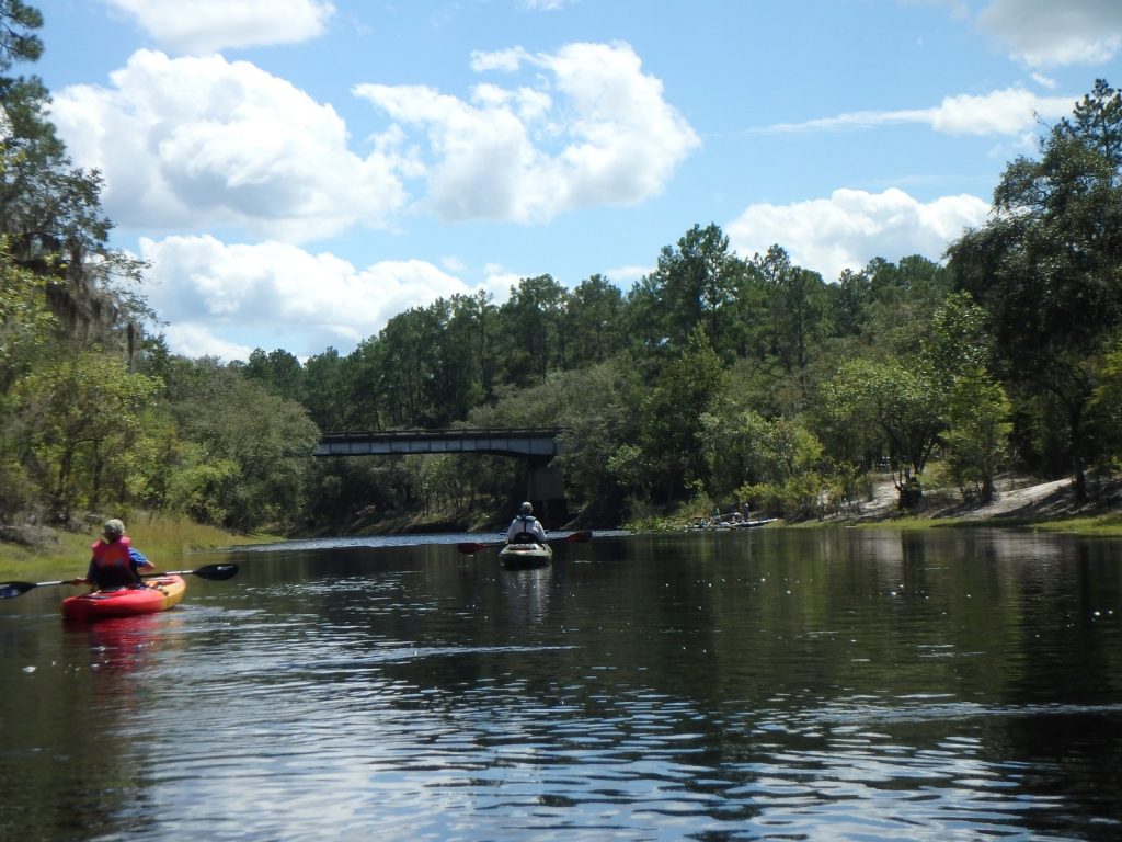
Stephen Foster Folk Culture Center State Park Launch @ Lillian Sanders Drive

CATEGORIES: Landing
LAYER: Brochure
OWNERSHIP: Public
ACCESS: Yes, Launch: riverbank
WATER BODY: Suwannee River
Lowest boatable: 51
Highest safe: 68
GAUGE: White Springs
MILE: 168.30
ADDRESS: Canoe launch is in Stephen Foster Folk Culture Center State Park in White Springs. Hamilton County.
ADDITIONAL INFO SOURCES: http://www.suwanneeoutpost.com/waterlevels.html
UPSTREAM: 2.70 miles from Stephen Foster Folk Culture Center State Park Launch to Suwannee River Wayside Park Ramp
DOWNSTREAM: 4.81 miles from Stephen Foster Folk Culture Center State Park Launch to Swift Creek Launch
PHOTO: https://wwals.net/pictures/2016-11-23–gammie-white-springs/384A3776.jpg
PHOTOSET: https://wwals.net/pictures/2016-11-23–gammie-white-springs/
PHOTO SOURCE: Beth Gammie for WWALS on Southwings flight
PHONE NUMBER: (850) 290-2350
Suggestions: https://forms.gle/DipPgU2TP5atc2Rf9
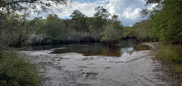
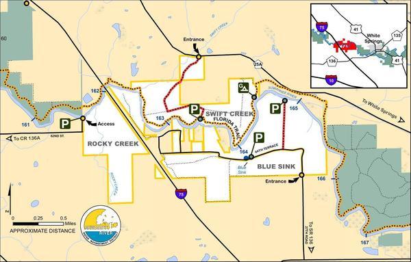
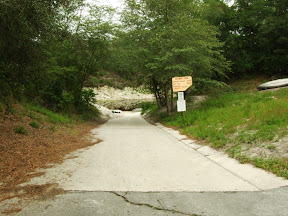
Swift Creek Launch @ CR 25A
CATEGORIES: Landing
LAYER: Brochure
GPS: 30.34129, -82.81692
OWNERSHIP: Public
ACCESS: Yes, Launch: riverbank
WATER BODY: Suwannee River
Lowest boatable: 51
Highest safe: 68
GAUGE: White Springs
MILE: 163.49
ADDRESS: Swift Creek tract from White Springs: Take CR 25A west; the entrance to the Swift Creek tract is on the left. Hamilton County.
DESCRIPTION: Swift Creek Landing is here: 30.34129, -82.81692, but google maps will route that to the wrong side of the river. So use 30.34278, -82.8221 to route to Swift Creek Tract, and then it’s left, right to the launch.
WEBSITE: https://www.mysuwanneeriver.com/274/Blue-Sink-Rocky-Creek-Swift-Creek
ADDITIONAL INFO SOURCES: http://www.suwanneeoutpost.com/waterlevels.html
UPSTREAM: 4.81 miles from Swift Creek Launch to Stephen Foster Folk Culture Center State Park Launch
DOWNSTREAM: 0.17 mile from Swift Creek Launch to Blue Sink Launch
PHOTO: http://www.l-a-k-e.org/blog/wp-content/uploads/2017/04/42e4036bc1a8e3c89dc06532da05aad1.jpg
PHOTOSET: https://www.mysuwanneeriver.com/274/Blue-Sink-Rocky-Creek-Swift-Creek
PHOTO SOURCE: SRWMD
PHONE NUMBER: (850) 290-2350
Suggestions: https://forms.gle/DipPgU2TP5atc2Rf9
Blue Sink Launch @ 64th Terrace

CATEGORIES: Landing
LAYER: Brochure
OWNERSHIP: Public
ACCESS: Yes, Launch: riverbank
WATER BODY: Suwannee River
Lowest boatable: 51
Highest safe: 68
GAUGE: White Springs
MILE: 163.32
ADDRESS: 3565 64th Terrace, White Springs, FL 32096, Suwannee County.
DESCRIPTION: Blue Sink tract from Live Oak: Travel northeast on SR 136 crossing I-75; travel approximately 1 mile past the interstate, turn left on 27th Road and the Blue Sink tract begins approximately .75 mile on both sides of the road. From White Springs: Travel southwest on SR 136, turn right on 27th Road.
WEBSITE: https://www.mysuwanneeriver.com/274/Blue-Sink-Rocky-Creek-Swift-Creek
ADDITIONAL INFO SOURCES: http://www.suwanneeoutpost.com/waterlevels.html
UPSTREAM: 0.17 mile from Blue Sink Launch to Swift Creek Launch
DOWNSTREAM: 1.60 miles from Blue Sink Launch to Rocky Creek Launch
PHOTO: https://wwals.net/pictures/2016-11-23–gammie-white-springs/384A3760.jpg
PHOTOSET: https://wwals.net/pictures/2016-11-23–gammie-white-springs/384A3760.jpg
PHOTO SOURCE: Beth Gammie for WWALS on Southwings flight
PHONE NUMBER: (850) 290-2350
Suggestions: https://forms.gle/DipPgU2TP5atc2Rf9
Rocky Creek Launch @ 62nd Street
CATEGORIES: Landing
LAYER: Brochure
OWNERSHIP: Public
ACCESS: Yes, Launch: riverbank
WATER BODY: Suwannee River
GAUGE: White Springs
MILE: 161.72
ADDRESS: Rocky Creek tract from Live Oak: Travel north on US 129, turn right on CR 136A, go east 6 miles, turn left on 53rd Road, follow 53rd Road to 62nd Street, turn right; the street dead ends at the Rocky Creek tract. Suwannee County.
WEBSITE: https://www.mysuwanneeriver.com/274/Blue-Sink-Rocky-Creek-Swift-Creek
UPSTREAM: 1.60 miles from Rocky Creek Launch to Blue Sink Launch
DOWNSTREAM: 2.51 miles from Rocky Creek Launch to Woods Ferry River Camp
PHOTO: http://www.l-a-k-e.org/blog/wp-content/uploads/2017/04/42e4036bc1a8e3c89dc06532da05aad1.jpg
PHOTOSET: https://www.mysuwanneeriver.com/274/Blue-Sink-Rocky-Creek-Swift-Creek
PHOTO SOURCE: SRWMD
PHONE NUMBER: (850) 290-2350
Suggestions: https://forms.gle/DipPgU2TP5atc2Rf9
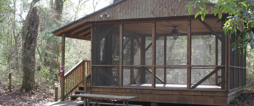
Woods Ferry River Camp 

CATEGORIES: Landing
LAYER: Brochure
OWNERSHIP: Public
ACCESS: Yes, Stairs: quite steep, CAMPING, WATER, RESTROOMS, SHELTER, PICNIC AREA
WATER BODY: Suwannee River
GAUGE: White Springs
MILE: 159.21
ADDRESS: The Woods Ferry River Camp is located 10 miles from White Springs. The river camps are accessible by river only. No vehicles or overnight parking is permitted. Call 800-868-9914 for more information. Suwannee County.
DESCRIPTION: The camp sits on a high bluff above the river, and an elaborate system of boardwalks will guide you in to the camp.
HISTORIC FACTS: Effective July 18, 2023: Please use caution when using the steps at Woods Ferry River Camp.
WEBSITE: https://www.floridastateparks.org/parks-and-trails/suwannee-river-wilderness-state-trail/river-camps
OTHER REFERENCE: https://map.mysuwanneeriver.com/tracts/woods-ferry-243/
UPSTREAM: 2.51 miles from Woods Ferry River Camp to Rocky Creek Launch
DOWNSTREAM: 1.21 miles from Woods Ferry River Camp to Woods Ferry Tract Launch
PHOTO: https://www.floridastateparks.org/sites/default/files/media/image/WoodsFerry.jpg
PHOTOSET: https://www.floridastateparks.org/parks-and-trails/suwannee-river-wilderness-state-trail/river-camps
PHOTO SOURCE: Florida State Parks
PHONE NUMBER: (800) 868-9914
Suggestions: https://forms.gle/DipPgU2TP5atc2Rf9
Woods Ferry Tract Launch @ Woods Ferry Path

CATEGORIES: Landing
LAYER: Brochure
GPS: 30.362, -82.868333
OWNERSHIP: Public
ACCESS: Yes, Launch: riverbank
WATER BODY: Suwannee River
GAUGE: Suwannee Springs
MILE: 158.00
ADDRESS: From Live Oak, travel north on US 129 to CR 136A; turn right; travel east to 57 Drive; turn left and continue north to Woods Ferry Path; follow Woods Ferry Path to canoe launch. Suwannee County.
DESCRIPTION: A sandy beach at the end of a woods road.
WEBSITE: https://map.mysuwanneeriver.com/tracts/woods-ferry-243/
UPSTREAM: 1.21 miles from Woods Ferry Tract Launch to Woods Ferry River Camp
DOWNSTREAM: 8.00 miles from Woods Ferry Tract Launch to Suwannee Springs Launch
PHOTO: https://wwals.net/wp-content/themes/pianoblack/img//2017/05/5b223e569b7bcbd91f5cef23e681eb04.jpg
PHOTOSET: https://wwals.net/2017/05/23/pictures-woods-ferry-tract-to-suwannee-springs-2017-05-20/
PHOTO SOURCE: John S. Quarterman
PHONE NUMBER: (229) 242-0102
PHOTO2: https://wwals.net/pictures/2016-11-23–gammie-white-springs/woods-ferry-tract-launch.jpg
Photoset2: https://wwals.net/pictures/2016-11-23–gammie-white-springs/
PHOTO2 SOURCE: Beth Gammie for WWALS on Southwings flight
Suggestions: https://forms.gle/DipPgU2TP5atc2Rf9

Suwannee Springs Launch @ 32 Street

CATEGORIES: Landing
LAYER: Brochure
OWNERSHIP: Public
ACCESS: Yes, Stairs: Wooden Steps
WATER BODY: Suwannee River
GAUGE: Suwannee Springs
MILE: 150.00
ADDRESS: 3243 91st Dr., Live Oak, FL 32060. From Live Oak, travel north on US 129 to 93 Drive; turn right; travel north to 32 Street; turn right and follow to park area. Suwannee County.
DESCRIPTION: A sand beach and stairs next to a sulfur spring with a stone spring wall.
HISTORIC FACTS: “”Suwannee Springs was one of Florida’s original tourist destinations. The spring pool was enclosed in the late 1800s to create a bathing area for a resort hotel, which used to be located nearby. People came from all around the east coast to partake of the “healing sulfur waters†which were rumored to cure everything from gout to marital problems. From the civil war to the 1920s the site had a succession of four wooden hotels, a bathhouse, and many private cottages. A special spur railroad line was established just to take the tourists to the springs. The last hotel burned in 1925 and with the decline of the railroads the resort faded away. Today the springhouse and some private cabins on adjacent property are all that is left of the site.”” https://visitsuwannee.com/live-oak/suwannee-springs
WEBSITE: https://visitsuwannee.com/live-oak/suwannee-springs
OTHER REFERENCE: https://www.mysuwanneeriver.com/168/Sugar-Creek-Suwannee-Springs-Linville
UPSTREAM: 8.00 miles from Suwannee Springs Launch to Woods Ferry Tract Launch
DOWNSTREAM: 1.50 miles from Suwannee Springs Launch to Spirit of Suwannee Music Park Ramp
PHOTO: https://www.wwals.net/pictures/2020-10-16–suwannee-fl-6-sl/20201016_142847.jpg
PHOTOSET: https://www.wwals.net/pictures/2020-10-16–suwannee-fl-6-sl
PHOTO SOURCE: John S. Quarterman
PHONE NUMBER: (229) 242-0102
Suggestions: https://forms.gle/DipPgU2TP5atc2Rf9
Spirit of Suwannee Music Park Ramp @ 95th Drive
CATEGORIES: Landing Public?
LAYER: Brochure
OWNERSHIP: Public? Spirit of Suwannee Music Park
ACCESS: Yes, Ramp: Concrete, CANOE, CAMPING: “RV, Tent, WATER, RESTROOMS, PARKING: Free, SHELTER, PICNIC AREA
WATER BODY: Suwannee River
GAUGE: Suwannee Springs
MILE: 148.50
ADDRESS: 2461 95th Dr, Live Oak, FL 32060, From Live Oak, travel north on US 129 to Spirit of Suwannee Music Park; turn left on 95 Drive and follow road to boat ramp. Suwannee County.
DESCRIPTION: Left bank. Somewhat sandy at times, but always clear up to Suwannee Canoe Outpost. Inside Spirit of Suwannee Music Park.
UPSTREAM: 1.50 miles from Spirit of Suwannee Music Park Ramp to Suwannee Springs Launch
DOWNSTREAM: 1.20 miles from Spirit of Suwannee Music Park Ramp to Deese-Howard Ramp
PHOTO: http://www.otariinae.net/Stanley/Suwannee/soc.jpg
PHOTOSET: http://www.otariinae.net/Stanley/Suwannee/index.htm
PHOTO SOURCE: SRWMD
PHONE NUMBER: (386) 364-4991
Suggestions: https://forms.gle/DipPgU2TP5atc2Rf9
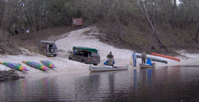
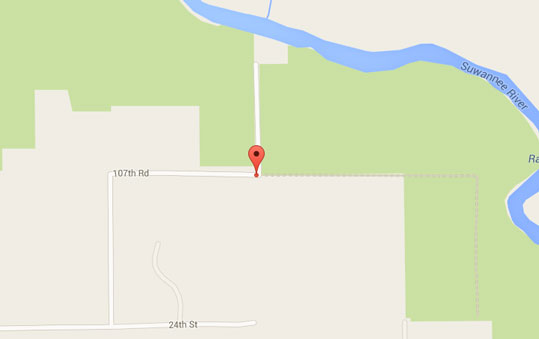
Deese-Howard Ramp @ 107th Road
CATEGORIES: Landing
LAYER: Brochure
OWNERSHIP: Public
ACCESS: Yes, Ramp: Concrete, PARKING: Free
WATER BODY: Suwannee River
GAUGE: Suwannee Springs
MILE: 147.30
ADDRESS: 107th Road, Live Oak, FL 32060, Suwannee County.
DESCRIPTION: From Live Oak, travel north on CR 795 to 24 Street; turn right on 24 Street; travel east to 107 Road; turn left and follow road to boat ramp.
UPSTREAM: 1.20 miles from Deese-Howard Ramp to Spirit of Suwannee Music Park Ramp
DOWNSTREAM: 6.22 miles from Deese-Howard Ramp to Holton Creek River Camp
PHOTO: http://suwanneeparks.com/wp-content/uploads/2013/09/kyakslide-940×300.jpg
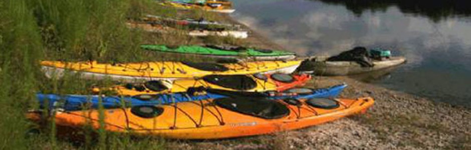
PHOTOSET: http://suwanneeparks.com/deesehoward-boat-ramp/
PHOTO SOURCE: Suwannee Parks & Recreation
PHONE NUMBER: (850) 290-2350
Suggestions: https://forms.gle/DipPgU2TP5atc2Rf9
Holton Creek River Camp
CATEGORIES: Landing
LAYER: Brochure
GPS: 30.42928553, -83.03571939
OWNERSHIP: Public
ACCESS: Yes, Stairs: steep, CAMPING, WATER, RESTROOMS, SHELTER, PICNIC AREA
WATER BODY: Suwannee River
GAUGE: Ellaville
MILE: 141.08
ADDRESS: Located between Spirit of the Suwannee Music Park and Suwannee River State Park. The river camps are accessible by river only. No vehicles or overnight parking is permitted. Call 800-868-9914 for more information. Hamilton County.
DESCRIPTION: The Holton Creek River Camp is the second river camp between White Springs and Branford and provides 5 screened shelters, a picnic pavilion, restrooms with hot showers, and a tent-camping area. For more information on the Suwannee River Wilderness Trail, call or visit: 800.868.9914 https://www.floridastateparks.org/parks-and-trails/suwannee-river-wilderness-state-trail
HISTORIC FACTS: Effective Sept. 12, 2023: Holton Creek River Camp remains closed after Hurricane Idalia.
WEBSITE: https://www.floridastateparks.org/parks-and-trails/suwannee-river-wilderness-state-trail/river-camps
OTHER REFERENCE: http://www.suwanneeadventures.com/river-camps.html
UPSTREAM: 6.22 miles from Holton Creek River Camp to Deese-Howard Ramp
DOWNSTREAM: 5.68 miles from Holton Creek River Camp to Gibson Park Ramp
PHOTO: https://www.floridastateparks.org/sites/default/files/media/image/Holton.jpg
PHOTOSET: https://www.floridastateparks.org/parks-and-trails/suwannee-river-wilderness-state-trail/river-camps
PHOTO SOURCE: Florida State Parks
PHONE NUMBER: (800) 868-9914
Suggestions: https://forms.gle/DipPgU2TP5atc2Rf9
Gibson Park Ramp @ SW CR 751

CATEGORIES: Landing
LAYER: Brochure
OWNERSHIP: Public, Hamilton County, PARCEL 3620-000
ACCESS: Yes, Ramp: Concrete, PARKING: Free, PICNIC AREA, HANDICAPPED ACCESSIBLE
WATER BODY: Suwannee River
GAUGE: Ellaville
MILE: 135.40
ADDRESS: 6844 SW CR 751, Jasper, FL 32052. Right bank, west side of the river. From Jasper, Hamilton County, FL, travel southwest on Right bank. SW CR 249 to SW CR 751; turn left and boat ramp is on the right in Gibson Park. Hamilton County.
DESCRIPTION: The last stop on the Alapaha River Water Trail is on the Suwannee River: Gibson Park Ramp, in a county park of Hamilton County, Florida. Much of the year those last 17.95 river miles are dry down from Jennings Bluff Launch. But in the rainy season (winter) sometimes the Alapaha is high and fast and it’s a quick paddle to the Suwannee and a very short upstream to Gibson Park Ramp.
AKA: Hutch Gibson Park Public Boat Ramp or Nobles Ferry.
WEBSITE: https://hamiltoncountyfl.com/parks-recreation/
UPSTREAM: 5.68 miles from Gibson Park Ramp to Holton Creek River Camp
DOWNSTREAM: 5.00 miles from Gibson Park Ramp to Suwannee River Campsites Ramp
PHOTOSET: https://www.wwals.net/pictures/2021-05-11–nondiscrimination-policy/
PHOTO SOURCE: Bobby McKenzie
PHONE NUMBER: (850) 290-2350
Suggestions: https://forms.gle/DipPgU2TP5atc2Rf9
Suwannee River Campsites Ramp @ SW 46th Ave.

CATEGORIES: Landing
LAYER: Brochure
GPS: 30.414, -83.159167
OWNERSHIP: Public, SRWMD? PARCEL 5555-555
ACCESS: Yes, Ramp: Concrete, PARKING: Free
WATER BODY: Suwannee River
GAUGE: Ellaville
MILE: 130.40
ADDRESS: Right bank. 10650 SW 46th Ave., Jasper, FL 32052, Hamilton County.
DESCRIPTION: From US 90, turn right onto NE Myrrh Street; cross the Withlacoochee River (road becomes CR 141); turn right on SW 74 Street; turn right on SW 44 Lane; travel south to SW 77 Street; turn left and follow to boat ramp. Government Owned for General Public Use.
HISTORIC FACTS: River put-in for many protests in 2015, 2016, and 2017 against the Sabal Trail fracked methane pipeline crossing slightly downstream. https://wwals.net/?p=28959
AKA: CR 141 Ramp (SRWMD) or Suwannee Campsites Ramp or Florida Trail Suwannee River Boat Launch Trailhead or Big Oak Boat Ramp.
UPSTREAM: 5.00 miles from Suwannee River Campsites Ramp to Gibson Park Ramp
DOWNSTREAM: 2.70 miles from Suwannee River Campsites Ramp to Suwannee River State Park Ramp
PHOTO: https://wwals.net/wp-content/themes/pianoblack/img//2021/12/20170423_125547-1.jpg
PHOTOSET: https://wwals.net/2017/04/23/suwannee-river-campsites/
PHOTO SOURCE: John S. Quarterman
PHONE NUMBER: (229) 242-0102
Suggestions: https://forms.gle/DipPgU2TP5atc2Rf9
Suwannee River State Park Ramp @ 201st Path
CATEGORIES: Landing
LAYER: Brochure
GPS: 30.3877, -83.1688
OWNERSHIP: Public, SRWMD
ACCESS: Yes, Launch: Concrete, CAMPING, WATER, RESTROOMS, PARKING: $5.00/vehicle, SHELTER, PICNIC AREA
WATER BODY: Suwannee River
GAUGE: Ellaville
MILE: 127.70
ADDRESS: Left bank, 3631 201st Path, Live Oak, FL 32060, Suwannee County.
DESCRIPTION: Slightly upstream from the Withlacoochee River Confluence with the Suwannee River.
WEBSITE: https://www.floridastateparks.org/park/Suwannee-River
UPSTREAM: 2.70 miles from Suwannee River State Park Ramp to Suwannee River Campsites Ramp
DOWNSTREAM: 3.30 miles from Suwannee River State Park Ramp to Anderson Spring Launch
PHOTO: https://wwals.net/wp-content/themes/pianoblack/img//2015/08/69d2ffd7fa67b505d9a5ee0658c5e8f31.jpg
PHOTO SOURCE: John S. Quarterman
PHONE NUMBER: (229) 242-0102
Suggestions: https://forms.gle/DipPgU2TP5atc2Rf9
Anderson Spring Launch @ River Road
CATEGORIES: Landing
LAYER: Brochure
GPS: 30.352967, -83.18937
OWNERSHIP: Public
ACCESS: Yes, Launch: riverbank
WATER BODY: Suwannee River
GAUGE: Ellaville
MILE: 124.40
ADDRESS: From Live Oak, go west on US 90; turn left onto River Road; entrance to Anderson Springs will be on your right. Suwannee County.
UPSTREAM: 3.30 miles from Anderson Spring Launch to Suwannee River State Park Ramp
DOWNSTREAM: 8.80 miles from Anderson Spring Launch to Boundary Bend Ramp
Suggestions: https://forms.gle/DipPgU2TP5atc2Rf9
Boundary Bend Ramp @ SE Boundary Bend Trail
CATEGORIES: Landing
LAYER: Brochure
OWNERSHIP: Public
ACCESS: Yes, Ramp: Concrete
WATER BODY: Suwannee River
GAUGE: Dowling Park
MILE: 115.60
ADDRESS: From Dowling Park, travel west on CR 250; turn right on NW CR 101; travel north on NW CR 101 (road becomes SE Waccamaw Avenue); turn right on SE Boundary Bend Trail and follow to ramp. Madison County.
UPSTREAM: 8.80 miles from Boundary Bend Ramp to Anderson Spring Launch
DOWNSTREAM: 2.37 miles from Boundary Bend Ramp to Dowling Park River Camp
Suggestions: https://forms.gle/DipPgU2TP5atc2Rf9
Dowling Park River Camp

CATEGORIES: Landing
LAYER: Brochure
OWNERSHIP: Public
ACCESS: Yes, Stairs: steep, CAMPING, WATER, RESTROOMS, SHELTER, PICNIC AREA
WATER BODY: Suwannee River
GAUGE: Dowling Park
MILE: 113.23
ADDRESS: Located right across the river from the Advent Christian Village in the town of Dowling Park. The river camps are accessible by river only. No vehicles or overnight parking is permitted. Call 800-868-9914 for more information. Lafayette County.
DESCRIPTION: Steep steps up from the river to a boat rack, across a dining pavilion, to two air-conditioned bathrooms with hot and cold running water, with nearby five elevated and screened sleeping pavilions with electricity.
HISTORIC FACTS: Effective Sept. 12, 2023: Dowling Park River Camp remains closed after Hurricane Idalia.
WEBSITE: https://www.floridastateparks.org/parks-and-trails/suwannee-river-wilderness-state-trail/river-camps
OTHER REFERENCE: https://map.mysuwanneeriver.com/tracts/dowling-park-river-camp-55/
UPSTREAM: 2.37 miles from Dowling Park River Camp to Boundary Bend Ramp
DOWNSTREAM: 0.23 mile from Dowling Park River Camp to Dowling Park Ramp
PHOTOSET: https://wwals.net/2020/08/26/pictures-suwannee-river-dowling-park-river-camp-2020-07-18/
PHOTO SOURCE: John S. Quarterman
PHONE NUMBER: (229) 242-0102
PHOTO2: https://www.floridastateparks.org/sites/default/files/media/image/Dowling.jpg
Photoset2: https://www.floridastateparks.org/sites/default/files/media/image/Dowling.jpg
PHOTO2 SOURCE: Florida State Parks
Photo2 Phone Number: 800-868-9914
Suggestions: https://forms.gle/DipPgU2TP5atc2Rf9
Dowling Park Ramp @ CR 250

CATEGORIES: Landing
LAYER: Brochure
GPS: 30.244833, -83.249
OWNERSHIP: Public
ACCESS: Yes, Ramp: Concrete
WATER BODY: Suwannee River
GAUGE: Dowling Park
MILE: 113.00
ADDRESS: The boat ramp is on the north side of CR 250 at the Suwannee River. Suwannee County.
DESCRIPTION: Wide and easily accessible, slightly downstream from Dowling Park River Camp.
UPSTREAM: 0.23 mile from Dowling Park Ramp to Dowling Park River Camp
DOWNSTREAM: 1.80 miles from Dowling Park Ramp to Sims Landing Ramp (North Lafayette County)
PHOTOSET: https://wwals.net/2020/08/26/pictures-suwannee-river-dowling-park-river-camp-2020-07-18/
PHOTO SOURCE: John S. Quarterman
PHONE NUMBER: (229) 242-0102
Suggestions: https://forms.gle/DipPgU2TP5atc2Rf9
Sims Landing Ramp (North Lafayette County) @ NW Sims Landing Road
CATEGORIES: Landing
LAYER: Brochure
GPS: 30.2275, -83.240667
OWNERSHIP: Public
ACCESS: Yes, Ramp: Concrete
WATER BODY: Suwannee River
GAUGE: Dowling Park
MILE: 111.20
ADDRESS: From Dowling Park, travel west on CR 250; turn left on NW CR 251; travel south on NW CR 251; turn left on NW Sims Landing Road and follow to boat ramp. Lafayette County.
UPSTREAM: 1.80 miles from Sims Landing Ramp (North Lafayette County) to Dowling Park Ramp
DOWNSTREAM: 1.00 mile from Sims Landing Ramp (North Lafayette County) to Christian Tract Launch
Suggestions: https://forms.gle/DipPgU2TP5atc2Rf9
Christian Tract Launch @ Shirley Springs Trail
CATEGORIES: Landing
LAYER: Brochure
GPS: 30.215, -83.243167
OWNERSHIP: Public
ACCESS: Yes, Launch: riverbank
WATER BODY: Suwannee River
GAUGE: Dowling Park
MILE: 110.20
ADDRESS: From Live Oak, travel southwest on CR 250 to 225 Road; turn left; travel south to 136 Street; turn right and travel west; crossover 233 Road onto Christian Path; follow road and turn right on Shirley Springs Trail; follow road to canoe launch. Suwannee County.
UPSTREAM: 1.00 mile from Christian Tract Launch to Sims Landing Ramp (North Lafayette County)
DOWNSTREAM: 3.70 miles from Christian Tract Launch to Charles Spring Ramp
Suggestions: https://forms.gle/DipPgU2TP5atc2Rf9
Charles Spring Ramp @ 237 Drive
CATEGORIES: Landing
LAYER: Brochure
GPS: 30.166833, -83.231
OWNERSHIP: Public
ACCESS: Yes, Ramp: Concrete
WATER BODY: Suwannee River
GAUGE: Luraville
MILE: 106.50
ADDRESS: From Live Oak, travel south on SR 51 to 152 Street; turn right on 152 Street; travel west crossing 237 Drive and boat ramp is in the county park. Suwannee County.
UPSTREAM: 3.70 miles from Charles Spring Ramp to Christian Tract Launch
DOWNSTREAM: 0.10 mile from Charles Spring Ramp to Ezell Landing Ramp
Suggestions: https://forms.gle/DipPgU2TP5atc2Rf9
Ezell Landing Ramp @ Ezell Landing Road
CATEGORIES: Landing
LAYER: Brochure
OWNERSHIP: Public, BOARD OF COUNTY COMMISSIONERS, Lafayette County, FL, PARCEL 05-04-11-0000-0000-00701
ACCESS: Yes, Ramp: Concrete
WATER BODY: Suwannee River
GAUGE: Luraville
MILE: 106.40
ADDRESS: 1384 NW Ezell Landing Rd, Mayo, FL 32066. From Mayo, travel north on US 27 to CR 292; turn right on CR 292; travel north to ninety degree turn; continue straight on Ezell Landing Road and follow to boat ramp. Lafayette County.
UPSTREAM: 0.10 mile from Ezell Landing Ramp to Charles Spring Ramp
DOWNSTREAM: 3.10 miles from Ezell Landing Ramp to Lafayette Blue Springs State Park Ramp
Suggestions: https://forms.gle/DipPgU2TP5atc2Rf9
Lafayette Blue Springs State Park Ramp @ NW Blue Springs Road
CATEGORIES: Landing
LAYER: Brochure
GPS: 30.127167, -83.2255
OWNERSHIP: Public, TIITF/BLUE SPRINGS PARK, PARCEL 21-04-11-0000-0000-00100
ACCESS: Yes, Ramp: Concrete
WATER BODY: Suwannee River
GAUGE: Luraville
MILE: 103.30
ADDRESS: South Entrance, Lafayette Blue Springs State Park, 808 Blue Springs Rd, Mayo, FL 32066. From Mayo, travel west on US 27 to CR 292; turn right and go north to NW Blue Springs Road; turn right and follow road to Lafayette Blue Springs State Park. Lafayette County.
UPSTREAM: 3.10 miles from Lafayette Blue Springs State Park Ramp to Ezell Landing Ramp
DOWNSTREAM: 5.10 miles from Lafayette Blue Springs State Park Ramp to Hal W. Adams Bridge Ramp
Suggestions: https://forms.gle/DipPgU2TP5atc2Rf9
Hal W. Adams Bridge Ramp @ FL 51
CATEGORIES: Landing
LAYER: Brochure
GPS: 30.098833, -83.171
OWNERSHIP: Public
ACCESS: Yes, Ramp: Concrete
WATER BODY: Suwannee River
GAUGE: Luraville
MILE: 98.20
ADDRESS: From Mayo, travel north on SR 51 to the river and the ramp is on the right. Lafayette County.
UPSTREAM: 5.10 miles from Hal W. Adams Bridge Ramp to Lafayette Blue Springs State Park Ramp
DOWNSTREAM: 0.80 mile from Hal W. Adams Bridge Ramp to Telford Springs Ramp
Suggestions: https://forms.gle/DipPgU2TP5atc2Rf9
Telford Springs Ramp
CATEGORIES: Landing
LAYER: Brochure
OWNERSHIP: Public
ACCESS: Yes, Ramp: Concrete
WATER BODY: Suwannee River
GAUGE: Luraville
MILE: 97.40
ADDRESS: From Live Oak, travel south on SR 51 to 180 Street; turn left; travel east to 203 Road; turn right and follow to boat ramp. Suwannee County.
UPSTREAM: 0.80 mile from Telford Springs Ramp to Hal W. Adams Bridge Ramp
DOWNSTREAM: 1.72 miles from Telford Springs Ramp to Peacock Slough River Camp
Suggestions: https://forms.gle/DipPgU2TP5atc2Rf9
Peacock Slough River Camp
CATEGORIES: Landing
LAYER: Brochure
OWNERSHIP: Public
ACCESS: Yes, Launch: riverbank, CAMPING, WATER, RESTROOMS, SHELTER, PICNIC AREA
WATER BODY: Suwannee River
GAUGE: Luraville
MILE: 95.68
ADDRESS: Located on the river just south of Peacock Springs State Park. The river camps are accessible by river only. No vehicles or overnight parking is permitted. Call 800-868-9914 for more information. Lafayette County.
DESCRIPTION: The outpouring of water from the spring system to the river is often visible at the river camp entrance.
AKA: Peacock Slough Landing
WEBSITE: https://www.floridastateparks.org/parks-and-trails/suwannee-river-wilderness-state-trail/river-camps
OTHER REFERENCE: https://thedyrt.com/camping/florida/peacock-slough
UPSTREAM: 1.72 miles from Peacock Slough River Camp to Telford Springs Ramp
DOWNSTREAM: 2.78 miles from Peacock Slough River Camp to Hardenbergh Ramp
PHOTO: https://www.floridastateparks.org/sites/default/files/media/image/Peacock.jpg
PHOTOSET: https://www.floridastateparks.org/parks-and-trails/suwannee-river-wilderness-state-trail/river-camps
PHOTO SOURCE: Florida State Parks
PHONE NUMBER: (800) 868-9914
Suggestions: https://forms.gle/DipPgU2TP5atc2Rf9
Hardenbergh Ramp
CATEGORIES: Landing
LAYER: Brochure
OWNERSHIP: Public
ACCESS: Yes, Ramp: Concrete
WATER BODY: Suwannee River
GAUGE: Luraville
MILE: 92.90
ADDRESS: From Mayo, travel east on US 27 to NE CR 361; turn left; travel north to NE CR 354; cross over to NE Pecan Avenue; turn right on NE River Road and follow to boat ramp. Lafayette County.
UPSTREAM: 2.78 miles from Hardenbergh Ramp to Peacock Slough River Camp
DOWNSTREAM: 1.00 mile from Hardenbergh Ramp to Suwannee River Rendezvous Ramp
Suggestions: https://forms.gle/DipPgU2TP5atc2Rf9
Suwannee River Rendezvous Ramp
CATEGORIES: Landing
LAYER: Brochure
GPS: 30.086833, -83.0945
OWNERSHIP: Public
ACCESS: Yes, Launch: riverbank
WATER BODY: Suwannee River
GAUGE: Luraville
MILE: 91.90
ADDRESS: From Mayo, travel US 27 east 4.5 miles to NE CR 354; turn left and travel north to NE Primrose Road; turn right at the curve; the ramp is at Suwannee River Rendezvous. Lafayette County.
UPSTREAM: 1.00 mile from Suwannee River Rendezvous Ramp to Hardenbergh Ramp
DOWNSTREAM: 1.50 miles from Suwannee River Rendezvous Ramp to Royal Springs Ramp
Suggestions: https://forms.gle/DipPgU2TP5atc2Rf9
Royal Springs Ramp
CATEGORIES: Landing
LAYER: Brochure
GPS: 30.083333, -83.074
OWNERSHIP: Public
ACCESS: Yes, Ramp: Concrete
WATER BODY: Suwannee River
GAUGE: Luraville
MILE: 90.40
ADDRESS: From Live Oak, take SR 51 south to CR 349; turn left on CR 349; travel south to 198 Terrace; turn right and travel west to 157 Lane; turn left and follow road to 198 Trail; turn left and travel east to 157 Drive; turn right into park. Suwannee County.
DESCRIPTION: In Hugh Byron Hollingsworth Sr. County Park.
AKA: Hugh Byron Hollingsworth Sr. Ramp
UPSTREAM: 1.50 miles from Royal Springs Ramp to Suwannee River Rendezvous Ramp
DOWNSTREAM: 3.80 miles from Royal Springs Ramp to Ft. Macomb Ramp
Suggestions: https://forms.gle/DipPgU2TP5atc2Rf9
Ft. Macomb Ramp
CATEGORIES: Landing
LAYER: Brochure
OWNERSHIP: Public
ACCESS: Yes, Ramp: Concrete
WATER BODY: Suwannee River
GAUGE: Luraville
MILE: 86.60
ADDRESS: From Mayo, travel east on US 27 to CR 410; turn left on CR 410; follow to boat ramp. Lafayette County.
UPSTREAM: 3.80 miles from Ft. Macomb Ramp to Royal Springs Ramp
DOWNSTREAM: 1.34 miles from Ft. Macomb Ramp to Adams Tract River Camp
Suggestions: https://forms.gle/DipPgU2TP5atc2Rf9
Adams Tract River Camp
CATEGORIES: Landing
LAYER: Brochure
GPS: 30.035, -83.019
OWNERSHIP: Public
ACCESS: Yes, Launch: riverbank, CAMPING, WATER, RESTROOMS, SHELTER, PICNIC AREA
WATER BODY: Suwannee River
GAUGE: Branford
MILE: 85.26
ADDRESS: Located just a few miles upriver of Troy Springs State Park, just north of Branford. The river camps are accessible by river only. No vehicles or overnight parking is permitted. Call 800-868-9914 for more information. Lafayette County.
DESCRIPTION: There are some open, treeless areas of the camp that are ideal for stargazing with the nearest city lights miles away. It is located within a Suwannee River Water Management District Tract and provides ample hiking trails to explore throughout a longleaf pine community. Please be aware that scheduled hunting is permitted on this property certain times of the year. For information on hunting season dates, call 386-758-0525 or visit Florida Fish and Wildlife Commission.
WEBSITE: https://www.floridastateparks.org/parks-and-trails/suwannee-river-wilderness-state-trail/river-camps
OTHER REFERENCE: https://map.mysuwanneeriver.com/tracts/adams-4/
UPSTREAM: 1.34 miles from Adams Tract River Camp to Ft. Macomb Ramp
DOWNSTREAM: 1.56 miles from Adams Tract River Camp to Walker Tract Launch
PHOTO: https://www.floridastateparks.org/sites/default/files/media/image/Adams.jpg
PHOTOSET: https://www.floridastateparks.org/parks-and-trails/suwannee-river-wilderness-state-trail/river-camps
PHOTO SOURCE: Florida State Parks
PHONE NUMBER: (800) 868-9914
Suggestions: https://forms.gle/DipPgU2TP5atc2Rf9
Walker Tract Launch
CATEGORIES: Landing
LAYER: Brochure
GPS: 30.016833, -83.006
OWNERSHIP: Public
ACCESS: Yes, Launch: riverbank
WATER BODY: Suwannee River
GAUGE: Branford
MILE: 83.70
ADDRESS: From Branford, travel west on US 27 to NE CR 425; turn right and travel north; at the end of the pavement the road becomes NE Jeff Walker Road; turn right on the first dirt road to the right and follow to canoe launch. Lafayette County.
UPSTREAM: 1.56 miles from Walker Tract Launch to Adams Tract River Camp
DOWNSTREAM: 1.70 miles from Walker Tract Launch to Ruth Springs Launch
Suggestions: https://forms.gle/DipPgU2TP5atc2Rf9
Ruth Springs Launch
CATEGORIES: Landing
LAYER: Brochure
OWNERSHIP: Public
ACCESS: Yes, Launch: riverbank
WATER BODY: Suwannee River
GAUGE: Branford
MILE: 82.00
ADDRESS: From Branford, travel west on US 27 to NE CR 425; turn right and travel north to NE Ruth Springs Road, turn right and take the first dirt road to the left and follow to canoe launch. Lafayette County.
UPSTREAM: 1.70 miles from Ruth Springs Launch to Walker Tract Launch
DOWNSTREAM: 3.00 miles from Ruth Springs Launch to Patrician Oaks Ramp
Suggestions: https://forms.gle/DipPgU2TP5atc2Rf9
Patrician Oaks Ramp
CATEGORIES: Landing
LAYER: Brochure
OWNERSHIP: Public
ACCESS: Yes, Ramp: Concrete
WATER BODY: Suwannee River
GAUGE: Branford
MILE: 79.00
ADDRESS: From Branford, travel west on US 27 to NE Lantana Road; turn right and follow road to boat ramp. Lafayette County.
UPSTREAM: 3.00 miles from Patrician Oaks Ramp to Ruth Springs Launch
DOWNSTREAM: 3.00 miles from Patrician Oaks Ramp to Ivey Memorial Park Ramp
Suggestions: https://forms.gle/DipPgU2TP5atc2Rf9
Ivey Memorial Park Ramp
CATEGORIES: Landing
LAYER: Brochure
OWNERSHIP: Public
ACCESS: Yes, Ramp: Concrete
WATER BODY: Suwannee River
GAUGE: Branford
MILE: 76.00
ADDRESS: Boat ramp is located in Branford on the south side of US 27 at the Bridge in Ivey Memorial Park. Suwannee County.
UPSTREAM: 3.00 miles from Ivey Memorial Park Ramp to Patrician Oaks Ramp
DOWNSTREAM: 9.30 miles from Ivey Memorial Park Ramp to Dorothy Land Ramp
Suggestions: https://forms.gle/DipPgU2TP5atc2Rf9
Dorothy Land Ramp
CATEGORIES: Landing
LAYER: Brochure
OWNERSHIP: Public
ACCESS: Yes, Ramp: Concrete
WATER BODY: Suwannee River
GAUGE: Branford
MILE: 66.70
ADDRESS: From Branford, travel US 27 west to CR 349; turn left and travel south to SE CR 480; turn left and travel east to SE CR 500; turn left and travel north to SE CR 490; turn right and follow to boat ramp. Lafayette County.
UPSTREAM: 9.30 miles from Dorothy Land Ramp to Ivey Memorial Park Ramp
DOWNSTREAM: 3.50 miles from Dorothy Land Ramp to Sims Landing Ramp
Suggestions: https://forms.gle/DipPgU2TP5atc2Rf9
Sims Landing Ramp
CATEGORIES: Landing
LAYER: Brochure
GPS: 29.854, -82.887333
OWNERSHIP: Public
ACCESS: Yes, Ramp: Concrete
WATER BODY: Suwannee River
GAUGE: Bell
MILE: 63.20
ADDRESS: From Branford, travel US 27 west to CR 349; turn left and travel south to SE CR 500; turn left and travel to SE S. N. Hill Road; turn right and travel to SE R. M. Mears Road; turn right and follow to ramp. Lafayette County.
UPSTREAM: 3.50 miles from Sims Landing Ramp to Dorothy Land Ramp
DOWNSTREAM: 2.87 miles from Sims Landing Ramp to Calloway Boat Ramp
Suggestions: https://forms.gle/DipPgU2TP5atc2Rf9
Calloway Boat Ramp
CATEGORIES: Landing
LAYER: Brochure
GPS: 29.821, -82.9077
OWNERSHIP: Public, Gilchrist County, PARCEL 03-08-14-0000-0013-0010
ACCESS: Yes, Ramp: Sand covering concrete, PARKING: Free
WATER BODY: Suwannee River
GAUGE: Bell
MILE: 60.33
ADDRESS: West end of NW 57th Court, Bell, FL 32619. From Branford, go west on US 27, cross the Suwannee River, turn left on CR 349, left on CR 340, cross the Suwannee River again, left on NW 55th Ave., left on NW 55th St., right on NW 57th Ct., left to stay on NW 57th Ct. to the ramp. Gilchrist County.
DESCRIPTION: According to Ken Sulak, a sand-covered concrete boat ramp. It is owned by Gilchrist County.
OTHER REFERENCE: https://mapcarta.com/N3670735860
ADDITIONAL INFO SOURCES: https://naturalatlas.com/boat-launches/calloway-boat-landing-2090279
UPSTREAM: 2.87 miles from Calloway Boat Ramp to Sims Landing Ramp
DOWNSTREAM: 0.73 mile from Calloway Boat Ramp to Hirsh Landing Ramp
Suggestions: https://forms.gle/DipPgU2TP5atc2Rf9
Hirsh Landing Ramp
CATEGORIES: Landing
LAYER: Brochure
GPS: 29.82525, -82.919833
OWNERSHIP: Public, Lafayette County
ACCESS: Yes, Ramp: Concrete, PARKING: Free
WATER BODY: Suwannee River
GAUGE: Bell
MILE: 59.60
ADDRESS: From Branford, travel US 27 west to CR 349; turn left and travel south to SE CR 500; turn left and travel to SE Leopard Road; turn right and travel to SE Foster Drive; turn right; ramp is on the left. Lafayette County.
UPSTREAM: 0.73 mile from Hirsh Landing Ramp to Calloway Boat Ramp
DOWNSTREAM: 2.50 miles from Hirsh Landing Ramp to NW 967 Street Ramp
Suggestions: https://forms.gle/DipPgU2TP5atc2Rf9
NW 967 Street Ramp
CATEGORIES: Landing
LAYER: Brochure
GPS: 29.7995, -82.9275
OWNERSHIP: Public
ACCESS: Yes, Ramp: Concrete
WATER BODY: Suwannee River
GAUGE: Bell
MILE: 57.10
ADDRESS: From Old Town, travel north on CR 349 to CR 340; turn left and travel east 2.5 miles to NW 967 Street; turn left; ramp is at the end of the road. Dixie County.
UPSTREAM: 2.50 miles from NW 967 Street Ramp to Hirsh Landing Ramp
DOWNSTREAM: 0.50 mile from NW 967 Street Ramp to Rock Bluff Ramp
Suggestions: https://forms.gle/DipPgU2TP5atc2Rf9
Rock Bluff Ramp
CATEGORIES: Landing
LAYER: Brochure
OWNERSHIP: Public, Gilchrist County, PARCEL 16-08-14-0161-0001-0010
ACCESS: Yes, Ramp: Concrete
WATER BODY: Suwannee River
GAUGE: Bell
MILE: 56.60
ADDRESS: 192 NE 967 Street Old Town, FL 32680, Gilchrist County.
DESCRIPTION: From Bell, travel north on US 129; turn left on CR 340; travel west to county park on the left at the river. The 1.94 acre Rock Bluff Ferry Landing Park combines with CR 340 road frontage for access to the Rock Bluff Ramp.
WEBSITE: https://visitdixie.org/boat-ramps/
UPSTREAM: 0.50 mile from Rock Bluff Ramp to NW 967 Street Ramp
DOWNSTREAM: 1.60 miles from Rock Bluff Ramp to Gornto Spring Ramp
Suggestions: https://forms.gle/DipPgU2TP5atc2Rf9
Gornto Spring Ramp
CATEGORIES: Landing
LAYER: Brochure
OWNERSHIP: Public
ACCESS: Yes, Ramp: Concrete
WATER BODY: Suwannee River
GAUGE: Bell
MILE: 55.00
ADDRESS: 2463 NE 816th Ave, Old Town, FL 32680, Dixie County.
DESCRIPTION: From Branford, travel south on CR 349 to NE 816 Avenue; turn left and follow road to boat ramp.
WEBSITE: https://visitdixie.org/boat-ramps/
UPSTREAM: 1.60 miles from Gornto Spring Ramp to Rock Bluff Ramp
DOWNSTREAM: 3.00 miles from Gornto Spring Ramp to Log Landing Ramp
PHOTO SOURCE: Daniel Gray
PHONE NUMBER: (352) 440-1203
Suggestions: https://forms.gle/DipPgU2TP5atc2Rf9
Log Landing Ramp
CATEGORIES: Landing
LAYER: Brochure
OWNERSHIP: Public
ACCESS: Yes, Ramp: Concrete
WATER BODY: Suwannee River
GAUGE: Bell
MILE: 52.00
ADDRESS: From Trenton, travel north on US 129 to CR 232; turn left and travel west to SW 70 Avenue; turn right; travel north to NW 7 Place; travel west to NW 6 Street; turn left and follow road to boat ramp. Gilchrist County.
UPSTREAM: 3.00 miles from Log Landing Ramp to Gornto Spring Ramp
DOWNSTREAM: 2.10 miles from Log Landing Ramp to Wannee Ramp
Suggestions: https://forms.gle/DipPgU2TP5atc2Rf9
Wannee Ramp
CATEGORIES: Landing
LAYER: Brochure
OWNERSHIP: Public
ACCESS: Yes, Ramp: Concrete
WATER BODY: Suwannee River
GAUGE: Bell
MILE: 49.90
ADDRESS: From Trenton, travel north on US 129 to CR 232; turn left and travel west to SW 70 Avenue; turn right; travel north to SW 10 Street; turn left; travel west to SW 80 Avenue; turn right and follow road to boat ramp. Gilchrist County.
UPSTREAM: 2.10 miles from Wannee Ramp to Log Landing Ramp
DOWNSTREAM: 3.90 miles from Wannee Ramp to Eula Landing Ramp
Suggestions: https://forms.gle/DipPgU2TP5atc2Rf9
Eula Landing Ramp
CATEGORIES: Landing
LAYER: Brochure
GPS: 29.700667, -82.9385
OWNERSHIP: Public
ACCESS: Yes, Ramp: Concrete
WATER BODY: Suwannee River
GAUGE: Bell
MILE: 46.00
ADDRESS: From Trenton, travel north on US 129 to CR 232; turn left and travel west to SW 70 Avenue; turn right; travel north to SW 25 Street; turn left; travel west to SW 25 Place; turn right and follow road to boat ramp. Gilchrist County.
UPSTREAM: 3.90 miles from Eula Landing Ramp to Wannee Ramp
DOWNSTREAM: 2.00 miles from Eula Landing Ramp to Turner Point Landing Ramp
Suggestions: https://forms.gle/DipPgU2TP5atc2Rf9
Turner Point Landing Ramp
CATEGORIES: Landing
LAYER: Brochure
GPS: 29.693, -82.957833
OWNERSHIP: Public
ACCESS: Yes, Ramp: Concrete
WATER BODY: Suwannee River
GAUGE: Wilcox
MILE: 44.00
ADDRESS: 886 NE 453rd Ave, Old Town, FL 32680, Dixie County.
DESCRIPTION: From Old Town, travel north on CR 349 to NE 410 Avenue; turn right; follow to sharp left curve; road becomes NE 835 Street; continue north to NE 453 Avenue; turn right into park; the boat ramp is at the end of the road.
WEBSITE: https://visitdixie.org/boat-ramps/
UPSTREAM: 2.00 miles from Turner Point Landing Ramp to Eula Landing Ramp
DOWNSTREAM: 0.90 mile from Turner Point Landing Ramp to Hart Springs Ramp
PHOTO SOURCE: David Grissett
PHONE NUMBER: (352) 210-7545
Suggestions: https://forms.gle/DipPgU2TP5atc2Rf9
Hart Springs Ramp
CATEGORIES: Landing
LAYER: Brochure
OWNERSHIP: Public
ACCESS: Yes, Ramp: Concrete
WATER BODY: Suwannee River
GAUGE: Wilcox
MILE: 43.10
ADDRESS: From Trenton, travel north on US 129 to CR 344; turn left and travel west to CR 232; turn right; travel north to CR 344; turn left and travel west to SW 90 Avenue; turn right and follow road to ramp. Gilchrist County.
UPSTREAM: 0.90 mile from Hart Springs Ramp to Turner Point Landing Ramp
DOWNSTREAM: 2.10 miles from Hart Springs Ramp to Purvis Landing Ramp
Suggestions: https://forms.gle/DipPgU2TP5atc2Rf9
Purvis Landing Ramp
CATEGORIES: Landing
LAYER: Brochure
OWNERSHIP: Public
ACCESS: Yes, Ramp: Concrete
WATER BODY: Suwannee River
GAUGE: Wilcox
MILE: 41.00
ADDRESS: 294 NE 832nd St, Old Town, FL 32680, Dixie County.
DESCRIPTION: From Old Town, travel north on CR 349 to NE 272 Avenue, turn right and follow road to boat ramp.
WEBSITE: https://visitdixie.org/boat-ramps/
UPSTREAM: 2.10 miles from Purvis Landing Ramp to Hart Springs Ramp
DOWNSTREAM: 1.00 mile from Purvis Landing Ramp to Shingle Landing Ramp
PHOTO SOURCE: Chantell Miller
PHONE NUMBER: (352) 949-5752
Suggestions: https://forms.gle/DipPgU2TP5atc2Rf9
Shingle Landing Ramp
CATEGORIES: Landing
LAYER: Brochure
OWNERSHIP: Public
ACCESS: Yes, Ramp: Concrete
WATER BODY: Suwannee River
GAUGE: Wilcox
MILE: 40.00
ADDRESS: From Fanning Springs, travel northeast on SR 26 to CR 232; turn left; travel north to SW 70 Street; turn left and follow road to boat ramp. Gilchrist County.
UPSTREAM: 1.00 mile from Shingle Landing Ramp to Purvis Landing Ramp
DOWNSTREAM: 4.20 miles from Shingle Landing Ramp to Suwannee Gables Ramp
Suggestions: https://forms.gle/DipPgU2TP5atc2Rf9
Suwannee Gables Ramp
CATEGORIES: Landing
LAYER: Brochure
GPS: 29.586667, -82.9575
OWNERSHIP: Public
ACCESS: Yes, Ramp: Concrete
WATER BODY: Suwannee River
GAUGE: Wilcox
MILE: 35.80
ADDRESS: From Fanning Springs, cross the river on US 19; travel west and Suwannee Gables Motel is on the right. Dixie County.
UPSTREAM: 4.20 miles from Suwannee Gables Ramp to Shingle Landing Ramp
DOWNSTREAM: 1.60 miles from Suwannee Gables Ramp to Joe Anderson Jr. Ramp
Suggestions: https://forms.gle/DipPgU2TP5atc2Rf9
Joe Anderson Jr. Ramp
CATEGORIES: Landing
LAYER: Brochure
OWNERSHIP: Public
ACCESS: Yes, Ramp: Concrete
WATER BODY: Suwannee River
GAUGE: Wilcox
MILE: 34.20
ADDRESS: 113 SE 155th Ave, Old Town, FL 32680, Dixie County.
DESCRIPTION: From Fanning Springs, cross the river on US 19; turn left on SE 989 Street; travel south to SE 155 Avenue; turn left and the ramp is at the end of the street.
WEBSITE: https://visitdixie.org/boat-ramps/
UPSTREAM: 1.60 miles from Joe Anderson Jr. Ramp to Suwannee Gables Ramp
DOWNSTREAM: 2.20 miles from Joe Anderson Jr. Ramp to Hinton Landing Ramp
PHOTO SOURCE: Barry Russel
PHONE NUMBER: (614) 563-1461
Suggestions: https://forms.gle/DipPgU2TP5atc2Rf9
Hinton Landing Ramp
CATEGORIES: Landing
LAYER: Brochure
GPS: 29.557833, -82.95
OWNERSHIP: Public
ACCESS: Yes, Ramp: Concrete
WATER BODY: Suwannee River
GAUGE: Wilcox
MILE: 32.00
ADDRESS: 119 SE 230th Ave, Old Town, FL 32680, Dixie County.
DESCRIPTION: From Old Town, travel south on CR 349 to SE CR 346; turn left; travel east to SE CR 317; turn right and follow road to boat ramp.
WEBSITE: https://visitdixie.org/boat-ramps/
UPSTREAM: 2.20 miles from Hinton Landing Ramp to Joe Anderson Jr. Ramp
DOWNSTREAM: 1.80 miles from Hinton Landing Ramp to Old Pine Landing Ramp
Suggestions: https://forms.gle/DipPgU2TP5atc2Rf9
Old Pine Landing Ramp
CATEGORIES: Landing
LAYER: Brochure
OWNERSHIP: Public
ACCESS: Yes, Ramp: Concrete
WATER BODY: Suwannee River
GAUGE: Manatee Springs
MILE: 30.20
ADDRESS: 239 SE 837th St, Old Town, FL 32680, Dixie County.
DESCRIPTION: From Old Town, travel south on CR 349 to SE 295 Avenue; turn left; travel east to SE 837 Street; turn right and follow road to boat ramp.
WEBSITE: https://visitdixie.org/boat-ramps/
UPSTREAM: 1.80 miles from Old Pine Landing Ramp to Hinton Landing Ramp
DOWNSTREAM: 1.50 miles from Old Pine Landing Ramp to New Pine Landing Ramp
Suggestions: https://forms.gle/DipPgU2TP5atc2Rf9
New Pine Landing Ramp
CATEGORIES: Landing
LAYER: Brochure
GPS: 29.529333, -82.9775
OWNERSHIP: Public
ACCESS: Yes, Ramp: Concrete
WATER BODY: Suwannee River
GAUGE: Manatee Springs
MILE: 28.70
ADDRESS: 22 SE 849th St, Old Town, FL 32680, Dixie County.
DESCRIPTION: From Old Town, travel south on CR 349 to SE 311 Avenue; turn left; travel east to SE 849 Street; turn left and boat ramp is on the right.
WEBSITE: https://visitdixie.org/boat-ramps/
UPSTREAM: 1.50 miles from New Pine Landing Ramp to Old Pine Landing Ramp
DOWNSTREAM: 0.60 mile from New Pine Landing Ramp to New Clay Landing Ramp
Suggestions: https://forms.gle/DipPgU2TP5atc2Rf9
New Clay Landing Ramp
CATEGORIES: Landing
LAYER: Brochure
OWNERSHIP: Public
ACCESS: Yes, Ramp: Concrete
WATER BODY: Suwannee River
GAUGE: Manatee Springs
MILE: 28.10
ADDRESS: From Chiefland, travel west on NW 115 Street to NW 110 Avenue; turn right and travel north to NW 129 Place; turn left and travel west to NW 130 Street; turn left and follow road to ramp. Levy County.
UPSTREAM: 0.60 mile from New Clay Landing Ramp to New Pine Landing Ramp
DOWNSTREAM: 3.00 miles from New Clay Landing Ramp to Manatee Springs State Park Launch
Suggestions: https://forms.gle/DipPgU2TP5atc2Rf9
Manatee Springs State Park Launch
CATEGORIES: Landing
LAYER: Brochure
GPS: 29.489, -82.977833
OWNERSHIP: Public
ACCESS: Yes, Ramp: Concrete
WATER BODY: Suwannee River
GAUGE: Manatee Springs
MILE: 25.10
ADDRESS: From Chiefland, travel west on NW 115 Street to Manatee Springs State Park. Levy County.
UPSTREAM: 3.00 miles from Manatee Springs State Park Launch to New Clay Landing Ramp
DOWNSTREAM: 0.50 mile from Manatee Springs State Park Launch to Usher Landing Ramp
Suggestions: https://forms.gle/DipPgU2TP5atc2Rf9
Usher Landing Ramp
CATEGORIES: Landing
LAYER: Brochure
OWNERSHIP: Public
ACCESS: Yes, Ramp: Concrete
WATER BODY: Suwannee River
GAUGE: Manatee Springs
MILE: 24.60
ADDRESS: From Chiefland, travel west on NW 115 Street to NW 107 Terrace; turn left and travel south to Usher boat ramp sign; turn right and follow road to boat ramp. Levy County.
UPSTREAM: 0.50 mile from Usher Landing Ramp to Manatee Springs State Park Launch
DOWNSTREAM: 1.40 miles from Usher Landing Ramp to Camp Azalea Ramp
Suggestions: https://forms.gle/DipPgU2TP5atc2Rf9
Camp Azalea Ramp
CATEGORIES: Landing
LAYER: Brochure
GPS: 29.4635, -82.986667
OWNERSHIP: Public
ACCESS: Yes, Ramp: Concrete
WATER BODY: Suwannee River
GAUGE: Manatee Springs
MILE: 23.20
ADDRESS: From Chiefland, travel west on NW 115 Street to NW 107 Terrace; turn left and travel south to Camp Azalea; turn right on NW 128 Court and follow road to boat ramp. Levy County.
UPSTREAM: 1.40 miles from Camp Azalea Ramp to Usher Landing Ramp
DOWNSTREAM: 0.50 mile from Camp Azalea Ramp to Yellow Jacket Ramp
Suggestions: https://forms.gle/DipPgU2TP5atc2Rf9
Yellow Jacket Ramp
CATEGORIES: Landing
LAYER: Brochure
OWNERSHIP: Public
ACCESS: Yes, Ramp: Concrete
WATER BODY: Suwannee River
GAUGE: Fowlers Bluff
MILE: 22.70
ADDRESS: 374 SE 752 Street, Old Town, FL 32680, Dixie County.
DESCRIPTION: From Old Town, travel south on CR 349 to SE 477 Avenue; turn left; travel east to SE 752 Street; turn right and follow road to boat ramp.
WEBSITE: https://visitdixie.org/boat-ramps/
UPSTREAM: 0.50 mile from Yellow Jacket Ramp to Camp Azalea Ramp
DOWNSTREAM: 5.90 miles from Yellow Jacket Ramp to Fowlers Bluff Ramp
Suggestions: https://forms.gle/DipPgU2TP5atc2Rf9
Fowlers Bluff Ramp
CATEGORIES: Landing
LAYER: Brochure
GPS: 29.3965, -83.026
OWNERSHIP: Public
ACCESS: Yes, Ramp: Concrete
WATER BODY: Suwannee River
GAUGE: Fowlers Bluff
MILE: 16.80
ADDRESS: From Chiefland, travel on SW 4 Avenue (CR 345) 6 miles; turn right on CR 347; travel 9 miles; turn right on NW 46 Lane and follow to boat ramp. Levy County.
UPSTREAM: 5.90 miles from Fowlers Bluff Ramp to Yellow Jacket Ramp
DOWNSTREAM: 0.80 mile from Fowlers Bluff Ramp to Weeks Landing Launch
Suggestions: https://forms.gle/DipPgU2TP5atc2Rf9
Weeks Landing Launch
CATEGORIES: Landing
LAYER: Brochure
GPS: 29.397, -83.035667
OWNERSHIP: Public
ACCESS: Yes, Launch: riverbank, PARKING: Free
WATER BODY: Suwannee River
GAUGE: Fowlers Bluff
MILE: 16.00
ADDRESS: From Old Town, travel south 17 miles on CR 349 to unmarked Lower Suwannee National Wildlife Refuge Road; turn left and follow road to canoe launch. Dixie County.
DESCRIPTION: In the Lower Suwannee River Wildlife Refuge. Shirley Kokidko reported 2025-05-25 that the Dixie County side is open during the different hunting seasons. Now the gate is locked but you can walk around it for foot/bike traffic. The canoe launch icon is on their map but lacking the information that you have to walk your kayak 1.5 miles to get from the gate to the river. We have used Weeks Landing in the past so maybe this is a new or temporary change. For anyone planning an itinerary to paddle the lower region, the phone number for LSRWR is 352-493-0238.
WEBSITE: https://www.friendsofrefuges.org
OTHER REFERENCE: https://www.fws.gov/refuge/lower-suwannee
UPSTREAM: 0.80 mile from Weeks Landing Launch to Fowlers Bluff Ramp
DOWNSTREAM: 8.40 miles from Weeks Landing Launch to Munden Creek Primitive Ramp
Suggestions: https://forms.gle/DipPgU2TP5atc2Rf9
Munden Creek Primitive Ramp
CATEGORIES: Landing
LAYER: Brochure
OWNERSHIP: Public, Dixie County, PARCEL 21-13-12-0000-3471-0000
ACCESS: Yes, Ramp: Concrete
WATER BODY: Suwannee River
GAUGE: Fowlers Bluff
MILE: 7.60
ADDRESS: From Suwannee, travel north on CR 349 to SE 371 Street; turn right and travel east to SE 374 Street and follow road to boat ramp. Dixie County.
UPSTREAM: 8.40 miles from Munden Creek Primitive Ramp to Weeks Landing Launch
DOWNSTREAM: 3.55 miles from Munden Creek Primitive Ramp to Suwannee Marina Ramp
Suggestions: https://forms.gle/DipPgU2TP5atc2Rf9
Suwannee Marina Ramp

CATEGORIES: Landing Private
LAYER: Brochure
GPS: 29.3279, -83.14007
OWNERSHIP: Private, Suwannee Marina Services LLC, PARCEL 19-13-12-2994-0003-5250
ACCESS: Yes, Ramp: Concrete, FOOD: Restaurant, WATER, RESTROOMS, PARKING: Free, SHELTER
WATER BODY: Suwannee River
GAUGE: Suwannee River above Gopher River
MILE: 4.05
ADDRESS: 49 SE 903 Avenue, Suwannee, FL 32692, Dixie County.
DESCRIPTION: Commercially Owned for General Public Use
AKA: Starling’s Suwannee Marina Inc. https://marinas.com/view/marina/55cq7e_Starlings_Suwannee_Marina_Inc_Suwannee_FL_United_States
WEBSITE: https://www.waterwayguide.com/marina/suwannee-marina-inc
UPSTREAM: 3.55 miles from Suwannee Marina Ramp to Munden Creek Primitive Ramp
DOWNSTREAM: 0.15 mile from Suwannee Marina Ramp to Anderson Landing Ramp
PHOTOSET: https://www.facebook.com/thesuwanneemarina/
PHOTO SOURCE: Suwannee Marina Inc.
PHONE NUMBER: (352) 542-9159
Suggestions: https://forms.gle/DipPgU2TP5atc2Rf9
Anderson Landing Ramp
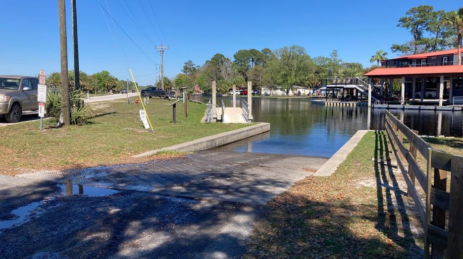
CATEGORIES: Landing Private
LAYER: Brochure
GPS: 29.3305, -83.143333
OWNERSHIP: Private, Dixie County
ACCESS: Yes, Ramp: Concrete, DOCK, CAMPING, WATER, RESTROOMS, PARKING: Free
WATER BODY: Suwannee River
GAUGE: Suwannee River above Gopher River
MILE: 3.90
ADDRESS: 2299 SE CR 349, Suwannee, FL 32692, mile 396 on the Florida Circumnavigational Saltwater Paddling Trail. Dixie County.
DESCRIPTION: Parking across CR 349. New floating dock to tie up to while parking. “”Restaurants and Bills Fish Camp and Motel nearby. Motel Reservations: (352) 542-7086″”
AKA: Demory Creek Public Boat Ramp.
WEBSITE: https://floridadep.gov/sites/default/files/Segment%206%20Maps%2012_13_23.pdf
OTHER REFERENCE: https://www.floridapaddlingtrails.com/complete-fpta-ct-map-set
UPSTREAM: 0.15 mile from Anderson Landing Ramp to Suwannee Marina Ramp
DOWNSTREAM: 0.12 mile from Anderson Landing Ramp to Miller’s Marina of Suwannee Ramp
PHOTOSET: https://paddling.com/paddle/locations/anderson-landing-river-camp
PHOTO SOURCE: Paddling.com
PHONE NUMBER: (850) 290-2350
Suggestions: https://forms.gle/DipPgU2TP5atc2Rf9
Miller’s Marina of Suwannee Ramp

CATEGORIES: Landing Private
LAYER: Brochure
GPS: 29.32613, -83.14512
OWNERSHIP: Private, 95 Van Dam Corp A New York Corporation, PARCEL 30-13-12-3500-000A-0012
ACCESS: Yes, Ramp: Concrete, DOCK, WATER, PARKING: Free
WATER BODY: Suwannee River
GAUGE: Suwannee River above Gopher River
MILE: 3.78
ADDRESS: 90 SE 910th Ave., Suwannee, FL 32692, Dixie County.
DESCRIPTION: Commercially Owned for General Public Use
AKA: Gateway Marina.
WEBSITE: http://www.gatewaymarina.us/img/docking02.jpg
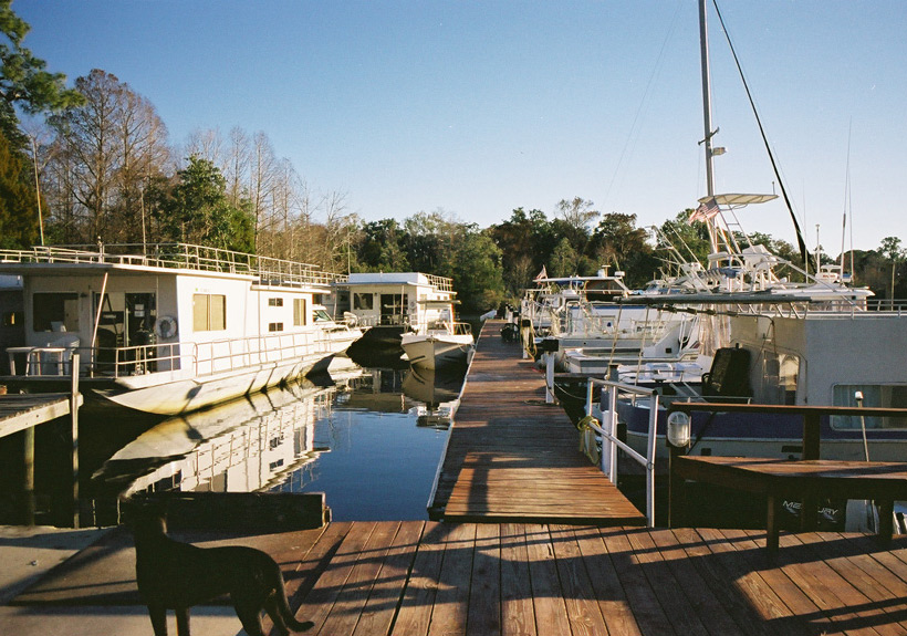
UPSTREAM: 0.12 mile from Miller’s Marina of Suwannee Ramp to Anderson Landing Ramp
PHOTOSET: https://www.facebook.com/pages/Millers-Marina-of-Suwannee-Inc/143206805725819
PHOTO SOURCE: Miller’s Marina of Suwannee
PHONE NUMBER: (352) 542-7349
Suggestions: https://forms.gle/DipPgU2TP5atc2Rf9
Suwannee Boat Ramp
CATEGORIES: Landing
LAYER: Brochure
GPS: 29.32371, -83.14433
OWNERSHIP: Public, Dixie County, PARCEL 30-13-12-3500-000D-0000
ACCESS: Yes, Ramp: Concrete
WATER BODY: Suwannee River
GAUGE: Suwannee River above Gopher River
MILE: 3.78
ADDRESS: 447 SE 205 Street, Suwannee, FL 32692, Dixie County.
DESCRIPTION: Government Owned for General Public Use
UPSTREAM: 0.12 mile from Suwannee Boat Ramp to Anderson Landing Ramp
Suggestions: https://forms.gle/DipPgU2TP5atc2Rf9
Craven’s Hammock Canoe Shelter @ Suwannee River Sill Road
CATEGORIES: Landing
LAYER: Brochure
OWNERSHIP: Public
ACCESS: Yes, Launch: overnight platform shelter, CAMPING, RESTROOMS, PARKING: $5 parking pass, SHELTER, PICNIC AREA
WATER BODY: North Fork Suwannee River
GAUGE: SCFSP
MILE: 5.14
ADDRESS: Five miles up from the Confluence of the North Fork Suwannee River at the Sill, which is a mile up the Sill from where the Suwannee River comes down to meet the Sill, or a little more than a mile past the first gate. Charlton County.
DESCRIPTION: One of the least-visited Okefenokee Swamp platforms.
WEBSITE: https://www.google.com/maps/place/Craven’s+Hammock+Canoe+Shelter/@30.8866211, -82.4196258, 672m/data=!3m2!1e3!4b1!4m5!3m4!1s0x88ef90446e1bf019:0x788f61b94039aca0!8m2!3d30.8866211!4d-82.4174371
Suggestions: https://forms.gle/DipPgU2TP5atc2Rf9
McKinney Landing
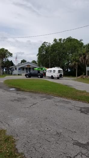
CATEGORIES: Landing
LAYER: Brochure
GPS: 29.32726, -83.1506
OWNERSHIP: Public, DIXIE DISTRICT SCHOOLS COMMUNITY & YOUTH CENTERS, PARCEL 19-13-12-0000-3384-0000
ACCESS: Yes, Ramp: Easy-launch, DOCK, WATER, RESTROOMS, PARKING: Free, SHELTER
WATER BODY: Tributary of Demory Creek
GAUGE: Suwannee River above Gopher River
MILE: 3.78
ADDRESS: 23461 SE 349 Hwy, Suwannee, FL 32692, Dixie County.
DESCRIPTION: Pretty new, with easy launch. At the Community Center in the Town of Suwannee.
WEBSITE: https://paddling.com/paddle/locations/suwannee-community-center
PHOTOSET: https://paddling.com/paddle/locations/suwannee-community-center
PHOTO SOURCE: Paddling.com
Suggestions: https://forms.gle/DipPgU2TP5atc2Rf9
Cedar Key Number 4 Bridge Boat Ramp
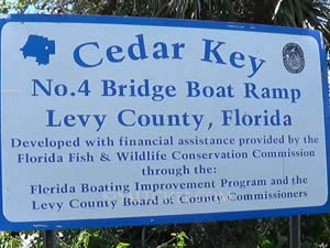
CATEGORIES: Landing
LAYER: Brochure
GPS: 29.16433, -83.02698
OWNERSHIP: Public, Levy County
ACCESS: Yes, Ramp: Concrete, DOCK, RESTROOMS, PARKING: Free
WATER BODY: Florida Circumnavigational Saltwater Paddling Trail
MILE: 413.30
ADDRESS: 11311 SW 153rd Court, Cedar Key, FL 32625, Levy County.
DESCRIPTION: This boat ramp and pier are located on State Road 24 in Cedar Key.
AKA: #4 Bridge Boat Ramp and Fishing Pier.
WEBSITE: https://www.visitnaturecoast.com/boat-ramps.php
OTHER REFERENCE: https://www.floridapaddlingtrails.com/complete-fpta-ct-map-set
DOWNSTREAM: 5.00 miles from Cedar Key Number 4 Bridge Boat Ramp to Shell Mound Park and Public Boat Ramp
PHOTOSET: https://www.saltchef.com/catch_fish/FL/Levy/boat_ramps.html
PHOTO SOURCE: FWC
Suggestions: https://forms.gle/DipPgU2TP5atc2Rf9
Shell Mound Park and Public Boat Ramp

CATEGORIES: Landing
LAYER: Brochure
GPS: 29.21007, -83.06331
OWNERSHIP: Public, Levy County
ACCESS: Yes, Ramp: Concrete, CAMPING: RV, RESTROOMS, PARKING: “RV $15, Tents $10, Tents no electric $5, PICNIC AREA
WATER BODY: Florida Circumnavigational Saltwater Paddling Trail
MILE: 408.30
ADDRESS: 17650 SW 78th Place, Cedar Key, FL 32625, Levy County.
DESCRIPTION: There are 20 campsites with water and power hookups, 10 primitive camping sites, restroom and shower facilities, boat ramp, a fish cleaning area, volleyball, basketball, and an RV dumping station. “”The historic Shell Mound is an interesting destination and a chance to stretch your legs. This five-acre, 28-foot-tall Timucuan Indian mound offers a panoramic view of a Gulf Coast Wilderness. It was primarily built from discarded oyster and scallop shells, possibly during winter solstice celebrations throughout generations that may have spanned 3500 years.””
HISTORIC FACTS: Archeological mound is approximately ½ mile west of campsites on County Road 32. Rebuilt Shell Mound Pier is now open, 2024-05-31. https://cedarkeynews.com/index.php/conservation/8483-shell-mound-pier-now-open
WEBSITE: https://visitnaturecoast.com/boat-ramps/
OTHER REFERENCE: https://floridadep.gov/sites/default/files/Seg_6_text_CT%20July%202023.pdf
ADDITIONAL INFO SOURCES: https://www.fws.gov/refuge/lower-suwannee
UPSTREAM: 5.00 miles from Shell Mound Park and Public Boat Ramp to Cedar Key Number 4 Bridge Boat Ramp
DOWNSTREAM: 12.3 miles from Shell Mound Park and Public Boat Ramp to FLCT Anderson Landing Ramp
PHOTO: https://cedarkeynews.com/images/PIX_2024/CONSERVATION/REFUGES/JUNE/100_0423.JPG
PHOTOSET: https://cedarkeynews.com/index.php/conservation/8483-shell-mound-pier-now-open
PHOTO SOURCE: Lower Suwannee National Wildlife Refuge via Cedar Key News
PHONE NUMBER: (703) 622-3896
Suggestions: https://forms.gle/DipPgU2TP5atc2Rf9
FLCT Anderson Landing Ramp
CATEGORIES: Landing Private
LAYER: Brochure
GPS: 29.33043, -83.1433
OWNERSHIP: Private, Dixie County
ACCESS: Yes, Ramp: Concrete, DOCK, CAMPING, WATER, RESTROOMS, PARKING: Free
WATER BODY: Florida Circumnavigational Saltwater Paddling Trail
GAUGE: Suwannee River above Gopher River
MILE: 396.00
ADDRESS: 2299 SE CR 349, Suwannee, FL 32692, Dixie County.
DESCRIPTION: Parking across CR 349. New floating dock to tie up to while parking. “”Restaurants and Bills Fish Camp and Motel nearby. Motel Reservations: (352) 542-7086″”
AKA: Demory Creek Public Boat Ramp.
WEBSITE: https://floridadep.gov/sites/default/files/Segment%206%20Maps%2012_13_23.pdf
OTHER REFERENCE: https://www.floridapaddlingtrails.com/complete-fpta-ct-map-set
UPSTREAM: 12.3 miles from FLCT Anderson Landing Ramp to Shell Mound Park and Public Boat Ramp
DOWNSTREAM: 2.50 miles from FLCT Anderson Landing Ramp to Cat Island rest stop
PHOTOSET: https://paddling.com/paddle/locations/anderson-landing-river-camp
PHOTO SOURCE: Paddling.com
PHONE NUMBER: (850) 290-2350
Suggestions: https://forms.gle/DipPgU2TP5atc2Rf9
Cat Island rest stop
CATEGORIES: Landing
LAYER: Brochure
GPS: 29.3283, -83.1769
OWNERSHIP: Public
ACCESS: Yes, Launch: sandy island bank
WATER BODY: Florida Circumnavigational Saltwater Paddling Trail
MILE: 393.50
ADDRESS: West of the town of Suwannee and north of the Suwannee River Mouth, Dixie County.
DESCRIPTION: Privately owned, with no facilities.
OTHER REFERENCE: https://www.floridapaddlingtrails.com/complete-fpta-ct-map-set
UPSTREAM: 2.50 miles from Cat Island rest stop to FLCT Anderson Landing Ramp
DOWNSTREAM: 5.10 miles from Cat Island rest stop to Shired Island Public Boat Ramp
Suggestions: https://forms.gle/DipPgU2TP5atc2Rf9
Shired Island Public Boat Ramp
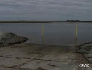
CATEGORIES: Landing
LAYER: Brochure
GPS: 29.39885, -83.20479
OWNERSHIP: Public, Dixie County
ACCESS: Yes, Ramp: Concrete, DOCK, RESTROOMS, PARKING: Free
WATER BODY: Florida Circumnavigational Saltwater Paddling Trail
MILE: 388.40
ADDRESS: 11072 SE Hwy 357, Horseshoe, FL 32648, Dixie County.
DESCRIPTION: “the county campground at Shired Island (pronounced Sheered), about 5 miles from Butler Island (fee required). The water is not potable and has a strong sulfur smell. Nearby, a large Indian shell midden about 12 feet high, with sides exposed due to erosion, is worth viewing.””, In Lower Suwannee NWR
WEBSITE: https://floridadep.gov/sites/default/files/Seg_6_text_CT%20July%202023.pdf
OTHER REFERENCE: https://floridadep.gov/sites/default/files/Segment%206%20Maps%2012_13_23.pdf
UPSTREAM: 5.10 miles from Shired Island Public Boat Ramp to Cat Island rest stop
DOWNSTREAM: 5.00 miles from Shired Island Public Boat Ramp to Butler Island Campsite
PHOTOSET: https://www.saltchef.com/catch_fish/FL/Dixie/boat_ramps.html
PHOTO SOURCE: FWC
PHONE NUMBER: (352) 498-0009
Suggestions: https://forms.gle/DipPgU2TP5atc2Rf9
Butler Island Campsite
CATEGORIES: Landing
LAYER: Brochure
GPS: 29.4312, -83.2697
OWNERSHIP: Public
ACCESS: Yes, Launch: sand, CAMPING
WATER BODY: Florida Circumnavigational Saltwater Paddling Trail
MILE: 383.40
ADDRESS: Island in the Gulf east-southeast of Horsehoe Beach, Dixie County.
DESCRIPTION: “”Beware of poison ivy. Horseshoe Beach Free FWC permit required.”” “”The Butler Island Campsite is 1.7 miles from Horseshoe Point, on the south side of the island. Camping is beneath a canopy of live oaks, palms, and a rare stand of mature cedars, but beware of poison ivy. As with other sites, the low-lying coontie palm grows here, a protected species. The starchy tubers—poisonous if not prepared properly—were once an important food source for Native Americans and early settlers.””
WEBSITE: https://floridadep.gov/sites/default/files/Segment%206%20Maps%2012_13_23.pdf
OTHER REFERENCE: https://floridadep.gov/sites/default/files/Seg_6_text_CT%20July%202023.pdf
UPSTREAM: 5.00 miles from Butler Island Campsite to Shired Island Public Boat Ramp
DOWNSTREAM: 1.40 miles from Butler Island Campsite to El Sea’s Fish Camp
Suggestions: https://forms.gle/DipPgU2TP5atc2Rf9
El Sea’s Fish Camp
CATEGORIES: Landing Private
LAYER: Brochure
GPS: 29.4395, -83.2885
OWNERSHIP: Private
ACCESS: Yes, Launch: canalside, DOCK, CAMPING, WATER, RESTROOMS, PARKING: Free, SHELTER, PICNIC AREA
WATER BODY: Florida Circumnavigational Saltwater Paddling Trail
MILE: 382.00
ADDRESS: 260 3rd Ave E, Horseshoe Beach, FL 32648, Dixie County.
DESCRIPTION: “”We are located on the main channel to the Gulf of Mexico with Dock space available on the property. You can tie off your boat, clean your fish, build a campfire and cook your meal all in one place. As well as rooms, kitchenettes and dry boat storage we also have RV spots available up to 50 amp service.”” Reservations (352) 440-2601, marinadmiller@yahoo.com https://www.tripadvisor.ca/Hotel_Review-g34302-d4893448-Reviews-El_Sea_s_Fish_Camp-Horseshoe_Beach_Florida.html
WEBSITE: https://www.facebook.com/elseasfishcamp/
OTHER REFERENCE: https://floridadep.gov/sites/default/files/Segment%206%20Maps%2012_13_23.pdf
UPSTREAM: 1.40 miles from El Sea’s Fish Camp to Butler Island Campsite
DOWNSTREAM: 0.60 mile from El Sea’s Fish Camp to Horseshoe Beach Park and Boat Ramp
Suggestions: https://forms.gle/DipPgU2TP5atc2Rf9
Horseshoe Beach Park and Boat Ramp
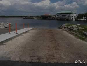
CATEGORIES: Landing
LAYER: Brochure
GPS: 29.44006, -83.29279
OWNERSHIP: Public, Dixie County
ACCESS: Yes, Ramp: Concrete, DOCK, CAMPING: RV, WATER, RESTROOMS, PARKING: Free, PICNIC AREA
WATER BODY: Florida Circumnavigational Saltwater Paddling Trail
MILE: 381.40
ADDRESS: 244 8th Avenue West, Horseshoe Beach, FL 32648, Dixie County.
DESCRIPTION: This is “”a county park in the town of Horseshoe Beach. You can replenish water supplies—enough for two days–and walk a short distance to a convenience store and a restaurant.”” https://floridadep.gov/sites/default/files/Seg_6_text_CT%20July%202023.pdf
AKA: Butler Douglas Memorial Horseshoe Beach Boat Ramp.
WEBSITE: https://boatzia.com/florida/dixie/horseshoe-beach-park-and-boat-ramp/
OTHER REFERENCE: https://floridadep.gov/sites/default/files/Seg_6_text_CT%20July%202023.pdf
UPSTREAM: 0.60 mile from Horseshoe Beach Park and Boat Ramp to El Sea’s Fish Camp
PHOTOSET: https://www.saltchef.com/catch_fish/FL/Dixie/boat_ramps.html
PHOTO SOURCE: FWC
PHONE NUMBER: Ms. Debbie (352) 210-5767
Suggestions: https://forms.gle/DipPgU2TP5atc2Rf9
North Launch Ichetucknee S.S.P. *

CATEGORIES: Landing
LAYER: Brochure
GPS: 29.98292, -82.76053
OWNERSHIP: Public, TIITF/DEP-REC & PARKS, PARCEL 07-6S-16-03790-000 (OTHER)
ACCESS: Yes, Stairs: wooden steps, CANOE, FOOD: Yes: Concession and Restaurant, WATER, RESTROOMS, PARKING: $6, SHELTER, PICNIC AREA, FISH BAIT
WATER BODY: Ichetucknee River
GAUGE: Ichetucknee
MILE: 5.20
ADDRESS: Ichetucknee S.P. North Entrance, 8294 SW Elim Church Rd, Fort White, FL 32038, Columbia County.
DESCRIPTION: Popular summer weekend tubing put-in and winter canoe and kayak put-in. * Paddlers are permitted to take food and drink on the Ichetucknee River in non-disposable containers only. Canoes and kayaks use during weekdays during summer season due to high volume of tubing traffic. Canoes and kaysks must yield right of way to tubers.
DOWNSTREAM: 2.04 miles from North Launch Ichetucknee S.S.P. to Dampier’s Landing
PHOTO: https://wwals.net/pictures/2020-01-20–ichetucknee-santa-fe-pictures/20200120_104549.jpg
PHOTOSET: https://wwals.net/pictures/2020-01-20–ichetucknee-santa-fe-pictures/
PHOTO SOURCE: John S. Quarterman
PHONE NUMBER: (229) 242-0102
Suggestions: https://forms.gle/DipPgU2TP5atc2Rf9
Dampier’s Landing *

CATEGORIES: Landing
LAYER: Brochure
OWNERSHIP: Public, TIITF/DEP-REC & PARKS, PARCEL 13-6S-15-00506-000 (OTHER)
ACCESS: Yes, Stairs: Dock, DOCK, CANOE, PARKING: $6, SHELTER, PICNIC AREA
WATER BODY: Ichetucknee River
GAUGE: Ichetucknee
MILE: 3.16
ADDRESS: About a 10 minute walk from parking lot at South Entrance, 11627 SW Us Highway 27, Fort White, Florida 32071, Columbia County.
DESCRIPTION: 2/3 of the way between North and South Ichetucknee S.P. river entrances. * Paddlers are permitted to take food and drink on the Ichetucknee River in non-disposable containers only.
WEBSITE: https://floridadep.gov/sites/default/files/IchetuckneeGUIDE_0.pdf
UPSTREAM: 2.04 miles from Dampier’s Landing to North Launch Ichetucknee S.S.P.
DOWNSTREAM: 1.05 miles from Dampier’s Landing to South Launch Ichetucknee S.S.P.
PHOTO: https://wwals.net/pictures/2020-01-20–ichetucknee-santa-fe-pictures/20200120_114722.jpg
PHOTOSET: https://wwals.net/pictures/2020-01-20–ichetucknee-santa-fe-pictures/
PHOTO SOURCE: John S. Quarterman
PHONE NUMBER: (229) 242-0102
Suggestions: https://forms.gle/DipPgU2TP5atc2Rf9
South Launch Ichetucknee S.S.P. *
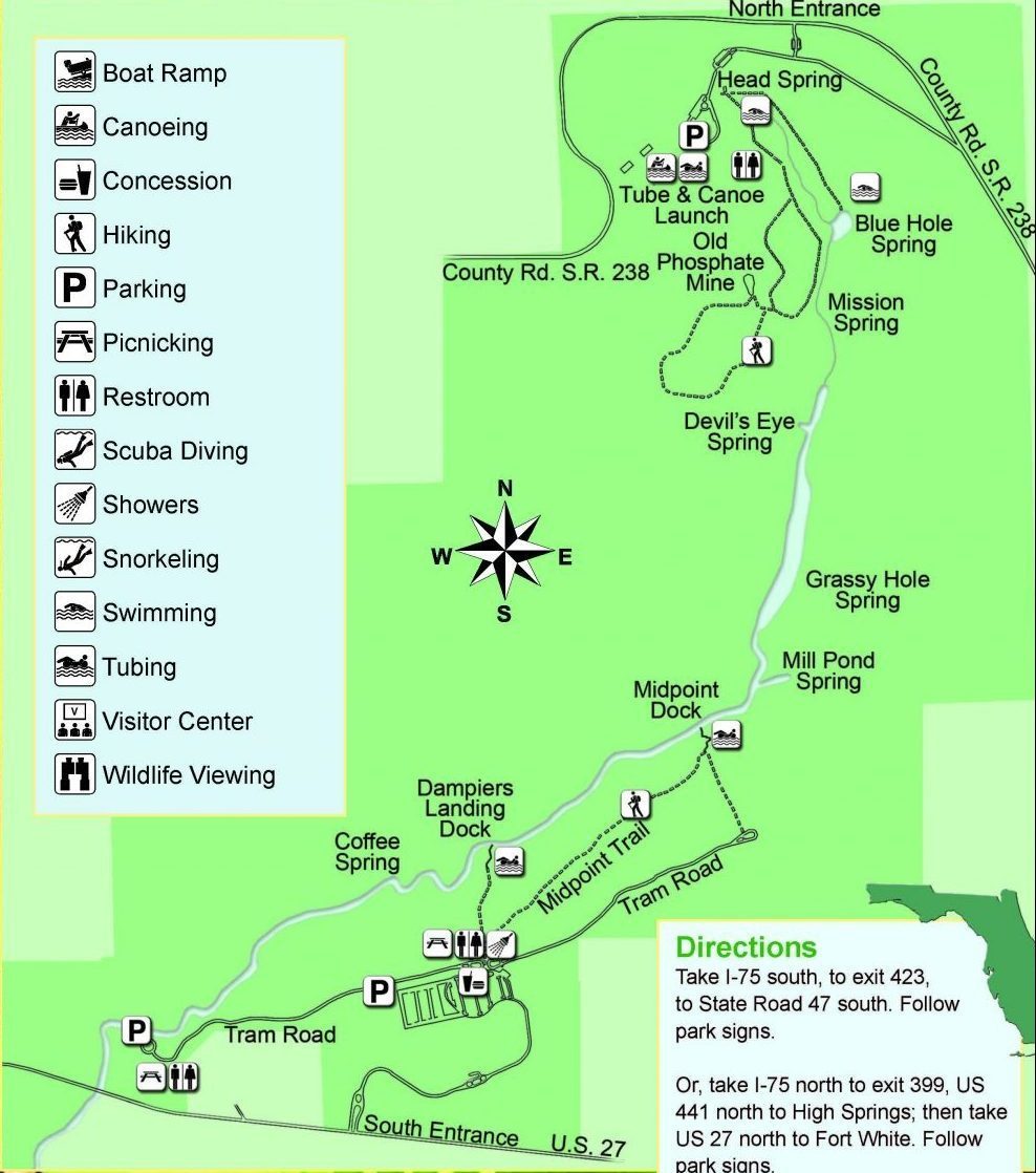
CATEGORIES: Landing
LAYER: Brochure
OWNERSHIP: Public, TIITF/DEP-REC & PARKS, PARCEL 23-6S-15-00508-000 (OTHER)
ACCESS: Yes, Stairs: wooden steps, CANOE, FOOD: Yes: Concession and Restaurant, WATER, RESTROOMS, PARKING: $6, SHELTER, PICNIC AREA
WATER BODY: Ichetucknee River
GAUGE: Ichetucknee
MILE: 2.11
ADDRESS: Ichetucknee S.P. South Entrance, 11627 SW Us Highway 27, Fort White, Florida 32071, Columbia County.
DESCRIPTION: Popular summer weekend tubing put-in and winter canoe and kayak put-in. * Paddlers are permitted to take food and drink on the Ichetucknee River in non-disposable containers only. Paddle craft only in winter months after Labor Day and before Memorial Day. Closed to paddle craft in summer due to tubers.
UPSTREAM: 1.05 miles from South Launch Ichetucknee S.S.P. to Dampier’s Landing
DOWNSTREAM: 3.99 miles from South Launch Ichetucknee S.S.P. to North Launch Ichetucknee S.S.P.
PHOTOSET: https://www.naturalnorthflorida.com/things-to-do/ichetucknee-springs-state-park/
PHOTO SOURCE: Visit Natural North Florida
PHONE NUMBER: (850) 290-2350
Suggestions: https://forms.gle/DipPgU2TP5atc2Rf9
Santa Fe Lake Boat Ramp
CATEGORIES: Landing
LAYER: Brochure
OWNERSHIP: Public
ACCESS: Yes, Ramp: Concrete, PARKING: Free
WATER BODY: Lake Santa Fe
GAUGE: Earleton
MILE: 82.00
ADDRESS: 42500 Northeast State Road 26, Melrose, FL 32666, Alachua County.
DESCRIPTION: On a wide paved entrance and parking road, on the southeast side of the lake.
AKA: Lake Santa Fe Boat Ramp
WEBSITE: https://www.bradfordcountyfl.gov/parks
PHOTO: https://maps.app.goo.gl/SEaFiimatCJcmifh6
PHOTOSET: https://www.google.com/maps/place/29%C2%B042’48.2%22N+82%C2%B003’48.1%22W/@29.7133028, -82.0633432, 5417m/data=!3m1!1e3!4m4!3m3!8m2!3d29.7133889!4d-82.0633611?entry=ttu
PHOTO SOURCE: Google Streetview
PHONE NUMBER: (850) 290-2350
Suggestions: https://forms.gle/DipPgU2TP5atc2Rf9
Little Lake Santa Fe Boat Ramp
CATEGORIES: Landing
LAYER: Brochure
OWNERSHIP: Public
ACCESS: Yes, Ramp: Concrete, RESTROOMS, PARKING: Free
WATER BODY: Little Lake Santa Fe
GAUGE: Earleton
MILE: 80.00
ADDRESS: 3858 Southeast 20th Avenue, Keystone Heights, FL 32656, west of the road, east of the lake. Bradford County.
DESCRIPTION: On a gravelled entrance and parking area.
AKA: Little Santa Fe Lake Boat Ramp
WEBSITE: https://www.bradfordcountyfl.gov/parks
OTHER REFERENCE: https://www.google.com/maps/place/Little+Santa+Fe+Lake+Boat+Ramp/@29.7730588, -82.0782891, 169m/data=!3m1!1e3!4m6!3m5!1s0x88e605049a100321:0x677e971d2f1be1ba!8m2!3d29.7737617!4d-82.078247!16s%2Fg%2F11c19qm086?entry=ttu
PHOTO: https://maps.app.goo.gl/RxyEWLA5YNWVNuet7
PHOTOSET: https://www.google.com/maps/place/Little+Santa+Fe+Lake+Boat+Ramp/@29.7730588, -82.0782891, 169m/data=!3m1!1e3!4m6!3m5!1s0x88e605049a100321:0x677e971d2f1be1ba!8m2!3d29.7737617!4d-82.078247!16s%2Fg%2F11c19qm086?entry=ttu
PHOTO SOURCE: Google Streetview
PHONE NUMBER: (850) 290-2350
Suggestions: https://forms.gle/DipPgU2TP5atc2Rf9
Worthington Springs Ramp @ FL 121
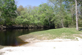
CATEGORIES: Landing
LAYER: Brochure
OWNERSHIP: Public
ACCESS: Yes, Ramp: Concrete
WATER BODY: Santa Fe River
GAUGE: Worthington Springs
MILE: 49.10
ADDRESS: The boat ramp is on the northwest side of SR 121 and the Santa Fe River. Union County.
DESCRIPTION: But “”a difficult place to navigate; shallow and swampy.”” —Joanne Tremblay
WEBSITE: http://www.mysuwanneeriver.com/64/Boating-Canoeing
DOWNSTREAM: 12 miles from Worthington Springs Ramp to Bible Camp Road Ramp
PHOTO SOURCE: SRWMD
Suggestions: https://forms.gle/DipPgU2TP5atc2Rf9
Bible Camp Road Ramp @ US 41

CATEGORIES: Landing
LAYER: Brochure
OWNERSHIP: Public, TIITF/DEP-REC & PARKS, PARCEL 36-6S-17-09862-000
ACCESS: Yes, Ramp: Concrete on dirt access road. PARKING: Free
WATER BODY: Santa Fe River
GAUGE: O’Leno
MILE: 37.10
ADDRESS: From High Springs, travel north on US 41 to SE Sprite Loop; turn right; travel north to SE Bible Camp Street and follow road to boat ramp on the right bank, just downstream from the I-75 bridge. Columbia County.
DESCRIPTION: Run by Columbia County on land owned by the State of Florida.
WEBSITE: http://www.mysuwanneeriver.com/64/Boating-Canoeing
OTHER REFERENCE: https://www.youtube.com/watch?v=u-SB7D7P8a4
UPSTREAM: 12 miles from Bible Camp Road Ramp to Worthington Springs Ramp
DOWNSTREAM: 3.12 miles from Bible Camp Road Ramp to O’Leno Canoe Launch
PHOTO SOURCE: SRWMD
PHOTO2: https://www.floridapaddlenotes.com/wp-content/uploads/2020/02/The-Take-Out-1536×1017.jpg
Photoset2: Florida Paddle Notes
Suggestions: https://forms.gle/DipPgU2TP5atc2Rf9
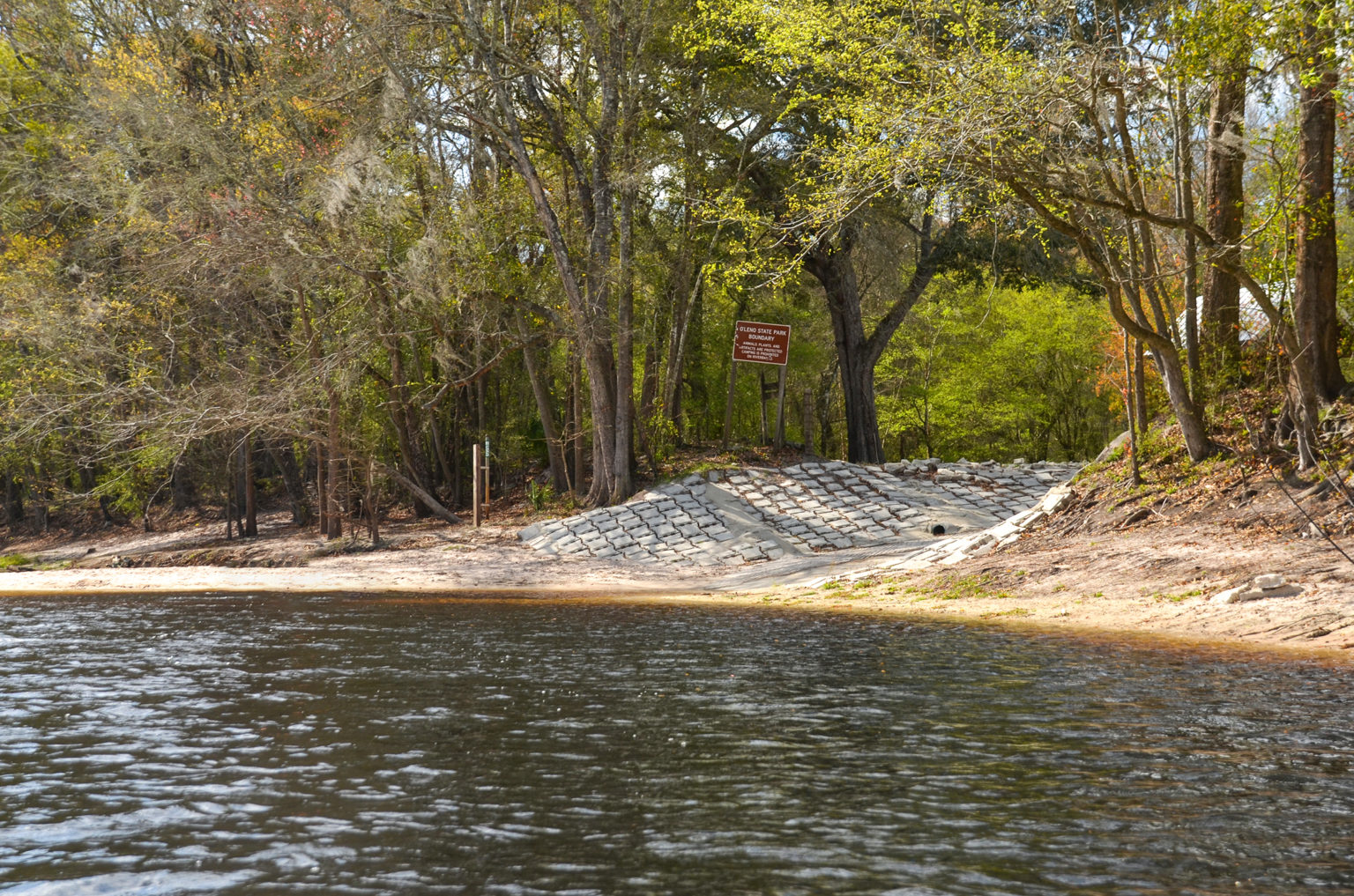
O’Leno Canoe Launch
CATEGORIES: Landing
LAYER: Brochure
GPS: 29.915, -82.5795
OWNERSHIP: Public, TIITF/DEP-REC & PARKS, PARCEL 02-7S-17-09867-000
ACCESS: Yes, Launch: dirt riverside, CAMPING: “Yes: RV, Tent, and Primitive, WATER, RESTROOMS, PARKING: $5, SHELTER, PICNIC AREA, HANDICAPPED ACCESSIBLE
WATER BODY: Santa Fe River
GAUGE: O’Leno
MILE: 33.98
ADDRESS: Right bank, just upstream from the floating swimming dock, in O’Leno State Park, 410 SE O’Leno Park Road, High Springs, FL 32643, Columbia County.
DESCRIPTION: Paddlers must go up river and return, as canoeing down river is prohibited due to the location of the swimming area and the environmental sensitivity of the river sink. Launches are subject to closure based on water levels and will be closed when the river is flooded or when water levels are extremely low. Please contact the ranger station at 386-454-1853 for more information and to inquire about the availability of the launches prior to your visit.
WEBSITE: https://www.floridastateparks.org/parks-and-trails/oleno-state-park
UPSTREAM: 3.12 miles from O’Leno Canoe Launch to Bible Camp Road Ramp
DOWNSTREAM: 6.38 miles from O’Leno Canoe Launch to High Springs Ramp
Suggestions: https://forms.gle/DipPgU2TP5atc2Rf9
High Springs Ramp @ NW 210 Lane
CATEGORIES: Landing
LAYER: Brochure
OWNERSHIP: Public
ACCESS: Yes, Ramp: Concrete
WATER BODY: Santa Fe River
GAUGE: Santa Fe River Rise
MILE: 27.60
ADDRESS: From High Springs, travel north on US 41 to NW 210 Lane; turn left and follow road to boat ramp. Alachua County.
DESCRIPTION: A concrete canoe and kayak ramp on a paved access road.
WEBSITE: http://www.mysuwanneeriver.com/64/Boating-Canoeing
UPSTREAM: 6.38 miles from High Springs Ramp to O’Leno Canoe Launch
DOWNSTREAM: 3.00 miles from High Springs Ramp to US 27 Ramp
PHOTO SOURCE: SRWMD
Suggestions: https://forms.gle/DipPgU2TP5atc2Rf9
US 27 Ramp @ US 27

CATEGORIES: Landing
LAYER: Brochure
GPS: 29.844121, -82.6309
OWNERSHIP: Public
ACCESS: Yes, Ramp: Concrete
WATER BODY: Santa Fe River
GAUGE: Santa Fe River Rise
MILE: 24.60
ADDRESS: From High Springs, travel north on US 27 crossing the Santa Fe River and the boat ramp is on the right. Columbia County.
DESCRIPTION: The ramp is in poor shape, can be an axle breaker.
AKA: River Rise Ramp
WEBSITE: http://www.mysuwanneeriver.com/64/Boating-Canoeing
UPSTREAM: 3.00 miles from US 27 Ramp to High Springs Ramp
DOWNSTREAM: 2.10 miles from US 27 Ramp to Poe Springs Ramp
PHOTO: https://www.wwals.net/pictures/2024-01-04–wq/2024-01-04–SF27–1.5.24-7.jpg
PHOTOSET: https://www.wwals.net/pictures/2024-01-04–wq/
PHOTO SOURCE: Joanne Tremblay
PHONE NUMBER: (850) 290-2350
PHOTO2 SOURCE: SRWMD
Suggestions: https://forms.gle/DipPgU2TP5atc2Rf9
Poe Springs Ramp @ CR 340
CATEGORIES: Landing
LAYER: Brochure
OWNERSHIP: Public
ACCESS: Yes, Ramp: Concrete
WATER BODY: Santa Fe River
GAUGE: Poe Springs
MILE: 22.50
ADDRESS: From High Springs, travel south on CR 236 to CR 340; turn right and travel 3 miles west; the entrance to Poe Springs is on the right. Alachua County.
DESCRIPTION: County park, admission may be required when staffed.
WEBSITE: http://www.mysuwanneeriver.com/64/Boating-Canoeing
UPSTREAM: 2.10 miles from Poe Springs Ramp to US 27 Ramp
DOWNSTREAM: 1.57 miles from Poe Springs Ramp to Rum Island Ramp
PHOTO SOURCE: SRWMD
Suggestions: https://forms.gle/DipPgU2TP5atc2Rf9
Rum Island Ramp @ CR 138
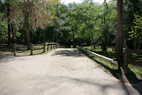
CATEGORIES: Landing
LAYER: Brochure
OWNERSHIP: Public
ACCESS: Yes, Ramp: Concrete
WATER BODY: Santa Fe River
GAUGE: Poe Springs
MILE: 20.93
ADDRESS: From Ft. White, travel south on SR 47 to CR 138; turn left; travel east to SW Rum Island Terrace; turn right and follow road to ramp. Columbia County.
DESCRIPTION: County park, must pay admission to get in: $5 per vehicle. https://www.columbiacountyfla.com/ParksandRecreation.asp
WEBSITE: http://www.mysuwanneeriver.com/64/Boating-Canoeing
OTHER REFERENCE: https://www.columbiacountyfla.com/ParksandRecreation.asp
UPSTREAM: 1.57 miles from Rum Island Ramp to Poe Springs Ramp
DOWNSTREAM: 1.68 miles from Rum Island Ramp to Ginnie Springs Ramp
PHOTO SOURCE: SRWMD
Suggestions: https://forms.gle/DipPgU2TP5atc2Rf9
Ginnie Springs Ramp @ NE 60th Ave.
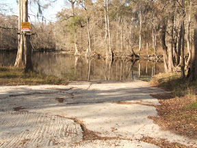
CATEGORIES: Landing
LAYER: Brochure
OWNERSHIP: Public, WRAY SPRING LAND TRUST, LLC, PARCEL 34-07-16-0000-0001-0000
ACCESS: Yes, Ramp: Concrete
WATER BODY: Santa Fe River
GAUGE: Fort White
MILE: 19.25
ADDRESS: From Ft. White, travel south to CR 340; turn left; travel east to NE 60th Avenue; turn left and follow road to park. Gilchrist County.
DESCRIPTION: Inside the Private Ginnie Springs Park; entry payment required. https://ginniespringsoutdoors.com/admission-pricing/
WEBSITE: http://www.mysuwanneeriver.com/64/Boating-Canoeing
OTHER REFERENCE: https://ginniespringsoutdoors.com/admission-pricing/
UPSTREAM: 1.68 miles from Ginnie Springs Ramp to Rum Island Ramp
DOWNSTREAM: 0.51 mile from Ginnie Springs Ramp to Eddins Boat Ramp
PHOTO SOURCE: SRWMD
Suggestions: https://forms.gle/DipPgU2TP5atc2Rf9
Eddins Boat Ramp

CATEGORIES: Landing
LAYER: Brochure
OWNERSHIP: Public, Gilchrist County, PARCEL 27-07-16-0000-0004-0000
ACCESS: Yes, Ramp: Unknown, PARKING: Free but limited space
WATER BODY: Santa Fe River
GAUGE: Fort White
MILE: 18.74
ADDRESS: I-75 Exit 423, south on US 47 through Fort White, cross the Santa Fe River, left on NE 65th St., left on NE 55th Ave., right on NE 70th St. to its end; left bank of the river. Gilchrist County.
DESCRIPTION: “”¼ acre park just past Ginnie Springs, on the South side of the river.”” “”This is a beautiful little pocket park bordering Ginnie Springs Recreational Complex. Its a great place to put in if you want to avoid the insanity of people partying at Ginnie. There is a tight turn around area, and a rough muddy landing. There is no trash recepticals. There were a couple of bonfire spots.”” —Joanne Tremblay
UPSTREAM: 0.51 mile from Eddins Boat Ramp to Ginnie Springs Ramp
DOWNSTREAM: 2.94 miles from Eddins Boat Ramp to FL 47 Ramp
PHOTO: https://www.wwals.net/pictures/2024-01-04–wq/2024-01-04–eddins–1.5.24-2.jpg
PHOTOSET: https://www.wwals.net/pictures/2024-01-04–wq/
PHOTO SOURCE: Joanne Tremblay
PHONE NUMBER: (850) 290-2350
Suggestions: https://forms.gle/DipPgU2TP5atc2Rf9
FL 47 Ramp @ FL 47
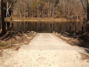
CATEGORIES: Landing
LAYER: Brochure
OWNERSHIP: Public
ACCESS: Yes, Ramp: Concrete
WATER BODY: Santa Fe River
GAUGE: Fort White
MILE: 15.80
ADDRESS: From Ft. White, travel south on SR 47; cross the Santa Fe River and the boat ramp is on the left in the county park. Gilchrist County.
DESCRIPTION: County park admission fee required Friday through Sunday.
AKA: Santa Fe River County Park Ramp, Santa Fe River Gilchrist County Park Ramp
WEBSITE: http://www.mysuwanneeriver.com/64/Boating-Canoeing
UPSTREAM: 2.94 miles from FL 47 Ramp to Eddins Boat Ramp
DOWNSTREAM: 0.50 mile from FL 47 Ramp to Hollingsworth Bluff Ramp
PHOTO SOURCE: SRWMD
Suggestions: https://forms.gle/DipPgU2TP5atc2Rf9
Hollingsworth Bluff Ramp

CATEGORIES: Landing
LAYER: Brochure
OWNERSHIP: Public
ACCESS: Yes, Ramp: Concrete
WATER BODY: Santa Fe River
GAUGE: Fort White
MILE: 15.30
ADDRESS: From Ft. White, travel south on SR 47 to CR 138; turn right; travel west to NE 2nd Way; turn right and follow road to boat ramp on the right. Columbia County.
WEBSITE: http://www.mysuwanneeriver.com/64/Boating-Canoeing
UPSTREAM: 0.50 mile from Hollingsworth Bluff Ramp to FL 47 Ramp
DOWNSTREAM: 2.70 miles from Hollingsworth Bluff Ramp to BW Turner Boat Ramp
PHOTO SOURCE: SRWMD
Suggestions: https://forms.gle/DipPgU2TP5atc2Rf9
BW Turner Boat Ramp

CATEGORIES: Landing
LAYER: Brochure
GPS: 29.89669, -82.763392
OWNERSHIP: Public, Gilchrist County, PARCEL 12-07-15-0000-0012-0000
ACCESS: Yes, Ramp: Concrete
WATER BODY: Santa Fe River
GAUGE: Fort White
MILE: 12.60
ADDRESS: From Ft. White, travel south on SR 47 to CR 138; turn right; travel west to NE 100 Street; turn right and follow road to NE 25 Avenue; turn left; turn right on NE 108th Place; follow that to the end. Gilchrist County.
DESCRIPTION: It’s in a 1.43 acre Gilchrist County park, and so may require an admission fee.
AKA: Santa Fe River Ramp
WEBSITE: http://www.mysuwanneeriver.com/64/Boating-Canoeing
OTHER REFERENCE: https://qpublic.schneidercorp.com/Application.aspx?AppID=820&LayerID=15174&PageTypeID=4&PageID=6883&KeyValue=12-07-15-0000-0012-0000
UPSTREAM: 2.70 miles from BW Turner Boat Ramp to Hollingsworth Bluff Ramp
DOWNSTREAM: 1.90 miles from BW Turner Boat Ramp to Ira Bea Oasis Ramp
PHOTO SOURCE: SRWMD
Suggestions: https://forms.gle/DipPgU2TP5atc2Rf9
Ira Bea Oasis Ramp @ NE 2nd Way

CATEGORIES: Landing
LAYER: Brochure
OWNERSHIP: Public, Gilchrist County, PARCEL 01-07-15-0000-0001-0000
ACCESS: Yes, Ramp: Concrete on gravel access road with parking, PARKING: Free
WATER BODY: Santa Fe River
GAUGE: Fort White
MILE: 10.70
ADDRESS: From Ft. White, travel south on SR 47 to CR 138; turn right; travel west to NE 2nd Way; turn right and follow road to boat ramp on the right. Gilchrist County.
DESCRIPTION: It’s in a 1.5 acre Gilchrist County park, and so may require an admission fee.
HISTORIC FACTS: Apparently Tudeen Ramp was completely rebuilt 2022-12-22 to the tune of $167, 974.00 in federal funds disbursed by the Florida Fish and Wildlife Conservation Commission. https://facts.fldfs.com/Search/ContractDetail.aspx?AgencyId=770000&ContractId=19027
AKA: Tudeen Boat Ramp
WEBSITE: http://www.mysuwanneeriver.com/64/Boating-Canoeing
OTHER REFERENCE: https://publictest.myfwc.com/LE/boatramp/public/Ramp.aspx?FacilityID=GI10008QS&Name=Tudeen+Boat+Ramp
UPSTREAM: 1.90 miles from Ira Bea Oasis Ramp to BW Turner Boat Ramp
DOWNSTREAM: 8.30 miles from Ira Bea Oasis Ramp to US 129 Ramp
PHOTO SOURCE: SRWMD
Suggestions: https://forms.gle/DipPgU2TP5atc2Rf9
US 129 Ramp @ 296th St.

CATEGORIES: Landing
LAYER: Brochure
OWNERSHIP: Public, SUWANNEE COUNTY, PARCEL 01-07S-14E-04490-000000
ACCESS: Yes, Ramp: Concrete
WATER BODY: Santa Fe River
GAUGE: Hildreth
MILE: 2.40
ADDRESS: From Branford, travel east on US 27; turn right on US 129; travel south to 296th Street; turn right and William Guy Lemons Memorial Park is on the left. Suwannee County.
DESCRIPTION: In a 1.85 acre Suwannee County Park.
AKA: William Guy Lemmon Memorial Park Ramp (Suwannee County), William Guy Lemmons Memorial Park Ramp (SRWMD), Hwy 129 Boat Ramp
WEBSITE: https://boatzia.com/florida/suwannee/william-guy-lemon-park/
OTHER REFERENCE: https://boatzia.com/florida/suwannee/william-guy-lemon-park/
UPSTREAM: 8.30 miles from US 129 Ramp to Ira Bea Oasis Ramp
DOWNSTREAM: 0.30 mile from US 129 Ramp to Sandy Point Campground Ramp
PHOTO: https://www.wwals.net/pictures/2024-03-06–wq/2024-03-06–SF129-other-IMG_4559.jpg
PHOTOSET: https://www.wwals.net/pictures/2024-03-06–wq/#Lemmons
PHOTO SOURCE: Joanne Tremblay
PHONE NUMBER: (850) 290-2350
Suggestions: https://forms.gle/DipPgU2TP5atc2Rf9
Sandy Point Campground Ramp @ 296th St.

CATEGORIES: Landing
LAYER: Brochure
OWNERSHIP: Public, FANNING DEBORAH ELAINE, PARCEL 01-07S-14E-04481-000000
ACCESS: Yes, Ramp: Concrete
WATER BODY: Santa Fe River
GAUGE: Hildreth
MILE: 2.10
ADDRESS: 29685 59th Dr, Branford, FL. From Branford, travel east on US 27; turn right on US 129; travel south to 296th Street; turn right; travel west on 296th Street; Sandy Point Campground is on the left. Suwannee County.
DESCRIPTION: Privately owned. Call for information 386-961-1390 or see facebook page. https://www.facebook.com/profile.php?id=100047676923284
WEBSITE: http://www.mysuwanneeriver.com/64/Boating-Canoeing
OTHER REFERENCE: https://www.facebook.com/profile.php?id=100047676923284
UPSTREAM: 0.30 mile from Sandy Point Campground Ramp to US 129 Ramp
DOWNSTREAM: 0.80 mile from Sandy Point Campground Ramp to Ellie Ray’s River Landing Ramp
PHOTO SOURCE: SRWMD
Suggestions: https://forms.gle/DipPgU2TP5atc2Rf9
Ellie Ray’s River Landing Ramp @ 110th St.
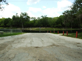
CATEGORIES: Landing
LAYER: Brochure
OWNERSHIP: Public
ACCESS: Yes, Ramp: Concrete
WATER BODY: Santa Fe River
GAUGE: Hildreth
MILE: 1.30
ADDRESS: From Branford, travel east on US 27; turn right on US 129; travel south; cross the Santa Fe River; travel to NW 110th Street; turn right and follow road to boat ramp. Gilchrist County.
DESCRIPTION: A private business that charges for access and has limited boat slips: “”Sitting on the spring fed, Santa Fe River, in North Central Florida, you can Kayak, fish, get a good tan, whatever your flavor, its here because you are on DAY-CATION when you are at Ellie Ray’s!””
WEBSITE: https://www.ellieraysrvresort.com/
UPSTREAM: 0.80 mile from Ellie Ray’s River Landing Ramp to Sandy Point Campground Ramp
DOWNSTREAM: 1.20 miles from Ellie Ray’s River Landing Ramp to Wanamake Ramp
PHOTO SOURCE: SRWMD
Suggestions: https://forms.gle/DipPgU2TP5atc2Rf9
Wanamake Ramp @ NW 38th Court

CATEGORIES: Landing
LAYER: Brochure
OWNERSHIP: Public, Gilchrist County, PARCEL 12-07-14-0000-0008-0000
ACCESS: Yes, Ramp: Concrete
WATER BODY: Santa Fe River
GAUGE: Hildreth
MILE: 0.10
ADDRESS: From Branford, travel east on US 27; turn right on US 129; travel south; cross the Santa Fe River; travel to NW 102nd Place; turn right; travel west to NW 38th Court; turn right and follow road to boat ramp. Gilchrist County.
DESCRIPTION: A Gilchrist County boat ramp on 0.19 acres that apparently charges no fee. Boatzia says it is an unpaved sand ramp and very shallow, so unloading boats from a trailer may be difficult.
AKA: GC Butler Boat Landing or GC Butler Boat Ramp or Butler Ramp
WEBSITE: http://www.mysuwanneeriver.com/64/Boating-Canoeing
UPSTREAM: 1.20 miles from Wanamake Ramp to Ellie Ray’s River Landing Ramp
DOWNSTREAM: 1.02 miles from Wanamake Ramp to Dorothy Land Ramp
PHOTO SOURCE: SRWMD
Suggestions: https://forms.gle/DipPgU2TP5atc2Rf9