Springs and sand like snow, red and yellow water, chatting as we go, Woods Ferry to Suwannee Springs on the Suwannee River, May 20, 2017, with Hands Across the Sand at noon. Even though everyone had a trash bag, there was surprisingly almost no trash to pick up until we got to Suwannee Springs. Here are some pictures, a few videos, and a google map showing the locations.
Update 2021-09-23: Water levels were 36.34′ on the Suwannee Springs USGS gauge and 49.47′ on the White Springs gauge.
What is the name of this spring?
 Upriver across the spring, 30.3695100, -82.8887100
It’s in SRWMD’s Camp Branch Tract, downhill from Camp Branch, but the SRWMD map doesn’t mention it.
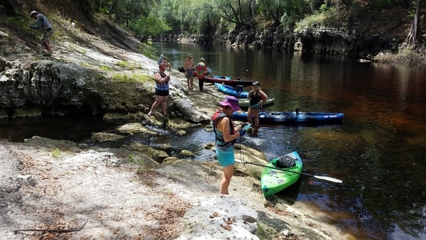
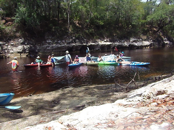
We thought, “Let’s do Hands Across the Sand on this sand bar!”

Wading in the river, 30.3693500, -82.8884400
So we did, with boats.

Picture by Gretchen Quarterman for WWALS 2017-05-20.

Sand or snow? 30.3838158, -82.9153755

Carefree, 30.3882461, -82.9052950
OK, what about this sulfur spring?
Movie: Very green sulfur spring water, 30.3903800, -82.9266500
Here are the infamous bubbles (no, there’s no pipeline there).

Movie: Bubbles above Suwannee Springs, 30.3948300, -82.9332000
And probably you know the name of this spring:

Green Suwannee Springs outflow, 30.3946288, -82.9346197
Join us for an upcoming outing! See the WWALS calendar.

Starting to paddle, 30.3621200, -82.8685000
-jsq, John S. Quarterman, Suwannee RIVERKEEPER®
You can join this fun and work by becoming a WWALS member today!
Videos
Video playlist, also embedded below.
Pictures

Woods Ferry Tract 57 Drive Entrance, Woods Ferry Path, 30.3433333, -82.8550000

Woods Ferry Tract Landing, 30.3615630, -82.8688362

District Lands, Yours to Enjoy,

SRWMD Vertical Control, 30.3619171, -82.8686340

Assembling at the Suwannee River, 30.3620500, -82.8685700

Upstream, 30.3620400, -82.8682200

Downstream towards the Landing, 30.3621300, -82.8683800

Yellow sandbar, 30.3623300, -82.8681800

Starting to paddle, 30.3621200, -82.8685000

Off to see the River, the wonderful river of Suwannee, 30.3617500, -82.8691200

Logs, 30.3609000, -82.8707200

Deadfalls, 30.3609600, -82.8712200

Bend to the left, 30.3660700, -82.8718600

Jerry Branch confluence? 30.3663171, -82.8722976

Paddlers near and far, 30.3664700, -82.8723400

Nice roots, 30.3663140, -82.8730949

Scotti Jay, and can we say karst? 30.3660100, -82.8732600

Limestone bottom, 30.3656800, -82.8764400

Orange-red water, 30.3655500, -82.8770800

Creek confluence, 30.3663300, -82.8778100

Second big bend to the left, 30.3664708, -82.8782716

Movie: Paddling and chatting, 30.3666000, -82.8783300

Paddling and picturing, 30.3669800, -82.8787700

Limestone cliff, 30.3672600, -82.8797200

Red and low, 30.3650000, -82.8838889

Many methods of travel, 30.3650000, -82.8838889

Undercut cliff, 30.3657700, -82.8853200

High contrast cave, 30.3659130, -82.8852608

Movie: Drifting into the cave, 30.3659300, -82.8851900

Fallen tree, 30.3669300, -82.8844600

Beach and cliff, 30.3670574, -82.8846413

20170520 112238 30.3671004, -82.8845715

20170520 112240 30.3671004, -82.8845715

Access to the river, 30.3671843, -82.8845574

Ravine, 30.3672239, -82.8849664

Camp Branch Conservation Area on right, 30.3676500, -82.8863700

Fishing on the riverbank, 30.3680800, -82.8877600

Must be something on the bank, 30.3686100, -82.8881800

Its a spring, 30.3691400, -82.8888700

Movie: Camp Branch Spring, 30.36925, -8288875

Upriver across the spring, 30.3695100, -82.8887100

Up the spring run, 30.3694600, -82.8886200

Down the spring run, 30.3695200, -82.8885500

Road or trail, 30.3695300, -82.8884600

Pictures up and down, 30.3694600, -82.8884500

Above the spring run, 30.3694000, -82.8884500

Try not to fall one someones head, 30.3693900, -82.8884900

Wading in the river, 30.3693500, -82.8884400

Climbing down, 30.3693300, -82.8884600

Roots, 30.3696754, -82.8892138

Relaxed, 30.3697866, -82.8892947

Following, 30.3697222, -82.8891667

Orange-red left, 30.3721351, -82.8900923

Small limestone cave below Mattair Springs, 30.3720494, -82.8903312

Movie: Drifting past caves, 30.3724200, -82.8905500

SE 128th Ave, White Springs, FL, 30.3827480, -82.8904040

Suwannee Riverkeeper, 30.3753621, -82.8930762

Suwannee Riverkeeper, tannic water, 30.3753621, -82.8930762

Bend left, grottos right, 30.3800243, -82.8906125

Orange and yellow water, limestone cliff, 30.3780694, -82.8911194

Cliff left, beach right, 30.3822200, -82.8910300

Movie: Dan Coleman by the caves, 30.3820000, -82.8907000

Dan Coleman, 30.3825000, -82.8907700

Boat dock in distance, 30.3827480, -82.8904040

Very red, 30.3842400, -82.8891900

Yellow water, 30.3842900, -82.8892900

Festive landing near CR 25A and SE 128th Ave., 30.3859100, -82.8887100

Bear tracks? 30.3864782, -82.8896368

Cant tell, 30.3865044, -82.8899418

Carefree, 30.3882461, -82.9052950

Landing, Sugar Creek Tract, 30.3877380, -82.9065767

Longleaf of the Suwannee, 30.3864600, -82.9060100

Natural vegetation or not? 30.3862200, -82.9056900

Inquiring minds want to know, 30.3862000, -82.9056800

Sand or snow? 30.3838158, -82.9153755

Movie: Does it smell like snake? Sulfur spring, 30.3901900, -82.9266100

Movie: Very green sulfur spring water, 30.3903800, -82.9266500

Power line, sand, and boats, 30.3912500, -82.9281400

Power line, Hamilton County, 30.3912400, -82.9283900

20170520 150549 30.3911632, -82.9282972

Power line, Suwannee County, 30.3910100, -82.9282600

Below 91st Drive, 30.3906341, -82.9316863

Beached dock below 91st Drive, 30.3905556, -82.9316667

3254 91st Dr, Live Oak, FL 32060, 30.3905556, -82.9316667

Level markers, 30.3923800, -82.9325889

More level markers, 30.3923800, -82.9325889

Broken concrete, 30.3923800, -82.9325889

Last point before Suwannee Springs, 30.3947319, -82.9326108

Driftwood, 30.3947319, -82.9326108

Movie: Bubbles above Suwannee Springs, 30.3948300, -82.9332000

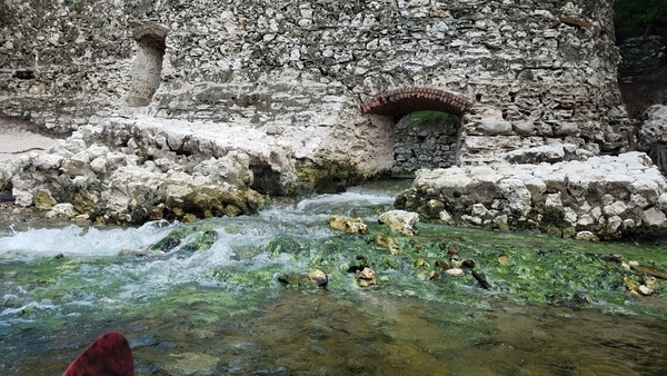
Suwannee Springs wall, 30.3946500, -82.9344300

Movie: Suwannee Springs, 30.3946300, -82.9345000

Movie: More springs just below, 30.3946300, -82.9345500

Green Suwannee Springs outflow, 30.3946288, -82.9346197

Dan Phillips at Suwannee Springs, 30.3946288, -82.9346197

Looking at the outflow, 30.3946447, -82.9346156

Movie: Suwannee Springs with reference human, Dan Phillips (31M)

Old bridge around the corner, 30.3947638, -82.9347537

93rd Drive Bridge, 30.3947638, -82.9347537

Closeup, 93rd Drive Bridge, 30.3947638, -82.9347537

Looking upstream at Suwannee Springs, 30.3947638, -82.9347537

93rd Drive Bridge and US 129 Bridge, 30.3947475, -82.9346413

US 129 Bridge, 30.3944444, -82.9352778

Reflections of Bridges, 93rd Drive and US 129, 30.3947610, -82.9353479

Back to Suwannee Springs, 30.3948325, -82.9354444

Carry the boats up those stairs, 30.3947222, -82.9352778
Google Map
Follow this link for the interactive google map, or it’s also embedded below.
Short Link:

