Tag Archives: Alligator Creek

River Gage Projections after Hurricane Irma 2017-09-14

Update 2017-09-15: On the seventh day.

Update 2017-09-15: Added Suwannee River at Wilcox @ US 19, plus another image for the Gage Map.

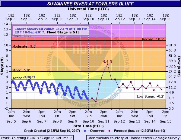
Hurricane Irma flooded the Suwannee River at White Springs, the Santa Fe River especially at Fort White, with a new record for the New River new Lake Butler. It did not flood the Withlacoochee or Alapaha Rivers.

N2017-09-14 Suwannee River at White Springs
2017-09-14 Suwannee River at White Springs

FDOT says the I-75 bridge over the Santa Fe River Continue reading

River Gage Projections for Hurricane Irma 2017-09-10

Update 2017-09-15: On the seventh day.

Hurricane Irma is bringing flood levels on on most of the rivers in the Suwannee River Basin. Here are the gages with projections from downstream to upstream, since Irma is coming from the south. The images here are static to show this moment, but click on any image to go through to the live gage.

Suwannee River

Suwannee River at Fowlers Bluff

Suwannee River at Fowlers Bluff

Suwannee River at Branford @ US 27

Continue reading