Tag Archives: Outing

Alapaha River at Statenville: January WWALS Outing

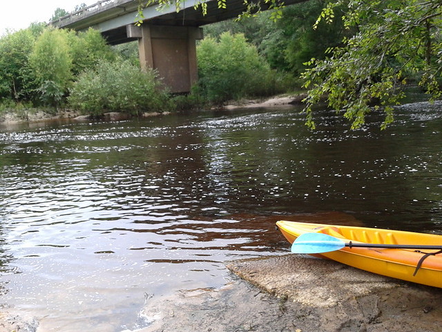
Meet at the boat ramp/parking lot on the left just before you get to Statenville heading east on Hwy 94 at 1:30. Boat launch is at 2. We will paddle upstream for 30 to 45 min. and then float back down. The river will likely be up, so it should be a work out.

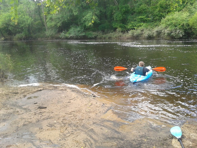
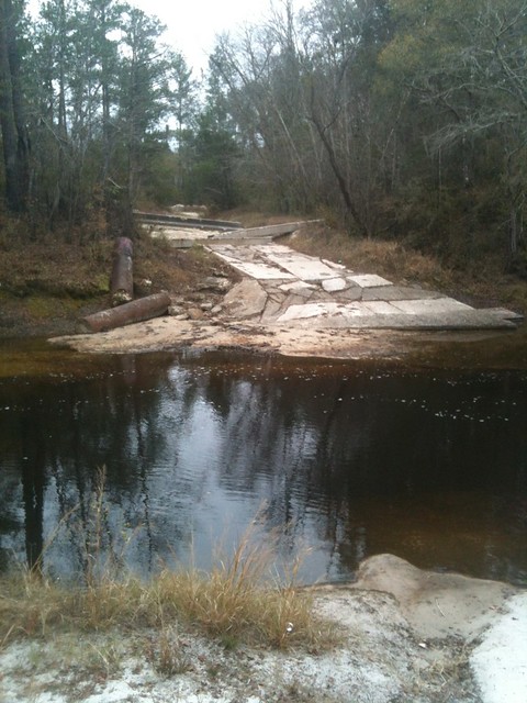
The river water temperature is currently 50 degrees Fahrenheit, so dress warmly. The Alapaha River at Statenville is currently at 9 feet and rising, which is well above the level recommended by Brown’s Guide for this river.

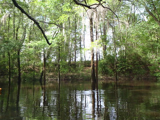
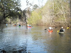
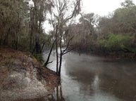
Jungle-like in its remoteness and luxurious with exotic vegetation, the dark reddish-brown waters of the Alapaha wind through a swampy wonderland teeming with wildlife. Signs of habitation are rare along the river’s course; only a few isolated cabins intrude on the remote tranquility.

Here’s a map: Continue reading

Alapahoochee River

Proposed for the WWALS January 2014 outing: the river most people know nothing about, from the convergence of Mud Swamp Creek where Grand Bay Creek forms the border between Lowndes County and Echols County in Georgia east of Valdosta, about 14 miles through Echols County between Lake Park and Statenville, to the Alapaha River in Hamilton County, Florida east of Jennings: the Alapahoochee River.

It has a waterfall, limestone caves, and boat ramps, all pictured by South Georgia Kayak Fishing 3 September 2011 in Alapahoochee convergence at Alapaha River – Jennings, FL.

Here’s a brief day paddle description, Florida whitewater, Alapahoochee River Grand Bay Canal), by riverfacts.com:

Echols / Hamilton county, GA SR 135 to FL SR 150 on Alapaha section whitewater kayaking, rafting, and paddling information.

This stretch of Alapahoochee River Grand Bay Canal) in Echols / Hamilton County is 4.5 miles long and is according to American Whitewater a class II section of whitewater.

They include a map.

Continue reading

WWALS Outing: Rivers Alive Little River Clean Up 2013-09-28

8AM to 1PM this coming Saturday at Reed Bingham State Park, it’s also the September WWALS outing now: Rivers Alive Little River Clean Up. Bring your canoe or kayak or rent one there for half price to volunteers!

Explore Georgia wrote:

We will be removing trash from the Little River and Reed Bingham Lake. Experienced canoeists and kayakers have the opportunity to paddle down the little river while picking up garbage. Canoes and kayaks are available to volunteers for half off. Please register in advance to ensure your rental spot is available. Non-boaters can walk around and in the lake and river picking up garbage and debris. $5 parking. 229-896-3551.

WWALS will be participating in the boating part. You can let us know you’re coming by joining the WWALS facebook event. Or Continue reading

Withlacoochee River from Nankin Landing to GA 31: WWALS June Outing 2013-06-22

A few pictures from today’s WWALS Outing on the Withlacoochee River from Clyattville-Nankin Road to GA 31, with 12 people in 8 boats (4 kayaks, 4 canoes).

Gage height, US 84 Quitman: 3.25 feet (86.75 feet NAVD 1988).

Withlacoochee River at Clyattville-Nankin Landing:

Withlacoochee River at Clyattville-Nankin Landing

Heather sets out:

Heather sets out

Continue reading

Withlacoochee River Outing: Clyattville-Nankin Road to GA 31

The June WWALS outing is from Clyattville-Nankin Road to Horn Bridge on Sun tree Madison Highway (GA 31) on the Withlacoochee River. Meet at the Clyattville-Nankin Road putin at 9AM, put in at 10AM, Saturday, 22 June 2013. Join the facebook event if you like. See you there!

Update 20 June 2013: How are we getting back to our vehicles with this trip? We’ll deposit all the boats at the put-in (Clyattville-Nankin Road), take most of the vehicles down to the take-out (Horn Bridge on Madison Highway aka GA 31), carpool in a few vehicles back to the put-in, and float down the river.

Tom Baird described this nine-mile two-hour trip as:

The section includes where Clyatt Mill Creek enters, a truly fun set of rapids (two drops) at the Ga – Fla border, a very nice Second Magnitude Spring (that I have yet to find the correct name), the remains of the enormous abandoned trestle over the river of the Georgia & Florida Railroad, or Ole God Forsaken as it was nicknamed, the ghost town of Olympia on the Georgia side, and several Indian quarry sites. It is along this section that the river cuts deeply enough that the banks switch from sand banks to limerock cliffs. Paddle distance is about 9 miles, so a little over two hours paddling time. There are plenty of places to stop and look around.

There are shoals right at the state line, so beware, esp. if you’re in a canoe. The book Canoeing and Kayaking Georgia, by Susanne Welander, Bob Sehlinger, and Don Otey (2004) says: Continue reading

Withlacoochee River at Franklinville 16 April 2013 2013-04-20

Come paddle the Withlacoochee River from GA 122 to Franklinville, 10 AM 20 April 2013, in the monthly WWALS outing.

Update 2016-02-01: Pictures by Gretchen Quarterman.

Franklinville Road Bridge (closed):

Franklinville Road Bridge (closed)

Withlacoochee River:

Continue reading

First annual Big LITTLE RIVER Paddle Race

Start On Saturday, March 30 WWALS held their first joint fundraiser with the Friends of Reed Bingham State Park: the first annual Big LITTLE RIVER Paddle Race. We had 18 boats and 27 paddlers participate. The start was at Rountree Bridge at the north end of Reed Bingham State Park.

-Bret Wagenhorst

Start:

Continue reading

WWALS outing called because of weather, but….

Gretchen posted:

The “official” event is off because of the weather. However, if you want to see the location, gather at Gary Rampley’s, past Mullins Lane at 6974 Old State Road and park in his yard and then walk to the River (less than .2 miles) at 1:00. Meet others who like a cold, rainy outing.

Or, at 2:00pm meet at Let’s Eat Cafe (Exit 18 from I75—across from Austin’s Steak House at the Shell Station) to discuss strategies for keeping access to the Alapaha River in Lowndes County.

Our local hosts still want to meet up with interested folks and for those not up to braving the weather, we will be indoors at Let’s Eat (an excellent local place to meet and eat).

Blocked: Hotchkiss Landing closed by big blocks of concrete, October 2010

Why was a public road, Old State Road, blocked by concrete blocks from late 2010 through at least early 2012, right at Hotchkiss Landing on the Alapaha River in Lowndes County, Georgia?

According to two witnesses, this is what Old State Road at Hotchkiss Landing looked like shortly after the Lowndes County Commission decision of 26 October 2010 to keep the road open:

Seen from north side
Picture by Cactus Clyde on flickr, who wrote:
“Alapaha River a mile upstream pf the US84 bridge (on the Hotchkiss Road) east of Naylor, GA- river level 77.96′ at Statenville, GA on 12/11/11. No acces on the west side any longer- this was taken looking west.”

April Huntley says “It happened right after the decision to not close the road.” Chris Graham says this was “Few days after we won.” According to the date on that picture, the road was still blocked 11 December 2011.

Google Earth shows that same blockage for 14 January 2012 in imagery taken by NASA, and that’s also what the current google map shows:

Continue reading