Tag Archives: railroad

Two GA-EPD water advisories about US 84 widening project

Thirty-day comment periods closing 12 August 2015 to comment on the US 84 widening project, say 300x175 Greasy Branch, CSX Railroad, Upper Suwannee River Watershed, in Two GA-EPD water advisories about US 84 widening project, by John S. Quarterman, for WWALS.net, 13 July 2015 two Public Advisories from GA-EPD Watershed Protection Branch. One is in the Satilla River watershed, about “two existing open water ponds (outflowing into jusrisdictional[sic] wetlands associated with Lees Branch)”: those ponds are next to the groundwater-contaminating CSX railyard in Waycross. One is in 
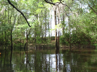
the Upper Suwannee River watershed, about “three existing open water ponds (outflowing into jusrisdictional[sic] waters associated with Greasy Creek and the CSX railroad)”. Maybe the Southern Environmental Law Center letter to GDOT and the U.S. Army Corps of Engineers got some results, although these advisories are from a different state agency.

The Upper Suwannee one starts at Continue reading

Lanier Park to CSX RR track Hotchkiss Road, WWALS outing 2015-07-11

Update 10 July 2015: Outing leader Chris Graham says there’s plenty of water, so we’ll be putting in on the Alapaha River tomorrow morning at Lanier Park. However, he says we’ll be taking out at Hotchkiss Road (instead of CSX RR), so about 14 miles or seven hours. Bring your lunch and plenty of water. See you at 8AM. -jsq

Breeze over mild rapids past sand beaches on the Alapaha River, from Lakeland to US 84.

It’s long, but there should be no deadfalls. In most places the river may be so low you could stand up, but as always bring your personal flotation device.

When: 8AM Saturday, July 11th, 2015
What: 15 mile paddle from Lanier Park to CSX RR track on the public right way.
Duration: 7-8 hours, after a 30 minute shuttle
Directions: Highway 122 about 1.5 miles west of Lakeland, GA, turn south on unmarked dirt road just west of river to ramp.
Responsible party: Chris Graham

This event is FREE! All we ask is that you are a current member of WWALS Watershed Coalition. If not, it’s easy Continue reading

Withlacoochee River Outing: Clyattville-Nankin Road to GA 31

The June WWALS outing is from Clyattville-Nankin Road to Horn Bridge on Sun tree Madison Highway (GA 31) on the Withlacoochee River. Meet at the Clyattville-Nankin Road putin at 9AM, put in at 10AM, Saturday, 22 June 2013. Join the facebook event if you like. See you there!

Update 20 June 2013: How are we getting back to our vehicles with this trip? We’ll deposit all the boats at the put-in (Clyattville-Nankin Road), take most of the vehicles down to the take-out (Horn Bridge on Madison Highway aka GA 31), carpool in a few vehicles back to the put-in, and float down the river.

Tom Baird described this nine-mile two-hour trip as:

The section includes where Clyatt Mill Creek enters, a truly fun set of rapids (two drops) at the Ga – Fla border, a very nice Second Magnitude Spring (that I have yet to find the correct name), the remains of the enormous abandoned trestle over the river of the Georgia & Florida Railroad, or Ole God Forsaken as it was nicknamed, the ghost town of Olympia on the Georgia side, and several Indian quarry sites. It is along this section that the river cuts deeply enough that the banks switch from sand banks to limerock cliffs. Paddle distance is about 9 miles, so a little over two hours paddling time. There are plenty of places to stop and look around.

There are shoals right at the state line, so beware, esp. if you’re in a canoe. The book Canoeing and Kayaking Georgia, by Susanne Welander, Bob Sehlinger, and Don Otey (2004) says: Continue reading