Tag Archives: Chris Graham

Pictures: WWALS on The Rocks between Lakeland and Hotchkiss, Alapaha River 2015-07-11

Update 2023-06-24: Work in progress at Lakeland Boat Ramp 2023-06-20.

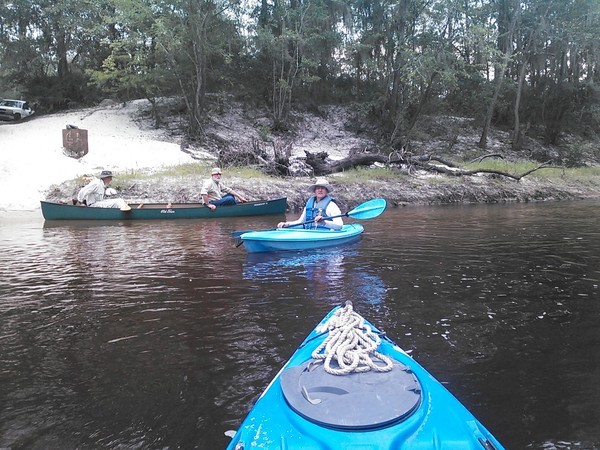
A good trip for experienced adult paddlers: deadfalls to paddle around or climb over, the famous rapids, The Rocks, plenty of sandy beaches for lunching or swimming beside, a mysterious platform that may be the remains of a very narrow bridge, all in a fine summer day on the Alapaha River, July 11, 2015.

[Collage, Lakeland to Naylor 08:30:00, 31.0458222, -83.0433889]
Collage, Lakeland to Naylor 08:30:00, 31.0458222, -83.0433889

It took us seven hours to paddle the fourteen river miles from Lakeland Boat Ramp, on GA 122 east of Lakeland, to Hotchkiss Road Landing. We were all experienced paddlers with plenty of supplies, especially water.

If you are a family with small children, please do not try this: it’s too far. There have been cases of such families calling 911 and having to be rescued.

A much more reasonable family paddle is Lakeland to Burnt Church Landing. That’s about two miles, and can be done in an hour. Or make it a leisurely paddle and still it should be doable.

FYI, Paffords Landing, just downstream from Lakeland Boat Ramp, is closed for the forseeable future. This is because too many people left trash and shot up things.

All these distances are in the WWALS web page for the Continue reading

Pictures: Alapaha River Outing, Hotchkiss Road to US 84 2014-08-24

This was a nice, short, one-mile paddle on the Alapaha River from Hotchkiss Road Landing beyond US 84, past the then-future site of Naylor Boat Ramp. All on the Alapaha River Water Trail (ARWT). Thanks to Chris Graham for leading this paddle.

[Hotchkiss Road Landing, Shoals, Naylor Beach, US 84 bridge, Alapaha River]
Hotchkiss Road Landing, Shoals, Naylor Beach, US 84 bridge, Alapaha River

Continue reading

Naylor Boat Ramp & Alapaha River Water Trail signs 2020-04-02

Update 2020-06-08: Signs printed and ready to be planted at Naylor Boat Ramp Out and Back, Alapaha River 2020-06-13.

Update 2020-04-04: Improved maps on both signs and better text on Naylor Boat Ramp sign.

The WWALS Trails Committee has drafted these two metal signs to go near the water at the new Naylor Boat Ramp that Lowndes County has built at US 84 with SPLOST VI penny sales tax funds. You can help by commenting on these designs, or by contributing to the cost of the signs.

[Naylor Boat Ramp]
Naylor Boat Ramp

What do you think should be added, deleted, or edited on the sign above, about this particular boat ramp? Yes, we know the type looks squinchy. That’s because the metal signs will be printed about twice this size.

What do you think of the sign below, about the Alapaha River Water Trail (ARWT)? Continue reading

Hotchkiss Road Landing, Old State Road, and Naylor Boat Ramp

Common question: isn’t Hotchkiss closed? Answer: the old Hotchkiss Landing in Lowndes County is closed, private, and don’t go there! Caution! But Hotchkiss Road Landing in Lanier County is open as always, do go there to get to the Alapaha River. Boat landing And there’s a new park at US 84, with a Naylor Boat Ramp being built by Lowndes County, as urged by WWALS.

600x450 Bret Wagenhorst, Dave Hetzel, Gretchen Quarterman, at Hotchkiss Road, in Alapaha River Outing, by John S. Quarterman, for WWALS.net, 24 August 2014
Bret Wagenhorst, Dave Hetzel, Gretchen Quarterman, at Hotchkiss Road (open, do go there Boat landing), in Alapaha River Outing, by John S. Quarterman, for WWALS.net, 24 August 2014.

Previously there was some discussion of using a different name for Hotchkiss Road Landing in the Alapaha River Water Trail, but then nobody would know what we were referring to, since that’s what it’s always been called, down at the end of Hotchkiss Road off of US 84.

For those relatively new to WWALS, WWALS was heavily involved in Continue reading

Sasser Landing to Jennings Bluff & Dead River Sink 2015-06-14

See three sinks, a waterfall, and a distributary in these videos from the WWALS Outing to Turket Creek Waterfall, the Alapahoochee River, the Alapaha River Sink, and the Dead River Sink, June 14, 2015. A WWALS video playlist follows the links to each video below. Continue reading

Winners, student logo contest, Withlacoochee and Little River Water Trail, by WWALS

FOR IMMEDIATE RELEASE

Valdosta, February 28, 2016 — Two VSU students took First and Second Prizes Saturday for logos for the Withlacoochee and Little River Water Trail (WLRWT), First prize: circle with trees, by Eboni Patterson at a Workshop at VSU, with an art exhibit and silent auction, and talks on history, archaeology, hydrogeology, and safety, organized by WWALS Watershed Coalition, the Waterkeeper® Affiliate for the Withlacoochee, Little, Alapaha, and upper Suwannee Rivers. “These logo winners reflect the beauty and unusual nature of our blackwater rivers,” said logo contest organizer Julie Bowland, a VSU Art Professor. She aded, “I’ve already heard talk that we may use both of these logos, one for color, and one for black and white.”

Logo Contest Winners

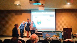
Logo winners with Julie Bowland (Gretchen Quarterman, Tom Potter, foreground) Eboni Patterson (center) won First Prize for the circle logo. Ann Reid (left) won Second Prize for the river trace logo. Both were congratulated by contest organizer Julie Bowland, who handed them checks from WWALS. The prizes were contributed by Continue reading

Alapaha River @ US 84 & CSX RR 2016-01-09

Chris Graham reported on facebook from the Alapaha River:

CSX Railroad bridge Here what the Alapaha River look like this afternoon near HWY 84 and CSX RR Track. Which it is high but it is going down tho.

The Alapaha was about 11.25 feet on the Statenville gauge at that time. Actually it kept going up. Today it’s at 13 feet.

We’ve been to that CSX railroad bridge before, Continue reading

Burnt Church in Lakeland to Hotchkiss in Stockton –Chris Graham 2015-06-20

Alapaha River Water Trail Committee Chair Chris Graham went with a few friends down the middle section of this Blueway:

Which is roughly 12 river miles. It was amazing epic river trip. Continue reading

Lanier Park to CSX RR track Hotchkiss Road, WWALS outing 2015-07-11

Update 10 July 2015: Outing leader Chris Graham says there’s plenty of water, so we’ll be putting in on the Alapaha River tomorrow morning at Lanier Park. However, he says we’ll be taking out at Hotchkiss Road (instead of CSX RR), so about 14 miles or seven hours. Bring your lunch and plenty of water. See you at 8AM. -jsq

Breeze over mild rapids past sand beaches on the Alapaha River, from Lakeland to US 84.

It’s long, but there should be no deadfalls. In most places the river may be so low you could stand up, but as always bring your personal flotation device.

When: 8AM Saturday, July 11th, 2015
What: 15 mile paddle from Lanier Park to CSX RR track on the public right way.
Duration: 7-8 hours, after a 30 minute shuttle
Directions: Highway 122 about 1.5 miles west of Lakeland, GA, turn south on unmarked dirt road just west of river to ramp.
Responsible party: Chris Graham

This event is FREE! All we ask is that you are a current member of WWALS Watershed Coalition. If not, it’s easy Continue reading

Little Alapaha River

Probably the least-known tributary of the Alapaha River, the Little Alapaha River is so shy it disappears underground between Jennings and Jasper, Florida.

The Little Alapaha River arises in Echols County, Georgia, just before it flows into Hamilton County, Florida, where it falls into a sinkhole west of Jasper, briefly reappearing before vanishing again. Theoretically it is a tributary of the Alapaha River, but it is not clear the waters of the Little Alapaha River ever reach the Alapaha River aboveground. Like the Alapaha River, the Little Alapaha’s sinkhole disappearance happens at the Cody Scarp. Chris Graham found this very interesting reference, Continue reading