Tag Archives: Hotchkiss Road Landing

Trash at Mayday Landing Hotchkiss Road Landing on the Alapaha River 2022-02-03

At Mayday Landing on Howell Road Hotchkiss Road Landing a WWALS member saw the beautiful Alapaha River in Echols Lanier County.

But she also saw trash.

ARWT Access

That’s a shame for such a conveniently located spot, a mile upstream from Naylor Boat Ramp and 12 miles downstream from Burnt Church Landing, with many beaches and small rapids in between, on the Alapaha River Water Trail (ARWT).

I will try contacting Echols Lanier County to see if they have a cleanup crew.

If not, maybe WWALS can organize a cleanup there. Continue reading

Pictures: WWALS on The Rocks between Lakeland and Hotchkiss, Alapaha River 2015-07-11

Update 2023-06-24: Work in progress at Lakeland Boat Ramp 2023-06-20.

A good trip for experienced adult paddlers: deadfalls to paddle around or climb over, the famous rapids, The Rocks, plenty of sandy beaches for lunching or swimming beside, a mysterious platform that may be the remains of a very narrow bridge, all in a fine summer day on the Alapaha River, July 11, 2015.

[Collage, Lakeland to Naylor 08:30:00, 31.0458222, -83.0433889]
Collage, Lakeland to Naylor 08:30:00, 31.0458222, -83.0433889

It took us seven hours to paddle the fourteen river miles from Lakeland Boat Ramp, on GA 122 east of Lakeland, to Hotchkiss Road Landing. We were all experienced paddlers with plenty of supplies, especially water.

If you are a family with small children, please do not try this: it’s too far. There have been cases of such families calling 911 and having to be rescued.

A much more reasonable family paddle is Lakeland to Burnt Church Landing. That’s about two miles, and can be done in an hour. Or make it a leisurely paddle and still it should be doable.

FYI, Paffords Landing, just downstream from Lakeland Boat Ramp, is closed for the forseeable future. This is because too many people left trash and shot up things.

All these distances are in the WWALS web page for the Continue reading

Pictures: Alapaha River Outing, Hotchkiss Road to US 84 2014-08-24

This was a nice, short, one-mile paddle on the Alapaha River from Hotchkiss Road Landing beyond US 84, past the then-future site of Naylor Boat Ramp. All on the Alapaha River Water Trail (ARWT). Thanks to Chris Graham for leading this paddle.

[Hotchkiss Road Landing, Shoals, Naylor Beach, US 84 bridge, Alapaha River]
Hotchkiss Road Landing, Shoals, Naylor Beach, US 84 bridge, Alapaha River

Continue reading

Naylor Boat Ramp upstream Alapaha River pictures 2020-06-13

We made it the 1.24 miles upstream from Naylor Boat Ramp to Hotchkiss Road Landing on the Alapaha River Water Trail in the Naylor Boat Ramp Out and Back paddle outing. Very nice weather, cool and overcast, and just enough water in the river.

[Banners]
Photo: Shirley Kokidko for WWALS, Banners at Hotchkiss Road Landing, Alapaha River, 2020-06-13.

First WWALS Trails Committee Chair Dan Phillips planted the new Naylor Boat Ramp ARWT signs.

[Paddlers with signs]
Paddlers with signs

Then we headed upstream. This may be a first: every paddler was already a WWALS member. Continue reading

Fundraising for Water Trail signs

Update 2019-11-08: Donate through GA Gives, including if you wish for Brochures.

Update 2019-04-26: Price of metal signs at the water at boat ramps and landings. Just the signs, Westbound

Update 2018-04-27: Pictures of Lakeland Boat Ramp signs in the ground.

Update 2018-03-15: People want to know how much the signs cost:

  • Road Signs
    • $150 one road sign
    • $300 pair of road signs for a landing or boat ramp
  • Signs at the water near a boat ramp or landing: if you donate for a specific location, your logo can go on the signs there, and on the water trail brochures and web pages

Any amount of donation helps put up the road signs that let people know the Alapaha River Water Trail (ARWT) exists and directs them to the landings, as well as the kiosks that inform people about what to expect nearby, so we get more people paddling the Alapaha River who will take care of the river.

The pair of metal signs at the water also work for the Withlacoochee and Little River Water Trail (WLRWT). Here is an example pair of metal signs at the water for Troupville Boat Ramp:

[Side by Side]
Side by Side

The Alapaha River Water Trail (ARWT) is a reality. We are ordering have bought the road signs from the Georgia Department of Transportation (GDOT) which has planted them on roads leading to landings, and we need to pay for them. We have a small amount of money from Continue reading

Hotchkiss Road Landing, Old State Road, and Naylor Boat Ramp

Common question: isn’t Hotchkiss closed? Answer: the old Hotchkiss Landing in Lowndes County is closed, private, and don’t go there! Caution! But Hotchkiss Road Landing in Lanier County is open as always, do go there to get to the Alapaha River. Boat landing And there’s a new park at US 84, with a Naylor Boat Ramp being built by Lowndes County, as urged by WWALS.

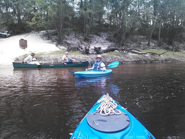
600x450 Bret Wagenhorst, Dave Hetzel, Gretchen Quarterman, at Hotchkiss Road, in Alapaha River Outing, by John S. Quarterman, for WWALS.net, 24 August 2014
Bret Wagenhorst, Dave Hetzel, Gretchen Quarterman, at Hotchkiss Road (open, do go there Boat landing), in Alapaha River Outing, by John S. Quarterman, for WWALS.net, 24 August 2014.

Previously there was some discussion of using a different name for Hotchkiss Road Landing in the Alapaha River Water Trail, but then nobody would know what we were referring to, since that’s what it’s always been called, down at the end of Hotchkiss Road off of US 84.

For those relatively new to WWALS, WWALS was heavily involved in Continue reading