
 Is this what you want Bradford, Union, and other counties in Florida to look like?
I wonder what effect this phosphate mine had on the much lowered water level of White Springs, or the Suwannee River?
Is this what you want Bradford, Union, and other counties in Florida to look like?
I wonder what effect this phosphate mine had on the much lowered water level of White Springs, or the Suwannee River?
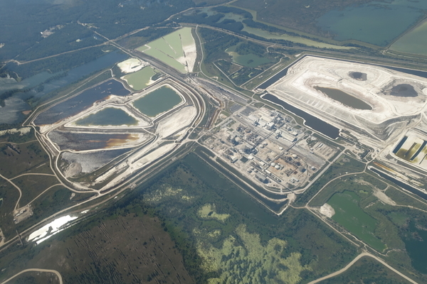
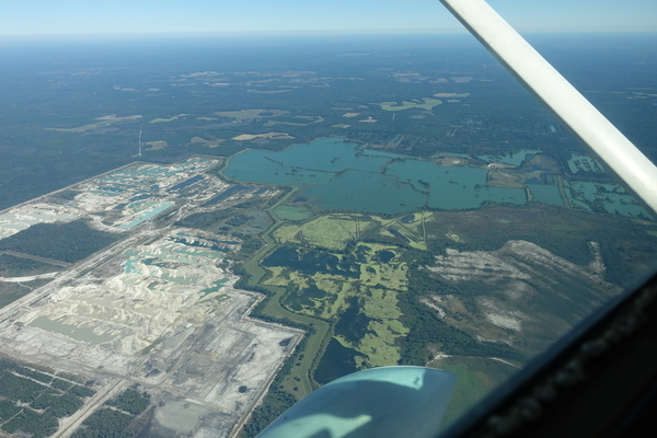
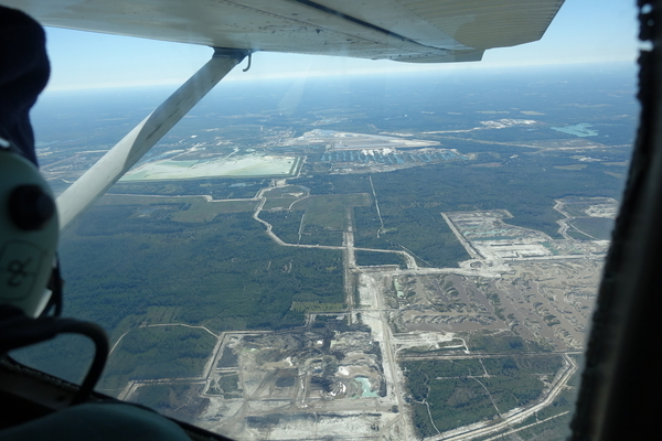
The PCS Phosphate mine in Hamilton County near White Springs and Jasper spread under our Southwings plane while surveying the Sabal Trail fracked methane pipeline 22 October 2016. On board were Southwings pilot Roy Zimmer, photographer Dominick Gheesling, Jim Tatum of Our Santa Fe River, and John S. Quarterman of WWALS. Here are pictures by Jim Tatum, a few videos by John S. Quarterman, and a Google map showing the locations.
Dave Wilson of Florida Springs Council will be presenting some of these pictures at a Santa Fe River Springs Protection Forum, Thursday, April 13, 2017, 9:30 am – 3:00 pm, at Otter Springs Campground, 6470 SW 80 th Avenue, Trenton FL, 32693. Here’s the agenda.
-jsq, John S. Quarterman, Suwannee RIVERKEEPER®
You can join this fun and work by becoming a WWALS member today!
Pictures by Jim Tatum
Jim already blogged some of these pictures for Our Santa Fe River, but he took more than he used in that post, and the rest are here.
W across PCS Phosphate Mine, 30.4429360, -82.7851800

W across PCS Phosphate Plant, 30.4414740, -82.7731960

Closeup, PCS Plant, 30.4418960, -82.7835560

Wetlands E of PCS Phosphate Plant, 30.4441750, -82.7741720
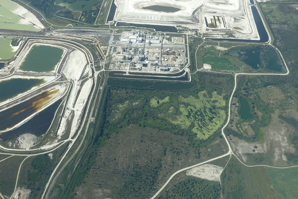
SE across PCS Phosphate Plant, 30.4480230, -82.7783780
ENE across Hogans Branch, Hunter Creek, 30.4785260, -82.7345540
NE across 18063 SE 62nd Dr, Jasper, FL 32052, Sugar Ridge Rd disappears into mine, 30.4806200, -82.7598530

Maybe SE 62 Drive, 30.4649830, -82.7948720

E across CR 6, SE 161 Ln, Jasper, FL 32052, 30.4873870, -82.7771790

SSW across 14307 CR 137, Jasper, FL 32052, 30.4753130, -82.8350010

S across 13111 CR 137 Jasper, FL 32052, Spring Branch Church, 30.4765460, -82.8742120

Bee Haven Bay, now PCS Phosphate mine, 30.5089370, -82.8682070
SE 120th Ave, Jasper, FL 32052, 30.5132880, -82.8997680

Shaky Pond, 30.5167070, -82.8977190

8215 Co Rd 6, Jasper, FL 32052, 30.5248380, -82.9171110

Closeup, unknown location

Videos by John S. Quarterman
-
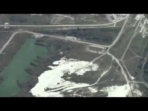
SE to PCS phosphate mine
-
Closeup, Phosphate mine

-
Closeup 2, PCS Phosphate mine

-
Closeup, PCS Phosphate plant

Here is a WWALS video playlist:
Google Map
Follow this link for the interactive google map, or it’s also embedded below.
-jsq, John S. Quarterman, Suwannee RIVERKEEPER®
You can join this fun and work by becoming a WWALS member today!
Short Link:
I don’t know- does 10,000,000 gallons a day from one plant have an effect? How about 5,000,000? How does dumping ‘treated process water’ directly into a river affect it? (which Mosaic has a permit to do.)
The real issue is whether phosphate should even be mined, to the extant it is. But we have been sold on needing fertilizer to feed the world for so long- by even Sierra Club liaisons-that we forget…permaculture. So we get too busy to even compost our own vegetative and bio waste, stacking up bags of leaves that go to the ‘single stream recycling facility’ because we can just run down to buy a bag of weed n feed.
Sierra Club calls for study on impacts of fertilizer plants, gypsum stacks
http://www.theledger.com/news/20161104/sierra-club-calls-for-study-on-impacts-of-fertilizer-plants-gypsum-stacks