Daily Archives: April 4, 2017

Ft Macomb to Ivey Memorial Park, Suwannee River, 2017-06-10

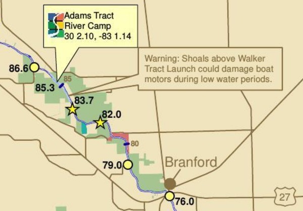
A medium length summer paddle on the Middle Suwannee River: Fort Macomb Ramp to Ivey Memorial Park June 10, 2017, past springs, shoals, and Branford. This one will probably take about 5 hours paddling, or 6 hours including shuttle. With lunch, swim stops, and bon-bons, of course.

Bring the usual personal flotation device, boat paddles, food, drinking water, warm clothes, and first aid kit.

When: 9AM Saturday 10 June 2017

Put In: Ft. Macomb Ramp, river mile 86.6
From Mayo, travel east on US 27 to CR 410; turn left on CR 410; follow to boat ramp.

GPS: 30.0097911,-83.0168023

Take Out: Ivey Memorial Park Ramp, river mile 76.0
Boat ramp is located in Branford on the south side of US 27 at the Bridge in Ivey Memorial Park.
29.9538379,-82.9303607
Event: facebook, meetup

River mile 86.6 to 76.0
This map detail and all landing directions are from Continue reading

Crop nitrogen losses into Suwannee Basin

Here is a very interesting paper about increasing nitrogen from crops into the Suwannee River Basin and its springs (promoting algae growth), with actual data on how well best management practices (BMPs) are containing the runoff: Environmental Nitrogen Losses from Commercial Crop Production Systems in the Suwannee River Basin of Florida, by Rishi Prasad, George J. Hochmuth, PLOSOne, Published: December 1, 2016, http://dx.doi.org/10.1371/journal.pone.0167558


Fig 3. Comparison of A) environmental nitrogen losses (Nenvloss) from three crops (potato, sweet corn and silage corn) during four growing seasons (2010 to2013) and B) relationship between seasonal total N rates and environmental nitrogen losses at the study farm in the Middle Suwannee River Basin, Florida. Silage corn was not studied during 2013. Mean values of Nenvloss (represented by individual bars and their standard errors for the three crops) followed by different letters indicate significant difference at α = 0.05 level

Abstract Continue reading