Tag Archives: Dominick Gheesling

PCS Phosphate Mine 2016-10-22

W across PCS Phosphate Mine, 30.4429360, -82.7851800 
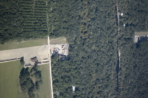
Is this what you want Bradford, Union, and other counties in Florida to look like? I wonder what effect this phosphate mine had on the much lowered water level of White Springs, or the Suwannee River?

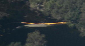
The PCS Phosphate mine in Hamilton County near White Springs and Jasper spread under our Southwings plane while surveying the Sabal Trail fracked methane pipeline 22 October 2016. On board were Southwings pilot Roy Zimmer, photographer Dominick Gheesling, Jim Tatum of Our Santa Fe River, and John S. Quarterman of WWALS. Here are pictures by Jim Tatum, a few videos by John S. Quarterman, and a Google map showing the locations. Continue reading

US 129 HDD Santa Fe River Sabal Trail 2016-10-22

South to North HDD, 29.9122530, -82.8515280 Sabal Trail plans to start drilling here in the next few days. I count three houses within the blast radius just in this picture at the Santa Fe River just east of US 129 in Suwannee and Gilchrist Counties, Florida. See also Jim Tatum’s pictures of this Santa Fe River Sabal Trail HDD location from this flight. Continue reading

From the air: US 84 HDD Withlacoochee River Sabal Trail 2016-10-22

Update 2016-10-24: Questions filed with FERC in Docket CP15-17 as Accession Number 20161024-5049 and emailed to USACE and GA-EPD (PDF).

Extreme closeup yellow in Withlacoochee River, 30.7952780, -83.4524840 What is that yellow thing in the river, Sabal Trail? Is that a sinkhole you’ve marked at the Lowndes County HDD site? And does blue pipe mean thinner for rural areas like your executive from Houston told us in WWALS v Sabal Trail & FDEP?

FERC gave you permission to Continue reading

Waydown with Dominick Gheesling: Fargo to the Gulf, Suwannee River, 2013

Many of us may have thought of this, but VSU art professor Dominick Gheesling actually did it: way down the Suwannee River from Fargo below the swamp all the way to the Gulf of Mexico.

Waydown: Summer 2013

All of the preparation that could be done was done. My ever-patient wife had given me permission to fall off the grid for a while. My friend Todd Bertolaet helped me load up all of the gear and took me to Fargo, Georgia where I launched on a twenty-nine day expedition, traveling the length of the Suwannee River, via canoe, to the terminus at the Gulf of Mexico. Photographing the length of this historic, iconic, southern river connected me to life and the earth in a manner that I had been missing for a long time.

I am more convinced than ever that Continue reading