
Sabal Trail has hidden the “depressions” they admitted to recently.

Updated 2017-05-23: Clarify what the google map is about.
See the Google map for the locations of these pictures.
See also Sabal Trail sign installation at SRSP, 2017-05-19, Sabal Trail signs at Suwannee River, 2017-05-20, and see elected officials a year ago hike past the sinkholes in Suwannee River State Park that Sabal Trail drills under.
-jsq, John S. Quarterman, Suwannee RIVERKEEPER®
You can join this fun and work by becoming a WWALS member today!

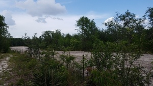
Wet spot right at the road 30.3998796, -83.1528225

No rain in weeks: why is this wet? 30.3996667, -83.1527157

Another wet spot 30.3996667, -83.1527157

And another wet spot 30.3996667, -83.1527157

Pipeline marker 30.4060048, -83.1527613

Down to the sinkhole they admitted 30.3639987, -83.1251918

l. Suwannee River State Park, r. Sabal Trail 30.3639987, -83.1251918

Sinkhole evidence buried near palmettos 30.4029284, -83.1528261

SRSP path 30.4034829, -83.1528378
To the corner 30.4034829, -83.1528378
Across 30.4034829, -83.1528378

To the entrance 30.4034829, -83.1528378

Another pipeline marker 30.4044921, -83.1528038

Yet another wet spot 30.4053009, -83.1527789

Tracks 30.4053009, -83.1527789

Tracks across dam 30.4059580, -83.1527842
Tracks at corner 30.4059579, -83.1527133

Landowners gate removed 30.4059579, -83.1527133

Guard tower and no berm 30.4059579, -83.1527133

No berm 30.4059717, -83.1527300

Random trash? 30.4060048, -83.1527613

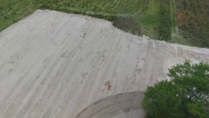
Sinkhole buried 30.4060048, -83.1527613

Towards the river 30.4060048, -83.1527613

In SRSP 30.4060048, -83.1527613

Back towards the pipeline 30.4060048, -83.1527613

Tiny gopher hole in SRSP 30.4149711, -83.1582350

Pipeline sign across Suwannee River (through the center tree), 30.4076500, -83.1563000

Party at the river bend, 30.4084550, -83.1558820

Sabal Trail seen from the riverside 30.4062724, -83.1566252

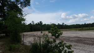
Evidence all buried at HDD site, 30.4072790, -83.1542080

Sinkhole site and guard tower, 30.4063570, -83.1528050

NE corner, 30.4070670, -83.1514720
Inside corner, 30.4067330, -83.1524380

Cant plant trees on the pipeline easement, 30.4061420, -83.1525560

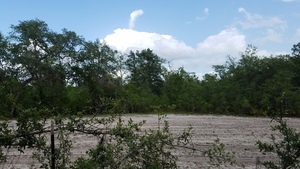
Still looks pretty wet, 30.4049290, -83.1525020

More wet spots towards the entrance, 30.4032450, -83.1523950

Longleaf in fence; tracks over dam 30.4048880, -83.1528402
Google Map
Follow this link for the interactive google map, or it’s also embedded below.
Short Link: