
This was a tiny outing for a couple of visitors from Oregon through what has since become a new Wildlife Management Area on the Alapaha River, between Hotchkiss Road (which had some magnificent potholes) in Lanier County to the site of the pending new park and boat ramp off of US 84 in Lowndes County, Georgia, all on the Alapaha River Water Trail.

The visitors were my cousin Philip Quarterman, originally from England, who along with his girlfriend Geri Ann Berg lives in Oregon. They asked for a brief river paddle with no alligators.
The Statenville gage showed 2.9 feet or 79 feet NAVD, which is above our recommendation of low at 2 feet and dragging at 1.5 feet.
Here are some pictures by Gretchen Quarterman, some by John S. Quarterman, and more by Gretchen, followed by a Google map.

-jsq, John S. Quarterman, Suwannee RIVERKEEPER®
You can join this fun and work by becoming a WWALS member today!
Pictures by Gretchen Quarterman

Floating backwards past closed Old State Road, 30.9365360, -83.0406050

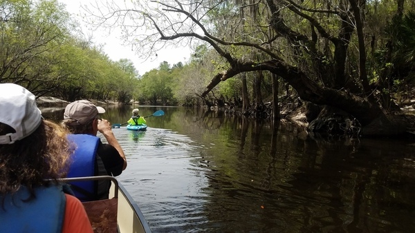
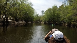
Philip, Geri, and jsq in the Suwannee Riverkeeper vessel, 30.9365010, -83.0395940

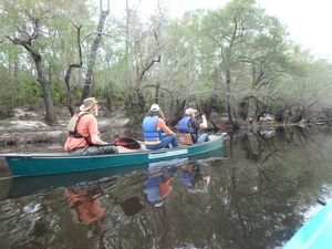
All paddling

Shiny circles

By the right bank
Front paddle drive 30.9335933, -83.0360117

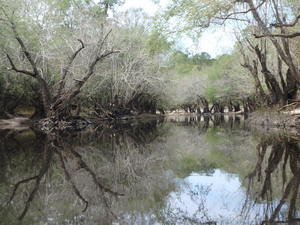
Reflections landscape 30.9327867, -83.0353600

Reflections portrait 30.9326317, -83.0353917
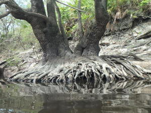
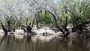
Tree roots 30.9325800, -83.0353750
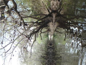
Leaning trees 30.9325800, -83.0353750

Suwannee Riverkeeper banner on the Alapaha River 30.9295817, -83.0360183

Suwannee Riverkeeper on the Alapaha River 30.9296033, -83.0360400
Bend to the left 30.9295883, -83.0360717

jsq, Geri, Philip 30.9295883, -83.0360717

Treescape 30.9290500, -83.0383817
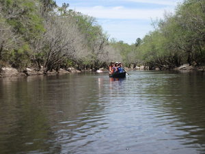
Here they come 30.9277900, -83.0403133

Sharp tree trunk 30.9266517, -83.0399467

Sand cliff 30.9260383, -83.0394517

Philip, Geri, jsq 30.9260633, -83.0394667

The beach and the US 84 bridge 30.9257700, -83.0389600

Geri, Philip, jsq, WWALS banner 30.9253350, -83.0384250

Philip, jsq, WWALS banner 30.9253517, -83.0384100

Philip, Geri, Gretchen, jsq, WWALS banner 30.9253133, -83.0384000
Pictures by John S. Quarterman

Cousins: jsq, Philip, Geri, Gretchen 31.0125000, -83.2694444
Gretchen leading the way 30.9365161, -83.0390604

Beach and trees 30.9365161, -83.0390604

Movie: Used to be ocean bottom (9.2M)

Paddling 30.9356840, -83.0382112

Island 30.9354967, -83.0381112


Spreading tree 30.9350284, -83.0378599

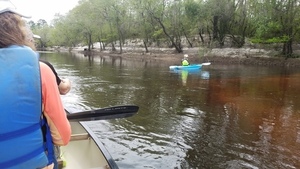
Red tannic water 30.9339418, -83.0374292

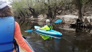
Gretchen leading from behind 30.9333333, -83.0369444

Trees closing in 30.9334366, -83.0369658

Bend to the right 30.9329388, -83.0364762

Look to the left 30.9329388, -83.0364762

Roots 30.9319687, -83.0360189

More roots 30.9319687, -83.0360189
Gretchen and the roots 30.9307588, -83.0361713

Yellow tannic water 30.9293686, -83.0376816

Gretchen looking for Hawthorne formation 30.9293686, -83.0376816

Look at them cypress knees! 30.9295340, -83.0385521

Bend to the left 30.9295340, -83.0385521

Look around the left bend 30.9295340, -83.0385521

Straight stretch 30.9295340, -83.0385521
Stream? 30.9290557, -83.0396257
Floating downstream 30.9280519, -83.0401350

Beach bend left 30.9276175, -83.0403301

Right bank 30.9262797, -83.0396969

Right bend 30.9262797, -83.0396969

Final beach and US 84 bridge 30.9258578, -83.0393638

Alapaha River from US 84 bridge
More pictures by Gretchen Quarterman

jsq, Philip

jsq, Philip, closeup

Alapaha River upstream

Alapaha River downstream

Quarterman Family of Liberty County, Georgia, and Relatives

Green book closeup
Google Map
Follow this link for the interactive google map, or it’s also embedded below.
Short Link:
Pingback: WMA in Lanier and Lowndes Counties | WWALS Watershed Coalition (Suwannee RIVERKEEPER®)