
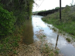
Sunday there was parking under the bridge, now that’s under water.
 The intended put-in for
this Sunday’s Withlacoochee Outing,
is just downstream from here, so we’re rescheduling that one for
Ray’s Millpond,
875 Rays Mill Pond Rd., Ray City, GA 31645,
still 9AM March 20th 2016.
Directions: From Valdosta, north on Bemiss Road (GA 125) to Ray City, right on Jones St. to boat ramp.
The intended put-in for
this Sunday’s Withlacoochee Outing,
is just downstream from here, so we’re rescheduling that one for
Ray’s Millpond,
875 Rays Mill Pond Rd., Ray City, GA 31645,
still 9AM March 20th 2016.
Directions: From Valdosta, north on Bemiss Road (GA 125) to Ray City, right on Jones St. to boat ramp.
It’s 14.75 feet, just below 15 foot flood at the the US 41 gage. This level could be fun boating if you’re an expert and like fast paddling, but not so much if you’re new at kayaking. Plus rain is predicted, so the river will probably be even higher Sunday. Nice flat Ray’s Mill Pond it is for us this weekend.
-jsq
You can join this fun and work by becoming a WWALS member today!
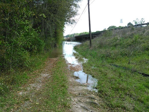
River seen from wastewater station
Wet
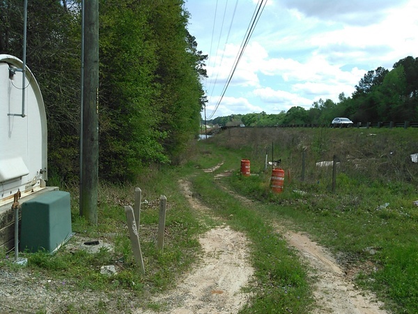
What parking?

Short Link:
Pingback: Withlacoochee River: Langdale Park to Little River Boat Ramp 2016-04-03 | WWALS Watershed Coalition