Sinkholes, springs, and caves abound where Spectra Energy wants to gouge
its yard-wide Sabal Trail pipeline
 through the heart of the Florida Springs Heartland, wrote a Practicing Geologist WWALS member to FERC, following up on his
testimony in WWALS v Sabal Trail & FDEP.
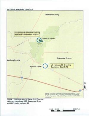
Here is the text of the report by Dennis Price, followed by the images (PDF in FERC accession number 20151027-5034), all about the same area where WWALS board member Chris Mericle recently guided Hamilton and Suwannee County Commissioners to see for themselves. -jsq
Continue reading
