Sinkholes, springs, and caves abound where Spectra Energy wants to gouge
its yard-wide Sabal Trail pipeline
 through the heart of the Florida Springs Heartland, wrote a Practicing Geologist WWALS member to FERC, following up on his
testimony in WWALS v Sabal Trail & FDEP.
Here is the text of the report by Dennis Price, followed by the images (PDF in FERC accession number 20151027-5034), all about the same area where WWALS board member Chris Mericle recently guided Hamilton and Suwannee County Commissioners to see for themselves. -jsq
You can join this fun and work by becoming a WWALS member today!
SE Environmental Geology
Dennis J. Price, P.G.
P.O. Box 45
White Springs, FL 32096
386-884-0039, MOB 362-8189, denl@windstrream.net10/25/2015
Norman C Bay, Chaiman
Tony Clark, Commissioner
Cheryl A. LaFleur, Commissioner
Phillip D. Moeller, Commissioner
Colette D. Honorable, Commissioner
Federal Energy Regulatory Commission
888 First St. NE.
Washington, DC. 20426RE: SABAL TRAIL TRANSMISSION, LLC FERC DOCUMENT No. CP15-17-000
Dear Commissioners:
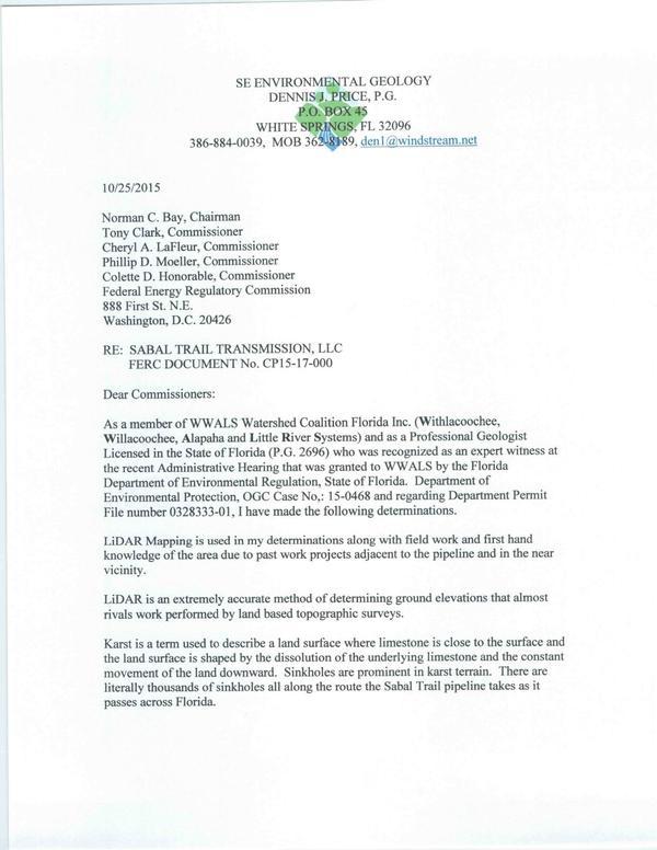
As a member of WWALS Watershed Coalition Florida Inc. (Withlacoochee, Willacoochee, Alapaha and Little [and upper Suwannee] River Systems) and as a Professional Geologist Licensed in the State of Florida (P.G. 2696) who was recognized as an expert witness at the recent Administrative Hearing that was granted to WWALS by the Florida Department of Environmental Regulation, State of Florida. Department of Environmental Protection, OGC Case No,: 15-0468 and regarding Department Permit File number 0328333-01, I have made the following determinations.
LiDAR Mapping is used in my determinations along with field work and first hand knowledge of the area due to past work projects adjacent to the pipeline and in the near vicinity.
LiDAR is an extremely accurate method of determining ground elevations that almost rivals work performed by land based topographic surveys.
Karst is a term used to describe a land surface where limestone is close to the surface and the land surface is shaped by the dissolution of the underlying limestone and the constant movement of the land downward. Sinkholes are prominent in karst terrain. There are literally thousands of sinkholes all along the route the Sabal Trail pipeline takes as it passes across Florida.
LOCATION OF PIPELINE ROUTE AS IT CROSSES THE SUWANNEE RIVER
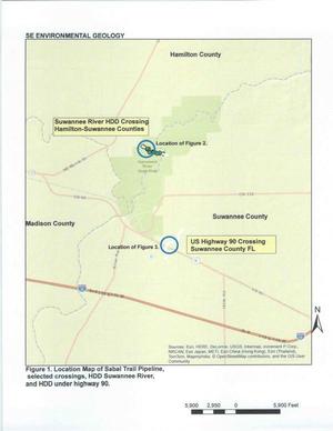
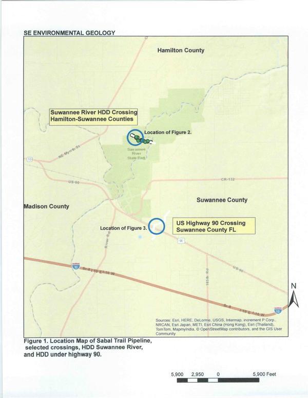
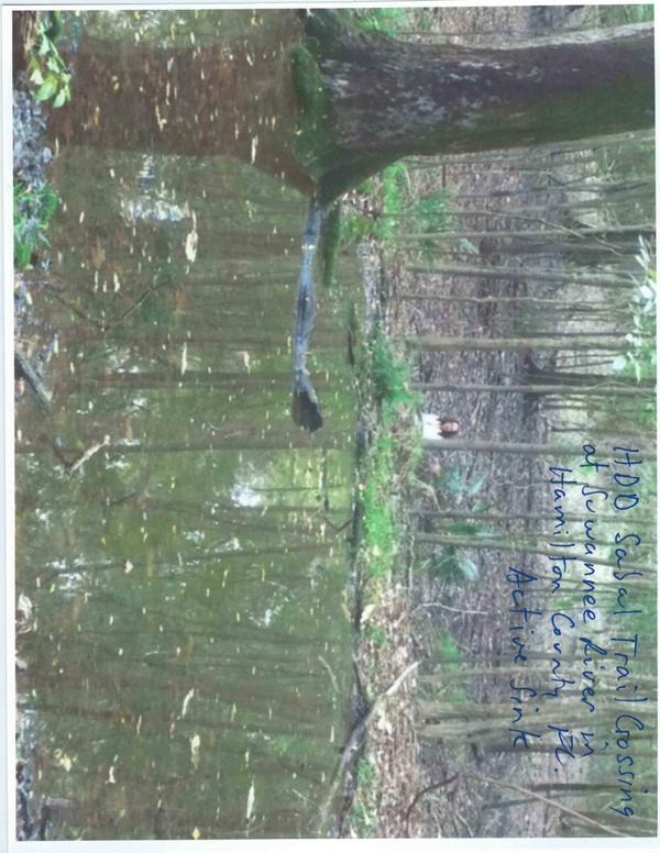
Attached are Figure 1 and Figure 2 and two Photographs. Figure 1 is the Location Map showing the route of the pipeline as it crosses the Suwannee River through the Suwannee River State Park (SRSP) property in Hamilton County. This area is in the Floodplain of the Suwannee River. It also shows the location of the route as it begins its crossing of US Highway 90.
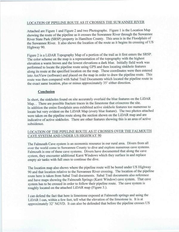
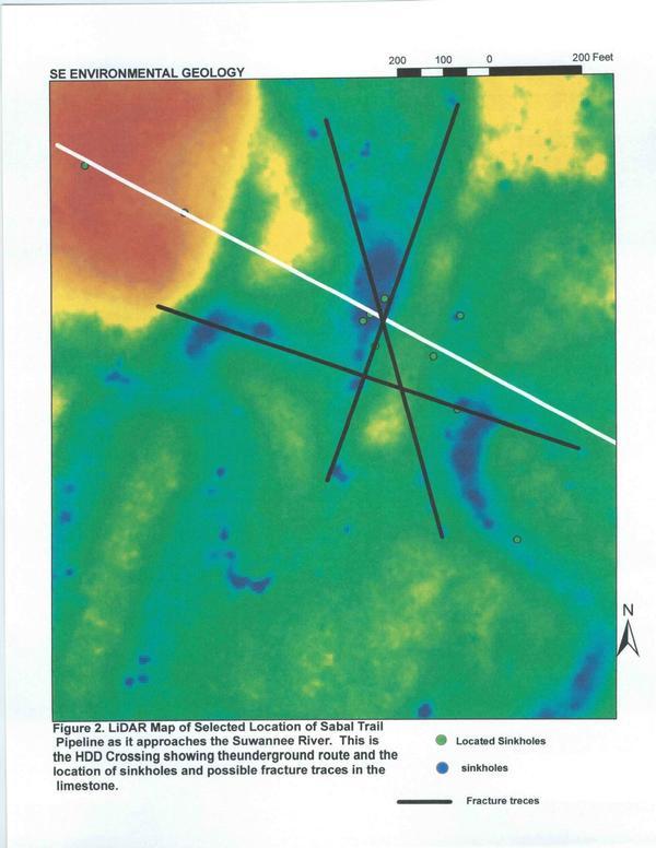
Figure 2 is a LiDAR Topogaphy Map of a portion of the trail as it first enters the SRSP. The color scheme on the map is a representation of the topography with the highest elevation a warm brown and the lowest elevations a dark blue. Initially field work was performed to locate the pipeline route using GPS and then locating sinkhole features along its route at the specified location on the map. These coordinates were then entered into ArcView (sofiware) and placed on the map in order to draw the pipeline route. This route was then compared with Sabal Trail Documents which located the pipeline route in the exact same location, plus or minus approximately 35′ either direction.
Conclusion
In short, the sinkholes found on site accurately overlaid the blue features on the LiDAR Map. There are possible fracture traces in the limestone that crisscross the site.
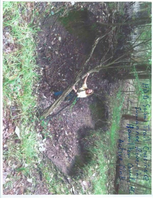
In addition the entire floodplain area exhibited active sinkhole features too numerous to locate but very evident on the LiDAR Map (every blue feature). The two photos attached were taken on the pipeline route along the section shown on the LiDAR map and are indicative of active sinkholes. There are other features showing this is an area of active subsidence
LOCATION OF THE PIPELINE ROUTE AS IT CROSSES OVER THE FALMOUTH CAVE SYSTEM AND UNDER US HIGHWAY 90
The Falmouth Cave system is an economic resource in our rural area Divers from all over the world come to Suwannee County to dive and explore numerous cave systems. Falmouth is one of these cave systems. Divers have documented that along the cave system, they encounter additional Karst Windows which they surface in and replace empty air tanks with full ones to continue the diver
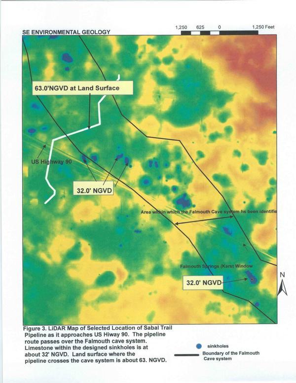
The location map also shows where the pipeline route will be bored under US Highway 90 and that location relative to the Suwannee River crossing. The location of the pipeline route here is taken from Sabal Trail documents. Sabal Trail documents also reference and have maps showing the Falmouth Springs (Karst Window) cave system. That cave system has to be crossed in order to follow their pipeline route. The cave system is roughly located on the attached LiDAR map (Figure 3.).
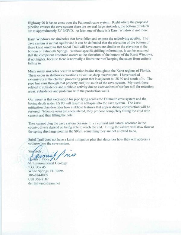
I can defend the fact that here is limestone exposed at Falmouth springs and using the LIDAR I can, within a few feet, tell what the elevation of the limestone is. It is at approximately 32′ NGVD. It can also be defended that before the pipeline crosses US Highway 90 it has to cross over the Falmouth cave system. Right where the proposed pipeline crosses the cave system there are several large sinkholes, the bottom of which are at approximer 32′ NGVD. At least one of these is a Karst Window if not more.
Karst Windows are sinkholes that have fallen and expose the underlying aquifer. The cave system is in that aquifer and it can be defended that the elevation of the bottom of these bars! windows that Saba] Trail will have cross are similar to the elevation at the bottom of Falmouth Springs. Without specific drilling information, it can be assumed that the competent limestone occurs at the elevation of the bottom of the Karst Windows. if not higher, because there is normally a limestone roof keeping the eaves from entirely falling in.
Many many sinkholes occur in retention basins throughout the Karst regions of Florida. These occur in shallow excavations as well as deep excavations. l have worked extensively at the chicken processing plant that is adjacent to US 90 and south of it. The pipe line runs through that property and just south of the cave system. My work there related to subsidence and sinkhole activity due to excavations of surface soil for retention areas. subsidence and problems with the production wells.
Our worry is that excavation for pipe lying across the Falmouth cave system and the boring depth under US 90 will result in collapse into the cave system. The karst mitigation plan describes how sinkhole features that appear during construction will be restored. When caverns are encountered, they propose completely filling the void with cement and then filling the hole.
They cannot plug the cave system because it is a cultural and natural resource in the county. divers depend on being able to reach the end. Filling the cavern will slow flow at the spring discharge point in the SRSP. something they are not allowed to do
Sabal Trail does not have a karst mitigation plan that describes how they will address a collapse into the cave system.
Sincerely,
[signed]
Dennis J. Price, P.G.
SE Environmental Geology
P.O. Box 45
White Springs, FL 32096
386-884-0039
Cell 362-8189
den1@windstream.net
LiDAR, karst, and sinkholes
Location of pipelne route across the Suwannee River
Falmouth cave system
Figure 1. Location Map of Sabal Trail Pipeline
Figure 2. LiDAR Map of Selected Location of Sabal Trail (Suwannee River)
Figure 3. LiDAR Map of Selected Location of Sabal Trail (US 90)
Figure 4: Active sink 1, Sabal Trail HDD, Suwannee River, Hamilton Co.
Figure 5: Active sink 2, Sabal Trail HDD, Suwannee River, Hamilton Co.
Short Link:

Pingback: Sabal Trail wants to proceed | SpectraBusters