
The Suwannee River flows most in May, and most of that comes almost equally from
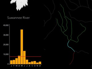 the Withlacoochee (with Little River and Okapilco Creek), the Alapaha, and the Suwannee from the Okefenokee Swamp to the Alapaha confluence.
This is an interestingly different seasonal pattern from other rivers of similar flow, such as the Altamaha, Savannah, St Johns, Flint, and Chattachoochee.
the Withlacoochee (with Little River and Okapilco Creek), the Alapaha, and the Suwannee from the Okefenokee Swamp to the Alapaha confluence.
This is an interestingly different seasonal pattern from other rivers of similar flow, such as the Altamaha, Savannah, St Johns, Flint, and Chattachoochee.
These are screenshots from the interactive ESRI Hydro Hierarchy, http://maps.esri.com/rc/radial/, whose Help message says:
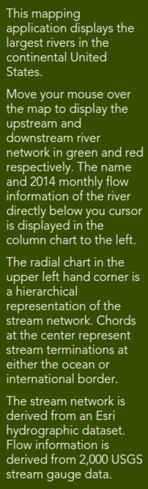
This mapping application displays the largest rivers in the continental United States.
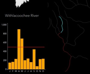
Move your mouse over the map to display the upstream and downstream river network in green and red respectively. The name and 2014 monthly flow information of the river directly below you cursor is displayed in the column chart to the left.
The radial chart in the upper left hand corner is a hierarchical representation of the stream network. Chords at the center represent stream terminations at either the ocean or international border.
The stream network is derived from an Esri hydrographic dataset. Flow information is derived from 2,000 USGS stream gauge data.
-jsq
You can join this fun and work by becoming a WWALS member today!
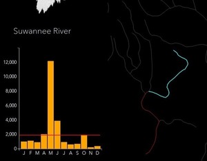
Swamp Suwannee River (above Alapaha confluence)
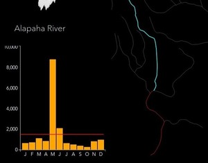
Alapaha River
Upper Withlacoochee River (above Little River confluence)

Okapilco Creek

Little River
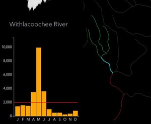
Withlacoochee River (with Little River and Okapilco Creek)
Upper Suwannee River (to Santa Fe River confluence)
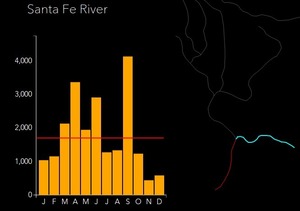
Santa Fe River
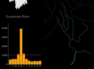
Suwannee River
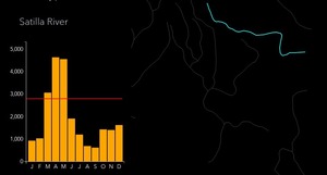
Satilla River

Altamaha River

Ogeechee River

Savannah River
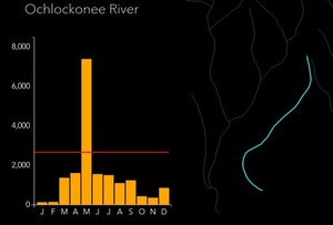
Ochlockonee River

Flint River
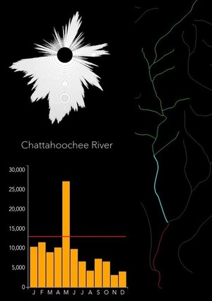
Chattahoochee River

Apalachicola River

St Johns River (misnamed Trout Creek)

Ocklawaha River

Myakka River

Kissimmee River
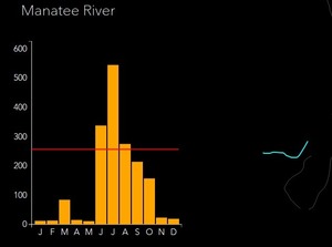
Manatee River

Peace River
Help: Stream flow
Short Link: