
Please go directly to the current WRWT Points.
All points on the WRWT Map 2015-05-04.
Updated 2015-06-21: added two outfitters, Suwannee Canoe Outpost and American Canoe Adventures and updated Moody FSS to say military or veteran only.
See also Categories and Access points.
Descriptions
 Access,
 Landing,
 Canoe Rental,
 Camping,
 Food,
Food,
 Water,
 Restrooms,
 Parking,
 Shelter,
 Picnic Area,
 Handicapped Accessible,
 Historic Attraction
Upper Ty Ty Road Bridge 
CATEGORIES: Bridge
LAYER: Bridge
ADDRESS: MILE 82.5, Little River at Upper Ty Ty Road, off of Whiddon Mill Road NW of Tifton, Tift County
Upper Ty Ty Road Gauge 
CATEGORIES: River Gauge
LAYER: River Gauge
WATER BODY: Little River
ADDRESS: MILE 82.5, Little River at Upper Ty Ty Road, near Tifton, Tift County
WEBSITE: http://ga.water.usgs.gov/flood/floodtracking/watersheds/little-south/02317797.html
DESCRIPTION: USGS 02317797
PHOTO: http://waterwatch.usgs.gov/wwapps/ww_chart.php?i=nwis&vt=uv&site_no=02317797&p_cd=00065
PHOTOSET: /2014/05/06/flooding-charts-2/
PHOTO SOURCE: WWALS
OWNERSHIP: Public
Kinard Bridge Road
CATEGORIES: Access
LAYER: Brochure
GPS: 31.2543, -83.507861
ACCESS: Yes
WATER BODY: Little River
ADDRESS: MILE 57.5, I-75 exit 49, west on Central Avenue becomes Kinard Bridge Road, 3 miles to bridge. Cook County
WEBSITE: http://www.brownsguides.com/blog/little-river-of-southern-georgia-paddling-guide/
PHOTO SOURCE: Marcus Roberts
OWNERSHIP: Public
DOWNSTREAM: 5.50 miles from Kinard Bridge Road to Red Roberts Landing
Kinard Bridge
CATEGORIES: Bridge
LAYER: Bridge
WATER BODY: Little River
ADDRESS: MILE 57.5, I-75 exit 49, west on Central Avenue becomes Kinard Bridge Road, 3 miles to bridge. Cook, Colquitt County
WEBSITE: http://www.brownsguides.com/blog/little-river-of-southern-georgia-paddling-guide/
PHOTOSET: http://mcrobertsmd.smugmug.com/photos/random.mg?AlbumID=381183&AlbumKey=MTWfCg&Size=Thumb&rand=6281
PHOTO SOURCE: Marcus Roberts
OWNERSHIP: Public
Kinard Bridge Gauge
CATEGORIES: River Gauge
LAYER: River Gauge
ADDRESS: MILE 57.5, I-75 exit 49, west on Central Avenue becomes Kinard Bridge Road, 3 miles to bridge.
WEBSITE: http://waterdata.usgs.gov/nwis/inventory/?site_no=02317830
DESCRIPTION: USGS 02317830, historical data only
Red Roberts Landing

CATEGORIES: Access
LAYER: Brochure
ACCESS: Yes, PARKING: Free, PICNIC AREA
WATER BODY: Little River
ADDRESS: MILE 52, At Rountree Bridge on Rountree Bridge Road (CR 251) west of Adel; exit 41 off I-75, Cook County
WEBSITE: /events-2/?ee=9
PHOTOSET: /2014/03/30/pictures-gretchen-quarterman-big-little-river-paddle-event-2014-03-29/
PHOTO SOURCE: Gretchen Quarterman
OWNERSHIP: Public
UPSTREAM: 5.50 miles from Red Roberts Landing to Kinard Bridge Road
DOWNSTREAM: 3.00 miles from Red Roberts Landing to Reed Bingham SP (West)
Rountree Bridge

CATEGORIES: Bridge
LAYER: Bridge
WATER BODY: Little River
ADDRESS: MILE 52, I-75 exit 41, west on Rountree Bridge Road to the Little River, Cook, Colquitt County
WEBSITE: /events-2/?ee=9
PHOTOSET: /2014/03/30/pictures-gretchen-quarterman-big-little-river-paddle-event-2014-03-29/
PHOTO SOURCE: Gretchen Quarterman
OWNERSHIP: Public
Reed Bingham State Park 

CATEGORIES: Public Land
LAYER: Other
ACCESS: Yes, Ramp: Concrete, CANOE, CAMPING: Tent Campsites, FOOD: Snack Machine, WATER, RESTROOMS, PARKING: $, SHELTER, PICNIC AREA, HANDICAPPED ACCESSIBLE
WATER BODY: Little River
ADDRESS: MILE 49, 542 Reed Bingham Rd, Adel, GA 31620, Cook, Colquitt County
WEBSITE: http://gastateparks.org/ReedBingham
DESCRIPTION: Between Adel and Moultrie
PHOTO: http://gastateparks.org/content/georgia/parks/parkphotos/reedbingham.jpg
PHOTOSET: http://gastateparks.org/ReedBingham
PHOTO SOURCE: Reed Bingham SP
OWNERSHIP: Public
Reed Bingham SP (West)
CATEGORIES: Landing
LAYER: Brochure
GPS: 31.16703, -83.54647
ACCESS: Yes, PARKING: $, SHELTER, PICNIC AREA, HANDICAPPED ACCESSIBLE
WATER BODY: Little River
ADDRESS: MILE 49, GA 37 to CR 99 to CR 221, Colquitt County
WEBSITE: http://www.georgiawildlife.com/sites/default/files/uploads/wildlife/maps/ramps/boatramp_locator.html
OWNERSHIP: Public
UPSTREAM: 3.00 miles from Reed Bingham SP (West) to Red Roberts Landing
DOWNSTREAM: 0.50 mile from Reed Bingham SP (West) to Reed Bingham SP (East)
Reed Bingham SP (East)
CATEGORIES: Landing
LAYER: Brochure
GPS: 31.16253, -83.54123
ACCESS: Yes, PARKING: $, SHELTER, PICNIC AREA, HANDICAPPED ACCESSIBLE
WATER BODY: Little River
ADDRESS: MILE 48.5, GA 37 to CR 99 to CR 221, Cook County
WEBSITE: http://www.georgiawildlife.com/sites/default/files/uploads/wildlife/maps/ramps/boatramp_locator.html
DESCRIPTION: On Reed Bingham State Park Lake
OWNERSHIP: Public
UPSTREAM: 0.50 mile from Reed Bingham SP (East) to Reed Bingham SP (West)
DOWNSTREAM: 9.50 miles from Reed Bingham SP (East) to Antioch Road
Adel Gauge
CATEGORIES: River Gauge
LAYER: River Gauge
WATER BODY: Little River
ADDRESS: MILE 48, GA 37 between Adel and Moultrie, Cook County
WEBSITE: http://ga.water.usgs.gov/flood/floodtracking/watersheds/little-south/02318000.html
DESCRIPTION: USGS 02318000, Just south of Reed Bingham State Park
PHOTO: http://waterwatch.usgs.gov/wwapps/ww_chart.php?i=nwis&vt=uv&site_no=02318000&p_cd=00065
PHOTOSET: /2014/05/06/flooding-charts-2/
PHOTO SOURCE: WWALS
OWNERSHIP: Public
GA 37 Little River
CATEGORIES: Access
LAYER: Brochure
ACCESS: , PARKING: Free
WATER BODY: Little River
ADDRESS: MILE 48, West side of Little River, south of GA 37, west of Adel towards Moultrie, Colquitt County
OWNERSHIP: Public
GA 37 Little River Bridge
CATEGORIES: Bridge
LAYER: Bridge
WATER BODY: Little River
ADDRESS: MILE 48, West of Adel towards Moultrie across the Little River, Colquitt, Cook County
OWNERSHIP: Public
Antioch Road
CATEGORIES: Access
LAYER: Brochure
ACCESS: Yes, PARKING: Free
WATER BODY: Little River
ADDRESS: MILE 39, Southwest of Adel, NW side of Antioch Road, NE side of river, Cook County
OWNERSHIP: Public
UPSTREAM: 9.50 miles from Antioch Road to Reed Bingham SP (East)
DOWNSTREAM: 8.60 miles from Antioch Road to Cook County Landing
Antioch Road Bridge
CATEGORIES: Bridge
LAYER: Bridge
WATER BODY: Little River
ADDRESS: MILE 39, Southwest of Adel across the Little River, Cook, Brooks County
OWNERSHIP: Public
Cook County Landing

CATEGORIES: Landing
LAYER: Brochure
ACCESS: Yes, PARKING: Free
WATER BODY: Little River
ADDRESS: MILE 30.4, Between Adel and Barney, east side of GA 37, north side of Little River, Cook County
WEBSITE: http://www.georgiawildlife.com/sites/default/files/uploads/wildlife/maps/ramps/boatramp_locator.html
PHOTO: http://www.georgiawildlife.com/sites/default/files/uploads/wildlife/maps/ramps/images/6127.jpg
PHOTOSET: http://www.georgiawildlife.com/sites/default/files/uploads/wildlife/maps/ramps/boatramp_locator.html
PHOTO SOURCE: GA DNR
OWNERSHIP: Public
UPSTREAM: 8.60 miles from Cook County Landing to Antioch Road
DOWNSTREAM: 5.90 miles from Cook County Landing to GA 122 Little River
GA 76 Little River Bridge
CATEGORIES: Bridge
LAYER: Bridge
WATER BODY: Little River
ADDRESS: MILE 30.4, Between Adel and Barney across the Little River, Brooks, Cook County
DESCRIPTION: State highway bridge
OWNERSHIP: Public
GA 76 Little River Berrien
CATEGORIES: Access
LAYER: Access
ACCESS: Yes, PARKING: Free
WATER BODY: Little River
ADDRESS: MILE 30.4, Between Barney and Adel, east side of GA 76, south side of Little River, Brooks County
OWNERSHIP: Public
Mary Turner Lynching Site 

CATEGORIES: Point Of Interest
LAYER: Point of Interest
ACCESS: , Memorial of May 1918 lynchings. HISTORIC ATTRACTION
WATER BODY: Little River
ADDRESS: On Wells Road just north of GA 122 near Little River west of Hahira, Lowndes County
WEBSITE: http://www.maryturner.org/
DESCRIPTION: Memorial to historical events of May 1918.
PHOTO: http://www.maryturner.org/images/unveil2.jpg
PHOTOSET: http://www.maryturner.org/
PHOTO SOURCE: Mary Turner Project
OWNERSHIP: Public
Little River GA 122 Gauge
CATEGORIES: River Gauge
LAYER: River Gauge
WATER BODY: Little River
ADDRESS: MILE 24.5, On GA 122 between Hahira and Barney, Lowndes County
WEBSITE: http://ga.water.usgs.gov/flood/floodtracking/watersheds/little-south/02318380.html
DESCRIPTION: USGS 02318380
PHOTO: http://waterwatch.usgs.gov/wwapps/ww_chart.php?i=nwis&vt=uv&site_no=02318380&p_cd=00065
PHOTOSET: /2014/05/06/flooding-charts-2/
PHOTO SOURCE: WWALS
OWNERSHIP: Public
GA 122 Little River
CATEGORIES: Access
LAYER: Brochure
ACCESS: Yes, PARKING: Free, HISTORIC ATTRACTION
WATER BODY: Little River
ADDRESS: MILE 24.5, Between Hahira and Barney, south side of GA 122, east side of river, Lowndes County
DESCRIPTION: Sand bank next to state highway bridge
OWNERSHIP: Public
UPSTREAM: 5.90 miles from GA 122 Little River to Cook County Landing
DOWNSTREAM: 4.25 miles from GA 122 Little River to Lawson Mill Pond Road
GA 122 Little River Bridge
CATEGORIES: Bridge
LAYER: Bridge
WATER BODY: Little River
ADDRESS: MILE 24.5, Between Hahira and Barney over the Little River, Brooks, Lowndes County
DESCRIPTION: State highway bridge
OWNERSHIP: Public
Lawson Mill Pond Road
CATEGORIES: Access
LAYER: Brochure
ACCESS: Yes, PARKING: Free
WATER BODY: Little River
ADDRESS: MILE 20.25, Between Morven and Hahira, south side of Lawson Pond Road, west side of river, Brooks County
DESCRIPTION: Sand bank next to county road bridge.
OWNERSHIP: Public, PARCEL 118 0004
UPSTREAM: 4.25 miles from Lawson Mill Pond Road to GA 122 Little River
DOWNSTREAM: 19.86 miles from Lawson Mill Pond Road to Little River Boat Ramp
Lawson Pond Road Bridge
CATEGORIES: Bridge
LAYER: Bridge
WATER BODY: Little River
ADDRESS: MILE 20.25, Between Morven and Hahira, over the Little River, Brooks, Lowndes County
DESCRIPTION: County road bridge
OWNERSHIP: Public
Franks Creek 
CATEGORIES: Tributary
LAYER: Other
ACCESS: no
WATER BODY: Little River
ADDRESS: MILE 3.81, West of Val Tech Road, south of Shiloh Road, Lowndes County
DESCRIPTION: Drains Hahira
OWNERSHIP: Private, R Derry Crosby, PARCEL 0055 005A
GA 133 Little River Bridge
CATEGORIES: Bridge
LAYER: Bridge
WATER BODY: Little River
ADDRESS: MILE 0.46, West of Valdosta off I-75 exit 18. Lowndes, Brooks County
OWNERSHIP: Public
Little River Boat Ramp
CATEGORIES: Landing
LAYER: Brochure
ACCESS: Yes, PARKING: Free, PICNIC AREA
WATER BODY: Little River
ADDRESS: MILE 0.39, @ GA 133 off I-75 exit 18. Lowndes County
WEBSITE: http://vlpra.rec1.net/location/2831
DESCRIPTION: Aka Troupville Landing (GA DNR)
OWNERSHIP: Public, VLPRA
UPSTREAM: 19.86 miles from Little River Boat Ramp to Lawson Mill Pond Road
TRWTC
CATEGORIES: Point Of Interest
LAYER: Point of Interest
WATER BODY: New River
ADDRESS: 80 Old Brookfield Rd W, Tifton, GA 31794, Tift County
WEBSITE: http://www.tifton.net/departments/utilities/
DESCRIPTION: Tifton Regional Wastewater Treatment Complex (TRWTC)
OWNERSHIP: Public
TMA
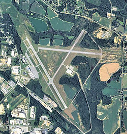
CATEGORIES: Point Of Interest
LAYER: Point of Interest
WATER BODY: Gum Creek
ADDRESS: Henry Tift Myers Airport (KTMA), Tift County
WEBSITE: https://www.airnav.com/airport/KTMA
DESCRIPTION: At headwaters of Gum Creek, 2 miles S of Tifton
PHOTOSET: http://en.wikipedia.org/wiki/Henry_Tift_Myers_Airport
PHOTO SOURCE: USGS
OWNERSHIP: Public, TIFTON & TIFT CO ARPT AUTH.
Paradise PFA 

CATEGORIES: Lake
LAYER: Brochure
ACCESS: Yes, Ramp: Concrete, DOCK, CAMPING: Primitive, RESTROOMS, PARKING: License fee, SHELTER, PICNIC AREA, HANDICAPPED ACCESSIBLE
WATER BODY: Paradise Lake
ADDRESS: 536 Paradise Drive, Enigma, GA 31749, Berrien County
WEBSITE: http://www.georgiawildlife.com/PFA/Paradise
DESCRIPTION: 68 lakes encompassing 525 acres of water. From Tifton: Travel East 8 miles on Hwy. 82 to Brookfield. Turn right on Whitley Rd. and follow signs from Hwy. 82 to the area. The entrance to the area is located on the Brookfield-Nashville Rd. approximately 1.5 miles from Brookfield.
PHOTO: http://www.georgiawildlife.com/sites/default/files/uploads/legacy_assets/Images/617.jpg
PHOTO SOURCE: GA DNR
OWNERSHIP: Public, GA DNR, PARCEL 007 8 000
Paradise PFA Hiking Trail 

CATEGORIES: Hiking Trail
LAYER: Hiking Trail
ACCESS: Yes, CAMPING: Primitive, RESTROOMS, PARKING: License fee
WATER BODY: Paradise Lake
ADDRESS: 536 Paradise Drive, Enigma, GA 31749, Berrien County
DESCRIPTION: Hiking trail east of Lake Patrick dam, From Tifton: Travel East 8 miles on Hwy. 82 to Brookfield. Turn right on Whitley Rd. and follow signs from Hwy. 82 to the area. The entrance to the area is located on the Brookfield-Nashville Rd. approximately 1.5 miles from Brookfield.
PHOTOSET: http://www.georgiawildlife.com/PFA/Paradise
PHOTO SOURCE: GA DNR
OWNERSHIP: Public, GA DNR, PARCEL 007 8 000
Gum Creek
CATEGORIES: Tributary
LAYER: Brochure
WATER BODY: New River
ADDRESS: East of GA 125 SE of Tifton, Tift County
DESCRIPTION: Starts below Henry Tift Myers Airport (TMA)
OWNERSHIP: Private
New River
CATEGORIES: Tributary
LAYER: Brochure
WATER BODY: Withlacoochee River
ADDRESS: East of Griffin Circle, NE of Adel, Cook, Berrien County
WEBSITE: /maps/#New-River
DESCRIPTION: Border of Cook and Berrien Counties, drains Tifton and its wastewater treatment plant
OWNERSHIP: Private
Bear Creek
CATEGORIES: Tributary
LAYER: Brochure
WATER BODY: Withlacoochee River
ADDRESS: Confluence east of Boyett Road, south of GA 37, Cook County
DESCRIPTION: Drains Adel
OWNERSHIP: Private
GA 37 Withlacoochee Cook
CATEGORIES: Access
LAYER: Other
ACCESS: Yes, PARKING: Free
WATER BODY: Withlacoochee River
ADDRESS: MILE 96, Between Adel and Ray City, GA, Cook County
OWNERSHIP: Public
Youngs Mill Creek
CATEGORIES: Tributary
LAYER: Other
ACCESS: Yes, PARKING: Free, HISTORIC ATTRACTION
WATER BODY: Withlacoochee River
ADDRESS: MILE 96, Just south of the GA 37 bridge, Cook County
DESCRIPTION: , Apparently there used to be a mill here
OWNERSHIP: Public
GA 37 Withlacoochee Bridge
CATEGORIES: Bridge
LAYER: Bridge
GPS: 31.12022, -83.321241
ACCESS: Yes
WATER BODY: Withlacoochee River
ADDRESS: MILE 96, Between Adel and Ray City, GA, Cook, Berrien County
DESCRIPTION: State highway bridge
OWNERSHIP: Public
GA 37 Withlacoochee Berrien
CATEGORIES: Access
LAYER: Brochure
ACCESS: Yes, PARKING: Free
WATER BODY: Withlacoochee River
ADDRESS: MILE 98, Between Adel and Ray City, GA, Berrien County
OWNERSHIP: Public
DOWNSTREAM: 13.6 miles from GA 37 Withlacoochee Berrien to GA 122 Withlacoochee
Banks Lake Outdoors Experience 

CATEGORIES: Outfitter
LAYER: Brochure
ACCESS: No, CANOE, FOOD: Store, WATER, Flush Toilet, PARKING: Free, FISH BAIT
WATER BODY: Banks Lake
ADDRESS: 307 Georgia 122, Lakeland, GA 31635, Lanier County
WEBSITE: http://www.fws.gov/uploadedFiles/BL_concession%281%29.pdf
DESCRIPTION: Partnership with the Banks Lake National Wildlife Refuge and the Lakeland-Lanier Chamber, Rents to public for use on Banks Lake or elsewhere
PHOTOSET: http://commons.wikimedia.org/wiki/File:Banks_Lake_National_Wildlife_Refuge_Kiosk.jpg
PHOTO SOURCE: Michael Rivera
OWNERSHIP: Public, U.S. Dept. of Interior, PARCEL 022 0023
Lindsey Branch
CATEGORIES: Tributary
LAYER: Other
ACCESS: No
WATER BODY: Withlacoochee River
ADDRESS: MILE 85.58, East of Louie Fletcher Road at the Cook-Lowndes County line, Cook County
OWNERSHIP: Public
Hutchinson Mill Creek
CATEGORIES: Tributary
LAYER: Other
ACCESS: Yes, PARKING: Free, HISTORIC ATTRACTION
WATER BODY: Withlacoochee River
ADDRESS: MILE 84.4, Just north of GA 122 bridge, Lowndes County
DESCRIPTION: Notorious for deadfalls backing up flood waters onto Skipper Bridge Road, Deadfalls on this creek were one reason for the formation of WWALS
OWNERSHIP: Public
GA 122 Withlacoochee
CATEGORIES: Access
LAYER: Brochure
ACCESS: Yes, PARKING: Free
WATER BODY: Withlacoochee River
ADDRESS: MILE 84.4, 7 miles east of Hahira, GA, Lowndes County
DESCRIPTION: , Between Hahira and Lakeland
OWNERSHIP: Public
UPSTREAM: 13.6 miles from GA 122 Withlacoochee to GA 37 Withlacoochee Berrien
DOWNSTREAM: 11.1 miles from GA 122 Withlacoochee to Staten Road
GA 122 Withlacoochee Bridge
CATEGORIES: Bridge
LAYER: Bridge
ACCESS: Yes
WATER BODY: Withlacoochee River
ADDRESS: MILE 84.4, 7 miles east of Hahira, GA, Lowndes County
DESCRIPTION: State highway bridge, Between Hahira and Lakeland
OWNERSHIP: Public
Franklinville Monument

CATEGORIES: Point Of Interest
LAYER: Point of Interest
GPS: 30.98292351, -83.27748871
ACCESS: No, PARKING: Free, HISTORIC ATTRACTION, HANDICAPPED ACCESSIBLE
WATER BODY: Withlacoochee River
ADDRESS: Between Skipper Bridge Road and the Withlacoochee River, Lowndes County
DESCRIPTION: , Site of original county seat of Lowndes County
PHOTO: http://www.lat34north.com/historicmarkers/Images/MarkerPic/Pic092-3.jpg
PHOTO SOURCE: David Seibert
OWNERSHIP: Public
Franklinville Road
CATEGORIES: Access
LAYER: Brochure
ACCESS: Yes, PARKING: Free, HISTORIC ATTRACTION
WATER BODY: Withlacoochee River
ADDRESS: MILE 72.48, Between Hahira and Moody AFB, Lowndes County
DESCRIPTION: Riverside bank on dirt road, Historic bridge, now closed
OWNERSHIP: Public
UPSTREAM: 0.82 mile from Franklinville Road to Staten Road
DOWNSTREAM: 4.28 miles from Franklinville Road to Langdale Park Boat Ramp
Franklinville Bridge
CATEGORIES: Bridge
LAYER: Bridge
ACCESS: Yes, PARKING: Free, HISTORIC ATTRACTION
WATER BODY: Withlacoochee River
ADDRESS: MILE 78.7, Between Hahira and Moody AFB, Lowndes County
DESCRIPTION: , Historic bridge, now closed
OWNERSHIP: Public
Redeye Creek
CATEGORIES: Tributary
LAYER: Other
ACCESS: Yes, PARKING: Free
WATER BODY: Withlacoochee River
ADDRESS: MILE 78.47, South of Franklinville Road, just downstream from the bridge, Lowndes County
DESCRIPTION: Beavers
OWNERSHIP: Public
Site of Cat Creek Mill
CATEGORIES: Point Of Interest
LAYER: Point of Interest
GPS: 30.992712, -83.24501
ACCESS: No, WATER, RESTROOMS, PARKING: Free, SHELTER, PICNIC AREA, HISTORIC ATTRACTION
WATER BODY: Cat Creek
ADDRESS: 5326 Cat Creek RdRay City, GA 31645, Lowndes County
DESCRIPTION: Millstone is at entrance to meeting hall, Historic mill
OWNERSHIP: Private
Cat Creek
CATEGORIES: Tributary
LAYER: Other
ACCESS: No
WATER BODY: Withlacoochee River
ADDRESS: MILE 77, Downstream from Franklinville Road, Lowndes County
DESCRIPTION: Drains Ray City and Rays Mill Pond
OWNERSHIP: Private
Moody FSS

CATEGORIES: Outfitter
LAYER: Brochure
ACCESS: No, CANOE, Flush Toilet, PARKING: Free
WATER BODY: Outfitter
ADDRESS: 6251 Davis St, Bldg 583, Moody AFB, GA 31699, Lowndes County
WEBSITE: http://www.moodyfss.com/content.asp?pid=13&id=424
DESCRIPTION: Moody Air Force Base Force Support Squadron Outdoor Adventures, Military base outfitter: military or veteran ID required to get on base.
PHOTO: http://www.moodyfss.com/content/areas/c424/misc/kayak.jpg
PHOTOSET: http://www.moodyfss.com/content.asp?pid=13&id=424
PHOTO SOURCE: Moody AFB
OWNERSHIP: Public
Reed Road Bridge
CATEGORIES: Bridge
LAYER: Bridge
GPS: 30.95705, -83.269801
ACCESS: No
WATER BODY: Withlacoochee River
ADDRESS: MILE 76, 4253-4399 Reed Rd, Valdosta, GA 31605, Lowndes County
DESCRIPTION: Permanently closed county road bridge
OWNERSHIP: Private
Skipper Bridge Gauge
CATEGORIES: River Gauge
LAYER: River Gauge
WATER BODY: Withlacoochee River
ADDRESS: MILE 75.3, Appears to be on pipeline row n of Skipper Bridge and due west of River Road, Lowndes County
WEBSITE: http://ga.water.usgs.gov/flood/floodtracking/watersheds/withlacoochee/023177483.html
DESCRIPTION: USGS 023177483
PHOTO: http://waterwatch.usgs.gov/wwapps/ww_chart.php?i=nwis&vt=uv&site_no=023177483&p_cd=00065
PHOTOSET: /2014/05/06/flooding-charts-2/
PHOTO SOURCE: WWALS
OWNERSHIP: Public
Skipper Bridge
CATEGORIES: Bridge
LAYER: Bridge
ACCESS: No
WATER BODY: Withlacoochee River
ADDRESS: MILE 75.2, 8.6 miles north of Valdosta, Lowndes County
DESCRIPTION: New county road bridge
OWNERSHIP: Public
Staten Road Bridge
CATEGORIES: Bridge
LAYER: Bridge
ACCESS: No, PARKING: Free
WATER BODY: Withlacoochee River
ADDRESS: MILE 73.3, 7.1 miles north of Valdosta, Lowndes County
DESCRIPTION: New county road bridge
OWNERSHIP: Public
Staten Road
CATEGORIES: Access
LAYER: Brochure
ACCESS: Yes, PARKING: Free
WATER BODY: Withlacoochee River
ADDRESS: MILE 73.3, 7.1 miles north of Valdosta, Lowndes County
DESCRIPTION: , Only for the Athletic
OWNERSHIP: Public
UPSTREAM: 11.1 miles from Staten Road to GA 122 Withlacoochee
DOWNSTREAM: 0.82 mile from Staten Road to Franklinville Road
Bay Branch
CATEGORIES: Tributary
LAYER: Other
ACCESS: No
WATER BODY: Withlacoochee River
ADDRESS: MILE 71, Between Lucas-Richardson Road and Sermons Lane, Lowndes County
OWNERSHIP: Public
Sermons Branch
CATEGORIES: Tributary
LAYER: Other
GPS: 30.91849, -83.309506
ACCESS: No
WATER BODY: Withlacoochee River
ADDRESS: MILE 70.55, 3816 Sermons Lane, Valdosta, GA, Lowndes County
DESCRIPTION: Not sure of the real name of this creek,
OWNERSHIP: Private, Pauline Kincade, PARCEL 0071 054
Shadrick Sink 

CATEGORIES: Sinkhole
LAYER: Brochure
ACCESS: Yes, PARKING: Free, HISTORIC ATTRACTION
WATER BODY: Withlacoochee River
ADDRESS: 3526 River Chase Drive, Valdosta, GA, Lowndes County
WEBSITE: /2015/02/18/shadrick-and-cherry-creek-sinks-on-the-withlacoochee-river-near-valdosta/
DESCRIPTION: 2.5 acre depression with two sinkholes at bottom that leak into the Floridan Aquifer, Has leaked into the aquifer for decades, causing Valdosta’s water wells to be sunk 400 feet deep to get below that level.
PHOTOSET: /2015/02/18/shadrick-and-cherry-creek-sinks-on-the-withlacoochee-river-near-valdosta/
PHOTO SOURCE: John S. Quarterman
OWNERSHIP: Public, Lowndes County, PARCEL 0072 023
Withlacoochee Slough at Cherry Creek
CATEGORIES: Obstacle
LAYER: Other
ACCESS: Yes, Launch: Riverside, PARKING: Free
WATER BODY: Withlacoochee River
ADDRESS: MILE 69.55, 3526 River Chase Drive, Valdosta, GA, Lowndes County
WEBSITE: /2015/02/18/shadrick-and-cherry-creek-sinks-on-the-withlacoochee-river-near-valdosta/
DESCRIPTION: a slough of the Withlacoochee River
PHOTO: /?attachment_id=6486
PHOTOSET: /2015/02/18/shadrick-and-cherry-creek-sinks-on-the-withlacoochee-river-near-valdosta/
PHOTO SOURCE: John S. Quarterman
OWNERSHIP: Public, Lowndes County, PARCEL 0072 023
Cherry Lake Dam

CATEGORIES: Point Of Interest
LAYER: Point of Interest
GPS: 30.903445, -83.30188
ACCESS: No, PARKING: Free, HISTORIC ATTRACTION
WATER BODY: Cherry Creek
ADDRESS: Cherry Lake Drive, Lowndes County
DESCRIPTION: aka “”the dip”” because when the road was open you could drive through water running over the dam, Was famous local attraction
PHOTOSET: https://www.facebook.com/groups/200086353383082/permalink/720792741312438/
PHOTO SOURCE: Charles Hinke
OWNERSHIP: Public, Cherry Creek Hills Property Owners Association, PARCEL 0106 069A
Cherry Creek
CATEGORIES: Tributary
LAYER: Other
GPS: 30.901774, -83.31094
ACCESS: No
WATER BODY: Withlacoochee River
ADDRESS: MILE 69.35, Downstream from Cherry Creek Drive, Lowndes County
WEBSITE: http://www.valdostacity.com/Modules/ShowDocument.aspx?documentid=5032
DESCRIPTION: See also Withlacoochee Slough at Cherry Creek
OWNERSHIP: Public, ARCH FOUNDATION FOR THE UNIVERSITY OF Georgia Inc. PARCEL 0072 031
Cherry Creek Sink
CATEGORIES: Sinkhole
LAYER: Other
ACCESS: Yes, PARKING: Free, HISTORIC ATTRACTION
WATER BODY: Withlacoochee River
ADDRESS: MILE 69.3, 3526 River Chase Drive, Valdosta, GA, Lowndes County
WEBSITE: /2015/02/18/shadrick-and-cherry-creek-sinks-on-the-withlacoochee-river-near-valdosta/
DESCRIPTION: a sinkhole into the Floridan Aquifer that opened in less than two months
PHOTO: /?attachment_id=6490
PHOTOSET: /2015/02/18/shadrick-and-cherry-creek-sinks-on-the-withlacoochee-river-near-valdosta/
PHOTO SOURCE: John S. Quarterman
OWNERSHIP: Public, Lowndes County, PARCEL 0072 023
Stillhouse Branch
CATEGORIES: Tributary
LAYER: Other
GPS: 30.895699, -83.31483
ACCESS: No
WATER BODY: Withlacoochee River
ADDRESS: MILE 69, 3500 Plantation Drive, Valdosta, GA, Lowndes County
WEBSITE: http://www.valdostacity.com/Modules/ShowDocument.aspx?documentid=5032
DESCRIPTION: Drains Valdosta Country Club
OWNERSHIP: Private, Valdosta Country Club Inc. PARCEL 0074 001
North Valdosta Road
CATEGORIES: Access
LAYER: Other
ACCESS: Yes, PARKING: Free
WATER BODY: Withlacoochee River
ADDRESS: MILE 68.7, 3966 N Valdosta Rd, Valdosta, GA 31602, Lowndes County
DESCRIPTION: State highway right of way
OWNERSHIP: Public
North Valdosta Road
CATEGORIES: Bridge
LAYER: Bridge
ACCESS: Yes, PARKING: Free
WATER BODY: Withlacoochee River
ADDRESS: MILE 68.7, betweeen I-75 exit 22 and Valdosta, Lowndes County
DESCRIPTION: State highway bridge and northern entrance to Valdosta
OWNERSHIP: Public
US 41 Gauge
CATEGORIES: River Gauge
LAYER: River Gauge
GPS: 30.8925, -83.318889
WATER BODY: Withlacoochee River
ADDRESS: On US 41 North Valdosta Road, Lowndes County
WEBSITE: http://waterdata.usgs.gov/usa/nwis/uv?02317755
DESCRIPTION: USGS 02317755
PHOTO: http://waterwatch.usgs.gov/wwapps/ww_chart.php?i=nwis&vt=uv&site_no=02317755&p_cd=00065
PHOTOSET: /2014/05/06/flooding-charts-2/
PHOTO SOURCE: WWALS
OWNERSHIP: Public
Langdale Park
CATEGORIES: Public Land
LAYER: Other
GPS: 30.8872, -83.314975
ACCESS: , PARKING: Free, SHELTER, PICNIC AREA
WATER BODY: Withlacoochee River
ADDRESS: MILE 62.2, 3781 N. Valdosta Rd., Valdosta, GA 31602
WEBSITE: http://vlpra.com/location/2830
DESCRIPTION: 178 acre public park
OWNERSHIP: Public
Langdale Park Boat Ramp
CATEGORIES: Landing
LAYER: Brochure
GPS: 30.88747, -83.32395
ACCESS: Yes, PARKING: Free, SHELTER, PICNIC AREA
WATER BODY: Withlacoochee River
ADDRESS: MILE 68.2, 3781 N. Valdosta Rd., Valdosta, GA 31602, Lowndes County
WEBSITE: http://vlpra.rec1.net/location/2830
DESCRIPTION: concrete boat ramp on dirt road in 100+ acre park
OWNERSHIP: Public, VLPRA
UPSTREAM: 4.28 miles from Langdale Park Boat Ramp to Franklinville Road
DOWNSTREAM: 10 miles from Langdale Park Boat Ramp to US 84
Three Mile Branch
CATEGORIES: Tributary
LAYER: Other
GPS: 30.875506, -83.32324
ACCESS: No
WATER BODY: Withlacoochee River
ADDRESS: MILE 67.7, Confluence with Withlacoochee River in south edge of Langdale Park, Lowndes County
WEBSITE: /2015/03/02/valdosta-spilled-into-alapaha-as-well-as-withlacoochee-watersheds-in-february/
DESCRIPTION: Drains Five Points and much of North Valdosta Road
OWNERSHIP: Public, VLPRA, PARCEL 0076C 025
Two Mile Branch
CATEGORIES: Tributary
LAYER: Other
ACCESS: No
WATER BODY: Sugar Creek
ADDRESS: Confluence with Sugar Creek north of Meadowbrook Drive, Lowndes County
WEBSITE: /2015/03/02/valdosta-spilled-into-alapaha-as-well-as-withlacoochee-watersheds-in-february/
DESCRIPTION: Infamous for flooding local houses, esp. in 2009
OWNERSHIP: Private, Estate of Georgia B. Eager, PARCEL 0078C 022
Sugar Creek
CATEGORIES: Tributary
LAYER: Other
ACCESS: No
WATER BODY: Withlacoochee River
ADDRESS: MILE 66.2, Confluence with Withlacoochee River downstream on Sugar Creek (north) from Gornto Road, Lowndes County
WEBSITE: /2015/03/02/valdosta-spilled-into-alapaha-as-well-as-withlacoochee-watersheds-in-february/
DESCRIPTION: Infamous for flooding, esp. in 2009
OWNERSHIP: Private, Estate of Georgia B. Eager, PARCEL 0078C 022
GSF RR Bridge 
CATEGORIES: Railbridge
LAYER: Railbridge
WATER BODY: Withlacoochee River
ADDRESS: MILE 66.1, North of Gornto Road, just downstream from Sugar Creek, Lowndes County
DESCRIPTION: Georgia Southern and Florida Railway bridge
OWNERSHIP: Private
One Mile Branch
CATEGORIES: Tributary
LAYER: Other
ACCESS: No
WATER BODY: Sugar Creek
ADDRESS: Confluence with Sugar Creek 1407 Baytree Road, Lowndes County
WEBSITE: www.valdostacity.com/Modules/ShowDocument.aspx?documentid=5036
DESCRIPTION: Drains Vallotton Park, Drexel Park, VSU, Sunset Hill Cemetery
OWNERSHIP: Private, Marlev Co. PARCEL 0082D 267
Hightower Creek
CATEGORIES: Tributary
LAYER: Other
ACCESS: No
WATER BODY: Sugar Creek
ADDRESS: Confluence with Sugar Creek behind 1407 BayTree Road, Lowndes County
WEBSITE: www.valdostacity.com/Modules/ShowDocument.aspx?documentid=5034
DESCRIPTION: Drains most of I-75 between St. Augustine Road and West Hill Avenue.
OWNERSHIP: Private, Marlev Co. PARCEL 0084B 024
VSU CORE

CATEGORIES: Outfitter
LAYER: Brochure
ACCESS: No, CANOE, Flush Toilet, PARKING: Free
WATER BODY: Outfitter
ADDRESS: 1300 Sustella Ave., Valdosta, GA 31698, Lowndes County
WEBSITE: http://www.valdosta.edu/student/rec-wellness/campus-recreation/core/welcome.php
DESCRIPTION: CORE (Center for Outdoor Recreational Experiences) at Valdosta State University, University outfitter that also rents to the public.
PHOTO: http://www.valdosta.edu/student/rec-wellness/campus-recreation/core/images/12-tarpon.jpg
PHOTOSET: http://www.valdosta.edu/student/rec-wellness/campus-recreation/core/rental-center/kayaks.php
PHOTO SOURCE: VSU CORE
OWNERSHIP: Public
Browns Canal
CATEGORIES: Tributary
LAYER: Other
ACCESS: No
WATER BODY: Sugar Creek
ADDRESS: Confluence with Sugar Creek 1401 Lankford Dr, Lowndes County
WEBSITE: http://www.valdostacity.com/Modules/ShowDocument.aspx?documentid=5024
DESCRIPTION: Drains much of downtown and west Valdosta
OWNERSHIP: Private, Blanton Park LLC, PARCEL 0084B 072
I-75 Bridge
CATEGORIES: Bridge
LAYER: Bridge
WATER BODY: Withlacoochee River
ADDRESS: MILE 64.11, About a mile north of exit 18. Lowndes County
OWNERSHIP: Public
GA 133 Withlacoochee Bridge
CATEGORIES: Bridge
LAYER: Bridge
WATER BODY: Withlacoochee River
ADDRESS: MILE 63.38, West of Valdosta off I-75 exit 18. Lowndes County
OWNERSHIP: Public
Confluence of Little River with Withlacoochee River
CATEGORIES: Tributary
LAYER: Brochure
ACCESS: No,, HISTORIC ATTRACTION
WATER BODY: Little River, Withlacoochee River
ADDRESS: MILE 63.2, About 2300 feet downstream from Little River Boat Ramp, Lowndes County
DESCRIPTION: , Near historic Troupville, GA
OWNERSHIP: Private, BETWEEN THE RIVERS LLC & T W PAINE, PARCEL 0057 003
Okapilco Creek Gauge
CATEGORIES: River Gauge
LAYER: River Gauge
WATER BODY: Okapilco Creek
ADDRESS: On GA 333 Moultrie Road north of Quitman, Brooks County
WEBSITE: http://ga.water.usgs.gov/flood/floodtracking/watersheds/withlacoochee/02318700.html
DESCRIPTION: USGS 02318700
PHOTO: http://waterwatch.usgs.gov/wwapps/ww_chart.php?i=nwis&vt=uv&site_no=02318700&p_cd=00065
PHOTOSET: /2014/05/06/flooding-charts-2/
PHOTO SOURCE: WWALS
OWNERSHIP: Public
GA 333 Bridge
CATEGORIES: Bridge
LAYER: Bridge
GPS: 30.825768, -83.56243
WATER BODY: Okapilco Creek
ADDRESS: On GA 333 Moultrie Road north of Quitman, Brooks County
OWNERSHIP: Public
US 84 Bridge
CATEGORIES: Bridge
LAYER: Bridge
WATER BODY: Withlacoochee River
ADDRESS: MILE 58.2, Between Quitman and Valdosta, Lowndes, Brooks County
OWNERSHIP: Public
US 84
CATEGORIES: Access
LAYER: Brochure
ACCESS: Yes
WATER BODY: Withlacoochee River
ADDRESS: MILE 58.2, Between the twin highway bridges on the Lowndes County side, Lowndes County
DESCRIPTION: Problematical access from busy highway right of way
OWNERSHIP: Public
UPSTREAM: 10 miles from US 84 to Langdale Park Boat Ramp
DOWNSTREAM: 0.20 mile from US 84 to Old Quitman Road
US 84 Gauge
CATEGORIES: River Gauge
LAYER: River Gauge
WATER BODY: Withlacoochee River
ADDRESS: MILE 58.2, Between US 84 bridge and CSX rail bridge, Brooks County
WEBSITE: http://ga.water.usgs.gov/flood/floodtracking/watersheds/withlacoochee/02318500.html
DESCRIPTION: USGS 02318500
PHOTO: http://waterwatch.usgs.gov/wwapps/ww_chart.php?i=nwis&vt=uv&site_no=02318500&p_cd=00065
PHOTOSET: /2014/05/06/flooding-charts-2/
PHOTO SOURCE: WWALS
OWNERSHIP: Public
CSX Rail Bridge
CATEGORIES: Railbridge
LAYER: Railbridge
ACCESS: No, HISTORIC ATTRACTION
WATER BODY: Withlacoochee River
ADDRESS: MILE 58.1, Between Quitman and Valdosta, just south of the US 84 bridge, Brooks, Lowndes County
DESCRIPTION: The old Atlantic Coast Line, The original rail line through this area.
OWNERSHIP: Private
Spook Bridge

CATEGORIES: Bridge
LAYER: Bridge
ACCESS: Yes, PARKING: Free, HISTORIC ATTRACTION
WATER BODY: Withlacoochee River
ADDRESS: MILE 58, On Old Quitman Road; walkable but closed to vehicular traffic. Brooks, Lowndes County
WEBSITE: http://en.wikipedia.org/wiki/Spook_Bridge
DESCRIPTION: Nice antique stone bridge with railing and ghost stories. Historic bridge
PHOTO: http://bridgehunter.com/photos/19/17/191726-M.jpg
PHOTOSET: http://bridgehunter.com/ga/lowndes/spook/
OWNERSHIP: Public
Old Quitman Road
CATEGORIES: Access
LAYER: Brochure
ACCESS: Yes, PARKING: Free, HISTORIC ATTRACTION
WATER BODY: Withlacoochee River
ADDRESS: MILE 58, On the Brooks County side (just south of US 84). Paved road, then walk a few hundred feet to Spook Bridge. Brooks County
DESCRIPTION: Not very practical as river access.
OWNERSHIP: Public
UPSTREAM: 0.20 mile from Old Quitman Road to US 84
DOWNSTREAM: 15.3 miles from Old Quitman Road to Knights Ferry Boat Ramp
Bowen Mill Pond

CATEGORIES: Lake
LAYER: Brochure
ACCESS: Yes, PARKING: Free
WATER BODY: Bowen Mill Pond
ADDRESS: Bowen Mill Pond Road, Quitman, GA, Brooks County
WEBSITE: /2014/09/29/bowen-mill-pond-brooks-county-georgia/
DESCRIPTION: Heading west on US 84 through Quitman, turn right on Barwick Road between the Harveys and the Rite Aid, or right on Shiver Road. Then turn left on Dry Lake Road, and eventually turn left on Bowen Mill Pond road. You’ll see the pond on your right after a while.
PHOTOSET: /2014/09/29/bowen-mill-pond-brooks-county-georgia/
PHOTO SOURCE: John S. Quarterman
OWNERSHIP: Public, Georgia Department of Transportation, PARCEL 048 0027
Piscola Creek
CATEGORIES: Tributary
LAYER: Brochure
GPS: 30.75648, -83.491864
WATER BODY: Okapilco Creek
ADDRESS: Near Dewey Road, Brooks County
WEBSITE: /maps/#Piscola-Creek
OWNERSHIP: Private
Okapilco Creek
CATEGORIES: Tributary
LAYER: Brochure
ACCESS: No
WATER BODY: Withlacoochee River
ADDRESS: MILE 45, Near Dewey Road, Brooks County
WEBSITE: /maps/#Okapilco-Creek
OWNERSHIP: Private
Grassy Pond Boat Ramp

CATEGORIES: Landing
LAYER: Other
GPS: 30.6545, -83.23495
ACCESS: Yes, PARKING: Free, SHELTER, PICNIC AREA
WATER BODY: Grassy Pond
ADDRESS: 5360 Grassy Pond Dr., Lake Park, GA 31636
WEBSITE: http://www.moodyfss.com/content.asp?pid=13&id=423
PHOTO: http://www.militarycampgrounds.us/georgia/grassy-pond-recreation-area
PHOTOSET: (229) 559-5840
PHOTO SOURCE: Moody AFB
OWNERSHIP: Public
Grassy Pond *
CATEGORIES: Lake
LAYER: Brochure
ACCESS: Yes, PARKING: Free, SHELTER, PICNIC AREA
WATER BODY: Grassy Pond
ADDRESS: 5360 Grassy Pond Dr., Lake Park, GA 31636
WEBSITE: /2015/01/19/grassy-pond-opened-public-moody-afb/
DESCRIPTION: An affiliate of Moody Air Force Base, now open to the public for daily enjoyment. *
PHOTO: http://www.moodyfss.com/content/areas/c423/misc/dock%20web.jpg
PHOTOSET: (229) 559-5840
PHOTO SOURCE: Moody AFB
OWNERSHIP: Public
Knights Ferry Boat Ramp
CATEGORIES: Landing
LAYER: Brochure
GPS: 30.71238, -83.455443
ACCESS: Yes, PARKING: Free, PICNIC AREA
WATER BODY: Withlacoochee River
ADDRESS: MILE 42.7, 6499 Knights Ferry Rd, Valdosta, GA 31601, Lowndes County
WEBSITE: http://vlpra.com/location/2828
DESCRIPTION: concrete boat ramp in 1 acre park
OWNERSHIP: Public, VLPRA
UPSTREAM: 15.3 miles from Knights Ferry Boat Ramp to Old Quitman Road
DOWNSTREAM: 6.40 miles from Knights Ferry Boat Ramp to Nankin Boat Ramp
Nankin Boat Ramp
CATEGORIES: Landing
LAYER: Brochure
ACCESS: Yes, PARKING: Free, PICNIC AREA
WATER BODY: Withlacoochee River
ADDRESS: MILE 36.3, 6899 Clyattville-Nankin Rd, Valdosta, GA 31601, Lowndes County
WEBSITE: http://vlpra.rec1.net/location/2834
DESCRIPTION: concrete boat ramp in 1 acre park
OWNERSHIP: Public, VLPRA
UPSTREAM: 6.40 miles from Nankin Boat Ramp to Knights Ferry Boat Ramp
DOWNSTREAM: 9.10 miles from Nankin Boat Ramp to Madison Highway Boat Ramp
Clyattville Road Bridge
CATEGORIES: Bridge
LAYER: Bridge
WATER BODY: Withlacoochee River
ADDRESS: Clyattville-Nankin Road, Lowndes, Brooks County
OWNERSHIP: Public
Oris Blackburn Memorial Park
CATEGORIES: Landing
LAYER: Brochure
GPS: 30.665647, -83.32
ACCESS: Yes, PARKING: Free, PICNIC AREA
WATER BODY: Oris Blackburn Pond
ADDRESS: 5750 Madison Hwy, Clyattville, GA 31601, Lowndes County
WEBSITE: http://vlpra.rec1.net/location/2839
DESCRIPTION: There is a boat ramp for johnboat access to the five-acre pond.
OWNERSHIP: Public, VLPRA
GA 31 Bridge
CATEGORIES: Bridge
LAYER: Bridge
WATER BODY: Withlacoochee River
ADDRESS: MILE 27.2, GA 31 Madison Highway at FL state line, Lowndes, Brooks County
OWNERSHIP: Public
Madison Highway Boat Ramp
CATEGORIES: Landing
LAYER: Brochure
ACCESS: Yes, PARKING: Free, PICNIC AREA
WATER BODY: Withlacoochee River
ADDRESS: MILE 27.2, Madison Highway at the Florida State Line. Lowndes County
WEBSITE: http://vlpra.rec1.net/location/2833
DESCRIPTION: From Pinetta, Madison County, FL, travel north on CR 145; cross the Withlacoochee River; at the end of the bridge turn left and follow road to ramp in Hamilton County, FL. Also known as GA 31 Ramp or State Line Ramp (GA DNR).
PHOTOSET: http://www.srwmd.state.fl.us/documentcenter/home/view/31
OWNERSHIP: Public, VLPRA
UPSTREAM: 9.10 miles from Madison Highway Boat Ramp to Nankin Boat Ramp
DOWNSTREAM: 5.30 miles from Madison Highway Boat Ramp to Sullivan Launch
CR 150 Bridge
CATEGORIES: Bridge
LAYER: Bridge
WATER BODY: Withlacoochee River
ADDRESS: MILE 21.9, East of Pinetta, Madison, Hamilton County
OWNERSHIP: Public
Sullivan Launch
CATEGORIES: Landing
LAYER: Brochure
GPS: 30.595667, -83.26
ACCESS: Yes, PARKING: Free, PICNIC AREA
WATER BODY: Withlacoochee River
ADDRESS: MILE 21.9, South of CR150 downstream of river bridge. Madison County
WEBSITE: http://www.srwmd.state.fl.us/documentcenter/home/view/31
DESCRIPTION: From Pinetta, Madison County, FL, travel east on CR 150; turn right at the bridge and follow road to launch. Also known as CR 150 Bridge Launch. In Twin Rivers State Park.
OWNERSHIP: Public, SRWMD
UPSTREAM: 5.30 miles from Sullivan Launch to Madison Highway Boat Ramp
DOWNSTREAM: 8.60 miles from Sullivan Launch to Withlacoochee Ramp
Pinetta Gauge
CATEGORIES: River Gauge
LAYER: River Gauge
WATER BODY: Withlacoochee River
ADDRESS: MILE 21.9, South of CR150 NE Bellville Road east of Pinetta, Madison County
WEBSITE: http://ga.water.usgs.gov/flood/floodtracking/watersheds/withlacoochee/02319000.html
DESCRIPTION: USGS 02319000
PHOTO: http://waterwatch.usgs.gov/wwapps/ww_chart.php?i=nwis&vt=uv&site_no=02319000&p_cd=00065
PHOTOSET: /2014/05/06/flooding-charts-2/
PHOTO SOURCE: WWALS
OWNERSHIP: Public
Withlacoochee Ramp
CATEGORIES: Landing
LAYER: Brochure
ACCESS: Yes, PARKING: Free, PICNIC AREA
WATER BODY: Withlacoochee River
ADDRESS: MILE 13.3, 4658 NW 21st Pl, Jasper, FL 32052, Hamilton County
WEBSITE: http://www.srwmd.state.fl.us/documentcenter/home/view/31
DESCRIPTION: From Jasper, Hamilton County, FL, travel north on US 41 to SR 6; turn left; travel west on SR 6 to CR 143; turn right and travel north to NW 44 Street; turn left; follow road to NW 45 Street; turn right; follow road to NW 22 Avenue; turn left and follow road to NW 21 Place and ramp is on the right.
OWNERSHIP: Public, Hamilton County
UPSTREAM: 8.60 miles from Withlacoochee Ramp to Sullivan Launch
DOWNSTREAM: 1.60 miles from Withlacoochee Ramp to Madison Blue Springs State Park Launch
FL-6 Bridge
CATEGORIES: Bridge
LAYER: Bridge
GPS: 30.482252, -83.24353
WATER BODY: Withlacoochee River
ADDRESS: MILE 12, 10.2 miles east of Madison, Madison, Hamilton County
OWNERSHIP: Public
Madison Gauge
CATEGORIES: River Gauge
LAYER: River Gauge
WATER BODY: Withlacoochee River
ADDRESS: MILE 12, on left bank 260 ft below bridge on State Highway 6, 10.2 mi east of Madison and 12 mi upstream from mouth. Madison County
WEBSITE: http://waterdata.usgs.gov/usa/nwis/uv?site_no=02319300
DESCRIPTION: USGS 02319300
PHOTO: http://waterwatch.usgs.gov/wwapps/ww_chart.php?i=nwis&vt=uv&site_no=02319300&p_cd=00065
PHOTOSET: /2014/05/06/flooding-charts-2/
OWNERSHIP: Public
Madison Blue Springs State Park Launch

CATEGORIES: Landing
LAYER: Brochure
ACCESS: Yes, PARKING: Free, PICNIC AREA
WATER BODY: Withlacoochee River
ADDRESS: MILE 11.7, 8300 FL-6, Lee, FL 32059, Madison County
WEBSITE: https://www.floridastateparks.org/park/Madison-Blue-Spring
DESCRIPTION: From Madison, Madison County, FL, travel east on SR 6 to the Withlacoochee River and Madison Blue Springs State Park is on the right.
PHOTOSET: https://www.floridastateparks.org/park/Madison-Blue-Spring
PHOTO SOURCE: SRWMD
OWNERSHIP: Public, SRWMD
UPSTREAM: 1.60 miles from Madison Blue Springs State Park Launch to Withlacoochee Ramp
DOWNSTREAM: 2.00 miles from Madison Blue Springs State Park Launch to Madison Boat Ramp
Madison Boat Ramp
CATEGORIES: Landing
LAYER: Brochure
ACCESS: Yes, PARKING: Free, PICNIC AREA
WATER BODY: Withlacoochee River
ADDRESS: MILE 9.7, 1307 NE River Park Rd, Lee, FL 32059, Madison County
WEBSITE: http://www.dep.state.fl.us/gwt/guide/designated_paddle/withn_guide.pdf
DESCRIPTION: From Madison, Madison County, FL, travel east on SR 6 to Old Blue Springs Road; turn right, travel east to NE Ivy Drive; turn left and travel east to NE Juniper Drive; turn right and follow to NE River Park Road; turn left and travel east; cross over NE Timber River Loop and into county park.
PHOTO SOURCE: Madison County
OWNERSHIP: Public, Madison County
UPSTREAM: 2.00 miles from Madison Boat Ramp to Madison Blue Springs State Park Launch
DOWNSTREAM: 1.70 miles from Madison Boat Ramp to CR 143 Ramp
CR 143 Ramp
CATEGORIES: Landing
LAYER: Brochure
ACCESS: Yes, PARKING: Free, PICNIC AREA
WATER BODY: Withlacoochee River
ADDRESS: MILE 8, From Jasper, travel north on US 41 to SR 6; turn left; travel south on SW CR 141 to SW CR 143; turn right and follow SW CR 143 to SW 64 Way and follow to ramp. Hamilton County
WEBSITE: http://www.srwmd.state.fl.us/documentcenter/home/view/31
DESCRIPTION: Also known as Allen Landing
OWNERSHIP: Public, Hamilton County
UPSTREAM: 1.70 miles from CR 143 Ramp to Madison Boat Ramp
DOWNSTREAM: 8.22 miles from CR 143 Ramp to Suwannee River State Park
CR 141 Bridge
CATEGORIES: Bridge
LAYER: Bridge
WATER BODY: Withlacoochee River
ADDRESS: MILE 2.3, 7.3 miles east of Lee, FL, Madison, Hamilton County
OWNERSHIP: Public
Lee Gauge
CATEGORIES: River Gauge
LAYER: River Gauge
WATER BODY: Withlacoochee River
ADDRESS: MILE 2.3, on right bank on downstream side of bridge on County Road 141 and Myrrh Road, 2.3 mi upstream from mouth, and 7.3 mi east of Lee. Madison County
WEBSITE: http://waterdata.usgs.gov/usa/nwis/uv?site_no=02319394
DESCRIPTION: USGS 02319394
PHOTO: http://waterwatch.usgs.gov/wwapps/ww_chart.php?i=nwis&vt=uv&site_no=02319394&p_cd=00065
PHOTOSET: /2014/05/06/flooding-charts-2/
PHOTO SOURCE: WWALS
OWNERSHIP: Public
Confluence of Withlacoochee and Suwannee Rivers
CATEGORIES: Tributary
LAYER: Brochure
WATER BODY: Withlacoochee River
ADDRESS: https://www.floridastateparks.org/park/Suwannee-River, Hamilton, Madison, Suwannee County
WEBSITE: https://www.floridastateparks.org/park/Suwannee-River
DESCRIPTION: About a thousand feet downstream from the boat ramp at Suwannee River State Park.
Suwannee River State Park

CATEGORIES: Landing
LAYER: Brochure
GPS: 30.3877, -83.1688
ACCESS: Yes, PARKING: $5.00/vehicle, SHELTER, PICNIC AREA
WATER BODY: Suwannee River
ADDRESS: MILE -0.22, 3631 201st Path, Live Oak, FL 32060, Suwannee County
WEBSITE: https://www.floridastateparks.org/park/Suwannee-River
DESCRIPTION: Slightly upstream from confluence of Withlacoochee and Suwannee Rivers
PHOTOSET: https://www.floridastateparks.org/park/Suwannee-River
PHOTO SOURCE: SRWMD
OWNERSHIP: Public, SRWMD
UPSTREAM: 8.22 miles from Suwannee River State Park to CR 143 Ramp
DOWNSTREAM: 2.48 miles from Suwannee River State Park to CR 141 Ramp
CR 141 Ramp
CATEGORIES: Landing
LAYER: Brochure
GPS: 30.414, -83.159167
ACCESS: Yes, PARKING: Free
WATER BODY: Suwannee River
ADDRESS: MILE -2.7, SW 46th Ave., Jasper, FL 32052, Hamilton County
DESCRIPTION: From US 90, turn right onto NE Myrrh Street; cross the Withlacoochee River (road becomes CR 141); turn right on SW 74 Street; turn right on SW 44 Lane; travel south to SW 77 Street; turn left and follow to boat ramp. Government Owned for General Public Use
OWNERSHIP: Public, SRWMD? PARCEL 5555-555
UPSTREAM: 2.48 miles from CR 141 Ramp to Suwannee River State Park
DOWNSTREAM: 18.1 miles from CR 141 Ramp to Spirit of Suwannee Music Park Ramp.
Spirit of Suwannee Music Park Ramp.
CATEGORIES: Landing Public?
LAYER: Brochure
ACCESS: Yes, CAMPING: “RV, Tent, WATER, RESTROOMS, PARKING: Free, SHELTER, PICNIC AREA
WATER BODY: Suwannee River
ADDRESS: MILE -20.8, 2461 95th Dr, Live Oak, FL 32060, From Live Oak, travel north on US 129 to Spirit of Suwannee Music Park; turn left on 95 Drive and follow road to boat ramp. Suwannee County
DESCRIPTION: Poured in place concrete, Inside Spirit of Suwannee Music Park
PHOTO: http://www.otariinae.net/Stanley/Suwannee/soc.jpg
PHOTOSET: http://www.otariinae.net/Stanley/Suwannee/index.htm
PHOTO SOURCE: SRWMD
OWNERSHIP: Public?
UPSTREAM: 18.1 miles from Spirit of Suwannee Music Park Ramp. to CR 141 Ramp
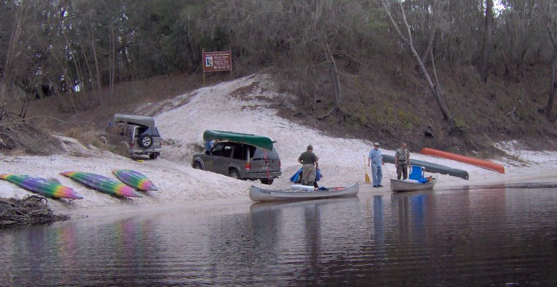
Suwannee Canoe Outpost

CATEGORIES: Outfitter
LAYER: Brochure
ACCESS: Yes, Ramp: Concrete, CANOE
WATER BODY: Suwannee River
ADDRESS: MILE -20.8, 2461 95th Dr, Live Oak, FL 32060, Suwannee County
WEBSITE: http://www.suwanneeoutpost.com/main.html
DESCRIPTION: The Suwannee Canoe Outpost is the original premier canoe outfitter on the Suwannee River! We have been at our current location in the Spirit of the Suwannee Music Park since 1993. We are fortunate to be located at a boat ramp, so we can maximize customer satisfaction while minimizing shuttle times! We offer canoe rental and shuttle service on three of the most exciting and remote rivers in Florida—the Suwannee, North Withlacoochee, and Alapaha Rivers!
PHOTO: http://www.suwanneeoutpost.com/sitebuilder/images/Suwannee_Springs_beach-600×450.jpg
PHOTOSET: http://www.suwanneeoutpost.com/daytripscenery.html
PHOTO SOURCE: Suwannee Canoe Outpost
OWNERSHIP: Private
American Canoe Adventures
CATEGORIES: Outfitter
LAYER: Brochure
ACCESS: Yes
WATER BODY: Suwannee River
ADDRESS: MILE -41.3, 10610 Bridge St. White Springs, FL 32096, Hamilton County
WEBSITE: http://aca1.com/whitesprings.htm
DESCRIPTION: You will be transported to your trip from our shop. On the way you will be provided with a river map, an explanation of your trip, and current river conditions. Approximated paddling times will vary with your paddling proficiency, weather conditions, and water level, but average 2 to 3 miles an hour.
PHOTO: http://www.aca1.com/images/logo.gif
PHOTOSET: http://aca1.com/
PHOTO SOURCE: American Canoe Adventures
OWNERSHIP: Private