Tag Archives: Barney

GA-EPD found Sabal Trail right of way violation 2016-12-14

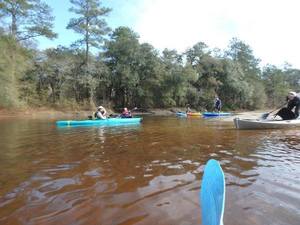
Georgia EPD found Sabal Trail out of its right of way at Okapilco Creek in Brooks County, and an enforcement action is being prepared. This was while investigating the possible wetlands and water violations reported by WWALS. So reports do sometimes work, although sometimes for violations different than the ones you thought you were reporting.

Update 21 Dec 2016: Please report potential violations.

This afternoon GA-EPD called me to provide a preliminary report on what they found when they inspected the possible violations WWALS reported December 8th 2016. The call came from Tommy W. Fowler, Program Manager, Southwest District, Georgia Environmental Protection Division (GA-EPD). These are my notes on what he said, in order from the WWALS complaint filing: Continue reading

Sabal Trail at Okapilco Creek 2016-12-06

Update 2016-12-08: Complaint filed with GA-EPD, USACE, FERC: PDF.

Movie: Red pipe, Okapilco Creek, Little Creek, Coffee Road, w. of GA 333, 30.9182490, -83.5904850 We didn’t see any silt fences where Sabal Trail has red pipe laid out across Okapilco Creek and Little Creek, north of Coffee Road, west of GA 333 in Brooks County, Georgia, between Barwick and Barney.

Red pipe, Okapilco Creek Middle Bridge, Sabal Trail,
Red pipe, Okapilco Creek Middle Bridge, Sabal Trail, 30.9174160, -83.5892520

Continue reading

Cook County Landing (GA 76) to Folsom Bridge (GA 122), Little River 20162017-01-14

Not a great boat ramp but public access it is. In January the water should be up like a year ago at this three-hour tour of the idyllic Little River between Brooks County and Cook and Lowndes Counties, Georgia. There should be no need to drag boats, like there was in July.

When: 10 AM Saturday January 14th 2017

Put In: Cook County Landing (GA 76) between Adel, Cook County and Barney, Brooks County, Georgia

GPS Coordinates: Continue reading

Little River Scouting 2016-07-10

My phone’s pedometer said I walked four miles of the six miles of this section of the Little River, with many fish, two white birds, lots of sand bars, some eroded bluffs, not a lot of trash after we got beyond the GA 76 bridge, and only one spot of invasive species (Japanese climbing fern).

Walk along home

This section would be better with about half a foot more water. The USGS GA 122 Little River gage showed about 3.71 feet for July 10th 2016, so let’s say at least 4.2 feet would be good. This is because there are many sand bars, including one directly upstream from the GA 122 bridge, where the water level is much closer to zero when that gage says 3.71.

Following up a report, Continue reading