Tag Archives: Barwick

GA DNR responds about Sabal Trail at Okapilco Creek 2017-09-21

Not the answer I was looking for, but GA-EPD is still by far the most responsive agency regarding Sabal Trail.

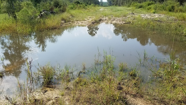
West to sinkhole, Coffee Road, near Okapilco Creek

Lisa Myler of GA-DNR called back Friday about 7PM saying Tom Fowler had been to the Okapilco Creek Sabal Trail sinkhole site I reported.

I called her back Monday, and after DNR’s web server came back up she forwarded Tom Fowler’s report today: Continue reading

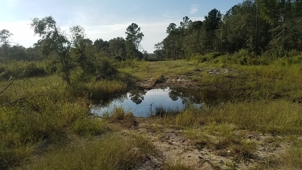
Sinkhole, Sabal Trail, Okapilco Creek, Brooks County, GA 2017-09-19

Update 2017-09-21: Yes, I reported it to GA-EPD, et al. (PDF), and here are facebook photos of most of the images below.

How close to exposed is Sabal Trail’s pipe? This sinkhole is at least a foot deep, maybe two or more, and Sabal Trail only buried their pipe three feet deep, despite requests by Brooks, Colquitt, and Lowndes Counties to bury it deeper.

At sinkhole, Sinkhole

N of sinkhole, Sinkhole

Is that fill material exposed Continue reading

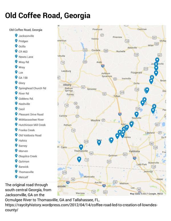
Old Coffee Road, Georgia

The Google map of locations on Old Coffee Road was used by many of the early settlers of south central Georgia, including in the watersheds of the Willacoochee, Alapaha, Withlacoochee, and Little Rivers and Okapilco Creek. It crossed all those and other waterways by ford or private ferry: there were no bridges back then.

Old Coffee Road map, WWALS.net
Follow this link for the interactive google map.

The Georgia Historical Commission erected markers at half a dozen locations in the 1950s and 1960, reading: Continue reading

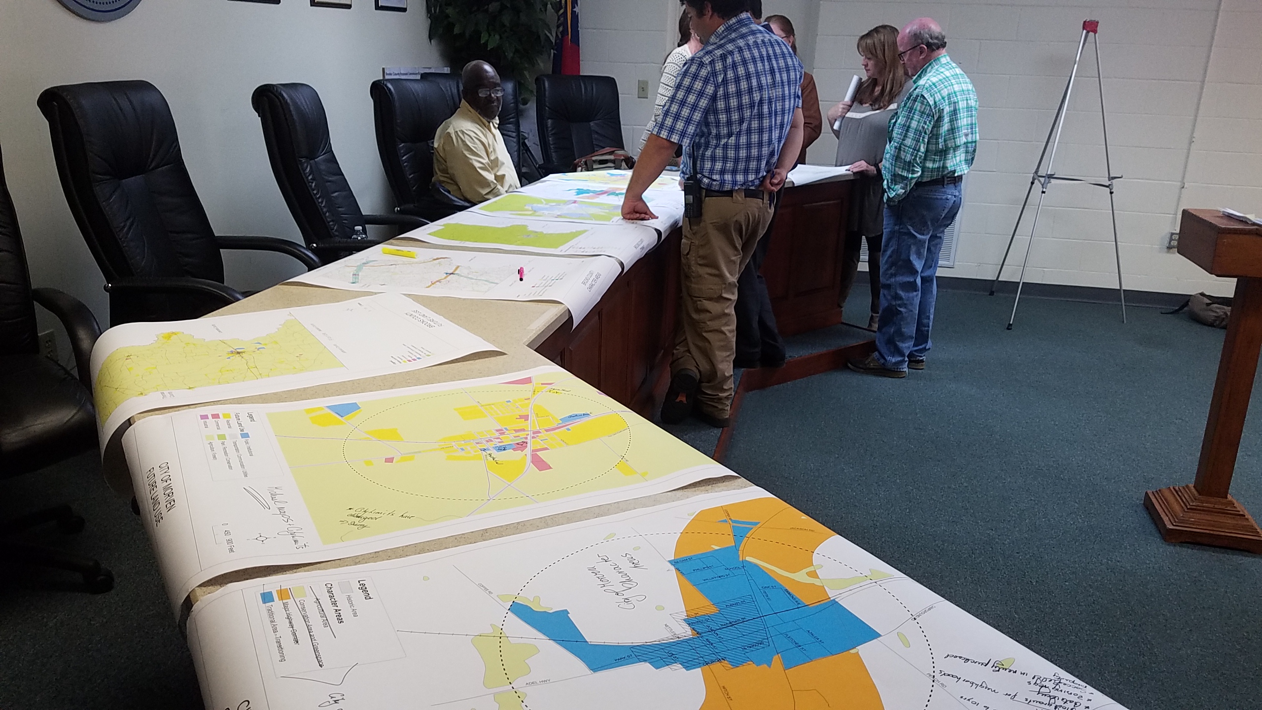
Brooks County Comprehensive Plan Workshop

More about that in a previous post.

 -jsq, John S. Quarterman, Suwannee RIVERKEEPER®

You can join this fun and work by becoming a WWALS member today!

Workshop, Greater Brooks 2030 Comprehensive Plan, 2017-02-07

First on the list of Areas Requiring Special Attention in Brooks County, Georgia:

  • Areas of significant natural or cultural resources, particularly where they are likely to be intruded upon or otherwise impacted by development; such as wetlands, groundwater recharge areas and river corridors.

/pictures/2007-01-01--brooks-compplan/[Map D-4 Water Resource Protection Districts]
Map D-4 Water Resource Protection Districts

According to Ariel Godwin of the Southern Georgia Regional Commission,

The next workshop for the Brooks County Comprehensive Plan will be:

Thursday, February 7th, 2017
9:30 a.m
Brooks County Commission Offices
610 South Highland Street, Quitman

In this workshop we will work on the Land Use Maps and Character Areas.

We are inviting you to participate to ensure Continue reading

GA-EPD found Sabal Trail right of way violation 2016-12-14

Georgia EPD found Sabal Trail out of its right of way at Okapilco Creek in Brooks County, and an enforcement action is being prepared. This was while investigating the possible wetlands and water violations reported by WWALS. So reports do sometimes work, although sometimes for violations different than the ones you thought you were reporting.

Update 21 Dec 2016: Please report potential violations.

This afternoon GA-EPD called me to provide a preliminary report on what they found when they inspected the possible violations WWALS reported December 8th 2016. The call came from Tommy W. Fowler, Program Manager, Southwest District, Georgia Environmental Protection Division (GA-EPD). These are my notes on what he said, in order from the WWALS complaint filing: Continue reading

Sabal Trail at Okapilco Creek 2016-12-06

Update 2016-12-08: Complaint filed with GA-EPD, USACE, FERC: PDF.

Movie: Red pipe, Okapilco Creek, Little Creek, Coffee Road, w. of GA 333, 30.9182490, -83.5904850 We didn’t see any silt fences where Sabal Trail has red pipe laid out across Okapilco Creek and Little Creek, north of Coffee Road, west of GA 333 in Brooks County, Georgia, between Barwick and Barney.

Red pipe, Okapilco Creek Middle Bridge, Sabal Trail,
Red pipe, Okapilco Creek Middle Bridge, Sabal Trail, 30.9174160, -83.5892520

Continue reading

Sabal Trail requests variance to Colquitt County, GA creek 2016-10-17

Monday Sabal Trail asked FERC to add a contractor yard in Colquitt County, and to change routing under a small stream. No rush: Sabal Trail wants approval by tomorrow, Thursday, October 20th 2016. Presumably because they’re racing hell-for-leather to meet their May 2017 in-service drop-dead date, after which (according to FPL’s RFP) they could forfeit a $200 million bond or lose the contract.

Here, courtesy of Lowndes Area Knowledge Exchange (LAKE), are Sabal Trail’s October 17th 2016 maps of that stream, plus Sabal Trail’s April 2016 maps of where it wants to cross the stream it flows into, Hog Creek and that stream’s downstream Okapilco Creek.

We’ve already seen where Sabal Trail is drilling under the Withlacoochee River between Valdosta and Quitman, Georgia and under the Suwannee River in Suwannee River State Park. Plus there’s an encampment of water protectors in Suwannee County.

Contractor Yard CY3-6

Continue reading