Tag Archives: Irwin County

Ockolocoochee, Little River 1889-01-29

Who knows the Ockolocoochee River? No, not the Ochlockonee River; that’s a bit to the west.

[Withlacoochee River labeled Suwanee R. in 1823 Irwin and 1834 Lowndes County maps; current WWALS Withlacoochee and Little River Water Trail map]
Withlacoochee River labeled Suwanee R. in 1823 Irwin and 1834 Lowndes County maps; current WWALS Withlacoochee and Little River Water Trail map

You do know the Ockolocoochee River as the Little River, of the Withlacoochee, of the Suwannee.

Here is news from 1889 that also includes the boat that didn’t survive from Troupville to Ellaville, which was apparently not a paddlewheel steamer. Continue reading

Ockolocoochee, Little River 1889-01-29

Update 2023-12-28: Revised version..

Who knows the Ockolocoochee River? No, not the Ochlockonee River; that’s a bit to the west. You do know the Ockolocoochee River as the Little River, of the Withlacoochee, of the Suwannee. Here is news from 1889 that also includes the boat that didn’t survive from Troupville to Ellaville, which was apparently not a paddlewheel steamer.


Irwin County, 1885a, GeorgiaInfo, Rand McNally Map of Georgia, 1885

Atlanta Constitution, January 29, 1889, Pg 12., quoted in Ray City History Blog, 18 October 2010, More About Troupville, GA and the Withlacoochee River,

THE WITHLACOOCHEE RIVER.

VALDOSTA, Ga., January 19. -[Special.]- Away up near the northern limit of the great wiregrass section there is a big cypress swamp. They call them bays there. From this bay emerges Continue reading

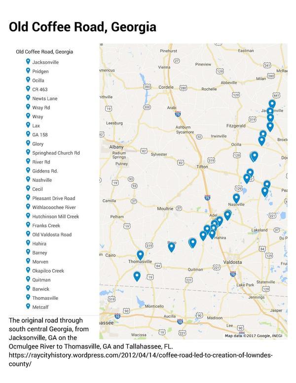
Old Coffee Road, Georgia

The Google map of locations on Old Coffee Road was used by many of the early settlers of south central Georgia, including in the watersheds of the Willacoochee, Alapaha, Withlacoochee, and Little Rivers and Okapilco Creek. It crossed all those and other waterways by ford or private ferry: there were no bridges back then.

Old Coffee Road map, WWALS.net
Follow this link for the interactive google map.

The Georgia Historical Commission erected markers at half a dozen locations in the 1950s and 1960, reading: Continue reading

Deserter Lake in Alapaha Wildlife Management Area

Update 2016-10-20: WMA check-in hunt does not count towards Georgia bag limit.

WWALS member Patrick Kunes took this video of Deserter Lake in Irwin County on the Alapaha River in the new Alapaha River Wildlife Management Area (WMA) on the Alapaha River betweeen Tifton and Ocilla. You can hear him talking about turkeys he saw, and you can see the lake on the river. He mentions deadfalls, which are a common feature on the upper Alapaha River. The river itself is not really boatable up that far much of the year, but lakes like this one often still have water. Many such lakes do not have public access, but Deserter Lake does now. This lake is upstream from the formal start of the Alapaha River Water Trail (ARWT), but we’ve included it in the online material about the ARWT because Deserter Lake is in the new Alapaha WMA.

Patrick wrote about this video: Continue reading

WWALS Outings, Rivers, and Pipeline on Chris Beckham drive-time radio WVGA 105.9 FM 8:00 7:30 AM 2016-09-02

8AM Friday morning WWALS will be on Chris Beckham’s drive-time radio show. WWALS president John S. Quarterman will be talking about Saturday morning’s Suwannee River paddle outing and other outings upcoming on the Alapaha and Withlacoochee Rivers, along with other developments on the Alapaha River Water Trail and the Withlacoochee and Little River Water Trail, along with many other things WWALS does. Plus what you can do about the FERC rubberstamp of the Sabal Trail fracked methane pipeline drilling under the Withlacoochee and Suwannee Rivers.

When: 8:00 7:30AM Friday September 2nd 2016

Where: Continue reading

Alapaha River Wildlife Management Area

Update 2017-04-28: Sandhills and wildlife at Alapaha WMA
WWALS is gratified that people are contacting us about the WMA, but we’re just reporting on it, we do not run it.
Contact information for the Alapaha WMA:
Greg Nelms, Wildlife Biologist, Game Management, Wildlife Resources Division, GA-DNR
(229) 426-5267 | M: (404) 985-6424

Update 2016-10-20: WMA check-in hunt does not count towards Georgia bag limit.

Update 2016-10-18: Video of Deserter Lake in the Alapaha WMA and hunting dates and bag limits.

Halfway between Tifton and Ocilla on the Alapaha River in Irwin County, apparently announced only by a public hearing in July about hunting reglations: Line Map: Alapaha River WMA the new 7,000-acre Alapaha River Wildlife Management Area (WMA). There’s an information kiosk off of US 319. , with the sign-in kiosk and campground across the WMA: from Ocilla take US 319 S, left onto Hawthorn Ln, right onto Palm Rd, right onto Farm Rd.
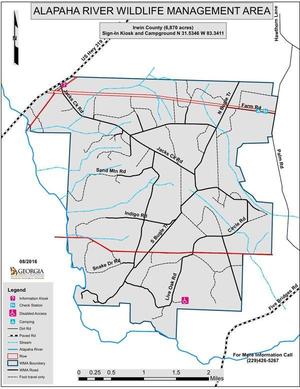
Update 2016-08-30: According to Greg Nelms, Wildlife Biologist, DNR, the main entrance will be off of US 319; there is already a WMA sign there. It’s not quite open yet; they’re still working on roads. A ribbon cutting is scheduled for September 30th. The first hunting season will be an archery hunt on October 1st; hunters can go in at noon the previous day to set up stands.

Here’s the announcement of the public hearing: GA DNR/Wildlife Resources Division/Game Management, 6 July 2016, Proposed Regulations for Alapaha River WMA; Public Hearing Scheduled,

The new regulations, probably adopted unchanged, and which seem to consist of dates and conditions for hunting seasons for various game animals, are online here.

Several maps are linked in for Continue reading

Alapaha River precipitation and levels

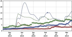
300x153 90 Days Levels Graph, in Alapaha River Levels and Precipitation, by USGS, for WWALS.net, 7 March 2015 Rainfall can be quite different in Statenville on the Alapaha River as shown here than in Valdosta on the Withlacoochee River. But remember half of Valdosta drains into the Alapaha River watershed.

Here are rainfall and water level graphs from the three USGS Alapaha River gauges in Georgia. The Florida gauge is shown separately, because it use a different base level, and precipitation doesn’t seem to be available from Florida gauges. See also always-current graphs of all the levels. Continue reading

Alapaha River water levels

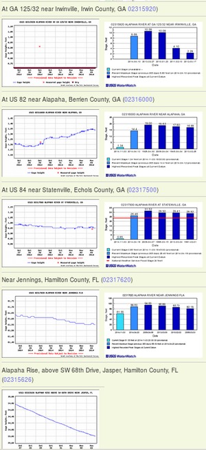
300x655 Example 2014-11-03, in Alapaha River Water Levels, by John S. Quarterman, for WWALS.net, 3 November 2014 Update 2016-12-23: graphs from water.weather.gov.

Update 2016-05-31: See sea level gage reports.

Update 2015-04-28: Added flood stages and tentative highest safe and lowest boatable water levels, both above the charts for each gauge and in a summary table. If you have data, please let us know.

Here are water level gauges for the Alapaha River in Georgia and Florida, north to south. The graphs should show the current levels at this time, in feet, plus for most of the gauges a bar graph of selected historic levels.

This is a draft of a concept for use with the Alapaha River Water Trail. See also Alapaha River Rainy Season.

It is also a companion to the similar set of graphs for the Withlacoochee and Little Rivers.

See below for the current Alapaha River water level graphs. Continue reading