Tag Archives: Turner County

Ashburn spilled sewage three times in September 2020-09-27

Update 2020-10-17: Very clean Withlacoochee River 2020-10-15.

Ashburn, Georgia, spilled 210,000 gallons of raw sewage spread over three times in September and the public only got notified Wednesday, four weeks after the first spill. There’s not enough water quality testing data downstream from those spills to know what effects they may have had for example on Reed Bingham State Park.

[Charts and Map: Ashburn spills to GA-FL line]
Charts and Map: Ashburn spills to GA-FL line

Ashburn spilled once into Hat Creek, which runs into the Alapaha River, and twice from its MLK Lift Station into a tributary of Ashburn Branch, which runs into the Little River. We don’t have any data downstream on the Alapaha for that time period, so we don’t know anything about downstream effects. We do have quite a bit of downstream data for the other two spills, but so far downstream and with so many other things going on that it’s hard to tell if there were any effects showing up in that data.

About the only thing we know for sure is it would be great for Ashburn to get a grip on its chronic sewage spill problem, starting by at least reporting spills in a timely manner. That and it would be great if the state of Georgia or the federal government would resume testing on the Little and Alapaha Rivers as they apparently used to do up until about 1998, so we would know, for example, did this spill affect Reed Bingham State Park.

These are the spills, as reported in the Georgia Environmental Protection Division (GA-EPD) Sewage Spills Report. WWALS commends GA-EPD for those online reports. GA-EPD can’t publish spills until it receives reports from the spilling organizaiton. Maybe Ashburn could be a bit more timely in reporting. Continue reading

Source of the Little River 2020-02-27

The source of the Little River (of the Withlacoochee) is in those trees.

[From Warwick Hwy @ CR 16, 31.749923, -83.767258]
From Warwick Hwy @ CR 16, 31.7499230, -83.7672580

I took this picture from Warwick Highway (CR 249) where CR 16 (Charlie Lamb Road) joins it, in Turner County, Georgia. Perhaps another time I will have time to Continue reading

Ashburn, GA, spilled at top of Little River Basin 2019-01-22

Another Georgia city at the top of the Alapaha River Basin seemed to have fixed its problems, yet it spilled again: Ashburn, in Turner County.

2015 through 2019-01-22, Spills
See also table.

The Georgia Environmental Protection Division (GA-EPD) used to know that this Ashburn Airport WPCP and its Hat Creek are in the Alapaha River Basin in the Suwannee River Basin: PUBLIC NOTICE NO. 2017–02 ML JANUARY 20, 2017,

I. NOTICE OF APPLICATION FOR A NATIONAL POLLUTANT DISCHARGE ELIMINATION SYSTEM (NPDES) PERMIT TO DISCHARGE TREATED WASTEWATER INTO WATERS OF THE STATE OF GEORGIA

NPDES permits are valid for a maximum Continue reading

WWALS Outings, Rivers, and Pipeline on Chris Beckham drive-time radio WVGA 105.9 FM 8:00 7:30 AM 2016-09-02

8AM Friday morning WWALS will be on Chris Beckham’s drive-time radio show. WWALS president John S. Quarterman will be talking about Saturday morning’s Suwannee River paddle outing and other outings upcoming on the Alapaha and Withlacoochee Rivers, along with other developments on the Alapaha River Water Trail and the Withlacoochee and Little River Water Trail, along with many other things WWALS does. Plus what you can do about the FERC rubberstamp of the Sabal Trail fracked methane pipeline drilling under the Withlacoochee and Suwannee Rivers.

When: 8:00 7:30AM Friday September 2nd 2016

Where: Continue reading

Video: Steam engine, bridges, trees, beaches, and trash: Alapaha River by Diane Shearer

Also boating, deadfalls, steam engine, and rapids. Diane Shearer presented slides about the Alapaha River of her homeland, 31 March 2012 at Georgia River Network Weekend for Rivers, and said:

Right there at Alapaha, where it’s been clearcut behind it. This is one of the main problems of the river: there used to be nothing on that shore there but huge cypress trees and tupelo trees, and that’s almost gone everywhere. And that’s one of the great dangers to this river, is agricultural runoff, the fact that people can suck all the water out of it they want to, for irrigation and those sorts of things.

The video starts Continue reading

Grants to clean up two creeks in south Georgia

Funds are available for farmers, ranchers, and forest owners to help clean up two creeks in WWALS watersheds: Deep Creek in Turner County, a tributary of the Alapaha River, and Piscola Creek in Thomas and Brooks Counties, a tributary of the Withlacoochee River. The deadline for applications is May 16th.

WCTV via AP 5 April 2104, Georgia to Clean Up Waterways, Continue reading

Pipeline alternate route still in WWALS watersheds, plus Tifton and Valdosta

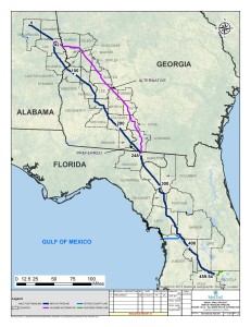
The Hillabee alternative route runs right down the middle of the WWALS watersheds, through Worth County, Turner County, Tift County, Colquitt County, Cook County, and Lowndes County in Georgia, and Hamilton County, Madison County, and Suwannee County in Florida. This puts it not only still in the Withlacoochee River watershed, but also in the Little River and Alapaha River watersheds. This route by the pipeline company Sabal Trail Transmission (owned and managed by Spectra Energy) avoids Albany but apparently goes through Tifton and Valdosta and still through Lowndes County before entering Florida in Hamilton County much like Spectra’s preferred route.

Hillabee (Valdosta and Tift County) Route Alternative, Georgia

This alternate route is the rest of the Option B that was first proposed to Lowndes County residents back in June: Continue reading