Update 2017-05-17: OK, the water’s gotten too low at the original location, so we’re moving downstream to
Woods Ferry Tract Launch to Suwannee Springs.
Update 2017-05-15: The water’s low, but so far it’s a go, plus it’s Hands across the Sands on the Suwannee against the Sabal Trail fracked methane pipeline and for solar power.
Update 2017-04-06: SRWMD tells us Blue Sink Launch is closed, so we’ll be taking out nearby at Swift Creek Launch.
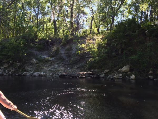
Join WWALS for a brief paddle 8 miles on the Suwannee River through White Springs down to Blue Sink Swift Creek Launch.
This shouldn’t take more than 4 hours paddling or 5 hours including shuttle.
With lunch, swim stops, and bon-bons, of course.
Bring the usual personal flotation device, boat paddles, food, drinking water, warm clothes, and first aid kit.
If you don’t have a boat, there are many outfitters, or let us know and many of us have spare boats.
When: 9AM Saturday 20 May 2017
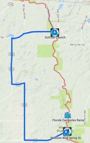
Put In: Suwannee River Wayside Park Ramp, river mile 171.0
From White Springs, travel south on US 41 to the river; the
ramp is on the south side in the town park.
GPS:
30.3255398,-82.7413685
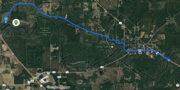
This map drawn using landing directions from the
Suwannee River Wilderness Trail map of
Boat Ramps & Canoe Launches
and SRWMD’s Blue Sink, Rocky Creek, Swift Creek.
Duration: 5 hours
Events:
facebook, meetup.
Free: This outing is Free!
And we recommend you support the work of WWALS by
becoming a WWALS member today!
Shuttle Distance: Continue reading →

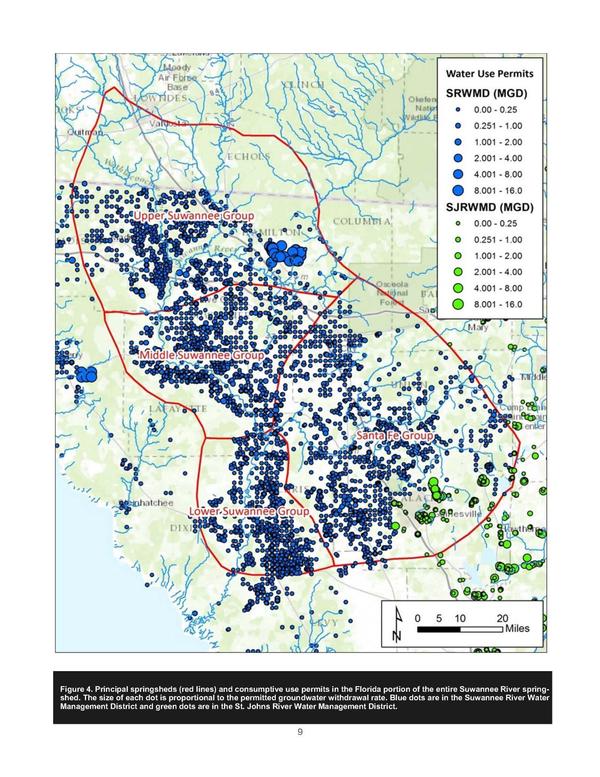
 A suggestion: say what it is you’d like the EPA, GA-EPD, FDEP, etc. to actually do.
And what I’d suggest is get them all to fund and implement regular, frequent,
closely spaced, water quality monitoring along all the rivers in the
Suwannee River Basin.
That way we’d know where pollution is coming from,
we’d be able to calibrate what cities including Valdosta say from
their own monitoring, and we’d have baselines to compare to.
A suggestion: say what it is you’d like the EPA, GA-EPD, FDEP, etc. to actually do.
And what I’d suggest is get them all to fund and implement regular, frequent,
closely spaced, water quality monitoring along all the rivers in the
Suwannee River Basin.
That way we’d know where pollution is coming from,
we’d be able to calibrate what cities including Valdosta say from
their own monitoring, and we’d have baselines to compare to.