Tag Archives: WLRWT

Ellaville Westlake & Jennings RR Bridge and Lee Bowstring Bridge, Withlacoochee River @ FL 141 2022-11-26

Ken Sulak, retired from USGS, is a bubbling spring of information about old bridges and ferries in Florida. Here’s what he sent recently about three Withlacoochee River bridges: a railroad bridge and two road bridges.

[EWJ RR Pillar and Lee Bowstring Bridge Lally column; Photos: Ken Sulak]
EWJ RR Pillar and Lee Bowstring Bridge Lally column; Photos: Ken Sulak

You can see two of them on the WWALS paddle from Allen Ramp on the Withlacoochee River to Suwannee River State Park, 2023-02-04. Continue reading

Allen Ramp to SRSP, Withlacoochee River, 2023-02-04

Update 2023-02-02: An hour later: Allen Ramp to SRSP, Withlacoochee River 2023-02-02.

Double Door Spring is an awesome thing to see for those who haven’t seen this part of the wild and beautiful Withlacoochee River. We will pass numerous rocky shoals requiring some skills so this outing may not be appropriate for beginners and young children. There are many other clear springs to explore.

When: Gather 8 AM, launch 9:30 AM, end 3 PM, Gather 9 AM, launch 10:30 AM, end 4 PM, Saturday, February 4, 2023

Put In: Allen Ramp, 2726 SW 64th Way Jasper, FL 32052, in Hamilton County, Florida.

GPS: 30.449167, -83.221328

Take Out: Suwannee River State Park Ramp, Left bank of the Suwannee River, upstream from Withlacoochee River Confluence, 3631 201st Path, Live Oak, FL 32060, in Suwannee County, Florida.

Bring: the usual personal flotation device, boat, paddles, food, drinking water, warm clothes, and first aid kit. Also trash pickers and trash bags: every WWALS outing is also a cleanup. Mosquitoes can be bad at dusk so come prepared.

Free: This outing is free to WWALS members, and $10 (ten dollars) for non-members. You can pay the $10 at the outing, or online:
https://wwals.net/outings

Plus $5 per vehicle parking fee payable at SRSP.

We recommend you support the work of WWALS by becoming a WWALS member today!
https://wwals.net/donations
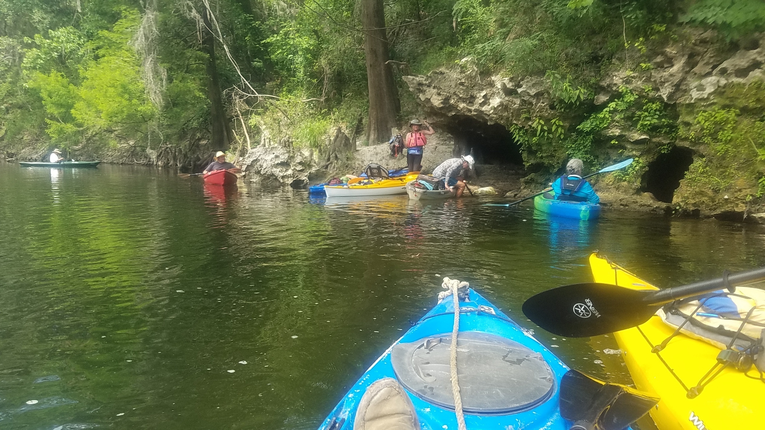
Double Door Spring, Withlacoochee River, Photo: John S. Quarterman 2019-06-01

Continue reading

Troupville at flood with dogs 2022-01-20

Me and the dogs were curious to see what the site of future Troupville Nature Park looked like at high water.

[Collage, Troupville River Park site, 2022-01-20]
Collage, Troupville River Park site, 2022-01-20

We did not make any exciting new discoveries; we just went to see how far we could go south and east at that water level. Well, we did find plenty of trash of various kinds.

The water level has been higher, but it was pretty high:

  • 14.5′ (147.3′ NAVD88) on the Folsom Bridge Gauge (Little River @ GA 122).
  • 14.16′ (124.56′ NAVD88) on the Valdosta Gauge (Withlacoochee River @ US 41 or North Valdosta Road)

Many pictures are on the WWALS website.

You can trace our path be the loop of binoculars on this Continue reading

Trash cans at Freedom Park 2022-11-21

Bobby McKenzie reported yesterday, “I’m at Freedom Park and what is new? I count 11 trash receptacles strategical placed in the baseball parking lot….guess what in them..😆 trash”

[Trash cans at Freedom Park 2022-11-21]
Trash cans at Freedom Park 2022-11-21

Imagine that: trash cans in a parking lot, like Valdosta city ordinances require.

And people do use them. Continue reading

Creeks bad, OK River Water Quality 2022-11-13

Apparently the rain Thursday did not have much effect, although there were E. coli hot spots when we tested again Sunday. The Withlacoochee River from GA 133 on down seems OK for swimming, fishing, and boating, although there’s not much water until you get farther down than that.

[Chart, Creeks and Rivers, Swim Guide, 2022-11-13]
Chart, Creeks and Rivers, Swim Guide, 2022-11-13

Looks like the Withlacoochee River is also OK from Skipper Bridge on down, except Langdale Park Boat Ramp tested very high. Also, upstream Franklinville Landing was too high. Continue reading

Pictures: Hahira Veterans Day Parade 2022-11-11

I didn’t know there was a Hahira Veterans Day Parade.

Turns out that’s because there wasn’t one since the 1950s, until Friday. WWALS was invited to participate, so we did.

[Hahira Veterans Day Parade, WWALS Booth, Inside]
Hahira Veterans Day Parade, WWALS Booth, Inside

Among the many WWALS members who are veterans, Vanessa and Nick Kroening rode in the parade with their children Jonah and Primrose. Continue reading

WWALS at Hahira Veterans Day Parade 2022-11-11

Update 2022-11-13: Pictures: Hahira Veterans Day Parade 2022-11-11.

WWALS was invited to participate in the annual Hahira Veterans Day Parade. Some WWALS veterans will be in the parade; others are invited to help at the WWALS booth.

All WWALS members are also invited to help at the booth.

When: Gather 8 AM, launch 10 AM, end 11 AM, Friday, November 11, 2022

Put In: Downtown Hahira, between the Little and Withlacoochee Rivers, on the Withlacoochee and Little River Water Trail.

Event: facebook,

[WWALS at Hahira Veterans Day Parade]
WWALS at Hahira Veterans Day Parade

Continue reading

Troupville River Park Kiosk 2022-07-02

A tour around the future site of Troupville River Camp and River Park, at and near the Little River Confluence with the Withlacoochee River, just west of Valdosta, on GA 133 at Val Tech Road, off of I-75 Exit 18. Included are some more pictures of that old dam site and the likely location of the Thomasville Stage Road Bridge on the Little River. Withlacoochee River pictures include the proposed takeout for Troupville River Camp, a slough, and several cleared deadfalls. Plus Old Broad Street. All this could go on a kiosk for Troupville River Park.

[Collage, Troupville, 2022-07-02]
Collage, Troupville, 2022-07-02

Using datapoints from this and other walkarounds, this map includes the apparent routes of two streets of old Troupville, the seat of Lowndes County before Valdosta: Continue reading

It’s Crawford Branch next to Skipper Bridge, Withlacoochee River

Phillip Williams has the answer to the first question about the creek that gushes out of the woods into the Withlacoochee River just downstream of Skipper Bridge Road: “For most of the 1800s, it was called Shanks Mill Creek after James D Shanks, who owned a fair bit of land in the area and had a mill a bit further up the run of the creek. By 1908, it was called Crawford Branch. The Crawford family moved to the area in 1866 and purchased the land from the heirs of James D Shanks.”

[Map: Shanks Mill next to Crawford Branch, in WWALS WLRWT map]
Map: Shanks Mill next to Crawford Branch in the WWALS map of the Withlacoochee and Little River Water Trail.

Phillip has also provided the approximate location of Shanks Mill: “”The deeds suggest somewhere in the WH of LL 99. LD 11. I have been locating it about here based upon the geography.” You can see it on the map above, behind Ziegler’s Auto Body Shop, about where there are dams now on a feeder creek.

How does Phillip know all this? Continue reading

What is this creek next to Skipper Bridge, Withlacoochee River? 2022-11-03

Update 2022-11-07: It’s Crawford Branch next to Skipper Bridge, Withlacoochee River 2022-11-03.

Just south (downstream) of Skipper Bridge, left (east) bank, Withlacoochee River: what is this creek gushing water during a drought?

[Pictures, Map]
Pictures, Map

Where is all that water coming from? It was really flowing Thursday, after no rain for weeks. Continue reading