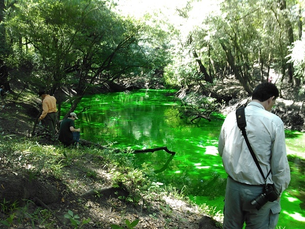
The Alapaha River is an intermittent river for its last eighteen miles.
A river is a natural watercourse, usually freshwater, flowing towards an ocean, a lake, a sea, or another river. In some rare cases a river could flow into the ground and dry up completely at the end of its course, without reaching another body of water.
—River, on Wikipedia
-
Alapaha River Sink
About 1600 feet south of Jennings Bluff Launch
the Alapaha River disappears into a sinkhole, except with very high water.
According to Alan Cressler, whose picture is used below with permission:
At low water levels, all the water in the Alapaha River sinks into a cave system.
The cave is developed in the Oligocene age Suwannee Limestone. There is no dry passage. To the best of my knowledge, the water is not seen again until it reaches the Alapaha Rise Spring on the north side of the Suwannee River about twenty miles away. That spring is a large tannin spring.
A dye test into the Dead River Sink in June 2016 came back up in the Alapaha River Rise and Holton Bluff Spring several days later.
-
Alapaha River Rise, 30° 26′ 20.3" N 83° 05′ 22.4" W. About 600 feet north of the Suwannee River, near Gibson Park Ramp, the Alapaha River comes out of a spring. According to Springs Fever: A Field & Recreation Guide to 500 Florida Springs, 2nd Edition, by Joe Follman and Richard Buchanan,
From Madison, take U.S. 90 east 2-3 miles until the fork with State Road 6. Take SR6 east, across the Withlacoochie[sic] River, and proceed about 12 miles to County Road 751. Turn right and drive about four miles to Suwannee River. Take boat ramp at Hutch Gibson Park (on the NW side of the river), and canoe upriver about ¼ mile. A few hundred feet past the CR751 bridge, you will see water rushing out with great force on the left — it is the mouth of the spring run.
For maps, latitude/longitude data, driving directions, satellite imagery, and topographic representations as well as weather conditions at this spring, go to Greg Johnson’s informative “Florida Springs Database” web site at the following address: http://www.ThisWaytothe.Net/springs/floridasprings.htm#Florida
Material found by Chris Graham. See also more Alapaha Underground material.
And don’t forget upriver a bit, the WWALS August Outing, Alapaha River @ Hotchkiss Crossing Lanier Side to 84 Bridge.
Short Link:

