
This Sunday afternoon, Oct 26th at 2PM:
where the Dead River meets the Alapaha River and goes underground
at the Dead River Sink, aka the Alapaha Sink.
 Park on SRWMD’s Jennings Bluff Tract and walk in with WWALS
to see what Samuel Taylor Coleridge dreamed as
“Where Alph, the sacred river, ran
Through caverns measureless to man
Down to a sunless sea.”
No boat required: this is a walking outing.
Park on SRWMD’s Jennings Bluff Tract and walk in with WWALS
to see what Samuel Taylor Coleridge dreamed as
“Where Alph, the sacred river, ran
Through caverns measureless to man
Down to a sunless sea.”
No boat required: this is a walking outing.
It’s an adventure, as Deanna Mericle reported recently:
…the hike to the sink does have some steep parts, especially if you go the scenic route, which I recommend. The area around the sink itself is kind of steep with slick mud/clay. So wear good shoes for hiking. There were only a few Mosquitos. The area is beautiful and worth the effort.
This event is FREE! All we ask is
 that you are a current member of WWALS Watershed Coalition. If not, its easy to join online today at
/donations/.
You do not have to be a member to come on this outing.
If you like the experience, we recommend that you join to
support the efforts of WWALS.
WWALS is an advocacy organization working for watershed conservation
of the Willacoochee, Withlacoochee, Alapaha, and Little River Systems
watershed in south Georgia and north Florida through awareness,
environmental monitoring, and citizen advocacy.
that you are a current member of WWALS Watershed Coalition. If not, its easy to join online today at
/donations/.
You do not have to be a member to come on this outing.
If you like the experience, we recommend that you join to
support the efforts of WWALS.
WWALS is an advocacy organization working for watershed conservation
of the Willacoochee, Withlacoochee, Alapaha, and Little River Systems
watershed in south Georgia and north Florida through awareness,
environmental monitoring, and citizen advocacy.
The Alapaha Sink is one of the sites on the Alapaha River Water Trail that WWALS is developing. Thanks to Hamilton County Tourist Development Council and Board of Commissioners for their support for the Water Trail. Your membership can help support WWALS as it develops the Alapaha River Water Trail.
Directions
Location: 30°34’01.3″N 83°02’21.1″W or 30.567035, -83.039202 (thanks to Great Florida Birding & Wildlife Trail).
Here are directions from Lakeland, GA, Tifton, GA, Valdosta, GA, Gainesville, Fl, Live Oak, Fl, Tallahassee, Fl, and Jacksonville, Fl.
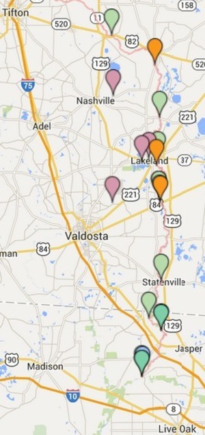
Once you get to Suwannee River Water management District (SRWMD)’s Jennings Bluff Tract, you can see on the map below that you then drive about another mile north to get to Jennings Bluff Launch, and keep going for another half mile or so to park near the Sink.

Directions from Lakeland, GA or Statenville, GA
Head south on GA-135 S
Continue onto State Hwy 141
Entering Florida
1.6 mi
Turn left onto U.S. 41 S/Plum St
Continue to follow U.S. 41 S
3.2 mi
Turn left onto NW 25 Ln
Destination will be on the right
Directions from Tifton, GA:
Follow I-75 S to NW Co Rd 143/Hamilton Ave in Jennings. Take exit 467 from I-75 S
64.0 mi / 53 min
Take U.S. 41 S to NW 25 Ln
7.0 mi / 13 min
Turn left onto NW Co Rd 143/Hamilton Ave
Continue to follow NW Co Rd 143
1.5 mi
Turn right onto U.S. 41 S/Plum St
Continue to follow U.S. 41 S
3.2 mi
Turn left onto NW 25 Ln
Destination will be on the right
Directions from Valdosta, GA:
Same as for Tifton, GA.
Or go south on US 41 instead.
Directions from Gainesville, FL, Lake City FL, etc.:
Head north on I-75, and then the same as for Tifton, GA.
Directions from Jacksonville, FL:
Head west on I-10,
Turn north on I-75
Then the same as for Tifton, GA.
Directions from Live Oak, FL:
Follow US-129 N and FL-6 W to NW 76 Terrace in Hamilton County
24.3 mi / 30 min
Drive to NW 25 Ln
2.2 mi / 5 min
Turn right onto NW 76 Terrace
0.9 mi
Turn right onto NW 25 Ln
Destination will be on the right
Directions from Tallahassee, FL:
Follow I-10 E to FL-14 E in Madison County. Take exit 251 from I-10 E
48.4 mi / 40 min
Take FL-6 E to NW 25 Ln in Hamilton County
31.8 mi / 41 min
Turn left onto FL-14 E (signs for Madison)
3.7 mi
Continue straight onto S Range St
0.5 mi
Turn right onto Base Street
299 ft
Continue onto FL-10 E/US-90 E/E Base St
Continue to follow FL-10 E/US-90 E
2.2 mi
Slight left onto FL-6 E (signs for Jasper)
21.4 mi
Turn left onto U.S. 41 N
1.9 mi
Turn right onto NW 76 Terrace
0.9 mi
Turn right onto NW 25 Ln
Destination will be on the right

-jsq
Short Link:
Pingback: Alapaha Sink: WWALS Outing 2PM 26 Oct 2014 - WWALS Watershed Coalition