Update 2021-03-09: The funding cost per gauge has gone up, to $22,500, of which usually the USGS contributes about $900.
How much would it cost
to fund the Okapilco Creek gage so it won’t go offline July 31st?
 About
$13,600/year, more or less, mostly for field and office labor
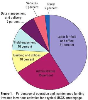
and administration, with only 10% for the field equipment.
Since this gage is located in Brooks County, Georgia,
the most likely funding body (after USGS itself)
would be the Brooks County Commission.
Yes, it’s in WWALS watersheds; no, WWALS doesn’t plan to take on
funding streamgages. If some funding organization appeared
that wanted to pass the funds through WWALS, which is a 501(c)(3)
educational institution, that would be possible.
But this seems more like a government issue.
Costs
U.S. Geological Survey, Fact Sheet 2010-30, June 2010, Streamgage Operation and Maintenance Cost Evaluation
Forty-one percent of the funding for the typical USGS streamgage is for labor costs of the USGS staff responsible for the measurement of the streamflow in the field and the time in the office to quality assure and finalize the data (fig. 1)….
However, actual costs are specific to a particular streamgage and can vary substantially depending on location and operational issues.
Location
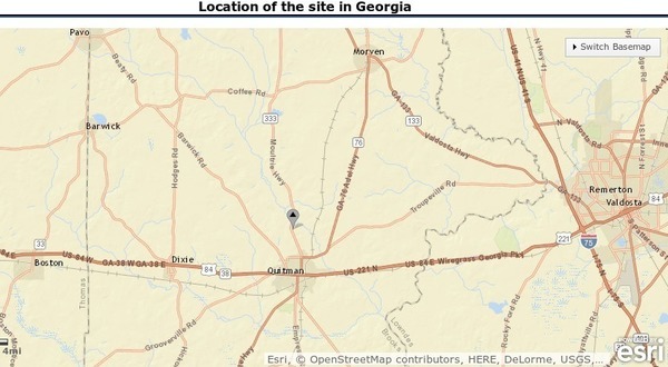
USGS says this gage is located at the GA 333 bridge over Okapilco Creek, just north of Quitman in Brooks County, Georgia. 30°49’32” N 83°33’45” W (30.825556, -83.562500), elevation 104.1 feet. It’s been reporting discharge since 1979 and water levels since 1999.
Okapilco Creek Watershed
 Okapilco Creek
starts in Turner County, runs through Moultrie in Colquitt County,
then Quitman in Brooks County, before joining the Withlacoochee River
at the Lowndes County line.
See the red line on the USGS Streamer map.
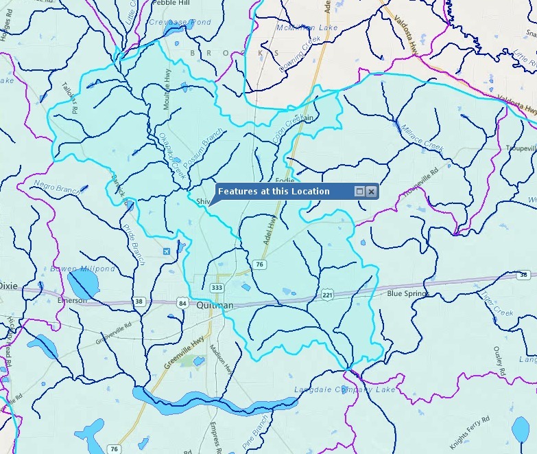
And see below the watershed of Lower Okapilco Creek according to EPA MyWaters Mapper.
This is all solidly in the Withlacoochee River watershed of WWALS original territory.
The Okapilco Creek gage is listed among eleven gages on the Withlacoochee and Little River Water Trail Map and listed for real-time viewing among live water level charts for the Withlacoochee and Little Rivers.
Lowndes County GA 122 Little River streamgage cost
The Lowndes County Commission pays annually for a USGS gage at GA 122 on the Little River. While that Commission is famously unwilling to publish details of what it’s voting on, for its 22 and 23 September 2014 meetings Lowndes Area Knowledge Exchange (LAKE) filed an open records request and got the board packet including three pages about the Little River USGS Stream Gauge”.
6.e. Little River USGS Stream Gauge
![[6.e. USGS Funding Agreement for Hwy 122 Stream Gauge]](https://www.l-a-k-e.org/govt/loco/2014-09-22--commission-packet/small/SCAN1020.jpg)
![[6.e. Joint Funding Agreement (1 of 2)]](https://www.l-a-k-e.org/govt/loco/2014-09-22--commission-packet/small/SCAN1021.jpg)
![[6.e. Joint Funding Agreement (2 of 2)]](https://www.l-a-k-e.org/govt/loco/2014-09-22--commission-packet/small/SCAN1022.jpg)
The agenda packet sheet says
The cost has remained unchanged since the original installation in 2009.
The first of two pages of the USGS Joint Funding Agreement says
Amount $13,600.00
So it seems safe to assume the annual cost of the Okapilco Gage would be about $13,600 a year.
Who will pay this cost for accurate forecasting of Okapilco Creek and Withlacoochee River water levels and flood prediction?
-jsq
Short Link:


Pingback: Flooding charts: Withlacoochee and Little Rivers - WWALS Watershed Coalition
This seems like a problem that should be able to be worked out, assuming there are not other issues that we are not privy to. Certainly if the office personnel are there anyway, they can either train a volunteer ‘citizen scientist’, or 2 or 3, or revisit how they came to this breakdown. Using the government scale to attribute work, I’m sure it works out somewhat higher than it actually is.
SWWMD did away with their funding share of the voluntary sampling project a few years ago for the same stated reason, yet the remaining personnel still are answerable to the public. Yet spend millions for their CEOs to drive across the state for meetings at which they announce after much study and debate that the water levels may be down because there has been less rainfall.