Update 2017-10-29: Meet at VSU CORE.
A first for WWALS: an urban cleanup! One Mile Branch runs right through the heart of the biggest city in the Suwannee River Basin (Valdosta) and through the biggest educational institution in the Basin (Valdosta State University). It has some trash, and you can help WWALS come get it!
When: 10AM, Saturday, November 11, 2017
Where: One Mile Branch, through the heart of Valdosta and VSU.
Meet:
VSU CORE, 1300 Sustella Ave., Valdosta, GA
31698
(This is a WWALS event; we’re just meeting in CORE’s parking lot.)

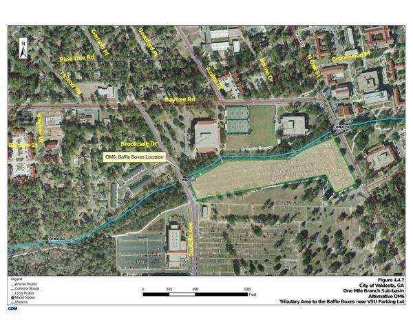
Map: Brookdale Drive and VSU parking lot
Hosts: Scotti Jay and Dan Phillips
Contact: Scotti Jay, whose idea this outing was
Boats: Not on this outing, although it would be interesting if we find some segment of One Mile Branch that is boatable for later use.
Bring: Gloves, boots, sturdy clothing, trash pickers, and we’ll supply trash bags.
Start:
Currently figuring on starting at Drexel Park or VSU.
Stay tuned in case we decide to go upstream first. We’re meeting at VSU CORE.
Springs and Waterfalls: Maybe Scotti Jay will show us where he has found springs and waterfalls on One Mile Branch.

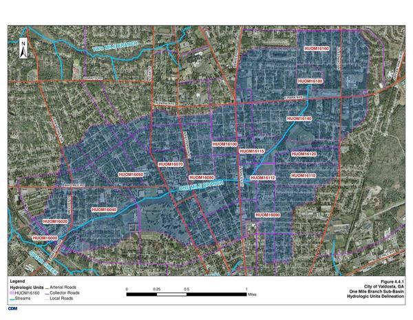
Aerial Map: One Mile Branch HUCs
What:
One Mile Branch
runs through the
 middle of Valdosta, south across Park Avenue, through Vallotton Park, across Ashley Street,
through Drexel Park (where we did water quality training years ago), across Patterson Street,
through VSU, across Oak Street, W. Gordon Street, and the railroad, through Remerton, ending up in
Sugar Creek back of Target.
Sugar Creek goes into the Withlacoochee River, and then the Suwannee River and the Gulf of Mexico,
so One Mile Branch is on the Withlacoochee and Little River Water Trail
and on the WLRWT map.

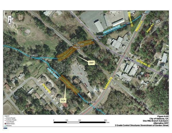
Map: Gordon Street, Lankford Drive, Sugar Creek
Azalea City Trail: One Mile Branch is paralleled by the Azalea City Trail, usable by pedestrians and bicyclists, which would provide a way to get from spot to spot. Dan Phillips when he worked for Valdosta was involved with cleaning up the Azalea City Trail.
Sewage Spills: Maybe we can get Valdosta Utilities to point out the sites of the numerous sewage spills into One Mile Branch, such as in October 2015, in in February 2016, and in April 2016.
Force Main and Still Sewage Spills:

Overview of Pump Satation and Force Main Work
More: Most of the above maps are from Section 4.4 One Mile Branch in Valdosta Stormwater Management Plan.
Armistice Day: Please also remember that day is Armistice Day or Veteran’s Day. On the eleventh hour of the eleventh day of 1918, the Armistice was signed that ended World War I.
-jsq, John S. Quarterman, Suwannee RIVERKEEPER®
You can join this fun and work by becoming a WWALS member today!
Short Link:


