
Update 2025-10-07: Public Hearing, Bradford Road subdivision @ Berrien Planning Commission 2025-10-16.
I handed this letter to the Berrien Planning Commissioners and the Zoning Administrator before I spoke to them at the recent Public Hearing. They tabled this item for another month, awaiting more documents from the applicant, Cole Livingston, for his proposal to subdivide for ten houses in an agricultural character area on Bradford and Strawder Roads and Old Valdosta Highway, in Berrien County, Georgia, draining to Gin Branch Creek and the Withlacoochee River.
![[Water issues, Bradford Road subdividing, WWALS 2025-09-18, to Berrien Planning Commission]](https://www.wwals.net/pictures/2025-09-18--wwals-berrien-co-bradford-road/many.jpg)
Water issues, Bradford Road subdividing, WWALS 2025-09-18, to Berrien Planning Commission
September 18, 2025
To: Teresa Willis
Berrien County Zoning Administrator
229-686-2149
twillis@berriencountyga.gov
201 N. Davis Street Room 122
Nashville GA 31639Re: Subdividing M&P 061-14-000, 061-16-002, Old Valdosta Rd. & Bradford Rd.
Dear Berrien County Zoning Administrator and Planning Commission,
Please recommend denial of the proposed subdividing, because:
- House lots would produce more runoff, which would run onto neighboring properties, as attested by several neighbors at the previous Public Hearing on August 21, 2025. See attached LIDAR map and attached wetland and flood zone map.
- Runoff would carry trash and other contamination into Gin Branch Creek that runs north across Bradford Road and west into the Withlacoochee River. See attached map of Gin Branch Creek.
- Under Bradford Road and along Gin Branch Creek is an aquifer recharge zone, into the groundwater from which we all drink. We do not need to risk more contaminants possibly getting into that. See attached aquifer recharge map.
- Increased traffic and runoff would erode Bradford and Strawder Roads, requiring more work by the county to fix them.
- The houses would not be accessory to farm operations as in the Berrien County Comprehensive Plan Strategy for an Agriculture Character Area, which says: “Preserve the rural/agricultural character of these areas by maintaining very low-density residential development primarily accessory to farm operations and large lot sizes.”
- A subdivision in an agricultural area in my experience leads to trespassers, poachers, four-wheelers in fields, trash into fields, people calling the fire department every time someone does a prescribed burn.
- Residents of this subdivision will expect the roads to be paved at county expense.
- This subdivision would cost more in services than it would bring in in taxes: for Sheriff and Fire on call, and especially for school buses and places in school for the students; see “The Local Government Fiscal Impacts of Land Use in Lowndes County: Revenue and Expenditure Streams by Land Use Category,” Jeffrey H. Dorfman, Ph.D., Dorfman Consulting, December 2007.
http://loco.quarterman.org/docs/Lowndes-Report-Final.pdf- This subdivsion would serve as a precedent for more subdivisions.
I ask the Planning Commission to recommend denial, and I ask the Berrien County Commissioners to deny the subdividing needed for this subdivision.
For the rivers and the aquifer,
John S. Quarterman
[signed]
Suwannee Riverkeeper
229-560-4317Attachments:
- LIDAR map
- Flood zone and county wetlands map
- Map of Gin Branch Creek
- Aquifer recharge map
![[Please recommend denial of the proposed subdividing, because: 2025-09-18 --WWALS to Berrien Planning Commission]](https://www.wwals.net/pictures/2025-09-18--wwals-berrien-co-bradford-road/2025-09-18--WWALS-Berrien-County-Bradford-Road-0001.jpg)
Please recommend denial of the proposed subdividing, because: 2025-09-18 –WWALS to Berrien Planning Commission
PDF
![[LIDAR map, state of Georgia, 2018-10-08 - May 25, 2022]](https://www.wwals.net/pictures/2025-09-18--wwals-berrien-co-bradford-road/2025-09-18--WWALS-Berrien-County-Bradford-Road-0002.jpg)
LIDAR map, state of Georgia, 2018-10-08 – May 25, 2022
![[Flood zone and county wetlands map, 2025-09-18 --Berrien County Property Appraiser]](https://www.wwals.net/pictures/2025-09-18--wwals-berrien-co-bradford-road/2025-09-18--WWALS-Berrien-County-Bradford-Road-0003.jpg)
Flood zone and county wetlands map, 2025-09-18 –Berrien County Property Appraiser
![[Map of Gin Branch Creek, 2025-09-18 --WWALS Withlacoochee and Little River Water Trail]](https://www.wwals.net/pictures/2025-09-18--wwals-berrien-co-bradford-road/2025-09-18--WWALS-Berrien-County-Bradford-Road-0004.jpg)
Map of Gin Branch Creek, 2025-09-18 –WWALS Withlacoochee and Little River Water Trail
![[Map of Aquifer Recharge Zones, 2025-09-18 from Georgia Department of Community Affairs]](https://www.wwals.net/pictures/2025-09-18--wwals-berrien-co-bradford-road/2025-09-18--WWALS-Berrien-County-Bradford-Road-0005.jpg)
Map of Aquifer Recharge Zones, 2025-09-18 from Georgia Department of Community Affairs
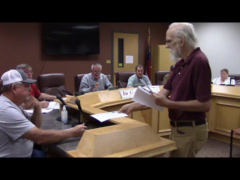
This is the WWALS video of what I said. See also the WWALS videos of the entire Public Hearing.
Maps
![[Map: LIDAR 2018-10-08 --GA 3 DEP]](https://www.wwals.net/pictures/2025-09-18--wwals-berrien-co-bradford-road/2018-10-08--map-lidar-ga-3dep.jpg)
Map: LIDAR 2018-10-08 —
GA 3 DEP
![[Legend: LIDAR 2018-10-08 --GA 3 DEP]](https://www.wwals.net/pictures/2025-09-18--wwals-berrien-co-bradford-road/2018-10-08--legend-lidar-ga-3dep.jpg)
Legend: LIDAR 2018-10-08 –GA 3 DEP
![[Map: Flood Zone, County Wetlands, 2025-09-18 --Berrien County Property Appraiser]](https://www.wwals.net/pictures/2025-09-18--wwals-berrien-co-bradford-road/2025-09-18--map-flood-zone-county-wetlands-berrien-property-appraiser.jpg)
Map: Flood Zone, County Wetlands, 2025-09-18 —
Berrien County Property Appraiser
![[Map: Gin Branch Creek, Bradford Road, 2025-09-18 --WLRWT]](https://www.wwals.net/pictures/2025-09-18--wwals-berrien-co-bradford-road/2025-09-18--map-gin-branch-creek-bradford-road-wlrwt.jpg)
Map: Gin Branch Creek, Bradford Road, 2025-09-18 —
WLRWT
![[Map: Aquifer Recharge, 2015-09-22 -GA-DoC]](https://www.wwals.net/pictures/2025-09-18--wwals-berrien-co-bradford-road/2015-09-22--map-aquifer-recharge-ga-doc.jpg)
Map: Aquifer Recharge, 2015-09-22
—
GA-DoC
BNOVR
![[Context, Public Notice, Old Valdosta Road, 2025:09:08 10:16:20, 31.0338147, -83.2644698 --jsq for WWALS]](https://www.wwals.net/pictures/2025-09-18--wwals-berrien-co-bradford-road/20250908_101620.jpg)
Context, Public Notice, Old Valdosta Road, 2025:09:08 10:16:20, –jsq for WWALS 31.0338147, -83.2644698
-jsq, John S. Quarterman, Suwannee RIVERKEEPER®
You can help with clean, swimmable, fishable, drinkable, water in the 10,000-square-mile Suwannee River Basin in Florida and Georgia by becoming a WWALS member today!
https://wwals.net/donations/
Short Link:
Pingback: Road costs, well risks, taxpayers should decide –Lisa Sumner for Wayne Nash 2025-09-18 | WWALS Watershed Coalition (WWALS) is Suwannee RIVERKEEPER®
Pingback: Videos: Bradford Road subdividing @ Berrien Planning Commission 2025-09-18 | WWALS Watershed Coalition (WWALS) is Suwannee RIVERKEEPER®
Pingback: Public Hearing, Bradford Road subdivision @ Berrien Planning Commission 2025-10-16 | WWALS Watershed Coalition (WWALS) is Suwannee RIVERKEEPER®