WWALS test results from US 41 above Valdosta down to Cleary Bluff below Allen Ramp and nearly to the Suwannee, plus Troupville Boat Ramp on the Little River,
are all clean for Thursday, July 15, 2021. Continue reading →
The miners finally responded to GA-EPD’s questions from April
about more information for the five permit applications
to strip mine titanium far too near the Okefenokee Swamp.
Checking today with Georgia Environmental Protection Division Deputy Director John Eunice,
it will probably take several weeks for EPD’s Mining group to review the documents.
If EPD finds documents or information still missing, they may ask Twin Pines Minerals, LLC, for more.
When at some point EPD finds enough information to call it a complete application,
they will announce a Public Hearing with a public comment period.
The miners’ recent documents contain plenty of reasons to reject the permits,
including they say themselves they didn’t answer all the questions, and they keep sending maps including land owned by TIAA as part of their mine site after TIAA rejected that many months ago.
Our most recent songwriter wrote his song yesterday and sent it in.
Come on, songwriters, make the competition fierce for that $300 cash First Prize,
with $300 equivalent in studio time!
And for the $50 prize for best song from within the Suwannee River Basin,
and $50 for best song from without.
And for the plaques for best in each song genre.
Everybody else, tickets will be on sale soon, to listen to our two headliners, Scott Perkins and his band Little Perks in Paradise from Atlanta, and Valdosta’s own Dirty Bird and the Flu. Each of the three judges will also play, even before we get to the finalists and the judging.
With food by Hibachi Hwy and drinks by The Pour House.
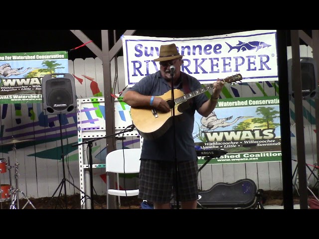
Scott Perkins singing Hoochie Coochie for the Withlacoochee, Suwannee Riverkeeper Songwriting 2020
Videos by Phillip Plumlee and John S. Quarterman for WWALS Watershed Coalition (WWALS),
Turner Center Art Park, Valdosta, Georgia, August 22, 2020.
I add up 358,525 gallons of sewage spilled at Mildred Street into Knights Creek in the Alapaha River Basin
and 355,875 gallons at Wainwright Drive into Onemile Branch in the Withlacoochee River Basin.
Those totals are each since 2015, according to records from the Georgia Environmental Protection Division (GA-EPD).
I haven’t added up spills from all the other locations that are on the Rehab lists.
I would hope there are not many that have spilled more than a third of a million gallons of raw sewage.
How many gallons does it take to get on Valdosta’s rehab list?
It’s also interesting that these lists include for almost every manhole
specific street addresses.
Unlike the vague “1200 block” addresses Valdosta puts in its sewage spill press releases,
and often in its spill reports to GA-EPD.
Speaking of which, despite Valdosta’s assurances that it had reported at least the two biggest spills of July 7th to GA-EPD,
there is still nothing about any of those in GA-EPD’s Sewer Spills Report.
WWALS Watershed Coalition was started after organizers were
concerned about sewage spills, and roads being closed because of
trees being down in the river.
Most of that was in the Withlacoochee River around 2009, but the Alapaha River
did have water quality issues back then.
The organization came to the Atkinson County Board of Commissioners
to thank them for the Alapaha River Water Trail contribution.
In 2018 commissions passed a resolution supporting the water trail.
This trail runs for more than 100 miles on the Alapaha River all the
way down to Florida.
Atkinson County has one landing on Georgia 135 that’s called
Willacoochee [Landing].
According to John Quarterman, the Watershed Coalition has expanded
its organization and is now tests waters to make it safer for people
to swim and fish.
Valerie Folsom, who tests in Atkinson County at Willacoochee Landing @ GA 135,
also spoke to the Atkinson County Commission about
the latest test results. Continue reading →
Tropical Storm Elsa washed E. coli into the Withlacoochee River,
according to WWALS test results for Thursday, July 8, 2021.
Some of it probably came from
Valdosta’s more than half a dozen sewage spills.
But that wasn’t the only source, since WWALS found bad water quality starting at Hagan Bridge @ GA 122 and US 41, well upstream from Sugar Creek.
Hagan Bridge is even upstream of Cat Creek, through which Moody Air Force Base’s Beatty Branch spill would reach the Withlacoochee.
So some of this is probably more of the usual cattle, hog, horse, etc. manure being washed into the river.
However, WWALS found much worse water quality at GA 133, downstream of Sugar Creek.
So possibly Valdosta’s 45,532 gallons of raw sewage into Twomile Branch
and 44,448 gallons into Onemile Branch, which both flush through Sugar Creek,
had some ill effect on the Withlacoochee River.
For Knights Ferry, Nankin, and State Line Boat Ramps, Valdosta’s own results for Wednesday
already showed too much E. coli, and the WWALS results for Thursday at Nankin and
State Line were no better.
WWALS did get acceptable results at Cleary Bluff, downstream of Allen Ramp,
but that may be just because the contamination had not washed down there yet.
For the Little River, WWALS got too-high E. coli at Troupville Boat Ramp, but acceptable upstream at Folsom Bridge Landing @ GA 122.
For the Alapaha River, results were good at Willacoochee Landing @ GA 135 Wednesday,
and acceptable at Lakeland Boat Ramp @ GA 122 Thursday.
We have no data downstream of where the 320 gallons of Valdosta sewage on MLK Drive
might have flushed down Duke Bay Canal, Mud Swamp Creek, and the Alapahoochee River
into the Alapaha River just upstream of Sasser Landing, but that was a very small amount.
So if you want to boat this weekend, I’d recommend the Alapaha River or upstream on the Little River,
but not the Withlacoochee River.
The Valdosta spills actually add up to 90,300 gallons of raw sewage from seven locations, mostly in the Withlacoochee River Basin, but one into the Alapaha River Basin.
Or more spills, since we have a report of one more that the city limed
but did not include in its list of spills.
The Starke spills apparently came from six locations, probably adding up to 45,000 gallons of raw sewage, all uphill from
Alligator Creek 00277787, above Lake Rowell, Lake Sampson, Sampson River, Santa Fe River.
Still, the good news is that there were no spills from Valdosta’s two wastewater treatment plants, and the new WWTP catch basin is only half full (so far).
Plus, the Mayor of Valdosta called to let us know about these spills.
And he says the notorious Wainwright Drive manhole on Onemile Branch is finally getting some attention.
Oh, and for once there was no spills reported on Mildred Street.
Here is the Valdosta Press Release about their spills.
I have added which [waterbody] the spill was on or uphill from.
GA-EPD still has not posted Valdosta’s spill reports in the GA-EPD Sewage Spills Report.
The WWALS maps show where the spills were, as near as I could read the tea leaves of Valdosta’s vague “200 block” location reporting.
They know the exact latitude and longitude of the affected manholes.
Why don’t they include that?
Note that Valdosta’s list does not include a spill that Valdosta limed, between Continue reading →
The good news: there were no spills from Valdosta’s two wastewater treatment plants, and the new WWTP catch basin is only half full (so far).
Plus, the Mayor of Valdosta called to let us know about these spills.
The bad news:
Valdosta spilled 89,980 gallons of raw sewage from at least six manholes, and Starke spilled probably 40,000 gallons or more from at least six locations.
At least one of the Valdosta spills was from a repeated spill offender
we have complained about many times: Wainwright Drive on Onemile Branch.
The other Valdosta spills apparently went into either Twomile Branch or Sugar Creek upstream from the Withlacoochee River,
and two possibly into creeks in the Alapaha River Basin.
Can’t tell without more precise locations.
A press release is expected soon from Valdosta.
I will probably follow up with that and which waterways were affected.
Maybe GA-EPD will post Valdosta’s spill reports in the GA-EPD Sewage Spills Report.
The Starke spills were all into or near
Alligator Creek 00277787, into Lake Rowell, Lake Sampson, Sampson River, Santa Fe River.
Rescheduled, to this new date of the last Saturday in July!
Join us for an approximately three-mile hike down the Dead River to the Dead River Sink, where the Alapaha River goes underground much of the year.
We will be led by Practicing Geologist Dennis J. Price of Hamilton County, Florida.
He will explain the geology, and how unusual this place is:
there’s nothing like it in Florida (or Georgia).
When:
Gather 9:00 AM, launch 9:15 AM, end 12:15 PM, Saturday, July 10, 2021
Put In:
Jennings Bluff Launch.
From Jennings, Hamilton County, FL, travel south on US 41 to NW 25 Lane; turn left; travel east to NW 82 Court and the entrance into the Suwannee River Water Management District’s Jennings Bluff tract; turn left and follow road to canoe launch.
Bring: drinking water, snacks, and first aid kit.
Also trash pickers and trash bags: every WWALS outing is also a cleanup.
Free: This outing is free to WWALS members, and $10 (ten dollars) for non-members.
You can pay the $10 at the outing, or online:
https://wwals.net//outings
Elsa has downgraded to Tropical Storm again, and is late for landfall.
As of 8 AM this morning Elsa is 35 miles west of Cedar Key,
according to the
National Hurricane Center.
Pretty much everything in Cedar Key is closed today.
The storm track has moved slightly west.
“On the forecast track, Elsa will make landfall along the north
Florida Gulf coast by late this morning or this afternoon.”
Late morning would be high tide, making storm surge worse.
Elsa is still predicted to move north up the Suwannee River Valley,
where county offices are closed today all the way up into Georgia.
Then over the Okefenokee Swamp Thursday,
on up the Georgia coast, but now somewhat inland, with tropical storm warnings most of the way, and storm surge warnings for the Georgia coast through Charleston, S.C.
And on up the eastern seaboard, inland until Virginia, onwards to the Canadian Maritimes by Saturday.
West coast of Florida from the Middle of Longboat Key to the
Aucilla River, including Tampa Bay
A Hurricane Warning is in effect for…
West coast of Florida from Chassahowitzka to the Steinhatchee
River
A Tropical Storm Warning is in effect for…
West coast of Florida from south of Chassahowitzka to the Middle
of Longboat Key
West coast of Florida north of the Steinhatchee River to
Ochlockonee River
Mouth of St. Marys River, Georgia to Little River Inlet, South
Carolina
A Tropical Storm Watch is in effect for…
North of Little River Inlet, South Carolina to Chincoteague,
Virginia
Pamlico and Albemarle Sounds
…
Interests elsewhere in the Carolinas, the mid-Atlantic coast,
southeastern New England, and the Canadian Maritimes should
monitor the progress of Elsa.

![[Chart, Withlacoochee River scenes, Swim Guide]](https://www.wwals.net/pictures/2021-07-15--wq/many.jpg)
![[Upon completion; Okefenokee Swamp, Suwannee and St Marys Rivers; TIAA land still in mining site maps]](https://www.wwals.net/pictures/2021-06-25--tpm-response-ga-epd/many.jpg)
![[Current Rehab list; already rehabilitated lists]](https://www.wwals.net/pictures/2021-07-13--valdosta-manhole-list/many.jpg)
![[Willacoochee Landing @ GA 135, Alapaha River Water Trail, Suwannee Riverkeeper at Atkinson County Commission, Reporter Typhani Gray and Tester Valerie Folsom, ARWT road sign]](https://www.wwals.net/pictures/2021-07-09--fox31-wwals-arwt-atkinson-co/many.jpg)
![[Bad Chart, Little, Withlacoochee, Alapaha Rivers, Swim Guide]](https://www.wwals.net/pictures/2021-07-08--wq/many.jpg)
![[Valdosta spills, Starke spills and mines]](https://www.wwals.net/pictures/2021-07-08--sewage-spills-valdosta-starke/many.jpg)
![[Closed manhole at 1208 Wainwright Drive]](https://www.wwals.net/pictures/2020-06-02--one-mile-branch-spill/5219.jpg)
![[Karst limestone cracks by the Alapaha River, Dead River, Sink, Dennis J. Price]](https://www.wwals.net/pictures/2021-07-10--hike-dead-river-sink/many.jpg)
![[Jennings Bluff Tract sign, 11:42:18, 30.5670965, -83.0388653]](https://www.wwals.net/pictures/2018-01-27--hike-dead-river-sink/20180127_114218.jpg)
![[5-day Cone No Line And Wind]](https://www.wwals.net/pictures/2021-07-07--elsa/115653_5day_cone_no_line_and_wind.jpg)