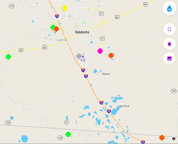
Update 2025-02-08: Withlacoochee River and New River clean, Sugar Creek Dirty 2025-02-06.
Finally! Valdosta Utilities got OK water quality results for Sugar Creek at Gornto Road, for the first time since the November 6-7, 2024, flash flood. Apparently the bypass is working.
WWALS got OK results for the New Little River south of Tifton and the Alapaha
River at US 82, GA 122, and US 84.
Valdosta Utilities got OK results for the Withlacoochee River at US 41, good at GA 133, and OK at US 84.
However, Valdosta Utilities got too-high results at Knights Creek at Inner Perimeter Road. I wonder if there is a Sewage Spill warning sign there?
No new sewage spills have been reported in the last week in Georgia or Florida.
No rain is predicted for the next nine days, with balmy weather this weekend.
So happy fishing, swimming, paddling, and boating this weekend!
Or join us next weekend for a chainsaw cleanup on Saturday, January 8.
https://wwals.net/?p=66873
Or another one on Sunday, January 9.
https://wwals.net/?p=66892
![[Clean New, Withlacoochee, Alapaha Rivers 2025-01-30, Sugar Creek finally OK 2025-01-28]](https://www.wwals.net/pictures/2025-01-29--wq/many.jpg)
Clean New, Withlacoochee, Alapaha Rivers 2025-01-30, Sugar Creek finally OK 2025-01-28

![[Trash down ditch beside Family Dollar, Inner Perimeter]](https://www.wwals.net/pictures/2022-08-08--trash-family-dollar-inner-perimeter-valdosta/many.jpg)

