Update 2019-07-24: Free to everyone!
Come help WWALS clean up at Franklinville Landing at Tyler Bridge on Franklinville Road on the
Withlacoochee River,
and on adjoining private land, courtesy of the landowner.
Per our usual arrangement, Lowndes County Public Works will come
get the trash after we bag it and set it on the public road right of way.
We will also visit the nearby monument to Franklinville, which was the county seat of Lowndes County before Valdosta and before Troupville.
When:
9 AM, Saturday, August 3, 2019
Gather at:
Franklinville Landing, 6560 Franklinville Road, Hahira, GA 31632. in Lowndes County.
Be sure to get to Franklinville Road from the west, from Skipper Bridge Road; you can’t get to the clean up site from Cat Creek Road.
From Valdosta, go north on N. Oak Street Extension,
which becomes Cherry Creek Road and then Staten Road.
After you cross the Withlacoochee River on Staten Road,
turn right on the next paved road, which is McMillan Road.
Turn left onto Skipper Bridge Road.
After 2.4 miles, turn right onto Franklinville Road,
which is a dirt road.
Continue to Tyler Bridge, which is closed,
so you can’t miss it because you can’t go any further.
From Hahira, go east on GA 122, after 4.2 miles turn right onto Skipper Bridge Road, and after 0.9 miles turn left onto dirt Franklinville Road.
GPS:
30.981249, -83.268027
Take Out:
Same.
Bring: Cleanup materials will be provided,
but if you’ve got a trash picker, bring it along.
No boat required, although you can bring one to paddle up and down if you want to.
Free: This outing is free to WWALS members, and $10 (ten dollars) for non-members everyone!
We recommend you support the work of WWALS by
becoming a WWALS member today!
For those interested, afterwards go to Langdale Park Boat Ramp
for an additional cleanup.
That is downstream on the Withlacoochee River, also on the Withlacoochee and Little River Water Trail.
Event: facebook,
meetup
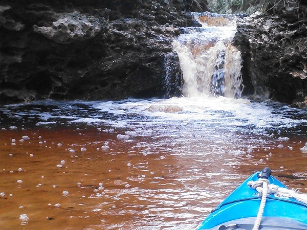
![[Downstream from bridge, 13:38:58, 30.981386, -83.267655]](https://www.wwals.net/pictures/2018-02-11--hagan-bridge-franklinville/20180211_133858.jpg)
Downstream from bridge, 13:38:58,,
2018-02-11
30.9813860, -83.2676550,
Continue reading →

![[Collage]](https://www.wwals.net/pictures/gretchen/2019-03-23--wwals-alapaha-mayday/many.jpg)
![[Trees saluting the moon]](https://www.wwals.net/pictures/2019-07-16--banks-lake-moon/20190716_212216.jpg)
![[Moon paddlers]](https://www.wwals.net/pictures/2019-07-16--banks-lake-moon/20190716_205647.jpg)
![[Ronnie, Shirley, Fountain, 13:50:02, 30.6253002, -83.0480667]](https://www.wwals.net/pictures/2019-07-06--statenville-sasser-pictures/20190706_135002.jpg)
![[Among paddlers]](https://www.wwals.net/pictures/2019-05-18--banks-lake-full-flower-moon-paddle/20190518_195826.jpg)
![[Osprey, nest, bird watcher]](https://www.wwals.net/pictures/2019-05-18--banks-lake-full-flower-moon-paddle/20190518_202721.jpg)
![[Luna paddler]](https://www.wwals.net/pictures/2019-05-18--banks-lake-full-flower-moon-paddle/20190518_213118.jpg)