
Update 2019-02-02: Delayed a day until Sunday morning.
Update 2019-01-31: We’re paddling unless it rains or the river rises, and thanks to The Langdale Company for a better takeout.
A long and rarely-paddled stretch with a confluence, some creeks, some wastewater treatment plants we won’t see and we hope we don’t smell, some shoals, and a challenging takeout. Bonus old bridge if we want to paddle down a bit farther and back.
When: Gather 9:30 AM, launch 10:30 AM, Saturday, February 2, 2019
Put In: Troupville Boat Ramp, 19664 Valdosta Hwy, Valdosta, GA 31602. On GA 133 off I-75 exit 18. The entrance off GA 133 is directly across from Val Tech Road.
Take Out: Just downstream from Spook Bridge on the Lowndes County riverbank, thanks to The Langdale Company.
US 84 Landing, 5092 US 84 W, Valdosta, GA 31601.
Between the twin highway bridges on the Lowndes County side. Problematical access from busy highway right of way. Also known as Quitman Landing.
Bring: a rope, in case we need to drag boats over shoals. Clippers for deadfall branches would also be useful. Plus the usual personal flotation device, boat paddles, food, drinking water, warm clothes, and first aid kit. Also trash pickers and trash bags: every WWALS outing is also a cleanup.
Free: This outing is free to WWALS members, and $10 (ten dollars) for non-members. We recommend you support the work of WWALS by becoming a WWALS member today!

Photo: John S. Quarterman, of
US 84 bridge downstream from above middle of river, 2017-05-21.
Shuttle distance: 13.7 mi one way
Shuttle duration: 40 minutes total
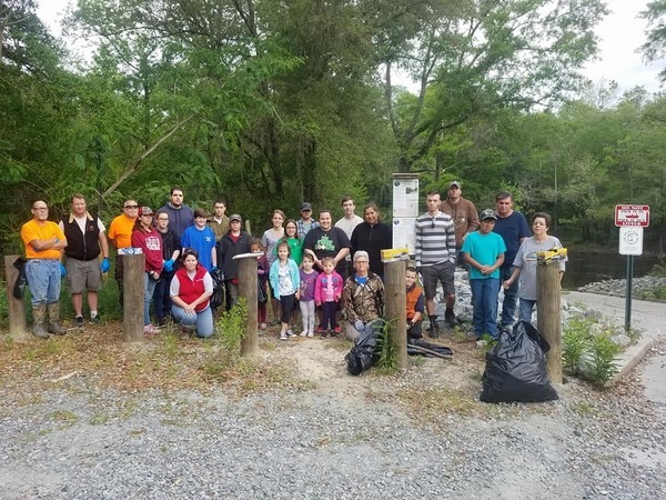
At
Troupville Boat Ramp, 2018-04-21,
by the
signs for the Withlacoochee and Little River Water Trail (WLRWT)
that
Phil Hubbard planted the day before.
Paddle distance: 11 miles
Paddle duration: 4 hours
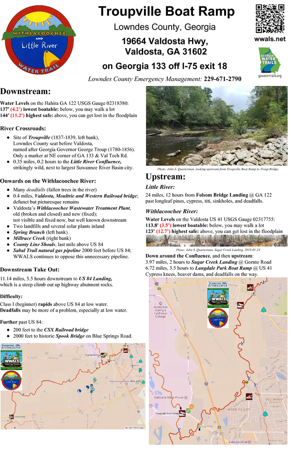
WWALS sign with upstream and downstream maps and text, at
Troupville Boat Ramp,
for the
Withlacoochee and Little River Water Trail,
planted
by Phil Hubbard 2018-04-20.
Host: Tom H. Johnson Jr.
Contact: Tom H. Johnson Jr.
Little River Confluence with Withlacoochee River: 30.847172, -83.347652. About 2300 feet downstream from Troupville Boat Ramp, the Little River joins the Withlacoochee River, although it looks like it’s the other way around.
![[Confluence, 09:41:49, 30.8471348, -83.3473936]](https://www.wwals.net/pictures/2018-10-13--troupville-cleanup-pictures/20181013_094149.jpg)
Photo: John S. Quarterman.
The Little River comes in from the right of the picture,
joining the Withlacoochee River, which comes in from the left
and continues through the top of the picture.
Little River Confluence, 2018-10-13 30.8471348, -83.3473936
Loch-Winn Creek: 30.841839485460575, -83.350515114396657. A few thousand feet farther downstream, a creek comes out of Loch-Winn Farms.
VMW Railroad Bridge: 30.841114, -83.35347. Only a few more thousand feet downstream from the Confluence, we’ll see what we can see of the Valdosta, Moultrie and Western Railroad Bridge (Closed 1923, now defunct).
Valdosta’s Withlacoochee Wastewater Treatment Plant (WWTP): We won’t see from the water the most notorious things along this stretch of the rivers: Valdosta’s old and new WWTPs, with a long history of spills, apparently (we hope) finally fixed now.
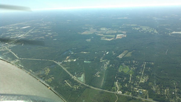
Photo: John S. Quarterman, looking south across GA 133,
with Troupville Boat Ramp center left, Little River Confluence with Withlacoochee River, Old WWTP center, New WWTP above it to the right, and landfills closed and open,
on WWALS Southwings flight 2018-10-22.
Wetherington Creek: 30.837028818801393, -83.364229114375377. That’s what we’re calling the creek that drains the WTPs; we may be able to spot it coming out of the swamps after a hair-pin river bend.
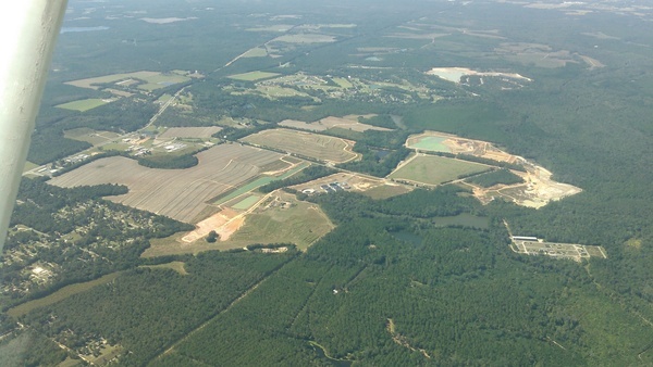
Photo: John S. Quarterman, of Old and New WWTP,
on WWALS Southwings flight 2018-10-22.
Landfills: Beyond the old and new WWTP are the old, closed, Veolia Pecan Row Landfill with PCBs, coal ash, and superfund wastwater in it, and the currently open Evergreen Landfill. Those landfills are drained by a the tiny creek that apparently has no official name, that we call Landfill Run, and which drains into….
Spring Branch: 30.828306, -83.385303, which we may spot a bit downstream on the Withlacoochee River.
Not visible in these pictures are numerous solar panels Valdosta since placed on top of the old WWTP site and next to the new WWTP.
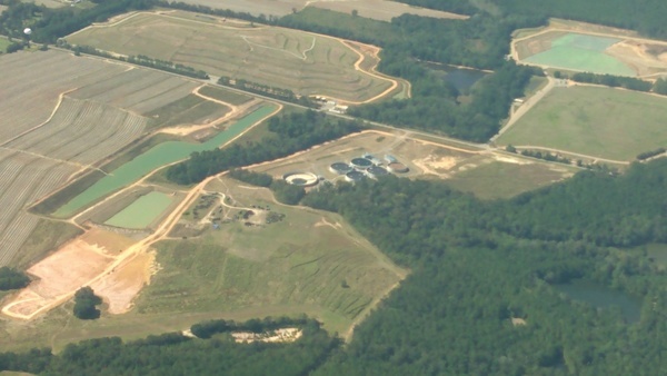
Photo: John S. Quarterman, New WWTP
on WWALS Southwings flight 2018-10-22.
Sabal Trail: What is that yellow thing in the river? It’s a frac-out, where the Sabal Trail pipeline blew drilling mud from its pilot hole up into the river.

Aerial photo: Dominick Gheesling using Phil Hubbard’s camera,
Yellow thing in Withlacoochee River, 30.7958970, -83.4530590, 2016-10-22.
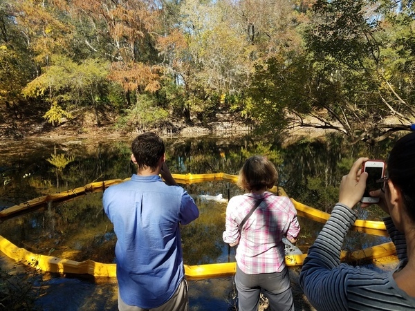
Photo: John S. Quarterman, of
media at Sabal Trail frac-out site, 2016-11-16.
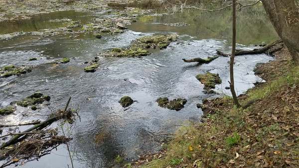
Shoals: Starting about a mile above US 84, we call them County Line Shoals.

Photo: John S. Quarterman,
Rapids above US 84, 2015-08-28, with water level
1.8 feet (85.3′ NAVD88) on the US 84 Gauge.
An interesting take out: at US 84.
The takeout at 1.73′ (85.23′ NAVD88) on the
US 84 Quitman Gauge,
2017-11-11.
Withlacoochee River at US 84
Video: John S. Quarterman,
Withlacoochee River at US 84,
2015-08-28,
with
2.05 feet (85.55 NAVD88)
US 84 Quitman Gauge.
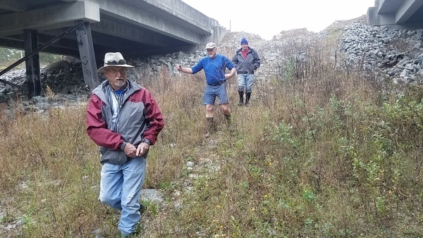
Photo: John S. Quarterman,
US 84 embankment takeout, 201711-11.
Spook Bridge: Downstream from US 84 past the CSX Rail Bridge is a famous old unused bridge: Spook Bridge.
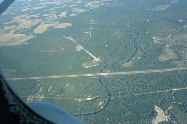
Photo: Jim Tatum, of
US 84, CSX RR Bridge, and Spook Bridge crossing the Withlacoochee River,
on
WWALS Southwings flight, 2016-10-22.
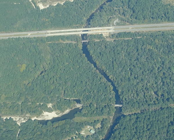
Photo: Jim Tatum, of
Spook Bridge crossing the Withlacoochee River,
on
WWALS Southwings flight, 2016-10-22.
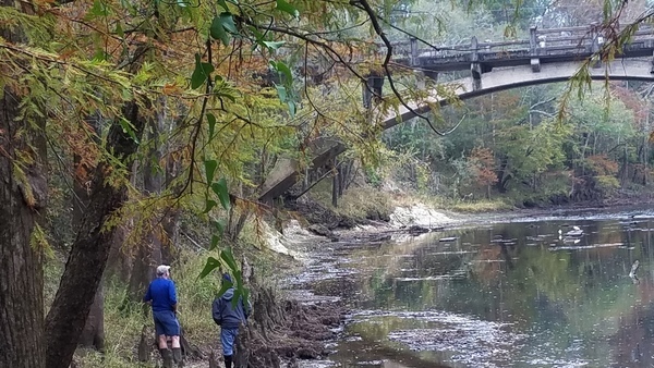
Photo: John S. Quarterman, Spook Bridge,
2017-11-11, at 1.73′ (85.23′ NAVD88) on the US 84 Quitman Gauge.
Upstream Gauge:
GA 122 at Little River (Hahira) USGS 02318380:
Highest safe 11 feet, 144 NAVD. Lowest boatable 4.25 feet, 137 NAVD.

Downstream Gauge:
US 84 (Quitman) USGS 02318500:
Highest safe 10.5 feet, 94 NAVD. Lowest boatable 2.0 feet, 85.5 NAVD.

Backup: in case of low water is: to paddle farther downstream. In case of high water is probably to cancel, since everything will probably be too high.
More: For more WWALS outings and events as they are posted, see the WWALS calendar or the WWALS outings and events web page. WWALS members also get an upcoming list in the Tannin Times newsletter.
-jsq, John S. Quarterman, Suwannee RIVERKEEPER®
You can join this fun and work by becoming a WWALS member today!
Short Link: