Tag Archives: Old Quitman Highway

Spook Bridge in minor flood, Withlacoochee River 2021-02-23

The Withlacoochee River is a tad high for novice paddlers.

[Takeout flooded, eddies upstream, boat parking flooded, muddy entrance road]
Takeout flooded, eddies upstream, boat parking flooded, muddy entrance road

Yesterday the Withlacoochee River was at 107.5′ NAVD 1988 (feet above sea level), or 24′ old-style above the riverbed. Minor flood stage starts at 104′, and Action stage at 99′. With no more rain predicted this week, currently it’s expected to be down about 100.5′ by Saturday noon. Continue reading

Delayed a day: Troupville to Spook Bridge, Withlacoochee River, 2019-02-03

It rained, and the river rose a bit, so we will paddle Sunday morning instead, unless it rains again or rises too much. Still on the Little River from Troupville Boat Ramp, then the Withlacoochee River to Spook Bridge. That’s right, Spook Bridge, thanks to The Langdale Company, which has arranged for us to take out just below the bridge.

River swirling by access, 30.7898000, -83.4516100
River swirling by access 30.7898100, -83.4517500

This is not public access. Langdale is making it available to WWALS for this February outing and for Paddle Georgia in June 2019. This takeout, while still up a steep riverbank, is much easier than climbing up those loose highway abutment rocks between the US 84 highway bridges. So I hope everyone will thank The Langdale Company.

See previous post for outing details. Continue reading

Troupville to Spook Bridge, Withlacoochee River, 2019-02-0203

Update 2019-02-02: Delayed a day until Sunday morning.

Water levels look good, so unless it rains, looks like Saturday morning we will paddle Little River from Troupville Boat Ramp, then the Withlacoochee River to Spook Bridge. We will probably encounter deadfalls and shoals, so bring a rope and be prepared.

That’s right, Spook Bridge, thanks to The Langdale Company, which has arranged for us to take out just below the bridge.

[Access and river, 14:47:36, 30.78981, -83.45175]
Access and river, 14:47:36, 30.7898100, -83.4517500

This is not public access. Langdale is making it available to WWALS for this February outing and for Paddle Georgia in June 2019. This takeout, while still up a steep riverbank, is much easier than climbing up those loose highway abutment rocks between the US 84 highway bridges. So I hope everyone will thank The Langdale Company.

See previous post for outing details. Continue reading

Pictures: Withlacoochee River and Sabal Trail @ US 84 2015-08-28

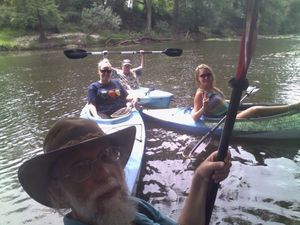
A paddle so brief we went past and had to float back WWALS at the proposed Sabal Trail pipeline crossing 30.7955398, -83.4526749 down the Withlacoochee River to where the Sabal Trail pipeline proposes to cross.

Winnie Wright of WCTV interviewed us at the US 84 bridge median while we were preparing to put in; don’t know if it aired.

Update 2015-08-28: WCTV story online.

See previous post for pictures of the put-in. It has everything: steep rocks, thorny Smilax vines, poison ivy, and wasp stings! Yes, this is Continue reading