
 A nice day for a paddle upstream, in these pictures and videos by Gretchen Quarterman
of the
18 January 2014 WWALS Outing at the Statenville Boat Ramp on the Alapaha River. Continue reading
A nice day for a paddle upstream, in these pictures and videos by Gretchen Quarterman
of the
18 January 2014 WWALS Outing at the Statenville Boat Ramp on the Alapaha River. Continue reading
Tag Archives: Statenville
Statenville to Sasser Landing on the Alapaha River, WWALS Outing, 2015-02-15
Expert Paddle on the Alapaha River Sunday, February,15th 12:00pm. facebook event
Update 2015-03-06: Summary and pictures.
| Launch site: | Statenville boat ramp on HWY 94 just west of Statenville, GA, 30°42’15.3″N 83°01’57.9″W 30.704260, -83.032750. |
| Take out: | Alapahoochee boat ramp (Sasser Landing) HWY 150 a few miles east of Jennings, FL, 30°36’02.6″N 83°04’23.7″W 30.600710, -83.073260. |

Picture by Michael Rivera,
used with permission.
This event is FREE! All we ask is that Continue reading
Alapaha River rainy season?
Veteran boater Bret Wagenhorst asked:
Is there a defined “rainy season” on the Alapaha? I have seen the water high in December, March, July, and once even in September.
Good question!
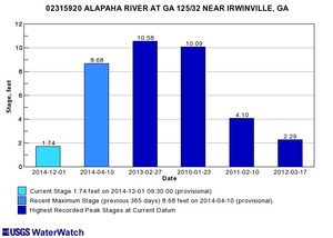 Looking at the record high water levels for
the gauges,
they’re all in April, March, February, or January.
Looking at the record high water levels for
the gauges,
they’re all in April, March, February, or January.
Also, the only January one is for Irwinville, the farthest upstream, which also had its highest ever in February with that January high only slightly lower.
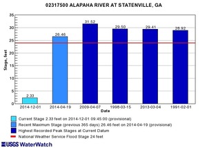 Downstream, Continue reading
WWALS January 18-2014 outing review.
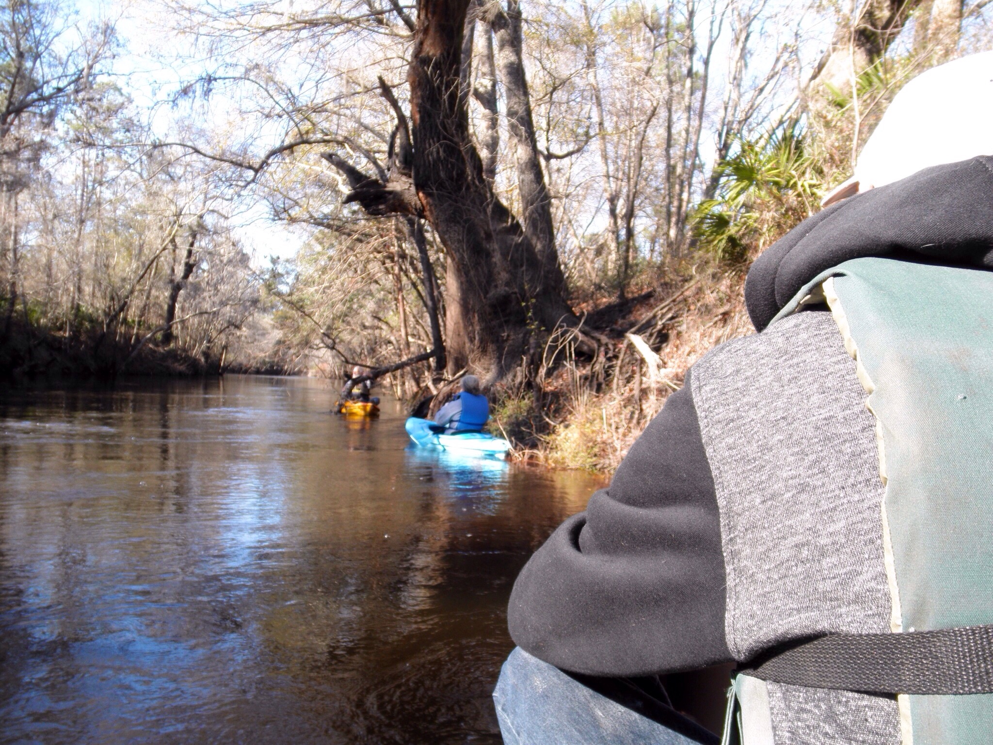 The WWALS outing was location in Statenville, Georgia DNR boat ramp on the Alapaha river. The water level @ the time of the outing was around 9 ft, but the river was within the backs. But the weather was sunny but cool day with a moderate wind. So the participants for this outing Continue reading
 Alapaha River at Statenville: January WWALS Outing
 Meet at the boat ramp/parking lot on the left just before you get to
Statenville heading east on Hwy 94 at 1:30. Boat launch is at 2. We will
paddle upstream for 30 to 45 min. and then float back down. The river
will likely be up, so it should be a work out.
Meet at the boat ramp/parking lot on the left just before you get to
Statenville heading east on Hwy 94 at 1:30. Boat launch is at 2. We will
paddle upstream for 30 to 45 min. and then float back down. The river
will likely be up, so it should be a work out.

 The river water temperature is currently
50 degrees Fahrenheit, so dress warmly.
The Alapaha River at Statenville is currently at
9 feet and rising, which is well above the level recommended by
Brown’s Guide for this river.
The river water temperature is currently
50 degrees Fahrenheit, so dress warmly.
The Alapaha River at Statenville is currently at
9 feet and rising, which is well above the level recommended by
Brown’s Guide for this river.
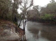
Jungle-like in its remoteness and luxurious with exotic vegetation, the dark reddish-brown waters of the Alapaha wind through a swampy wonderland teeming with wildlife. Signs of habitation are rare along the river’s course; only a few isolated cabins intrude on the remote tranquility.
Here’s a map: Continue reading