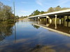
Kind of high (movie):

Picture and video by John S. Quarterman for WWALS Watershed Coalition (WWALS),
Berrien County, Georgia, 8 July 2013.
-jsq

Kind of high (movie):
Picture and video by John S. Quarterman for WWALS Watershed Coalition (WWALS),
Berrien County, Georgia, 8 July 2013.
-jsq
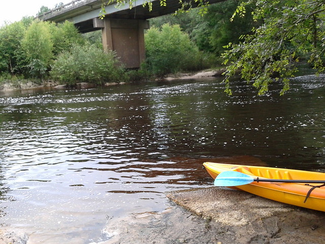
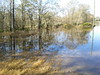
A few pictures from today’s WWALS Outing on the Withlacoochee River from Clyattville-Nankin Road to GA 31, with 12 people in 8 boats (4 kayaks, 4 canoes).
Gage height, US 84 Quitman: 3.25 feet (86.75 feet NAVD 1988).
Withlacoochee River at Clyattville-Nankin Landing:
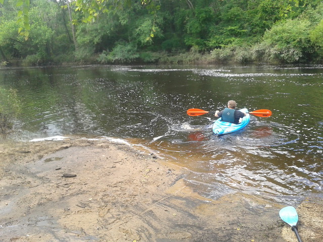
Heather sets out:
The June WWALS outing is from Clyattville-Nankin Road to Horn Bridge on
 Madison Highway (GA 31) on the Withlacoochee River.
Meet at the Clyattville-Nankin Road putin at 9AM, put in at 10AM, Saturday, 22 June 2013.
Join the
facebook event if you like.
See you there!
Madison Highway (GA 31) on the Withlacoochee River.
Meet at the Clyattville-Nankin Road putin at 9AM, put in at 10AM, Saturday, 22 June 2013.
Join the
facebook event if you like.
See you there!
Update 20 June 2013: How are we getting back to our vehicles with this trip? We’ll deposit all the boats at the put-in (Clyattville-Nankin Road), take most of the vehicles down to the take-out (Horn Bridge on Madison Highway aka GA 31), carpool in a few vehicles back to the put-in, and float down the river.
Tom Baird described this nine-mile two-hour trip as:
The section includes where Clyatt Mill Creek enters, a truly fun set of rapids (two drops) at the Ga – Fla border, a very nice Second Magnitude Spring (that I have yet to find the correct name), the remains of the enormous abandoned trestle over the river of the Georgia & Florida Railroad,or Ole God Forsaken as it was nicknamed, the ghost town of Olympia on the Georgia side, and several Indian quarry sites. It is along this section that the river cuts deeply enough that the banks switch from sand banks to limerock cliffs. Paddle distance is about 9 miles, so a little over two hours paddling time. There are plenty of places to stop and look around.
There are shoals right at the state line, so beware, esp. if you’re in a canoe. The book Canoeing and Kayaking Georgia, by Susanne Welander, Bob Sehlinger, and Don Otey (2004) says: Continue reading
 Water issues strongly affect economic development, so I talked about
the new WWALS Watershed Coalition at the
16 April 2013 Board Meeting
of the Valdosta-Lowndes County Industrial Authority.
Water issues strongly affect economic development, so I talked about
the new WWALS Watershed Coalition at the
16 April 2013 Board Meeting
of the Valdosta-Lowndes County Industrial Authority.
The VDT declined to speak, so I did. After apologizing for no okra today, I commended the Authority for talking about the missing agenda items and for mentioning due diligence and flood control.
Mostly I talked about the new WWALS Watershed Coalition,
www.wwals.net,
incorporated in June 2012, which is about watershed issues
such as flooding, water quality, and invasive species related to the Withlacoochee, Willacoochee,
Alapaha, and Little River System.
I mentioned
arsenic in some local well water,
which
the Department of Health has finally said should be tested,
three years after
Janet McMahan discovered it was a problem.
 I invited VLCIA board and staff to two upcoming WWALS events:
WWALS board meetings are every second Wednesday of the month, usually at the IHOP in Adel because it’s centrally located. WWALS is communicating with Valdosta and various organizations about flooding and other watershed-wide issues, which in my opinion have to do with things like too much clearcutting without consideration for where the water goes, too much development without consideration for what the impervious surface would do, (to my surprise, the Executive Director and several board members nodded along with that) so it was good to hear them mention flood containment.
Here’s the video:
Arsenic, Outings, and Flooding: WWALS Watershed Coalition
Regular Meeting, Valdosta-Lowndes County Industrial Authority (VLCIA),
Norman Bennett, Tom Call, Roy Copeland, Chairman, Mary Gooding, Jerry Jennett,
Andrea Schruijer, Executive Director, J. Stephen Gupton, Attorney, Tom Davis, CPA, Allan Ricketts, Project Manager,S. Meghan Duke, Public Relations & Marketing Manager, Lu Williams, Operations Manager,
Video by John S. Quarterman for Lowndes Area Knowledge Exchange (LAKE), Valdosta, Lowndes County, Georgia, 16 April 2013.
-jsq
Come paddle the Withlacoochee River from GA 122 to Franklinville, 10 AM 20 April 2013, in the monthly WWALS outing.
Update 2016-02-01: Pictures by Gretchen Quarterman.
Franklinville Road Bridge (closed):

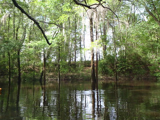
Withlacoochee River:
Continue reading
 Valdosta City Council Tim Carroll spoke about the need for watershed-wide
planning to reduce flooding and provide water for agriculture with
distributed flood containment reservoirs.
He
referred to
the
materials he sent in advance
as well as to some additional data about water quality measurements
upstream and downstream of selected points.
And he sent an update the next day.
Valdosta City Council Tim Carroll spoke about the need for watershed-wide
planning to reduce flooding and provide water for agriculture with
distributed flood containment reservoirs.
He
referred to
the
materials he sent in advance
as well as to some additional data about water quality measurements
upstream and downstream of selected points.
And he sent an update the next day.
 Tim Carroll noted that one thing that was clear from the
Valdosta City Manager Larry Hanson’s 2010 presentation to the
Suwannee-Satilla Water Council about the 2009 flood was that the
drainage basin study proposed by that Council (which completed
its report and disbanded) still needs to be completed.
For that purpose, Hanson had just sent
a letter to the Army Corps of Engineers requesting assistance.
Apparently they have
partial answer,
and they’re also talking the state.
Tim Carroll noted that one thing that was clear from the
Valdosta City Manager Larry Hanson’s 2010 presentation to the
Suwannee-Satilla Water Council about the 2009 flood was that the
drainage basin study proposed by that Council (which completed
its report and disbanded) still needs to be completed.
For that purpose, Hanson had just sent
a letter to the Army Corps of Engineers requesting assistance.
Apparently they have
partial answer,
and they’re also talking the state.
Carroll said that with the renewed attention to flooding problems Continue reading
Valdosta City Council member Tim Carroll will speak tonight
at the monthly WWALS Watershed Coalition board meeting
at 7:30 PM at the IHOP in Adel (exit 39 from I-75, 1200 W 4th St, Adel, GA, 229-896-2662); the public is invited.
In advance he sent the appended letter from the City of Valdosta
to the Army Corps of Engineers requesting assistance related to
flooding and droughts.
March 11, 2013Continue reading
William Bailey
Chief of Planning Division
US Army Corps of Engineers – Savannah District Office
100 W. Oglethorpe Avenue
Savannah, Georgia 31401Dear Mr. Bailey,
Over the last several years, the City of Valdosta and neighboring communities have been severely impacted by the increase of flood events that have occurred throughout our region and particularly the drainage basin we are located in. The city recognizes the various levels of responsibility throughout government agencies for flood management and flood control and is interested in furthering the discussions to understand the changes that are occurring and to ensure the protection of our communities from future flood events.
In February 2009, the city began updating its 1996 Master Stormwater Management Plan. In April, just two months later, our county along with 46 counties in south Georgia, experienced historic flooding and were declared disaster areas. The Federal Emergency Management Agency (FEMA) reported
 CNN iReports lets citizens send in videos.
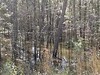
One jkluke has posted four videos of flooding on the Withlacoochee River.
CNN iReports lets citizens send in videos.
One jkluke has posted four videos of flooding on the Withlacoochee River.
Here’s that last video embedded:
-jsq
PS: Owed to John C. Griffin.
The Withlacoochee River in flood stage after 10 inches of rain, at the GA 122 bridge in Lowndes County, Georgia.
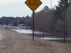
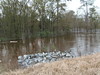

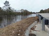

Here’s a video playlist:
Continue reading
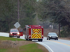
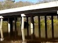 Movies on 18 February 2013 after the first rains of
the Alapaha River on GA 122 at Lakeland in Lanier County
and
the Withlacoochee River at GA 122 and Hambrick Road in Lowndes County
and some points in between.
Movies on 18 February 2013 after the first rains of
the Alapaha River on GA 122 at Lakeland in Lanier County
and
the Withlacoochee River at GA 122 and Hambrick Road in Lowndes County
and some points in between.

Here’s a video playlist.
Continue reading